


Solomon’s Jewels with the Ramblers
I am sitting at home in my comfy armchair warmed by the fire crackling to my right; it’s cold and windy outside, almost hostile in that bleak way Tasmania’s weather excels at. It’s in sharp contrast to yesterday when at this same time, I was driving down to the LINC centre to meet the other walkers, ramblers all, for the walk to Solomons Jewels.
This was not a treasure hunt, well not in the usual sense of historic or mythical artefacts with monetary value or at least serious bragging rights, for the treasures are of the transcendent type, offerings of natural beauty with sensations and memories to be hopefully treasured.
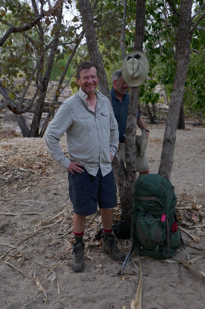
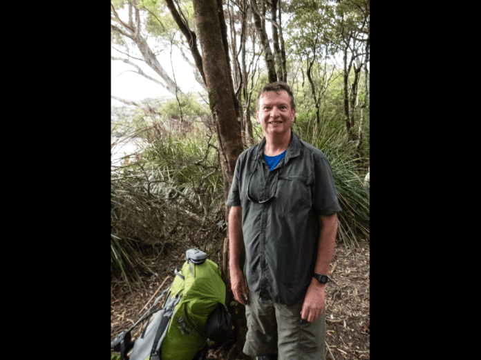
Neville is the leader, a tall, silver bearded true gentleman who gathered up we chicks as we arrived, handing us each in turn, the record book in which I signed too. I soon learned that there were to be twenty one walkers in all. This is a big turn out. Despite my forebodings about big groups in the bush, it all worked. The group turned out to be great as a group and sparkling and fun as individuals.
The weather looked very, very promising. It had been raining the previous few days, including an impressive lightning and thunderstorm but the morning of may 5th, was one of clear skies with, a mere hint of wind. I must admit to feeling a bit of a fraud as regards being a true dinks Tasmanian hiker as I have rarely walked in conditions that were anything less than superb. I should have experienced appalling, character building inclement conditions, but no, I generally trot along in warm sunshine, cool breezes, returning home in complete safety, while other walkers, leaving as I arrived back at a trail head, have to be airlifted out because of flooding a day later. I almost feel guilty while enjoying warm jammy crumpets with the sound of rain on the roof, and self emblazoning myself with walking credits all while I willingly eluded most bad weather.
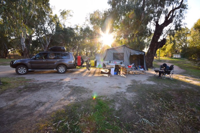
I joined three others in one of the cars and we drove first to Mole Creek, for toilet stops and to admire the Hereford cows, munching grass with the Western Tiers behind them.
Then carried on to the Walls of Jerusalem car park. This car park is in the process of being upgraded, with improved, larger area for car parking ( read level, marked spaces as opposed to sprawled vehicular chaos) and toilet facilities. The construction area is already marked off within a square of cyclone fencing. This car park can often overflow, with 4WDs crammed along the narrow road near the entrance to the car park.
We left the car park at 10am, and soon strode up to a boot cleaning station. The problems of fungi are quite real in the Tasmanian bush, already it has seriously damaged the Douglas Apsley area on the east coast. Scrape the boots, then insert into what looks like a high tech mouse trap. There is a handle with black squeeze pump which squirts antiseptic liquid under the boot. I like the smell of antiseptic, maybe it’s an occupational fetish.
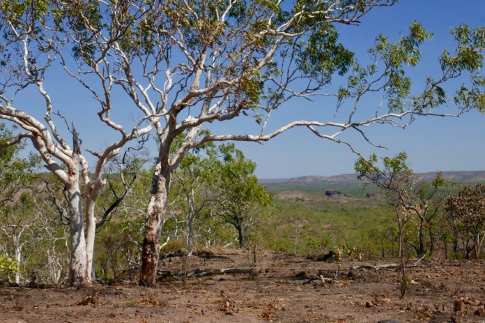
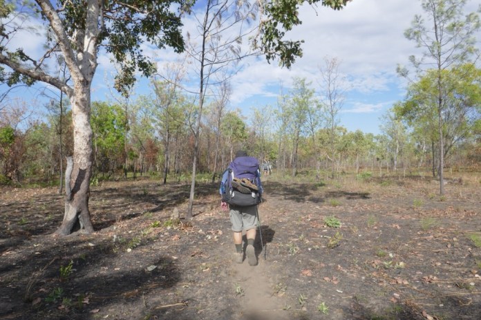
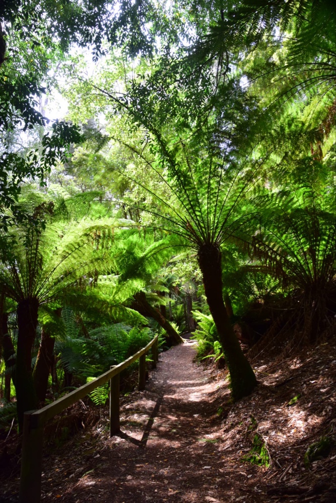
The the walk finally begins, with the steep ascent to Trappers Hut. There are two routes to the hut, the one we are doing now; it is about three kilometres of winding, slightly rocky track with Waratahs ( no flowers till Spring), Ash and tall gum trees filtering the intense blue light of this Tasmanian morning. It’s not an easy climb, nor is it hard demanding acrobatics and strength; as is Goldilocks, it’s just right. The other option, is to drive along Fish creek road and take the short track, it is a mere 500m, but that is all 500m up.
Neville led the way and Floyd was tail end. They each had a Walkie talkie to stay in contact. Inevitably, the group strung out, but Peter regularly waited and let us all catch up. I was impressed he let the late arrivals have a rest too. In most clubs, and most casual groups, it’s traditional, to start again as soon as the slower walkers catch up to the main group. This of course makes the slower walkers even more hopelessly fatigued. On this walk, everyone’s comfort and well being was included as has always been the case on all the other Rambler walks I have done.
I took the principle of: BE BOLD START COLD. I am glad I did, as I soon warmed up on the ascent and thereby did not have to worry about putting on a pullover until I sat down for lunch at a Solomon’s Jewels.
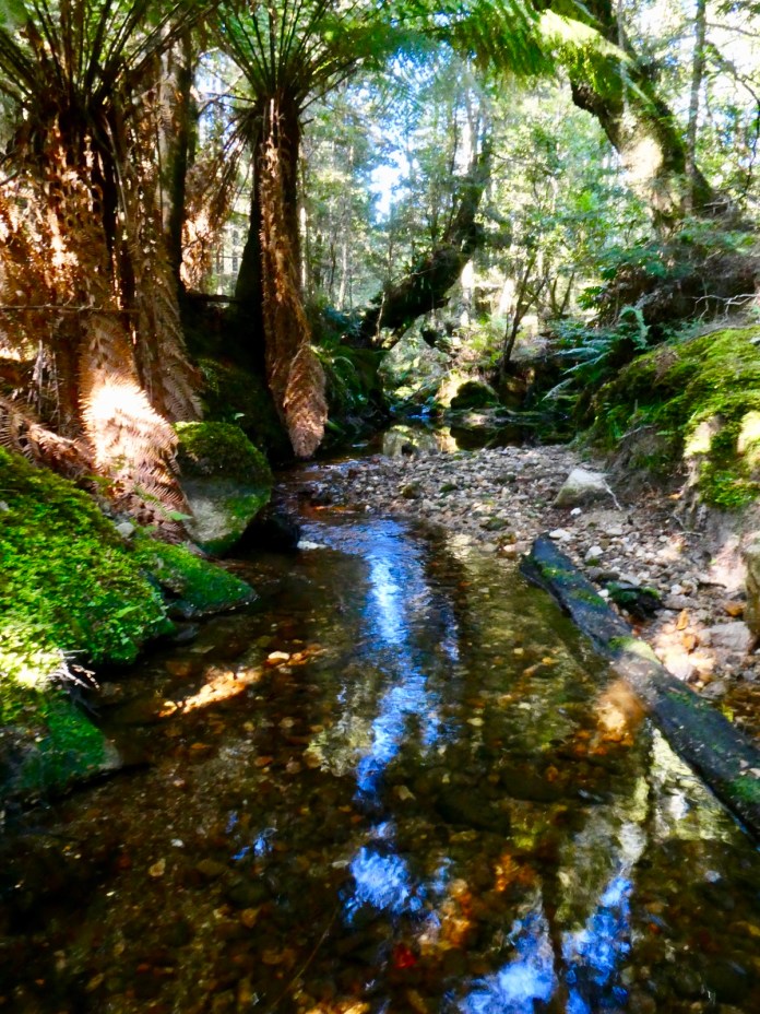
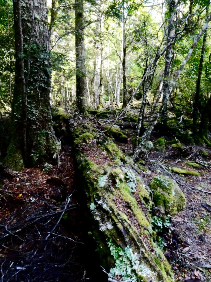
There was some water on the track, mostly from small streams that intersected it, and the water splashed along amongst the rocks for a few meters before returning in into the forest, eventually it would reach Lake Rowellan via Fish Creek. The track is rough in parts, and modestly steep, especially in this section to Trappers Hut. The rocks and stones vary in size but provide a generally non slippery surface and handy foot holds. It’s a narrow track but the trees and shrubs are scattered enough that the route is hardly crowded by foliage.
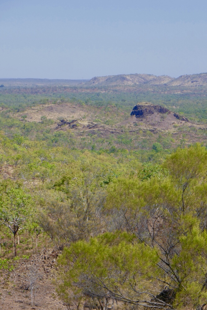
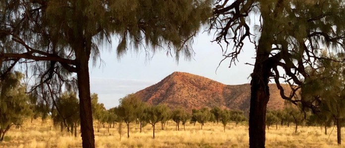
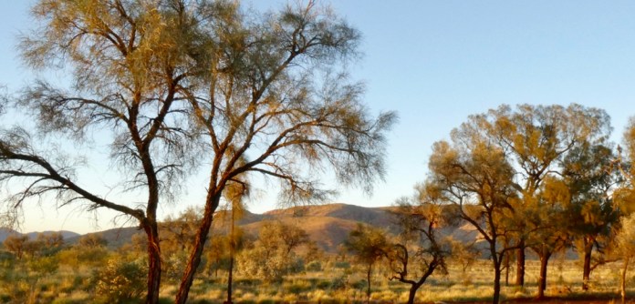
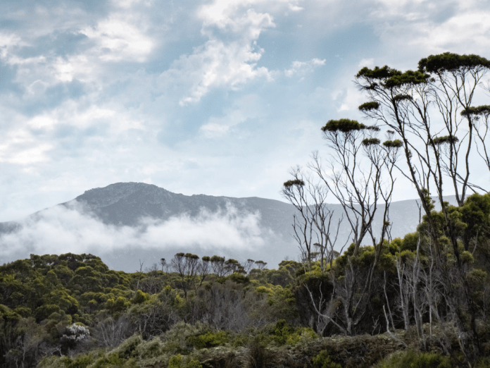
One section of the walk that must not go unremarked are the views of the mountains that make up the Overland Walk. In these unusually clear skies, the clarity of view was wonderful. There was the massive bulwark of Mt Ossa, and over there the twin Pelions, east and west; and to the south, Mount Olympus.
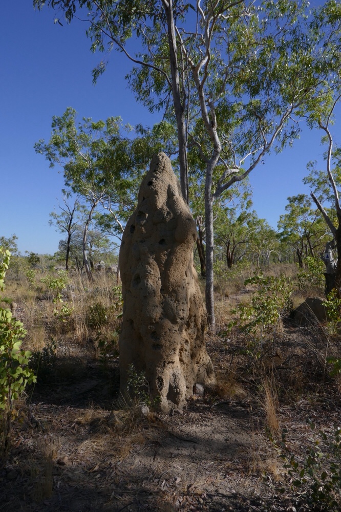
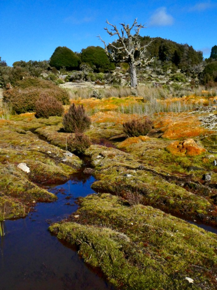
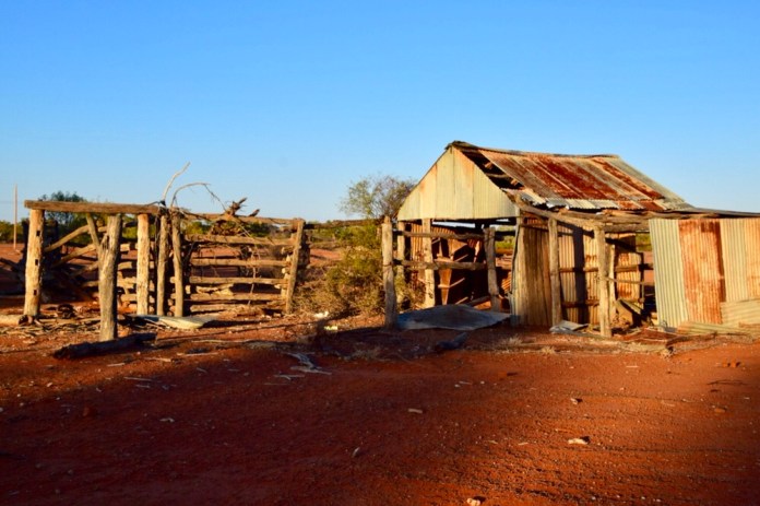
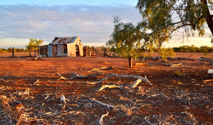
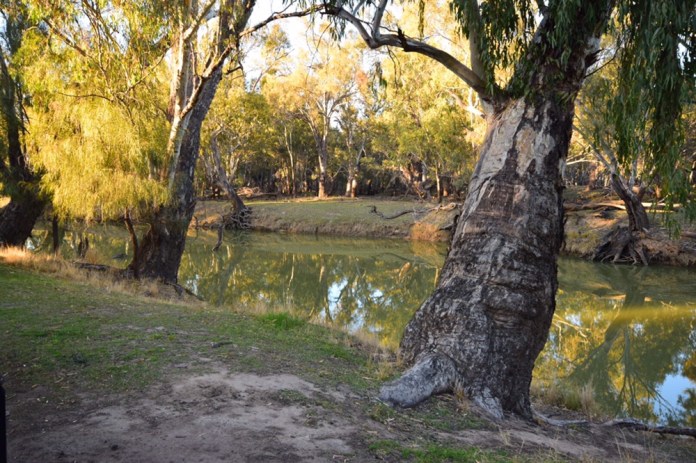
Trappers Hut is an old construction with wooden slat walls, timber roof tiles and infamous for its population of truly Bolshevik possums which make sleeping inside a doubtful outcome for an evening sojourn. There is really no camping nearby. Approximately a kilometre further on, shortly beyond the side track to Lake Adelaide there is an attractive peat field, a luxurious lawn just asking for a golf tee.
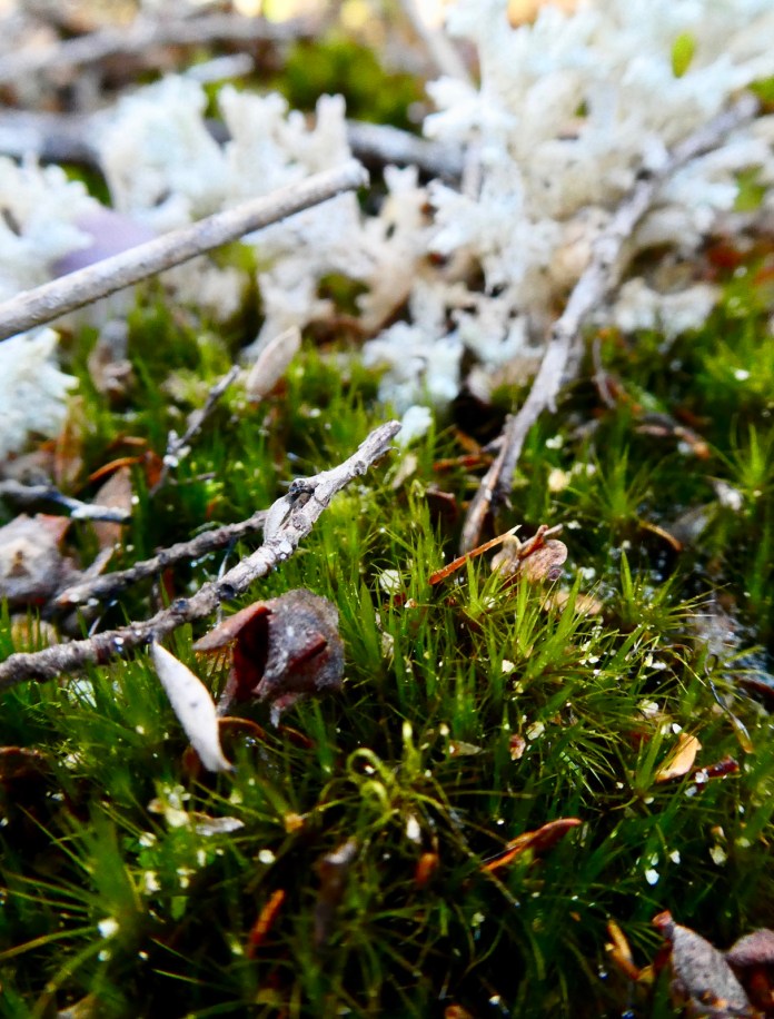
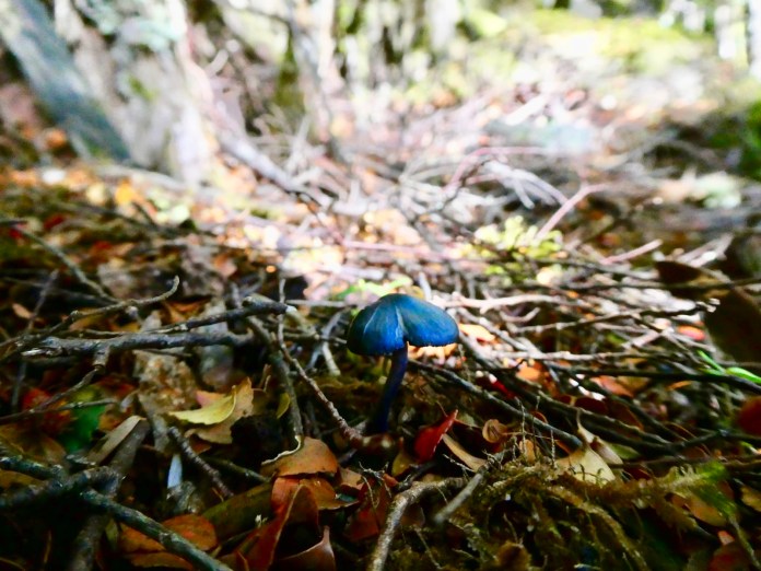
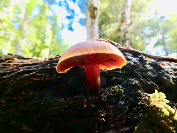
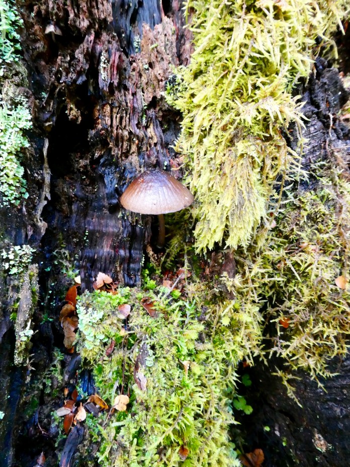
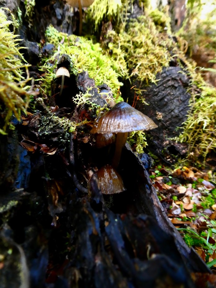
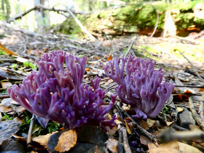
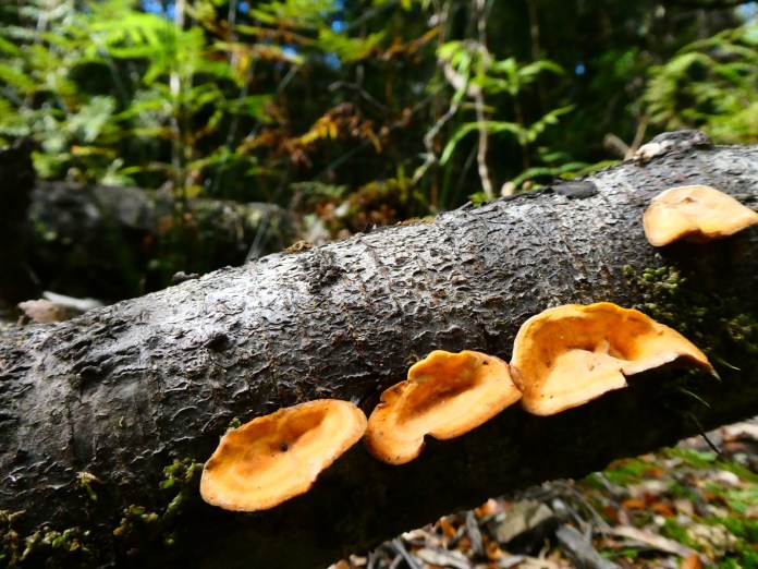
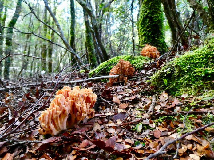
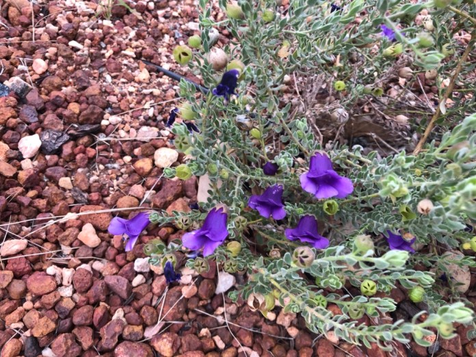
We sat on the rocks for morning tea. I spent the time admiring the beautiful forest, tall silvery and white trees towering above a scattered floor of shrubs, Waratahs, Mountain Peppers, red berries Bush or Mountain Berries and the many old timbers and now rotting trunks and logs fallen in winter storms or from the consequences of age. Several other walkers remarked how remarkably intense was the blueness of the sky. The rain and storms of the preceding few days had done a wonderful job of clearing any dust from the air as well as cleaning away the volatiles from the leaves of the eucalypts; these chemicals typically evaporate into the lower atmosphere with the later warming of the morning , washing out the rich natural boldness of the forests and mountains colours.
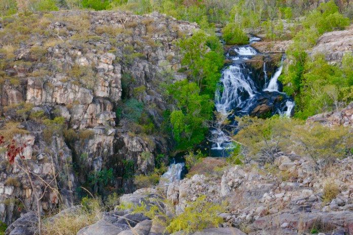
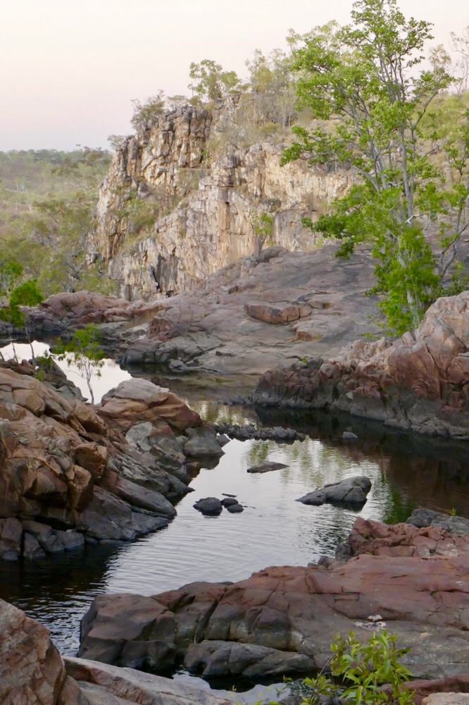
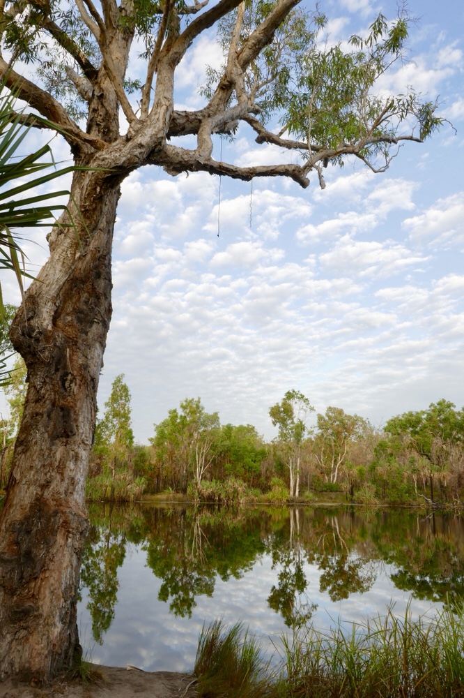
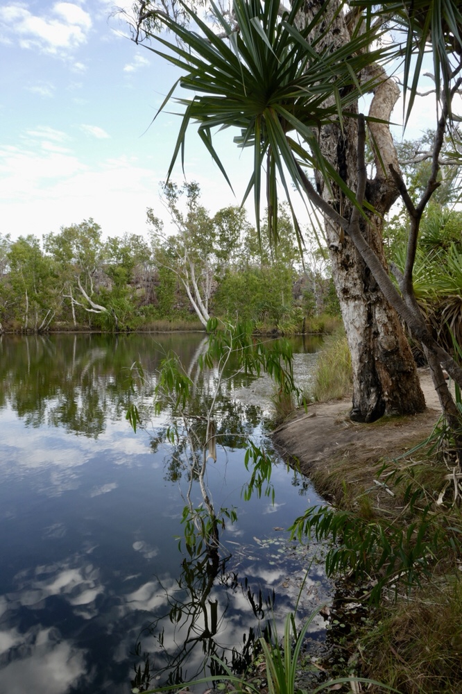
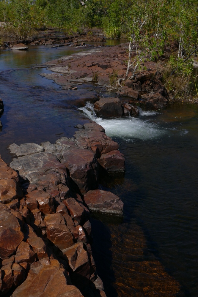
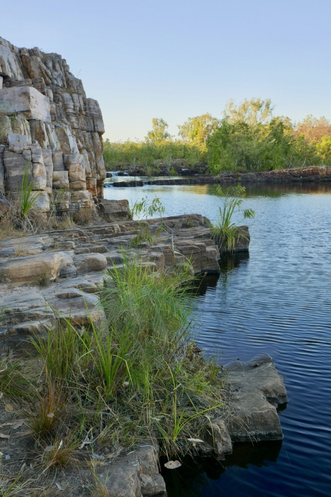
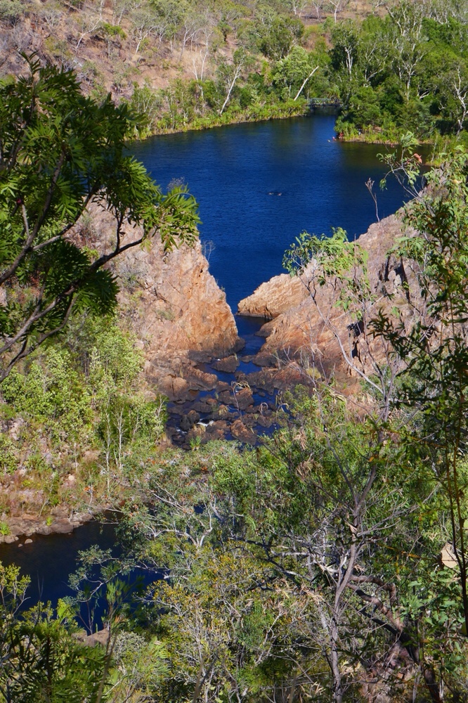
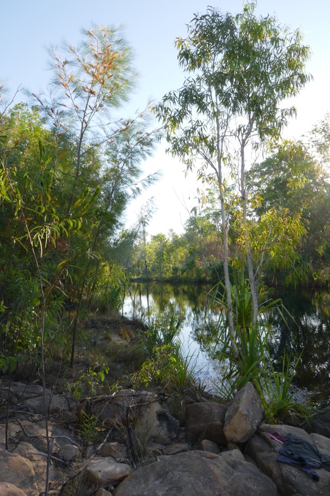
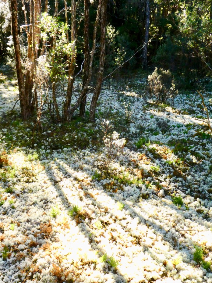
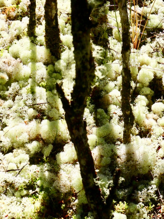
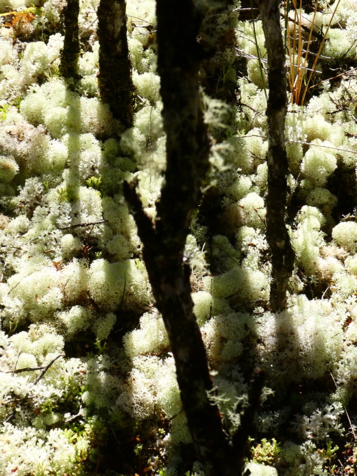
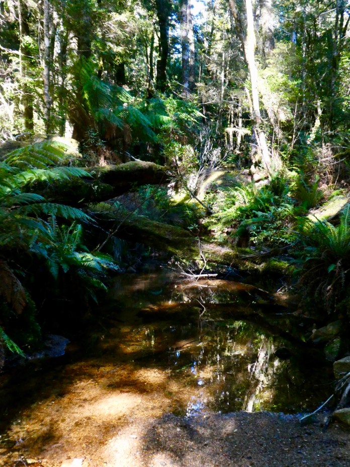
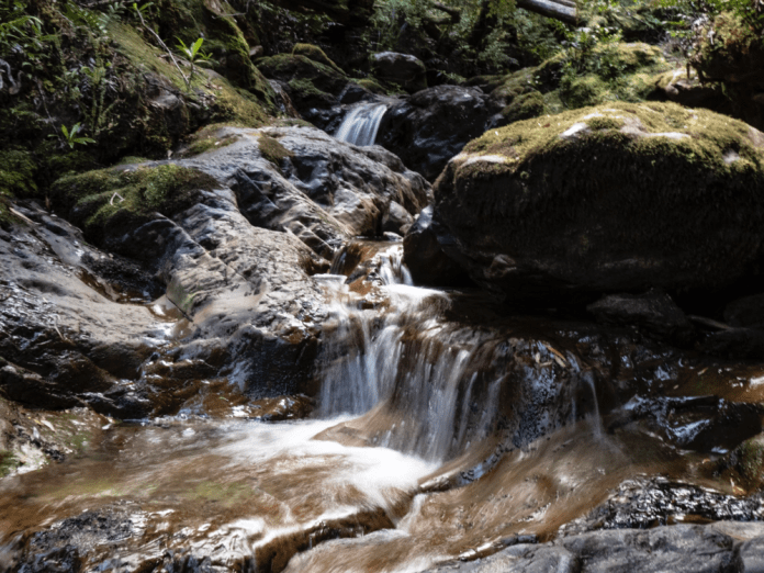
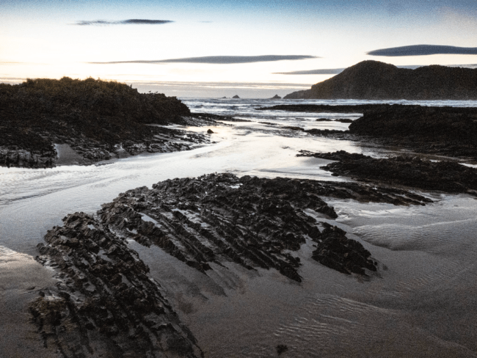
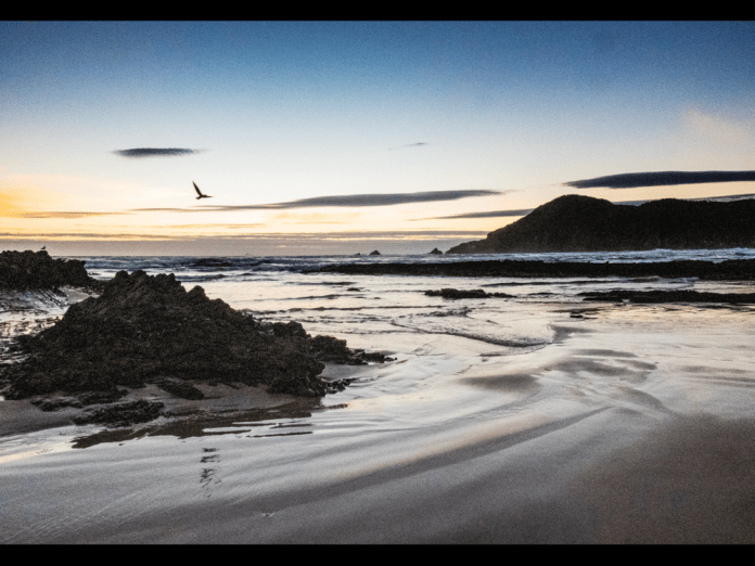
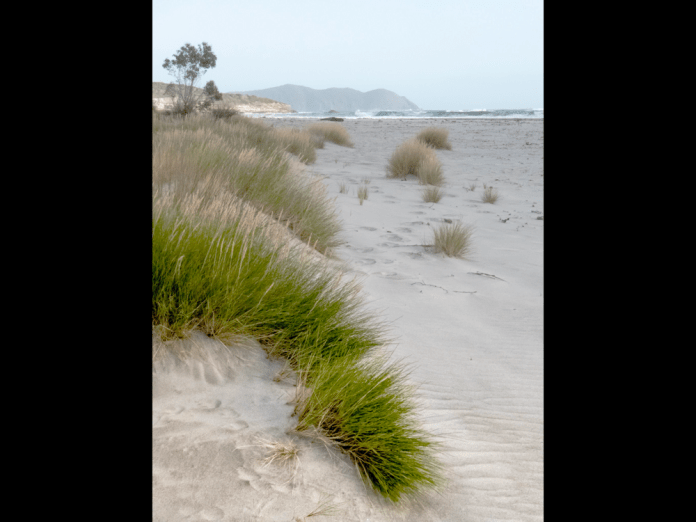
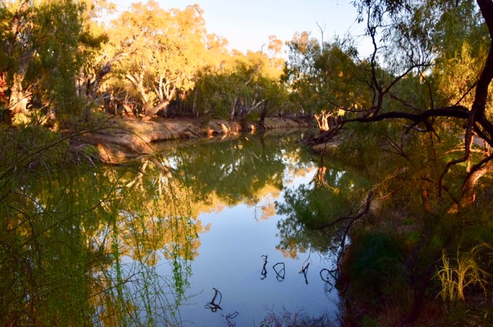
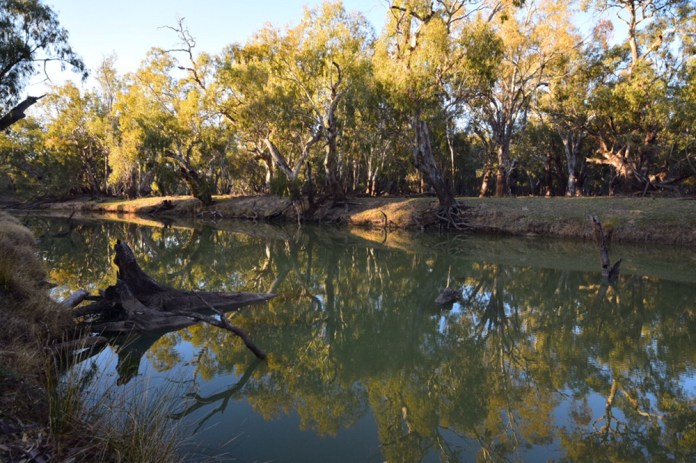
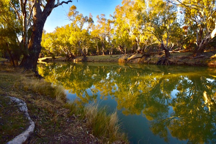
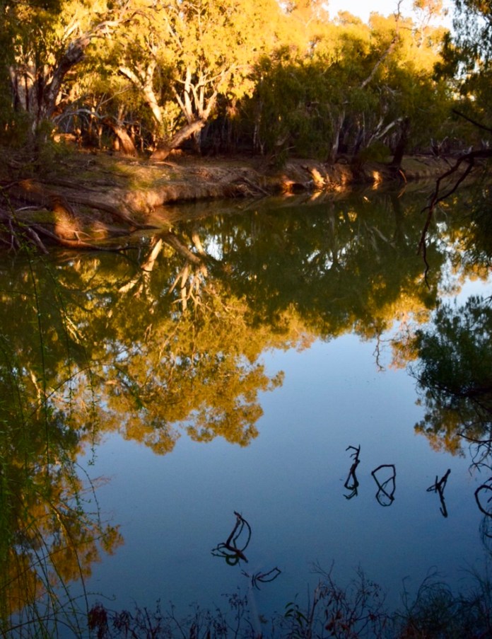
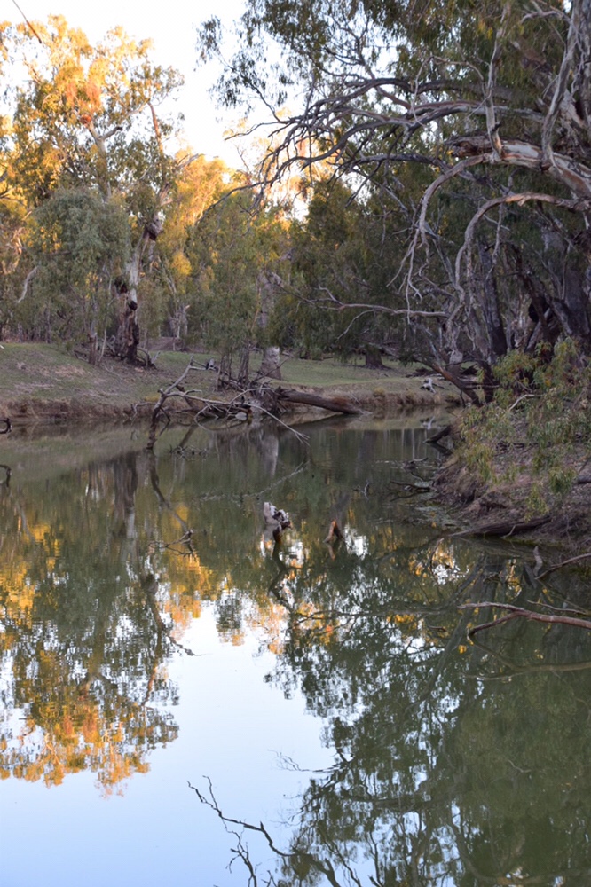
After morning tea we continued upwards and onwards, the track undulates more now, dropping down repeatedly to streams and tarns, before arriving at the turn off to Solomon’s Jewels. The tarns are gorgeous, the water is still and cold; in it stillness reflecting the forests, mountains, and rocks, whether near and far in translucent clarity. The steely majestic Pencil Pines spiral about the waters edge, lichen strewn rocks form repeating, mirrored ovals and distant stands of trees on rocky platforms now hover in watery sky.
The hues of the forest are breath taking. I’m looking at the photographs, I must admit if I had not been there, I would not believe the force of colour that comes from this scenery. I have always acknowledged the forces of nature; wind, sun, water but to that should be added colour.
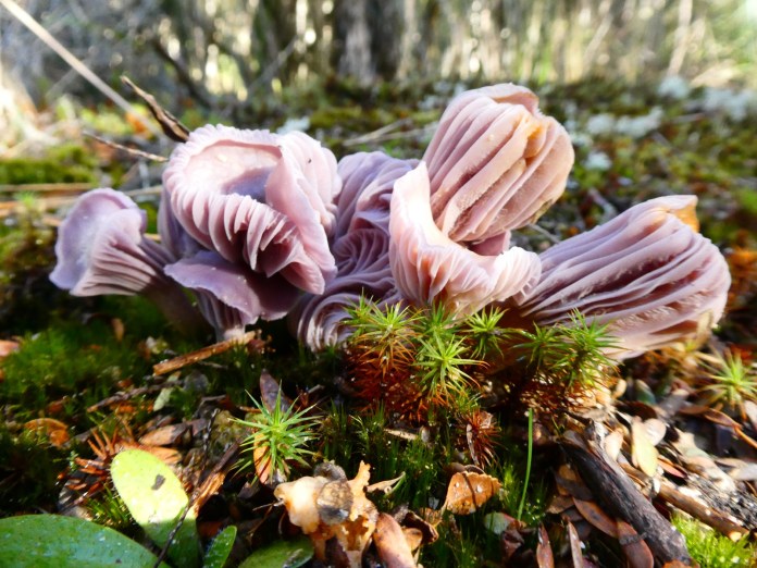
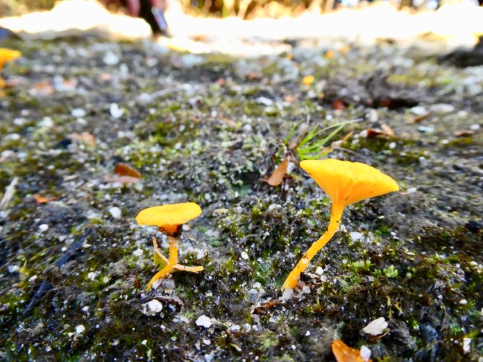
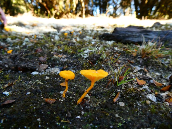
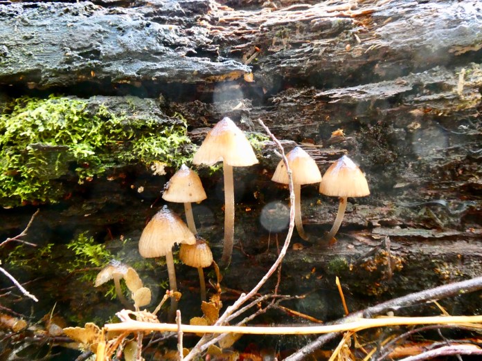
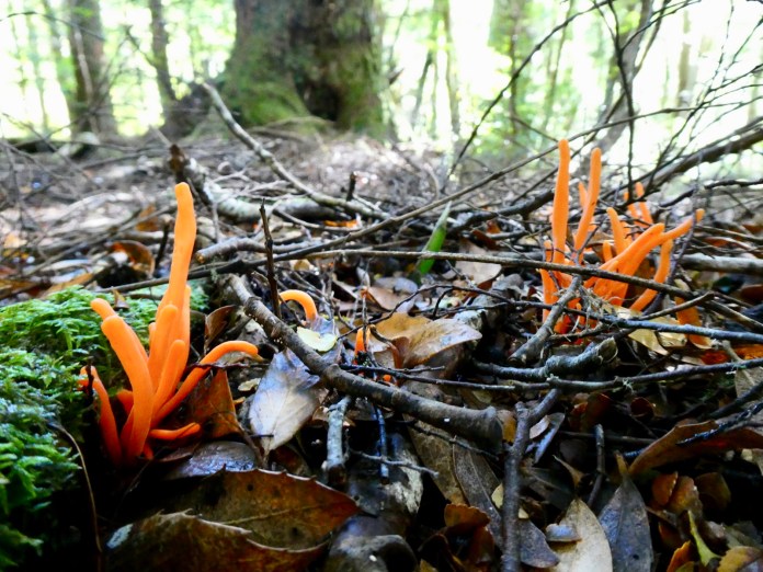
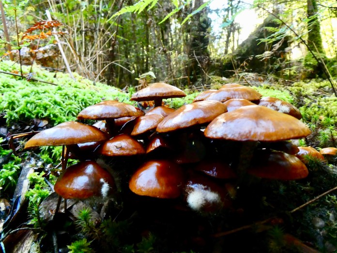
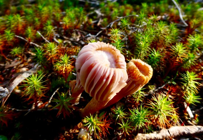
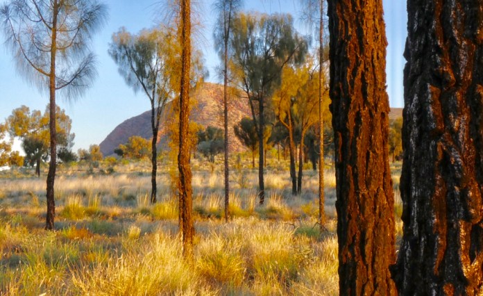
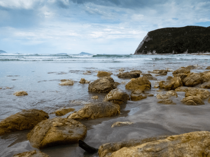
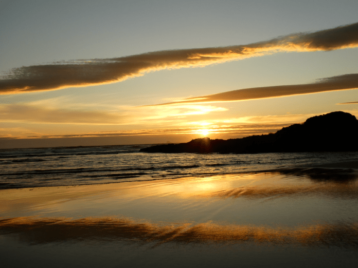
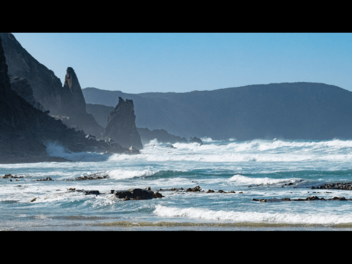
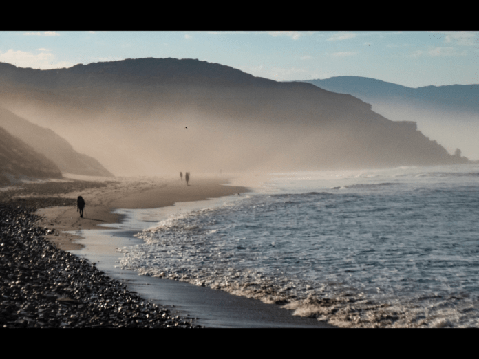
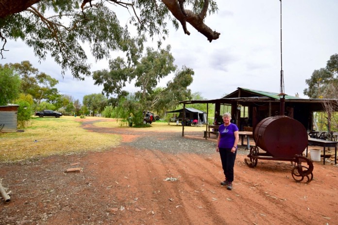
We enjoyed lunch and mugs of tea or coffee, sitting on a rocky, tree sprinkled promontory amongst the tarns which make up Tasmania’s Solomon’s Jewels. In the distance the Walls – the majestic mountain which is King David’s peak; the wide blue sky; the water motionless and cool; the trees and forest visible all around and far beyond the tarns, and the 21 of us, all enjoying Neville singing the ballad of Ben Hall; the gentleman bush ranger who died at Forbes, NSW; his sad story all sung in his firm, clear voice. The putative reason being an anniversary of said event, the cause being the sheer joy of being in this wonderful place.


")
")
")
")
")
")
")
")
")
")
")
")
")
")
")
")
")
")
")
")
")

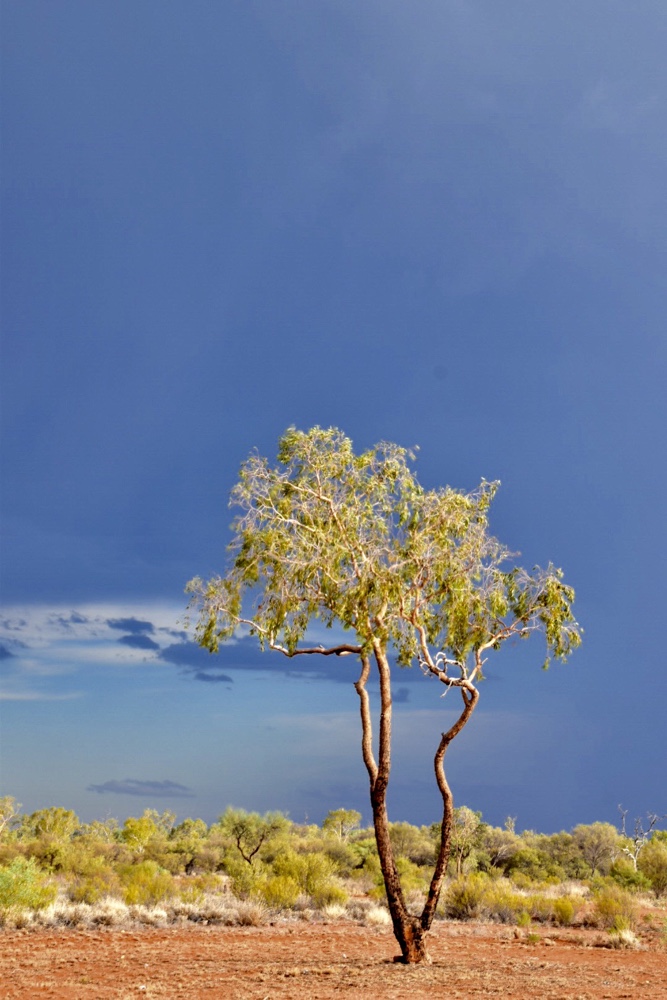
Vignettes from the desert
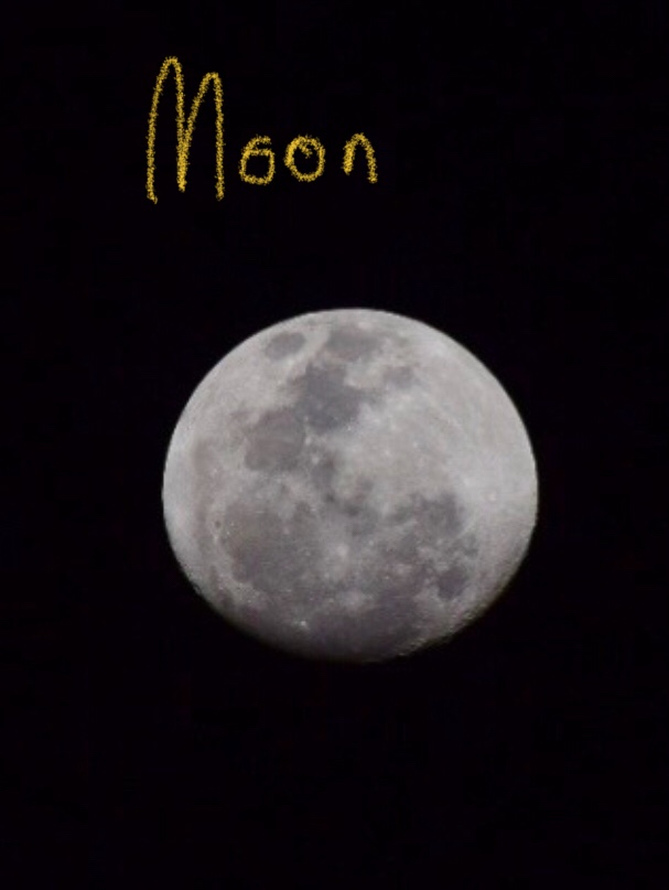
I am lying down in our cabin on the “Spirit of Tasmania”. It is just past 8pm and a nearly full moon is sitting amongst clouds in the sky. The engine is throbbing the superstructure. The ship horn sounds from high above me. To the south I can see land, green, flat and dark inching out of the water.
I have not written much about my work in the last few months and feel that omission is overdue for correction. My previous blog described my walk in the South West. This narrative will leap frog that with stories, impressions and photos spanning the last few months.
Flying
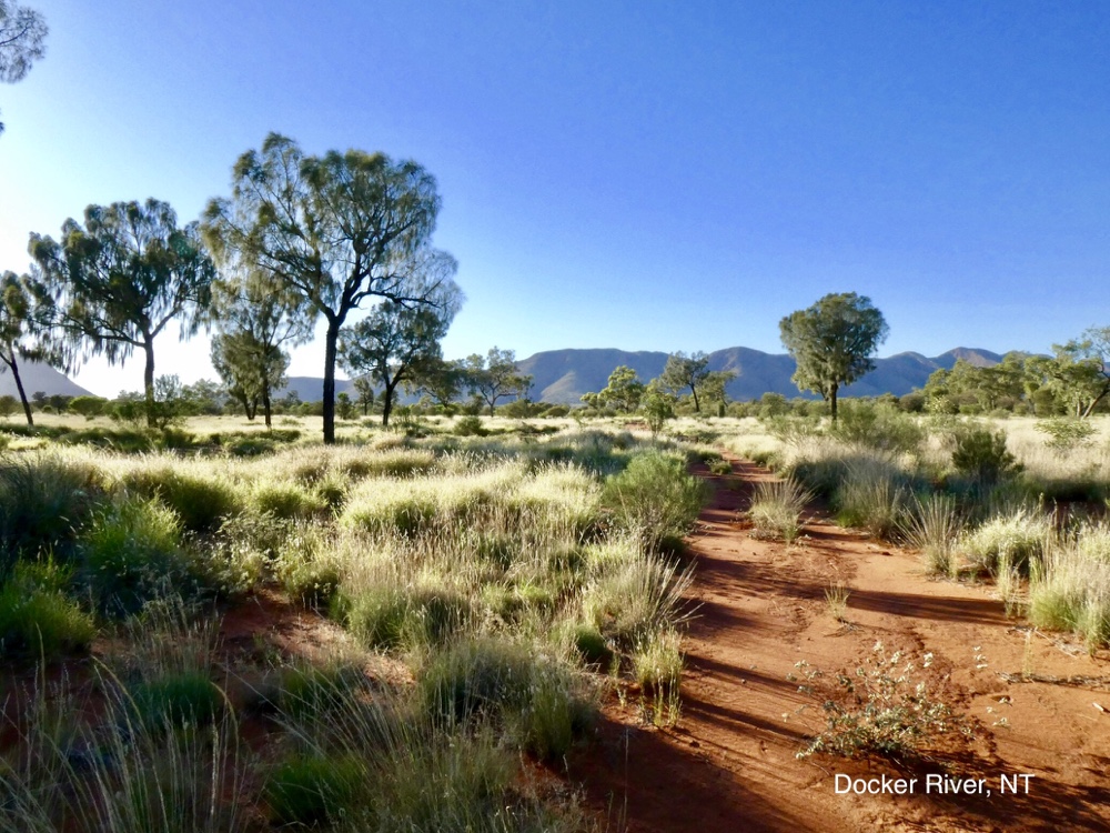
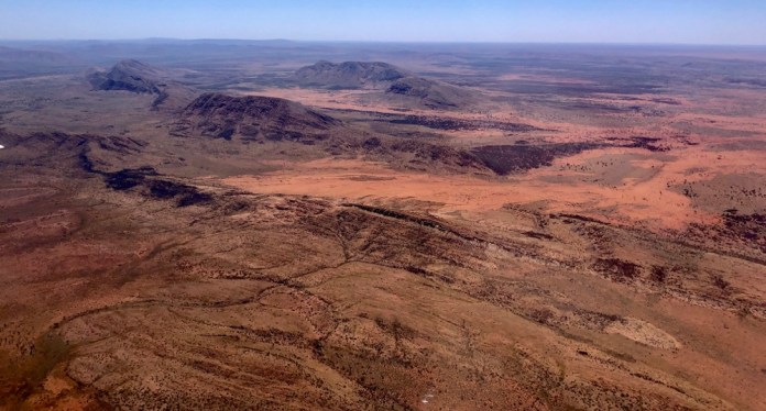
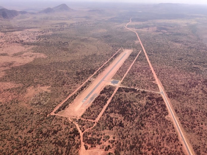
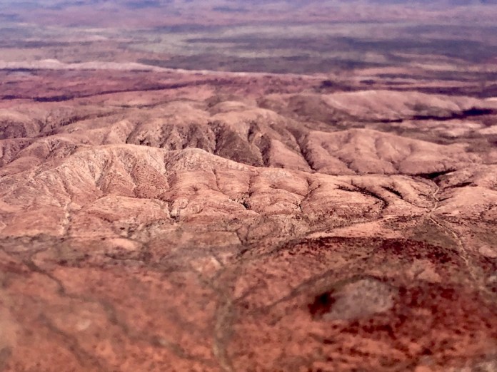
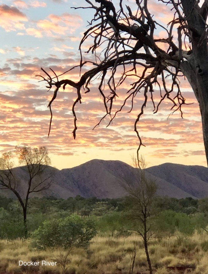
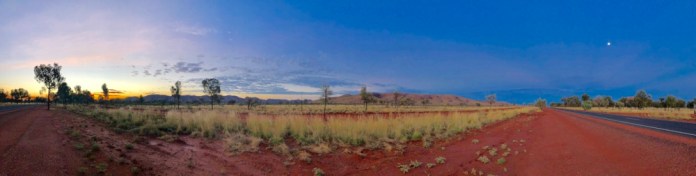
I am minutes from landing at the airstrip at Docker River. I am in a Cessna. I cannot recall the actual designation but it has six seats and two engines. The land beneath us is hot and has been hot for the last three months. For December and January the temperature has been regularly over forty Celsius. The air above the red sand of the arid zone swirls upwards in invisible thermals. These small planes pivot and twist in the cavorting air giving their pilots plenty of work. The plane bucks like an angry brumby as we encircle the strip far below. We almost hover over the several curving ranges which surround Docker River. As the plane drops, the hills, steep and worn, rich browns and reds, rise up to span the vista around me.
Then, one wheel touches the tarmac; the velocity of the plane had seemed slow relative to the landscape but with landing the true speed became fully apparent. The slowness of flight moments before was an illusion that collapsed on reaching the ground. Now trees rushed past, fence poles blurred where they had been so distinct and studying them down below me through the planes window had been a leisurely process.


Walking
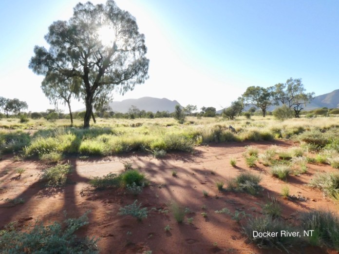
I like walking, walking without people swerving in front and behind me. I walk early in the morning to complete several kilometres before I need to get ready for work which starts at eight o’clock. It’s dark, most dark when clouds blot out the stars and the moon has set. I wear a small rechargeable headlight which illuminates the ground I front of me. At Docker my small flat is on the outskirts of the community so walking does not rise much interest in the local dogs. There are only a few scattered barks from a fenced but open gated property fifty meters down the road and opposite me. I make sure my light is turned hard down and walk quietly and quickly in the other direction. This road is made of bitumen not dust, and therefore provides a smooth surface. It’s also very new and therefore lacks the potholes and cracks as the road is flexed by the repeated heats of summers.
It’s still hot, about 25 degrees and will climb to 45 degrees by lunchtime. This is the other reason for walking before sunrise. Even a short walk to and from the clinic back to my flat at lunchtime is exhausting, the power of the sunlight assaults my bare arms and it’s heat is felt through my shirt. Noon and afternoon do not make for pleasant walking.
The air is still which is unusual as cyclones far away in Queensland have created a torrent of wind that has buffeted the community for several days. It is pleasant walking into a cool breeze but not when the wind hurls the western dust against my skin and eyes. Motionless dead air is acceptable at least until the temperature begins its ascent with sunrise.
I walk carefully. If I am going to meet a snake it will be now. The high temperatures of desert daylight are as uncomfortable for the snakes, lizards and native animals so they do their hunting and scavenging in the dark. My narrow beam of light guides me along the road. It’s illumination keeps me on the road and avoid the sharp edge to red dust. It’s not the dust I fear, it’s ubiquitous, it’s the edge itself. A serious fall has consequences that don’t exist in the city or town. It can be hours before some vehicle travels nearby and mobile phones usually do not work so even calling for help can be impossible.
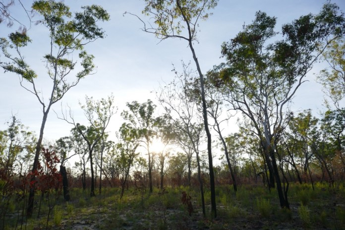
The tall grasses are dry and fill this narrow plain from the community to the highway and beyond that to the ranges. There are old desert oaks aligning the high way. On this walk, there is a kilometre Walk north then I turn west on the highway. This highway is bitumen from just before Docker and much of the distance to the West Australian border, near a town called Giles. When the sun rises and I walk along the highway I can look to every cardinal and see pink stained hills rising out of red dust plains, spotted by groves of desert oaks. These trees are impressively vertical with none of the twisting boughs typical of gum trees. They are dark grey green with a rough, deeply corrugated and ridged bark on their trunks. On the ground are dark brown discarded seed pots, split along their flanks to all the fine seeds to disperse in the summer wind.
It’s still to dark to see this as I walk along. I hear a low throbbing sound and to the right of the road I can see something moving vertically. My appreciation of colour is still poor in this light but it seems to be washed out yellow, a bump of matter lifting from the ground to the air. To my left I see a large male camel bare its teeth at me from twenty metres away. There are trees behind me I get get to if I moved quickly but I do t move fast, I move deliberately avoiding sudden movements, avoiding any motion that would signal me a predator or prey for that matter. I cannot outrun a camel but I was far enough away to get to shelter amongst the trees. It turned its head away and wanders away from me but still paralleling the road. It’s lost interest but I abandon that route for this morning. One of the great dangers of outback driving in the Western Desert occur at night; a dip in the road, a dip sheltered by desert oaks is a favourite place for camels to sleep overnight.
Brumbies, especially the stallions, can be very threatening. I cannot deny how beautiful they look, the lean, well flanked mares, shiny new colts beside them and the tall, powerful stallions standing guard over them. Both camels and brumbies are more common than is usual near this community owing to the lack of water. I saw two donkeys trapped in the local teachers yard, this vertical huge ears studying me above their black eyes.
I walked back braving the brumbies that had walked into grazing near the highway. I got as far off the road as I could as a white stallion watched me out from the red dust; it flicked its head and mane as it snorted before losing interest and cantered back to it small herd.

 People
I like meeting people and I want to connect with them. It’s not enough to provide the consultation. I want to try and make a positive change for them possible by talking and relating to them in some way. This positive action can be a judicious medical decision about treatment or a test. That’s perfectly valid and in fact why I am paid to do this job. However, I want to make the encounter positive in a more fundamental, human sense. I want to show I believe they are important, that this doctor believes their human experience is valuable and that their efforts to survive in these isolated places is appreciated.
I don’t think I can truly understand their experience, I have had not my culture besieged by another one; all its values and structure undermined or just plain torn apart as theirs has over the last century. Young people are so different from the Elders. They have grown up with easily available alcohol even in dry communities, they have money to gamble with, DVDs to watch at all hours and have too abundant time on their hands. Elders can survive in the country in which they live but most of the younger ones here in the Centre would struggle to do so. All that knowledge, all that culture, all those stories are under threat. Some of it is spread at cultural gatherings such as Men’s Business but the attitude to the old ways is often pretty lackadaisical. I asked one young man what he did to pass the time, thinking it would be doing cultural stuff, making spears or boomerangs, preserving the bush skills that connect him and enable him to survive in his country, but no it was watching DVDs.
I can understand that many of the skills and knowledge and stories may seem irrelevant if you have a modern car, can just buy food in a store, or watch TV for entertainment. I talked with a 40 year old Indigenous professional man who admits he ignored the old songs and stories his parents wanted to teach, preferring to listen to Pop music on the transistors popular when he was growing up. Now he is very interested in obtaining many of the stories and traditions but it is a race to do so before the old ones pass on. What makes his connection to his country strong is knowing its stories, knowing where the soakages are, knowing which foods are available, where and when and just being here. As a white person much of the world has become homogenised by our culture of industrial capitalism, exploitation of poorer peoples over the entire world and the adulation of celebrities, and I don’t want that to happen to my Aboriginal patients and friends. It’s not my decision what a people do but I want to make clear in my encounters that I admire their achievements as a people and as individuals. I believe this is the most important thing I do here.
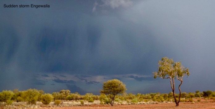
Thunderstorms
We were at Lake Nash and it had been hot, that dry, furnace like heat which assaults you as you leave the air conditioning in the clinics or houses. To the north east, great bundles of grey clouds were lifting off the horizon. We had been watching the news reports of a cyclone over North Queensland including the flooding of Townsville. We are about 10 kilometres from the Queensland border with the Northern Territory so its not a surprise to get some spill over here. The clouds had that grey sheen beneath them descending to earth; a tell tale sigh of rain. Then multiple streams of lightning formed a wall to the east, at least four almost simultaneous strikes. It was at least a minute before the thunder reached us.
By now we were sheltering under the carport attached to our donga, not that that would be any protection. The wind rose up, wafting clouds of red dust off the roads and desert, sending it into our eyes and faces. Now at last there would be rain. The need for rain is an almost visceral physical sensation; at last something to end the heat if only for a while, the heart of the land and the people beats differently, faster and lighter.
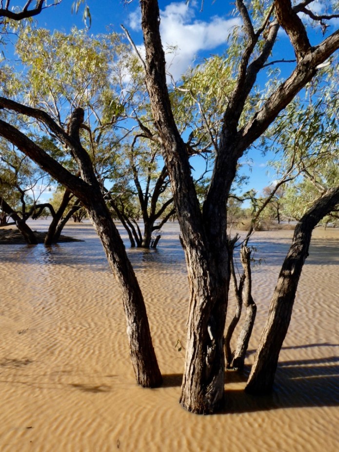
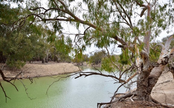
But it never came, well not from the sky but from the north. The rain fell abundantly in the catchment of the Georgina River. Two days later, we drove with Adele to the river where the Mt Isa Road crosses it. The river was flowing with water not sand. The local children were playing in the river-water covering the road. Infants with paper nappies were splashing in the brown liquid. Other children bent down to pick up stones and toss them into the water. Adults stood around talking, an older lady sat on the new bank and her grand children dug channels in the mud making new routes for the rising water.
The water swirled around the tree trunks as three young Aboriginal teenage boys jogged into the water, then swam the deeper midstream until they could reach the bottom again with their feet. A group of three sat on the opposite bank, some 100 metres away from us on our bank. They were sitting patiently in the sunshine. They had crossed earlier today and were marooned as the water level quickly rose. The local station owner was going to bring a motor boat down from his property to ferry them Homeside.
This water is destined for Lake Eyre where it will glisten over the salt until it fills the Great Basin and then pelicans and other sea birds will come to breed and nest in their hundreds and then thousands until the central desert sun dries the lake and recreates it’s salt plain, with a residue of sludgy, salty mud beneath the surface.


South West Walk
South West Walk, Tasmania
26/12/2018
The adventure begins! I am having a wonderful dinner with Jennifer opposite me at Rockwalls Bar and Grill Restaurant, Salamanca Place. An eye fillet steak washed down with an excellent Riesling from France; on its side is a plain rectangular white label with “Burgoyne” in curled italics and 2015 higher on the nape of the bottle.
At 2pm today, I met the other walkers about to commence the South West walk with Tasmanian Expeditions. We met our two Tasmanian Expedition guides at the Mountain Outdoor store in Bathurst Street. I felt a tap on my shoulder and turned to see Earle. Earle was one of the three guides on the Jatbula Trail I completed a few months before. Nom is a young woman and with Earle, the second half of our guiding complement. They checked our gear.
(In retrospect, I really, really need to economise on the gear I take on these long walks but everything seems so… necessary at the time of packing. It does not feel so necessary when I am carting a 24 kilogram pack for 10 hours up hill and down dale.)
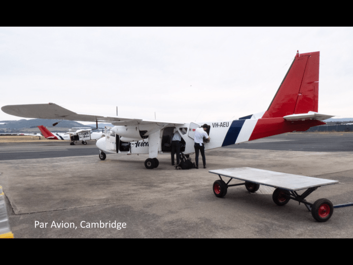
Tomorrow we will meet on the pavement outside the doors of the Astor Private Hotel, for bus transfer to Cambridge airport. From Cambridge, Par Avion will convey our group piecemeal to Melaleuca.
I must admit to some self-doubt about my fitness. I have been training for 4 months with packs and weight vests and I hope that will be enough.
Sunday 30/12/2018
I have not written about any events or musings these last few days due to straight out weariness. A weariness which is not ennui surrounding modern consumerism but weariness which means I cannot actually move any part of my body. Arrive camp, set up tent, collapse (in it), hibernate until I can move something and my overall body pain drops to tolerable levels: this was arrival protocol for the last 3 days of walking.
The reason I am writing today, day 4 of the walk, is that it has been a rest day and I must admit was an opportunity very well received by me.
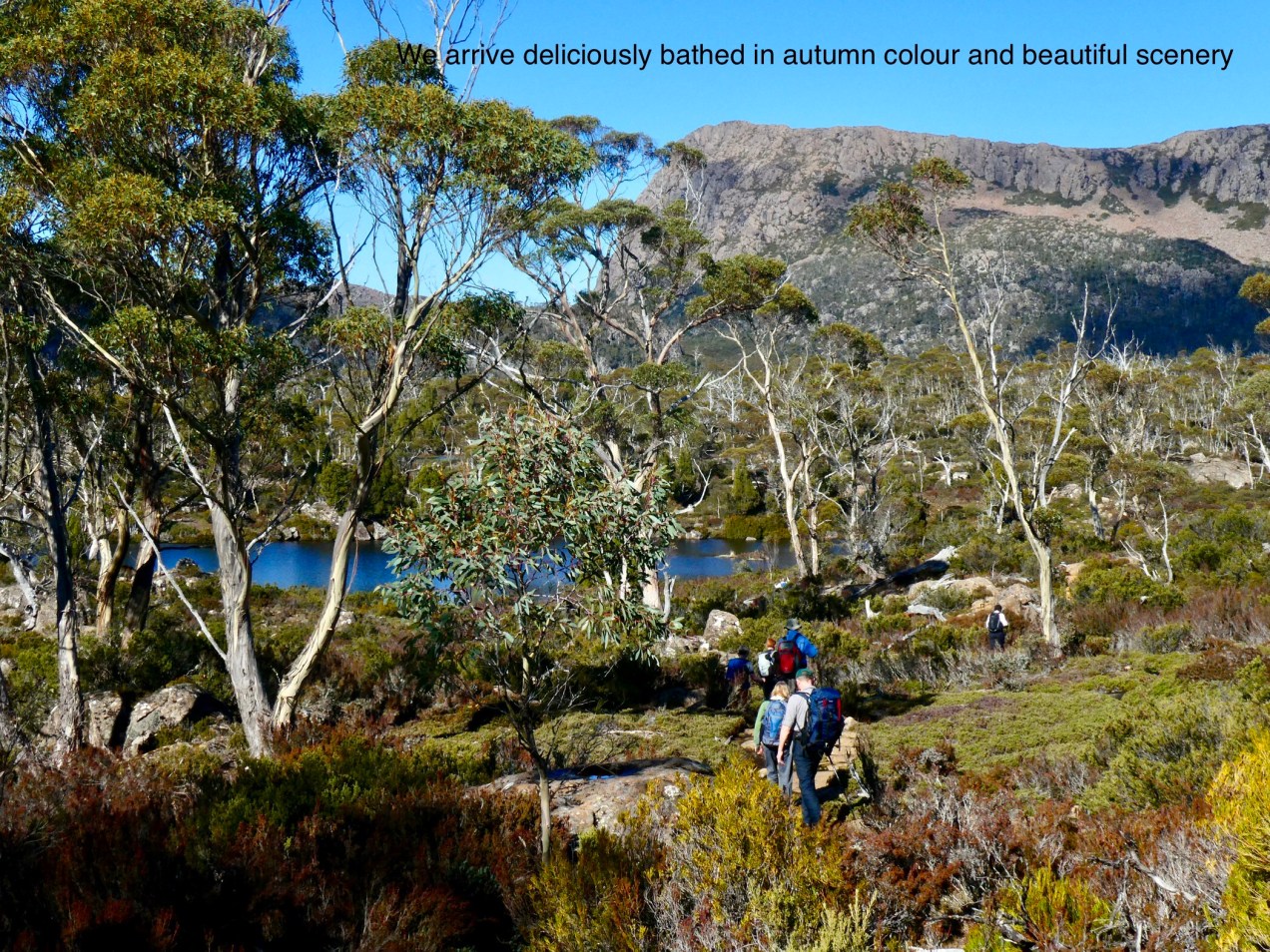
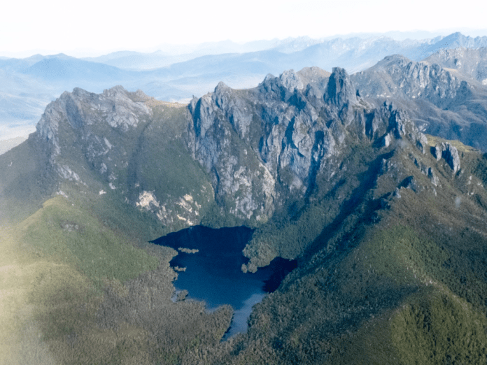
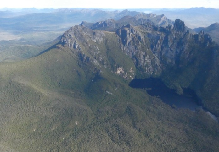
In the late morning of the 27th of December, we arrived in aerial convoy into Melaleuca. Each plane carried four of our party as well as our gear. The flight can be described as fantastic, with almost clear skies, minimal wind and magnificent scenery over which to fly. The blue of the sky punctuated by scatterings of white fluffy clouds and distant views only vanishing into haze hundreds of kilometres away. I could see Cradle Mountain hovering on the horizon far to the north. There were the Western Arthurs rising into the air; ranges of massive rugged mountains some with lakes, blue, still and poised between pillars of stone.
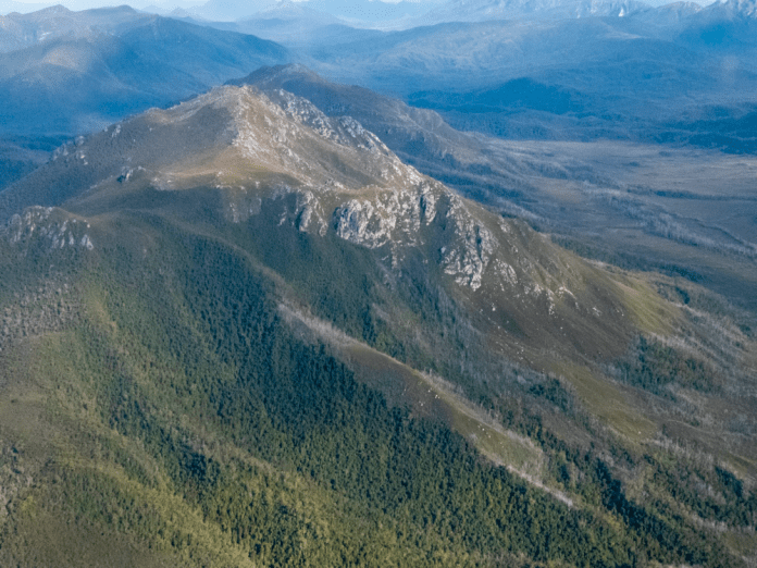
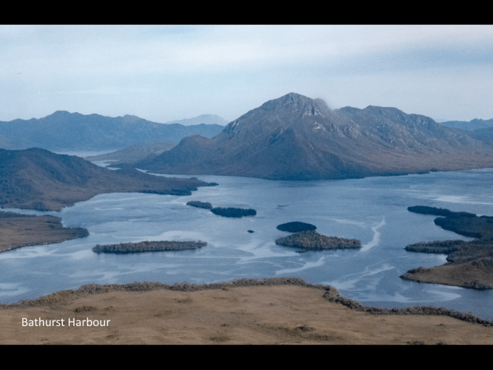
The plane skirted Mt Picton; great buttresses of rock erupted through bare, slopes, all stark and featureless above the dense forest situated below its tree line. Then we saw Bathurst Harbour. It has been barely 45 minutes since we departed Cambridge. The harbour is huge and our destination, Melaleuca, sits on one of the southern arms. Islands dot the harbour. The solitary air strip looks as if a giant pale cream paint roller was run along the ground leaving a narrow white strip. As the plane turns and spirals down, the mountains and ranges all around spin crazily around, until the craft adroitly levels again, and the strip lies in front and just below the nose.
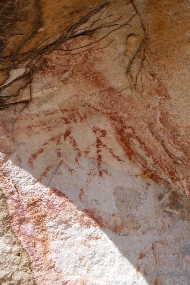
At Melaleuca, we had an hour of free time to explore the area before leaving on the first part of the walk. This afternoon’s hike leads to Cox Bight ; a beach nestled beneath and to the east of the New Harbour Range as it juts into the southern ocean. I visited the Deny King museum, which has displays about the area as well as the many personalities like Deny who lived and worked here for much of their lives. Deny’s old radio transmitter/receiver is on display under a glass cabinet. He used this to communicate with the outside world, to help in rescues and in educating his children. I did the short walk beside the river which eventually carries on all the way to Port Davey. This short walk has many interesting displays about the Aboriginal experience in this region.
I walked back to the airfield. The ranger was wearing gumboots and a sunhat, typical southwest apparel and told us tiger snakes and their babies, were lodged under the water tank. Mmmm. Thirsty or not?
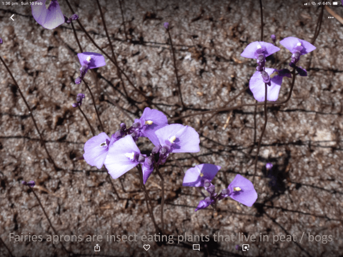
We loaded up, put our packs on and began the 11 km walk to Cox Bight. The track consists of pine boardwalks and dried-out muddy tracks; it winds and undulates gently, surrounded by button grass and low heath. At ground level are fairies aprons as well as sundews emerging from the dense mud. Fairies aprons are single petal purple flowers with thin dark stalks and are carnivorous. They are a member of the genus, bladder worts. The term Bladder worts refers to “bladder” a sac filled with water and “wort” is old English for plant. Water fleas or other insects thriving in the water at the base of the plant. The “bladder” is filled by water under negative pressure, and has a small opening at water level, sealed by stoma. An insect touching these stoma triggers them to open, and water and the insect are then sucked into the bladder. The opening is sealed internally by mucus and then the feast begins! Sundews have glistening, sugary mucus that attracts flies but once they alight, they cannot extricate themselves and then the sundew produces digestive enzymes.
I saw a sun orchid, it was so heavily festooned with flowers that it lay on the surrounding grasses. A duck orchid stood proudly, barely bobbing in the sea breezes.
The boards on which we walked are dry and provide a secure walk way. When wet I think the outcome would be very different. The sliding of hikers on the now wet, already smooth, timber is legendary.
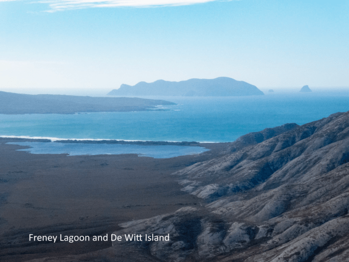
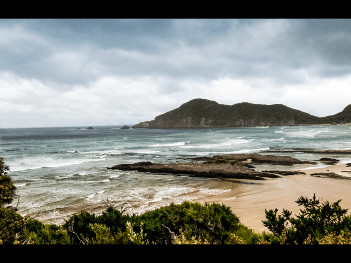
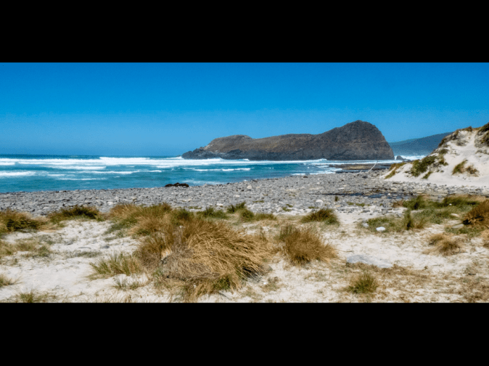
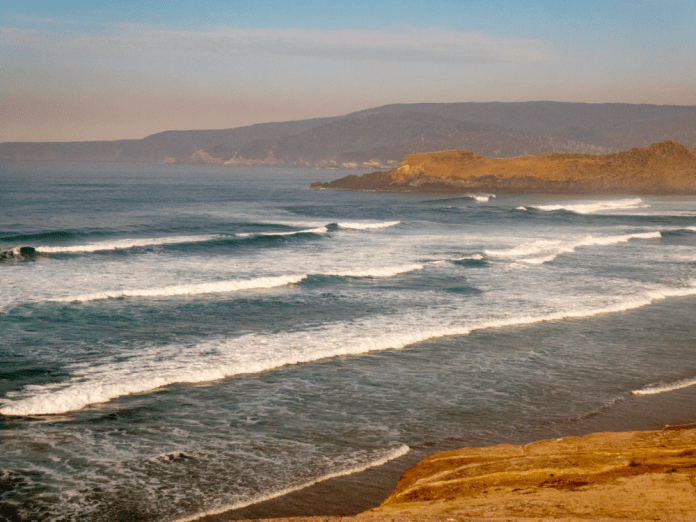
The track slews up and around the lower eastern slopes of New Harbour range. Freney lagoon is a brackish large body of water that lies behind the beach at Cox Bight. Freney lagoon was grey; a silver shimmer danced on its surface in marked contrast to the long lines of rolling white surf coming into Cox Bight from the Southern Ocean.
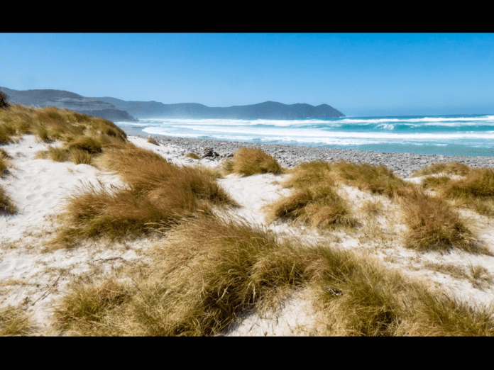
It is only a short walk along the beach to the campsite near Eric Point. The campsite is both beautiful and sheltered. After setting up my tent I walked along a sandy track back down to the beach. White sand within the reach of water darkens to metallic grey as surf transmutes and merges into repeating circles on the bank; wavelets ascend the shore then fall back, awash into the sea. This blisteringly clean beach and coast is magnificently back dropped by Eric Point and New Harbour range.
Some of the walkers decided to go for a swim. They all described the rip on the bays edge.
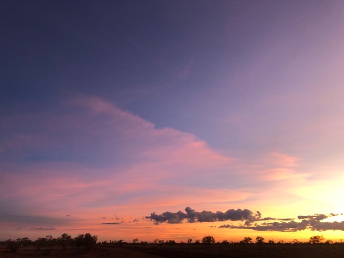
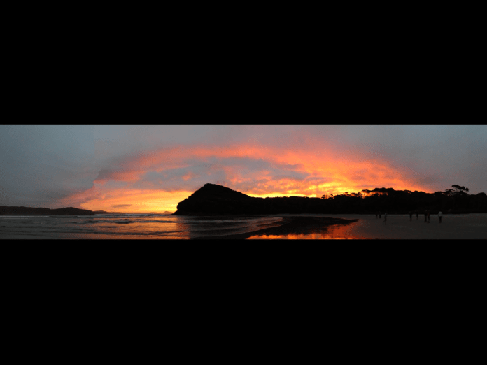
In the approach of evening, a band of curved cloud hung over the hills, and as the sunset grew in colour, the pink purple richness of the sky was reflected in a film of water glistening on the beach.
As I laid my head down in my tent, the sound of surf did not lull me to sleep as I still felt untested on this walk, and much was still to come.
In the morning, I needed to fill my two water bottles for the days walk. A nearby stream carved its way through the beach. The water tested fresh and cool. Our guides had set up breakfast. Tea, porridge and coffee. The way they made coffee is interesting. A large, wide lidded saucepan is filled with water, the water is boiled. Over the top of the boiled water, sprinkle ground coffee. Let it brew for a few minutes. Then score the coffee with a knife (Criss-crossing). Then replace the lid and bang on the side of the saucepan. Then wait for the grounds to sink. This takes about 10 minutes. Then use a scoop to fill your coffee cup while taking care not to disturb the coffee at the bottom of the water.
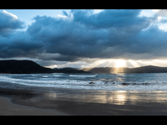
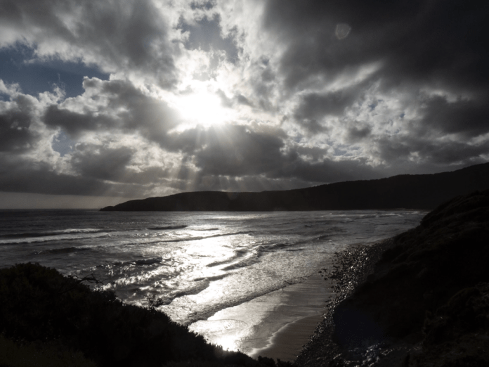
I visited the beach again. To the south the sky was filled with abundant grey cloud, turning the water and surf a steely-grey. Then the sun pierced through a small gap in the clouds, sending scintillating beams of light through the air to dance on the crests.
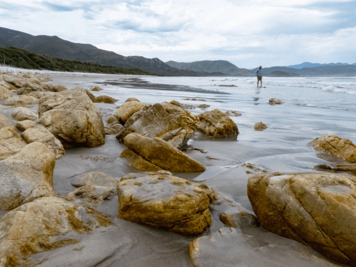
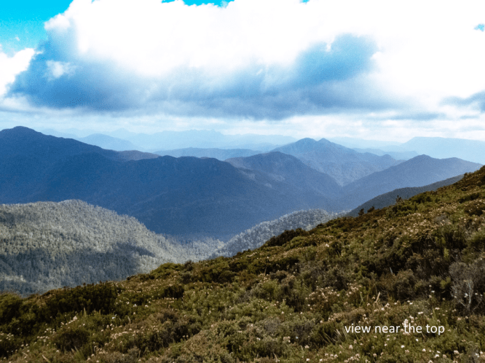
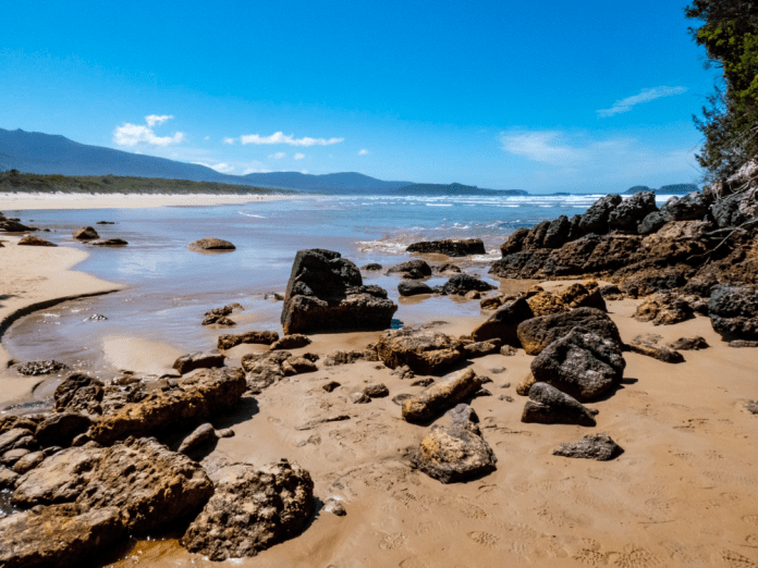
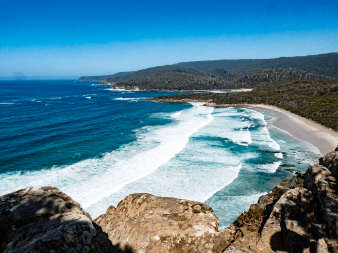
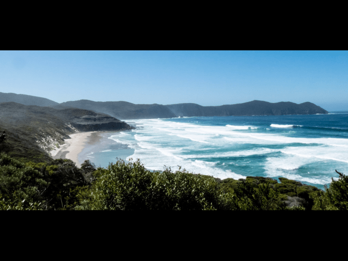
Today we walked from Cox Bight to Louisa River. The walk begins with a stroll along the beach which offers wonderful views in all directions. The full majesty of the New Harbour range becomes increasingly apparent as it rises above the straggly gum trees with each step eastwards. There are a few shallow creek crossings, the streams diffused as water straggles over the shore. The yellow coloured rock at the end of the beach is the point where we left the beach and truly begin our approach to the climb over Red Point Hills. These hills are 250 meters high, with a pretty steep and unrelenting climb. It provides a litmus test to whether a walker (like me) should continue the rest of the South west walk or not.
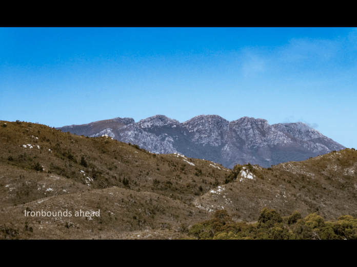
Climbing up carved steps, then rocky depressions, all the time ascending inside a forest; views hidden by the trees. It is indeed a solid walk and a fair test of anyone’s fitness. After descending the hills. The track winds, travelling up and down through the Spica Hills, patches of forest interspersed with heathland full of wind stunted scrub. This scrub is virtually impenetrable. The reason people get lost is that there are sometimes many tracks, created to skirt deep ponds of mud. However, the dry conditions and winds of the last month, have made the muddy areas considerably easier to negotiate. A few creeks were crossed but all were shallow and presented no challenge or concerns. Over one of them, a rope was suspended across to help walkers get over in high water conditions. In a situation where a fall could occur, it is essential to undo the buckles on your pack otherwise there is a real risk of drowning if trapped by your pack under water. Beyond this creek, the forest is murky and dark, trees blotting out the sun. Suddenly I entered a great field of button grass and heath, a waving plain of soft green, and there above low hills was the Ironbound Range, a triple peaked monolith silhouetted against purest, blue sky.
It is a massive range that stands alone, a fusing of four mountains with a demanding 1000meter ascent and then an equally difficult descent.
By this time. Some 7 hours into the walk, I was getting sore in the shoulders. I am using a new pack that I think is operating above its weight specifications and I am sure I have not correctly set it up. It is amazing how additionally fatiguing pain can be over and above the physical effort of a hike. The pain became so troublesome, I just walked in a gritted teeth, determined way but even the aching I was tolerating was not enough to lessen my appreciation of the beautiful views around me.
We then dropped into a narrow valley, into forest, and skirted a river at its bottom following it downstream briefly. Here was the Louisa River and the camp site was on the other side! This river is far from fast flowing now but is none the less much deeper than all the creeks I had already crossed with nonchalance. I tried to balance on rocks to get across and keep my boots dry. Well that did not last long. I slipped in sideways, avoiding a fall into the river but I could not prevent water tumbling over the lips of my gaiters and into my boots. Bother!
I cannot be too upset as the experience of many other walkers is that crossing the Louisa River can be a terrifying affair. A rope crosses over the flow, to provide a hand hold. The water can be deep and very fast flowing and can often be impassable, forcing walkers to wait till it is safe to cross. A small sign advises you to do just this.
The campsite is beside the river. After tipping the excess water out, I put my boots on a fallen tree branch beside my socks to encourage some drying in the afternoon sunlight! I had brought some sandals to wear around the camp site and give my feet a chance to breathe. Early in today’s walk, I had developed a blister on my big toe, and Nom had help me dress it. I was surprised how quickly it formed while still on the beach at Cox bight. I think it put the tape on too tight as the nerves in my toe were affected, almost a tourniquet effect as the toes swelled up on the rest of the walk. Blisters are a serious problem on long walks, a common reason for forcing air evacuation if it becomes impossible to continue.
I found a flat site near the river and near the camp kitchen. I put up the inner part of my tent then correctly fitted the fly on. I had put it on upside down the night before! Other campers did not believe that was even possible to do.
Before dinner, I sat down with Earle and we adjusted the pack back cables to shorten the fitting along my spine. It is a new design to both of us both, but I think we figured it out.
We walked 18 kilometres today and boy, was I tired. I walked down the short track to the river and took many photographs. I followed the river around its bend climbing over branches and balancing on rocks. The water is deeply tannin stained by the tea trees that line the valley and river edge. Like nearly all the water here, it requires no filtration or cleaning. Only at one spot (South East cape rivulet) was the drinking water somewhat brackish and I emptied it as soon as I could to replace it with fresh stream water.
Nom gathered us together after dinner to tell us about the next day, the walk up and over the Ironbounds; up and out of sleeping bags, then breakfast at 4am. The hike is 12 kilometres but involves 1 kilometre up and 1 kilometre down and 1 kilometre across the top. Did I imply it’s hard? Well it certainly is, and all the more for lugging up 23kg of pack. Alan, another walker, carried an item for me that saved me a few kilograms. This was very much appreciated. If I can pre-empt my overall impression of the Ironbounds; it is the hardest walk and the most beautiful walk I have ever done. This description can be justly applied to the entire South West walk.
In the morning, I awoke to a pitch interior in little tent, grabbed my headlight and then quickly packed up my gear into the pack. By 4.30 am I was having porridge, and by 5am I was ready to set off. Light was beginning to filter over the horizon, the valley walls and the trees as I walked into and among the trees and as swiftly, began my ascent.
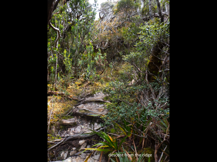
The track winds up steeply through forest, the track alternately rocky and muddy in stages. It’s a grunt, a slog rather than technical mountaineering. We left the tree line, entering the sole preserve of shrubs and grasses. As I climbed these were increasingly lower and more stunted. Around me the wind shrieked louder and louder. While behind me, the clouds looked increasingly threatening and dark, obscuring distant views of the coast, and the nearby mountains and valleys of yesterday’s hike. There were the tell-tale signs of rain, the grey thin streaks of water bending in the wind which was steadily rising more and more as we ascended. Rarely, a portion of the skies would clear and sunlight stream in to illuminate a tiny portion of the landscape. To the south was the Southern Ocean with its surf entering Cox Bight; to the west the majestic Spica hills, and far to the south there were the many islands of the Matsuyker group. I did not know that Sue and Tony, my friends, were sitting at Louisa Bay and thinking of me as I climbed into the teeth of a gale. Then mists, wind and cloud jostled the mountains and I could see nothing more of what was now far below me.
Nom was encouraging me as I walked up. Both of our guides are first rate and blend a love of the country with a ton of practical knowledge about safe walking in remote places like this. Nom explained that it is important to shorten the stick and palm the hand, with the palm over the top of the stick. This helps increase both strength and balance. The pack adjustments made last night, were very helpful in reducing pain in my shoulders.
As I ascended, there were sections of board walk, and some wooden and rock steps to make it easier. It is not a trackless ascent. However, much of the climb up the western side of the Ironbounds is very exposed and as the wind rose and rose, it became harder and harder to keep my balance and walk as well. Some of the other hikers had bad falls injuring knees and ankles.
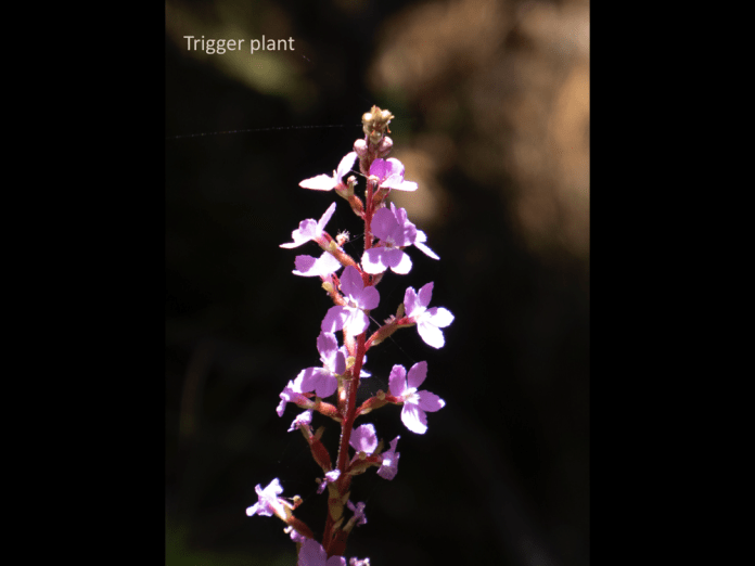
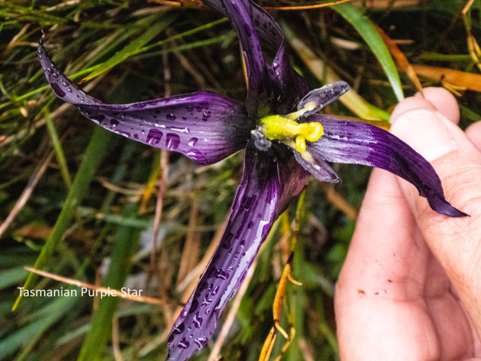
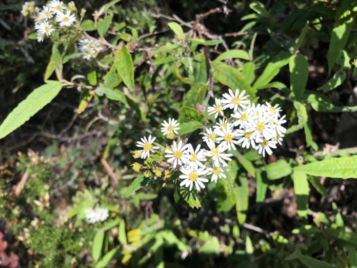
Nom and I found several flowers, including: a Tasmanian Star lily which for all the world looks just like an orchid – it’s a purple flower with long petals and a yellow stamen and style. I photographed this in rain and wind and somehow the shot worked. There were many other flowers including; other irises, Christmas bells with their cherry red bells, spider orchids which should be too delicate for these places but thrive here, and the brown and beautiful duck orchid. Orchids are the largest of all plant groups. They get their nourishment not from photosynthesis like most plants. They have symbiotic fungi that tap into other plants root systems and steal nourishment from them and then shares the stolen sugars and minerals with the orchid perched gaily above.
The ascent is described in three stages, a steep first pinch, a less sloped section then a final steep pinch. I had got used to the less steep middle section, skirting between pillars of rock, decked at their bases with orchids and other flowers. Then I looked up, a high peering through mist, the other walkers were dotted on the slope far above me. With echoes of our favourite movie, Galaxy Quest, “you have got to be kidding”. “Who designed this?”
I climbed up this section feeling somewhat aggrieved but admittedly I was forewarned by Nom. At the top, the wind slammed into me. The boardwalk on this near level section across the tops, would normally provide an easy path but today the wind barrelled over the lip of the mountain throwing me off. Walk a few little, little steps then stop, balance into the wind while the gust hits. I fell twice dancing over the rocks till I was left standing, amazingly with no injury but at some points the boardwalk is high off the ground and I am very glad I did not fall there.
The wind roared over the mountain. It was deafening.
The top of the Ironbounds is reasonably flat, and it is 2 kilometres until High Camp, the first sheltered spot. Actually, this is the first sheltered spot since leaving Louisa River. When I arrived there the earlier arrivals were wearing rain jackets, stamping feet and snacking to keep warm. I enjoyed a muesli bar and a drink of water before heading out again. I was under the impression it was going to be all downhill from here, but I was mistaken. The track re-joined the plateau and quickly became even more exposed to the weather. Earlier the wind would erupt toward me in gusts with pauses, brief ones but with just enough time to shuffle onwards; this time it gusted non-stop. We all had to walk leaning 40 degrees into the wind and walk like crabs clutching our sticks and toppling side-ways to where the descent properly began. The track drops quickly from the plateau but the walk is not precipitous, just “technical”. The term “Technical” is jargon for difficult terrain; abundant muddy tracks, fallen branches, long rocky drops, diverging tracks and all of it, very slippery; yep it was technical.
I can only begin to imagine how hazardous and demanding it would be in really bad weather with rain and fog obscuring the route and frustrating walking. The rain that had dogged the early ascent of the Iron bounds had gone, and sunshine splintered through the overhanging crowns of trees. I soon stopped to remove my waterproof jacket and pull out my tucked in shirt to let it flap around me. Two hours after leaving High Camp, I arrived at Low Camp where I met the leading walkers. I could have stopped for the day right here; my earlier energy was spent. However, on this walk, there were still many kilometres to go before I could relax at a campsite. I just had to dig deep and keep going. The lunch was splendid as always; wraps we could generously stock with salad and meats.
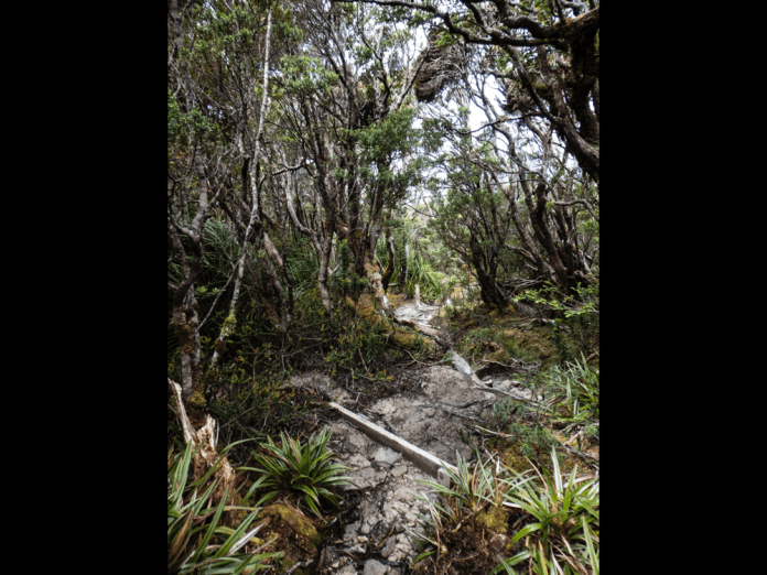
I hope I have made clear how totally demanding the walk is but what I have not emphasized enough is how truly beautiful and biologically amazing the flora is. Over the last two hours I had travelled in alpine flora, then subalpine trees and flowers; wandered into fern glades, littered with glistening moist moss, slime moulds hunting: then entered a dark gloomy rainforest at the bottom of the Ironbounds. If you know New Zealand, this single day is like a Heaphy track in splendid miniature.
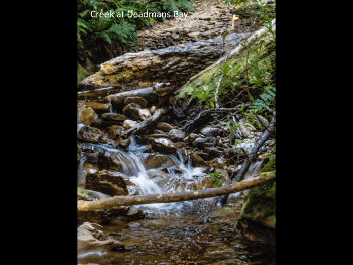
From Low Camp there was still three more hours to get to Little Deadman’s Bay.
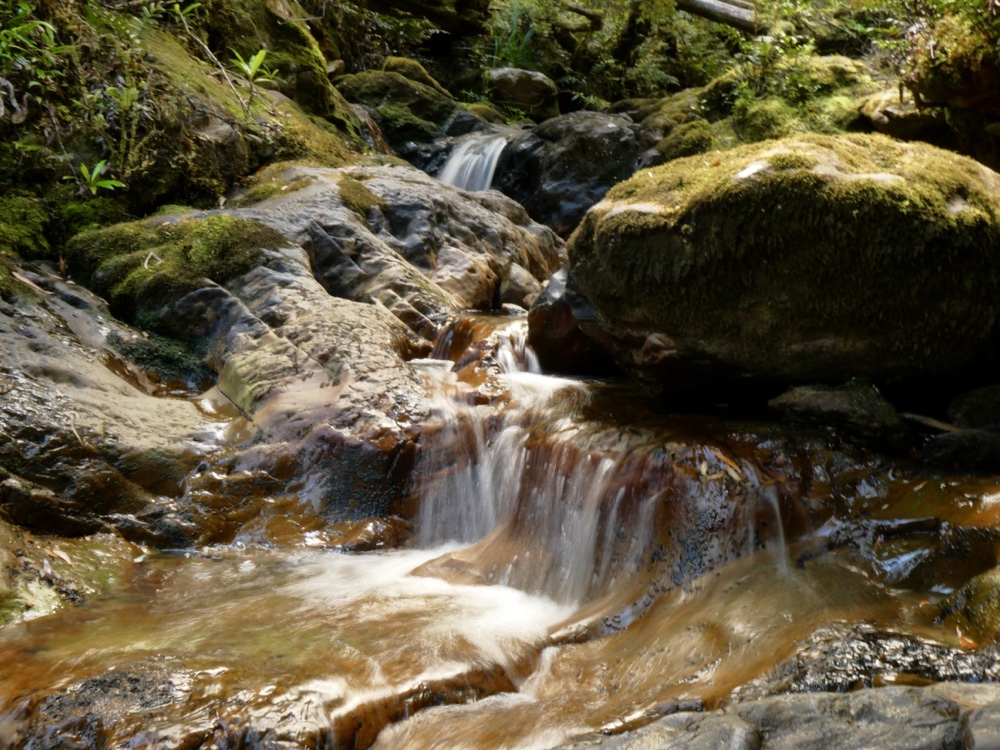
A kilometre from the lunch spot is a set of waterfalls and cascades, great for a rest and a place to fill up my diminishing supply of water. I carried 4 litres of water. One of the bottles had electrolyte solution to replace some of the salts my body lost on the walk; doing this this really helped prevent cramps and muscle fatigue. The rocks and platforms around the waterfalls are sloped and wet, very slippery and especially so when trying to put heavy packs back on. These heavy packs require a wild hurl into the air then swiftly swinging a shoulder under one harness before wrestling into it, and that is hard enough to do correctly on the flat. Luckily, Earle has spent some time with me resetting the pack and as a result the walk was much more comfortable than on the previous day. Most of the remaining three hours walking was on easier track with the notable exception of the first few kilometres. This section had a steep sideways cambered slope, so it paid not to fall over and end up down in the tree filled gully on my right. Considerable erosion combined from, the many walkers, the wild rain and weather, had severely narrowed the track and made many sections deep and very muddy. Then suddenly there was a hint of blue, the ocean through the trees, and steadily the increasing roar of surf penetrated the forest. There was still 45 minutes to go, and the track was now quite easy twisting its way amongst sassafras, coast banksias and ferns. The track hovers above the coast, the rocky cliffs and promontories, and rocky narrow grottos at sea level: all struck by waves that surge up their stony flanks. The sea is a blue expanse rippled by long lines of waves which span the full length of the greater bay. As they finally meet land they become airborne, roaring into tumbling, white foam above the rocks.
There are many small inlets, choked with kelp and offering caves in their cliffs. Alan climbed down to one the next day and later told us about the sounds of water echoing within them as water surged in.
The rocks and platforms of the many inlets glisten and glow, reflecting the light of the falling sun.
I arrived at the camp at Little Deadman’s Bay at 6pm; I had walked for at least 12 hours after commencing at 5 am. I was astonished that I felt less tired than at the end of the previous day. However, all I wanted to do was sleep. It had been easy to keep myself well hydrated using the twin water bottles tucked in small packs on my front. After dinner, a pasta dish, I went to bed and crashed into slumber. I don’t think I even dreamed, just slept! I woke at 6am and decided to spend this break day bludging which was more- or- less the plan from the start. This was a designated rest day and I was going to do just that. I beach combed up and along the small bay, then wandered a short distance along the forest tracks; I sat on rocky platforms to admire and photograph the beautiful southern light and gorgeous coastal scenery. Off the coast are magnificent islands including: DeWitt, Il de Golfe, both are part of the larger Maatsuyker group. To the south east, South Cape could be seen jutting into the Southern Ocean. Though my legs did not actually hurt they were not really interested or indeed motivated to do things like lift me up or walk more than a short distance, so I spent much of the day resting in my tent, eating and reading. I sent messages to Jennifer on my In-reach communicator, just to let her know I was okay and what I was doing. It is only capable of sending and receiving text but does include a map of my location with very accurate longitude and latitude. Being able to keep in touch with Jennifer was great for my morale. The weather was exceptionally kind, sunny and a warm breeze perfect for drying off wet boots, gaiters and other gear.
31/12/2018
Well 2019 is about to commence. I am in my tent camped at Surprise Bay as I write this. Unlike the soft lapping of the water at Little Deadman’s Bay or the riverine gurgling at Louisa river, there is now the steady sound of uninterrupted surf; white caps on the top of the rolls of waves are ceaselessly entering Surprise Bay. In the distance, surf is jetting into the air as the ocean washes up the rocky edges of islands off Pretty Point. Before I wrote this, I went for a morning walk on the sand and amongst the rocks, to take advantage of the morning light. When descending to the beach from the campsite, the track steepens and a rope with monkey fists tied along its length provides traction and support. At the base of this cliff, my first obstacle is a lagoon; depending on the tide it is about 5 metres across. It is shallow now and the water is refreshing as I wade through it. It is cool and wet on my bare ankles and feet as I cross over to the beach. Now I am wearing sandals, so it does not matter if they get wet. Seagulls wheel in the air and screech as I approach their nesting platforms hidden high among the rocks. My short walk on a lonely beautiful beach is an inspiring way to commence the day. However, I am getting ahead of myself so I will recommence today’s story with the tale of my walk from Little Dead man’s bay which ended at Surprise Bay last night.
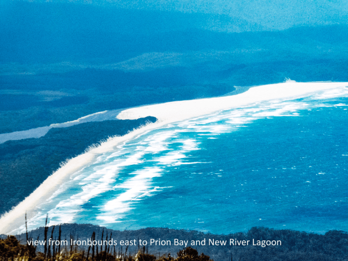
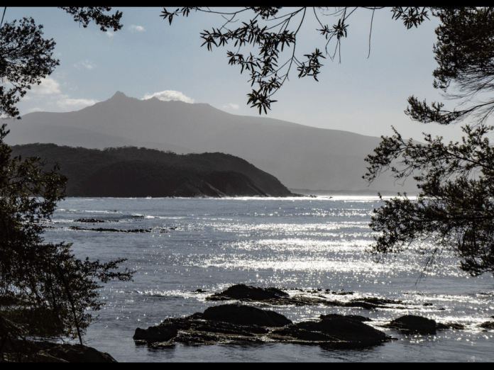
Though it is “only” thirteen kilometres from Little Deadman’s bay to the campsite at Surprise Bay, it took me 13 hours including breaks; leaving at 8am and arriving at 7pm. The walk begins with a short stroll along the rocky Little Dead man’s Bay, past the little creek that provides such delicious fresh water, until reaching an orange marker on a tree. Here is where the track continues. The track is rough (but easy to follow) requiring sustained concentration on foot placement and balance. An injury anywhere on this walk would be very difficult to manage. On a map the small black dots that signify the walk route break few contour lines, but inside that contour interval of 40 metres, it undulates and twists remorselessly. We briefly walk along Deadman Bay before leaving the coast once more to walk through forest and climb over Menzies Bluff. Many matures trees provide shade for this section of the walk. About three hours after leaving Little Deadman’s Bay we reach the stately Prion beach. The walk along Prion beach goes for four kilometres and provides wonderful views of the surrounding mountains, and adjacent ocean. We continued along its length until meeting a sandbar. Here we turned north to find the boats and other walkers all making ready to cross. The boats are well secured against rising tides and weather and we needed to unclip and haul them down to the wide lagoons water line. This beautiful body of water, the end of the biggest river of this coast is named New River lagoon. The water is a deep blue, a breeze ruffling its surface; there is a band of trees and scrub and standing far behind and high above them, I can see Precipitous Bluff. This is an impressive near vertical monolith stained an even blue by haze and distance. To cross, packs are stowed in the rowboats and oars placed in rowlocks; it only takes 10 minutes to row across. It is essential to leave a boat on each side and both will need to be secured as we leave. The attachment points are sturdy steel carabineers attached in turn to heavy rope. We had lunch sitting on the ground in the forest lying just beyond the lagoon. The weather was beautiful, sunshine and clear skies, it all made for amazing vistas. I could only imagine how difficult it would be to cross the lagoon in rough seas and heavy rain.
After lunch we continued the walk. The track first dropped into forest, its warm still air hovers in the shade. Then a sudden climb, a grunt up a short climb to a vantage point; I could see Precipitous bluff, and to the left and much further away was Federation Peak, looking like a small collection of toppled pillars on the horizon.
We left the coast, losing sight of water and waves, walking on tracks, some muddy, some very muddy, through plains of button grass and heath. Here at last we met the serious mud for which this walk is famous (or is that infamous). I have not described the extensive lengths of track that had mud some 20 cm deep but here some bogs a metre or more in depth and were met with no warning. Nom plopped downwards in front of me as if she was riding a fast elevator straight down. She adeptly lurched to the right placing herself against the more solid edge of the track. Alan helped hoist her out. Luckily her boots stayed on; boots can be sucked off in the process of being extracted from the sucking mud.
The boardwalks are few on this section of the walk. Typically, they consist of two parallel boards, 10 cm wide and 2 metres long; there is usually no chicken-wire (anti slip) covering them. This is not a problem in the dry conditions we have had on our walk but in the wet the timber can be very slippery indeed. I should mention that the weather conditions of this current walk are exceptional; dry, minimal rain, warm sunny days. Look it certainly makes for easier, more pleasant walking but the plants, especially ferns and shrubs looked stressed. They flourish in and are adapted for wind, cool weather and frequent rain, not these persisting sunny, hot and dry conditions. Even while I was walking this section, fires were kindling north of me, in the heart of the South West Wilderness Area.
Soon we re-entered forest, appreciative of the shade and skirted the coast once more, providing more opportunities for views of the steep rocky promontories piercing the southern sea. It was now two kilometres from the tracks junction with Surprise Bay. By now I am tired but there is no option but to continue. In this situation, I rely on my training for the walk; the fitness it has provided as well as a determination to just keep going. Life is about two things; turning up and keeping going. I think that most people who do this walk have to dig deep in their personal resources (physical and mental) at one stage or another. I did not rely on mental and physical toughness. I snacked on glucose treats. I had muesli bars. I made sure every second litre of fluid I drank was topped with electrolyte solution to replace some of the salts lost in sweat on the walk; disturbances in body chemistry are easily prevented but hard to remedy without prolonged rest.
The track wove its way up and down through forests of tall eucalypts and ancient tree ferns, their litter of shed leaves and fallen fronds making this steep track deliciously soft underfoot. The fronds of the many ferns hanging above shone with golden auroras of light from the setting sun. I was simultaneously tired in one sense but refreshed in another; it is strange how two such contrary feelings can exist side by side. Now, the walk meets a steep uphill section, then turns beginning a gentle downhill meander that seemed to be take me near the beach, so close I felt I was about to arrive, then it drifted away, time and time again this happened before finally I arrived at the beach.
This beach is truly beautiful and worth every painful step to get here. The sand is clean, white and pure, it surrounds several rock formations; sandstone and conglomerate cobbled together; then tossed into the sky by the energies of the ancient earth. It reminded me of the Statue of Liberty tipped askew and emerging from a similar beach in the closing scene of the original “Planet of the Apes”.
There is still a kilometre to go and my feet hurt! When I walk up a track and especially down a cliff, my increasingly swollen toes jam and strike the boots toe box.
At the end of the beach is shallow river, it is an easy wade across to reach a rocky platform. This continues up a cliff. Here is the end of a gracefully curving lagoon, tannin coloured water eager to enter the ocean. As I cross the flow tugs at my ankles. The track then continues on up a steep rock face which is easy to climb because of a length of sturdy rope, its repeated knots provide hand holds allowing me to haul myself up, step by step.
The campsite is only a few tens of metres further on. By now I am in a daze and intellectually struggle to find a camp spot. All my mental processes are sluggish; thick like cold porridge. Finally, I find a site, assemble my tent, climb in and rest without bothering to inflate a mat or pillow; being horizontal never felt so good!
At 7:40 pm I felt rejuvenated enough to climb down to the beach. I crossed the river in my sandals then walked across the sandy shore. The sun was now low in the sky; coloured horizon and clouds glowed in orange and gold in interrupted bands; its richness mirrored faithfully in the sheen of seawater on the beach.
Dinner was cooked by our terrific guides and consisted of Beef Stroganoff with Tim Tams for dessert. Afterwards I slept very well.
Today, it is only a short walk of 3 hours to the campsite at the east end of Granite Bay.
1/1/2019
It is 6pm and I am sitting after a fashion in my tent at Granite Bay Campsite; I am more hunched over than I would prefer as I am scribbling on my note pad. It is too hard writing lying down. We spent the morning relaxing at Surprise Bay and left on the walk to Granite Bay after lunch. Nom gave us a very interesting talk about ferns. The track enters the forest and goes up and up, and you guessed it, up some more. The track is not rough just steep. The forest itself is beautiful; mountain gums, ferns, mountain peppers, geebungs and many other Tasmanian shrubs and trees create a botanical wonderland which is a pleasure to walk within. The track then descends to Granite Bay. There is a precipitous climb down an ancient timber ladder held together by ropes down to the beach, all of which I negotiated on my bottom. Large packs have an unspoken shared conspiracy with any ladder to cause teeter tottering on any descent. I am a safe walker but not an elegant one! Nom stepped down this rickety ladder with complete confidence.
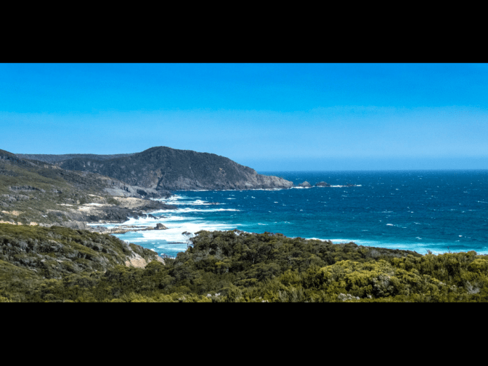
At the beach we could see across the waves and ocean swells, the magnificent cliffs of South Cape. These kilometres of dolerite cliffs, Earle explained, are 300 metres high. Dolerite is ancient, it forms deep beneath the surface and is immensely strong rock: it has been described as the backbone of Tasmania. These cliffs drop vertically into the ocean, each hexagonal pillar fused to its neighbour for aeons. Sea surf crashes into their bases never endingly sending up jets of salty sea spray into clouds of sea haze.
It was a short walk along a rocky beach, hence the name Granite Bay. The surf covered the sandy part of the shore near the water’s edge. We had to clamber like lobsters with our walking sticks in place of pincers, balancing on the slippery rocks. At the end of the beach is a waterfall which was not all that impressive owing to minimal rain. I clambered up the rock face with some help and then it was barely a hop and a step to the campsite. This is perhaps my favourite camping area of the entire walk, with abundant tea trees, plum trees, and celery top pines. Later on, Alan and I visited a small waterfall upstream of the other waterfall that plunges onto the beach.
2/1/19
This morning we left the Granite Bay campsite. My sleep was only interrupted by the need to get up at 1 am and reorient the tent. It was a simple matter to remove pegs and turn it to lie down the slope and not obliquely across it. The entire slope issue had utterly escaped me when I set up the inner and fly earlier in the day. The wind howled over me as I fixed the tent pegs down. The toilet at this camp site is a disgrace! Most of the toilets on the walk are modern enough with heavy doors which cannot be opened by the local fauna and a seat and “bowl” over a drop toilet. At Granite bay, there was merely a small rectangular hole in the floor, no seat at all, and already the results of the morning ablutions were sad to say the least. Eeech!
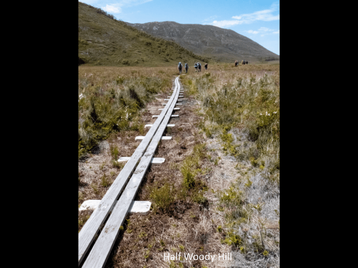
We left the campsite at 7:50 am and immediately entered forest and began a 5 kilometre climb up a rocky track of which the first two were very steep. On the way up, the track would dip creating hollows where water and mud would collect, creating some very boggy track. These bogs are not only deep but wide as well and it can be challenging to skirt them without damaging the track even further. I think that in these difficult sections, there should be track work to not only ease walker access but help prevent erosion. The track modifications need to be selective, targeting stretches of track where walkers are causing damage. On the sections of the walk with boardwalk or hardened surface, plants and flowers can be found right beside the track while in the muddy boggy sections, the churn of 1500 (per annum) walkers prevent anything at all from growing there.
The track dried out considerably as the highest point was reached. The other walkers were waiting under a canopy of tall eucalypts. They were talking about seeing a large tiger snake on the track. I never saw a snake on the entire walk which does not bother me one bit. After a snack and a drink, I hauled my pack back on, and headed down the track. It was a beautiful walk, a track winding its way gently downhill amongst tall straight mountain gums, between ferns and scattered native trees. Then the track emerged suddenly into splendid sunshine before carrying along a boardwalk to the lunch spot; the route sinuously twisting in a landscape of dense heath and small native trees.
Lunch: wraps stuffed with salad, salami, cheese and tomato.
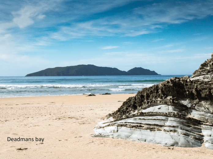
There was only a further three kilometres to go after lunch. After lunch, there was yet another climb but a much gentler one than earlier. Then it drops down slowly descending a long ridge. On the way, it cuts across to the clifftops, to form eyries with fine views of South Cape and Ocean far below. The track ends today at South Cape Rivulet. At the rivulet, Earle lead us seaward where the water was shallow. The rivulet enters at the western end of superb long sandy beach with a forest of tea tree and tall native grasses above the seashore. To my left, the rivulet widens into a wide, serpentine lagoon that blends into forest. Sunlight lit up the leafy crowns of the tallest trees on the hills above the lagoon. Far across the bay, South East Cape beckoned amongst surf and waves: as the sun provides a crystalline blue sky to bathe all of the bay and beach.
In a romantic (impractical) beachcomber way, I pitched my tent on the sand on the beach. There was some shelter from the wind but not nearly enough. I improvised sand pegs, burying the pegs in the sand. The tent at least was not going to blow away. I was feeling smug with myself. I rested in the tent and though admittedly it was not going to blow away, least of all with my weight inside, the walls of the tent were flattened into my face by the wind. I decided I would move the tent and I soon found a much more sheltered spot among the grass trees. Mum and daughter on the walk pitched their two- person tent adjacent to me. Suddenly a gust of wind pulled the tent into the air, jettisoning the pegs into the underbrush. They (the pegs) were never located. I must bear some responsibility as my first choice of campsite heavily influenced their own selection. In my new campsite, I could still hear the roar of the surf and the wind blowing through the trees but now that the tent was sheltered and motionless. I would sleep easily.
3/1/19
I have had a nap. The day has been all a dreamy heat and after a short walk from the Rivulet camp site we soon arrived at the new campsite located just beyond Lionhead Island. I slept okay last night at South Cape Rivulet, but it was too warm, and overnight, I soon exited my sleeping bag and thermals to lie on them instead. These small tents are terrific at keeping heat in and the fly zips are not adequate to adequately ventilate them. After so many days with no shower, I am glad I was in a single person tent.
This morning I woke up, grabbed my trusty camera, a Panasonic TZ-90, and revisited the beach for some early morning photography. It impossible for me to do justice in words or even pictures to the serenity and still beauty of this place. Far in the distance, across an expanse of ocean, is South East Cape a narrow promontory, a featureless blue due to sea and wind haze. Turning my eyes to the left, I can see a nearer promontory, its distinct layers of stone and rock merging with the east end of the beach. Surf crashes over the rocky platforms that emerge from the sand covering them in white flecks of tumbling water. The beach sweeps around the bay, white and unobstructed, with hooded plovers quickly marching on the shore, sea gulls and pied oyster-catchers wheel over the waves before landing on the beach and peck at the sand beneath their feet. Grasses clump in small protective mats in the sand higher up the beach. Behind them tea trees and taller grasses form a forest well above the water-line. The surf roars non-stop: long unbroken wave crests cross the width of the bay, before crashing into rocky points or surging up the beach where I am standing. Waves surge into the mouth of the rivulet, sending ripples across the brown water of the lagoon before dissipating upstream, wobbling the tree reflections as they pass.
I followed the rivulet upstream, it bends first to the left and then to the right, it is a wide and lazy water, mirroring the forest above it. After breakfast and packing up my gear, we began the walk from South Cape Rivulet to Lionhead. The walk begins along the beach which I had already explored, turning off into the scrub at the orange marker used the length of this track. It began on loose stones to a clear smooth track. The walk goes through coastal forest, full of banksias, ferns and low gum trees, forever shorn of height by winter storms and winds. The way was often overgrown; I struggled to clear the path with my sticks trying to locate any snakes. The track was muddy in sections and moderately steep. Some trees had been felled by wind or weather and had to be climbed over, but all in all, it was not a difficult walk. I arrived at the first of two beaches. As I walked along the sand skirting the waves, I looked up to see a gothic tower, perhaps built by nature out of its arrogant opposition to surf and waves; its crown was the wild water tossed high over its battlements.
Then this beach was left behind. The walk twisted upwards through forest before descending to a sandy grotto where the most delicious water flowed. The water at the rivulet had been adequate but was a bit too brackish to enjoy. I glutted myself with this new water before filling my two water bottles. There was only a short walk to the beach, worn boots collapsing in the soft deep sand.
I walked along the stony uphill section of the beach, past Lionhead rock and I would have carried on all the way to Cockle Creek given the ease of the walking. Earle tapped me on the shoulder and telling me I had walked right past the campsite. I had seen the steps leading up the site but carried on anyway. It was located very close to the stream where I had stopped earlier to drink. The timber stairs are solid and well built. The drop on either side of the steps is a few metres. I am a bit nervous of heights, but Nom sensing my concerns, had told me of a useful trick. Hold your poles in front of you and just in the periphery of your vison. The brain sees this as a wall and if you don’t dilly dally, the brain can maintain this illusion long enough to descend a staircase or steep, narrow slope or a narrow bridge.
At the top of the staircase is a short boardwalk through tea trees to leads to a small campsite. We had the pick of the sites as we were the first to arrive that day. Later arrivals had to find other sites such as near the bottom of the stair case amongst the grasses or in the sand behind the beach.
Most of the other walkers decided to try and walk to south East Cape. Though it looks close on the map, the tough tea tree, heath and scrub make a direct traverse impractical. This was my opinion. I stayed behind enjoying a nap in my tent, a quiet read on my kindle, and a pleasant generally mindless reverie in the afternoon sunshine; an afternoon filtered through the branches.
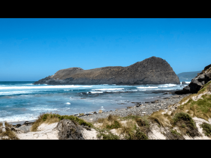
I wandered down to the beach to fill up my bottles once more and then walked to explore the rocks and rock pools beneath the Lionhead, the huge stone island abutting the coast. To me it resembles a lion couchant, with its hind quarters facing the incoming seas. Between the island and the beach are vast rock pools and stone formations, while giant untethered kelp now wafts in the water beneath its surface.
The others arrived back at 4pm.
Tomorrow is the final section of the South West walk, the 11 kilometres to Cockle Creek.
4/1/19
I am lying in bed at Amberly House, Sandy Bay road. I have had a shower, extracted dead insects from behind my ears, admired the wreckage of my toes, shaved my nine-day beard and have put on clean clothes.
This morning began at Lionhead, after a hot night in the tent. I opened the fly as much as I could do but it was still warm, too warm to stay consistently asleep. I woke up at 5:30 am, I let my thoughts meander for 30 minutes, vainly trying to slot them in useful parts of my brain. I packed my gear into the pack, sent a message to Jennifer on the in reach and had breakfast. Porridge in a bowl, added hot water, mixed vigorously with a spoon till the flakes dissolve and form an edible mixture. I scooped a cup of coffee into my cup with the ladle sitting on the lid.
I descended the four flights of stairs. I stopped often to admire the impressive views of beach and coast. Unfortunately, the clear vista of the Lionhead itself was obscured by haze. I walked along the beach leaving Lionhead behind me. The sea haze filled the atmosphere over the beach giving a magical quality, a hazy background to silhouettes of the walkers further along the beach. The track commences with a short steep path from the beach, up and over Coal Bluff where there is a visible seam of coal. Fragments of what look like shattered briquettes crunch under foot. The track enters a forest; cool shade is very welcome as the day is already beginning to warm up. The path is easy, its undemanding nature makes for quick walking. Also, the packs are the lightest they have been, putting lightness in the step. The forest soon opens out into a rolling expanse of button grass and heath. The coastal views of ocean and mountains enjoyed early in the walk are now replaced by low hills, with none of the drama of our first climbs. It is none the less gentle sweet country. We finally enter a tea tree woodland, before arriving at Cockle creek. I had spent much of today’s hike walk chatting with first one then another of my fellow walkers and the day had gone quickly.
We visited the whale sculpture and generally stretched our legs, having left our packs near where the bus would arrive. We boarded the bus on our return to our packs. We stopped for lunch in Huon at a café. We soon arrived at our destination outside the Astor Private hotel. The walk was over at last.
Afterword
I am in the townhouse at Alice Springs, its hot outside but the air conditioners are keeping us both comfortable. It has been four weeks since I completed the walk. I can sum up the walk like this; it was the hardest walk I have ever done, and the most beautiful. The other walkers and guides supported and encouraged me and I did likewise for them. Perhaps this is the most important lesson for me; whatever you can achieve alone is nothing when compared to what can be achieved as a team working toward the same goal.
Walking in Tasmania
As you may realise not a great deal happened on our stint in October. It’s starting to resemble comfortable slippers, a few less surprises and a lot more comfort. I took some sky photos in Hart’s Range. This is a community on the Plenty Highway only about Three hundred and fifty kilometres from the Queensland border. Almost shopping distance! The accomodation for staff is a short distance from the community so it makes walks in the surrounding country easier and being outside at night is a bit safer too.


 I was able to do some wilderness walks with friends while back in Launceston.
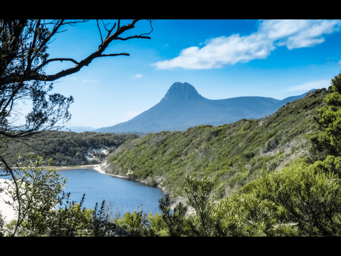
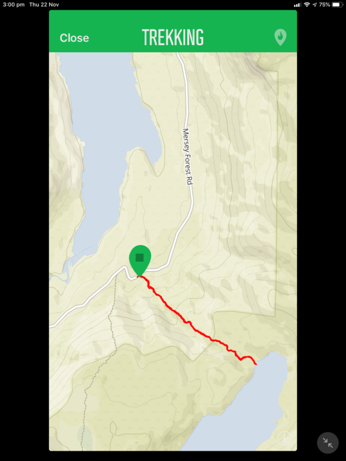
I joined a walk with the Ramblers club. It’s was a fine sunny day, a Sunday. We drove all the way to Lake Rowellan and along the Mersey forest road. This road allows access to the Walls walk, Lake Myrtle and of course Lake Louisa. Yep, we were going to walk to this highland lake. An ancient glacial lake which splashes its banks only 3 kilometres from Lake Rowellan but it’s a somewhat vertical route. The walk starts about 100 meters short of the Juno river road crossing. Pink tape is suspended from tree branches to mark the start and to indicate much of the route. The track is not well defined but if there is any doubt, just go up!
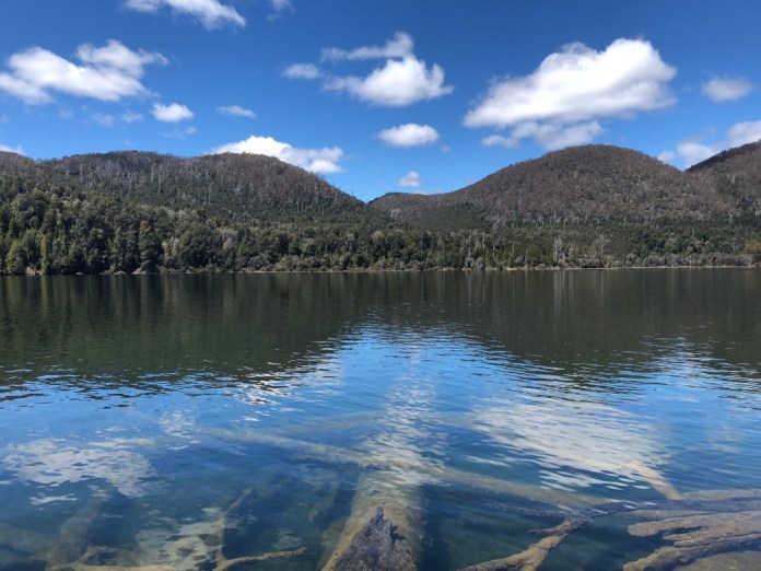
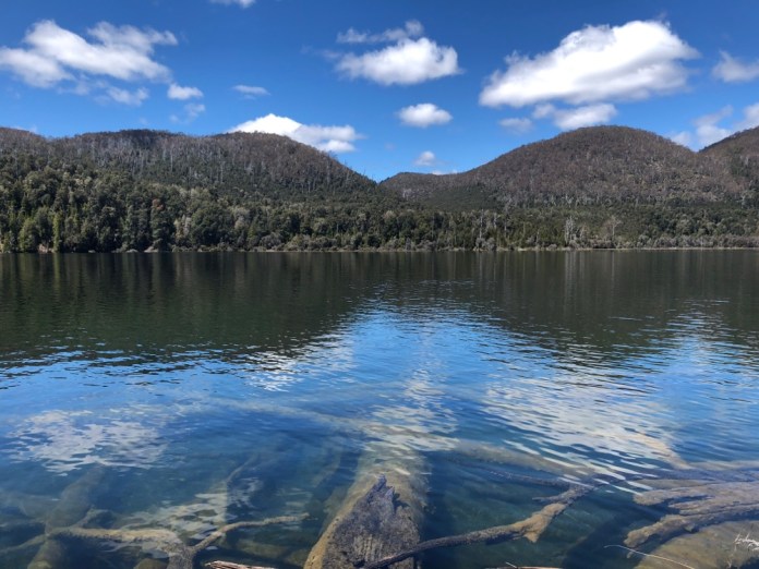
There were 16 walkers, Jock took up the tail end and Trevor lead the way. We were warned to keep the next walker in sight because of the scrub and narrow winding track. It’s a solid climb up, including a short scrambles over rocks and trees that have crashed on the path, then a refreshing meander through a glistening rainforest, all the branches, mosses and lichens dripping with moisture despite the sunshine. A slime mould which I kid you not, resembled snot smeared over a child’s cheeks, it was white and shiny and snotty on a log we all carefully stepped over. The end of the track is on a narrow lake bank. We stopped for lunch right here and munched sandwiches while enjoying the view both sublime and very peaceful.The water was so clean and clear, the ancient logs which had tumbled in over the years could be distinctly seen beneath the surface.
The weather was beautiful from start to finish. We headed down, and thankfully, it’s never as steep going back. Funny that. We surfaced from the forest above Juno creek taking some photos there before re entering the forest and then dropping down to the road.
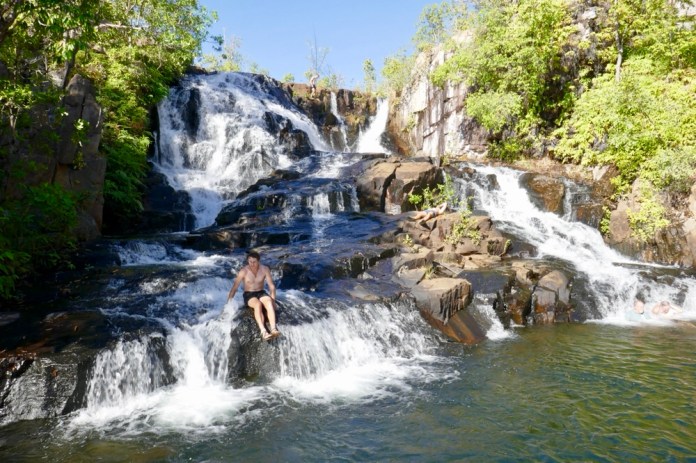
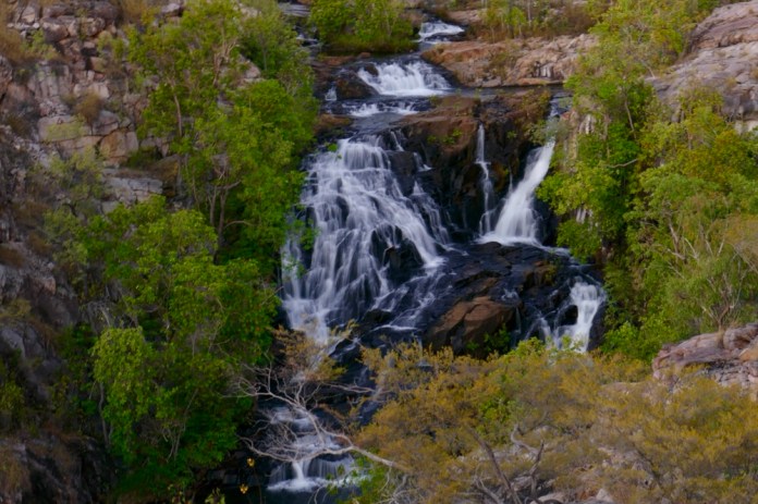
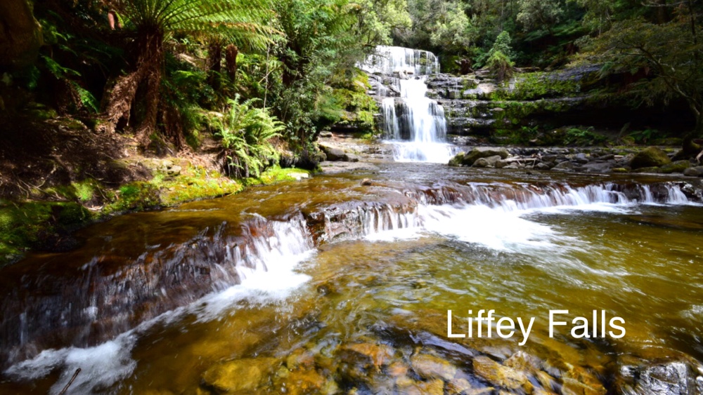
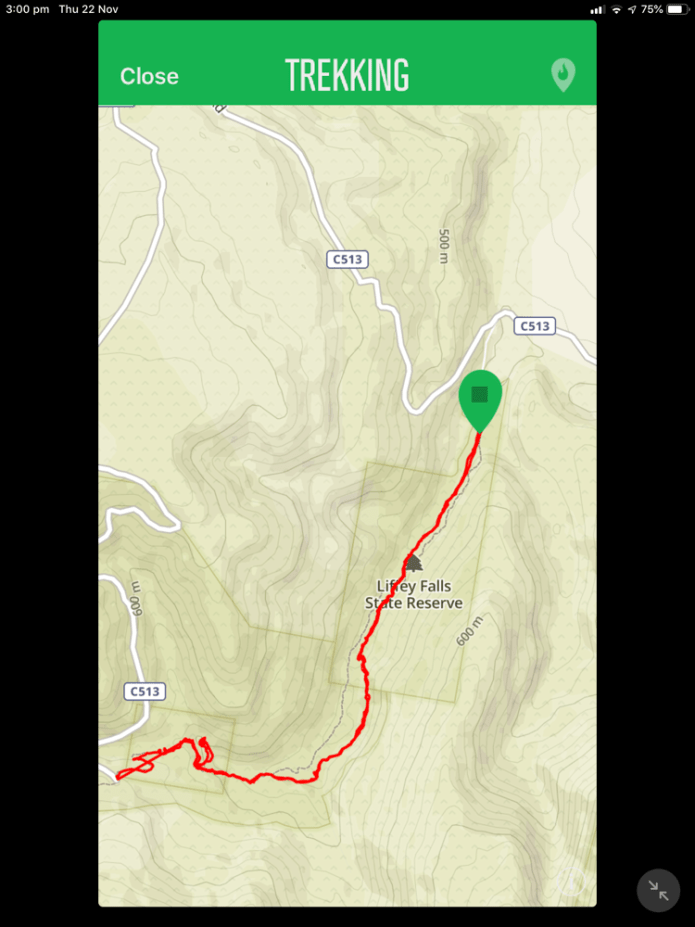
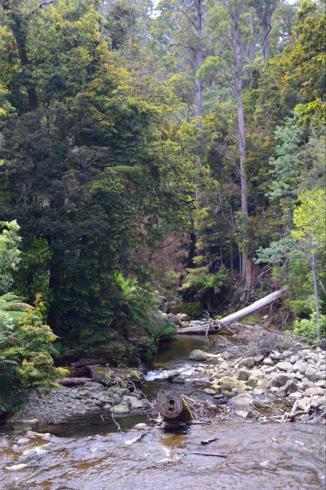
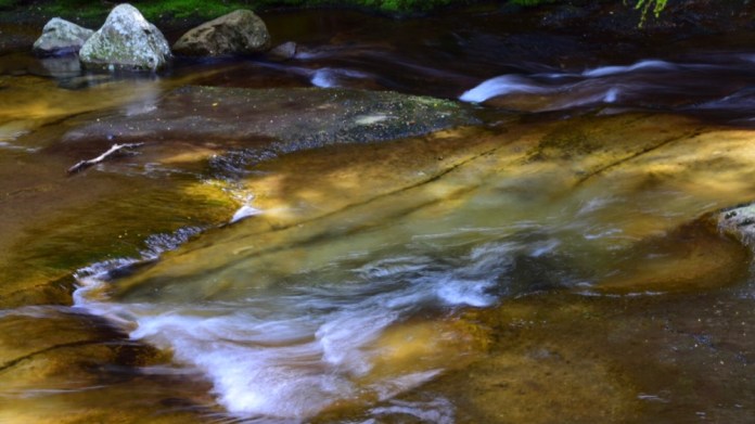
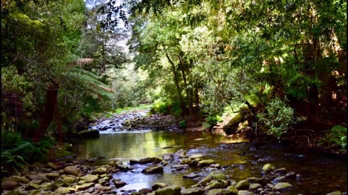
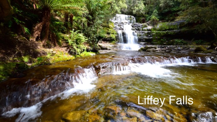
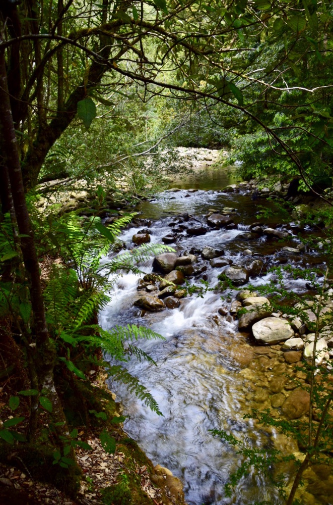
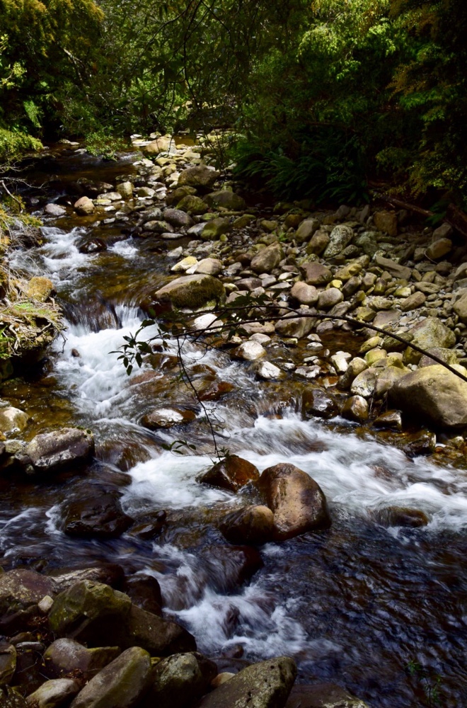
 On Monday I went walking with Gareth. We drove to the lower, downstream end of the Liffey falls walk. It was a very pleasant hike up always within cooeee of the rivers and creeks of this area. The track is vastly improved from a few years ago, it’s well benched and easy to follow. There are established ferns and trees providing shade and shelter. There are creek crossings on well built bridges. Not a challenging walk perhaps, but very refreshing and beautiful. The waterfalls did not disappoint. There are now several viewing platforms to enjoy the river and waterfalls.
We had lunch in the upper visitors area, sandwiches for me and some sort of sport food for Gareth, that read like rocket fuel, it’s ingredients were so alien to actual food. But after a mug of hot tea our spirits were amply restored and so sustained, we continued our walk, back downhill to the car, strolling along the river.


Rose Isle
Rose Isle
About 70 kilometres south of Bourke on the Loath road is the sheep station called Rose Isle. The road is dusty and corrugated for much of the way. We were met on our arrival by Samantha Mooring. Samantha is a fifth generation western NSW lass. Despite the parched, grassless pastures extending in all directions she was still cheerful and very welcoming. We met Pippa and Arabella, two dachshunds. Pippa is the informal meet and greet for any guest. She would run up, ears flapping, tail wagging, and after a brief pat rolled onto her back for a full on tummy scratch.

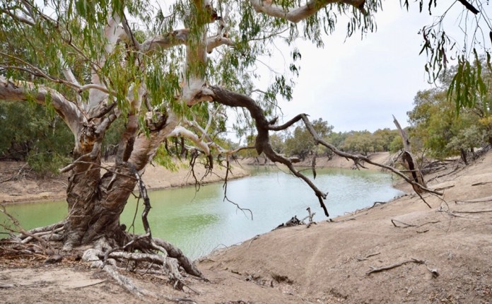
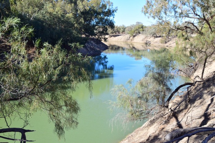
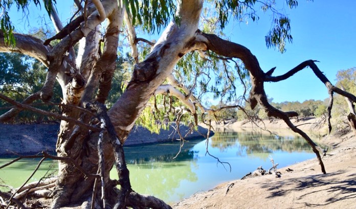
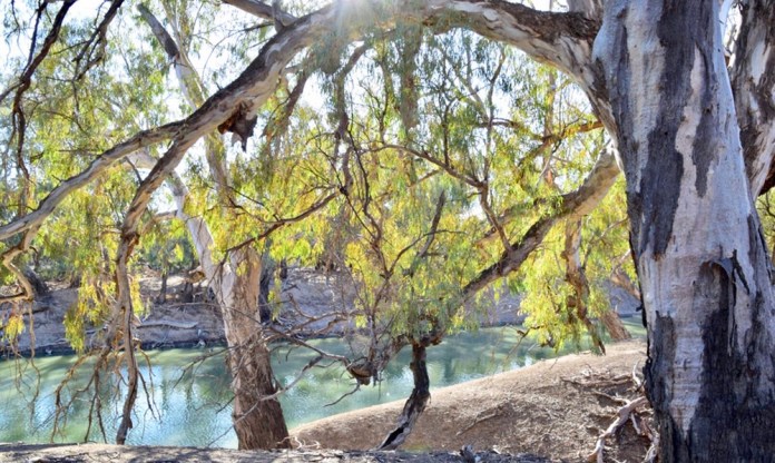
Gary, her husband was our host for our three day stay as Samantha had to go to Sydney to collect furniture. Fortunately she has Gary well trained. He brought us delicious scones for morning tea the next day. He stayed to chat about the drought and farming life on this stretch of the Darling River. He explained that though the lack of rain is a problem, a bigger and far more persistent one is how the water is divided up. Cubby, a cotton grower has huge water requirements, and has a dam upstream that holds the volume of Sydney harbour and half again. The introduction of European Carp to control water grass that choked canals has lead to the complete loss of water weeds and grasses, a massive number of carp and the explosion in nutrients causes regular Blue green algal blooms: its impossible to swim in many of our inland rivers due to this problem.
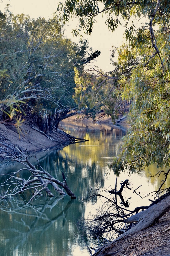
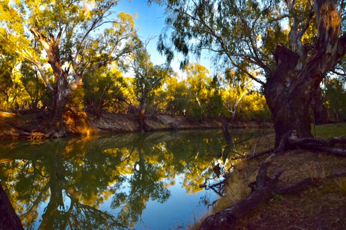
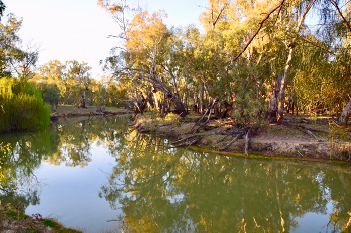
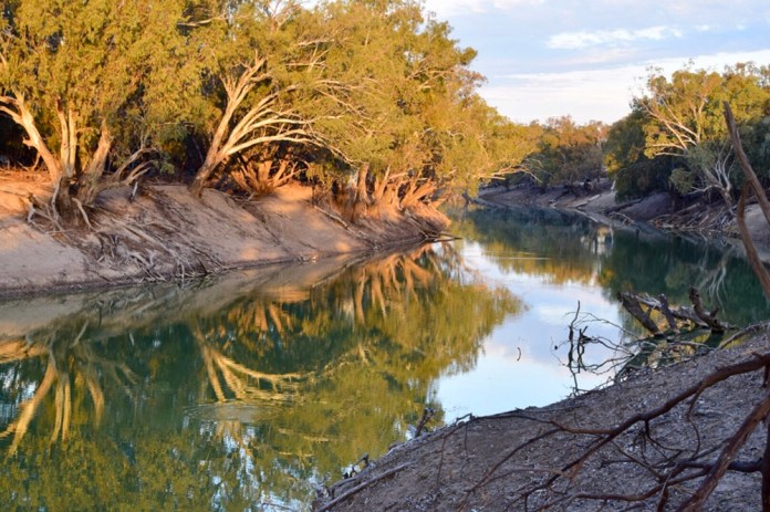
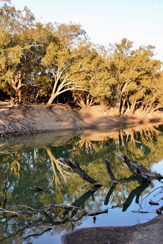
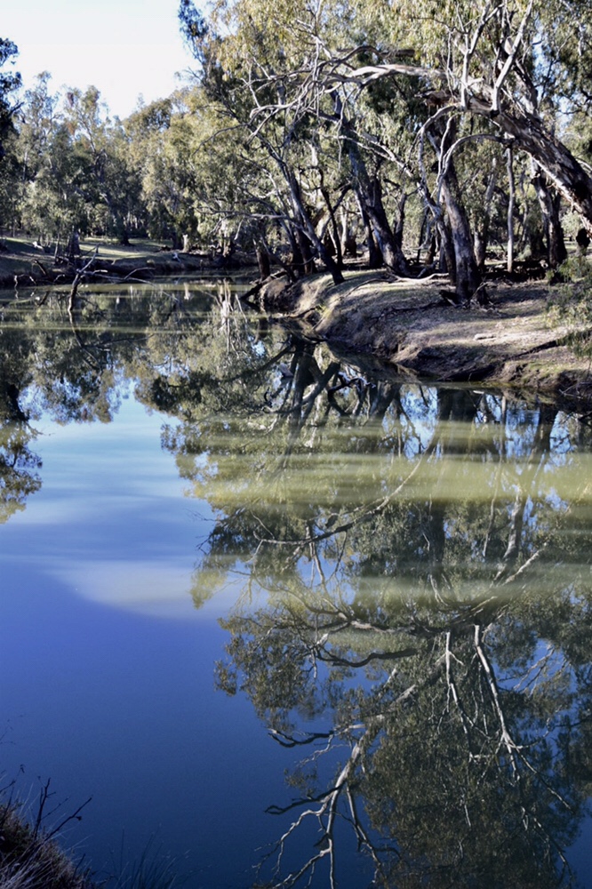
Each morning of our three day stay I would walk along the Darling River all the way up to the bush camping area. I saw the river in different moods; the warm orange light and stillness of later afternoon, the fresh light glittering trees of the opposite bank reflected in the river of morning and the windy swaying trees and rippling water of mi day. I passed an old shearing shed of coolabah and corrugated iron walls and roofing. There were the shearers quarters, small green painted cottages with bedside made up, television and kitchen facilities. There are not many sheep wandering the pastures. If pastures conjures up an image of verdure, of waves of lush green grass with sheep and lambs cavorting in the sunshine, forget it. There is no grass, none for nearly twelve months. All feeding is from hand delivered hay, lying in blocks of straw behind metal fences. There is enough water for the sheep to drink but not nearly enough to irrigate or use sprinklers to make this land truly productive again. Goats trot about, oblivious to the harsh landscape. A decent size goat earns a farmer like Gary, $60 a head now. Gary has moved most of his stock to another property and like most of the farmers in western NSW and QLD, he is loath to sell his sheep because when the drought finally ends from where would he buy more sheep? In most droughts large areas of the eastern seaboard are spared, well enough to enable restocking but not this time as the dry extends not only in time but in geographic extent. He is pretty stoical about the whole thing but there is a sense of his frustration with large businesses who monopolise water to a scandalous level.

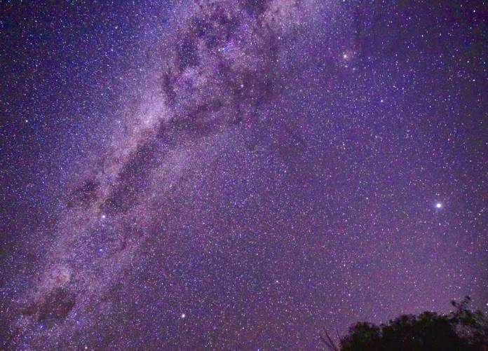
Each night we set up our telescope. We had lugged it all the way north and been pretty frustrated with it to be totally honest but at Rose Isle it all came together. The telescope worked brilliantly. We explored globular clusters, galaxies, stars and planets in what was perfect sky conditions. What a great night! The next evening high level cloud came in but it did not matter, we were confident we could do it again if the sky was right.


We spent time just resting and reading. It was beautiful by the river when a raucous brown bird landed on the table beside us. It’s brown spots and bars on its back and it’s typical cry indicated it was a spotted bower bird. We saw mallee ring necks, a magnificent green parrot, on the grass of the camping area. Kookaburras laughed as they called out of the forest at dawn. When the afternoon cooled approaching evening, Jennifer lit a fire in the fireplace. We sat in comfy chairs as darkness gathered outside and read our books, Jennifer a detective novel and me consuming SF.
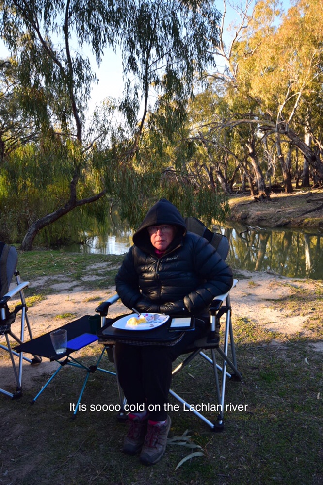
We drove from Rose Isle to Billabourie. This is a station on the Lachlan river and it’s a mixed farm. It’s about forty kilometres from Hillston. Josh is a young miner from Cobar who arrived at Rose Isle with his wife and young son. He told us about this farm stay. It’s a pretty spot by the river. We parked the camper trailer adjacent to and overlooking the river. I played my guitar in the afternoon while Jennifer read. No luck with a telescope as the trees, the river gums and coolabahs, blocked unhindered access to the sky. A very relaxing afternoon.


From here, we drove to Deniliquin, then to Melbourne via Echuca.
Jennifer and I have just spent a wonderful few hours with the kids in Carlton. We will spend a few more days in Melbourne before boarding the ferry for a trip home.
Central Australia to Bourke
Central Australia road trip 2018


I’m sitting on my comfy camping chair at Kidman Camp. It’s a caravan and camping ground about 6 kilometres from the town centre of Bourke, NSW. There is a cool breeze, cloud overhead and so I am wearing a down jacket, undone but a down jacket none the less. I have rarely seen clouds the last four months, and rain only once this entire trip. The rain was a few droplets miserly dropped from the sky few days ago when we camped in Charleville about 500 kilometres north of here.
We had planned to return to Melbourne via the Birdsville Track. A few days before our rotation finished Jennifer was perusing information on the web about Birdsville; road conditions, accommodation and so on then she stopped, gasped, “ the Birdsville races are running next week.” The population of Birdsville jumps from 120 to between 9,000 to 11,000 people which means overflowing campgrounds, pre-booking any accommodation several months ahead, and seriously choked outback roads and toilets. A change of plan was required.
Our last job, in that last week before our break, was based at Elliott. I did the Barkly run with Tony and our pilot was a delightful young lady called Kelly. Kelly is one of three female pilots who work at RFDS in the centre. She learnt the skills of outback flying on the huge cattle stations, landing on sandy strips, dodging kangaroos on the tarmac and following dusty roads from bore to bore, station to station. Jennifer worked at Elliott while I was flying around and was very busy seeing local Aboriginal women and a fair few white locals too. On Friday we started packing up the car and trailer which we had driven north from Alice Springs the previous weekend; breaking up the distance with an overnight stay at Wauchope.
Late Saturday morning we began our trip home. Our first overnight stop was at Barkly homestead on the Barkly Highway. As it is located right beside the highway, road trains were reasonably frequent. There is good dining available and so Jennifer and I shared a seafood platter. Many road trains stop at Barkly, and I love watching them. They are so big, so powerful, it hard not to be impressed by the engineering of their construction and the skill of most of the drivers. Even minor changes in driving can throw the last trailer into a passing car. Im told, a centimetre at the steering gets wheel equals a meter for the last trailer.
The next day we drove to Mt Isa, through Camooweal. We stayed at Top Tourist Caravan Park for two nights. We have never been to Mt Isa before so it is all very new to us. For some reason we arrived thirty minutes late for everything. A few days later, and I mean days, we figured out the time zone was different.
Top Tourist Park was great. We had a shady site near the entrance. The camper trailer was in shade most of the day. Our chairs snuggly placed around it. We went for dinner out on the first evening to Buffs RSL Club. We had to become temporary members. We could have been anybody or nobody. It felt a bit weird showing bits of paper when I ordered a meal. Anyway, the meal was superb. I have never had better steak. We had so much that we secreted some in alfoil to slice up for our lunch the next two days. After dinner a courtesy bus dropped us off outside the caravan park. The next day after breakfast, we drove to the information centre. A wing of the Information Centre is dedicated to the Riversleigh fossils. On our drive to Mt Isa, we passed the turn off to Riversleigh. It’s a station on the Gregory River where some of the most important Miocene fossils in Australia have been found. Soon after it’s importance was realised, this laboratory to process the fossils was established in Mt Isa. Scientists not only supervised and participated in the dig itself but also helped with the processing. Teams of technicians worked on the fossils. Then suddenly the money dried up, and the laboratory was closed. For eight years, the forgotten fossils laid in their rocks on shelves, microscopes gathered dust and any fossils recovered at the dig site were shipped straight to Sydney. Mt Isa had lost out. Two enterprising locals in 2008 convinced the local council the centre should be reopened. These two people process the fossils from Riversleigh. They dissolve the limestone rock in which the fossils are imbedded using baths of 2% vinegar. Of course this takes time, but finally the bones emerge out from the dissolving stone. As they do they are coated with plastic dissolved in acetone. The acetone evaporates leaving a residue, a protective coating of plastic. These two people are not trained formally at all to do this type of work, but their fossils have been used by universities around the world. These scientists borrow the fossils for years or months, but they have to be returned to the lab in Mt Isa. Here they are displayed for people like me to study, to amaze and to enjoy.
Pieta guided us through the museum, including the labs where she works. There are splendid models, life size of the unusual marsupials which lived at Riversleigh. In the Miocene which is about thirty to ten million years ago, the great inland sea of northern Australia had retreated, leaving abundant rivers, forest and a mild climate, these ancestral marsupials all thrived. Giant diprotodon, the ancestors of wombats, and the size of a hippopotamus, ate the shrubs and plants of the temperate jungle. Marsupial lions and thylacines hunted them, pursuing them, hiding in the trees and foliage. Baru, one of several ancient species of Miocene crocodiles, as well as other giant reptiles including pythons equal in size to the modern anaconda of South America and giant lizards like Megalenia hunted the diverse marsupial megafauna. Giant kangaroos, possums, and even a creature called a “ thingodonta” lived in the Australian Miocene. All of them exploited different food sources.
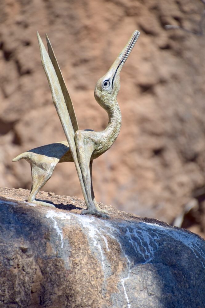
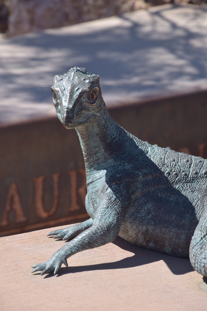
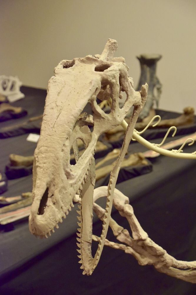

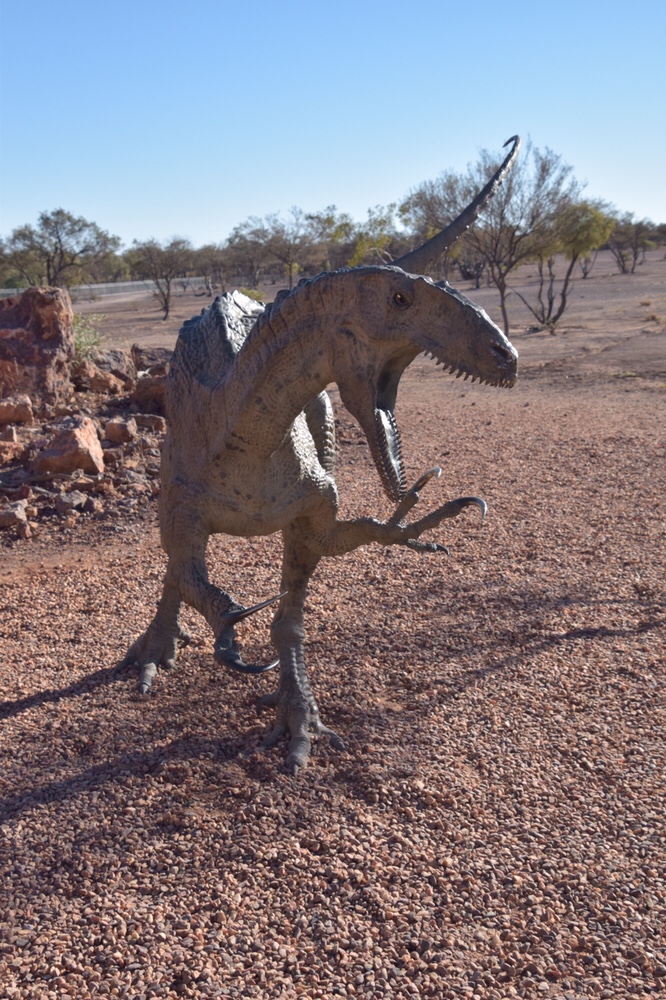

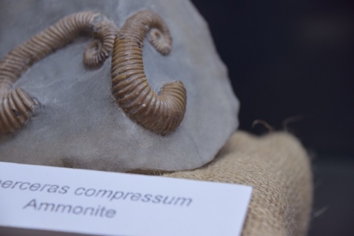


On our last weekend in Alice Springs, Jennifer and I had visited the new megafauna museum that had just opened in Todd Mall. It’s a Centre for the display and study of megafauna from Alcoota near Engewala. There are many wonderful fossils on display but my favourites are of a giant goose, that stands over two meters tall and a complete baru. A baru is an ancient crocodile that hunted in the billabongs of mid Miocene Alcoota . Alcoota and Riversleigh are of similar age but the latter has fossils from a longer period of the Miocene and extends into the Oligocene as well.. At Mt Isa, there are some fabulous fossils of ancient bird, including the “demon duck of doom”. There is the colossal beak of this ancient bird, it stood three meters tall. This is more formally called a dimorphid but I prefer the alliteration of its common name.
We spent three hours there and the high point, the best thing of all was using the microscopes to see the tiny fossils. The jaws of marsupials, and the teeth and inner ears of bats. These specimens are so perfect, and all prepared here.
While in Mt Isa we bought some new camping chairs. We had left similar ones in Alice Springs to use on our return in October. It was great to get our bums and backs, especially backs into these terrific chairs. We spent the afternoon relaxing in our new chairs, soaking in the wonderful experience of seeing the Riversleigh fossils.
From Mt Isa, we drove to Winton. This is a long drive and we were happy to finally arrive at the Tattersalls hotel. It was thirty dollars to stay at their caravan park. Our only excursion that day was to visit the information centre. We had heard vague comments about dinosaurs in Winton. We had seen signs mentioning various dinosaur themed sites in this general area. Well, the information centre was a waste of time. However, luckily, when opening a garbage bin, I noticed a discarded brochure about Dinosaur Canyon. I retrieved this brochure later, after dinner. Then Googled Dinosaur Canyon. . Ah ha! About twenty four kilometres from Winton was the Australian Age of Dinosaurs museum.
The next day we packed up the trailer, and began our drive to Longreach. This section was only 180 kilometres so we had ample opportunity to spend some time at Dinosaur Canyon. It’s not like Jurassic Park, no accountants were eaten by theropods, so it was much better. We opted for the Ultimate pass. This pass includes, a visit to the processing laboratory, a guided visit to the collection display centre and an outdoor walk to visit LifeSize metal casts of the creatures discovered here in Winton and in Queensland. From the visitor centre there is a short walk to the laboratory. Before I tell you about the laboratory, I had better give you some background. A local grazier, David Elliot, discovered a fossil, well he more or less tripped over it, it was a femur of a sauropod. It’s about two meters long. He spoke with the Queensland museums scientists who were very sceptical. It’s been the conventional understanding amongst many scientists in Australia, that we have a poor dinosaur fossil record due to our geology. Elliot took a contrary view, as a farmer he is very aware of soil and how it behaves. The soil over a vast area of Queensland is called black soil. When wet it churns materials up from deeper layers including the sedimentary rock, laid down in the Cretaceous and containing fossil dinosaurs. His theory is that many of the fossils are of older, or sick animals that died, trapped and unable to extricate themselves from the thick mud of billabongs common in that time in Australia’s history. The billabongs were surrounded by vast forests of conifers, angiosperms ( the earliest of flowering plants) and cycads. Plant eaters like the sauropods ( Diamantinasauras Matildae) and hadrosaurs ( muttabasaurus ) were the prey of meat eating dinosaurs. The pack hunting theropods like Australovenator Wintonensis also named ‘Banjo’ are also located in these fossil deposits. Fossils have been located over a wide area, and it looks like this area of Queensland will be one if the richest fossils site for Cretaceous dinosaurs in the world.
David Elliot was frustrated that the recovery of fossils was so slow due to lack of money and personnel so he started a museum dedicated to the study, recovery and preparation of the fossils found here. The laboratory is where each fossil is painstakingly drilled out of the surrounding sedimentary rock. The technicians are all volunteers. This means that fossils can be processed far more quickly than a museum or university, more people, less cost. Fossils that are brought to light are lent to museums or individual scientists but they ultimately will be displayed at the museum in Winton. This means the local people, the farmers who locate the fossils and the visitors who help prepare these wonderful specimens, can enjoy them and get some financial return for the local community too. In the lab four volunteers who have done a ten day course in preparing these fossils, drilled away, bringing these fossils back to life ( as it were). On the shelves are massive rocks containing yet to be prepared fossils, all dated and on inscribed on their their covering plaster of Paris, are descriptions, names and location and the number of associated fragments. The collection room, has three fossil dinosaurs, a twenty metre sauropod called Matilda. Another bigger, more robust sauropod called Wade ( not his real name ) and the bad boy, a two meter tall theropod called Banjo. Banjo has enormous twenty centimetre curled claws on feet and hands which were used to embrace then disembowel another dinosaur.
The outdoor section consists of a walk to see artistic recreations of the animals recovered here. There is a display of small dinosaurs, fleeing from Banjo. This is based on the fossil tracks at Lark Quarry which show a dinosaur stampede on what would have been a wet clay surface. Other dinosaurs are displayed as well as a groups of small pteranodons, which are not actually dinosaurs but flying reptiles. All so much fun.
When we arrived in Longreach We were quite tired as though the trip was not that long, it was fatiguing. So we skipped the Qantas exhibition in Longreach and instead had an early night. We had dinner at the campground while listening to a country and western singer. An unusual form of entertainment for us.
The next day we drove to Charleville. We decided to spend three days in Charleville because there was not only a great deal of interesting things to do but also because the people there were so friendly. We started our activities with an early nine o’clock visit to the Bilby Experience Centre, which is right next door to Charleville old railway station. The first 9 am session is a touch and look session. Yep, we were able to see a Bilby close up and actually pat it. The fur is so soft. They are the most gorgeous animal. Most animals start off cute but don’t stay cute. I was originally quite cute when young but that cuteness has quite recently faded, nose dived actually. Well Bilbies are cute forever!

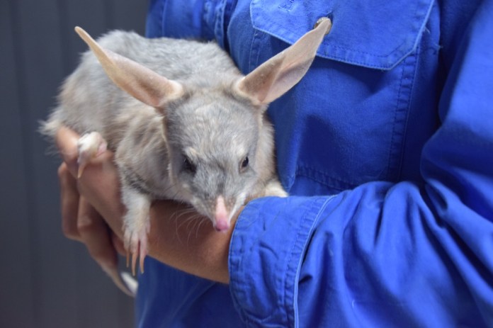
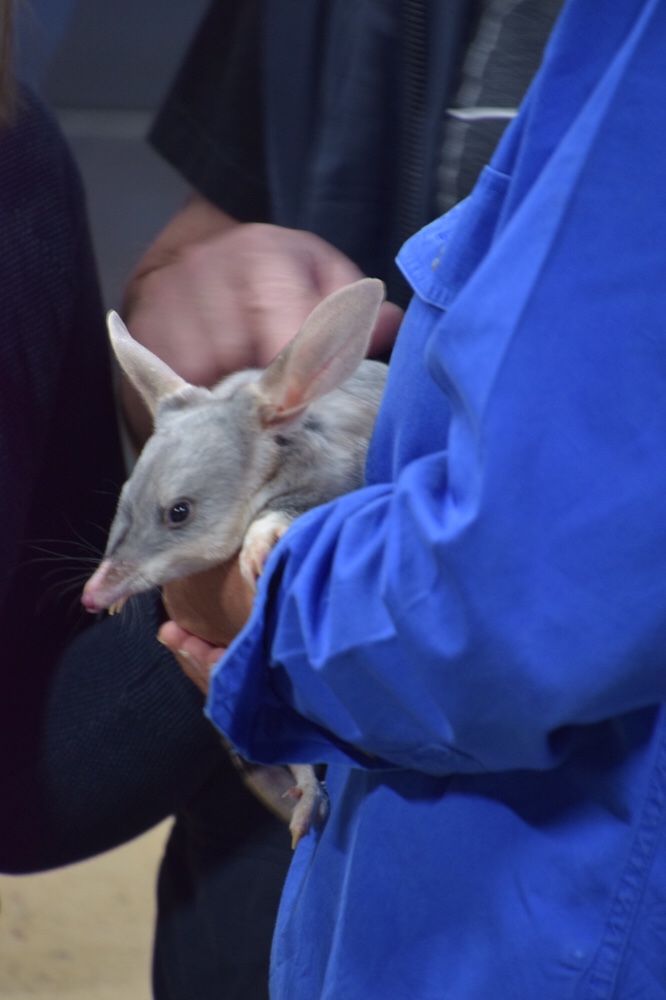
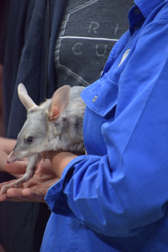

This is a fund raiser, and information hub for the non profit Bilby Association which is saving Bilbies in Australia. A local man and a scientist worked together to educate Australians about the threat to Bilbies especially in outback Queensland. Their numbers were falling drastically due to competition with rabbits, and being preyed upon by feral cats and foxes. The only way to protect these small marsupials until feral animals could be controlled was to fence large areas of bilby habitat and reintroduce Bilbies that had been born in captivity in Charleville. Charleville Bilbies have been also used to repopulate similar fenced areas in south Australia as well. A really inspirational story and for us a wonderful experience.
We relaxed over the afternoon, then went out for dinner at the Corones Hotel. This is a beautifully restored old building. We had a great meals. We stayed at Charleville Bush Caravan Park. It was quiet. It had clean and modern amenities. Plenty of shelter to stay out of the wind and lots of visitors. There were Apostle birds, chattering about us. They are also called CWA birds due to the noise they make. They’re called Apostle birds because they travel in groups of 12 or less. Grey kangaroos and emus are in the paddocks adjoining the park. Every day at 4:30 there is happy hour when all the guests sit around a blazing campfire and chat about our day. On some nights, Ian, cooks up damper in a camp over, pouring hot coals over the oven. His recipe is self raising flower, lemonade, salt and water.
The next day we did a WW2 tour. A young man led us as we did a tag along tour to see some of the fascinating artefacts pertaining to the WW2 history of Charleville. Charleville was the largest American base in Australia. We were shown the top secret Norton bombsight used in WW2 and in subsequent wars till mid way through the Vietnam catastrophe. It is still classified by the American military. So how did Charleville get a working, fully restored norton bombsight. eBay is the answer. It was so accurate that a bomb dropped from 28,000 feet would land within thirty feet of the target.
We learnt about the weekly dips for enlisted men in a 50:50 mix of water and DDT. We saw the regimental aid station staffed by two nurses for about a thousand soldiers and airman. We saw the runways where B17s, B 24s and fighters both American and Australian took off to head north or fight in the pacific. The concrete floor of a dance hall built in 1946.
James really brought it all alive. The long term project of the history buffs in Charleville is restore the buildings on any concrete remains and make it an even more enlightening experience.
Th high point was our visit to the Cosmos centre on the last evening in Charleville. We spent two and half hours seeing wonderful stuff in the sky. As we journeyed from nebula ( ring nebula, swan nebula, dumb bell nebula) from globular clusters ( omega Centaurus) containing millions of stars. To hearing about the birth and death of stars. The fate of our sun as a planetary nebula. I could see the double star of Alpha Centauri looking all the world as two headlights. This telescope was a 14 inch Meade telescope. This is a serious light bucket. We saw the majesty which is Vega. We also looked at Saturn and the satellites and bands of Jupiter. After our sky viewing we spent another hour doing astrophotography, learning how to use our cameras to take stunning views of the night sky. Mike our guide, did a fantastic job of inspiring and educating us about the wonders of the big sky.
The next morning, we drove to Bourke. As in Back of Bourke. Well the back of Bourke is hard country indeed and is a synonym for tough country. The land, the paddocks have been desiccated by the drought herein outback NSW and Southern Queensland. In Charleville, there is a sign thanking tourists for spending time and, of course, money in Charleville. The drought is making it very hard for locals to survive.
We are staying two nights at Kidman Camp Caravan Park. Last night we went to a regular function here at the park called Poetry on a plate. A bush poet sings songs while his offsider prepares a meal. Tonight it was beef stroganoff, dhal and rice with a desert of lemon tart for afters. Before I could get my meal, a call went out, does anyone know CPR. Well that sounds like business. I jogged toward the commotion to find Jennifer already there helping. An older man had had a stroke. His poor wife was just bereft. He regained some consciousness after about five minutes. The ambulance arrived and transferred him to Bourke Hospital. We spoke to his wife this morning; she said he’d substantially recovered but was being air lifted to Dubbo for a CT brain scan.
The music was okay. No, let me be fair, he was actually a very good singer but I find the schmaltz of many of the songs about loving mothers, lost love and dying dogs, some what excremental. What a cynic!
Today we had a slow start after yesterdays long drive. We drove into Bourke and took some photographs of the fine buildings in the town centre. We visited the Back of Bourke experience. This is really good. There are three buildings joined by stone paths and each looks at different facets of Bourke’s history. There was way too much to take in in one go but thankfully, the pass to the museum goes for two days. Stories of the mythical inland sea that propelled Sturt, Wentworth, Oxley and Mitchell to explore the centre of Australia. The tales and endeavours of the explorers are balanced by the records of the local Aborigines.
The other buildings had more information about paddle boats, Cobb and co, RFDS, locals, bushrangers, and the railways, and, above all else, sheep.
We drove back in time to board the PV Jandra which is a Paddle vessel not steamer. It is squarely based on the original Jandra from extant contemporary designs and photos. The trip began at 2pm and goes up stream, under the old bridge with a it’s central section that can be raised. This was not necessary today but when water ran high, it was very necessary indeed. The old paddle steamers of which there were 250 all up plying the Murray-Darling system transported cargos over vast distances. In flood years, paddle steamers would go up 180 Miles Overland, right to the doors of some remote stations. The catchment for the Darling goes from NSW and well into Queensland. The current Jandra was built in 2000 and is diesel-electric powered paddle steamer. Like its steam forbears, it’s very manoeuvrable but nothing like as fast. The last paddle steamer pulled out of Bourke in 1931. Railways killed the paddle steamers. We had a very relaxing cruise soaking up the stories of these amazing vessels and taking photographs of birds, bridges and the ubiquitous grey barked, squat, coolabah trees situated just beyond the river banks. The metal frame of one old paddle steamer remains on the golf course. It was marooned behind the levee banks before it could reach the main channel. The captain lived in the beached vessel for many years.
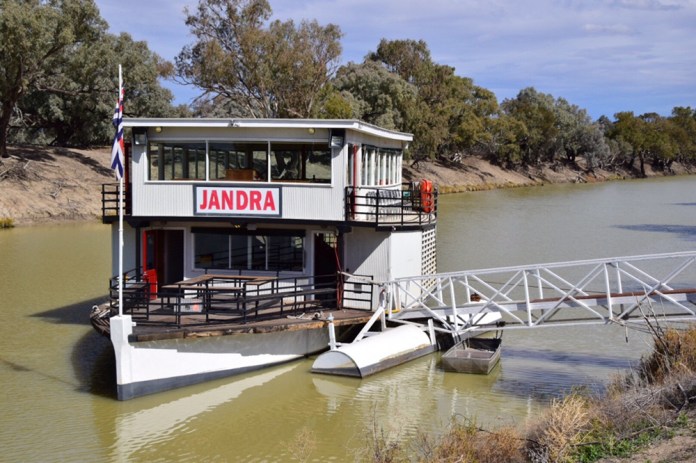


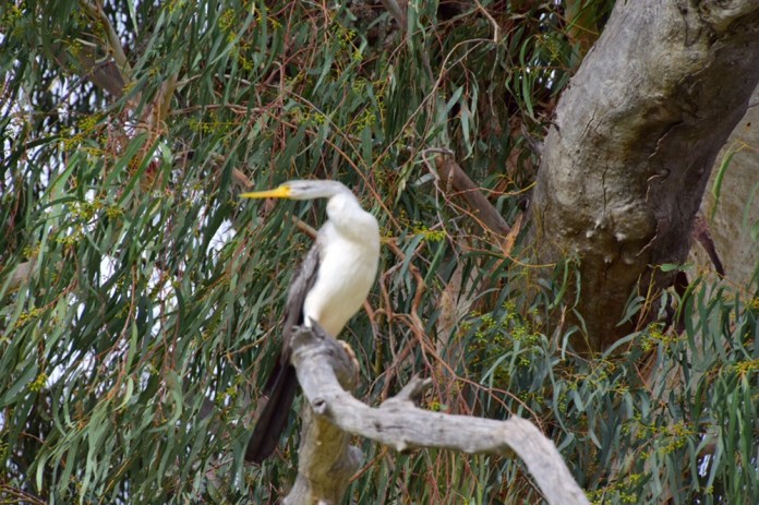
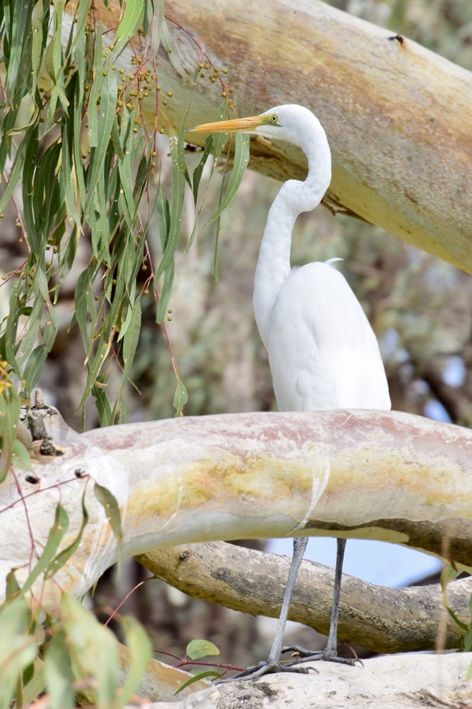

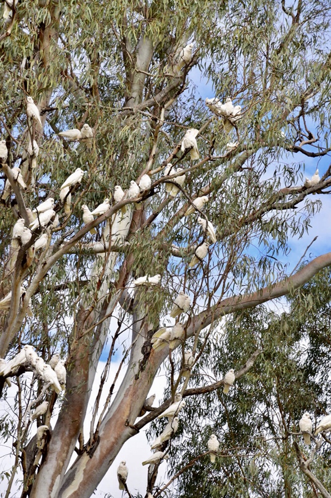
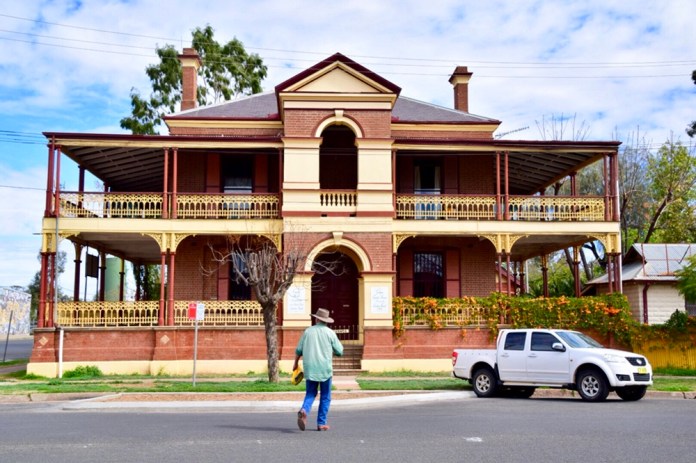
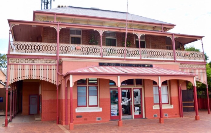
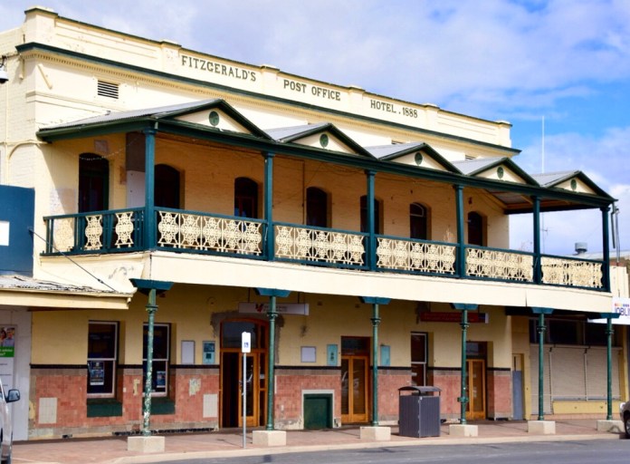


On Tuesday morning we packed up the trailer, left Kidman Camp and drove to Rose Isle. On the way we stopped to revisit the Back of Bourke Centre to continue where we left off. There is so much information here that we had to break up our study of all the exhibits.
A few presentations of local identities really impressed me. Percy Hobson was an Aboriginal man who excelled at the high jump and won the Commonwealth games, setting a new record. He stayed in Bourke and travelled every weekend all the way to Sydney to compete in club sport. He was refused attending the warm up competition in Jakarta because of his aboriginality. He was told to keep his aboriginality pretty quiet. He was heading for the Tokyo Olympics when a serious knee injury put paid to his athletic career. He was much loved and very respected in Bourke. When he set a new high jump record for Australia as a junior on his return to Bourke on Sunday evening, the whole town met him at the station.
Abdul Khan was an Afghan entrepreneur who set up camel teamsters to haul freight in the outback. He and his drivers got into some hairy situations with rival horse teamsters. He was rich and successful due to paying his drivers very poorly indeed. He was a gambler who lost his Sydney mansion in a card game. Constable Cleary was sent to Bourke in 1865 to deal with the lawlessness in western NSW. Several officers had been shot by bushrangers. Cleary was Irish and a determined man who hunted down Captain Starlight, and made Captain Thunderbolts life so difficult by pursuing him hundreds of kilometres that he moved out of the area to easier country. He never received any service medal or rewards for his undoubted gallantry due to his Irish heritage.
Right now, I’m completing this essay sitting at Rose Isle Station. A cloudy sky, a gentle breeze, a glass of wine and Jennifer sitting reading beside me. What more could anyone want or need.
Katherine Gorge . Sunrise. Sunset.
Katherine Gorge cruise
We were on our way back to Alice but had one more outing to do. We arrived on Sunday afternoon at Max & Lyndal’s place then went out for dinner with them and a fellow teacher from Lyndal’s school to the “ big fig” named after the great fig tree in the middle of this outside dining venue.
Early Monday morning, Jen and I drove out to Nitmiluk National Park. It was very dark before sunrise as we mingled with the other guests. It was a wonderful trip as the sun rose and we chugged along up the first Gorge. The boat is moored at the end of the Gorge then there is a short walk to another boat which takes us all along second Gorge. Really very beautiful. As we are the first boat, the watercourse was still, reflection sublime and the sunlight splashed through gaps in the Gorge rock cliffs illuminating stone and water alike.
And in the evening we did the sunset and dinner cruise. This is very, very good. The light was in the western sky and it was very different. Fresh water crocodiles lazed on the sandy beaches or cruised languidly between boat and shore. The same route as the morning trip but a lazy return on first Gorge, enjoying a delicious meal including crocodile meat. It tastes like chicken which means it tastes of nothing in particular.
A wonderful day.
And a great end to our holiday in Top End!


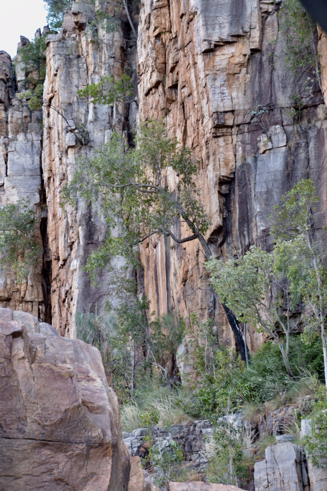
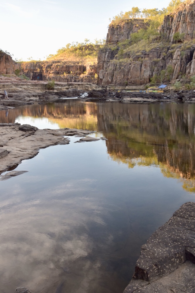
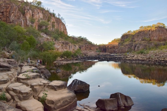

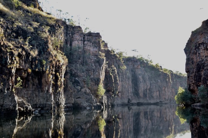
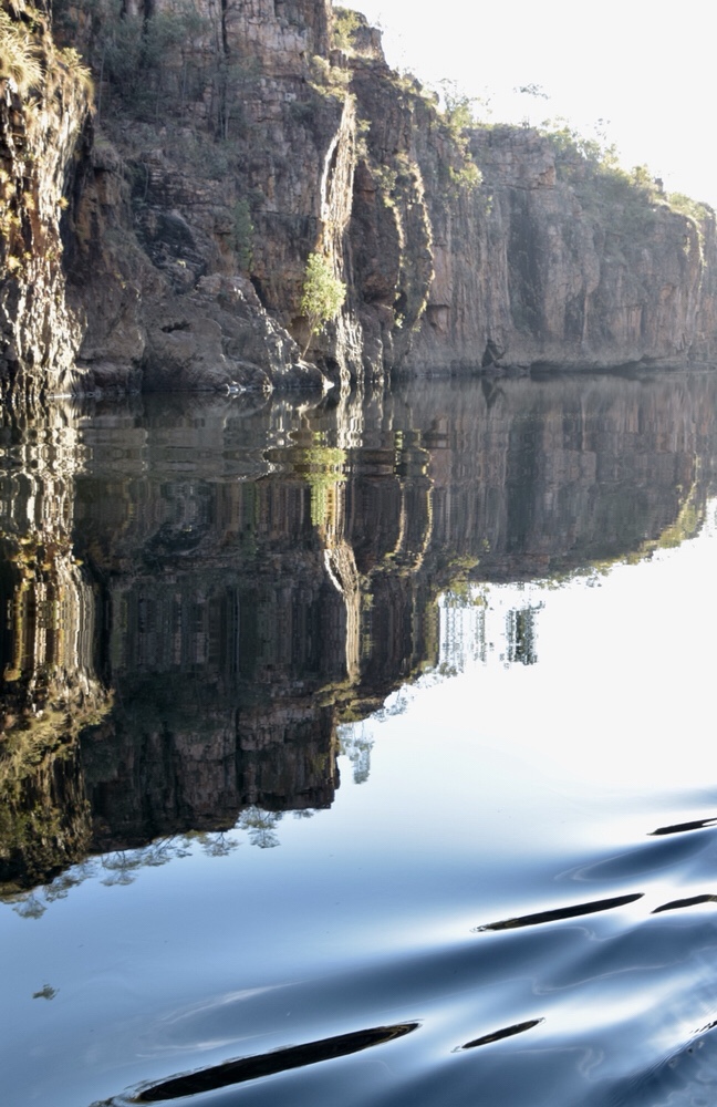
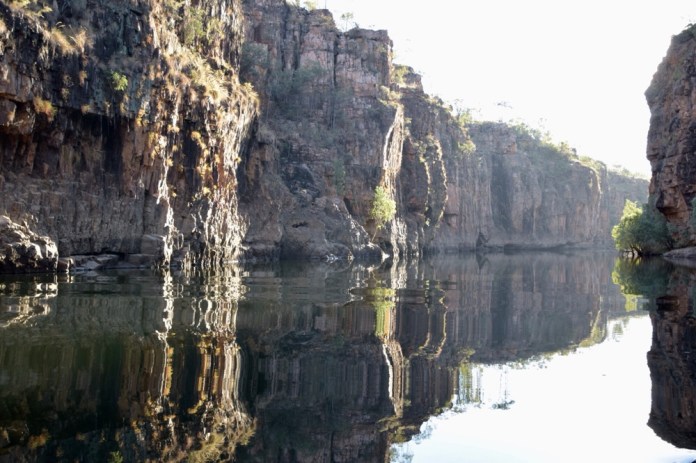
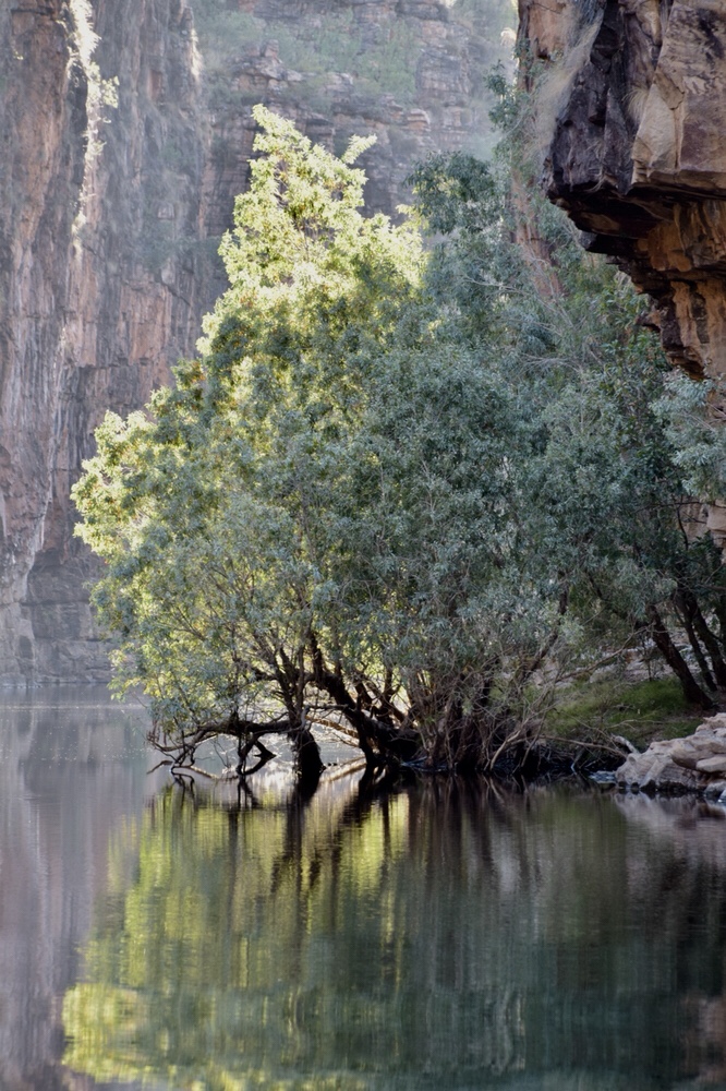
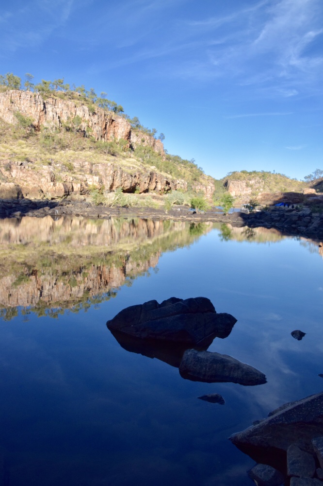
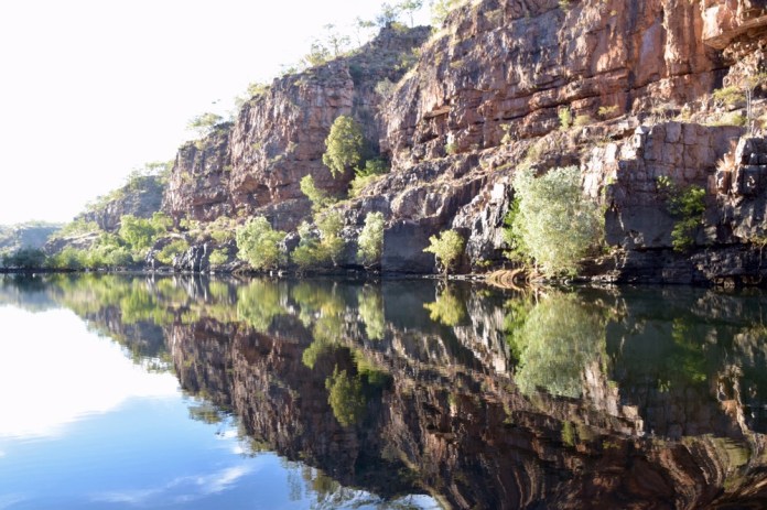
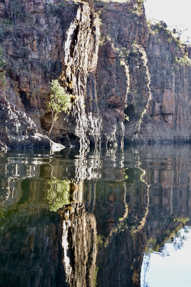

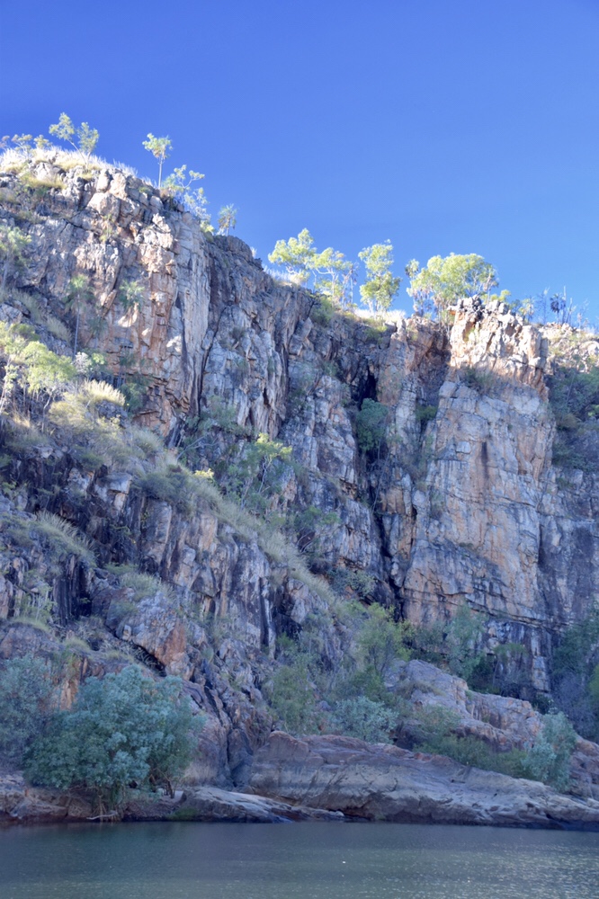
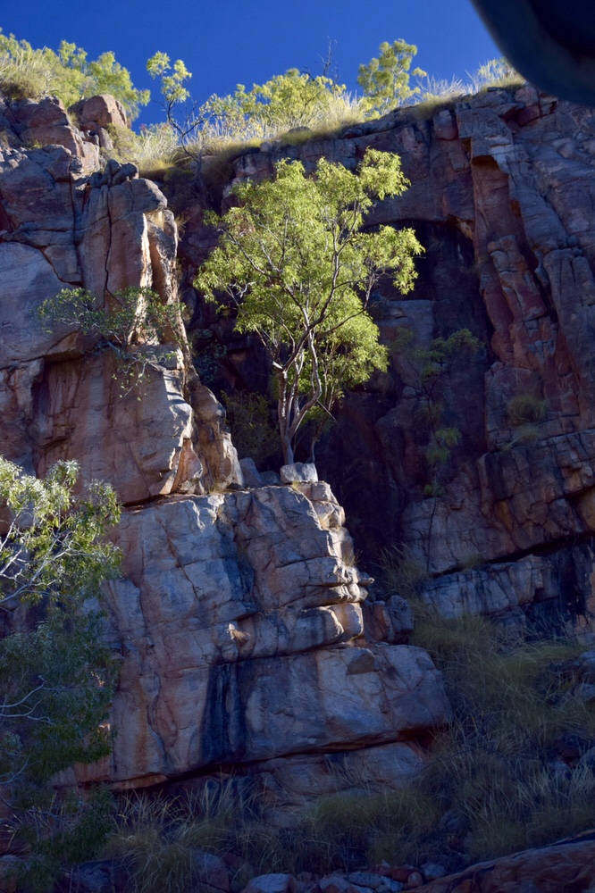
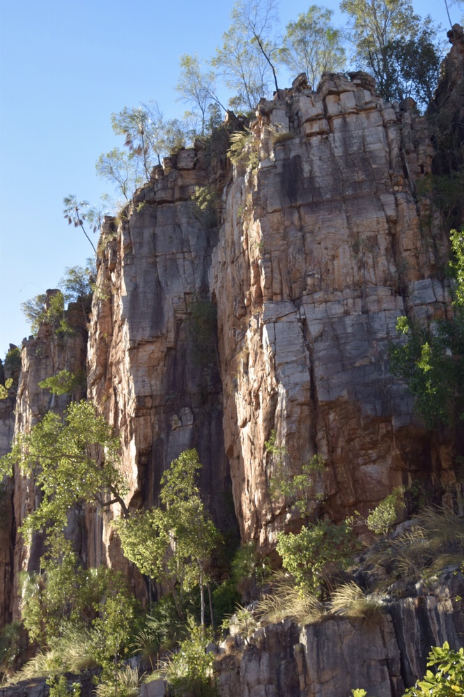
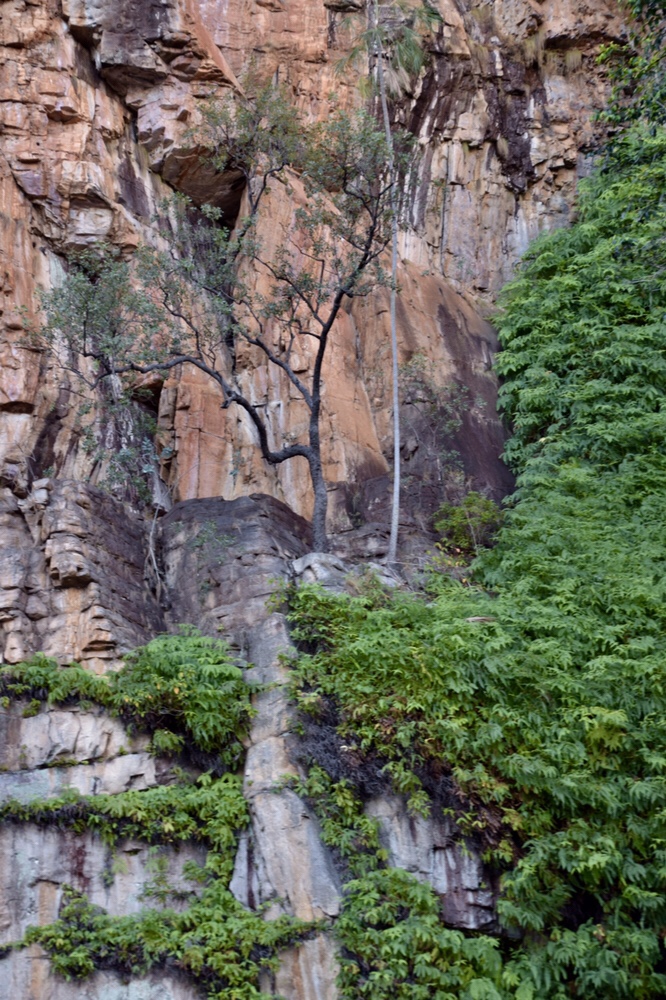
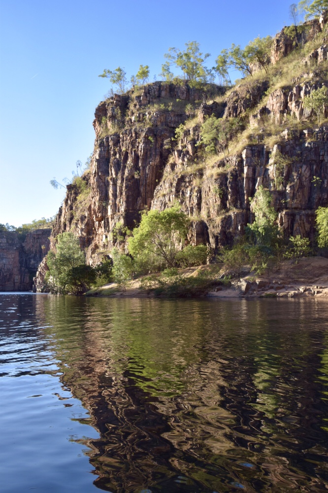

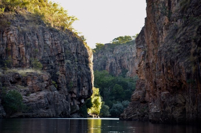
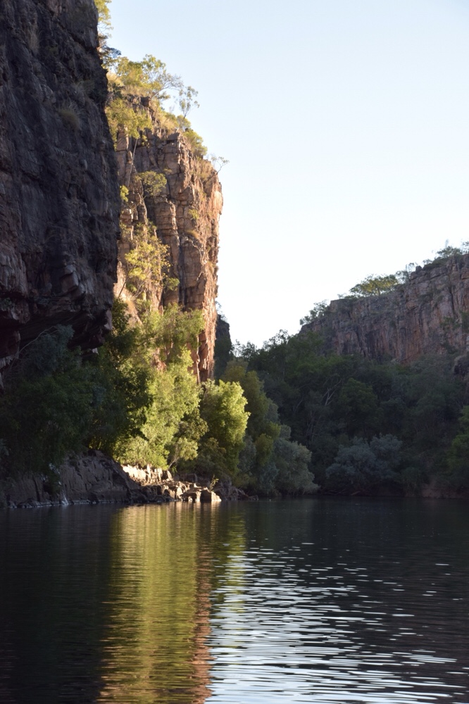

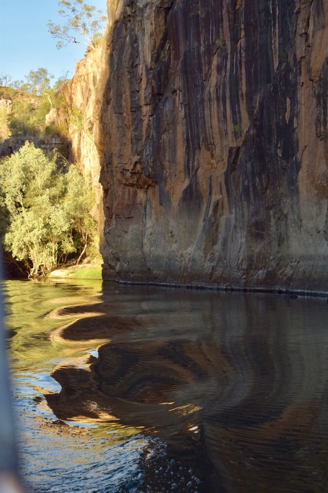
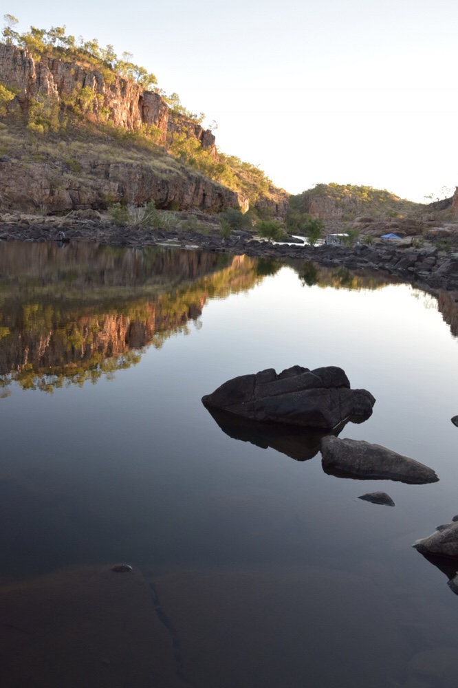
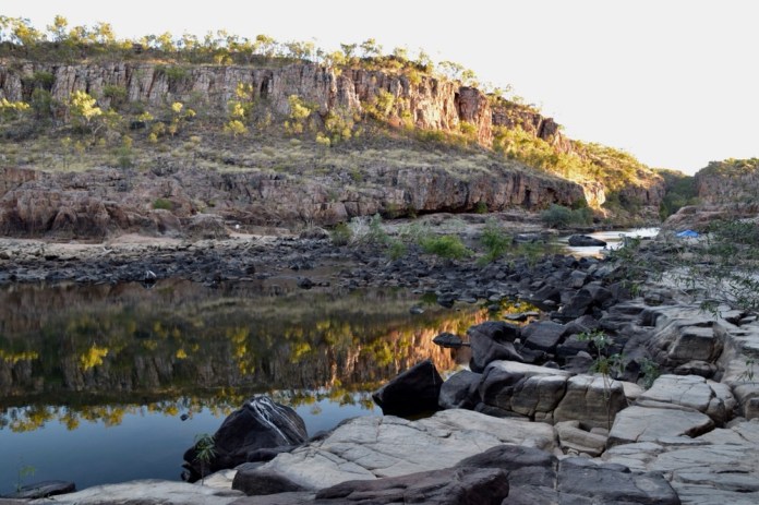
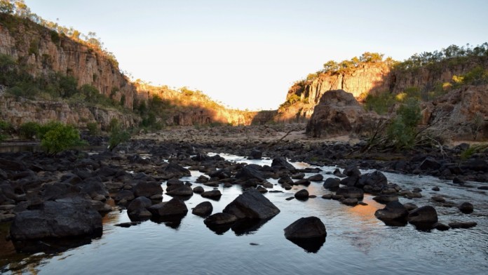
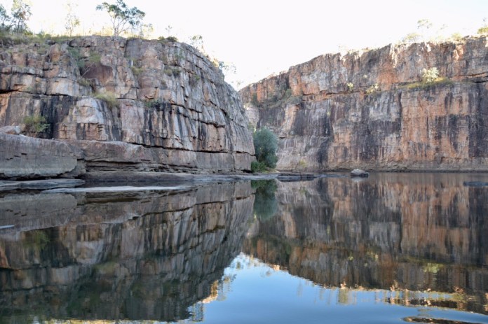
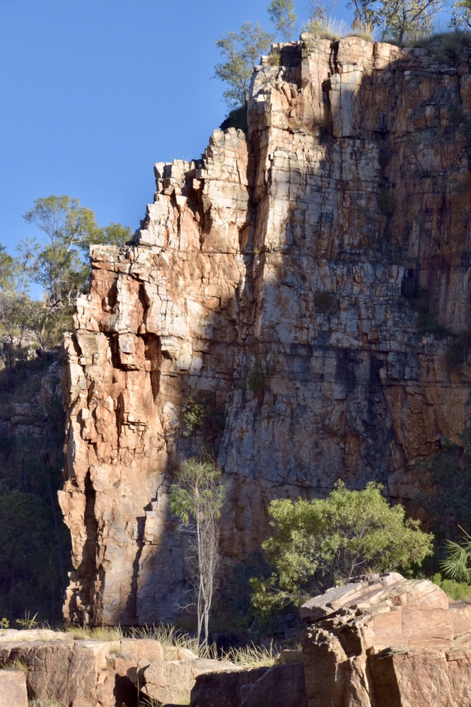

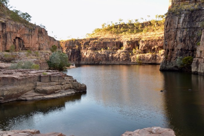

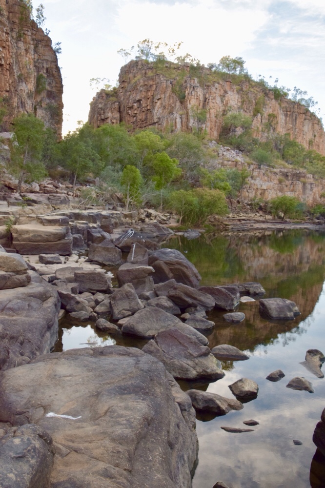
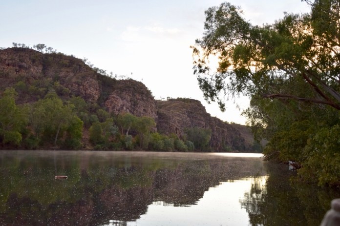


Jatbula walk
Jatbula conjures up very definite images to the bushwalking fraternity in the know. I had the privilege of completing this six day walk through Nitmiluk National park. I was one client in a group of walkers in a trip organised through World Expeditions. There were three guides, Michael, Reed and Travis, all young fit men who guided us all and helped the more nervous amongst us to cross rivers ( which included me).
This national park is jointly run by the Jawoyn traditional owners and the parks service. This walk and the fees that go with doing other activities in the park as well as monies from the excellent visitor centre, all contribute to the income stream from the park. The park provides many job opportunities for indigenous people here in Katherine.
July is the best time to do the Jatbula walk. In June the trailblazers have established the route through native greases and spear grasses, crushing the grasses. The regular burns have now finished allowing for new fire dependent sprouting of trees and grasses. The burn has also cleared the land for travel removing low scrub and the sharp spear grass. The seeds of spear grass are the main food source of the Gouldian finch. These small brightly coloured birds flies in the air in small flocks, sparkling with flashing green, red and purple, nestling together on branches of small shrubs.
The bigger trees sit aloof and only somewhat blackened on their trunks by the cool burns of this season.
The walk begins at Katherine Gorge as a short ferry ride from the canoe ramp to the opposite bank. The first day is 9 kilometres and was hot, mid 30s, as we clambered up to the high ground. The track is generally easy to follow. There are frequent white metal markers with a blue triangle suspended from trees, either hanging down or wired to a trunk. The track is variable. Some areas have smooth surfaces of gravel that permits quick walking, others are studded with rocks, some are on rock platforms. These sections get very hot underfoot even through my boots. The pounding of walking with a heavy pack on solid ground or rock gave me bruised feet. Each morning it was a bit hard to start but the ache settled down enough to enjoy the walk.
Each day ended by camping near water: waterfalls, rivers, waterholes and billabongs. The water is very clean and there were no problems about drinking it. After a long hot walk it was refreshing to cool off in this water. The water comes from Springs. Rain falls in huge quantities in summer, and drips through the porous soil and rock to meet an impervious shield of stone, the water can sink no further but bubbles and percolates along to emerge as fresh springs. As the water never travels deeply, it’s cool and crisp.
Other inhabitants enjoyed the water as well. We saw Rainbow bee eaters, I saw a forest kingfisher, whispering kites and herons hunted their respective prey as well. A water monitor lay on a rock near one waterfall while nearby a brown snake bathed in the sunshine. All this while we were all splashing around in the waterfall landing pool. Some waterfalls were tall, all were beautiful. The golden sunlight at dawn and again dusk lit up the adjacent rock face as water plummet down narrow slots.
Some of the highlights were visiting very remote rock art painting sites. The amphitheatre is a steep climb down into a wide gully and on the smooth face of the cliff, are painted crocodiles, barramundi, kangaroos and nine fingered bad spirits; red and white and and orange pigments were used to create these lively apparitions.
In the evening, I could stand on the bank and look down through the water. Perch and turtles were swimming, the perch with grace and purpose, while the turtles flopped around as if going forwards was a hazy concept, and beneath them, fresh water yabbies and small crayfish scurried on the bottom rushing into shadow as torchlight penetrated the depths around him. Small red eyes on the water, that’s freshwater crocodiles.
Dinner and meals were different every evening. Pesto spaghetti, cous cous, and many more with an emphasis on the vegetarian menu a sits hard to carry meat in these hot conditions. The guides would gather up the food and utensil bags were all helped carry to assemble meals. We would be setting up our insect nets, hanging them from cord strung between trees. On the ground, a simple tarp, then sleeping mat and sleeping bag. The sleeping bag is rated for mild climates. There is no way I could have justified using my alpine bag.
Looking upwards at night, the branches of the overhanging trees resemble delicate fingers with stars silhouetted far above them. The stars are cool and bright in the otherwise dead black sky at least until the moon rises from the east. I pulled my beanie over my eyes to shield them from the glare. The evening started warm but at about 2am it gets cool and I zip up my bag.
Going to the toilet can be interesting. I’m glad there is a no alcohol policy ( that’s a personal one) on these walks as the climb to the facilities can be steep and uneven. One evening death adders were coiled beside the steps leading up to the door. I developed retention for a few hours. They are composting toilets so water can ever flush down into the nearby streams and water holes. We don’t use soap or detergent even washing dishes to avoid contaminating the natural environment in any way. The numbers are very limited on the walk with only 13 people allowed per day. Most of them walk with walking companies but three people can go fee style. The competition to get these three spots is intense and many people have missed out for years.
The tracks are different each day and within each day. Some sections are exposed and the sun beats down through sparse tree cover, other sections are shady with gums, salmon gums, wattles, pandani and ghost gums. We did not see any wallabies or kangaroo at all. We saw ghost bats flitting and squeaking above us in the dark of evening. The region was not lively with animals during the day but at night I could hear the howling of dingos. It’s a plaintive noise from the skyline that hovers over the forest. Some dingos came through our campsite early one morning to flee when disturbed by our movements sleeping.
The other walkers were my vintage and mostly retired. They all enjoyed the walk including one man who thought it was going to be a day pack walk. Well it was not. The packs were initially 18kg and were finally 16 kg as the supplies were used up. It was good to share jokes and stories with the other fellas. Three ladies did the walk and enjoyed it just as much.
Most clothes were rinsed when we cooled off in the streams and waterholes. One walker placed his wet underwear in a tree to dry off over the remaking afternoon. To his horror and much amusement, green tree ants infested them and despite generous bets, he could not be persuaded to put them on.
The walk ends at Edith Falls. It felt strange to be amongst so many people again. Kids carrying floaty toys, mums in bikinis and Dads with snorkels. I felt out of place with my huge ruck sack, grubby Tilley hat and dusty boots. The walk is terrific, and it’s whetted my appetite for more adventures in the outdoors.