Uncategorized

Flinders Island Kayaking

Kayaking Flinders Island

Our trip began on the morning of Sunday the 10th of March and concluded with our arrival back in Launceston on Saturday the 16th.

Jennifer and I requested a car through Uber to take us to the Aero Club. It is a short distance from the main Launceston Air Terminal. A grey Amarok dropped us at the car park nestled between the Aero Club and the Launceston Distillery. This beautiful sunny day seemed full of promise for the trip. The temperature and rainfall in north Tasmania had been exceptionally mediterranean in attitude all Summer and the same disinterest in raining, looked like persisting into Autumn. In company with many Tasmanians, the plants in our garden had suffered, and many had died due to these unusual conditions.

Standing by the wire fence, located between us and the tarmac, were our two guides for the coming adventure. Mads, a tall, slim, and very elegant young woman, was the first to welcome the two of us. Alayne, bubbly, warm and friendly, quickly introduced herself as well.  Ove the next 20 minutes, the other participants in our kayak trip arrived. Kerri Anne and Michael, a well-travelled couple, then Mary Anne and David who proved to be inspiring story tellers of their trips to Alaska and elsewhere, and then Leigh and Jean, both scientists on their annual holiday from their Professorial research positions in Bacteriology, their scientific department  based in Montana, USA. This proved to be an outstandingly friendly group, perhaps the best group we have ever had the pleasure to journey with.

None of us were new to tackling adventurous activities.  Kerri Ann has done very difficult and long bush walks all over Australia, Mary Anne and her husband David, have tackled Alaska, including walking in Denali. Leigh and Jean shared stories about travelling all over the world as well as their travels in Montana during Winter; gives cold a whole new meaning.

We flew to Flinders Island in a Cessna Caravan, it’s a ten-seater aeroplane with abundant luggage space under the passenger compartment accessed by doors along the side of the fuselage. Steve, the pilot, placed our bags inside. A few of us had favourite paddles to use during the week. These paddles are assembled from two halves and reasonably compact, much more than the standard full-length paddles.

There had been fires in the forest near Ravenswood, a suburb of Launceston and notorious for conflagrations of various sorts. This bushfire proved to be challenging, classified as out of control for at least two days. As we drove back from Trevallyn the day before our departure, we could see the angry, orange glow in the distance piercing the dark.

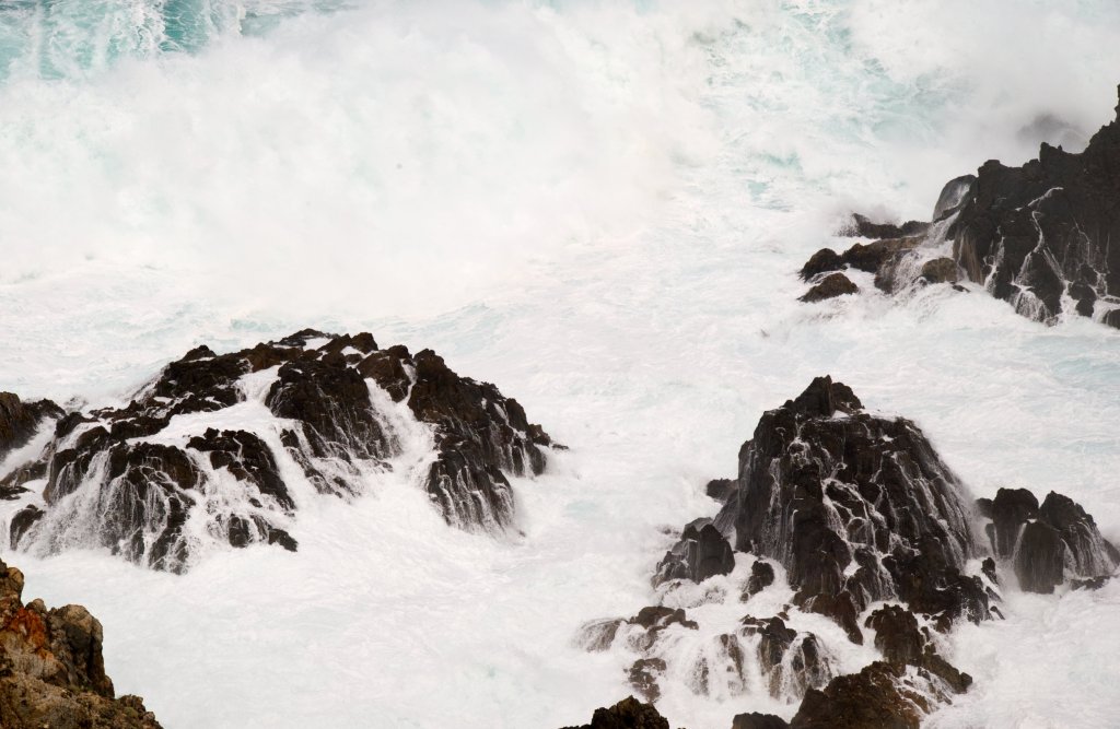
Smoke haze hung in the air thwarting any crisp photography. Despite this, even the fuzzy views of the islands below us were still exciting.

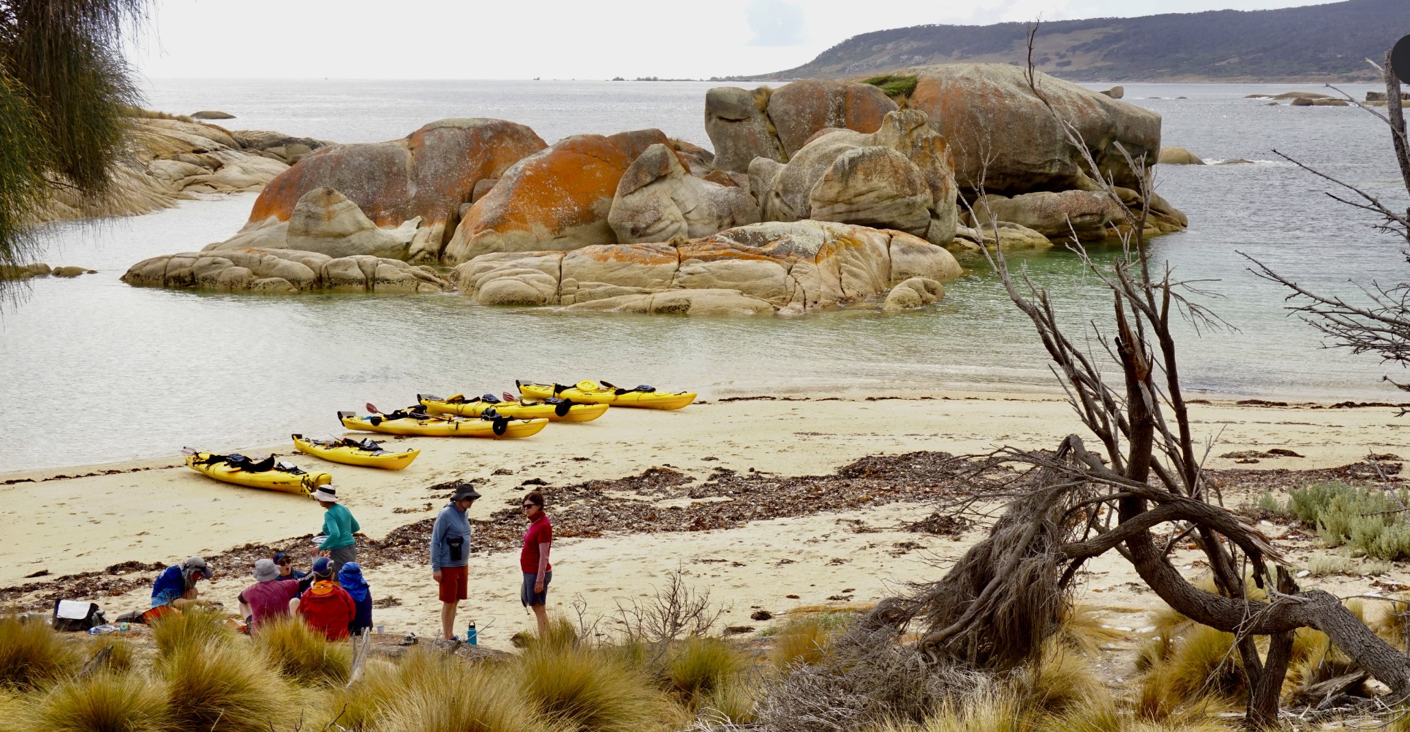
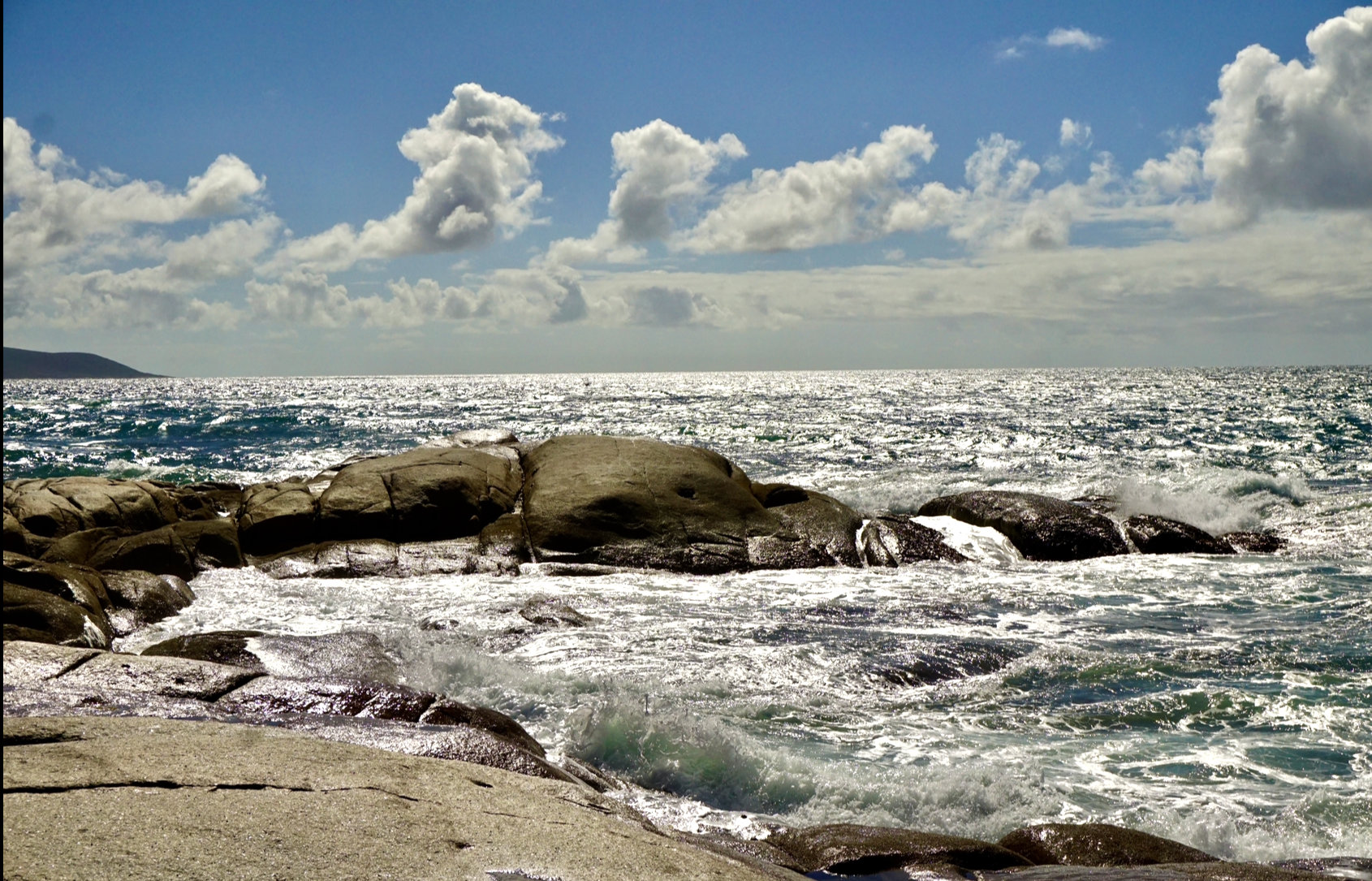
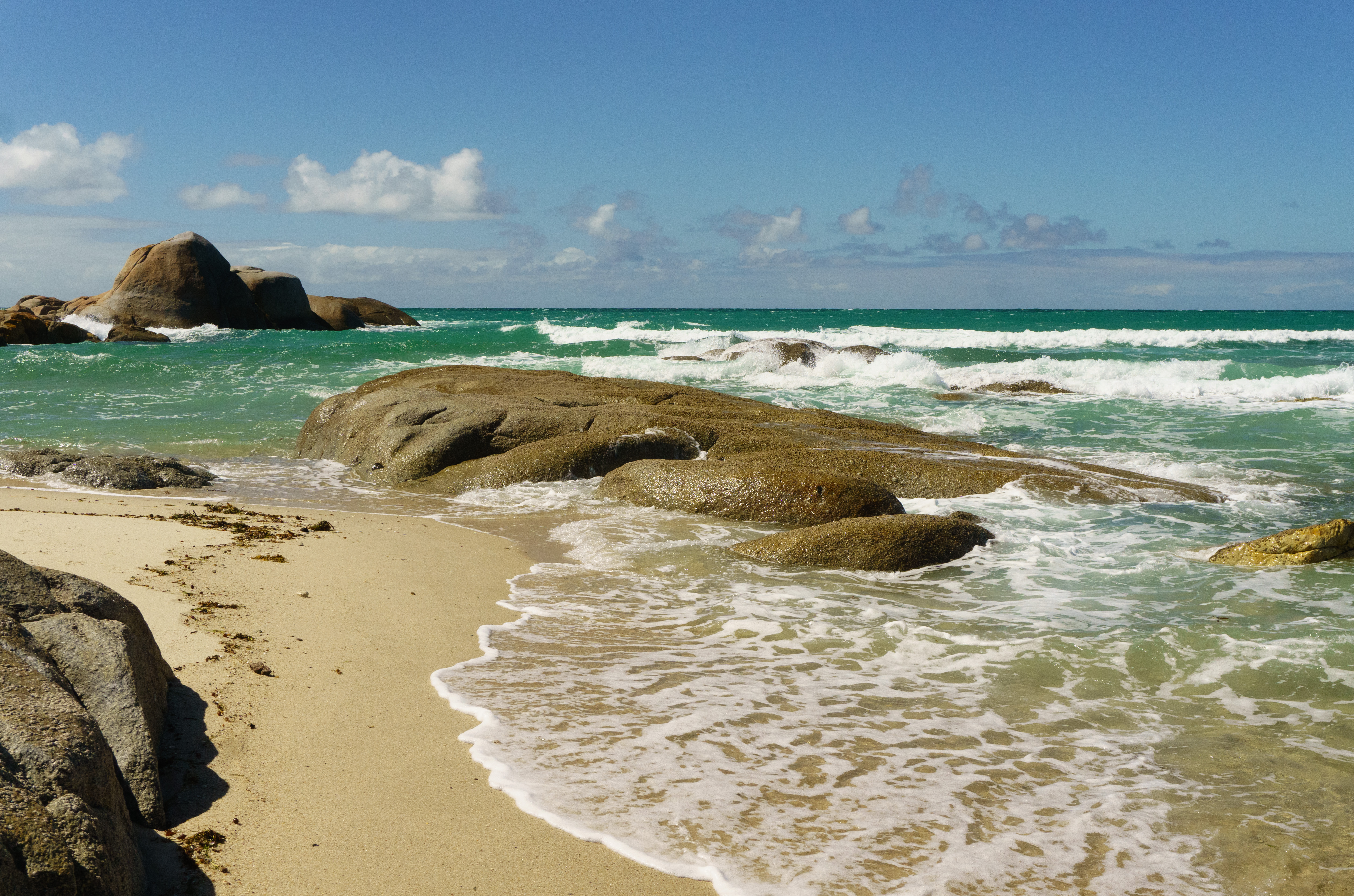
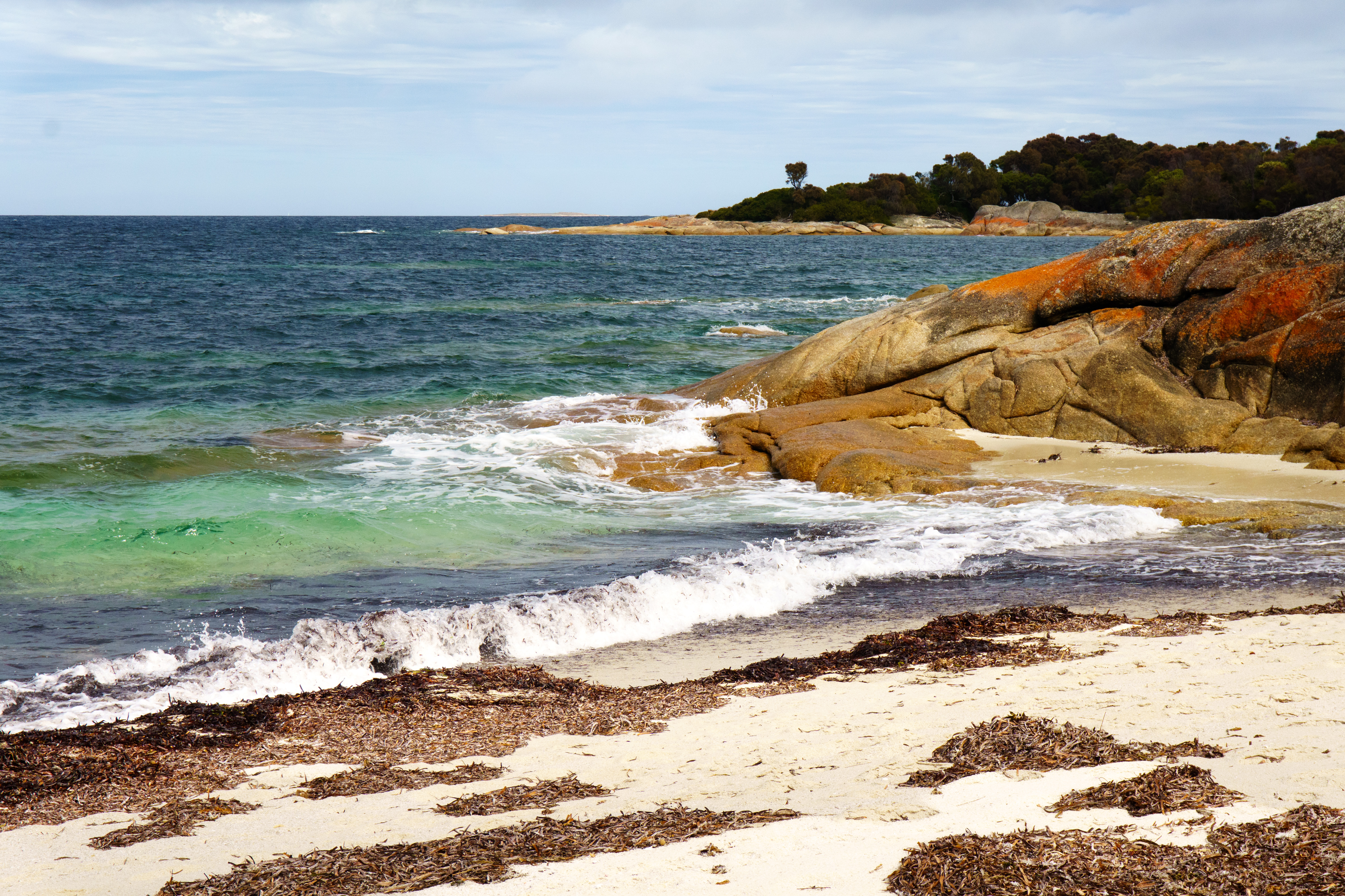
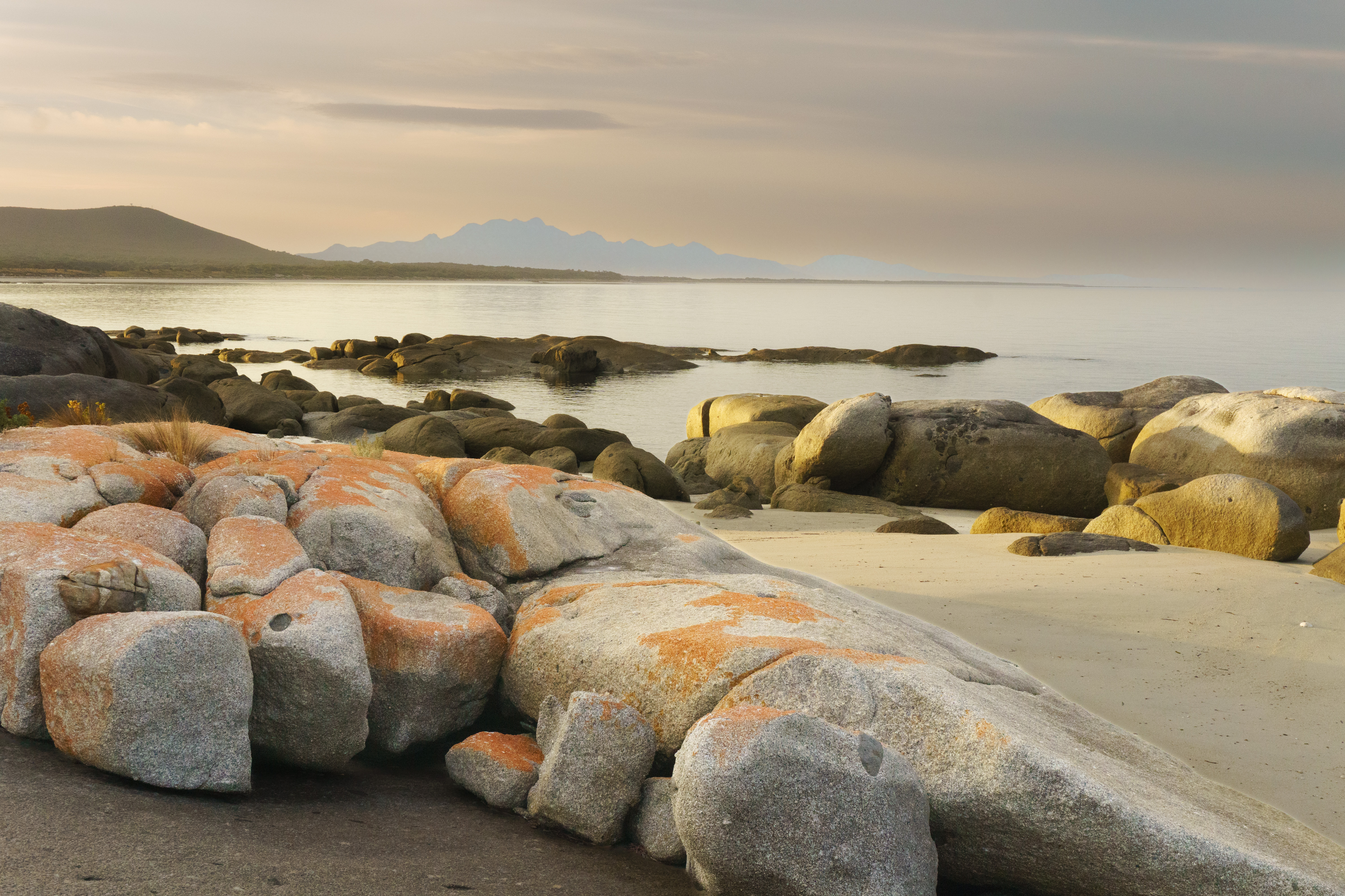
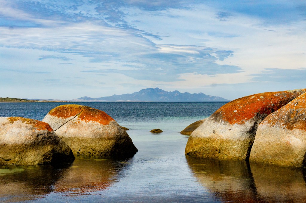
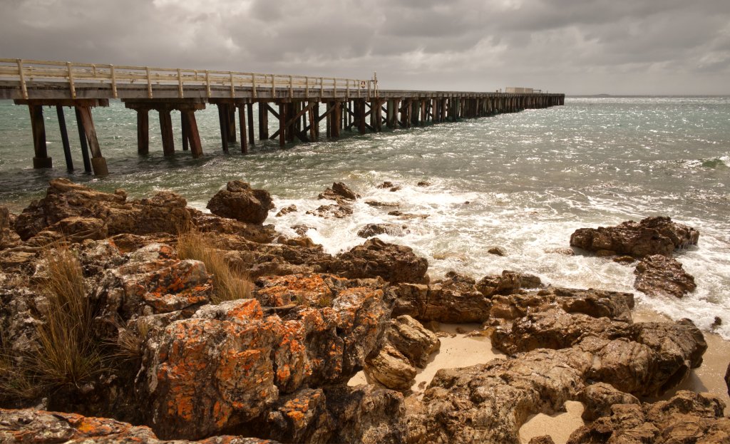
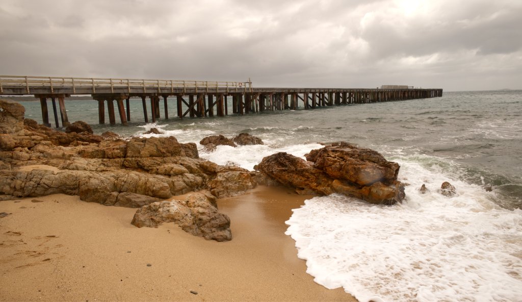
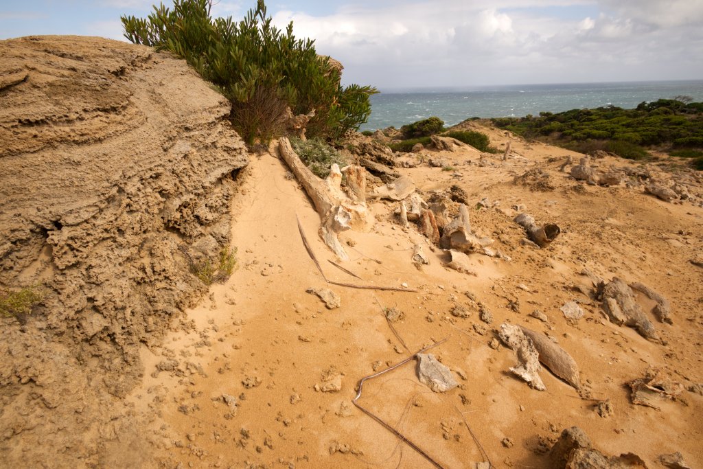
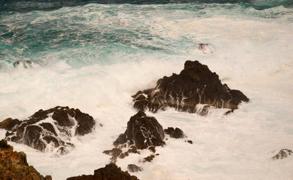
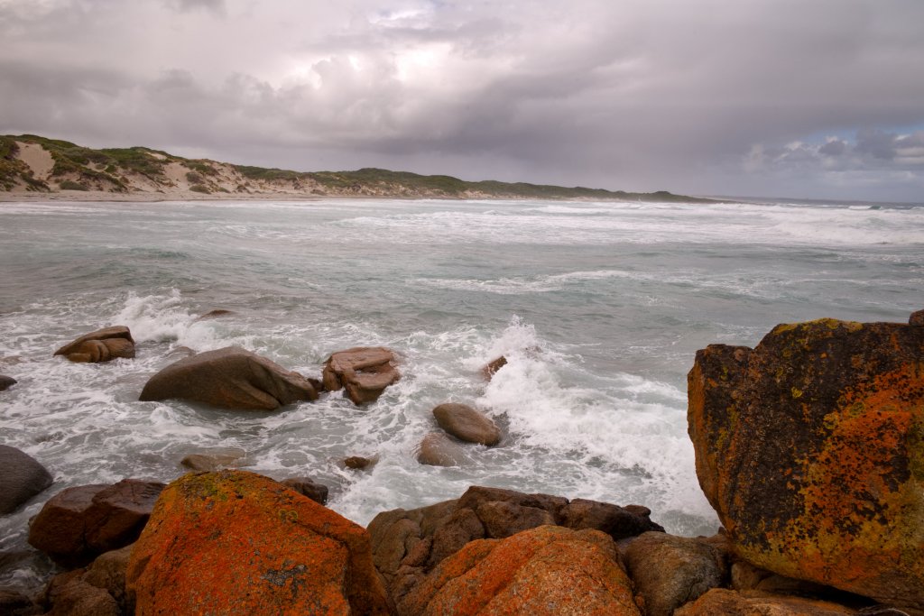
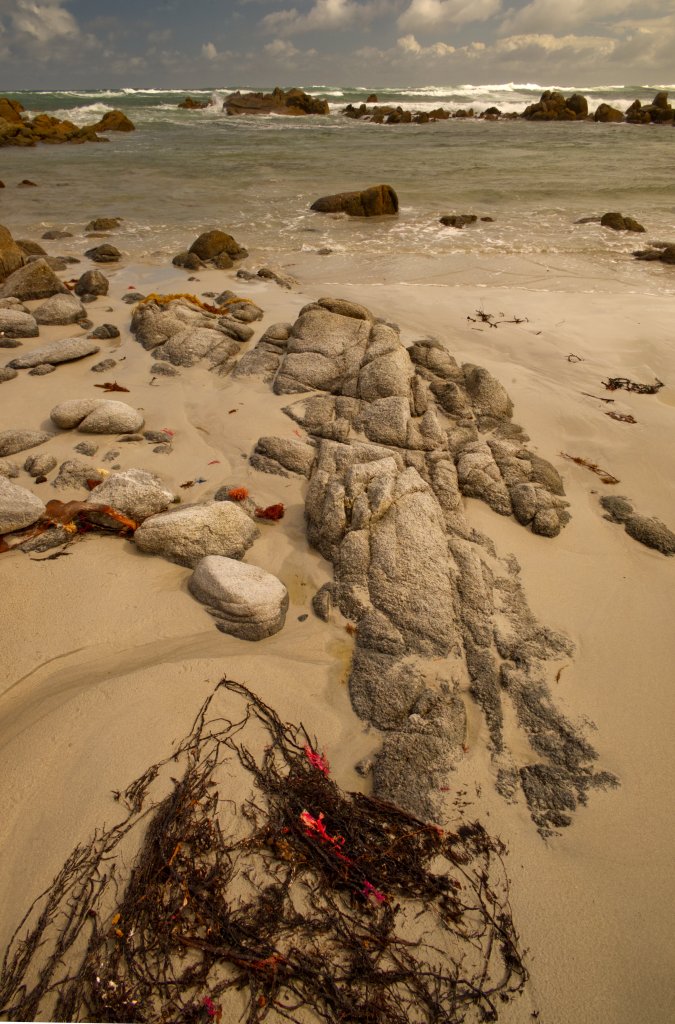
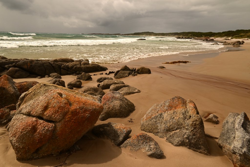
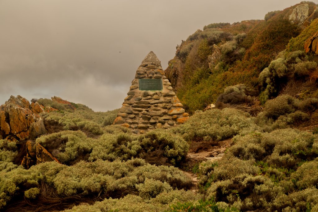
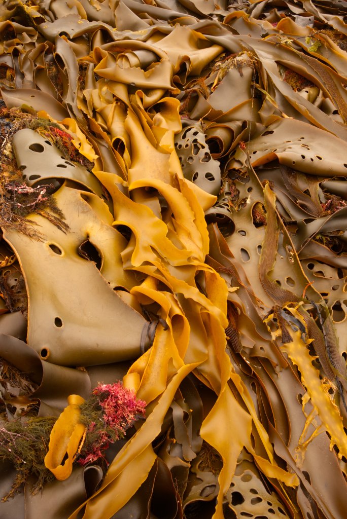
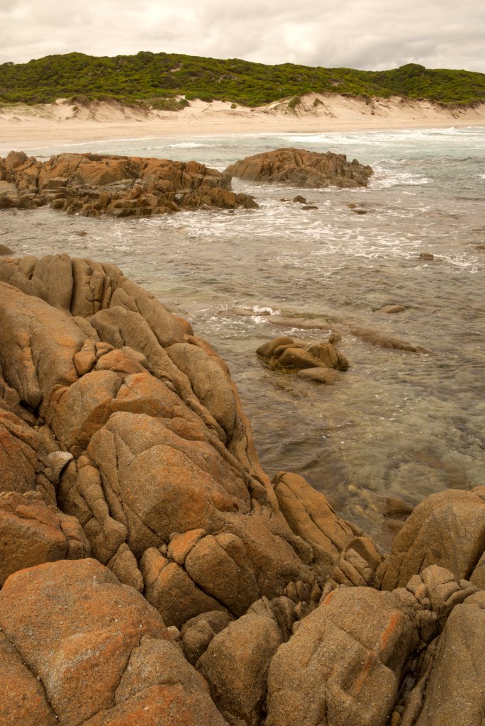
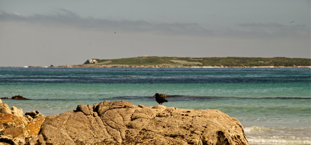
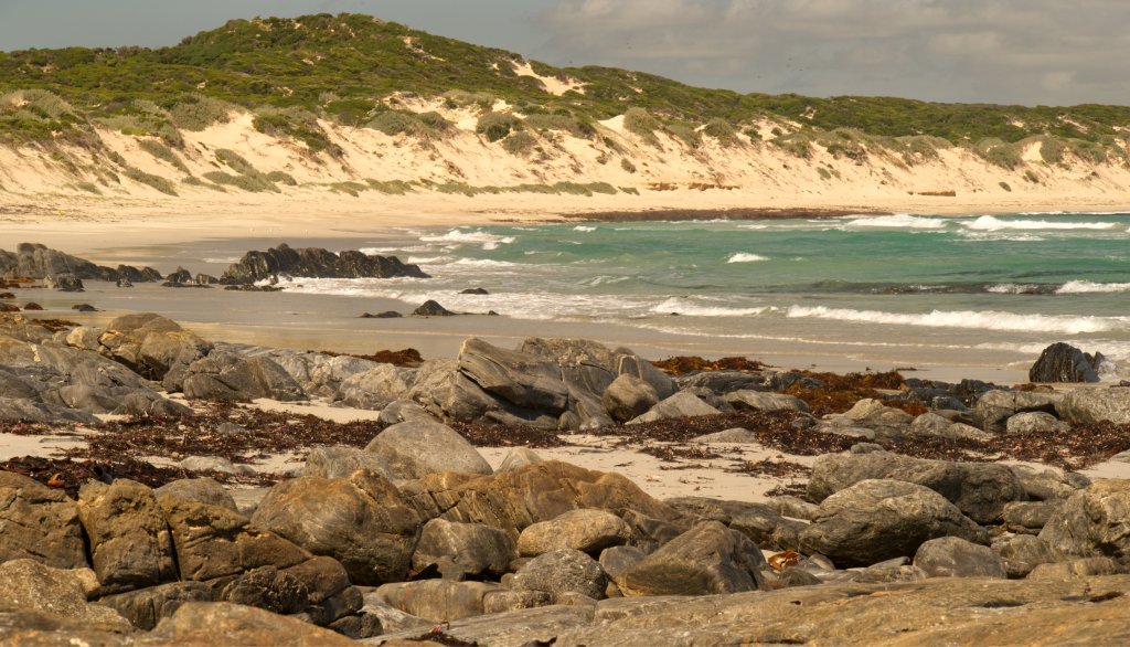
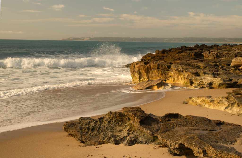
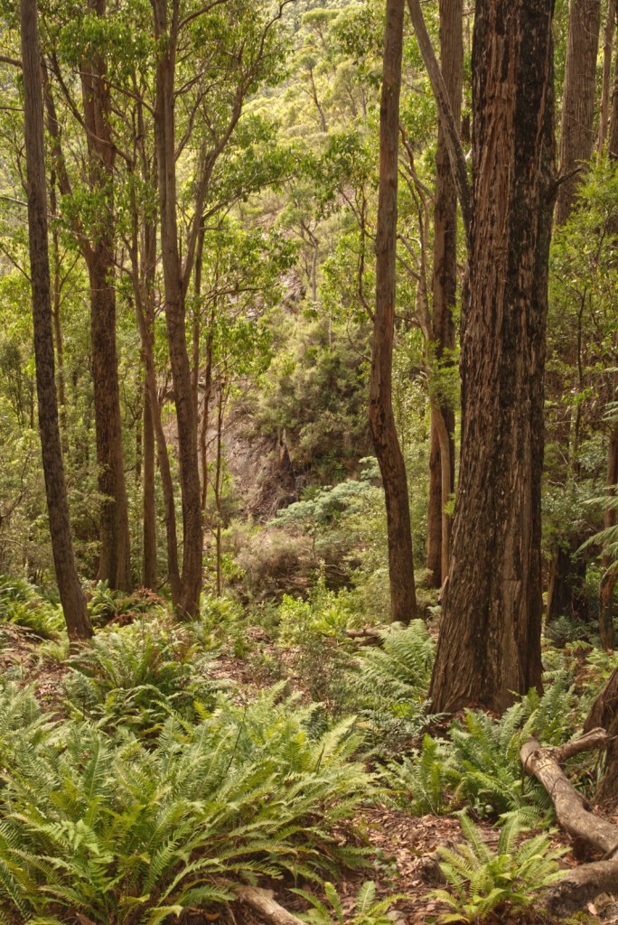
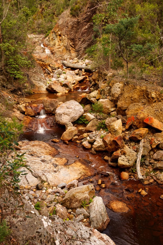
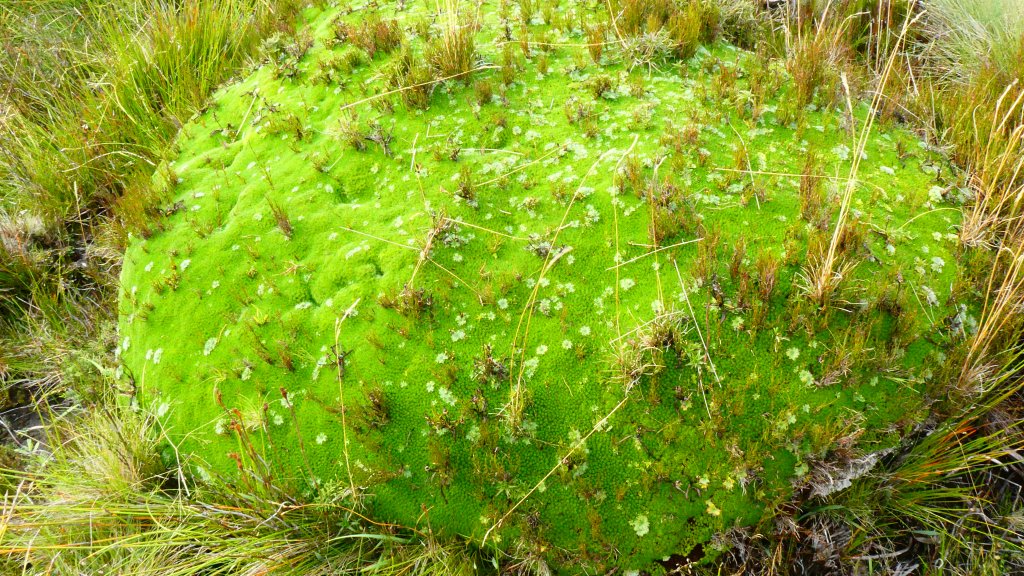
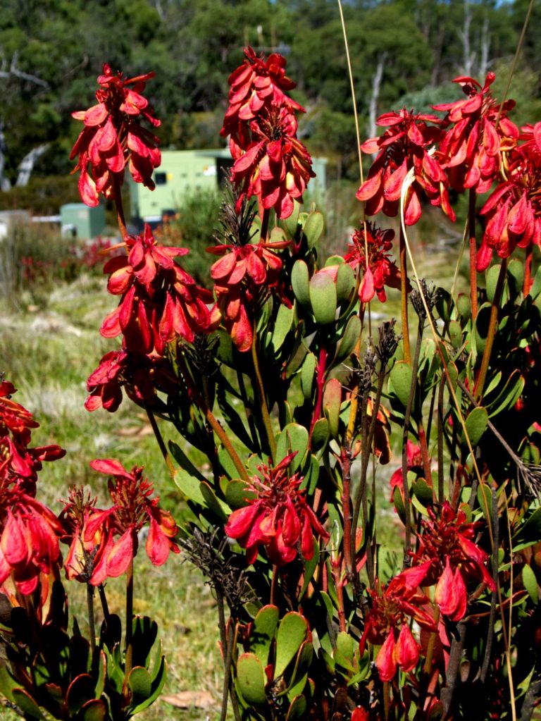
We landed at Whitemark Airfield, after a 40-minute flight. At the airfield, the bus was parked, waiting patiently for us to store our gear and then climb in. Mads drove us to Lillies Beach. There was no one else on the beach. A beautiful long beach, garlanded with red, dried out sea grass tumbled onto long swathes to well above the water line. We had our first sight of the granite boulders which are ubiquitous, extending from mountains to beach and to water. Richly coloured by extensive, by touch imperceptible, orange lichens. Now mute, these sand blown and water carved sentinels seem to guard the beaches. The sea water is translucent, its colour is a limpid green in the shallows and a steely blue away from the oceans edge. Wooden pillars of an ancient jetty, stand witness as white and grey ghosts of a time when sealing and whaling demanded easy access to the coast. 

The timbers are split vertically, curving the wood upwards and outwards, flowers opening to the sun.

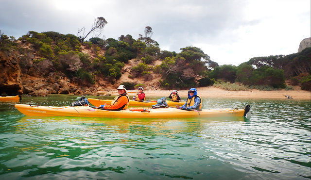
The yellow, sturdy, rotomolded double kayaks were lined up, side by side on the beach well above the water line. These looked and indeed proved to be tough, no-nonsense kayaks capable of comfortable travel in both smooth and rough seas. Mads explained the basics, including, the safe use of the spray skirt. Using the elbows to get the front edge on the lip of the cockpit, and when pulling it off, pushing away using the strap located there. Sand had clogged up the fittings for the footrests in my front cockpit and the steering pedals position inside the stern cockpit were jammed too. A fair bit of pushing and swearing was needed to get them to move. For the record, Alayne and Mads could move them with much more skill than Jen or me; and they did not need to swear???

At last, all of us were set up, looking very elegant in our spray skirts which were clipped up to our life jackets for convenience if not aesthetics. We unfastened them, and pushed out boats in, bow first, to allow the front paddler to get in, get their spray skirt on, and balance the kayak for the rear paddler. Jennifer climbed in, and after some help getting the rudder down, we began our first paddle to Sawyers Beach; this is where the shacks, we were to stay in, are located.

The first three days were sunny and hot, even on the water. I wore a tea shirt under my life jacket with liberal amounts of sun block down my arms. This paddle took two hours, and in generally calm water. We paddled past boulders, sand, and bushland, then around a point to see the length of Sawyers Beach. There were very few buildings to help our bearings. We certainly could not see the cabins, even when we were quite close to them.

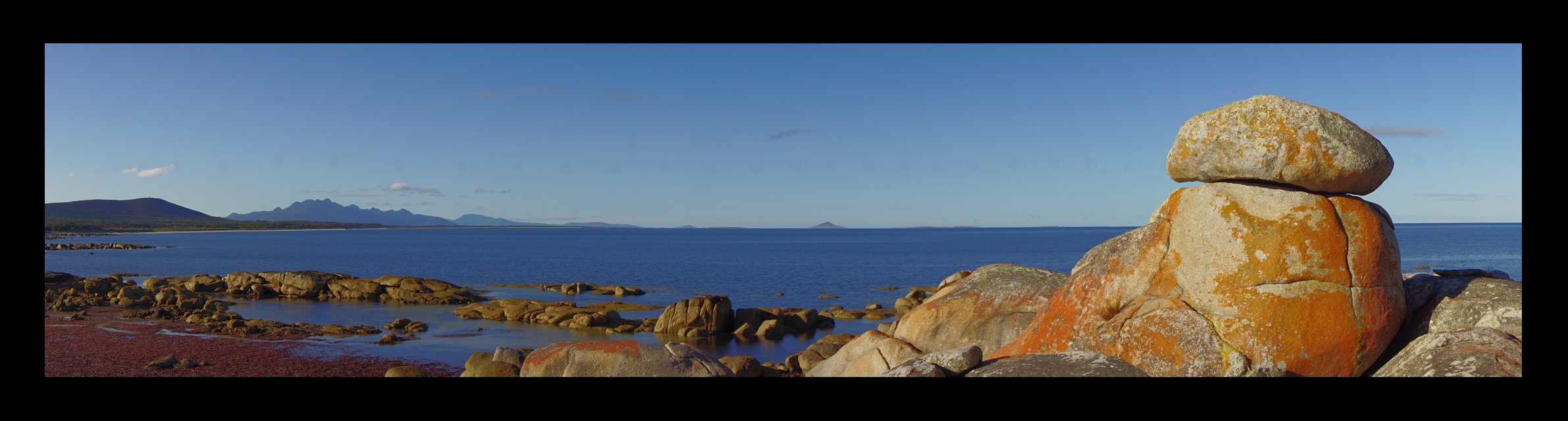
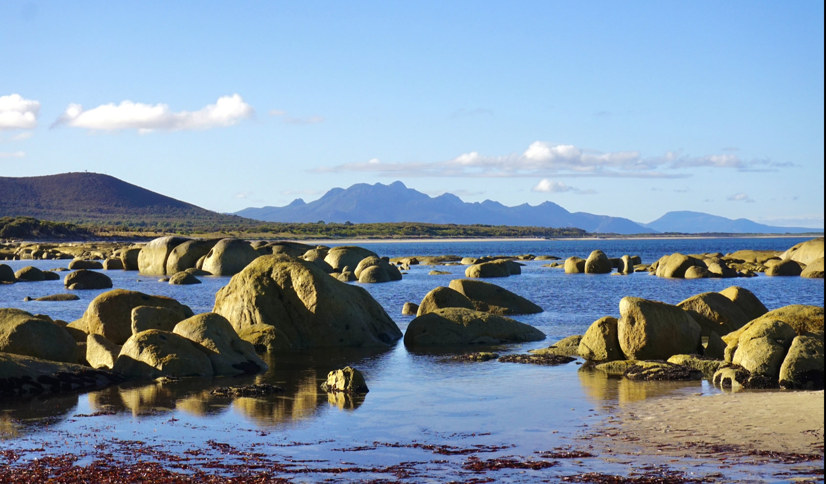
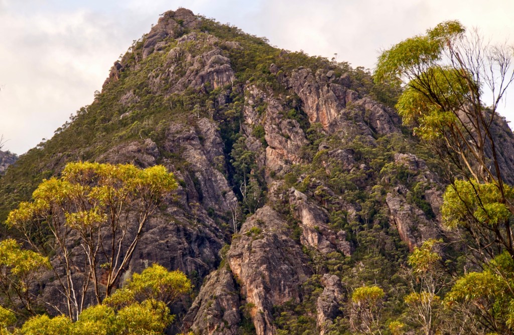
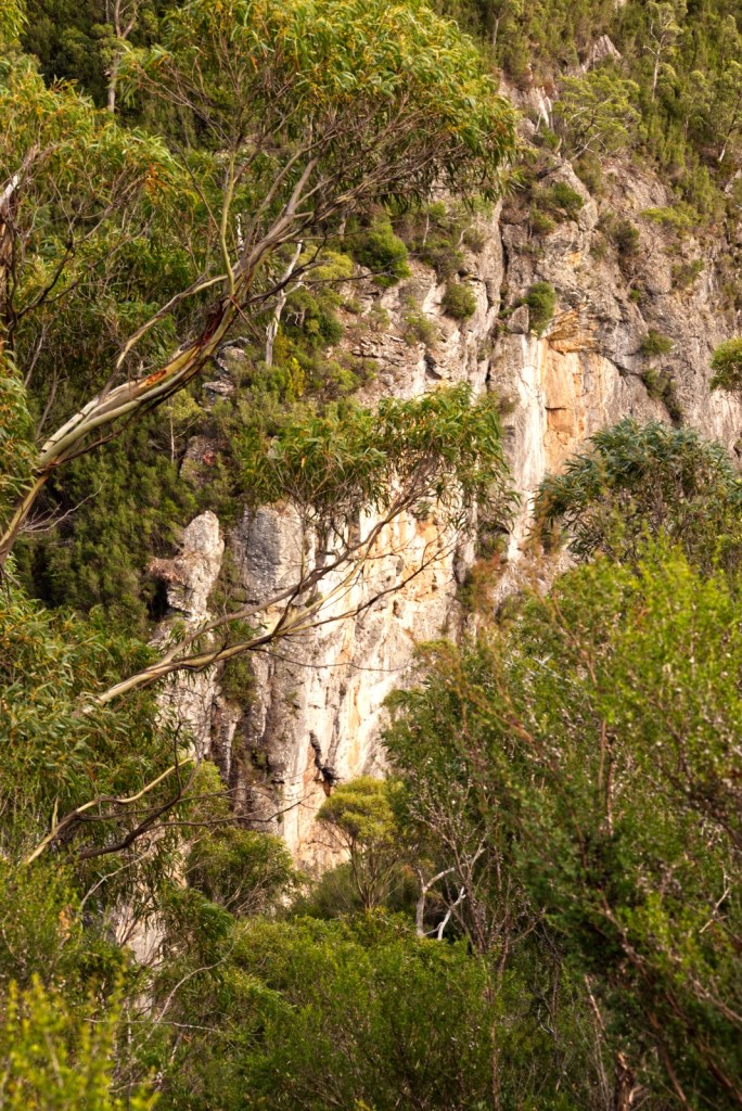
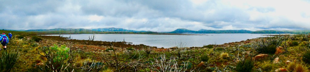
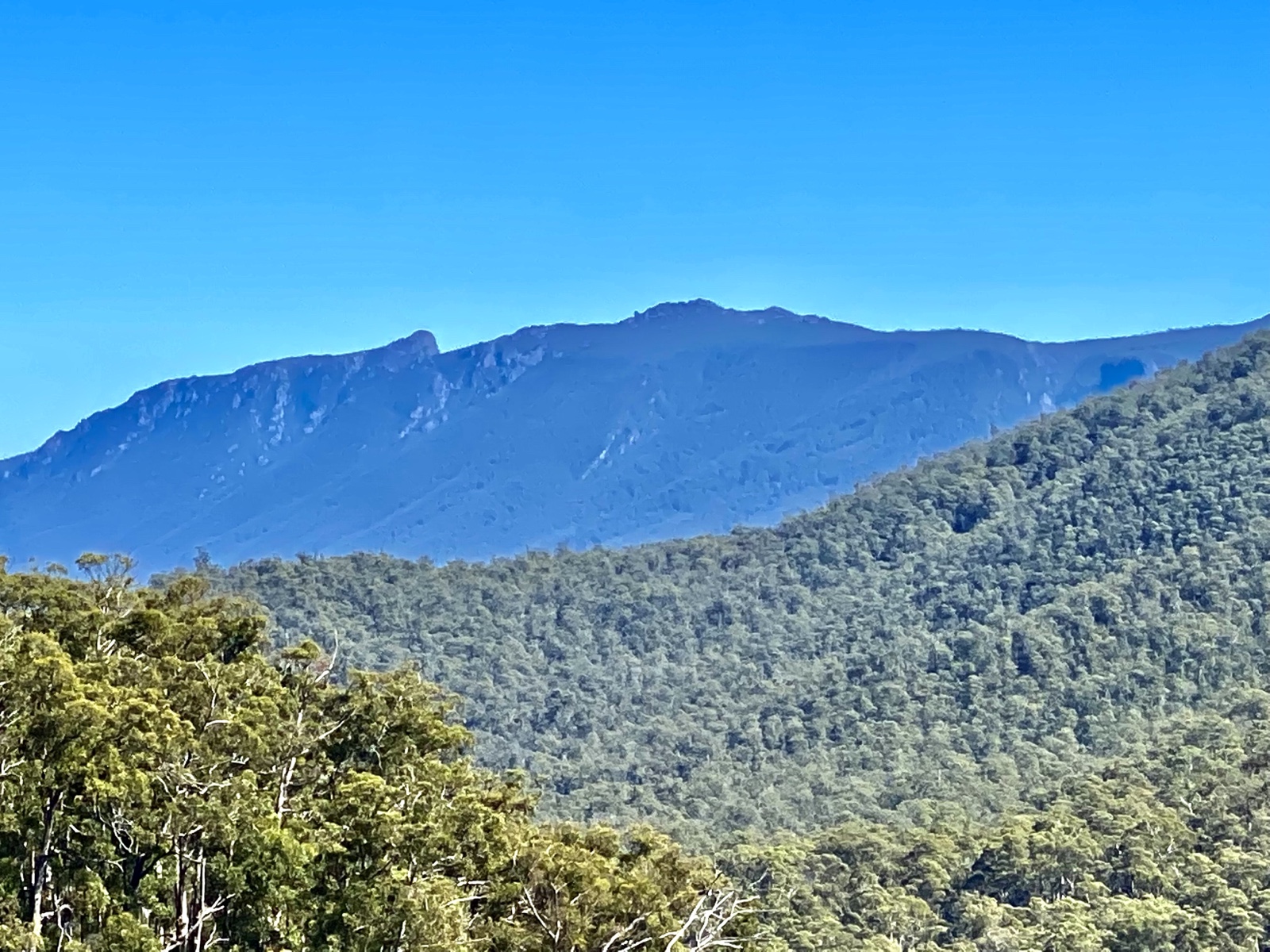
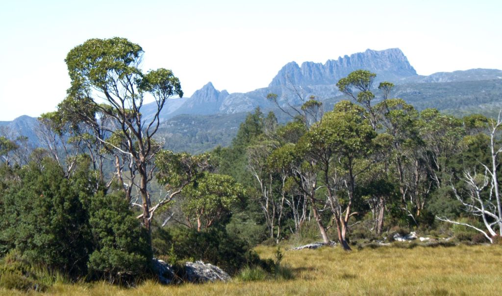
To the south, far beyond the bay is a blue silhouette, Mt Strezlecki is a jagged saw tooth of s mountain, it hovers over an ocean, it’s slope’s features made anonymous and indistinguishable by haze and distance. Oceans need the intimacy of proximity to be best appreciated while mountains stand impressive however distant.

The feel and smell of water was wonderful. The feel is that heaving swell which rumbles out of the ocean to spend itself against the coast but on the way cradles every boat, vessel, and ship in its hands. The surging of the ocean was muted and gentle today. I unconsciously used my legs to brace the inside of the kayak and balance all the contrary motions. The sea was once our home and perhaps always will be.

The smell is clean, a tantalizing fresh aroma, an amalgam of ozone, leached salt, ancient water, and all the aromas of the aquatic life around and beneath; from the algae tumbling in nearby kelp forests, the microscopic foraminifera hovering under the waves, and the many fish and molluscs, all of them splendidly alive, and all around me.

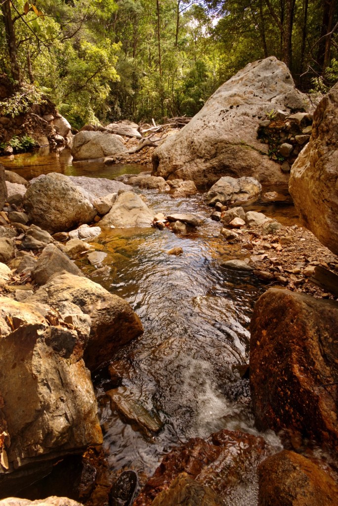
As I stroke the curved blade of the paddle, I am looking down. I can see the dark sea grass swaying to and fro in the currents, and then suddenly beneath us is an irregular patch of sand, its startlingly white, uninhabited by plants, rocks, or kelp. The water seems so shallow here, barely a hand span in depth, but it is not, it is more than two meters deep. Now there is a boulder submerged beneath us; its true to say that many more of them lie below than above the waves.

We brought the kayaks near the shore, finding a path for them between the boulders.

Each of us, sitting in our sleek boats, are dwarfed in an avenue of stone, aeons of weird carving has formed them into platforms, rings, or pillars. Here, gentle waves break or if they can, wash over them, dissolving into splashing, hissing crests.

We beach the boats and draw them up and away from the water. The tide is well out, and the sand is wet, glutinous like mud, and the deep piles of storm shredded sea grass; all make footing treacherous as we carry the boats away from the shore, and onto the trailer parked behind the shacks.

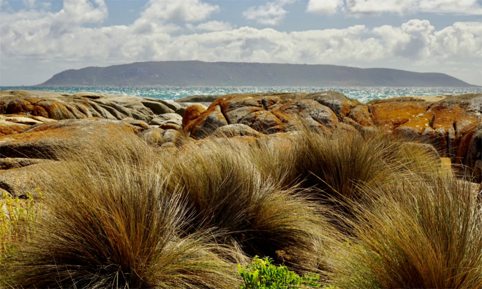
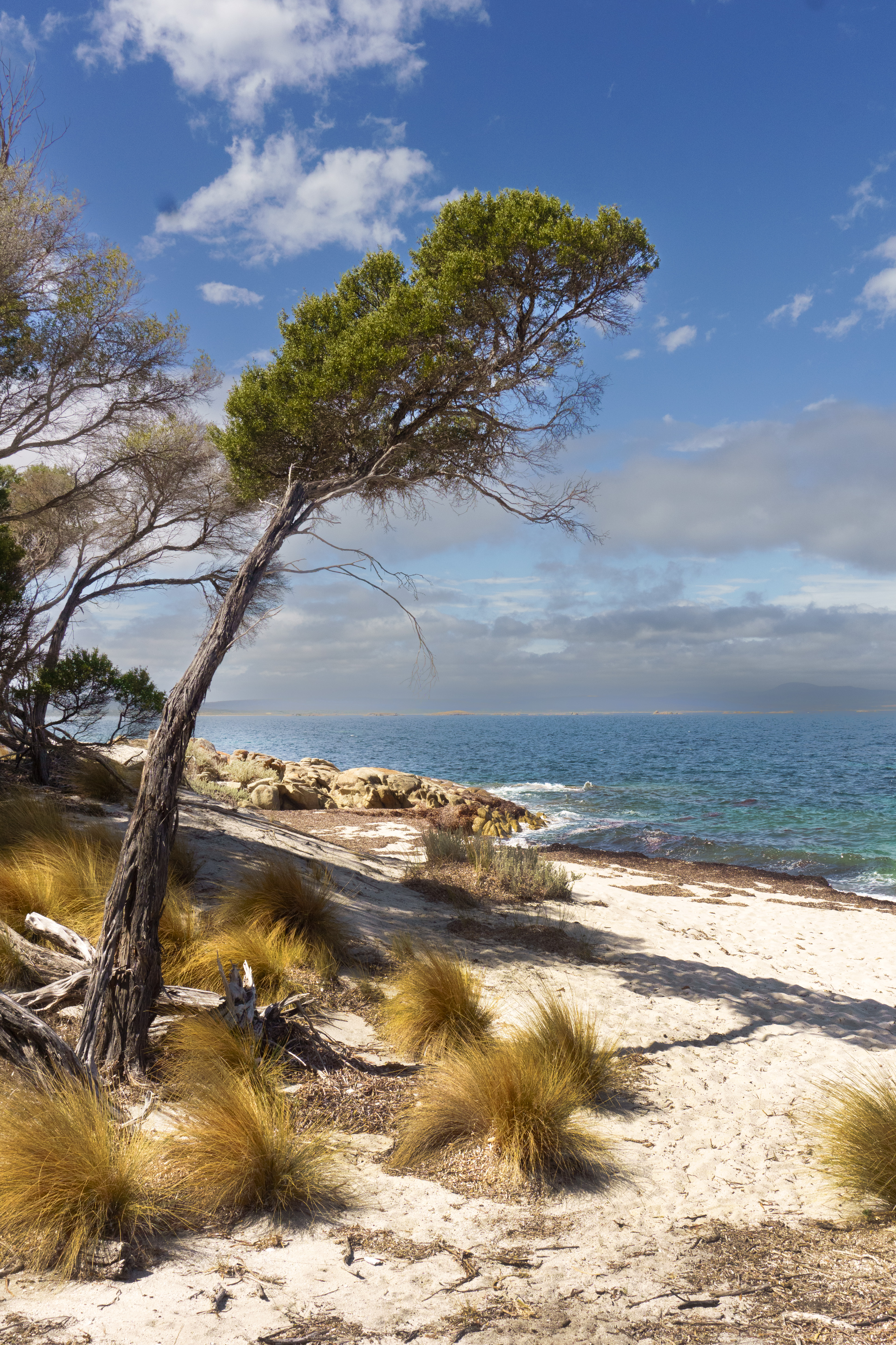
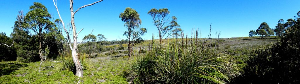
The accommodation for the group are two small houses. Jennifer and I stayed at the main building with another of the couples, Mary Anne and David. We had the bedroom on the west, so it was quite warm from the afternoon sun. There are no fans, but the windows can be opened to catch any evening breeze off the water. One of the two long, grey lounges faces the ocean. I could look over the grounds. There is extensive grass, parched brown from this unseasonal Summer dry. There are bare patches of sand and earth, grass scoured by the many grazing wallabies. They travel singly or in twos.  They rest in mottled shade in the heat of the day, then become active at dusk and in the evening and early morning. Two frequent visitors are Mum travelling ahead of a smaller junior who is jumping with more enthusiasm than skill. Together, they pause then stop, bending down to the grass, nibble at shrubs or to stand up and grasp low hanging bundles of the casuarina branchlets. They tear off the foliage with its teeth. These trees fringe the property and follow the slope down to a small beach. Most evenings, Jennifer and I would walk down one of the paths to the beaches, high and close up views of a coast, richly strewn with rocky hills and boulders. To the north is a headland covered in featureless dark bush and scrub before it tapers into the bay. Turning to the south, we could see Mt Strezlecki, its walled cliffs were no longer hidden in daytime, blue haze but were distinct and fiercely aglow. The mountain peaks were framed with interweaving and scattered cloud. A scene lavishly brushed in orange light.

With a glass of wine provided by our hosts, we can relax and take in the views. There are folding chairs, we can draw out onto the veranda. This area is separated from the main lounge and dining table by a full-length window. A group of Superb Blue Wrens flit over the grass and then land atop a nearby table. The bright blue male is with his many females and youngsters. They clockwork peek from side to side, then fly off and quickly vanish into nearby shrubs.

Day 2

Today we went to Wybalenna Island.

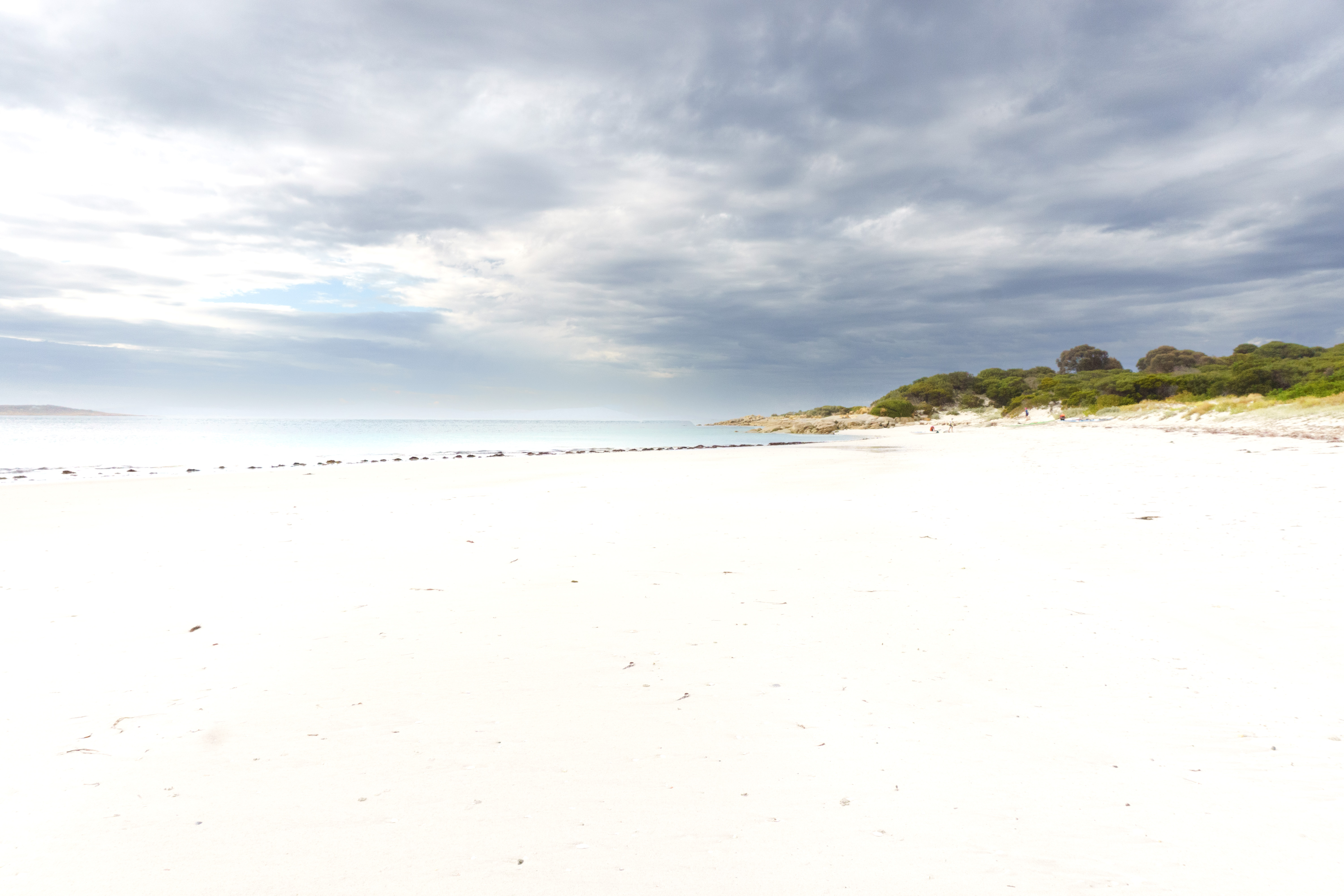
Another warm and sunny day, a few clouds blown listlessly over the horizon. We went in the bus to Allport’s Beach. A typical Flinders Island beach with sand curving across the bay, and boulders resting together at one end, adjacent to where we launched the kayaks. The water was calm, almost still, until broken by the rhythmic attack and draw back of each blade. As the blade propels, passing beside the hull, it creates a whoosh and thrum in the water.  With each stroke, I can both hear, and feel this resonance in the kayaks shell.

As I paddle, I imagine a fulcrum in front of me and its tip is some 25 cm above the deck. This point is the spot where the centre of the paddles shaft stays. Perhaps consider it as a point of purchase about which I simultaneously aim to push the airward blade forward and the seaward blade back. I can keep this going for hours as it diffuses the load of paddling between as many muscles as possible. Add this to the sideward twisting of the torso to increase excursion and power of the stroke, and you have a very efficient way to move across water.

The paddling itself is a universe unto itself, but the scenery. Oh Wow!

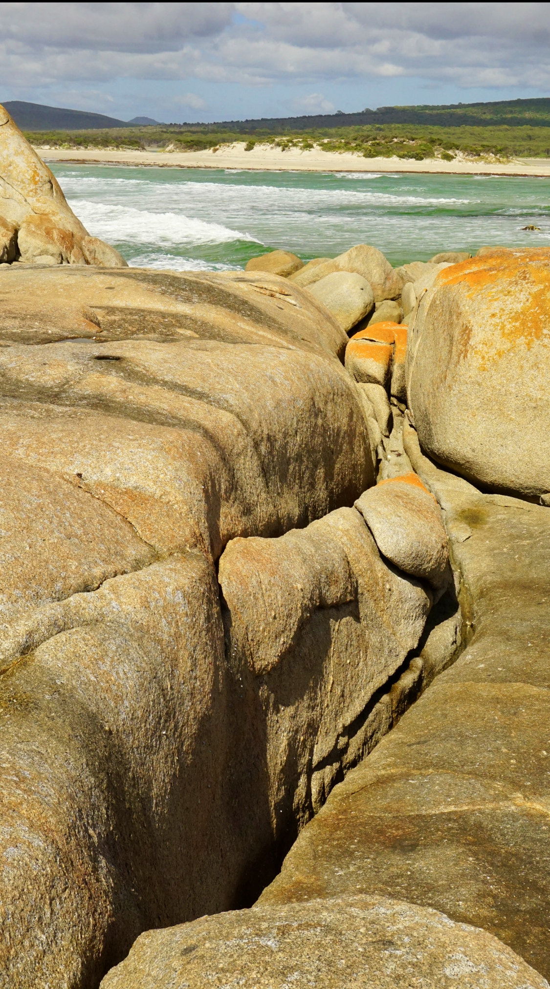
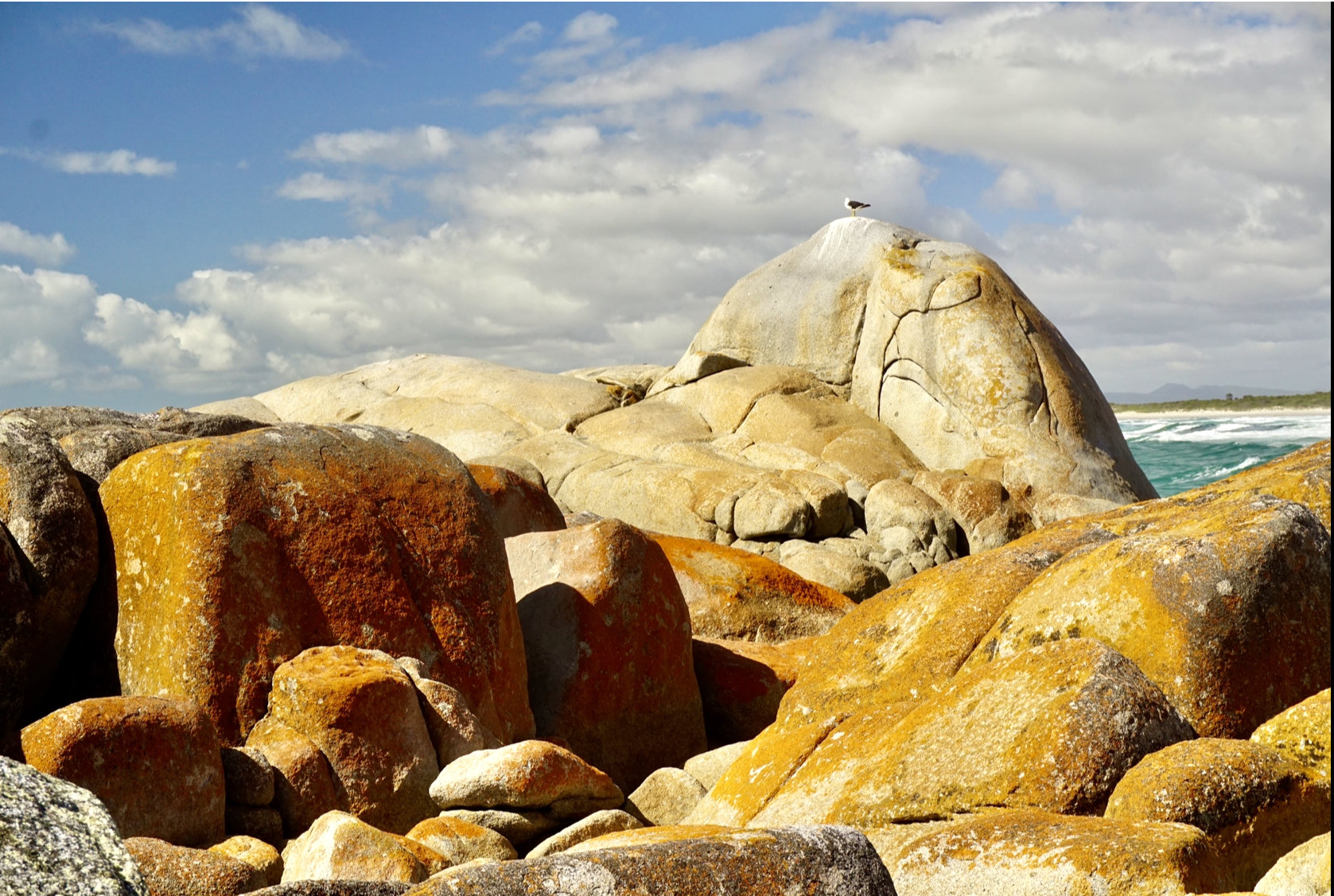
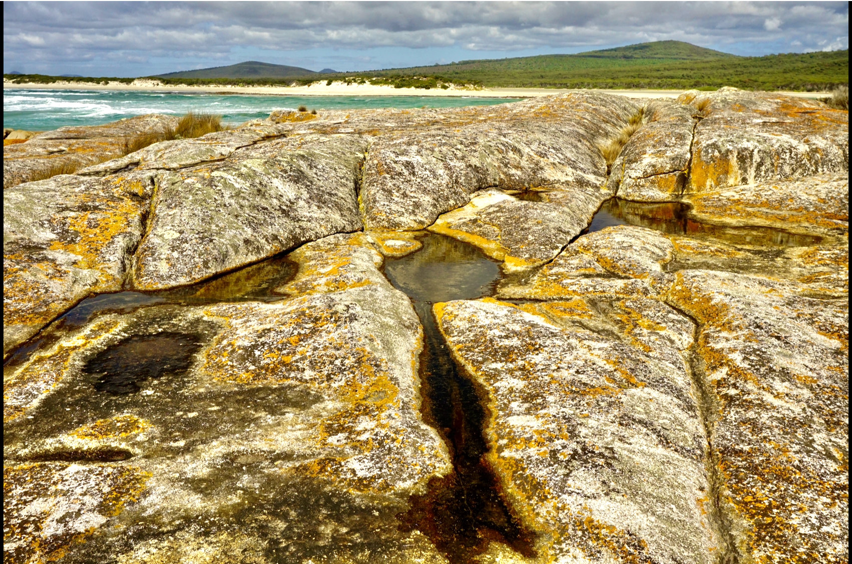
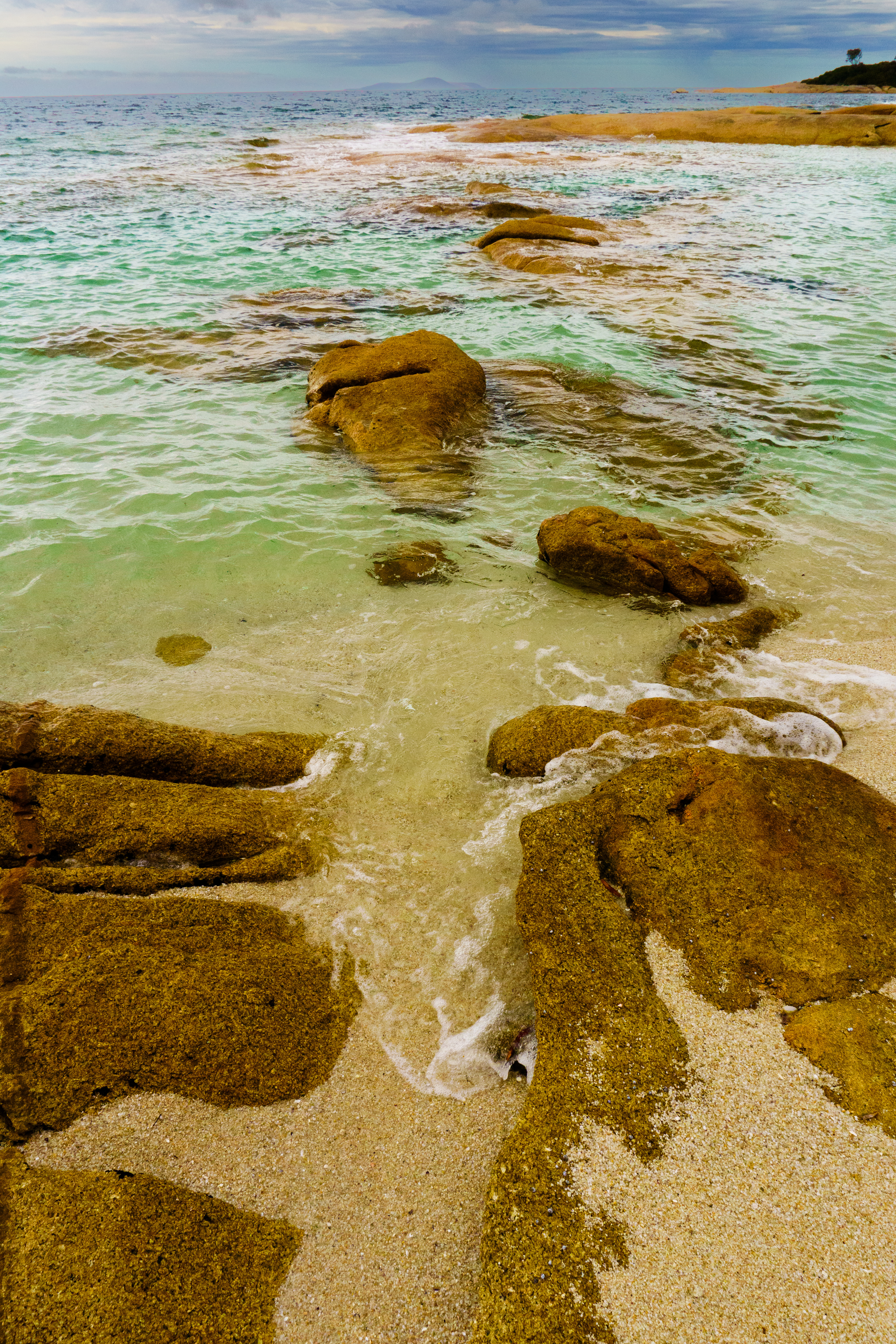
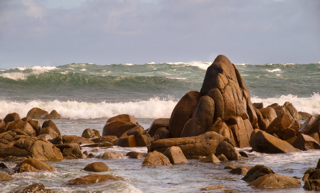
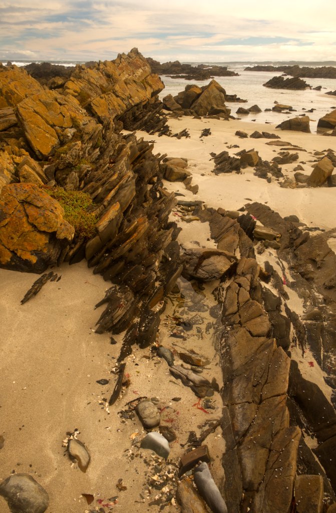
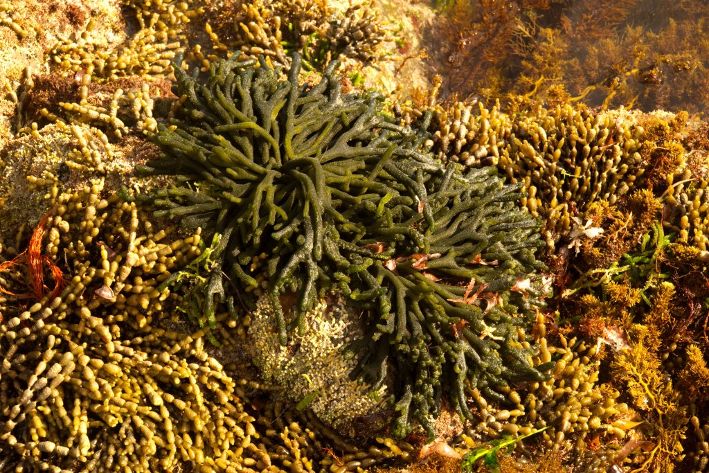
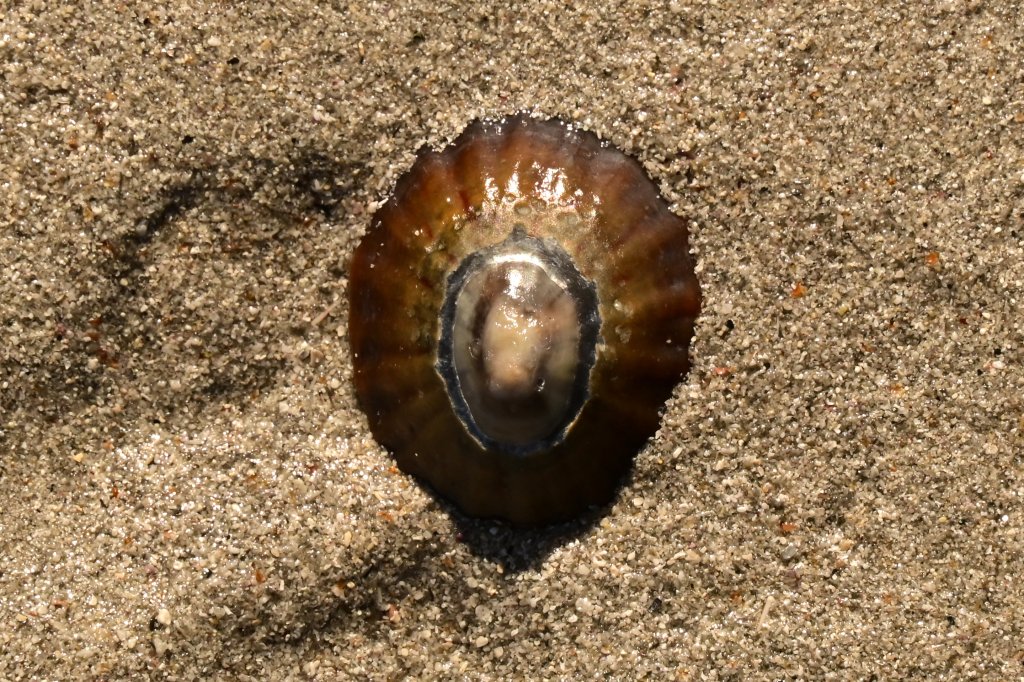
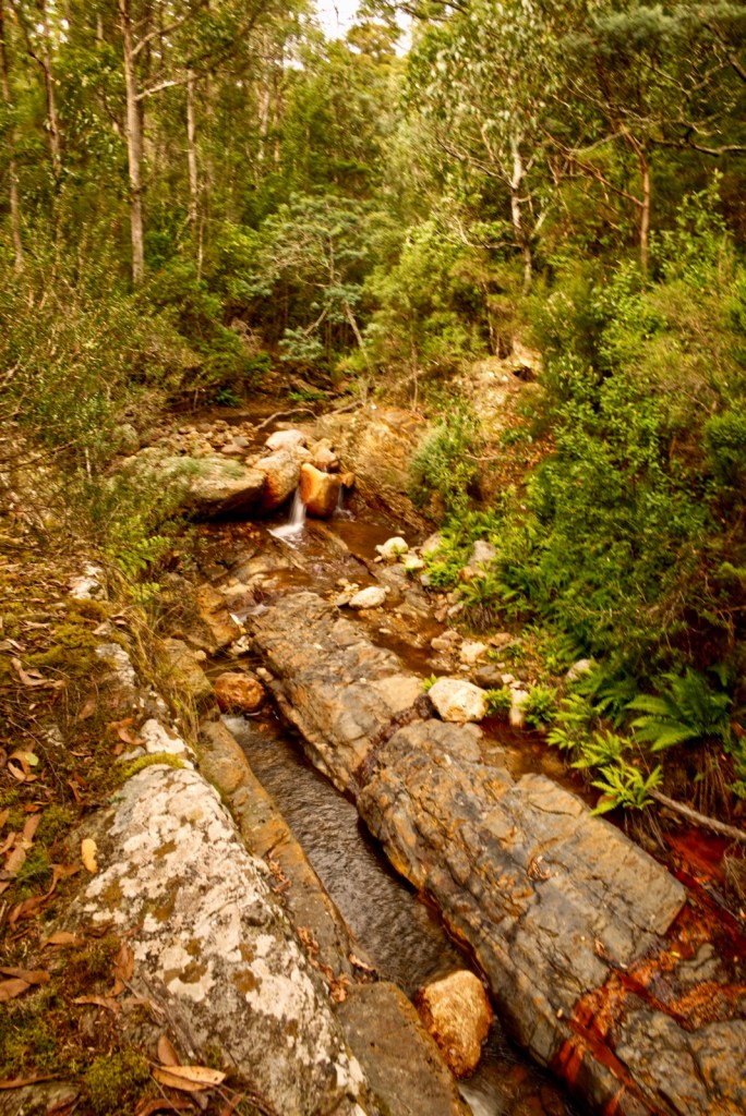
Boulders, smoothed by the sea, quixotic shapes; broad pillars carved narrow at their base to stand as inverted roughhewn pyramids. I see caves deep enough for permanent darkness despite a sunlight sky. The most vivid orange stains on the boulders are from lichen. The lichen is most abundant on any sunlit side, and any surface sheltered from the tides. To wind, sand, spray and storms, these tiny living things, give no heed at all. Lower down on each boulder, where water covers the stone much longer each day, the lichen is absent. It is replaced by slimy, translucent moss. Small black seashells (? nerites) and Pipis crowding the surface, waiting for the incoming tide.

Looking closely at the boulders, there is the frequent glint of mica. These silvery fragments are crystals and sit accompanied by other minerals such as feldspar. The slow cooling of granite deep inside the earth, beneath insulating layers and layers of sedimentary rock not only allows crystals to from, but as the cooling continues, great vertical lines of fragility form in the monolith; tiny, long splits run up and down creating potential columns. This occurs due to the contraction of any hot, expanded material that occurs with cooling, except for water. And it is water, wedging itself in these cracks, that freezes and expands splitting these rocks into vertical columns.

 It is the nature of stone to be extremely strong when vertically loaded. You cannot squeeze a rock and break it, as a column it can support many times its weight, but when falling, the side of the pillar strikes the ground, and as lateral loads or impacts are not borne well by natural stone, they shatter into boulders. At first these huge fragments have sharp edges and distinct corners, but with time, the processes of erosion ceaselessly smooth and fashion. It is the physics of materials, that erosion proceeds faster on edges and corners rather than the flanks of a boulder hence the curved, smooth stones we see today. They preserve their mass and size but have discarded the violence of their formation.

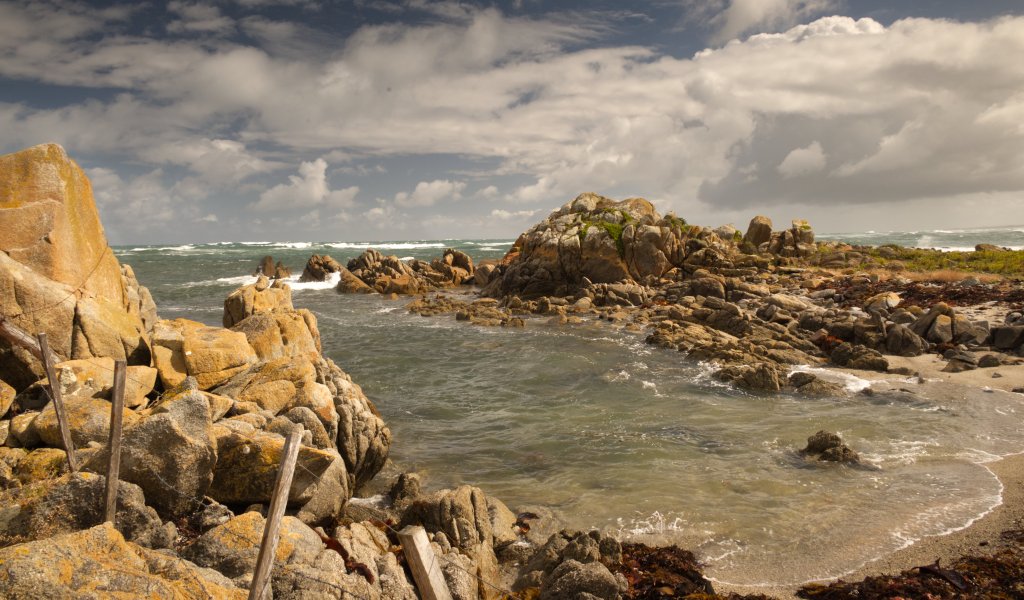
It did not take long to get to Wybalenna Island. This is a small yet quite magnificent island. There is a small sandy beach with excellent swimming, nestled between complex rock formations. Climbing from the beach there is tussock grass and numerous small tunnels dug into the ground. We saw a penguin chick in one. I think mutton birds or shearwaters roost here. There are none about now.

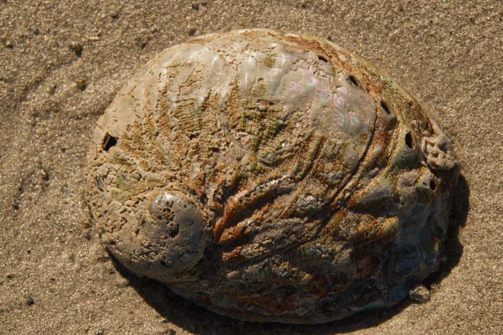
The bay we have beached the kayaks in, is small but very sheltered, and the rocky platforms around us make excellent vantage points to look out across the water. Kerri Ann went for a swim and found many fish and sea animals. She would swim out, then bob down, her snorkel just above the water. The water here is shallow and warm. She saw fish swimming along amongst the patchy sea grass. Anemones, molluscs, and corals, attach between nests of small rocks, evidence of a rich marine habitat.

We had morning tea on the island before setting off back to our lunch spot on Settlement Beach. The trip continued in bright sunshine and on calm water. Mads and Alayne set up a tarpaulin which was held aloft by two paddles buried in the sand. Lunches were terrific. There were 4 sealed bowls, each of them full of different salads, freshly grated carrot, chopped beetroot, lettuce, tomato, cheese, and more. There was bread, wraps and vita-wheat biscuits. There were abundant spreads, including peanut butter, humus, and a selection of condiments made by a local named “John the Juggler”. I particularly enjoyed his Brinjal Pickles on salami or cheese. I later bought some home to Launceston with me to enjoy with cheese and crackers.

We all sat in the shade from the tarp and looked out over the water. High overhead, fine cloud laced  in the sky, it’s azure blending with sun tinted ocean, an ocean which turned suddenly from silver to opalescent green as my eyes tracked towards the shore. Standing in the deep water beyond the bank, I looked down, and was startled by the clarity. I had a short swim here, splashing a few strokes into deeper water; I felt warm and clean. Though I had lathered myself in sun block, I missed the front of my ankles which first turned itchy in the afternoon, before becoming a hot, tender and red in the evening.

We continued to Lillies Beach. There were the now familiar wooden pylons leading to a narrow sandy beach, with flattened clumps of drying seaweed every few meters. The bus and trailer were only a few steps away. We soon had the kayaks loaded and tied down.

We went for a visit to the nearby Wybalenna. A relic and shameful example of how white people have treated Aboriginals, the true Tasmanians.

Aboriginal history is a sorry as it gets when you begin to explore the events on Flinders Island. They were bad enough to galvanise a petition to Queen Victoria and change how Aborigines were treated here.

In 1835, over 200 Aboriginal people were transported here from Tasmania. Conditions and hostility against them on the mainland by both government and settlers, had so badly deteriorated that they were forced to take up the (initially appealing) offer to temporarily settle in a community on Flinders Island. Perhaps they arrived at Lillee’s Beach, walking along that now ruin of a jetty.

The main building that remains, and it has been restored, is the chapel. A brown, brick modest sized rectangular structure. It has an entrance alcove and then a hall. There are grey timber floors. It is not dark inside but well-lit from the sunlight outside, by large, tall windows. Attached to the wall or in display cabinets, are photographs, assorted texts including, reproductions of letters, explanatory narratives, and summaries. The photographs show Aboriginal people dressed uncomfortably in white European-style clothes.

There are crude drawings of the huts in which they lived. They were crowded, accommodation that was cold in winter, and unbearably hot in summer. These dispossessed people soon descended into misery and disease. Only 45 people left here when the facility was finally closed. Most of them moved to Cape Barron Island and their descendants live not only there but also throughout Tasmania.

Day 3

A visit to Roydon Island.

Today was cooler and more overcast, promising a remit from the hotter conditions of the first few days. Breakfast is at 6:30 am in the main kitchen. We sat around the long wooden table chatting as the other guests drifted in. Hot tea and coffee, beverages poured from large thermoses at one end. The bowls, utensils, and cereals.  Freshly prepared fruit including berries, sliced apple, pear, and sultanas could be liberally added to the cereal. I think this morning’s treat was toast and scrambled eggs.

The rising sun peeped over the low hills behind us, its light dancing over the topmost of the trees and then to Mt Strezlecki on the horizon. The personal equipment is stored in large, round buckets. This includes, a spray deck made from neoprene, a deck bag which can be strapped to the cords on the kayak, a soft seat / back support depending on where it slips to, soft water bottle, as well as camera, snacks, dry jacket and sunblock. And not to forget, sea to summit life jackets.

We left at 7:30 am.

Our personal equipment sat on the front floor and seats of the passenger section of the bus. A mountain bike sat in the walkway to be dropped off, hidden at our landing site then used to by Alayne to retrieve the trailer.

The take off point was West End Boat ramp. Accessing this was far from easy. As we drove a sandy twisting track, branches of scrubs and trees lashed the glass of the minibus. Thankfully, there is a turnaround, a loop from which Mads was able to back the trailer steeply down and toward the beach.

We paddled off the beach toward Roydon Island. Toward is used in a somewhat loose way, it was to be our destination, but the direction we travelled was far to the right of the island. This is to take allowance for the winds and especially the movement of the tide which propelled us leftwards. Much of the planning done every evening by Mads and Alayne was to assess the tides, currents and conditions. Thus to determine the best route, best launch locations, indeed safest destinations, and direction on the water as well as the best time to minimise or at best, utilise the tides.

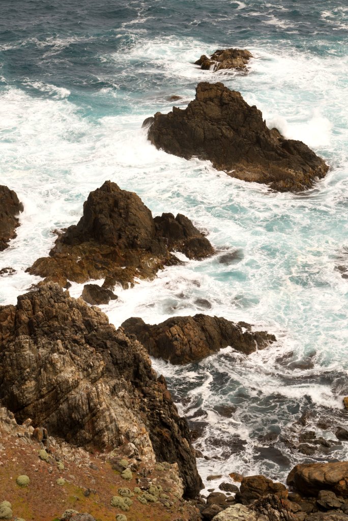
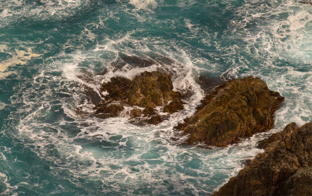
The water was rougher than on the previous trips with irregular waves atop the currents. These “confused” waves result from the different directions of wind, tide and current. Who wouldn’t be confused? We passed a small rocky island with its entourage of cormorants and pacific gulls. The cormorants drying themselves in the wind and the gulls peering out over the water from any vantage point high up on a peaked boulder.

We soon entered the protection of Roydon Island, it’s main stony promontory shielding is from the wind driven waves. We passed beyond this, to see a beautiful, long sandy beach extending from the crests breaking along its shore to the thick scrub hugging the topmost sand dunes. This wide expanse of sand and shells runs between two rocky points. There were a group of brightly coloured kayaks already off the water. These paddlers had come from Melbourne and had island hopped across Bass Strait. Their longest stretch away from land had been 12 hours. Roydon Island is a recognised stop off for these crossers.

We moored the kayaks on the beach. The beach is only gently sloped and so we drew the boats well up the sand to avoid the tide washing them away. We clipped our spray jackets to our life jackets and went to explore. A track leads from the beach to a wooden hut. This shelter has cooking facilities and sleeping facilities. A rough-hewn wooden chair stands in one corner. Primitive this may be, but I am sure this shelter would be a very welcome respite from a stormy crossing of the strait. Richard Flanagan has written a short book, a narrative of how he and his friends paddled Bass Strait in terrible conditions. This is not the best book to read before a kayaking trip.

On the way back to the kayaks, I stopped and admired the Mirage kayaks the first group had all used. While our boats are indisputably strong and stable, theirs were sleek fibreglass craft in loud colours. I would not drag these boats up a rocky platform but oh they did look good.

We left the beach with its inviting sand and water, and turned southeast toward Flinders Island, and soon were skirting another long and magnificent beach. We entered an archipelago of boulders and and tiny islands, waves pitching the kayaks up with the swell. The boats felt incredibly stable, only doing a subtle wiggle at the crest of each wave as it corrected itself for the descent.

We exited the water at Pole 41 on the West End Road. While Alayne rode the bike back to collect the bus, we all took the opportunity to explore. Kerri Ann went into the water while the rest of us explored the beach and took in the views even a short stroll could reveal. I climbed a small headland, through drying tea tree, and visited a beach. After a cool morning, the sun had burned away the clouds and it was now pleasantly warm.

Lunch was excellent. Jennifer and I sat on the sand. I had a plate of salads, cold meats, splashed in yummy pickles.

After showers and a freshen up, some of us visited Whitemark. This is the main town on Flinders Island. We purchased some wine at the IGA located there. And did some half-hearted shopping as we were all a bit tired from our morning adventure.

Day 4

A trip to Fisher Island and return to Badger Head.

Badgers are wombats, or at least that what they early settlers thought.

The start of the paddle was from a boat ramp at Badgers head. The ramp is slippery and steep with not much space to co-locate several kayaks. We walked down the ramp carefully, three to each side of each kayak, hugging the right side and then jammed up the kayaks on the rocky area near the water’s edge.

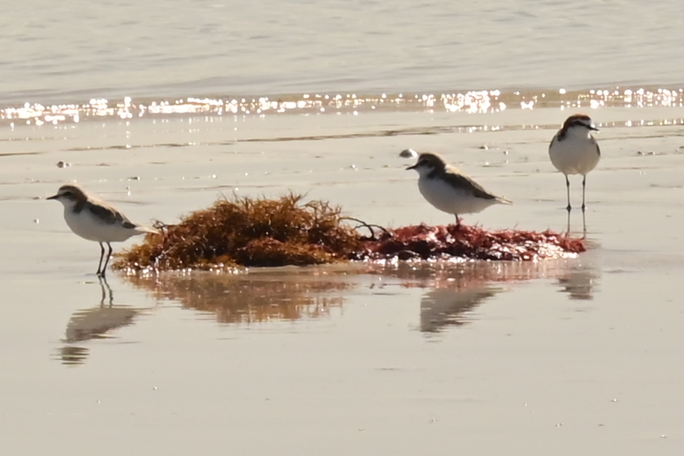
On the water, it became clear immediately that the tide was moving quickly, and we were paddling against it. Progress in the kayaks was slow and hard won. As we reached a wide shallow area with the depth barely greater than the rudder, the speed of the tides flow increased. There was long beach to our left. A vast intertidal zone was free of water and many birds were taking advantage of the opportunity to hunt for food. There were many swans between us and the estuary. Gulls, ducks, native hens, wading birds, and cormorants crowded the mud and shallow water in huge numbers.

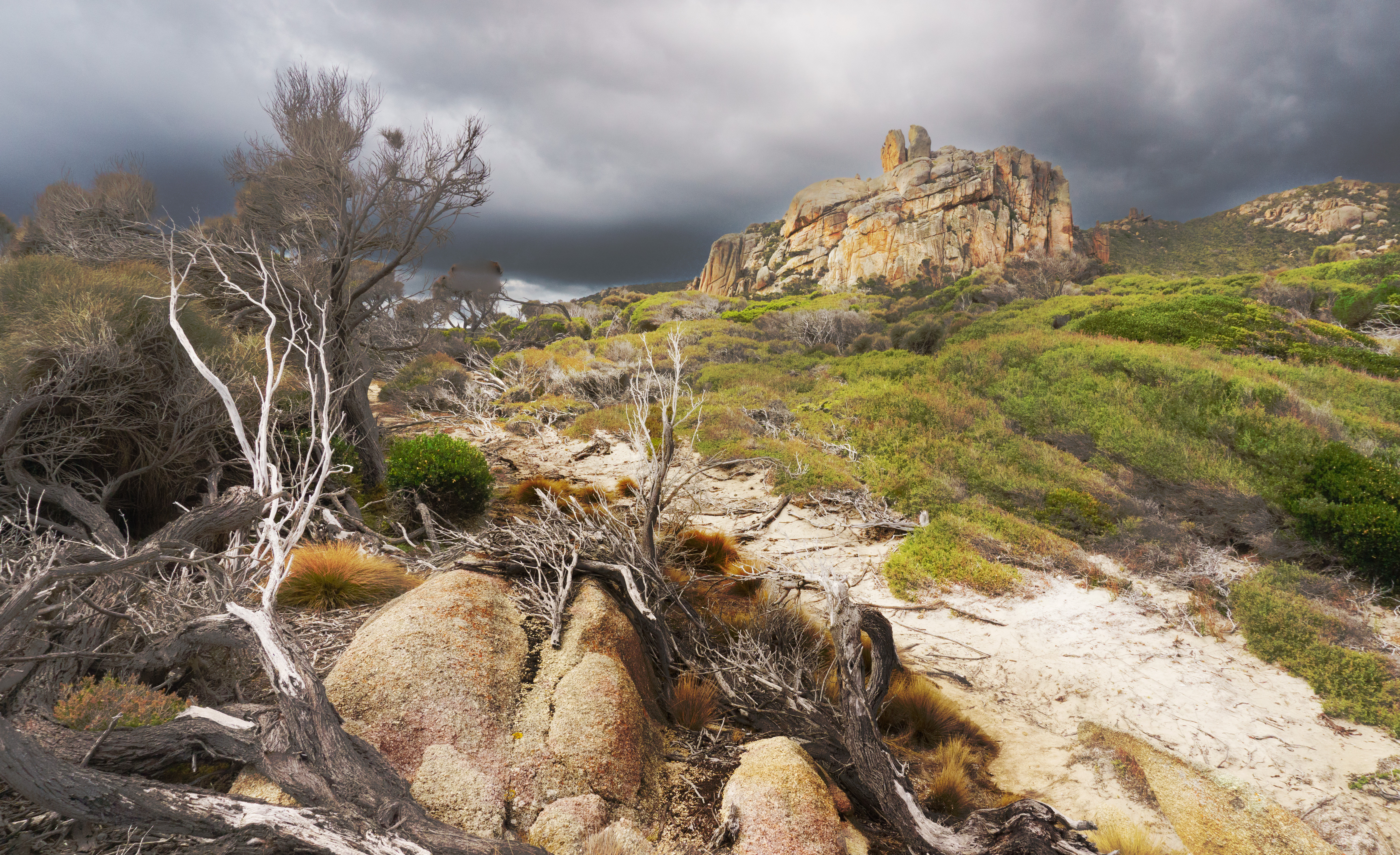
We carried on beneath a threatening sky, through patches of bouncy water to Fisher Island. On this trip we learned of many interesting terms for choppy water including, spicy, confused, and technical, a strange cobbling of food, mental health, and engineering nomenclature for paddling. There is no beach anywhere on the perimeter of Fisher Island. There is a low-lying rocky platform that provided an access point and facility to carry the boats out of the water, well mostly.

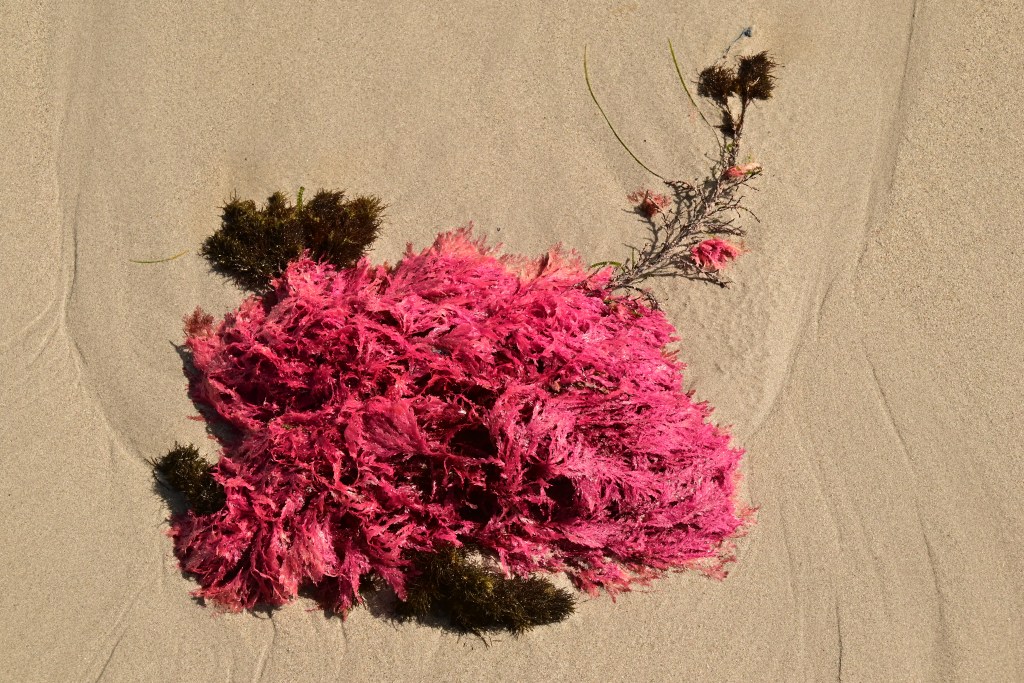
There are a host of Islands to the south and southeast. Their dark blue contours suspended on a sea, the colour and light of reflected steel. Water surrounded mossy wet rocks providing an uninspired foreground for photographs. The darkness from thick cloud stealing any faithful colours away. At first, there appears not much to see on the island, the rocky seashore, the small patches of native grass and wind stunted shrubs. Mary Anne called me over to look at some things on the ground. As soon as my eyes became tuned to the small and not the large, here were miniature gardens, composed of fine shards of tiny shells, purple scallop shells like Chinese fans, flecks of coloured seaweed and fragments of coral. Tiny and very beautiful. Now I could see, everywhere these tiny theatres of marine life. While they were nestled in sheltered clefts.  Orange lichen flamboyantly covered any exposed boulders above the tideline.

We enjoyed a morning tea by the kayaks, resting the thermos on the rocks.

Near to Fisher Island is another even smaller island. A home for cormorants. Here, they basked aplenty and took no heed of us as we passed, barely turning their white throated heads to gaze at us.

In the water, we aimed the kayaks straight to Badger Head. This course took us well off the coast. By now the incoming tide which had proved so challenging, had covered all the mud and only the thin sandy beach remained. Many of the birds had left to explore other parts of the Island. However, the tide was far from exhausted, it whips around the eastern corner of Flinders and carries on past Fisher Island and Little Green Island and surges into Bass Strait with Mt Strezlecki to the north. Propelled quickly, we soon had unobstructed views of Cape Barren Island.

Waves frequently toppled and broke over the foredecks and spray decks. I dangled my fingers into the water, its cold colours glossy and black, but to my surprise, it was as warm as just worn silk.

We rapidly arrived at Badger Head; 45 minutes back compared to over 2 hours out to Fisher Island. At the ramp, we took turns bringing our kayaks into land then pulled each one well out of the water, so the next couple of paddlers could bring in their boat. There was nowhere to sit down and enjoy our lunch so we drove back to Sawyers Bay.

After lunch we went to visit Furneaux Museum near Allport’s Beach and only a short drive from Sawyers Beach. It’s a modern building bursting with history; natural, colonial, indigenous, and more. There are smaller buildings retrieved from around the island and reassembled here. These are used for dedicated exhibitions. There is a muttonbirding hut with artefacts and information relating to this hunting activity which is still practiced not only on Flinders Island but also nearby islands of the Furneaux. On display, there is an example of a local delicacy, a tin can of  “Squab in Aspic” which is canned mutton bird.

In the hut devoted to Shipping and Shipwrecks, there are two massive anchors from the early wreck of the Sydney Cove. This ship was on a trip from India where it had been a coastal trader for many years, all the way to Port Jackson. On the long trip, the ship suffered through gales and awful seas, and was damaged so badly that the bilge pumps had to be pumped continuously, exhausting the men onboard. This ship and her crew limped around Southwest, Tasmania, then passed Maria Island, and then began to cross Bass Strait. Now the boat sprang an even greater leak, so the Captain turned her westwards, and the ship was wrecked on Preservations Island just south of Flinders Island. A select crew, less ravaged by scurvy, took the longboat and sailed across Bass Strait with intention of going to Port Jackson and notifying the port there about their situation.

The luck of this voyage did not improve as the longboat was wrecked near Cape Howe, eastern Victoria. The survivors walked cross country to Port Hacking, near Sydney!! The rescue ships retrieved the survivors on Preservation Island, as well as the copious amounts of rum, stored away on another island. In all there are 120 shipwrecks on or near Flinders Island but unlike King Island, none included such enormous loss of life.

The geology display is arranged as a series of drawers, it is truly a cabinet of sweet delights. There are examples of the many rocks discovered on the island. They are well labelled and described. The abundant granite, dolerite more typical in mainland Tasmania, sandstone, shale, and limestone, amongst many others. The display of Aboriginal artefacts included several delicate and very beautiful shell necklaces, with many tiny shells threaded on strands. All of them were unique. The craft is still practiced today by Aboriginal women in Tasmania. 

One aspect of Aboriginal history I found interesting was that Aborigines lived on Flinders Island for thousands of years but abandoned it 8000 years ago. This corresponds to rising sea levels and the flooding of the Bassian Plain. Flinders Island became cut off from the mainland of Australia and Tasmania. Was it a lack of water in a dry Summer, the loss of cultural and family contacts, or difficulty with year round food resources? No one knows the reason for their departure.

Each evening, Mads and Alayne cooked up wonderful meals for us. And this evening was no different. Fish, chicken dishes, casseroles, yummy deserts; all excellent.

Day 5

The big paddle from Palana to Port Killicrankie.

All our paddles so far have been of the order of 9 to 12 kilometres. Today was a planned 22 km. As always, Mads and Alayne had meticulously assessed the conditions we would have to deal with. This is typical of the attention to detail that made of us feel confident in our guides and the trip. When we left Sawyers Beach, it was sunny, mildly windy, and at Palana, it was much the same. In fact, the weather was better than the forecast had suggested. The wind had a cool bite to it so jackets it was to be. We waited at the boat ramp for Mads to take the trailer to Killicrankie port and then a lift back. Too far for the bike today which has proved overly fond of leaking air.

The ramp was slippery, very much so, for the last meter of the concrete. Small black shells dotted the slimy surface. As we took each kayak down to the water, we pushed them beside the sunny side of the ramp, onto a bed of sand and rock. with the kayaks settled, Mads gave us all a talk on how to turn a kayak in a confined space. This a sweep turn. The paddlers “sweep” in different directions to pivot around the kayaks centre. The paddle is held near one end allowing the other, now distant end, to reach out much further over the water. The front paddler paddling forwards and the rear paddler paddling backwards on the other side of the hull.

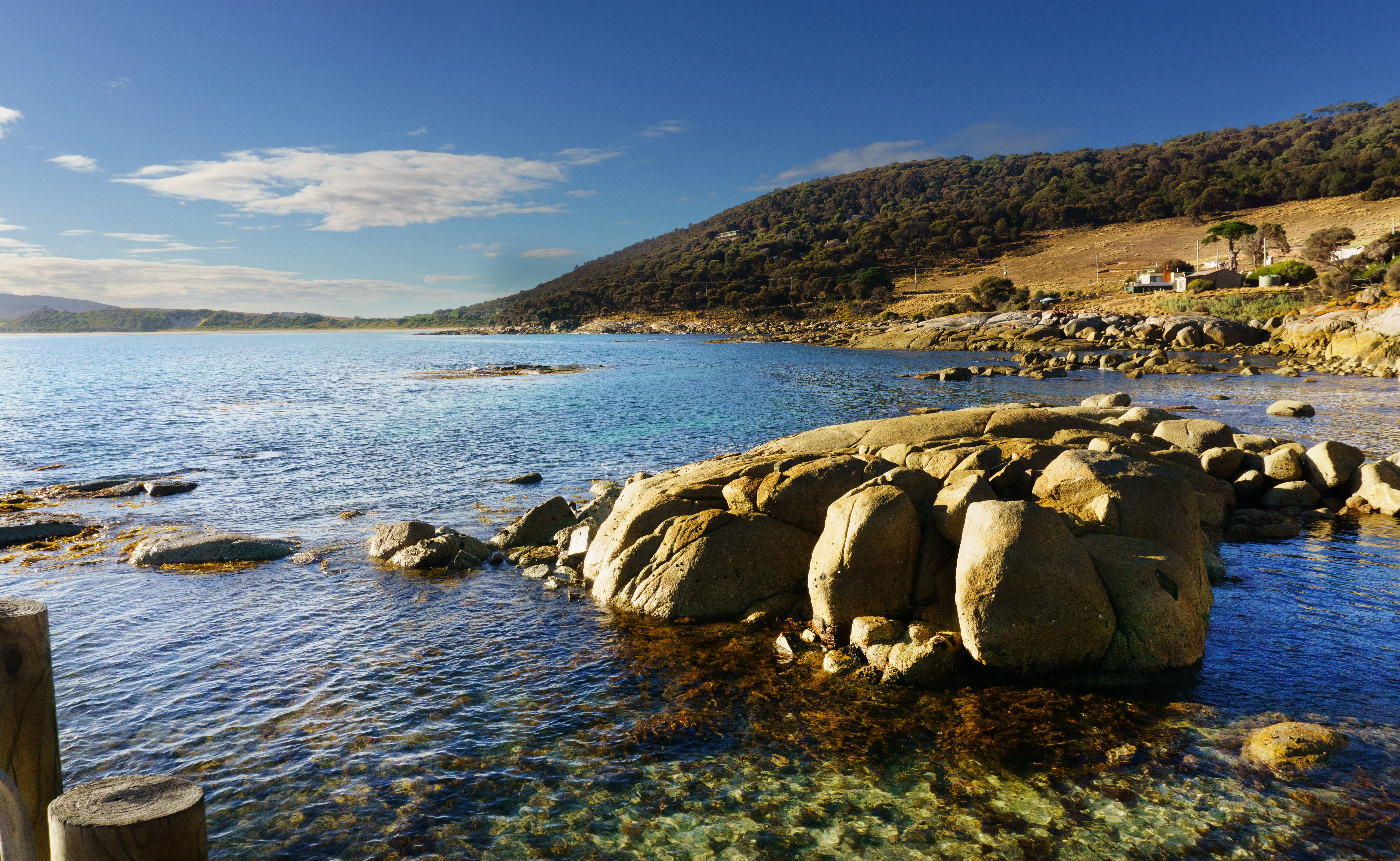
The location of Palana boat ram is idyllic. North, there is a rocky meadow with waving tussocks of native grass growing in any sand to be found sparingly between boulders. Beyond are two islands, both of which gather into modest hills; the Sisters, one called Inner and the more northerly one, unsurprisingly, is named Outer. There is a single house above the boat ramp and beach looking out over this magnificent view.

We launched consecutively to sit in the confined harbour at the base of the ramp, and then when we were all in the water, rudders down (always an issue for us at least), we set off. From the start the scenery, the boulders, the forest above, and the sun-drenched water. We paddled over submerged boulders, flashes of green, algae smeared monoliths then a deep dip in the wake of a wave would reveal them, water surging around, briefly inhabiting the world of air and light.

Water has peaks and valleys as well as land, only more fleeting. Our kayaks were buoyed up then dropped down by the swell and waves.

Initially all was calm, and the wind was soft, until we passed the northern tip of Blyth Point, and left the shelter of land. Here the currents and winds were at odds, and the water and wind grew more challenging. The depths and heights, and the force of the swell had greatly increased, large waves, white caps broke near to us suggesting a nearby reef. The prow of the kayak barrelled into the rising black of a wave, then launched upwards from a mixture of momentum and buoyancy, sending white sea water streaming along the foredeck and over my spray skirt.  Superimposed on the greater battle, dark wavelets darted up and down with nowhere to go.

Soon, we encountered even large seas, Mads had told us to position our kayak to meet them prow or stern first, not to meet them sideways. Always, keep the power on, turning depends on a rudder and for a rudder to work it needs propulsion from the paddlers. It was exhilarating, riding the swell into and with the waves. We stayed close together, sometimes too close when prows tipped rudders.

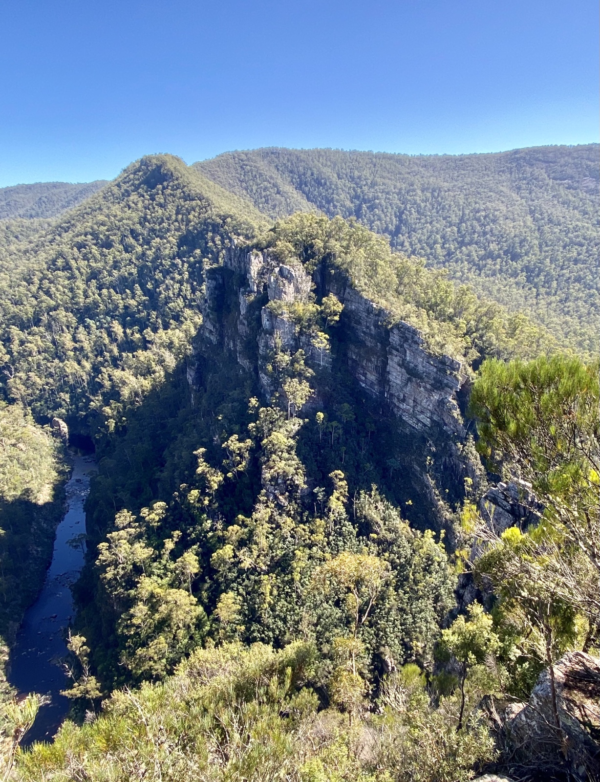
The water became calmer as we entered a natural breakwater, a long line of boulders jutting from the sea, some singly and other in short chains. The swell broke over them with a roar on the seaward aspect. Their energy dissipated, the water grew gentle and lapped the kayaks. We could now see Mt Killicrankie, sunlit and bright, despite dark clouds gathering from the east. A long line of boulders created a mid-ground with the bulk of this great mountain beyond.

We leisurely paddled between these ocean marbles; boulders scattered by the ancient shattering of great columns of granite. Cormorants sunned themselves in small groups atop round boulders, covered in guano. We beached the boats at Limestone Bay for a toilet break. I climbed up the sand above the beach, through the low-lying scrub and toward a ridge, to view Mt Killicrankie. It was only a short paddle to the Dock, a long deep beach sheltered by a virtual labyrinth of boulder sand tiny islands. Above us was the mountain itself. This is a magnificent location and we had similarly magnificent weather. The mountain is steep, with immense granite cliffs. Eucalyptus forests, Melaleucas, and many native trees and shrubs, crowd the land between the beach and the low foothills. I saw where a mini cyclone had passed ripping out and smashing trees, their broken trunks scattered around me. I walked to and fro exploring and when walking up to one vantage point, I felt a sudden tear high in my left calf. For the rest of the trip, I was on boat securing duty rather than lifting the boats as it was painful to walk. It had no effect on my kayaking ability, modest to begin with in any case.

We met hikers circumnavigating the mountain. They were interested in what we were doing. As a group we all readily acknowledge the privilege we have in being able to afford the time and money to do a trip like this. A privilege arising not only from work but just as much from unearned opportunity, supportive parents, good health, good career choices and happy marriages. And don’t forget a liberal dose of good luck!!

We ate lunch, selecting salads and dressings from the bowls set out on the green mat by Mads and Alayne. I had hot chai, while others thirsted for coffee. I took the opportunity to refill my water bottle. A very relaxing spot even though I was limping around. Over our meal, the clouds rolled in, threatening rain, and softening the glare of the beach.

We paddled around the western side of Mt Killicrankie. The foothills are gentle with easy walking but above those paths, any way is steep with sheer cliffs only suitable for gifted climbers. The cliffs are split precisely and vertically for nearly 100 meters. On the seaward side, giant boulders that have tumbled from the mountain litter the beach and low-lying land. It was a scale of sorts, seeing see the kayaks seriously dwarfed by the distant features on the coast. We saw caves, vast and deep, and geological oddities carved in the rocks like the Old Man; one real and the other, imaginary.

Stacky’s Bight is a limestone arch. The last time I was here on a walking trip, the tide was out and I walked under the arch. Today the tide is very much in. We went under the arch in our kayaks several times.

After stopping briefly on the beach at Stacky’s Bight we carried on, across Killicrankie Bay. To the left was a long sandy beach ending at Killicrankie Bluff. We crossed the bay heading directly for the beach and houses. The water was rougher than earlier, but the kayaks are awesomely stable, and besides we were all used to these conditions. The day’s trip ended on the beach. We were soon packed up and, on the way to Sawyers Beach.

Day 6

Michael had missed two days paddling, possibly due to a virus. On the evening of day 5, we were presented with two options; 1. A long paddle and 2 a shorter paddle with time to relax afterwards. As a group we decided that a short paddle was the  best decision as to include Michael. Michael was able to come along!

The shorter paddle – northeast river and estuary.

What a beautiful day it was!

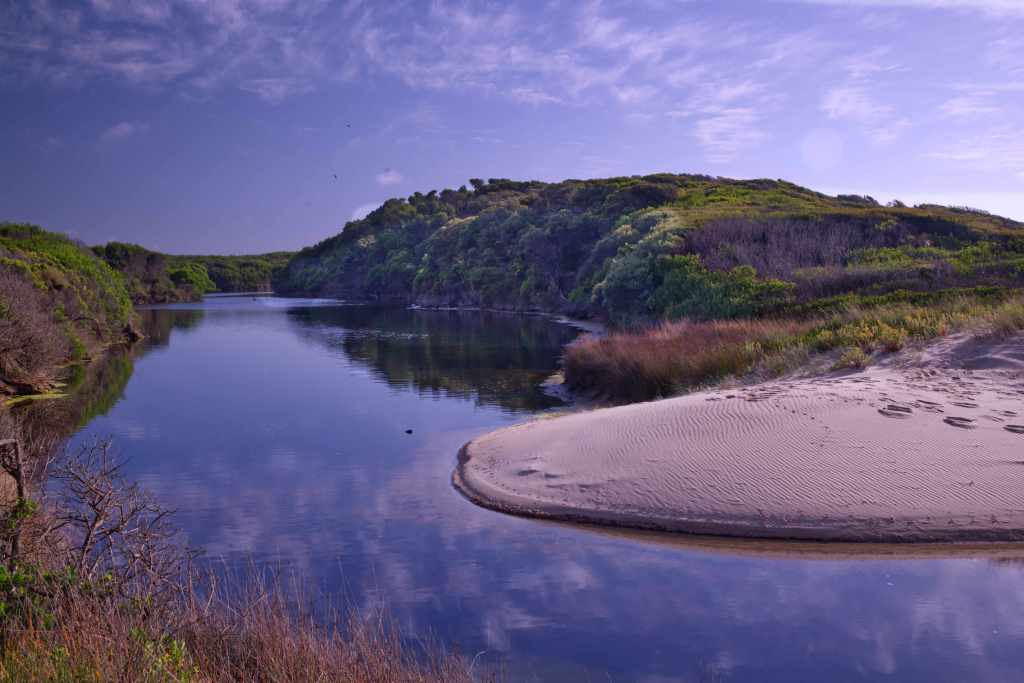
Mads drove the bus and boats to the entrance of the Northeast River which is tucked up in the top corner of the island. Beneath a deep blue sky, the surf was beating in from the sea and sent surging into the river mouth. The water at the beach we were to launch, churned with the tide and swell, too much water competing for too little space. However, only a short distance upstream the surface was much calmer.

Leaving the boats on the sand, we walked to a picnic spot a few minutes away. There was more opportunity to admire views from the road of Jackson Cove, its beach and of Blyth point in the distance.

It proved interesting getting the boats in and navigating the turbulent water. No time to waste, paddle out off the beach into a gap between the surf, then hard right and paddled to pause near some rocks, slightly upstream. Our rudder was pushed down by Alayne as we launched. However, David and Mary Anne had no luck getting their rudder down. No harm done as they turned the boat and asked another paddler to shove it into place.

While all this was happening, we were madly backing to avoid hitting the rocks near the beach. Thankfully, it did not take long for everyone to be on the water and ready to start our paddle.

It proved a delightful 5km paddle with the tide behind us and calm water before us. The shores and shallows were crammed with birds, swans in vast numbers, pelicans, cormorants, and terns, all flew or hovered above us.  We though that we had passed a sting ray then suddenly it blasted from the water to my right and shot forwards splashing me. It would have been a meter wide or more.

To our left, a thin spit of land, all of it just sand, separated the estuary from the sea, but it was enough to ensure a smooth paddle. Near the end as we were heading toward the shore to meet the trailer and bus, we crossed a sandbank, and stopped. I climbed out and pulled the stricken kayak with Jennifer in the stern to deeper water. I could not put the rudder back down and there was no one near enough to help, but we battled on, going right then left but finally getting to the shore. We may have flattened the batteries in our GPS watches.

The highlight of our evening was a gourmet meal cooked by a local chef and cook, Julie who owns a café in Whitemark. In the afternoon, after the kayak Mads drove us to Whitemark, where we had coffees (and raspberry cheesecake), met a local artist in her gallery and purchased some of the wonderful pickles from the IGA. Jen and I bought a bottle of the local whisky!

The evening meal began with scallops on sticks, then crayfish then a local fish. Complimented by delightful local wines. It was a wonderful way to round out what had proved a superb trip. We toasted not only our chef but Mads and Alayne for their care, professionalism, and friendliness. Great job, Ladies!!

On Saturday morning, we packed up, cleaned up and boarded the bus to Whitemark Airfield. The arriving guests with new guides walked along the path from the airplane to the wire mesh gate. We could only hope that they would have a trip as terrific as ours!!

Standard
Uncategorized

King Island Imperial

It’s Sunday, March 5th, and I’m writing this sitting on an old leather couch in the lounge at Beach Shala. In the near distance, Bass Strait is a blue grey floor of water beneath a cloudy sky.  Beach Shala is the name given to a rental shack owned by two locals – Jackie and her partner, Shimon.

Beach Shala is about twenty-five meters from the beach. It is a ramshackle, idiosyncratic house with a vast lawn. The fences define a sharp, rectangular perimeter– sea and wind spray has scoured all the timber palings to mottled grays. The fence is broken off near the ground in several spots making the lawn’s abundant grass accessible to local wallabies. These always graze warily; leaping away if they see one of us exiting the lounge to the verandah. Beach Shala is spacious with three bedrooms. A queen size bed had already been made up for us before we arrived. It proved warm and comfortable. It is Autumn now and getting colder overnight. Last night, the rain bucketed down.

Beyond the fence, across the road, is a bunch of tall tea trees. Grouped and crowded together, with scrawny, narrow trunks and a miserly sprout of green foliage confined to the very apex of each tree. There are no significant branches until a meter from the top. Just beyond these trees is the beach; it is more of rock than sand. A good distance offshore is Councilor Island. Its only feature is its light house which becomes visible as it blinks lazily overnight across the water.

When we arrived yesterday (Saturday), the sea at Naracoopa was rough, waves and white caps were forming in long angry lines far from the shore. The surface of the water was lifted airborne by strong, easterly winds. This wild sea haze quickly coated our camera lenses and glasses with salt.

We had flown in on Saturday morning with Sharp Airlines. It is a 17-seater passenger plane that promptly left Launceston at 10:45 am. We stopped at Wynyard, mysteriously called Burnie airport, then took off for the final leg to Currie, King Island.

We only saw King Island on our final approach when the aircraft dropped beneath thick cloud banks. Here was a repeating patchwork consisting of huge green and brown paddocks that ended abruptly at a spectacular rocky coast, its irregular fingerlings of brown and black rock penetrating a white flecked ocean. Bass strait was in a tumult, white caps erupting from the heaving surface kilometers from the coast; many were tossed up by reefs, but most were conjured into being by the sheer strength of the wind. After we exited the plane and walked across the tarmac to the arrival lounge, we were amazed at the blustery conditions and were impressed at how gentle our landing had been. Westerlies are the general rule here in King Island, but Easterlies can be just as powerful.

Jennifer drove the rental RAV4 to Currie to purchase supplies, have lunch and buy a coffee. The human population of King Island is 1600 but if you add in Wallabies (500,000 to 1,000,000), assorted marsupials, seabirds of all sorts and snakes, it could be considered crowded. On Saturday afternoon only the King Island Bakery and IGA and Foodworks supermarkets are open. We both had chicken and cheese toasties for lunch. After shopping, we drove across the Island to Naracoopa. Beside the road, the verge is a narrow corridor of grass or trees which seamlessly extends into the forests or farmland behind; the bush is full of wallabies, padymelons, possums and magpies. Jennifer repeatedly slowed down to avoid injuring any if they should suddenly decide to leap onto the road. There was abundant road carnage to drive over or around. I kept an eye out for them, but wallabies are well camouflaged and very still, and so frequently, we only saw them as we drove by.

After we threw our bags onto the beds in the spare room, we went for a short walk. We crossed over the road, and across the beachside park to the beach itself. The rocks have been molded into irregular platforms and pillars, some formations resolutely faced the waves, others permitted sea water to tumble into pools through narrow openings and poured into wide stony channels. The thick sea haze obscured Naracoopa Jetty; waves could be heard crashing high into its supporting pylons. This, together with the fierce wind, meant a walk on the jetty was too hazardous. Moored fishing boats tossed about, held securely at their bows by anchors and chains.

Saturday evening was relaxing, Jennifer spent the time reading while I played my guitar until I joined her in the lounge room to read.

On Sunday, after a relaxed start to the morning, we drove north to Blowhole beach. The wind and waves had calmed down. In fact, it is strongly suggested in the guidebooks that any visit here would be unsafe when there is an easterly blow as it propels surf far up onto the beach.

Getting to the car park near the beach is easy – head north up a gravel road parallel to the coast to the signed turn-off. There are sheltering trees around the car park. We walked south over the rocks near the water’s edge. The waves were not tumultuous but still impressive. There are at least four blow holes. They are not large. The wave comes in, shoots up creating a wall of water as it ricochets against the rocks, but a portion enters a tiny channel; it rifles vertically, meters upwards as a thin white cylinder. Suddenly, it vanishes, its impetus gone, and drops out of view, to be followed by deep, throaty gurgles as the trapped air and water is sucked back by the retreating waves.

The rock formations of this patch of coast are incredibly diverse due to their intrinsic geological natures and the multiplicity of patterns and shapes caused by erosion and weathering from sea, wind, and sun. There are pillars, platforms, and repeating jagged patterns; all of them angled from vertical to any obliquity. Pools hang suspended above the tide embraced by stone like baptismal founts while others are open to the sea; washed and replenished ceaselessly by incoming waves.

It was enormous fun taking photos, watching the waves and blowholes; all the while avoiding getting wet from the flying surf twirling about in the air; and fighting off annoying, biting March Flies. We walked as far as the sandy part of the beach then returned to the car. Our plan was to visit Elephant Seal River. This is an estuary formed by sand dunes that blocked the mouth of the river. All of King Island is sand dunes.

The sand is covered with grass, trees, roads, and houses but sometimes the mask slips and the golden yellow sand reappears; this occurs when thin, over moistened topsoil slides downwards or covering foliage is burnt away. Thousands of years ago, King Island was no Island, rather a plateau of stone and sand which towered above a vast watershed of forests, dunes, and scrub, the Bassian Plain; this extended from Tasmania to Victoria. It was a region drained by the mighty Tamar River which entered the Australian bight after coursing westwards through this ancient landscape. Dunes were in constant battle with the forests and grasslands; with wind as its ally, sand smothered the trees and grasses atop older dunes. This battle swung both ways repeatedly. Now the dunes seem locked away, but they are only sleeping.

Elephant Seal River snakes through the center of the island, yet it is rarely impressive. A narrow creek under road bridges, hardly worth a second look. Until this estuary before us, here the river widens into a vast curving and attractive lake. Swans, Cormorants and Herons bask, swim and fish here. Thick, low forest visible on the opposite bank, extends from Elephant River north to embrace both Martha Lavinia Beach and Penny’s Lagoon. This region is a particularly important refuge for both local and itinerant bird species.

There is a short walk to a look out. Before we did our walk, we sat down at an outside table to enjoy steaming cups of tea. Cradling our mugs, we read the information boards about the inhabitants and significance of this area. The dusty track goes past a bird hide which has a tree flourishing immediately in front of the slots cut for viewing. From the look out, it is easy to admire the sweeping curve of the estuary. The deep blue water lies placidly beneath a sky streamed with fine clouds soon to be sent scattering over the island.

We went across the island to have lunch at the King Island Hotel which is situated in the main street of Currie. We shared a generous presentation of a fishermen’s basket. We relaxed back at Naracoopa for the rest of the afternoon. I was reading David Goggin’s book on running, life and adversity, a very inspirational experience. I found the concepts he discussed and events he described so deeply interesting that I read it again. There is no denying that he is rather intense about life.

On Monday, the weather had continued to improve, the sky was bright and clear, and even the sea showed a gentler aspect. Now, a calmer ocean with infrequent, low waves which climbed half-heartedly up the shore, roaring surf was replaced by the soft, tinkling waves.

Firstly, we drove to Currie, stopped for coffee at the Bakery, and purchased a few books about King Island at the Post Office / News agency. We continued north; Jennifer driving and me with the tourist map spread out on my thighs. King Island is not flat, the paddocks and roads roll over sand dunes, sand ultimately wedged into the underlying granite, this rock is the hidden spine of the island. Black cows, heads mostly lowered, munched the browning grass, they dot the interwoven nests of hills, each hanging suspended above another.

Cape Wickham is near the very northern tip of King Island. The building of the lighthouse commenced in 1855 and was completed by 1861. It’s 48 meters tall and unrivalled in grace and strength. It is made entirely of granite; each stone was hand hewed to fit exactly into the greater design. Its white tapering form is fastened 3 meters below the surface to solid granite. Sand dunes form gentle hills, created by the powerful winds; mostly they blow westerly and continually across the land. We climbed one to see the lighthouse from a different vantage. The wind was strong, so care had to be taken with footing in these grassy hills. For most of its working life there was a flotilla of small houses to house the people involved in the running and maintenance of the lighthouse as well as accommodate their families. These are now gone. Unfortunately, there is no access for tourists as the lighthouse’s operation is automated. No lighthouse keeper’s children have run squealing up the stairs or played here for many years. There is a small shelter for visitors on the adjacent lawn but the gardens that would have supplied herbs and vegetables are long gone. A commemorative plaque and plinth commemorate the lighthouse in its heyday.

When the light was first ignited, as it was not electric in those early days, the light shone out over Bass Strait. Some of the ships masters who first saw it, confused it with the Cape Otway Light house and turned their vessels south not north. King Island and Cape Otway are the bottom and top of a very narrow eye in the needle for sailors negotiating Bass Strait. Long after the lighthouse was finished, winds, storms, fatigue, poor seamanship, and ill fortune conspired to continue the carnage of shipwrecks on the coasts and reefs of King Island. Sailing to Victoria or Tasmania in the nineteenth century was a chancy affair at best. There were horrendous losses of life from many shipwrecks. Repeatedly, inhabitants of King Island faced enormous risks to rescue crews of the ships that foundered. In the days before roads, rescuers would have to walk carrying oil lights and supplies over difficult rocky, storm-tossed coasts for many miles to reach the site nearest a shipwreck such as the “British Admiral”. It’s now a short drive from Currie, but in the 1840s, access was only along the actual coast. Amazingly, many ships were able to get their crews and passengers safely to land but there were many terrible disasters and even disappearances of ships and planes into the modern era.

Nowadays, King Island evokes the tastes and textures of delightful cheeses and warm, tender steaks but in earlier times, it had the opprobrium of danger, from storms, shipwrecks, and the perils of the sea.

Despite the strong westerly wind, a few stalwarts were playing golf on the course situated near the lighthouse. A golf buggy, wobbled down to the greens, as sea spray flitted over it. We couldn’t help wondering how many golf balls finished up in the sea or on the other side of the island!

After our visit to Cape Wickham Lighthouse, we headed south and, on a whim, visited Disappointment Bay. This is near the tip of the island but on the more sheltered (today at least) side. This is a very beautiful place, a long arc of unblemished beach that ends in a distant grey rocky promontory. As we walk its length, we soon cross rocky outcrops that meet the ocean. The rocks are many colors, some are grey, others black, orange, or even golden in the sea light. A gently tumbled ocean searches out this coast. Waves crest in, breaking and climbing the sand, and as they retreat, they thin into a shining, delicate oil, revealing a stunning mirror of sky and cloud. We walked on for an hour, enjoying this amazing place.

We visited Penny’s Lagoon. This is a short drive, south of Disappointment Bay. By now, it was getting windy. The lagoon is a perched lake. Perched lakes are fed by rainwater alone with no entering streams or any hidden springs beneath them. Sand and organic matter, especially leaves, form a solid layer, a barrier to water, thereby trapping any water that falls. This oval lake is surrounded by tea-tree, shrubs, and woodland with a narrow beach of white sand. It is famous for the wide variety of native birds that live and visit here.

There is a small shelter and covered barbecue a few meters from the edge of the lake. There are large information boards that describe the Orange Bellied Parrot. It is the only migratory parrot. Summer is spent in the Southwest of Tasmania where nesting and fledging of the new chicks occurs. The cooler months are spent on the mainland, living in coastal forests, from the Coorong in South Australia to Gippsland in Eastern Victoria. They migrate twice a year, flying up the west coast of Tasmania, Robbins Island, to King Island and then to various locations on the mainland. Originally it was called the Orange Breasted parrot due to concerns about propriety, but the orange area is on the lower belly, and thankfully common sense at last determined its current name. The many large conservation areas, the trees on farmland, and the woodlands near the coast, are all essential for providing food and shelter for these wonderful birds.

We visited the splendid King Island Cheese factory. This is an impressive and large concern. A shiny, metallic tanked delivery truck was parked about to deliver its store of milk. The Tasting Centre is open on certain days. I had a can of King Island Pale Ale and Jennifer a white wine – a pinot grigio, I recall. Placed before each of us was a round wooden platter with six different cheeses to try out. Sitting inside, away from the wind, just cheese, beer/wine, and each other for company, made for a pleasant respite.

Today, it’s Tuesday and the annual King Island show is running at the Racecourse complex near Currie. The weather was not kind for the show. It is cold, windy, and wet, but still many locals were walking about in shirtsleeves and shorts. It’s a ten-dollar entry fee. There were two pavilions. The main pavilion had local art prizes, vegetables, cakes, and woodwork. The other pavilion had chickens and a duck. There were some local prime cattle to admire. The pavilion with the local crafts was the most interesting for us. The food and beverages for sale were typical starchy and greasy nosh which the children enjoyed.

We retreated to Naracoopa for somewhere warm and dry to spend our Tuesday afternoon. We had booked dinner at “Wild Harvest” which is a well-regarded restaurant at Grassy, a township in the south corner of the island. When we left Beach Shala, there was enough light to drive but the wind and rain was fierce. Water fell in sheets and had to be peeled off the windscreen by the madly flying wipers. When driving through the forested areas we were concerned a tree or branch might be thrown onto the car. It was with some relief to reach farmland and exit the dangerous section of the road.  We had passed a tree that had already fallen.

We arrived early at Grassy and parked beside the restaurant. We waited for a cloudburst to ease up, to rush from the car up the steps to the restaurant door. “Wild Harvest” requires a booking. The interior is spacious, tables gradually filled over the evening. Its steel roof beating with the rain has patches of rust which reminds me of an old shearing shed. There was a welcoming fire with logs ablaze in a brick fireplace. We elected to sit as near the fire as we could! The large windows give a view of Grassy Harbour with its wide, long breakwater, or they would have done if the rain had not completely obscured the exterior world.

I looked at my menu and it was different to Jennifers. Apparently, it can change very fast. The managers were waiting on a small tour group that took up the central table. My menu was meant for them. The service was friendly and relaxed. We chose a bottle of Stefano Lubiana Sav Blanc for our evening meal. Jennifer had an entrée of Salmon cured in King Island Gin. For mains, Jennifer chose another meal from the entrée menu – a small serve of beautifully cooked scallops.  I’d had the scallops for an entrée then followed with a lamb rack for mains. We both had chocolate flavored brulee for dessert.

It was not a cheap meal, especially as there is a booking fee as well! However, we enjoyed the meal very much and will go again when we return to King Island.

It’s Wednesday morning and raining as we woke up and had breakfast. It kept raining in squalls for the whole day. Nonetheless we drove to the southwest corner of King Island to visit the “Calcified Forest”. There is a small car park in a sheltered forest not far from the coast with a short 650m walk to the “forest”.

It was not a forest. Once upon a time there had been a forest, on an exposed headland, maybe a thousand years ago, then sand dunes swept in and slowly choked the trees. The calcium carbonate in the sand, congealed around the roots, making casts that persisted long after the roots themselves, much less the trunks and branches had withered away. Years later, wind blew the surface sand away and this revealed weird, delicate crystalline sculptures.  Thus, its casts of the roots of the original trees which populate and emerge from the remaining sand.

We drove the short distance to Seal Rock Lookout. It is an 80m walk to the lookout. The lookout is perched on the cliff edge with a reassuring steel barrier. The seas were wild. Waves and surf were belting in from the west, in no order, in chaos, one striking another, creating even more disordered turbulence and frenzy below us. This maelstrom crashed into the huge rock formations below us. Water and surf hurled into the air, sending sea spray over us. There are black, pyramidal pillars below the cliff which the sea surges over and around, angry white water streaming into the rocky rills and flanks. A thick sea mist hovers at the lower levels of the cliffs. It is a very impressive sight. We looked south toward Stokes Point, past repeating rocky headlands, and the whole sea was a boiling white as far as we could see. We were almost blown back to the car. We sheltered in the car to have our sandwiches and hot tea protected from the wind outside.

As we returned to Currie, we drove the short road to “British Admiral” Beach. As we waited in the car, rain fell from determined, dark clouds. The tide was high, shrinking the beach to a few meters beneath the sand dunes. This was not the best day to go exploring.

King Island is a graveyard for many ships. The “British Admiral” sank off this coast on a miserable night in 1845. Reefs seaward of this beach was the ship’s undoing. Of the 89 people onboard, 88 died. For many weeks after the disaster, bodies washed up onto the beaches of the island. Soon after, a convict ship, carrying mostly women, foundered with over 200 dead as a result. But it was the “Cataraqui” which finally prompted the construction of a lighthouse, a shipwreck where 400 people drowned.

We had afternoon tea at a shop in Currie, then returned to Naracoopa to wait out the wild weather.

On Thursday, we decided to tie up a few loose ends. We had driven past many touristy spots in the last few days and today was the day to visit them. It proved a mixed blessing but with a happy ending. We stopped at Currie for coffee at the “Larder” and I bought one of their huge muffins to have with lunch. We planned to visit the remnants of the “Shannon” that sank on the coast. It had run aground on Quarantine Beach in 1904, fortunately, with no loss of life. The ship is long gone but the boiler and the drive shaft are still visible above the waves, especially at low tide. There are two ways to get there. Our guidebook recommended driving along North Yellow Rock Road, parking the car near the coast and walking the short distance to the beach. The track runs beside a wide and beautiful river that only flows into the sea at high tide or it has a high flow from rainfall. We entered the forest and crossed to an area of low scrub. The track was indecipherable. There was only one way back through the forest and would prove hard to find if we took a wrong turning. We abandoned this walk.

There is a bird hide on Heddles Road, it is only a short distance from where it meets the northern road. When we saw it, we first thought it was a bus stop. It’s right next to the road and about 400 meters from a lagoon. You could sort of see swans over on the water but as for seeing or photographing anything smaller, it was hopeless.

Luckily, we had some ideas! We drove to “Porky Bay Beach”. The road to this beach bisects the King Island Cheese Factory. The road continues over grass covered dunes, past some fine houses, which would have awesome views and stopped at a car park beside Porky Bay. What a beautiful day to visit this magnificent coast. Off the coast a sea breeze fostered some gentle curling white caps but there was no rain to worry about. Porky Bay is a long, grey, sandy beach with interesting rock formations to explore on the way. On the sand were many tiny blue jellyfish with long thin, blue strands draped toward the sea. There were some scattered shells from abalone and snails as well as large leathery dollops and swirls of kelp marooned by previous tides. These thick piles of blue green algae were being gently washed and slowly tumbled by the waves. Seaweed fragments, some pink, brown, white, or gold, were splashed randomly across the beach creating dashes of bright color. Gee, beachcombing is fun! We neared a point where incoming waves nearly reached the dunes and so it was here where we decided to turn back. When we got back to the car, Jennifer turned it around so we could have our lunch watching the sea crashing into the miniature rocky harbour that spread before us.

Attempting to access more tourist hot spots in Currie proved fruitless. The Cultural Centre that is listed as open in the council supplied information sheet – a weekly publication – is not in fact open at all, only by appointment. This information sheet had many errors that wasted time and missed opportunities. The Cultural Centre is near the jetty that provides moorings for boats in Currie Harbour.  As we walked along the jetty, we could see fishing and cray boats bobbing up and down in the surf that entered the harbour. Beneath a hill across the harbour was the “Boatshed”, a local Centre, and above that was the squat Currie Lighthouse. This lighthouse is not as impressive as the one at Cape Wickham. The harbour entrance was full of white caps, racing before a fierce westerly. It would not be an easy entrance to navigate in bad weather.

On the return drive to Naracoopa, we diverted to visit the local brewery.  One of the owners was serving at the brewery. She and her husband built the brewery and do all the brewing of their ales. It is in an attractive location, perched atop a hill which overlooks sweeping paddocks of farmland. The buildings are barely 18 months old. I had already tried a pale ale at the cheese factory so was keen to sample some of their other products. We sat in their sheltered verandah, we were settling ourselves into comfortable, black armchairs just as she brought out the samples, they were larger servings than I was used too. I’m glad we shared them. I liked the Pale Ale, the HPA and the malt beer but did not like the apple cider (too astringent for me), the ginger beer or the dark ale. Unfortunately, all these ales are only available on King Island. They have a major manpower shortage and are busy enough supplying the island. However, they hope to have a website with online sales soon.

On Friday we drove to Currie. We stopped for coffee at “Larder” in Edward Street and hung around the town until 10am waiting for the Information booth to open for the King Island Imperial. There was a selection of running tops, shorts, and hats for sale. I bought a tea shirt and singlet, while a bit warm for summer or racing, would be terrific in the cooler, wetter months. Jennifer bought a tea shirt (the first of two) and a vest commemorating the race. We collected our racing bibs for Sunday. I am number 114 and Jennifer is 115. There are about 30 runners competing in the 32 km race. There are also many walkers who will do the 32 km distance. Jennifer, along with many others, is doing the 8 km walk.

The race is handicapped so we don’t all start together but hopefully will all finish together. The first runners begin at 7:20 am and I was to start at 7:36 am. Though the weather on Friday was still squally and cold, it had improved from earlier in the week. Saturday proved a mild day, and Sunday was perfect with a slight southerly breeze and a few clouds. Cloudy, cool, and gentle breezes, these tick all the right boxes for race weather conditions. We had a chat with the volunteers at the information center who do so much for the race and King Island generally.

We visited the site of the Cataraqui wreck. This ship is still the worst maritime disaster in Australia’s peacetime history. 400 people drowned with only a handful of survivors. The coast here is rocky, wild, and very beautiful. If you were pitched into the water in the middle of the night, in rough seas, with no light, even if you could swim, you would be killed by the sharp rocks as the waves threw you onto them. We parked the car on a small headland and walked along a stony, narrow road to the beach. We reached the memorial cairn, one of two. This one is amongst the rocks while the second is high in the dunes behind the beach. It was a profoundly moving place to visit. No one knows where the recovered bodies were all buried. The original wooden markers are gone, and the dunes move obscuring the geography, so even the burial team barely a year later, could not find the location.

We drove back to Seal Rocks again, hoping to see a gentler aspect of that part of the coast. We had lunch at the Calcified Forest Carpark then drove the short distance to the parking area near the look out. It was less windy, sea spray was minimal, though the waves surging below us were still impressive. Last time the water was colored a deep indigo or white but now we can see many more shades scattered between green and blue. Brief whirlpools and eddies, conjured by the disordered meeting of incoming and retreating waves, bubble up into an iridescent green, a surface streaked with a lacework of creamy foam. Does a ghostly light from a drowned ship illuminate the water above it? The lookout is high over the cliffs and provides wonderful views of the scenes playing out below us, as well as to the coasts spreading north and south. This coast begins with a grassy and forested hinterland, which suddenly drops to the sea, now black cliffs, and headlands. Land is torn by these angry seas leaving only a rocky skeleton. Waters swirl around the rocky pillars below us, crash and climb the cliffs till they inevitably weaken, and tumble backwards, ethereal acrobats.

As we drove back to the main road, we saw an echidna. We stopped, grabbed our cameras, and stepped out. An old farmer was driving a small tractor. He stopped to ask if anything was the matter. He told us that the grave site we had passed, not far from the road, was his great grandmother. His name was Peter Bowles, as we learned from some locals later. He is an identity on King Island because he is not only fourth generation, he owns most of the southern portion of King Island. His grandmother was a truly amazing woman. Jennifer knew much of her story and told me about her. She married a man in England who had dreams of making a farm for himself on King Island. She was the daughter of a peer and had lived a life of luxury and privilege until departing for Australia. She and her husband brought eleven of their children to King Island and established a farming empire that still thrives. Her days of luxury were over, living rough in those wild, early days of the Island’s history.

Just a note about history. We were never able to visit the museum (because we were always doing something else or tuckered out by too many adventures), so we never had the opportunity to find out anything about the Aboriginal History of King Island. This is something I hope to remedy when we return in a year or two.

Rather than return home via Currie, we took a backroad to visit Grassy Harbour. The sky had turned overcast, and a chill wind came off the sea. The breakwater for the harbour is a refuge for Little Penguins – also called Fairy Penguins – they arrive at dusk and depart before dawn. We heard some chicks calling out but did not see any. Grassy harbour is more sheltered and much larger than Currie Harbour. This is where cargo ships travel from the Tasmanian mainland, or the North Island, to swap supplies and produce for the locals and visitors like us. It cannot be called a pretty harbour. For many years, this is where the King Island Imperial race began – with a vicious climb past the township of Grassy, then the route diverted northeast to Currie. It was the same distance as the current race, but it was not really a coast to coast, in terms of how most people would understand the concept. On Friday afternoon, we relaxed in the shack and ventured out for a beach walk in the evening. A solitary port-a-loo, standing in the park, was the only harbinger of Sunday’s race, at least here in Naracoopa.

Last day before the race, Saturday morning, and we were at a loss what to do for the day. The information brochure has listed POKI as a monthly event. We found out later from locals we stopped to ask in Currie that it had not run in years! POKI means Produce of King Island. It’s a market. We had coffee at Currie instead. Over the cups of hot drink, we decided to revisit “British Admiral Beach”. This time the tide was low and presented a wide beach with glistening sand which welcomed us as we walked down from the adjacent car park. We walked a few kilometers along the beach. There were rock formations imbedded on the sand, some gray, some brown and golden due to encrusting lichen. Great sheets of kelp ran in long piles along the beach. Another stretch was not made of sand but rather of millions of weathered small stones and rocks. We walked on the tracks where car tyres had pressed a path creating a smoother pavement of stone and sand.  It is a beautiful bay with a magnificent long, curving beach. The sea was almost placid with gentle waves arriving then sighing way from the sand. The dunes behind us were checkered with hardy sea grass and small shrubs.

On Saturday evening, we returned to Currie to meet many of the runners, volunteers, and race organizers at the Pre-Race dinner. The function was held in one of the larger rooms at the King Island Hotel. We had already booked and paid for this event when we entered the race a few months ago. It was wonderful to meet people who are as passionate about running as us. Between courses, a video was shown with highlights of the race for the first fifteen years it took place. This included the Free Willy run on a Porky Beach. I had no idea that this is a NUDE MIXED RACE. It is only 200 meters and towels which were swiftly shed are as quickly replaced at the race’s conclusion. At least until they go for a swim!!

The video included winners of the race including Steve Monegetti’s famous record-breaking run in 2002. A record that no one has come close to breaking. He looked fantastic in the videos taken as he ran along the course. A short video from Steve, captured on a phone, encouraged everyone to have a great time as well as some reminiscing about his terrific race.

The meal was excellent, a buffet featuring Island steak! The evening finished at 8:30 so we had plenty of time to have an early night.

On Saturday night I was a bit churned up and had trouble sleeping. This was to be the longest run I have done since I was 19 years old, when I did the Melbourne Marathon in 1979. Finally, I got to sleep, then Jennifer’s alarm woke me at 5:30 am, Sunday morning. I had laid out my running gear the previous evening. I had decided that unless it was freezing, the best option was to wear a racing singlet. I clipped my bib with the race number, to the front of my running top. To my horror, it was raining heavily outside. Fortunately, the rain was brief and there was no more that day. The starting line with its rectangular, inflated doorway was only a short distance from Beach Shala. Most of the participants had caught a bus from Currie. The first walkers set off at 7:00 am. The first runners commenced their race at 7:20 am. By now, the sky was beginning to lighten; I was going to run it all in daylight. I started at 7:36. My watch was a fiddle to start with. The problems with GPS watches are that the text is so small, and so vital (at least to the watch), that I must guess the correct sequence of buttons to press to stop it from sulking. Thankfully, it seemed to work, righting itself as the starter called out to begin my race.

The course begins by going north along the road beside the beach at Naracoopa. These first few FLAT kilometers warmed me up for the climb out of Naracoopa. The track then turns in earnest to Currie, my destination on the other side of the island. After crossing Bronzewing Creek (yet another shipwreck), the road ascends, winding its way upward away from the sea. I had planned to walk this section but as I felt so good, I changed my mind and ran instead. The next 5 km continues along the road with tall melaleuca and shrubs on the narrow verge. It is a very beautiful part of the run.

I stopped at the first drink stop for water. There were water stops every 4km for the whole race, but there were no electrolyte solutions available. This proved to be a problem for me later in the run where my leg muscles became very weak, and I had to switch from running to a walk-run style.  However, at this early stage and up until the 27km mark, my legs felt strong, and I was able to run confidently at my usual training pace. One young lass passed me, and we would continue to pass each other until 28km.

The road crosses the island and generally ascends to the 11 km mark and afterwards it “generally” descends to the western coast. However, the road undulates wildly, there are few flat sections until the 28 km mark where the track diverts north for a while before entering Currie on a southern sprint. These hills made for a challenging race, as it was hard to get that running rhythm which is so easy to maintain on a flat course. The benefit is that the course is more interesting, and the race is more tactical. I found each extra hill demanded more of me as I continued. I deliberately drank a glass of water at each aid station. The whole run is staffed by volunteers who do a fantastic job, encouraging and helping the runners and walkers. Marshalls were stationed at every road junction or turn so there was never any danger of getting lost.

The race went past many farms, some had cows gazing up with rheumy, brown eyes, they soon lost interest in us, dropping their heads to bite off more grass and continue their chewing. The wind changed from a gentle westerly to as sweet a southerly. The forest trees swayed in this wind; their leaves and branches quietly susurrating as they moved and touched. It was very peaceful. This was not a hectic, busy run with brass bands, taiko drummers or rock bands. It felt good to be running beside farms and forests, cows, and wallabies, with possums peeking out from knolls in the trees; Magpies squabbling and hoping over roadkill. The natural vitality of the island is rich and palpable to me as pass through. The wind, the trees and shrubs, the cloudy fresh sky above me, and the many hills some decked with old farmhouses, some buildings occupied, others derelict to weathered ruins. Running is such an up close and personal experience with the life of King Island, an experience I never had in a car, it was merely scenery. By 27 km I felt fine, I seemed to have plenty in the tank to keep the same pace and cadence. I had flown past the half marathon distance effortlessly. The track was marked every kilometer with an accurate distance; this enabled me to keep a very accurate idea of how far I had come and how far I still had to go. As I said earlier, I have trouble reading my watch to obtain this sort of helpful information. I focused on form and pace, tried to maintain good posture, a gentle smooth foot strike and good balance. So far so good!

Some stronger and faster runners passed me, which is to be expected in a handicap race. My goals for this race were to complete the distance and secondly, to learn how I could improve any future runs over this or a greater distance. After 27 km, I started to struggle. At the last few drinks stops, I felt my legs getting weaker. This could be just fitness and strength, but I wondered if the lack of electrolyte replacement was beginning to tell. The weather conditions were changing, it was now warmer, and I was sweating a lot, losing salt as well as water, as I ran along.

At the 28 km mark, I first began doing walks, about 150 m then I would run a kilometer then walk again. Of course, more runners passed me in the last 2 km of the race, as running slowly is still faster than walking. The last hill into Currie was walking territory. After reaching the top of the hill, Currie was well in sight. I ran from here, through town, lots of cheering people and I could see the finish line. I ran past this and down to the harbour. I ran around an orange witches’ hat then back up and returned, uphill, finally to the finish line. I had run most of the 20 miles. I was 20th of 27 in the race. I was pleased with my result. I have not run this distance for many, many years.

I recalled the thrill of seeing the ocean as I reached the end of Fraser Road, that’s the turn off to the last stretch to Currie. Gee, I had run from one side of an island to another. This gave me an enormous feeling of achievement even before I finished the race. I ran under the finish sign with its electronic clock ticking away. I was given my medal, then wandered amongst the other recent finishers. I felt pretty good.

I am very impressed by many participants; in particular, Stephen Barker, who has run the race every year since it began. Stephen is 79. When I passed him earlier in the race, I could see he was struggling. Yet despite his obvious difficulties, he finished the race. He is a true champion.

Another participant impressed but I don’t know if she finished or not. A young woman was walking the 32 km event and by her gait and posture, she had suffered a cerebral insult at some point. Her walking was ungainly but there was no denying her determination and guts. Wow, what a girl!

Wearing my King Island Imperial Medal, I collected my King Island cheeses, a generous hamper of local cheeses. I skipped the sausage in a roll. I could not face it. What I craved was water and electrolytes. I had stowed a bag on the vehicle that went from Naracoopa to Currie, with stuff like rainwear, a warm jacket and my keys. I drank the solution I had stored in my bag. By now, my quads, those troublesome, big muscles on the front of the thighs, were protesting. When I sat down, they were not happy about me getting up again.

I “walked” to the finish line to see Jennifer, storming in on her 8 km walk. I’d heard her at the 24 km mark, where the walkers were assembling prior to their race. I crippled down the road to see her again as she walked up from the harbour and then across the finish line. Beside her Garmin watch playing up and not recording the last third of her race, Jennifer had a terrific walk.

We chatted to Lizzie, a local lady and keen naturalist, who had met Jennifer on the walk. Jill was another local who befriended us at dinner on Saturday evening. Jill was also the volunteer who greeted me at the finish and presented me with my medal for completing the race. Jill had led our table to victory in the Trivia Competition on Saturday night. Our table won a $100 voucher to spend at King Island Brewery. Like most of the locals, both Lizzie and Jill were full of enthusiasm for King Island, its wonderful lifestyle and the people who live there.

As she completed the race, Jennifer collected her own medal, we drove back to Naracoopa. After Jennifer removed my sweaty socks, I showered, groaning as my chaffed skin was hit by warm water. After a cursory wash because I could not actually reach anything, I then hobbled to bed, plopped in, and promptly slept for an hour.

At 4pm, we met at the Brewery, the walkers, and runners with whom we shared the Trivia prize on Saturday evening. We had a very pleasant chat about the race with the other people there. We especially warmed to Karen and James. Karen, I learned later, won the handicap race by coming first over the line. They live in Invermay. We arranged a dinner invitation on our return to Launceston. (P.S. That dinner was fascinating as Karen told us stories of her ultra marathoning experiences and races and James experiences of incredible walks in Tasmania).

The postrace dinner was held at the King Island Club in Currie. This club is straight out of the 1970s and reminded me strongly of the bar and interior of the club in the Australian Film “Crackerjack”. Today’s race marked the 30th anniversary of the King Island Imperial. More videos were shown, this time it was the turn for the races for the last 15 years. What I was not expecting was the presentation of today’s race! A Ute had passed me early in the race, and I was videoed. And there I was on screen in glorious color. Everyone who participated had a guernsey. There was Jennifer standing at the start in Naracoopa. There was me running along and waving!  Thankfully it was taken when I still felt good and was running with good form. I noticed that the older runners, in particular the ones who had passed me, all had hydration packs. The other thing I learned is that form is more important than speed. The fastest woman was not going quickly as she passed me, but she had the most effortless, smooth style. Form creates speed and minimizes fatigue. It was a terrific evening of dining, chatting and entertainment. After I exited the front door, I had to negotiate a terribly rude 5cm step – oh it felt a long way up.

On Monday, Labour Day, Jennifer, and I drove to Quarantine Bay and beach. Our previous attempt had failed so we decided to use a different access point from South Yellow Rock Road. We walked in the sand, above the wave line, 5½ km along this magnificent beach beneath clear skies. Gentle seas lapped the sand, waves glittering in the sunlight. We passed rock formations, which create multiple rock pools brimming with molluscs and seaweed, while lichen, seashells, and mussels shelter attached to the dry stone, briefly above the water. We found the remnants of the “Shannon” , it’s rust encrusted boiler and drive shaft sitting in shallow water 100 m from the beach. The Shannon sank here in 1906.

There are two long flat islands off the coast here. Cresting waves broke over a reef that spanned the gap between the two of them. Along the beach, we could see many sea birds. There were pacific gulls, plovers, sooty oyster catchers and groups of skittish, small, fairy terns that hot footed along the beach, their little legs moving so fast I could hardly see them – blurred, they seemed to hover over the waves. We had lunch back at the car overlooking the beach. After lunch we stopped briefly at the beach end of Springs Road, the northern end of Quarantine Bay.

We decided to revisit Cape Wickham, in sunny and placid conditions. The sky was a magnificent deep blue splashed sparingly with high and far off wisps of cloud. It is an impressive lighthouse, its stark white form standing, stark sentinel between the sea and the hills of Cape Wickham. It’s hard to imagine that today anybody would hand fashion blocks to fit as firmly and create this sturdiest of structures.

The information sheet had said the Cheese Factory was closed on Monday. As we were about to drive past it, we could see several cars parked there. So, we dropped in.  We repeated our sampling of their cheeses and enjoyed the same wine and beer as before. As we waited, we chatted to some other runners and walkers who were relaxing post-race. They were very experienced trail and distance runners who have participated in events all over the country. They had some helpful advice about running. I was all ears, as despite all my years of running, I have much to learn about racing long distances.

On Monday evening, we sat together in the lounge at Beach Shala, overlooking the sea. It’s gentle enough but I can still hear the sound of rolling waves and wind. This is our last night on King Island.

We enjoyed our stay very much. We have made new friends. We have learned a lot about running. We enjoyed the splendid scenery, especially the coasts and forests. More than anything, completing this race gives me the knowledge and confidence to tackle other racing events.

On Tuesday morning, we completed our packing for the return flight to Launceston. We stopped at “City of Melbourne Bay” (yet another wreck). This beach is south of Naracoopa. It is unique. The beach is nearly entirely made of pebbles and small rocks, there are some rock formations, but the vast majority are much smaller pieces of stone. They are slippery and not easy to walk on. The stones were an awesome variety of colours, from purple, to blue, to yellow to bright orange; all different shapes and sizes; some oblong, some rectangular, and some like river pebbles. Giant, twisted piles of kelp discarded from the underwater forests of Bass Strait, festoon the high-water mark.

After our exploration of “City of Melbourne Bay” we drove back to Currie. We stopped off at the Larder for coffee. Some other runners and walkers had been delayed by computer issues regarding their flights so were whiling away some time here. It was great to hear all their plans. A couple, a husband (racewalker) and wife (runner) had already completed the London Marathon and were planning to do more. They entered the race using a running travel company called TRI TRAVEL. This company organizes the entry, accommodation and transport including the day of the race.  They were enthused about the London Race, running past the famous buildings and parks, crossing London Bridge in streaming sunshine, and all the cheering crowds. This year they are going to participate in the New York Marathon. Their stories were inspiring. I cannot help but think about other races I could do. Many races around the world include smaller, shorter distances for other non-runners to participate in, like the 8km walk on King Island. Jennifer and I had lunch at the King Island Hotel before driving out to the airport to wait for our flight.

What a great trip it has been!

Our close friend, John Elcomb, collected us at the airport in Launceston. I must also thank Linda Hall, his partner, for driving us out when we departed for King Island. Trips they have done many times for us. So, thank you John and Linda.

Standard
Uncategorized

Old Lorinna Road

On Sunday, another legendary Ramblers hike. It began from the Titanic, not in the deep waters of the North Atlantic but on the highway at Cephania. Stick with me kid and pick up new facts like this. We stayed at Gowrie Park on Saturday night in the new camper van and then the shirt stretch of highway, meeting the other 21 ramblers.

In 2009, this road was finally closed. It went to the now abandoned town of Lorinna. It winds its way around Round Mountain, above steep gullies and crosses Machinery Creek. It was always a narrow, rough road with vertiginous drops to the trees massed above the creeks, in 2008, Kentish Council received an estimate of the cost to make this road safer. Not safe,just safer. It was in the millions.

It’s been 14 years and the road surface is barely recognisable in many areas. It’s a medium walk, the standard I mean, the actual hike is better described as outstanding. The treed mountains and hills, the jagged cliffs, the broken mountains, the ferns and mosses and the fascinating geology with great faults directing the creeks and momentum to leaping waterfalls.

It does my heart good to see how quickly nature reclaims and restores its landscapes once humans neglect maintenance of structures like roads. In twenty years, no one would even suspect it was ever a road. There is no trace of Lorinna township even now.

Everyone enjoyed the walk. There were many high points, crossing the creek on rocks, crossing another on broken pallet boards ( how did they get there), and lunch beside the creeks with its pools and boulders.

We had Tassie weather at its Autumn best, cool, sunny, a few clouds and no rain.

Special thanks to Trevor and Neville who prepared the walk.

Great day.

Standard
Uncategorized

Lake Mackenzie

Last Sunday, ten Ramblers drove out past Mole Creek all the way to the dam at Lake Mackenzie. The skies and clouds threatened rain. When we exited our vehicles warm clothes were essential. The surface of the land gently undulates, most trees are dead, burnt offerings, leaving only cushion plants and native grasses. The bright native called Mountain Rocket is splashed haphazardly, nestled on the ground beside dolerite boulders. Brightly coloured fungi sit beneath grasses and twigs or emerge en masse from dead blackened branches. There are massive, splendid green cushion plants which evaded the fires. At my feet are miniature havens brimming with tiny plants, masses of white flowers in some, red berries in another and all are awash with water.

We walked along a minimal track,  skirting the lake. We entered a boulder field. We carried on to Lake Mackenzie hut. This small cabin was built to replace the original hut swamped by the rising water when the dam was built. There many artefacts including canals and pipes to manage the water now stored in the lake.

The hut is well built. It has a wall dedicated to information about the hut, lake and the high country of the central plateau. There are sturdy timber bunks. There is a loo a short walk away with fabulous views; views of the person using the throne. 

There are some trees that survived the fires, a patch of snow gums and pencil pine within fingertips of another pencil pine burnt down to a skeleton. There are fine views the old shore line, previously sandy lake was one of three adjacent lakes, now combined into one, a crescent of water that arches around the elevation adjacent to the hut.

After lunch we took a shorter route back but this was harder than the tramp in. Thickly congested boulders provided ample opportunity to balance, jump, pivot and so on. 

After we reached the cars, it was only a short drive to the other end of the dam wall. Estelle saw two wedge tails circling high above the dam wall. 

We walked beside a canal then descended steeply beside a huge water pipe to Parsons creek. For much of the descent there were concrete steps. Parsons creek was challenging because of fresh boulders. Jen and Elaine decided they had ample time on boulders and went back to the cars. The rest of us persisted on, the track entered the forest, it took us in just a few minutes to a lookout over parsons falls and the pool beneath. Then a forest scramble until we reached the viewpoint at the bottom of the falls which we could see across the water of the pool.

On our way back, it began to rain. I found my umbrella to be adequate as there was little wind. We decided that visiting Devils Gullet in the rain was not worth the effort so we drove to Earthwater cafe for coffee, tea and cakes. 

Parsons falls
mountain rocket
Cushion plants
Tiny refuges
Lake Mackenzie hut
Lake Mackenzie
A tarn near the hut

A magnificent Pencil pine that defied the fire
Coral fungus
Standard
Uncategorized

Inala

At the end of March, 2022, Jennifer and I drove to Bruny Island to spend time at Inala as well as with Max and Lyndel. We drove straight to our accommodation which is off the lighthouse road and about twenty minutes drive to Inala. Inala is a property dedicated to conservation. The owner, Tonia has owned this area of 1500 hectares since the 1990s. Previous owners had logged some sections and Tonia has allowed that section to recover. It’s not as pristine or as rich in birds, plants and other animal life as the recovery is slow.

The house we stayed at for three days is leased by Inala. From its back verandah, It’s only a short walk, a descent to a beautiful beach. There is a small island immediately beyond the mouth of the bay. The house is large with comfortable furniture. Around the house is forest, tall eucalypts spiral and twist above a low bush crowded with ferns and bracken. At night, as darkness comes, Quolls frequent many of the houses on Bruny Island in their search for food.

That evening Max and Lyndel arrived to share this house for one night. I went for a walk with Max to see the beach at sunset. Very quiet, water lapped the beach, narrowed as it was near high tide mark. The following morning, there was a large tidal flat with wet rippled sand and small pools left by the retreating water.

On Tuesday morning, we woke up early to the sound of our alarms. We needed to be at Inala by 7:30 am. It pays not to drive too quickly. Even so, the next day, a pademelon launched itself from a culvert, breaking its leg as it hit the rear tyre of our car. It was very annoyed. We tried to get help as we were near Inala but the little creature climbed into a blackberry patch. By the time help arrived, he was hiding in the prickly, dark blackberry bush.

After we arrived at Inala, our guide conducted us to the bird hide. We had exclusive use for two hours. This hide is for taking photographs and observing raptors. Road kill, mostly pademelons, are laid out near the hide. There is a large glass window of photographic quality. The first bird to visit was a Grey Goshawk. The example we saw and watched for some time, had glossy, white plumage. At first it perched on an old tree branch, seeming to gain in confidence, then it dropped down to the carcass. The local birds know about this regular food and will come here for a meal rather than take their chances with cars when eating on the road. It is really a magnificent bird. Bright intelligent, yellow eyes sit behind a sharp, curved beak. It’s legs are muscular, and end it strong, sharp, orange claws.

Max, Felix ( a young friend Max is teaching photography) and Jennifer had exactly the right lenses while I had a great camera but too underpowered a lens. Their photos were really outstanding. Max used a gimbal that allowed him to pivot easily and precisely on his tripod.

We all took so many photographs. Jennifer took 700!

Then, after the Grey Goshawk was sated and flew away, a brown goshawk arrived. He was even more skittish. He perched on the tree branch, flew away, then soon returned, then at last he flew the short distance to his waiting breakfast. This is a very beautiful bird, a brown and white stripped chest, soft brown plumage down his back and had the same piercing, yellow eyes. He had to contend with ravens who were interested in the carcass as well. They would flap around, dancing to and fro, gauging the annoyance and irritation of the Goshawk, before pecking away as it’s back was turned.

The time went quickly, at at 9:30 we packed up our cameras, lenses and tripods. We went back to our car, and drove back to the house. Max and Lyndel, left later in the morning. We returned to Inala to explore the unique gardens located there. Gondwanen species are well represented, so we can see trees and plants , mostly native to South America and the Pacific, including Australia.

There are concrete paths but it’s easy to cross the lawns as well. There is an electrified fence to keep cats out. Native animals such as antechinus and swamp rats now make this area their home. There are so many of them, and so busy commuting between trees with their yummy seeds and nuts, that their trackways can be seen in the grass. There are several Wollemi pines. Often pot bound when they arrive, they all flourish when properly planted here in Southern Tasmania.

We had a relaxing afternoon. The next day we packed up the car with our belongings, grabbed cameras, and went back to Inala. We were to meet Tonia, and spend three hours walking with her, exploring the property. By now it was overcast. In short, a dismal sort of day, that later turned to rain. We did not see as many birds as we hoped but we we still had a great time. Tonia explained many interesting aspects of the life here. We spent some time at the pardolote hide which is nestled amongst manna gums. The forty spotted pardolote is an exclusive feeder, eating the sap of manna gums by piercing leaf veins with its specially evolved beak. It also eats lerp, the leftovers of insects which live beneath the bark of manna gums. The striped pardolote is much less fastidious in its diet. We did catch a glimpse of one later, it was amongst a nothofagus in the garden but here in the hide in what can be considered prime real estate for these elusive birds, they were scarce. Now in fairness, this may be due to a Collared Sparrow hawk that was flying from tree to tree, hassling a pair of green rosellas. A pardolote would be an easy meal for a sparrow hawk.

We walked along bush lanes which Tonia had built to wind within the forest. We could hear many birds but is hard to see them. I had a wonderful glimpse of a pink robin behind some bracken. I was amazed how quickly and accurate Tonia was in identifying birds from their calls.

By the time we finished, we were all cold and wet as the rain had settled in. We had a lovely day but more importantly I began to learn some of the skills a bird watcher would need. These would include ; patience, listening, good binoculars and knowledge of the birds habits. Tonia has Swarovski binoculars which are very expensive and very good, providing a wide, crystal clear view. At home in Launceston, Jennifer bought a pair of Nikon 8 x42 binoculars which are light and much less costly.

We had lunch at the Bruny Island Winery. We both enjoyed Pork Rillete which is sort of a pate. It was served with bread and crushed nuts. It was a very good meal.

We carried onto Max and Lyndel’s place. We let ourselves in and had showers before Lyndel arrived back. She had spent much of the day, driving on Bruny Island to show another guest some of the highlights.

We had a relaxing afternoon. I played some guitar. In the evening, we watched one of our favourite movies; Dean Spanley. The next morning, we continued our journey. We drove to Hobart to stay at Hadleys Hotel. That evening we had dinner at Rockwall, Friday night at Maldini and Saturday lunch at the Greek restaurant in Salamanca place.

Hadleys is very quiet despite being in the centre of Hobart. The rooms are old school, very comfortable and quite charming. Our room faced the roof which covers the dining atrium on the ground floor. We did some shopping for some hiking and camera gear. We thoroughly enjoyed our visit to the State Cinema where we saw the documentary called River. The seating was comfortable and the film was excellent. We visited the adjoining bookshop.

On Saturday morning we walked to Salamanca for the market.we hoped to get dresses for both our grand daughters. We succeeded in getting two lovely dresses for Lauren but not for Isla. It seems to be a problem buying nice clothes for her size and age. Luckily we did purchase two tea shirts to add to the books we already have for her imminent birthday.

Each morning I went for a run along the old railway track. Jennifer on her Brompton bike was close behind. The first time she became very cold and so the next time, she wore some purchased thermal tops and fresh gloves and was much more comfortable.

Saturday night was concert night. Beethovens ninth symphony as performed by the TSO in the concert hall. It was a wonderful performance which was only marred by two mobile phones going off, the latter in one of the few quiet passages in the symphony.

Standard
Uncategorized

King Solomons cave

On Friday the 18th of March, Jennifer and I drove southwest from our home in Launceston to visit Mole Creek.

We went straight to the ranger station as wanted to purchase tickets for cave tours. Lucky for us there were some afternoon slots still available. It was barely 10am so we had a few hours to kill before our booked lunch at Earthwater Cafe.

We decided to do the short walk to Alum Cliffs lookout which starts the other side of Mole creek. Earlier this morning we had already passed it. Coffee was on the agenda. We stopped at a small cafe, painted blue with a steeply sloping roof. Coffee and Portuguese tarts went down very nicely.

When I was standing by the counter, on the wall behind me, were astronomically themed and framed photographs for sale. Nebulae and galaxies. We bought four of them! They are beautiful images of some of my favorite sights as well as one I have read about but have yet to see; Thors Helmet nebula.

The walk to Alum cliffs lookout begins at the end of a gravel road just before it bends and carries on through farmland. It’s a solid tramp uphill through magnificent and very stately forest. Great, tall eucalypts with a lower storey of bracken and smaller trees including Native Cherries. These were reliable sources of bush food as the trees were covered in delicious red berries between March and December each year.

We soon arrived at the lookout. It’s timber framed and ruggedly built, fashioned into two tiers with each providing a different view. The upper tier is positioned to give the best opportunity to see the cliffs while from the lower one you can clearly see the karst towers and ridges high above the river flowing dark and cold.

The alum cliffs are a source of ochre. I could see at least three different colors of clay on the cliff wall. It’s been used by the local Aboriginal people for thousands of years for culture and as the basis for their economy, paying for goods like food, tools and animal skins for clothig from other Aboriginal groups.

The ridge line to our right drops steeply to a river. Gum trees spot the few locations where the ascending slope pauses for a short horizontal step before recommencing it’s vertical climb. There is A narrow wall of limestone, shear from its base, which ends in a rugged edge of bare stone.

We took many photographs. The blue sky, the isolation, the dramatic scenery was very inspiring for both of us.

We drove back to Earthwater cafe for lunch. We both had vegetable burgers and then shared a chocolate brownie for desert. A wonderful lunch in a picturesque location and beside a spacious garden.

We arrived at King Solomon’s cave an hour early so Jennifer read while I angled my seat back and closed my eyes.

There is a short, shady walk beneath ferns to the waiting area booth. It’s wasn’t long before John, our guide, introduced himself. Due to COVID, the guest numbers are STRICTLY limited to eight people. These small numbers mean it is easy to both hear the guides and take excellent photographs.

King Solomon’s cave is one of many in the area. It’s limestone country, Karst is the name used by geologists to describe the topography which results from abundant limestone exposed to water. Limestone is finely crushed shells of ancient, tint marine animals. It’s mostly calcium carbonate. There are inevitably joints or cracks in the rock due to pressures from geological forces. In limestone they run in a Criss cross pattern and vertically down at right angles to the surface. These joints permit water to drop down into the limestone and percolate through. They can form rivers, caverns like King Solomon’s cave or tunnels. Rainwater absorbs carbon dioxide, which converts neutral water with no capacity to dissolve limestone into a solution of carbonic acid which can. Each drop of calcium carbonate laden water, a load collected in its passage through the limestone above the cave, hangs suspended high above us. The water loses its carbon dioxide to the air in the cave and the calcium carbonate comes out of solution contributing to one of many different speleothems. This is the general term for the many fascinating manifestations of crystallizing calcium carbonate, this crystal is also called calcite.

Calcite can be pure white, it can be stained orange by iron oxide, grey by contamination with tin, or uncommonly it can have pink tint from manganese. There can be flowstone. There is a massive flow stone in Marakoopa cave which hovers above the river located there. There are straws. These are long, hollow and impossibly delicate structures which hang downwards up to 6 meters from the ceiling. Water dribbles through the straw, and deposits a minuscule layer of calcite at the tip of the slowly growing straw, before dropping to the floor. When some debris blocks the straw, water escapes and flows down the outside and in time, in thousands of years. A stalactite will form. There are variations such as “parsnips” and “Turnips” which are small but peculiar looking excrescences held suspended by a straw.

While the stalactite always has a hollow straw in its heart, a stalagmite is the splash point and forms a round dome. As time passes, the two structures, the stalactite above and the stalagmite below, may join and flow together creating a column.

The precipitation of calcite can form sculptures which the guides are keen to point out, the three cats, the little mermaid riding a dolphin and so on. I think the science and beauty of this environment is considerable and does not need the razzamatazz of conjuring patterns in clouds.

There are shawls also called bacon rinds , which form from water trickling to and fro but ultimately downwards, creating a waving and translucent sheet of calcite. There can be many of these on the walls or dangling from prominences in the cave. Stalactites can crowd the ceiling creating a veritable organ loft of orange stone.

There are tiny grottos lit by lights tucked in a corner, out of sight.

We followed along behind our guide. John frequently stopped to explain and draw our attention to the fascinating features that crowded around us. The illumination provided by installed lights is a good white balance, with a good rendition of the actual colors as you see them in daylight.

After our wonderful walk through a portion of the cave we quickly drove to Marakoopa cave. We were there in plenty of time to meet our guide, this time a woman called Sue escorted us. Like John, Sue was friendly and also very knowledgeable about the caves.

For the first thirty meters, no one is permitted to take photographs as the light from the cameras disturbs the flow worms on the cave ceiling. Even with the flash off, many cameras use light to help with focusing in dark conditions and these are dark conditions

Later in our visit, Sue turned the artificial illumination off. The darkness is TOTAL. Eyes are utterly useless, there is nothing in front of them. To be in such complete night is unnerving. Even night is a poor comparison to cave or mine darkness as the moon or stars usually give some light, and if the eyes have long enough, you can pick out something but now, in this cave, darkness blanketed each of us.

The insects here as well as other invertebrates have all lost both the power of sight and of any pigments that rely on sight to provide any survival advantage. You don’t need camouflage in the dark. Cave spiders can live for thirty years and can reach 20 cm in breadth. Their legs are unusually long. Their lungs are on the outside of their abdomens. We saw not only the shed carapace and limbs of a spider but saw two specimens. A youngster and an older bigger one, the latter nestled in a rock cleft with her web spanning an aerial thoroughfare. We saw a cave cricket. Again it had unusually long legs. I wonder if this is an adaption to help proprioception of its world, much as blind people benefit from a white stick. There are blind shrimp in the underground stream, creatures that will never leave the dark confines of this cave.

Both caves are very beautiful, King Solomon’s cave with its jeweled and richly decorated caverns and Marakoopa with its underground river and cool, still pools suspended in calcite ponds and behind frozen waterfalls of creamy drip stone.

Standard
Uncategorized

Speelers Track

6/3/22

On Sunday the 6.3.22 I joined seven other Ramblers for a trip to Speelers plain. I woke up early on Sunday morning with the sound of wind buffeting the trees and our windows. We checked the weather and though Launceston was going to experience strong winds for most of the day, the prediction for Cradle Mountain was excellent, and so it proved to be. Jennifer opted out because of concerns about tree roots which can be ankle twisting if wet and slippery. In retrospect She would have been fine but it’s best to be safe.

I drove my Honda to the Ranger station opposite the mountain lodge. I had a passenger as well. As I have mentioned, there were eight of us.

After assembling and kitting up in the car park, we set off along Pencil Pine creek on the Enchanted walk. All of this was in brilliant sunshine. A metre long Tiger snake was basking on a rock beside the walking track. 

The track is very benign here, beginning on boardwalk. It continues along the banks of the creek winding beneath myrtle beech and other rainforest trees and shrubs. It skirts button grass meadows dotted with a few tall eucalypts. We took the turn off to the pond behind Cradle mountain lodge and passing that we followed the signs to Speelers track.

The track has some elevation and descents to negotiate but they are not difficult, not technically demanding at all. We walked past a creek then entered thicker, taller forest.

We soon reached extensive button grass plains. There was some water to be seen but it wasn’t much compared to many other walks in Tasmania. Myrtle beech, groves of early flowering celery top pine, it’s small white flowers emerging from buds, sassafras and groups of tall eucalypts. Later we saw massive, old King Billy pines on the King Billy Track. This track joins the Speelers track toward the end.

There were tree roots but as the slope was minimal and the wood mostly dry, they were not a problem walking. 

The plains called Speelers Plain is a large area of button grass, with clumps of xanthorrhea on its perimeter. I could imagine this place being very cold in  any strong wind or heavy rain. Today was great, unlimited sunshine with only a mild breeze. I wore a light top for the walk but many of the walkers were comfortable in  shirts.

The track had no other walkers until near the end. The many natural scenes we encountered provided wonderful vignettes. Each a seperate image which includes sounds and smells.As we began our gentle descent and before we re entered the forest, here was a panorama;  of trees, plains, and with crystal clear views of Barn Bluff and Cradle Mountain in the distance. 

We stopped to take many photos and admire the many fungi. They were of different colours, shapes and sizes. On  dead logs or sheltered on the cool wet bark of trees. They liked shadows but some were in bright sunshine surrounded by King Billy fronds, beech leaves and rampant mosses. 

The myrtle beech varied as well from scraggy shrubs to dense, majestic forest. Thick mosses covered Spring fallen limbs and trunks of trees,  creating a rolling, repeating, chaotic sea of green as I peered into the forest in any direction from where I stopped.

It is very peaceful in the cool of the forest or walking beside the button grass. There is no need to rush, no need to think about all todays worries of the world. It’s a joy to have some space between the concerns of every day.

We stopped for lunch overlooking the plains. The sky was blue and clear; no haze hovered over the forests and mountains behind us. Distances seemed hardly to exist at all.

Pencil Pine Falls

Mountain rockey
Speelers Plain
Cradle
Tiger snake
Standard
Hiking, tasmania

Liffey Falls walk, Northern Tasmania

14.2.2022

We decided to do the walk from the lower car park at Liffey to the top car park and return.

Its about a 9 km hike. The track begins at the campground located downstream on the beautiful Liffey River. The track is very clear as it begins its way north through dry sclerophyll forest with abundant tall, straight trunked gum trees and bracken ferns. A sawmill was located here in bygone times and the timber was all extracted from this valley. There is now little other evidence of forestry activities except for the track itself where felled trees were brought down on a simple log railway. In convict times heavy transport was done by groups of men who were chained together but in the more enlightened times when Liffey was exploited, I suspect horses were used.  Animals have been badly treated in the most part. I think back to my own Welsh heritage when my grandfather worked as a  boy in the coal mines, sweating beside pit ponies who were born, lived, worked and died without ever seeing the sun.

Thankfully in this part of Tasmania, the forest has been permitted to recover. It lacks the giants of the rainforests seen further south, especially in the magnificent Florentine Valley but there is still plenty of variety to enjoy on this walk.

The sky is hazy from forest fires burning northeast of Launceston. The bluffs above the river are finely obscured by smoke. They are sandstone. It was lifted here by dolerite, which is still deep in the earth, far below our boots. The genesis of the Western Tiers is one of the geological consequences of Antarctica tearing itself from Australia. Antarctica  left behind the island of Tasmania with which it has always previously travelled.

The rain and snow spilled onto the high country to the west (well at least West now) and melt water formed torrents, the landform changed, creating the ancestral Liffey River. It flowed with vigour, powered by altitude and abundant water, etching its way through the sandstone. This sandstone forms the river floor and the steep valley sides, littered with caves.

Man ferns, also called Tree ferns, and even more correctly, Dicksonia Antarctica. Again, this link with Antarctica. The track winds gently, swaying and undulating between these tall ferns. They are abundant, especially in dense groves nestled between the larger eucalypts located on the shallower slopes. Their fern branches arch over the track shading walkers like us. The brown fibrous surface of the ferns is inviting to touch, its pleasant to run my fingers over it. The light is even; a sunlight dimmed by morning, smoke, and the many sheltering trees and ferns. It scatters softly over the plants and down along the river; much of the bank is dark, forested, obscured but there are some renegade splashes of light which graze the water or a fortunate fern; aglow before the rest.

Soon we ascend, into a mixed forest with Myrtle Beech, Dogwood, Native Olives, Leatherwood, Sassafras, Celery top pines and tall eucalypts; the latter stand high, confidently astride the others except for the occasional large Myrtle Beech. The Myrtle Beech is an evergreen with small delicate leaves. Their dropped, brown, dry leaves are scattered over track and forest floor alike.

There is always the sound of water flowing, tumbling in the river. At some locations its possible to drop down the bank and look along the stream. It has been unusually dry in Tasmania the last 3 months, and the general water level is low. Fish can be easily seen as they dart to and fro in the transparent water.  The ofttimes single river running from bank to bank is now braided into separate, shallow streams; these splash between rocks; at times congregating in deep pools then they continue, their paths re-joining again and again.

We crossed the well fashioned bridge over Quinn’s Creek, a tributary of the Liffey.

A family of Superb Blue Wrens flitted together out of the forest to alight en masse on the branches of tree ferns. They rapidly darted off again and through the twisted branches of Myrtle Beech and as suddenly disappeared as they had arrived.

The first waterfall is 4 km from the beginning of the walk. It has been the subject of many calendars including one of mine. There are many round or oval stones that are not sandstone. The question arises about how they got here. They are called drop stones. At one time, probably the last great Ice Age from 2,000, 000 to 10,000 years ago, there were glaciers and ice bergs calved by them. Glaciers collect stones and rocks, then as the Ice bergs begin to melt, these stones are lost and fall to the bottom of the river or lake. The waterfall is series of horizontal sandstone shelves which sweep across the rivers course. It is a delightful waterfall even with the minimal flow we were seeing today.

Jennifer and I set up cameras, attached lenses, played with filters, and took lots of photos. Later we saw a family group with some 2 year and 3-year-olds straddling and climbing the steps to enjoy the views. We carried on the track to the cascades. We sat on a dry rocky platform beside the stream to relax. Afterwards we took more photos of the river, its pools, and cascades as they swirled around us.

We walked up the steps to the car park for a light lunch while sitting at one of the wooden picnic tables. On our return, we stopped off at a look out, then, when I returned to the track, I met a Tiger snake. It was in loose coils sunning on the dusty path. Suddenly unravelled and tried to enter the cover of foliage beside the track. I stepped backwards quickly and inadvertently collided with Jennifer and sent her flying backwards. Jennifer was sore from her heavy landing. Thankfully no permanent damage. The snake was gone by now. Tiger snakes are very venomous. This one was an adolescent as it was not big or long. These are even more risky as they cannot do dry bites very easily or limit the amount of venom they instil into a bite. Tiger snakes can be black (like this one), stripped, or even yellow and have a large head unlike the more delicate tapered head of a Copperhead snake.

It as getting warmer as the morning turned to afternoon. The air was dry and becoming dusty from distant smoke, but the forest was just as beautiful. The harsher light discouraged photography. At the conclusion of the walk, we both felt tired and a little irritable. We had not drunk enough. We knew this as we studied our water bags when we pulled  them out of our packs.

Main Liffey Falls
Ancient Myrtle Beech
Liffey River in the early morning
dicksonia antartica (tree ferns)
upper falls
lazy river above the falls
Standard
Hiking, tasmania

A gentle walk around Lake Dove, Tasmania

Walk around Dove Lake.

Date:  8.2.2022

As Jennifer and I are now retired, we have the time to do more walking and not just together each morning on the streets of Launceston but to some of the many beautiful places available to us in Tasmania.  Tonight, I am sitting on the big, green couch in our living room. Jennifer is sitting in her favourite chair. She is watching an old episode of New Tricks. I look up occasionally to see what’s happening. I spent an hour or so editing yesterday’s photos. The walk around Lake Dove has been my first opportunity to use the Z5 camera I bought early last year. I took my older Nikon camera and my very portable Lumix on our travels up north.

On Sunday we discussed driving to and exploring Cradle Mountain, well at least Lake Dove. As Jennifer has had some awful injuries over the last few years, any bushwalking must start gently. Tasmania has many wild hikes, and Lake Dove is not one of those. However, in awful weather, even the most benign hike can be dangerous. We have walked Lake Dove in freezing conditions. The track is mostly sheltered from wind and storms, but the surface of the track can freeze over. Snowmelt water pools in the rocky and scree covered paths and then freezes. The track becomes very slippery.

Jennifer decided to buy a roast chicken so she could make up sandwiches the morning of our walk. It has been 4 years since we last walked there , and we were very surprised at the many changes to the facilities and tracks.

We were tardy leaving on Monday morning. I am not clear why merely getting up takes so long when you are retired. Maybe it is the leisurely breakfast, the long shower or basking in the absence of haste. Anyway, we finally set off. It was a magnificent drive when we left the highway. We stopped at ETC for coffees. The road allowed us to cruise beside the Mersey River, we turned before a caravan and car but then were stuck behind a truck. Our reprieve was temporary. The road took us to Moina, nestled in forest, then turned left, past the turn off to Lemonthyme Lodge, then finally to the turn off to Cradle Mountain National Park.

We did not recognise the new visitor centre. A double storey complex with a huge footprint. It does not house many more services than the old, small timber building, but it now looks impressive, and if you feel the need or ever have the opportunity you can swing a cat in it, even a large one.  And this you could not do in the old centre. At one end is a shop for souvenirs and some hiking paraphernalia hanging on the display walls, which you should have brought with you before you ever came to Cradle Mountain. At the other end are hermetic reception desks for booking the bus or getting a park pass. We already had our annual pass, so it was the only bus ticket we needed and that’s free. Communication is more difficult as I get older, hearing issues, speed of modern speech, masks and the plastic walls between everybody. I am glad our needs were simple as no complex discussion could begin to take place with any hope of achieving clarity of meaning. None of the Chinese tourists had their bus pass as they waited for the shuttle. When the doors opened, they marched on and just as quickly marched off as the driver shooed them off to get a ticket at the information centre. I don’t understand why a free service needs a ticket. I suspect that collecting the ticket means you must show or buy a Parks pass. No ticket = maybe no pass. These national parks, and none more so than Cradle Mountain, are huge income generators for Tasmania.

The bus stops at the siding, a short walk form the visitor centre, there is a loud whooshing sound as the bus drops downwards to enhance access. We got in and found two seats near the front and tucked up with our packs. So many other walkers are only clutching a mobile phone as they enter the bus. We take the whole proper equipment thing very seriously. Despite the brilliant sunshine baking the entire surface of northern Tasmania and Cradle Mountain in particular, we had water and rain jackets, snake bit kits, in case there were multiple snake bites, extra warm gear, lotions for sunburn and insects as well as the lunches Jennifer had made. The indigenous insects I hate most are March flies. They take not the slightest notice of any insect repellent, whether this is chemical indifference or just plain bloody mindedness, I don’t know. As we have made the effort to put on these revolting sprays, I don’t believe it is unreasonable for any reasonable insect to at least pretend to be repelled by them. Its seems unfair, and even discourteous.

It did not take long to get to Dove Lake. At present, there is no car park as construction work spreads from the building site itself to the old car parking area where all the raw supplies are scattered about. The building is proceeding apace, its wall of glass spanning one entire aspect. The glass reflects the green of the grasses and shrubs. Despites its large size, the building is surprisingly discrete. Now it is not finished and horror of horrors they may give the building a golden roof or add statues of heroic Tasmanian Politicians, both of them.

We walked from the sign in office down a gravel to the track around Lake Dove. We went clockwise as usual. The track is well maintained, the steps graded, though Jennifer does find that the levels of each step are too big for one pace and too small for two. She must do a series of bunny hops to my leisurely amble. At least the steps are not so high that she to climb up or down each one as she had to when descending Tongariro in NZ.

The sky is amazing, I have never experienced this clarity of view and such perfect blue skies. The beauty of the rocks, mountains, towers, water, and plants are for once supplanted by this wonderful light. Everything was lit up. The colours of flowers left over from Spring and summer glittered, the wind propped waves shone over the deep, in stately dance over the lake from edge to edge. Cradle Mountain, Mount Campbell, majestic Hanson Peak, the ruggedly beautiful hanging valley beneath Kathleens Pool, and Marions Peak could be seen in detail, every shadow, every rock and pitted wall, seemed so close, you could reach a hand and drape a finger down along the columns and ancient stone. Distance seemed irrelevant, light connected and illuminated with a rare pleasure.

We stopped at Glacier Rock. I am going to pause here to explains that this feature was once called Suicide rock because of a steep wall and drop to water on one side. This steep wall is very characteristic of glacial action. The glacier met this dense lump of quartzite, and climbed one side, then descended grinding and sculpting the rock. Yet, it proved too tough a beast to be ground out altogether, but the shards it carried all splattered beneath its icy belly, debris it had gathered on its journey from the top of Cradle Mountain, did their damage creating the sheer wall that drops to the lake below me. It is now called Glacier Rock. The top of the rock is now festooned with a wooden veranda, and a rim of steel posts. No more having picnics and seeing your thermos or a younger sibling roll off into the lake. I used to enjoy the clamber on to the top of Glacier rock. In retrospect it was inevitable that anything this close to a road was gong to be made SAFE. I am thankful that the steel posts are dark green and arguably discrete when observed from the other side of the lake. It could have been so much worse.

We carried on our walk, warm in the sunshine and easy underfoot. We stopped frequently to enjoy the views of the trees, shrubs and we even saw an echidna. Another walker stopped on the path, and it was he who silently pointed into the shrubs. There was the echidna, he was resting for only a moment, before he clambered over a branch, gave us a quick, blurry look, then disappeared.

We visited two spits of land, that create small beaches, to look out over the lake. There are fine views to be had and especially of Cradle Mountain. Now the name “Cradle” Mountain has created some confusion over the years, so I have done some research. I used a book and not Google. A practice I no longer thought possible. Well retirement is an opportunity for exploring new ways of being and doing things. Any way. The name cradle precedes the introduction to Australia of the Miners Cradle. It was used to exploit alluvial gold in Victoria and NSW. It was used by surveyors in the 1820’s which is 30 years before the Gold Rush. In fact, It was named after a baby’s cradle, a nineteenth century version at that. It is no wonder that modern parents who can only recall an Ikea inspired bassinet won’t recognize a rocky version of its wooden ancestor. Only compounding the problem of interpretation are the liberal servings of imagination and alcohol, that seem to be fundamental in the naming of features geographic.

One of the great pleasures of walking around this lake is the diversity of plants. Certain aspects lend themselves to certain species. The most sheltered areas favour the beeches, while the darker, cooler spots have pandani reaching upwards in the speckled light. There are waratahs, mountain pepper, celery top pines and many more. At least the celery top pine has leaves that look like celery. It gives one a fighting chance of identifying at least one plant when the flowers have fallen off onto the ground litter. Mountain plum pines with their bright red cherries are plentiful. Cabbage gums, also called Snow gums in Victoria are twisted into agonised contortions by the weather and snow of the cold winter months. Banksia flowers, warm, yellow bottles are splashed atop their trees. The only reliable flower in this location.

We stopped for lunch at our usual spot, a wooden platform nestled at the southern waters of the lake, a spot planted beneath Weinfdorfers Tower.  We relaxed, looked around us, chatted, and then ate our sandwiches. Soon after we had finished, one of our daughter’s friends from school with her Mum arrived. It was great to catch up on what Issie had been doing since school. Of course, she keeps reasonably up to date with everyone on Facebook, so we did not have a lot of news for her. They soon left us on the track as we stopped to take more photographs of the forest and lake.

Previously on our visits, the walking from this point on was not as good. This was solely due to these long metal wire paths hanging suspended above the ground. They would wobble as we walked. I never felt safe on them. Now, there is a new surface, rubber matting on firm struts to walk on. This is much more pleasant. The trail goes through beech forest, skirts a rocky prominence then there is an ascent on stairs to the track. This track continues upwards and provides many beautiful views of the mountains. The cliff beneath Kathleen’s pool abuts Marions lookout. This is a massive block of stone; I suspect its quartzite. This would make it much older than the dolerite of which Cradle Mountain, and the towers are made. Quartzite is sandstone which has been heated and compressed by tectonic movement eons ago. Dolerite is magma that erupted form the mantle but is then trapped beneath other layers of rock. the slow cooling that allows giant hexagons to form; the columns that you can see. Quartzite has another property, the tectonic forces that created it, also twisted it and for this reason it is sometimes called Folding rock. there are numerous spots where the grain of the rock can be seen to bend and twist. This all take place long before the dolerite was formed.

The leaves of the Myrtle Beech are all green; no early hints of the colours they will sport in April or May. As we ascended, the forest thinned and stunted, then fell away, till only grasses and low shrubs abutted the track. The track consists of loose stone held by sturdy wooden barriers to each step. The footing was certain for nearly the whole walk. We stopped at the Boathouse by the lake. Its colour, pale and muted greys from its ancient timber slats, blends in with the beach with its grey erratics and the light washed green of the grassed slope behind. On some of the older, less used tracks, the same timber which supplied the wood for the boathouse provided boards; first placed there by Gustav Weindorfer in the 1890s.

We caught the bus back. We were too late for coffees at the café but visited the Souvenir shop before beginning our drive home. As we would not arrive home till after 6 pm, we decided to visit Empire India for dinner. Rogan Josh and Chicken Saagwala are great for dinner after a long but very pleasant hike. When we got home, Jennifer started the washing machine while I passed out. What a super day!

South end of Lake Dove, with Marion’s Peak insight
the boathouse with Cradle Mountain to the left. Glacial Erratics are at the waters edge
FROM LEFT TO RIGHT: Mt Campbell, Hanson’s Peak, Cradle Mountain, and Marion’s Lookout.
Standard