


It’s Sunday, March 5th, and I’m writing this sitting on an old leather couch in the lounge at Beach Shala. In the near distance, Bass Strait is a blue grey floor of water beneath a cloudy sky. Beach Shala is the name given to a rental shack owned by two locals – Jackie and her partner, Shimon.
Beach Shala is about twenty-five meters from the beach. It is a ramshackle, idiosyncratic house with a vast lawn. The fences define a sharp, rectangular perimeter– sea and wind spray has scoured all the timber palings to mottled grays. The fence is broken off near the ground in several spots making the lawn’s abundant grass accessible to local wallabies. These always graze warily; leaping away if they see one of us exiting the lounge to the verandah. Beach Shala is spacious with three bedrooms. A queen size bed had already been made up for us before we arrived. It proved warm and comfortable. It is Autumn now and getting colder overnight. Last night, the rain bucketed down.
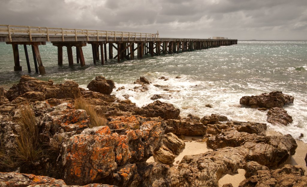
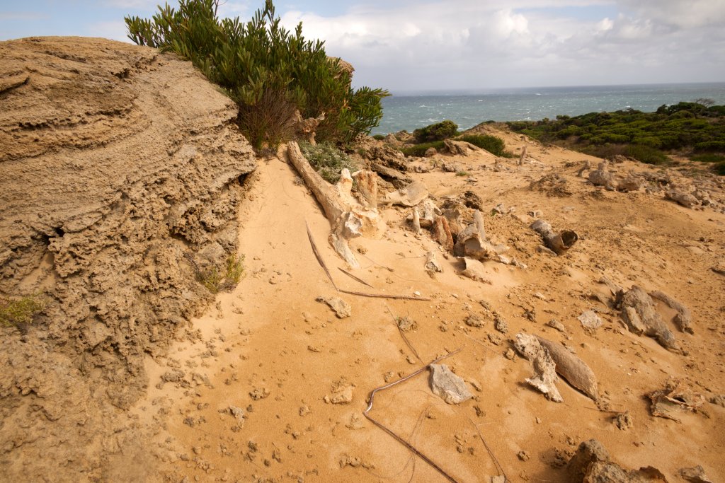
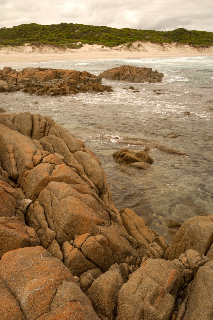
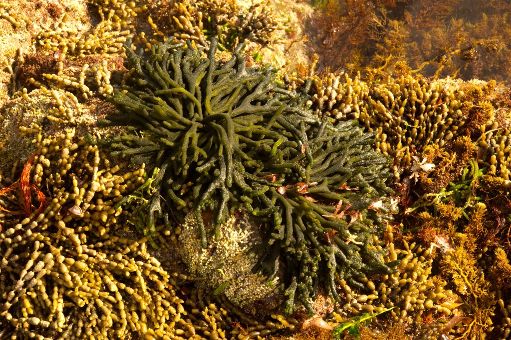
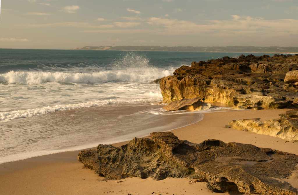
Beyond the fence, across the road, is a bunch of tall tea trees. Grouped and crowded together, with scrawny, narrow trunks and a miserly sprout of green foliage confined to the very apex of each tree. There are no significant branches until a meter from the top. Just beyond these trees is the beach; it is more of rock than sand. A good distance offshore is Councilor Island. Its only feature is its light house which becomes visible as it blinks lazily overnight across the water.
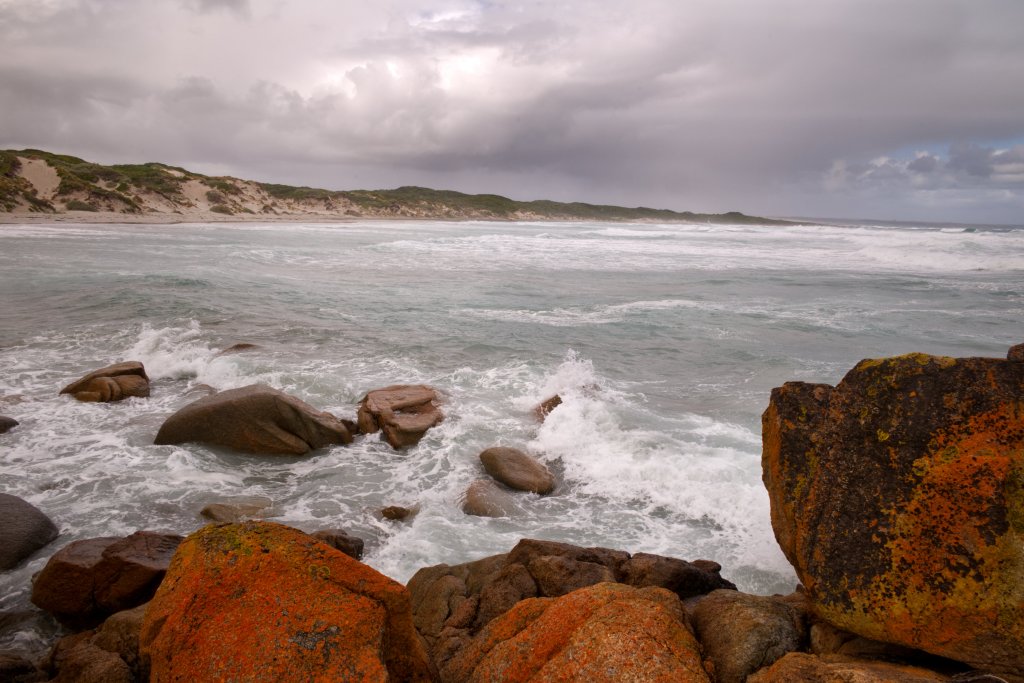
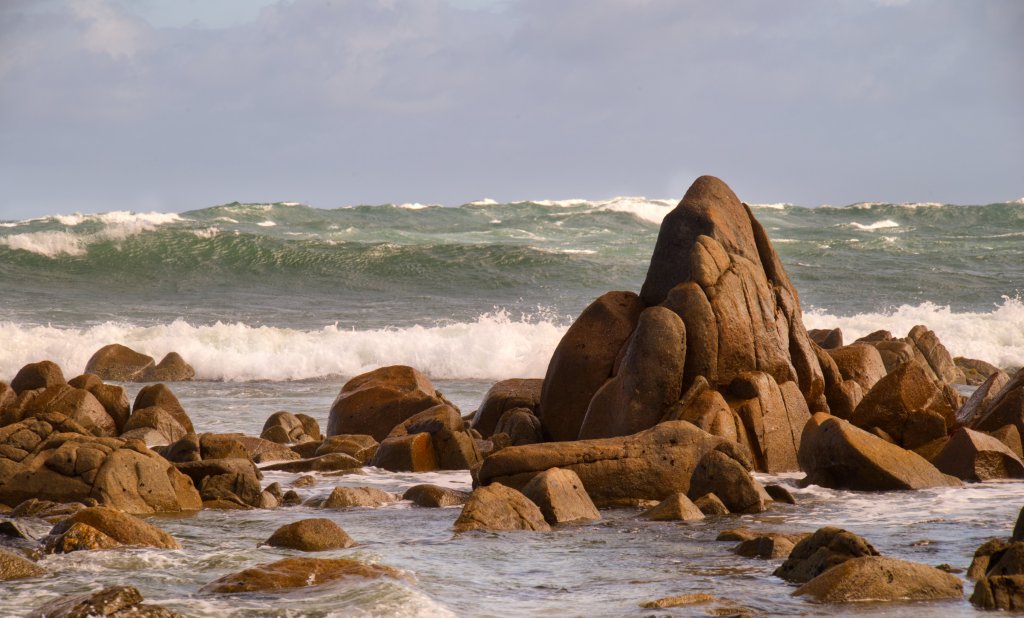
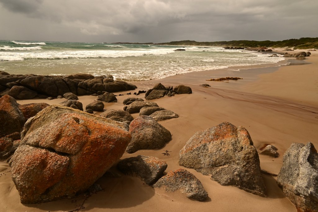
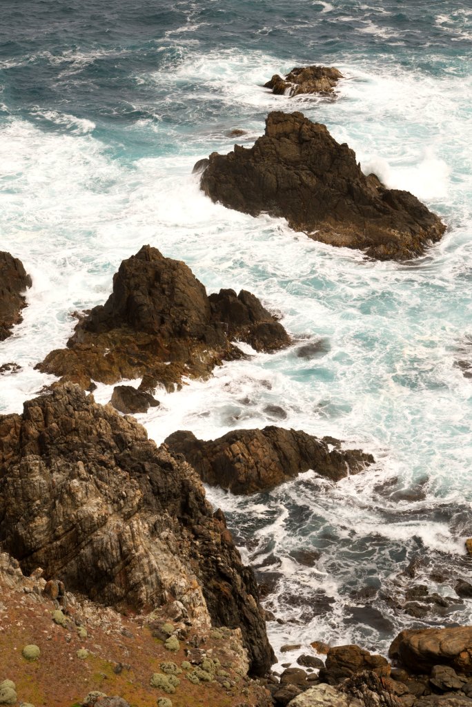
When we arrived yesterday (Saturday), the sea at Naracoopa was rough, waves and white caps were forming in long angry lines far from the shore. The surface of the water was lifted airborne by strong, easterly winds. This wild sea haze quickly coated our camera lenses and glasses with salt.
We had flown in on Saturday morning with Sharp Airlines. It is a 17-seater passenger plane that promptly left Launceston at 10:45 am. We stopped at Wynyard, mysteriously called Burnie airport, then took off for the final leg to Currie, King Island.
We only saw King Island on our final approach when the aircraft dropped beneath thick cloud banks. Here was a repeating patchwork consisting of huge green and brown paddocks that ended abruptly at a spectacular rocky coast, its irregular fingerlings of brown and black rock penetrating a white flecked ocean. Bass strait was in a tumult, white caps erupting from the heaving surface kilometers from the coast; many were tossed up by reefs, but most were conjured into being by the sheer strength of the wind. After we exited the plane and walked across the tarmac to the arrival lounge, we were amazed at the blustery conditions and were impressed at how gentle our landing had been. Westerlies are the general rule here in King Island, but Easterlies can be just as powerful.
Jennifer drove the rental RAV4 to Currie to purchase supplies, have lunch and buy a coffee. The human population of King Island is 1600 but if you add in Wallabies (500,000 to 1,000,000), assorted marsupials, seabirds of all sorts and snakes, it could be considered crowded. On Saturday afternoon only the King Island Bakery and IGA and Foodworks supermarkets are open. We both had chicken and cheese toasties for lunch. After shopping, we drove across the Island to Naracoopa. Beside the road, the verge is a narrow corridor of grass or trees which seamlessly extends into the forests or farmland behind; the bush is full of wallabies, padymelons, possums and magpies. Jennifer repeatedly slowed down to avoid injuring any if they should suddenly decide to leap onto the road. There was abundant road carnage to drive over or around. I kept an eye out for them, but wallabies are well camouflaged and very still, and so frequently, we only saw them as we drove by.
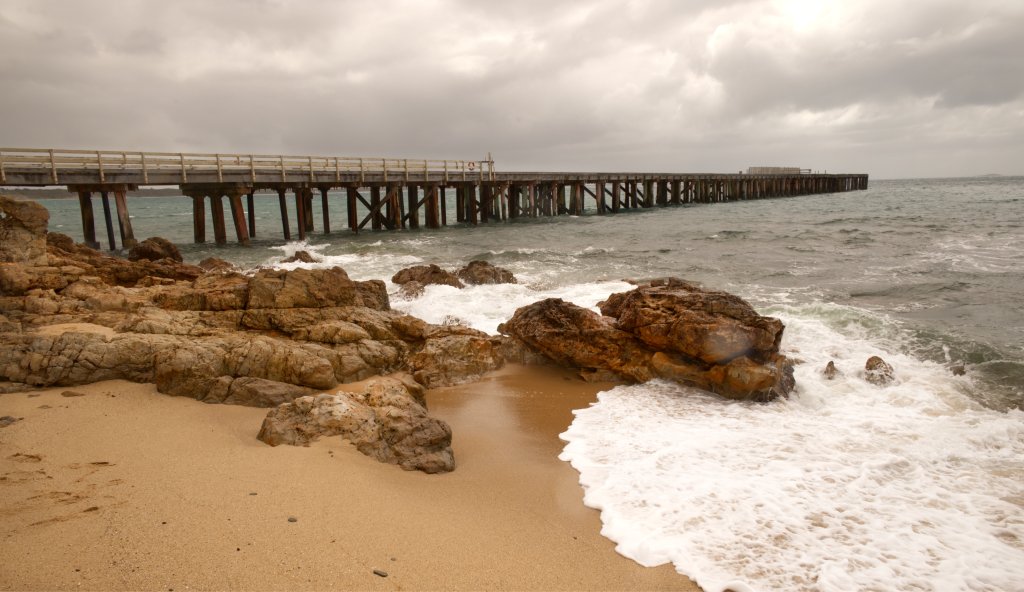
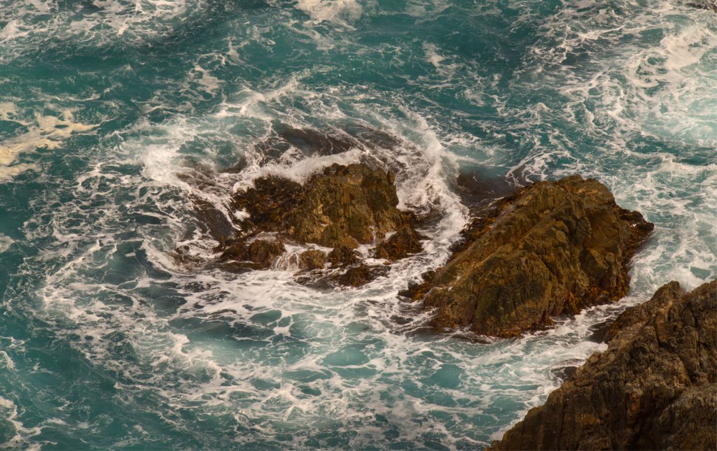
After we threw our bags onto the beds in the spare room, we went for a short walk. We crossed over the road, and across the beachside park to the beach itself. The rocks have been molded into irregular platforms and pillars, some formations resolutely faced the waves, others permitted sea water to tumble into pools through narrow openings and poured into wide stony channels. The thick sea haze obscured Naracoopa Jetty; waves could be heard crashing high into its supporting pylons. This, together with the fierce wind, meant a walk on the jetty was too hazardous. Moored fishing boats tossed about, held securely at their bows by anchors and chains.
Saturday evening was relaxing, Jennifer spent the time reading while I played my guitar until I joined her in the lounge room to read.
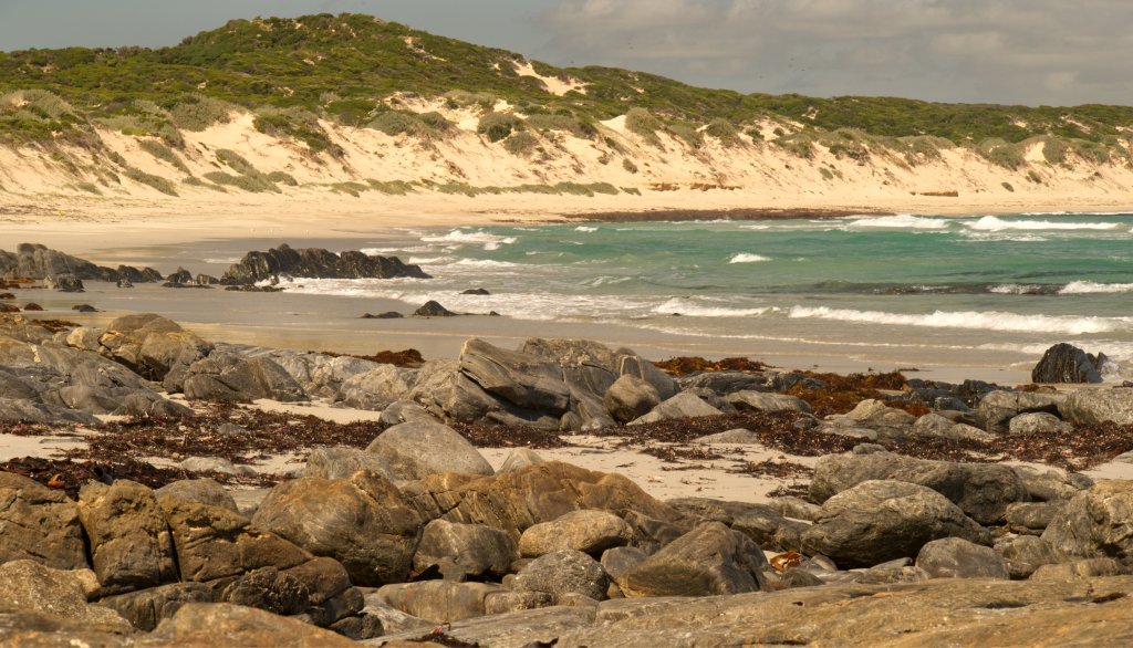
On Sunday, after a relaxed start to the morning, we drove north to Blowhole beach. The wind and waves had calmed down. In fact, it is strongly suggested in the guidebooks that any visit here would be unsafe when there is an easterly blow as it propels surf far up onto the beach.
Getting to the car park near the beach is easy – head north up a gravel road parallel to the coast to the signed turn-off. There are sheltering trees around the car park. We walked south over the rocks near the water’s edge. The waves were not tumultuous but still impressive. There are at least four blow holes. They are not large. The wave comes in, shoots up creating a wall of water as it ricochets against the rocks, but a portion enters a tiny channel; it rifles vertically, meters upwards as a thin white cylinder. Suddenly, it vanishes, its impetus gone, and drops out of view, to be followed by deep, throaty gurgles as the trapped air and water is sucked back by the retreating waves.
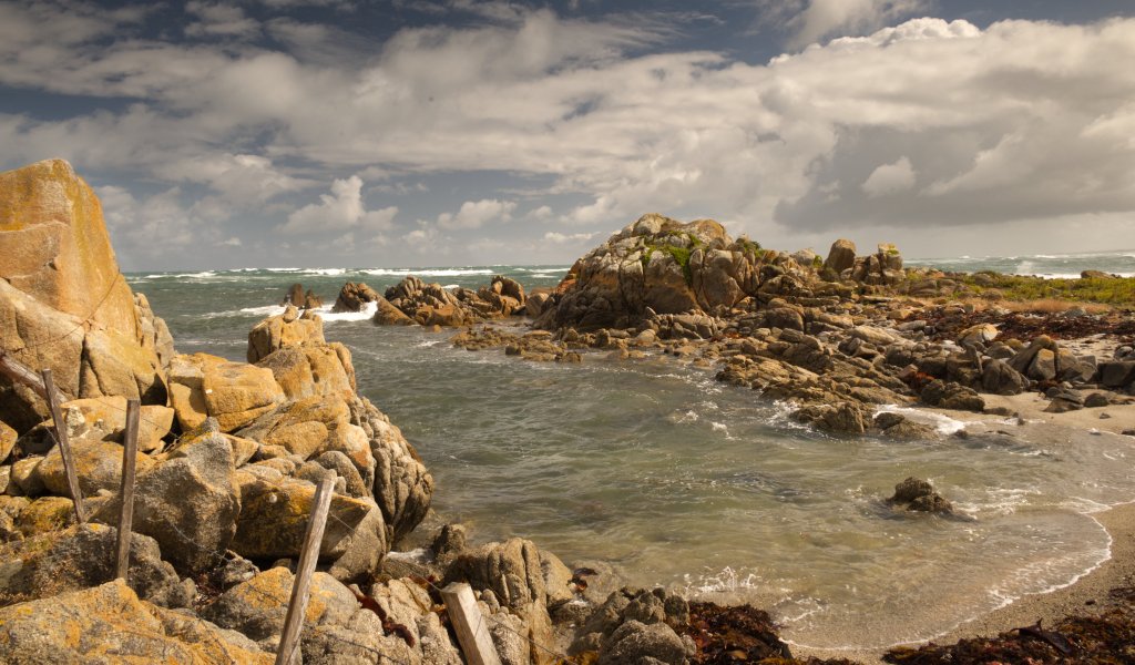
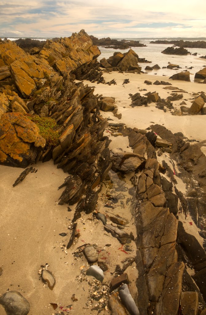
The rock formations of this patch of coast are incredibly diverse due to their intrinsic geological natures and the multiplicity of patterns and shapes caused by erosion and weathering from sea, wind, and sun. There are pillars, platforms, and repeating jagged patterns; all of them angled from vertical to any obliquity. Pools hang suspended above the tide embraced by stone like baptismal founts while others are open to the sea; washed and replenished ceaselessly by incoming waves.
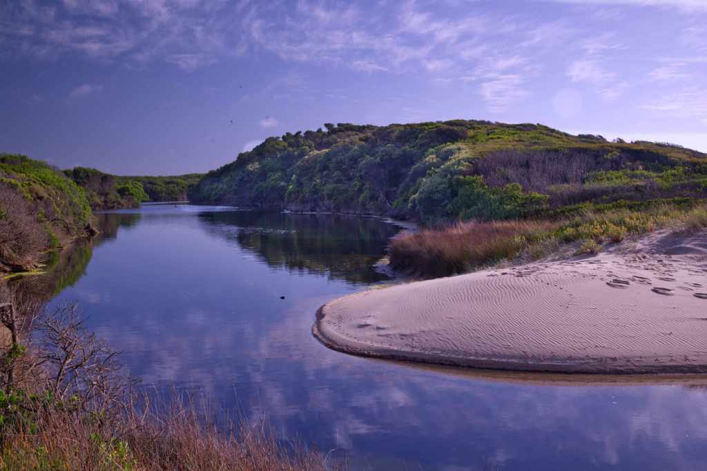
It was enormous fun taking photos, watching the waves and blowholes; all the while avoiding getting wet from the flying surf twirling about in the air; and fighting off annoying, biting March Flies. We walked as far as the sandy part of the beach then returned to the car. Our plan was to visit Elephant Seal River. This is an estuary formed by sand dunes that blocked the mouth of the river. All of King Island is sand dunes.
The sand is covered with grass, trees, roads, and houses but sometimes the mask slips and the golden yellow sand reappears; this occurs when thin, over moistened topsoil slides downwards or covering foliage is burnt away. Thousands of years ago, King Island was no Island, rather a plateau of stone and sand which towered above a vast watershed of forests, dunes, and scrub, the Bassian Plain; this extended from Tasmania to Victoria. It was a region drained by the mighty Tamar River which entered the Australian bight after coursing westwards through this ancient landscape. Dunes were in constant battle with the forests and grasslands; with wind as its ally, sand smothered the trees and grasses atop older dunes. This battle swung both ways repeatedly. Now the dunes seem locked away, but they are only sleeping.
Elephant Seal River snakes through the center of the island, yet it is rarely impressive. A narrow creek under road bridges, hardly worth a second look. Until this estuary before us, here the river widens into a vast curving and attractive lake. Swans, Cormorants and Herons bask, swim and fish here. Thick, low forest visible on the opposite bank, extends from Elephant River north to embrace both Martha Lavinia Beach and Penny’s Lagoon. This region is a particularly important refuge for both local and itinerant bird species.
There is a short walk to a look out. Before we did our walk, we sat down at an outside table to enjoy steaming cups of tea. Cradling our mugs, we read the information boards about the inhabitants and significance of this area. The dusty track goes past a bird hide which has a tree flourishing immediately in front of the slots cut for viewing. From the look out, it is easy to admire the sweeping curve of the estuary. The deep blue water lies placidly beneath a sky streamed with fine clouds soon to be sent scattering over the island.
We went across the island to have lunch at the King Island Hotel which is situated in the main street of Currie. We shared a generous presentation of a fishermen’s basket. We relaxed back at Naracoopa for the rest of the afternoon. I was reading David Goggin’s book on running, life and adversity, a very inspirational experience. I found the concepts he discussed and events he described so deeply interesting that I read it again. There is no denying that he is rather intense about life.
On Monday, the weather had continued to improve, the sky was bright and clear, and even the sea showed a gentler aspect. Now, a calmer ocean with infrequent, low waves which climbed half-heartedly up the shore, roaring surf was replaced by the soft, tinkling waves.
Firstly, we drove to Currie, stopped for coffee at the Bakery, and purchased a few books about King Island at the Post Office / News agency. We continued north; Jennifer driving and me with the tourist map spread out on my thighs. King Island is not flat, the paddocks and roads roll over sand dunes, sand ultimately wedged into the underlying granite, this rock is the hidden spine of the island. Black cows, heads mostly lowered, munched the browning grass, they dot the interwoven nests of hills, each hanging suspended above another.
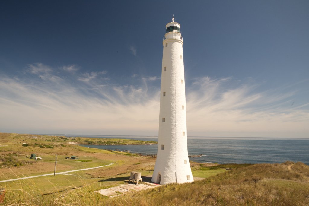
Cape Wickham is near the very northern tip of King Island. The building of the lighthouse commenced in 1855 and was completed by 1861. It’s 48 meters tall and unrivalled in grace and strength. It is made entirely of granite; each stone was hand hewed to fit exactly into the greater design. Its white tapering form is fastened 3 meters below the surface to solid granite. Sand dunes form gentle hills, created by the powerful winds; mostly they blow westerly and continually across the land. We climbed one to see the lighthouse from a different vantage. The wind was strong, so care had to be taken with footing in these grassy hills. For most of its working life there was a flotilla of small houses to house the people involved in the running and maintenance of the lighthouse as well as accommodate their families. These are now gone. Unfortunately, there is no access for tourists as the lighthouse’s operation is automated. No lighthouse keeper’s children have run squealing up the stairs or played here for many years. There is a small shelter for visitors on the adjacent lawn but the gardens that would have supplied herbs and vegetables are long gone. A commemorative plaque and plinth commemorate the lighthouse in its heyday.
When the light was first ignited, as it was not electric in those early days, the light shone out over Bass Strait. Some of the ships masters who first saw it, confused it with the Cape Otway Light house and turned their vessels south not north. King Island and Cape Otway are the bottom and top of a very narrow eye in the needle for sailors negotiating Bass Strait. Long after the lighthouse was finished, winds, storms, fatigue, poor seamanship, and ill fortune conspired to continue the carnage of shipwrecks on the coasts and reefs of King Island. Sailing to Victoria or Tasmania in the nineteenth century was a chancy affair at best. There were horrendous losses of life from many shipwrecks. Repeatedly, inhabitants of King Island faced enormous risks to rescue crews of the ships that foundered. In the days before roads, rescuers would have to walk carrying oil lights and supplies over difficult rocky, storm-tossed coasts for many miles to reach the site nearest a shipwreck such as the “British Admiral”. It’s now a short drive from Currie, but in the 1840s, access was only along the actual coast. Amazingly, many ships were able to get their crews and passengers safely to land but there were many terrible disasters and even disappearances of ships and planes into the modern era.
Nowadays, King Island evokes the tastes and textures of delightful cheeses and warm, tender steaks but in earlier times, it had the opprobrium of danger, from storms, shipwrecks, and the perils of the sea.
Despite the strong westerly wind, a few stalwarts were playing golf on the course situated near the lighthouse. A golf buggy, wobbled down to the greens, as sea spray flitted over it. We couldn’t help wondering how many golf balls finished up in the sea or on the other side of the island!
After our visit to Cape Wickham Lighthouse, we headed south and, on a whim, visited Disappointment Bay. This is near the tip of the island but on the more sheltered (today at least) side. This is a very beautiful place, a long arc of unblemished beach that ends in a distant grey rocky promontory. As we walk its length, we soon cross rocky outcrops that meet the ocean. The rocks are many colors, some are grey, others black, orange, or even golden in the sea light. A gently tumbled ocean searches out this coast. Waves crest in, breaking and climbing the sand, and as they retreat, they thin into a shining, delicate oil, revealing a stunning mirror of sky and cloud. We walked on for an hour, enjoying this amazing place.
We visited Penny’s Lagoon. This is a short drive, south of Disappointment Bay. By now, it was getting windy. The lagoon is a perched lake. Perched lakes are fed by rainwater alone with no entering streams or any hidden springs beneath them. Sand and organic matter, especially leaves, form a solid layer, a barrier to water, thereby trapping any water that falls. This oval lake is surrounded by tea-tree, shrubs, and woodland with a narrow beach of white sand. It is famous for the wide variety of native birds that live and visit here.
There is a small shelter and covered barbecue a few meters from the edge of the lake. There are large information boards that describe the Orange Bellied Parrot. It is the only migratory parrot. Summer is spent in the Southwest of Tasmania where nesting and fledging of the new chicks occurs. The cooler months are spent on the mainland, living in coastal forests, from the Coorong in South Australia to Gippsland in Eastern Victoria. They migrate twice a year, flying up the west coast of Tasmania, Robbins Island, to King Island and then to various locations on the mainland. Originally it was called the Orange Breasted parrot due to concerns about propriety, but the orange area is on the lower belly, and thankfully common sense at last determined its current name. The many large conservation areas, the trees on farmland, and the woodlands near the coast, are all essential for providing food and shelter for these wonderful birds.
We visited the splendid King Island Cheese factory. This is an impressive and large concern. A shiny, metallic tanked delivery truck was parked about to deliver its store of milk. The Tasting Centre is open on certain days. I had a can of King Island Pale Ale and Jennifer a white wine – a pinot grigio, I recall. Placed before each of us was a round wooden platter with six different cheeses to try out. Sitting inside, away from the wind, just cheese, beer/wine, and each other for company, made for a pleasant respite.
Today, it’s Tuesday and the annual King Island show is running at the Racecourse complex near Currie. The weather was not kind for the show. It is cold, windy, and wet, but still many locals were walking about in shirtsleeves and shorts. It’s a ten-dollar entry fee. There were two pavilions. The main pavilion had local art prizes, vegetables, cakes, and woodwork. The other pavilion had chickens and a duck. There were some local prime cattle to admire. The pavilion with the local crafts was the most interesting for us. The food and beverages for sale were typical starchy and greasy nosh which the children enjoyed.
We retreated to Naracoopa for somewhere warm and dry to spend our Tuesday afternoon. We had booked dinner at “Wild Harvest” which is a well-regarded restaurant at Grassy, a township in the south corner of the island. When we left Beach Shala, there was enough light to drive but the wind and rain was fierce. Water fell in sheets and had to be peeled off the windscreen by the madly flying wipers. When driving through the forested areas we were concerned a tree or branch might be thrown onto the car. It was with some relief to reach farmland and exit the dangerous section of the road. We had passed a tree that had already fallen.
We arrived early at Grassy and parked beside the restaurant. We waited for a cloudburst to ease up, to rush from the car up the steps to the restaurant door. “Wild Harvest” requires a booking. The interior is spacious, tables gradually filled over the evening. Its steel roof beating with the rain has patches of rust which reminds me of an old shearing shed. There was a welcoming fire with logs ablaze in a brick fireplace. We elected to sit as near the fire as we could! The large windows give a view of Grassy Harbour with its wide, long breakwater, or they would have done if the rain had not completely obscured the exterior world.
I looked at my menu and it was different to Jennifers. Apparently, it can change very fast. The managers were waiting on a small tour group that took up the central table. My menu was meant for them. The service was friendly and relaxed. We chose a bottle of Stefano Lubiana Sav Blanc for our evening meal. Jennifer had an entrée of Salmon cured in King Island Gin. For mains, Jennifer chose another meal from the entrée menu – a small serve of beautifully cooked scallops. I’d had the scallops for an entrée then followed with a lamb rack for mains. We both had chocolate flavored brulee for dessert.
It was not a cheap meal, especially as there is a booking fee as well! However, we enjoyed the meal very much and will go again when we return to King Island.
It’s Wednesday morning and raining as we woke up and had breakfast. It kept raining in squalls for the whole day. Nonetheless we drove to the southwest corner of King Island to visit the “Calcified Forest”. There is a small car park in a sheltered forest not far from the coast with a short 650m walk to the “forest”.
It was not a forest. Once upon a time there had been a forest, on an exposed headland, maybe a thousand years ago, then sand dunes swept in and slowly choked the trees. The calcium carbonate in the sand, congealed around the roots, making casts that persisted long after the roots themselves, much less the trunks and branches had withered away. Years later, wind blew the surface sand away and this revealed weird, delicate crystalline sculptures. Thus, its casts of the roots of the original trees which populate and emerge from the remaining sand.
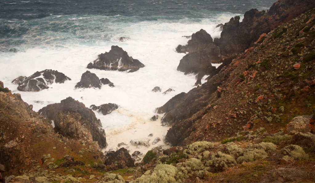
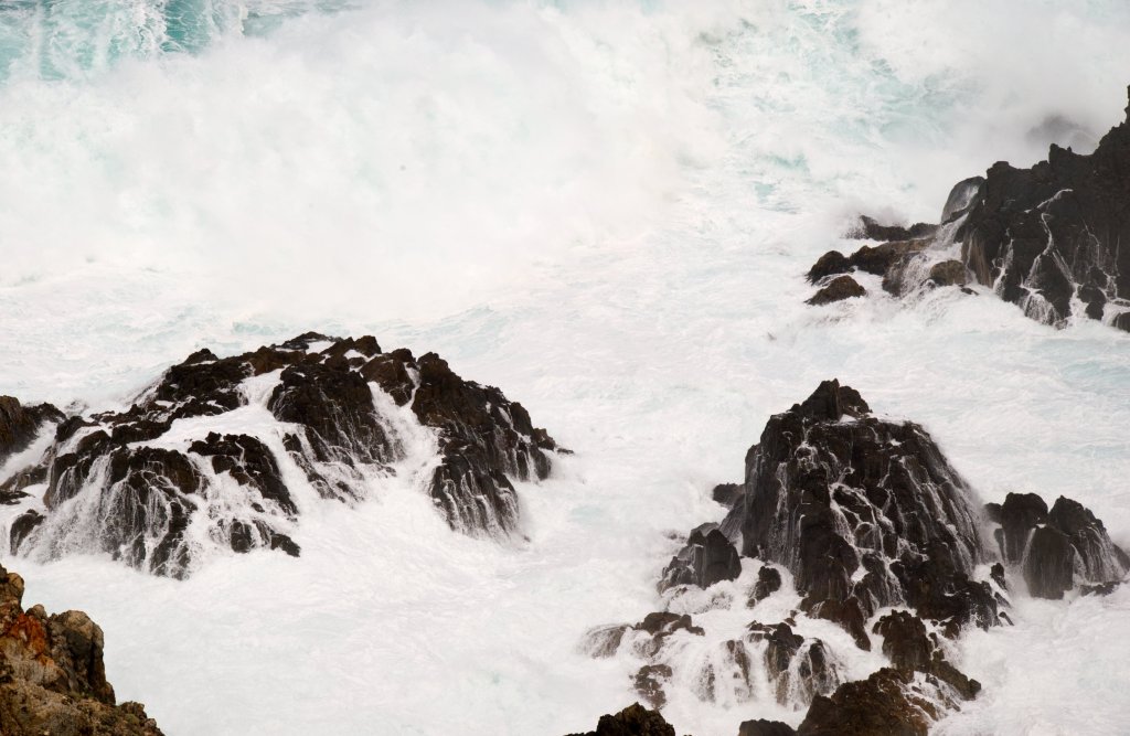
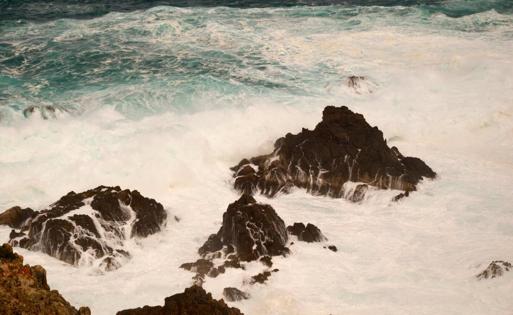
We drove the short distance to Seal Rock Lookout. It is an 80m walk to the lookout. The lookout is perched on the cliff edge with a reassuring steel barrier. The seas were wild. Waves and surf were belting in from the west, in no order, in chaos, one striking another, creating even more disordered turbulence and frenzy below us. This maelstrom crashed into the huge rock formations below us. Water and surf hurled into the air, sending sea spray over us. There are black, pyramidal pillars below the cliff which the sea surges over and around, angry white water streaming into the rocky rills and flanks. A thick sea mist hovers at the lower levels of the cliffs. It is a very impressive sight. We looked south toward Stokes Point, past repeating rocky headlands, and the whole sea was a boiling white as far as we could see. We were almost blown back to the car. We sheltered in the car to have our sandwiches and hot tea protected from the wind outside.
As we returned to Currie, we drove the short road to “British Admiral” Beach. As we waited in the car, rain fell from determined, dark clouds. The tide was high, shrinking the beach to a few meters beneath the sand dunes. This was not the best day to go exploring.
King Island is a graveyard for many ships. The “British Admiral” sank off this coast on a miserable night in 1845. Reefs seaward of this beach was the ship’s undoing. Of the 89 people onboard, 88 died. For many weeks after the disaster, bodies washed up onto the beaches of the island. Soon after, a convict ship, carrying mostly women, foundered with over 200 dead as a result. But it was the “Cataraqui” which finally prompted the construction of a lighthouse, a shipwreck where 400 people drowned.
We had afternoon tea at a shop in Currie, then returned to Naracoopa to wait out the wild weather.
On Thursday, we decided to tie up a few loose ends. We had driven past many touristy spots in the last few days and today was the day to visit them. It proved a mixed blessing but with a happy ending. We stopped at Currie for coffee at the “Larder” and I bought one of their huge muffins to have with lunch. We planned to visit the remnants of the “Shannon” that sank on the coast. It had run aground on Quarantine Beach in 1904, fortunately, with no loss of life. The ship is long gone but the boiler and the drive shaft are still visible above the waves, especially at low tide. There are two ways to get there. Our guidebook recommended driving along North Yellow Rock Road, parking the car near the coast and walking the short distance to the beach. The track runs beside a wide and beautiful river that only flows into the sea at high tide or it has a high flow from rainfall. We entered the forest and crossed to an area of low scrub. The track was indecipherable. There was only one way back through the forest and would prove hard to find if we took a wrong turning. We abandoned this walk.
There is a bird hide on Heddles Road, it is only a short distance from where it meets the northern road. When we saw it, we first thought it was a bus stop. It’s right next to the road and about 400 meters from a lagoon. You could sort of see swans over on the water but as for seeing or photographing anything smaller, it was hopeless.
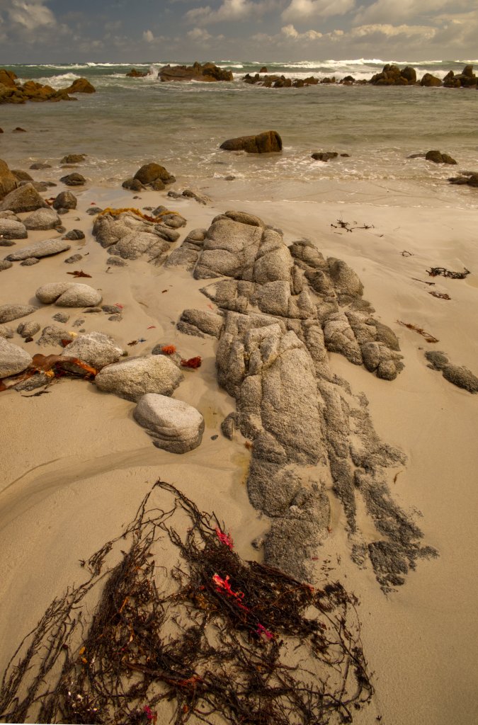
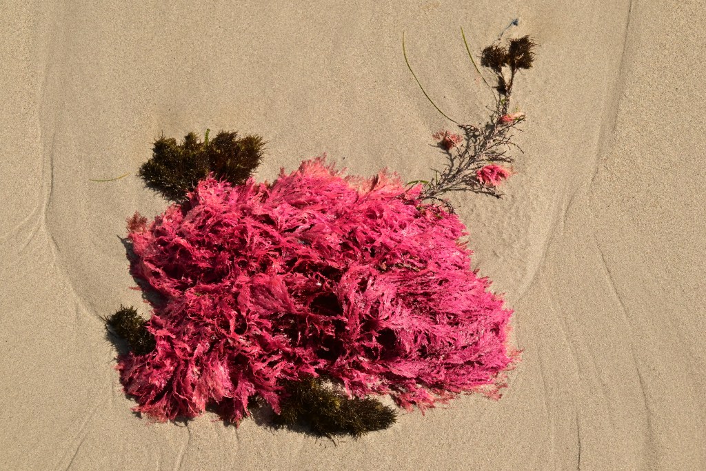
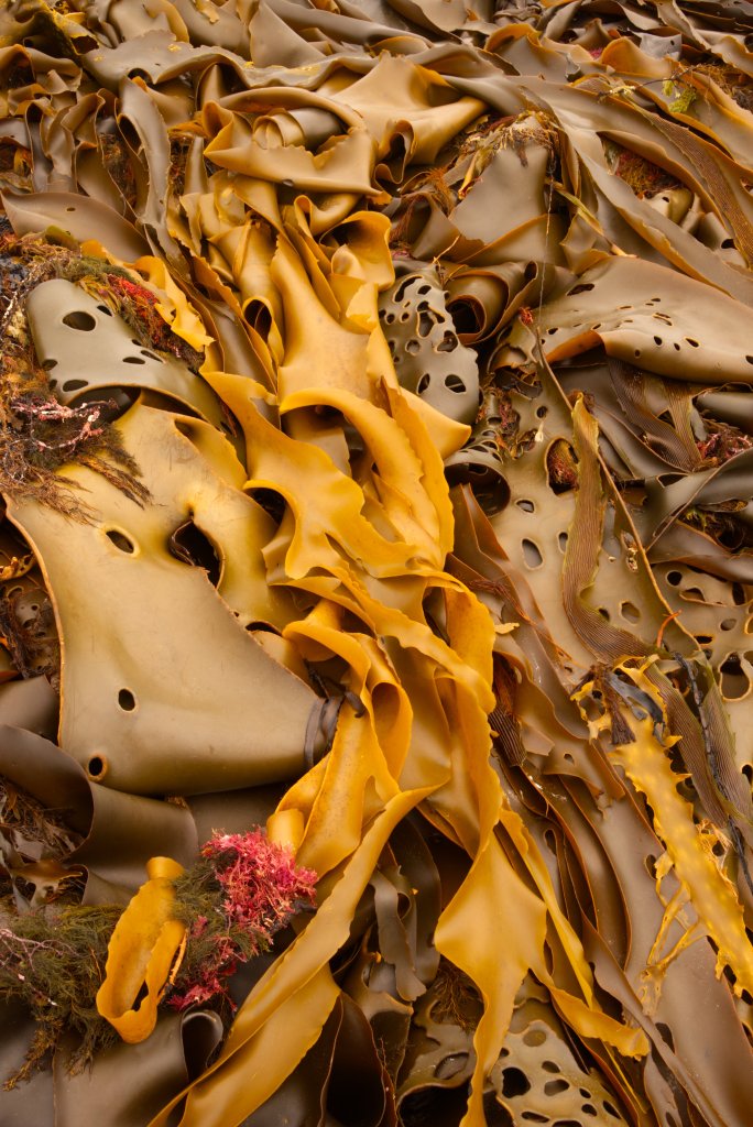
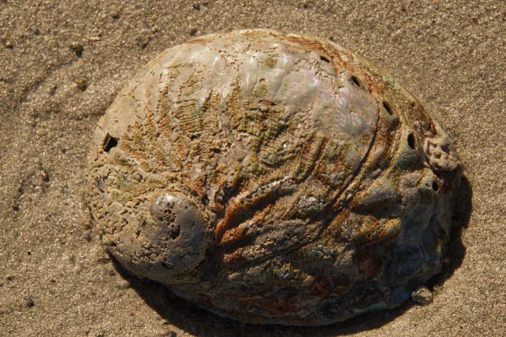
Luckily, we had some ideas! We drove to “Porky Bay Beach”. The road to this beach bisects the King Island Cheese Factory. The road continues over grass covered dunes, past some fine houses, which would have awesome views and stopped at a car park beside Porky Bay. What a beautiful day to visit this magnificent coast. Off the coast a sea breeze fostered some gentle curling white caps but there was no rain to worry about. Porky Bay is a long, grey, sandy beach with interesting rock formations to explore on the way. On the sand were many tiny blue jellyfish with long thin, blue strands draped toward the sea. There were some scattered shells from abalone and snails as well as large leathery dollops and swirls of kelp marooned by previous tides. These thick piles of blue green algae were being gently washed and slowly tumbled by the waves. Seaweed fragments, some pink, brown, white, or gold, were splashed randomly across the beach creating dashes of bright color. Gee, beachcombing is fun! We neared a point where incoming waves nearly reached the dunes and so it was here where we decided to turn back. When we got back to the car, Jennifer turned it around so we could have our lunch watching the sea crashing into the miniature rocky harbour that spread before us.
Attempting to access more tourist hot spots in Currie proved fruitless. The Cultural Centre that is listed as open in the council supplied information sheet – a weekly publication – is not in fact open at all, only by appointment. This information sheet had many errors that wasted time and missed opportunities. The Cultural Centre is near the jetty that provides moorings for boats in Currie Harbour. As we walked along the jetty, we could see fishing and cray boats bobbing up and down in the surf that entered the harbour. Beneath a hill across the harbour was the “Boatshed”, a local Centre, and above that was the squat Currie Lighthouse. This lighthouse is not as impressive as the one at Cape Wickham. The harbour entrance was full of white caps, racing before a fierce westerly. It would not be an easy entrance to navigate in bad weather.
On the return drive to Naracoopa, we diverted to visit the local brewery. One of the owners was serving at the brewery. She and her husband built the brewery and do all the brewing of their ales. It is in an attractive location, perched atop a hill which overlooks sweeping paddocks of farmland. The buildings are barely 18 months old. I had already tried a pale ale at the cheese factory so was keen to sample some of their other products. We sat in their sheltered verandah, we were settling ourselves into comfortable, black armchairs just as she brought out the samples, they were larger servings than I was used too. I’m glad we shared them. I liked the Pale Ale, the HPA and the malt beer but did not like the apple cider (too astringent for me), the ginger beer or the dark ale. Unfortunately, all these ales are only available on King Island. They have a major manpower shortage and are busy enough supplying the island. However, they hope to have a website with online sales soon.
On Friday we drove to Currie. We stopped for coffee at “Larder” in Edward Street and hung around the town until 10am waiting for the Information booth to open for the King Island Imperial. There was a selection of running tops, shorts, and hats for sale. I bought a tea shirt and singlet, while a bit warm for summer or racing, would be terrific in the cooler, wetter months. Jennifer bought a tea shirt (the first of two) and a vest commemorating the race. We collected our racing bibs for Sunday. I am number 114 and Jennifer is 115. There are about 30 runners competing in the 32 km race. There are also many walkers who will do the 32 km distance. Jennifer, along with many others, is doing the 8 km walk.
The race is handicapped so we don’t all start together but hopefully will all finish together. The first runners begin at 7:20 am and I was to start at 7:36 am. Though the weather on Friday was still squally and cold, it had improved from earlier in the week. Saturday proved a mild day, and Sunday was perfect with a slight southerly breeze and a few clouds. Cloudy, cool, and gentle breezes, these tick all the right boxes for race weather conditions. We had a chat with the volunteers at the information center who do so much for the race and King Island generally.
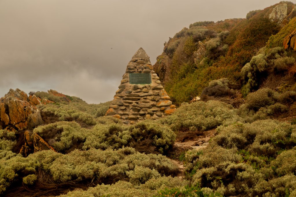
We visited the site of the Cataraqui wreck. This ship is still the worst maritime disaster in Australia’s peacetime history. 400 people drowned with only a handful of survivors. The coast here is rocky, wild, and very beautiful. If you were pitched into the water in the middle of the night, in rough seas, with no light, even if you could swim, you would be killed by the sharp rocks as the waves threw you onto them. We parked the car on a small headland and walked along a stony, narrow road to the beach. We reached the memorial cairn, one of two. This one is amongst the rocks while the second is high in the dunes behind the beach. It was a profoundly moving place to visit. No one knows where the recovered bodies were all buried. The original wooden markers are gone, and the dunes move obscuring the geography, so even the burial team barely a year later, could not find the location.
We drove back to Seal Rocks again, hoping to see a gentler aspect of that part of the coast. We had lunch at the Calcified Forest Carpark then drove the short distance to the parking area near the look out. It was less windy, sea spray was minimal, though the waves surging below us were still impressive. Last time the water was colored a deep indigo or white but now we can see many more shades scattered between green and blue. Brief whirlpools and eddies, conjured by the disordered meeting of incoming and retreating waves, bubble up into an iridescent green, a surface streaked with a lacework of creamy foam. Does a ghostly light from a drowned ship illuminate the water above it? The lookout is high over the cliffs and provides wonderful views of the scenes playing out below us, as well as to the coasts spreading north and south. This coast begins with a grassy and forested hinterland, which suddenly drops to the sea, now black cliffs, and headlands. Land is torn by these angry seas leaving only a rocky skeleton. Waters swirl around the rocky pillars below us, crash and climb the cliffs till they inevitably weaken, and tumble backwards, ethereal acrobats.
As we drove back to the main road, we saw an echidna. We stopped, grabbed our cameras, and stepped out. An old farmer was driving a small tractor. He stopped to ask if anything was the matter. He told us that the grave site we had passed, not far from the road, was his great grandmother. His name was Peter Bowles, as we learned from some locals later. He is an identity on King Island because he is not only fourth generation, he owns most of the southern portion of King Island. His grandmother was a truly amazing woman. Jennifer knew much of her story and told me about her. She married a man in England who had dreams of making a farm for himself on King Island. She was the daughter of a peer and had lived a life of luxury and privilege until departing for Australia. She and her husband brought eleven of their children to King Island and established a farming empire that still thrives. Her days of luxury were over, living rough in those wild, early days of the Island’s history.
Just a note about history. We were never able to visit the museum (because we were always doing something else or tuckered out by too many adventures), so we never had the opportunity to find out anything about the Aboriginal History of King Island. This is something I hope to remedy when we return in a year or two.
Rather than return home via Currie, we took a backroad to visit Grassy Harbour. The sky had turned overcast, and a chill wind came off the sea. The breakwater for the harbour is a refuge for Little Penguins – also called Fairy Penguins – they arrive at dusk and depart before dawn. We heard some chicks calling out but did not see any. Grassy harbour is more sheltered and much larger than Currie Harbour. This is where cargo ships travel from the Tasmanian mainland, or the North Island, to swap supplies and produce for the locals and visitors like us. It cannot be called a pretty harbour. For many years, this is where the King Island Imperial race began – with a vicious climb past the township of Grassy, then the route diverted northeast to Currie. It was the same distance as the current race, but it was not really a coast to coast, in terms of how most people would understand the concept. On Friday afternoon, we relaxed in the shack and ventured out for a beach walk in the evening. A solitary port-a-loo, standing in the park, was the only harbinger of Sunday’s race, at least here in Naracoopa.
Last day before the race, Saturday morning, and we were at a loss what to do for the day. The information brochure has listed POKI as a monthly event. We found out later from locals we stopped to ask in Currie that it had not run in years! POKI means Produce of King Island. It’s a market. We had coffee at Currie instead. Over the cups of hot drink, we decided to revisit “British Admiral Beach”. This time the tide was low and presented a wide beach with glistening sand which welcomed us as we walked down from the adjacent car park. We walked a few kilometers along the beach. There were rock formations imbedded on the sand, some gray, some brown and golden due to encrusting lichen. Great sheets of kelp ran in long piles along the beach. Another stretch was not made of sand but rather of millions of weathered small stones and rocks. We walked on the tracks where car tyres had pressed a path creating a smoother pavement of stone and sand. It is a beautiful bay with a magnificent long, curving beach. The sea was almost placid with gentle waves arriving then sighing way from the sand. The dunes behind us were checkered with hardy sea grass and small shrubs.
On Saturday evening, we returned to Currie to meet many of the runners, volunteers, and race organizers at the Pre-Race dinner. The function was held in one of the larger rooms at the King Island Hotel. We had already booked and paid for this event when we entered the race a few months ago. It was wonderful to meet people who are as passionate about running as us. Between courses, a video was shown with highlights of the race for the first fifteen years it took place. This included the Free Willy run on a Porky Beach. I had no idea that this is a NUDE MIXED RACE. It is only 200 meters and towels which were swiftly shed are as quickly replaced at the race’s conclusion. At least until they go for a swim!!
The video included winners of the race including Steve Monegetti’s famous record-breaking run in 2002. A record that no one has come close to breaking. He looked fantastic in the videos taken as he ran along the course. A short video from Steve, captured on a phone, encouraged everyone to have a great time as well as some reminiscing about his terrific race.
The meal was excellent, a buffet featuring Island steak! The evening finished at 8:30 so we had plenty of time to have an early night.
On Saturday night I was a bit churned up and had trouble sleeping. This was to be the longest run I have done since I was 19 years old, when I did the Melbourne Marathon in 1979. Finally, I got to sleep, then Jennifer’s alarm woke me at 5:30 am, Sunday morning. I had laid out my running gear the previous evening. I had decided that unless it was freezing, the best option was to wear a racing singlet. I clipped my bib with the race number, to the front of my running top. To my horror, it was raining heavily outside. Fortunately, the rain was brief and there was no more that day. The starting line with its rectangular, inflated doorway was only a short distance from Beach Shala. Most of the participants had caught a bus from Currie. The first walkers set off at 7:00 am. The first runners commenced their race at 7:20 am. By now, the sky was beginning to lighten; I was going to run it all in daylight. I started at 7:36. My watch was a fiddle to start with. The problems with GPS watches are that the text is so small, and so vital (at least to the watch), that I must guess the correct sequence of buttons to press to stop it from sulking. Thankfully, it seemed to work, righting itself as the starter called out to begin my race.
The course begins by going north along the road beside the beach at Naracoopa. These first few FLAT kilometers warmed me up for the climb out of Naracoopa. The track then turns in earnest to Currie, my destination on the other side of the island. After crossing Bronzewing Creek (yet another shipwreck), the road ascends, winding its way upward away from the sea. I had planned to walk this section but as I felt so good, I changed my mind and ran instead. The next 5 km continues along the road with tall melaleuca and shrubs on the narrow verge. It is a very beautiful part of the run.
I stopped at the first drink stop for water. There were water stops every 4km for the whole race, but there were no electrolyte solutions available. This proved to be a problem for me later in the run where my leg muscles became very weak, and I had to switch from running to a walk-run style. However, at this early stage and up until the 27km mark, my legs felt strong, and I was able to run confidently at my usual training pace. One young lass passed me, and we would continue to pass each other until 28km.
The road crosses the island and generally ascends to the 11 km mark and afterwards it “generally” descends to the western coast. However, the road undulates wildly, there are few flat sections until the 28 km mark where the track diverts north for a while before entering Currie on a southern sprint. These hills made for a challenging race, as it was hard to get that running rhythm which is so easy to maintain on a flat course. The benefit is that the course is more interesting, and the race is more tactical. I found each extra hill demanded more of me as I continued. I deliberately drank a glass of water at each aid station. The whole run is staffed by volunteers who do a fantastic job, encouraging and helping the runners and walkers. Marshalls were stationed at every road junction or turn so there was never any danger of getting lost.
The race went past many farms, some had cows gazing up with rheumy, brown eyes, they soon lost interest in us, dropping their heads to bite off more grass and continue their chewing. The wind changed from a gentle westerly to as sweet a southerly. The forest trees swayed in this wind; their leaves and branches quietly susurrating as they moved and touched. It was very peaceful. This was not a hectic, busy run with brass bands, taiko drummers or rock bands. It felt good to be running beside farms and forests, cows, and wallabies, with possums peeking out from knolls in the trees; Magpies squabbling and hoping over roadkill. The natural vitality of the island is rich and palpable to me as pass through. The wind, the trees and shrubs, the cloudy fresh sky above me, and the many hills some decked with old farmhouses, some buildings occupied, others derelict to weathered ruins. Running is such an up close and personal experience with the life of King Island, an experience I never had in a car, it was merely scenery. By 27 km I felt fine, I seemed to have plenty in the tank to keep the same pace and cadence. I had flown past the half marathon distance effortlessly. The track was marked every kilometer with an accurate distance; this enabled me to keep a very accurate idea of how far I had come and how far I still had to go. As I said earlier, I have trouble reading my watch to obtain this sort of helpful information. I focused on form and pace, tried to maintain good posture, a gentle smooth foot strike and good balance. So far so good!
Some stronger and faster runners passed me, which is to be expected in a handicap race. My goals for this race were to complete the distance and secondly, to learn how I could improve any future runs over this or a greater distance. After 27 km, I started to struggle. At the last few drinks stops, I felt my legs getting weaker. This could be just fitness and strength, but I wondered if the lack of electrolyte replacement was beginning to tell. The weather conditions were changing, it was now warmer, and I was sweating a lot, losing salt as well as water, as I ran along.
At the 28 km mark, I first began doing walks, about 150 m then I would run a kilometer then walk again. Of course, more runners passed me in the last 2 km of the race, as running slowly is still faster than walking. The last hill into Currie was walking territory. After reaching the top of the hill, Currie was well in sight. I ran from here, through town, lots of cheering people and I could see the finish line. I ran past this and down to the harbour. I ran around an orange witches’ hat then back up and returned, uphill, finally to the finish line. I had run most of the 20 miles. I was 20th of 27 in the race. I was pleased with my result. I have not run this distance for many, many years.
I recalled the thrill of seeing the ocean as I reached the end of Fraser Road, that’s the turn off to the last stretch to Currie. Gee, I had run from one side of an island to another. This gave me an enormous feeling of achievement even before I finished the race. I ran under the finish sign with its electronic clock ticking away. I was given my medal, then wandered amongst the other recent finishers. I felt pretty good.
I am very impressed by many participants; in particular, Stephen Barker, who has run the race every year since it began. Stephen is 79. When I passed him earlier in the race, I could see he was struggling. Yet despite his obvious difficulties, he finished the race. He is a true champion.
Another participant impressed but I don’t know if she finished or not. A young woman was walking the 32 km event and by her gait and posture, she had suffered a cerebral insult at some point. Her walking was ungainly but there was no denying her determination and guts. Wow, what a girl!
Wearing my King Island Imperial Medal, I collected my King Island cheeses, a generous hamper of local cheeses. I skipped the sausage in a roll. I could not face it. What I craved was water and electrolytes. I had stowed a bag on the vehicle that went from Naracoopa to Currie, with stuff like rainwear, a warm jacket and my keys. I drank the solution I had stored in my bag. By now, my quads, those troublesome, big muscles on the front of the thighs, were protesting. When I sat down, they were not happy about me getting up again.
I “walked” to the finish line to see Jennifer, storming in on her 8 km walk. I’d heard her at the 24 km mark, where the walkers were assembling prior to their race. I crippled down the road to see her again as she walked up from the harbour and then across the finish line. Beside her Garmin watch playing up and not recording the last third of her race, Jennifer had a terrific walk.
We chatted to Lizzie, a local lady and keen naturalist, who had met Jennifer on the walk. Jill was another local who befriended us at dinner on Saturday evening. Jill was also the volunteer who greeted me at the finish and presented me with my medal for completing the race. Jill had led our table to victory in the Trivia Competition on Saturday night. Our table won a $100 voucher to spend at King Island Brewery. Like most of the locals, both Lizzie and Jill were full of enthusiasm for King Island, its wonderful lifestyle and the people who live there.
As she completed the race, Jennifer collected her own medal, we drove back to Naracoopa. After Jennifer removed my sweaty socks, I showered, groaning as my chaffed skin was hit by warm water. After a cursory wash because I could not actually reach anything, I then hobbled to bed, plopped in, and promptly slept for an hour.
At 4pm, we met at the Brewery, the walkers, and runners with whom we shared the Trivia prize on Saturday evening. We had a very pleasant chat about the race with the other people there. We especially warmed to Karen and James. Karen, I learned later, won the handicap race by coming first over the line. They live in Invermay. We arranged a dinner invitation on our return to Launceston. (P.S. That dinner was fascinating as Karen told us stories of her ultra marathoning experiences and races and James experiences of incredible walks in Tasmania).
The postrace dinner was held at the King Island Club in Currie. This club is straight out of the 1970s and reminded me strongly of the bar and interior of the club in the Australian Film “Crackerjack”. Today’s race marked the 30th anniversary of the King Island Imperial. More videos were shown, this time it was the turn for the races for the last 15 years. What I was not expecting was the presentation of today’s race! A Ute had passed me early in the race, and I was videoed. And there I was on screen in glorious color. Everyone who participated had a guernsey. There was Jennifer standing at the start in Naracoopa. There was me running along and waving! Thankfully it was taken when I still felt good and was running with good form. I noticed that the older runners, in particular the ones who had passed me, all had hydration packs. The other thing I learned is that form is more important than speed. The fastest woman was not going quickly as she passed me, but she had the most effortless, smooth style. Form creates speed and minimizes fatigue. It was a terrific evening of dining, chatting and entertainment. After I exited the front door, I had to negotiate a terribly rude 5cm step – oh it felt a long way up.
On Monday, Labour Day, Jennifer, and I drove to Quarantine Bay and beach. Our previous attempt had failed so we decided to use a different access point from South Yellow Rock Road. We walked in the sand, above the wave line, 5½ km along this magnificent beach beneath clear skies. Gentle seas lapped the sand, waves glittering in the sunlight. We passed rock formations, which create multiple rock pools brimming with molluscs and seaweed, while lichen, seashells, and mussels shelter attached to the dry stone, briefly above the water. We found the remnants of the “Shannon” , it’s rust encrusted boiler and drive shaft sitting in shallow water 100 m from the beach. The Shannon sank here in 1906.
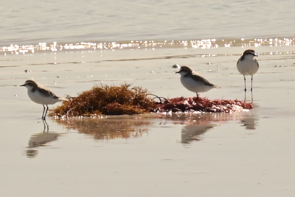
There are two long flat islands off the coast here. Cresting waves broke over a reef that spanned the gap between the two of them. Along the beach, we could see many sea birds. There were pacific gulls, plovers, sooty oyster catchers and groups of skittish, small, fairy terns that hot footed along the beach, their little legs moving so fast I could hardly see them – blurred, they seemed to hover over the waves. We had lunch back at the car overlooking the beach. After lunch we stopped briefly at the beach end of Springs Road, the northern end of Quarantine Bay.
We decided to revisit Cape Wickham, in sunny and placid conditions. The sky was a magnificent deep blue splashed sparingly with high and far off wisps of cloud. It is an impressive lighthouse, its stark white form standing, stark sentinel between the sea and the hills of Cape Wickham. It’s hard to imagine that today anybody would hand fashion blocks to fit as firmly and create this sturdiest of structures.
The information sheet had said the Cheese Factory was closed on Monday. As we were about to drive past it, we could see several cars parked there. So, we dropped in. We repeated our sampling of their cheeses and enjoyed the same wine and beer as before. As we waited, we chatted to some other runners and walkers who were relaxing post-race. They were very experienced trail and distance runners who have participated in events all over the country. They had some helpful advice about running. I was all ears, as despite all my years of running, I have much to learn about racing long distances.
On Monday evening, we sat together in the lounge at Beach Shala, overlooking the sea. It’s gentle enough but I can still hear the sound of rolling waves and wind. This is our last night on King Island.
We enjoyed our stay very much. We have made new friends. We have learned a lot about running. We enjoyed the splendid scenery, especially the coasts and forests. More than anything, completing this race gives me the knowledge and confidence to tackle other racing events.
On Tuesday morning, we completed our packing for the return flight to Launceston. We stopped at “City of Melbourne Bay” (yet another wreck). This beach is south of Naracoopa. It is unique. The beach is nearly entirely made of pebbles and small rocks, there are some rock formations, but the vast majority are much smaller pieces of stone. They are slippery and not easy to walk on. The stones were an awesome variety of colours, from purple, to blue, to yellow to bright orange; all different shapes and sizes; some oblong, some rectangular, and some like river pebbles. Giant, twisted piles of kelp discarded from the underwater forests of Bass Strait, festoon the high-water mark.
After our exploration of “City of Melbourne Bay” we drove back to Currie. We stopped off at the Larder for coffee. Some other runners and walkers had been delayed by computer issues regarding their flights so were whiling away some time here. It was great to hear all their plans. A couple, a husband (racewalker) and wife (runner) had already completed the London Marathon and were planning to do more. They entered the race using a running travel company called TRI TRAVEL. This company organizes the entry, accommodation and transport including the day of the race. They were enthused about the London Race, running past the famous buildings and parks, crossing London Bridge in streaming sunshine, and all the cheering crowds. This year they are going to participate in the New York Marathon. Their stories were inspiring. I cannot help but think about other races I could do. Many races around the world include smaller, shorter distances for other non-runners to participate in, like the 8km walk on King Island. Jennifer and I had lunch at the King Island Hotel before driving out to the airport to wait for our flight.
What a great trip it has been!
Our close friend, John Elcomb, collected us at the airport in Launceston. I must also thank Linda Hall, his partner, for driving us out when we departed for King Island. Trips they have done many times for us. So, thank you John and Linda.
