


Category Archives: Uncategorized
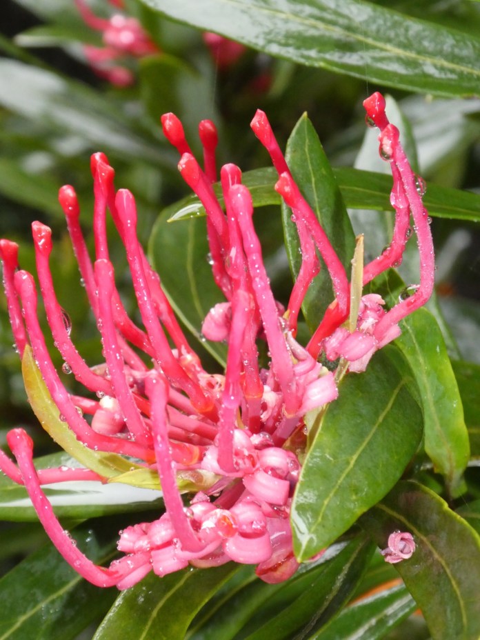
Flinders Island with Tas Ex 2020
I am sitting very comfortably on a camp chair, perched beyond the reach of our near permanent summer sunlight, sheltering in a gazebo/tent. I am on a Tasmanian Expeditions trip to Flinders Island with two guides; MJ and Alice and six guests and Mitch who is in a slot between guest and the Tas Ex. company. Most of the guests are of my knee popping, hip creaking, and back crunching demographic. None of us have been to Flinders Island previously and I think all of us are excited about the possibilities for this visit.
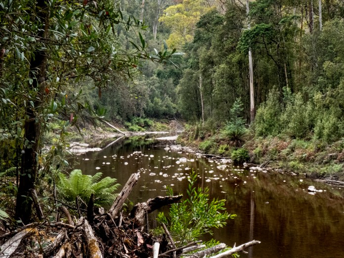
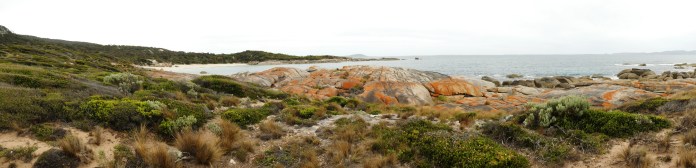
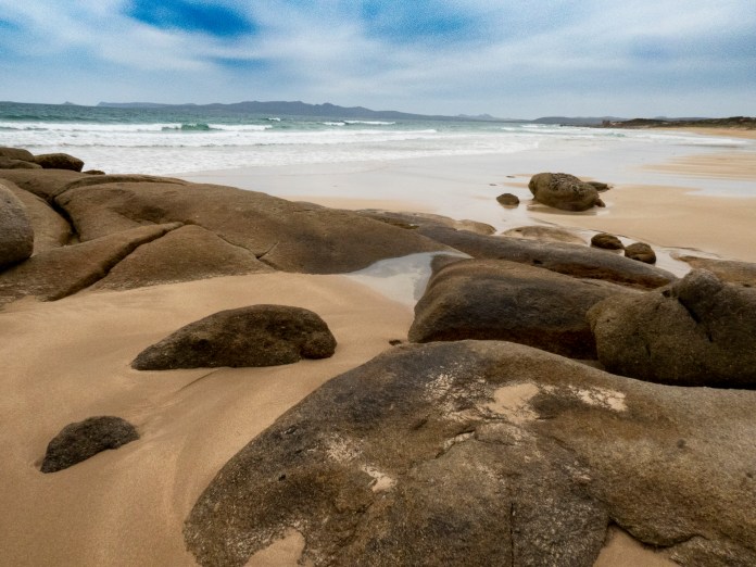
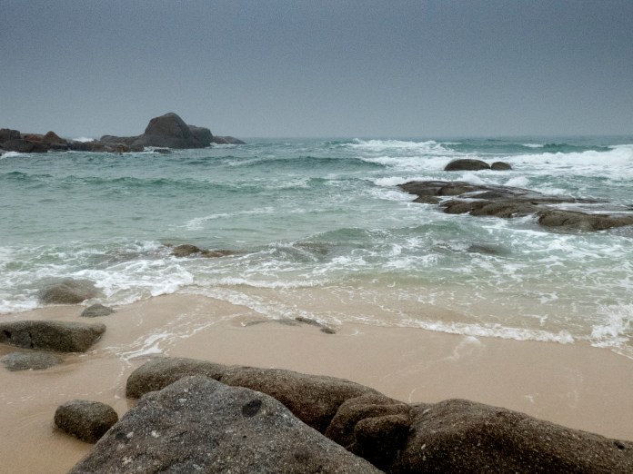
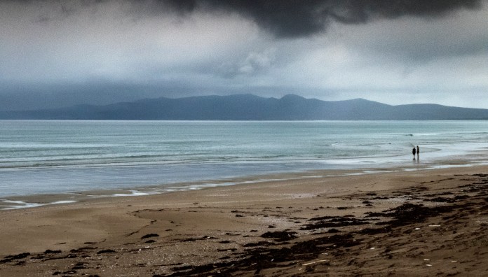
At the campsite where we will be staying are a smorgasbord of facilities, let me take you around; there is the sheltered meal area where MJ and Alice prepare most of the meals and which doubles as a shelter from sun and rain, there are the scattered tents set up on timber platforms each containing a stretcher, there is the toilet and shower and then there is the ground spotted with strategic potholes, wombats, snakes and jack jumpers. Tas Ex rents this area from a local landowner but is looking at obtaining a camping area nearer a beach – any beach – as they are all fabulous, isolated, clean and beautiful, and curve endlessly into the distance.
Flinders Island is the main land mass of the Furneaux group of Islands. In every direction, from any highpoint or beach, you can see these islands. Apparently, they are all teeming with snakes. The vast numbers of these reptiles are all the more appalling as they are the size of industrial pipes and dripping with venom. Of course, I cannot see them from here on Flinders Island, but I know they are there.
Tobias Furneaux was a captain on a ship called the “Adventure” and was the junior officer to Captain Cook being historical on the “Resolution”. You may know that Captain Cook came to Australia a few times, first in the” Endeavour” and later in the “Resolution”. Cook wanted to know if there was a strait between Van Diemen’s land and Australia or not and tasked Furneaux with this problem. Furneaux bobbed up the east coast of Tasmania and saw loads of water, strong currents, all flowing from the west, but he thought it was a bay, possibly with a very big rip. Thus, the discovery of Flinders Island was delayed -until – the non-arrival of rum provided the needed motivation and finances. In 1796, a ship carrying 7000 gallons of rum, which in metric is the equivalent of 5 million hangovers, left Calcutta tasked with bringing alcoholic oblivion to Sydney Cove. The ship was called Sydney Cove, to help with navigational challenges, given the amount of alcohol on board such challenges could be reasonably expected. On the way they managed to locate at least five hurricanes which is something of a record – it is unclear if there was more water in the ship than outside it. They rounded the southern tip of Tasmania, hit the water north of our island, then easterlies blew them west, until they were shipwrecked, between what came to be called Preservation and Rum Islands. The rescue of the surviving crew and the restoration of all that rum to a thirsty Sydney, were naturally top priorities. It was a shemozzle in many ways, the poor crew who paddled off north, were mostly drowned or speared or arrived in Sydney after weeks of just awful walking from ninety- mile beach to the outskirts of Sydney. One of the ships that came to rescue them, sailed into the sunset then promptly sank, and was only located by divers in the mid- twentieth century. Matthew Flinders was a young officer, in charge of the third rescue ship. On his return to Sydney, he convinced the powers that be, to give him and his best mate, explorer Dr George Bass, a small ship to explore the waterway before any more rum was lost. It was Flinders who named Bass Strait in his friend’s honour. Flinders Island was not named that by Flinders, who christened it Great Island. It was Governor George King, who chose the name by which we know it today. Matthew Flinders was not only incredibly competent but a truly decent human being, and it is fitting that this beautiful island is not his only namesake but that a fine university in South Australia is named after him as well.
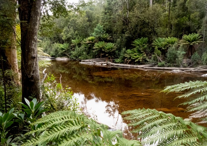
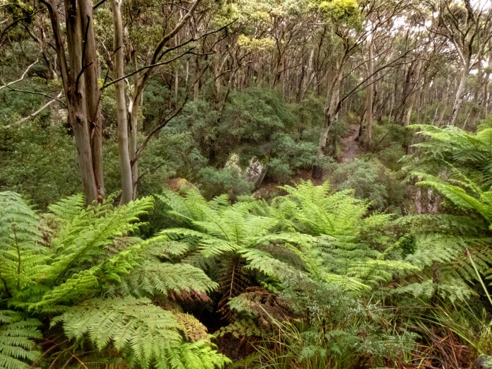
I have dreamt for years about coming to Flinders Island. Together with King Island floating just to the west of Bass Strait, they are the only two places where the 40th parallel makes landfall all the way to South America. It’s just water and albatrosses for thousands of kilometres in either direction. Closer to home, there are at least forty islands in the Furneaux group depending on the tides and prevailing seas. Our flight to Whitemark began at Bridport which is an hour drive from home. Whitemark is the principal town on Flinders Island. The group was split between two planes. These chubby machines resemble obese shopping trolleys as they rumbled happily through the air. We flew along the scenic Tasmanian coast, then diverted north to Clarke Island, then skirted Cape Barren before arriving at Flinders Island. Below us we could see many flat topped, islets resembling beached turtles. Their splendid rocky, granite coasts and faultless sandy beaches each had a penumbra of green water which swiftly blended into the dark waters of Bass Strait. There were great shoals of green tinted granite beneath the waves, these hazards would have been invisible when sailing across these waters in the wooden ships of the nineteenth century.
Only the bravest of mariners or fisherman would venture in these waters. The government in Sydney was reluctant to build a lighthouse, as it was not going to be built near Sydney – has anything changed? Unfortunately, it took twoshipwrecks with great loss of life finally to prompt construction.
For most of our short week on Flinders Island as well as the flights there and back, the sky was hazy from both mainland fires and a blaze on the north east of the island. I feel a bit frivolous being a tourist while my country, its forests, homes, native animals and businesses are incinerated but the places that aren’t burning need the economic benefits of tourism.
Alice and MJ met us at Lady Barron Airfield, they were standing outside the minibus and its trailer. I had spoken to MJ (Mary Jane) a few days before by phone, but it was the first time I had met Alice, which is odd in a way, as she is a Launceston lass through and through. We were driven north, past Whitemark, along mostly well surfaced, gravel roads, past haze obscured mountains, farm–houses on dry paddocks, round barrelled black or brown cattle and small flocks of Cape Barren geese posing beside shrinking farm dams. Mating currawongs bustled in the trees and then flew out to race the bus.
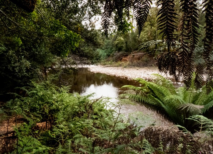
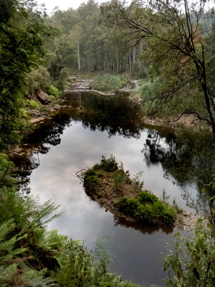
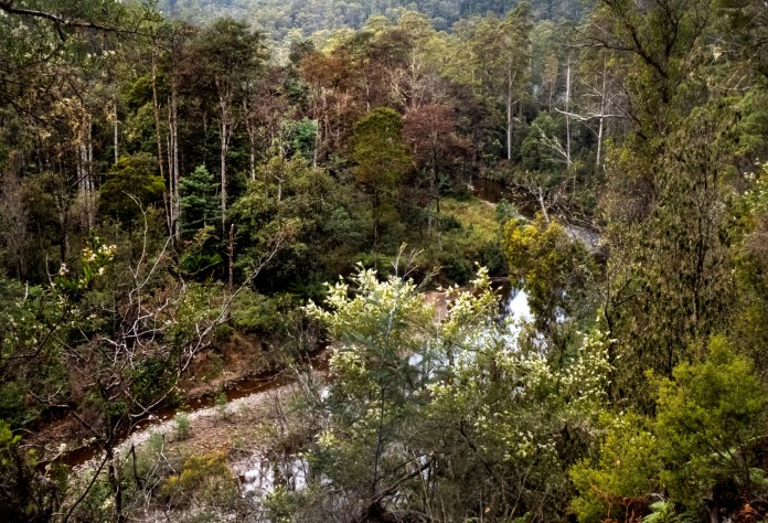
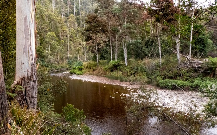
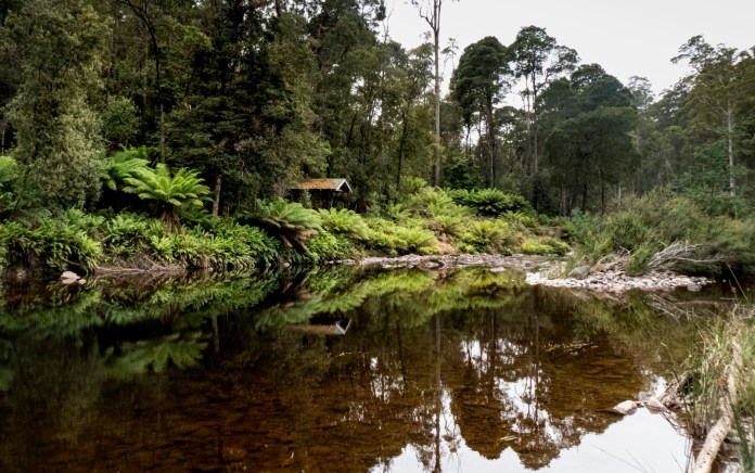
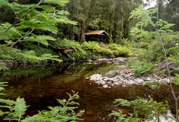
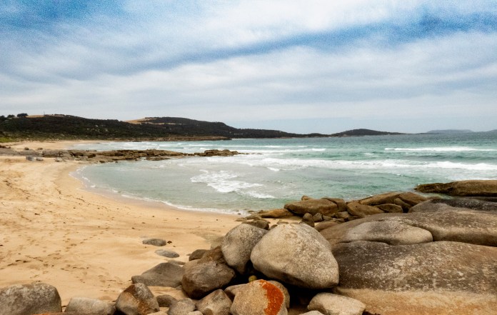
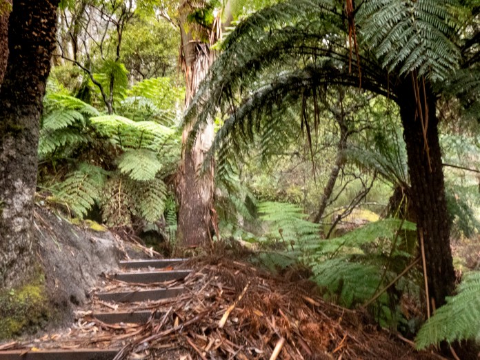
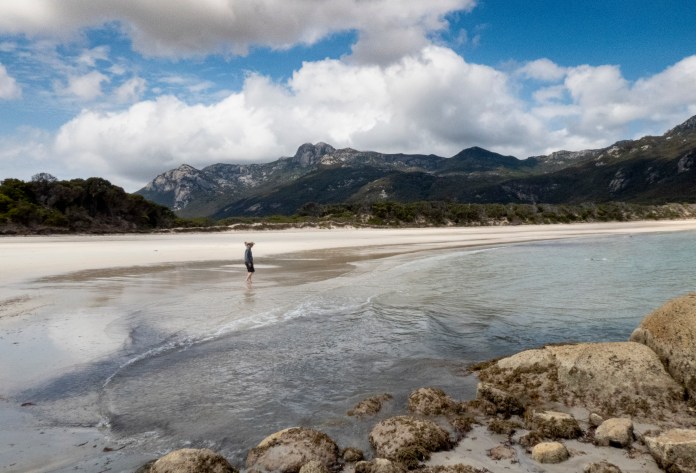
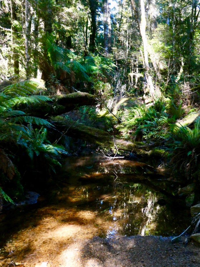
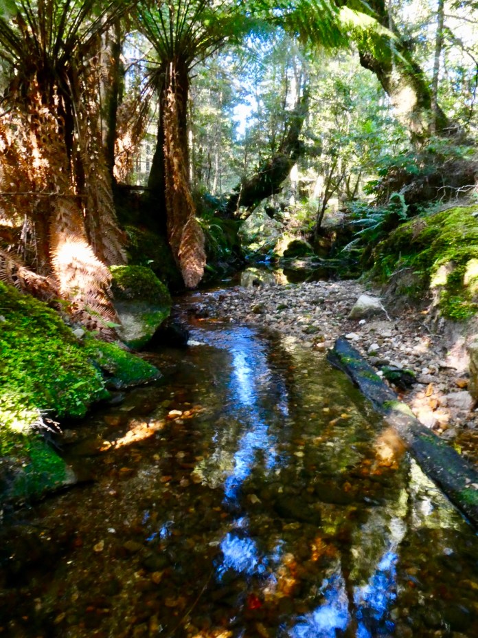
The contents of the campsite were discussed above but its location has remained a secret till now; the property abuts the main road on its eastern aspect and Marshall Beach on the west. The campsite is near the road, and you can hear the occasional car or truck. The beach is about 1 kilometre away, a walk along a vehicle track then spiralling through a maze of tea tree and she-oak to Marshall Beach.
Marshall Beach was named after a shipwreck. In the splendid Furneaux Museum are artefacts from its wreckage recovered over the years – especially brass taps. Everybody survived this shipwreck and surprisingly this was the norm for this sort of calamity. Boats did vanish or were lost with considerable loss of life but that was unusual, which says a great deal about the competence and bravery of the crews and captains of these ships, not to mention, the passengers. It must have felt like a lottery every-time they boarded a ship, but board they did. We get anxious about delays traveling by air while they were not fussed about dragging themselves in their ankle–length crinolines or woollen suits, through surf onto an isolated beach after a shipwreck. Another ship was filled with clocks, and littered beaches with tens of thousands of spoked rings when it split up on a submerged shoal off the coast.
Flinders Island has some great eating and drinking spots. I forgot to mention that before arriving at the camp site, we interrupted our drive with a visit to a new café at Whitemark, where I had a coffee. There is a fine selection of wines and even a local whisky. I must admit I did not like it; young, and a bit rough on the throat, but a few years down, it will mellow I’m sure.
Each tent is of a robust construction and fabrics, quite waterproof, and fastened to a wooden frame/base. There is a stretcher and mat for sleeping but nowhere to hang clothes which doesn’t affect me as I always pile my clean and discarded clothes together in corners making them simultaneously easy to find and as a bonus, provides a habitat for spiders. I had one circle hook inside the tents apex – I used this to hang wet jumpers or shirts, but the interior was so well protected from the elements, nothing could actually dry as humidity sky rocketed whether the sun came out or not.
Lunch on day 1 was a locally made quiche with salads prepared by MJ and Alice. We gathered ourselves in our chairs into a rough circle basking in smoke muted sunshine. In cooler weather, the centre of any group of chairs would be a campfire. Not today or any time this week, as its all total fire ban.
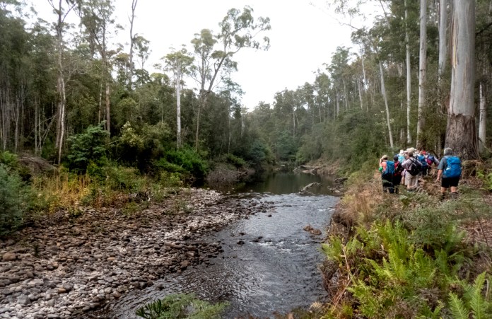
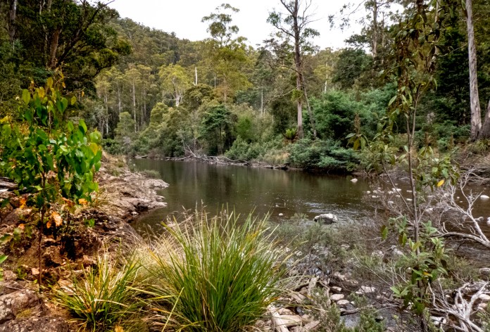
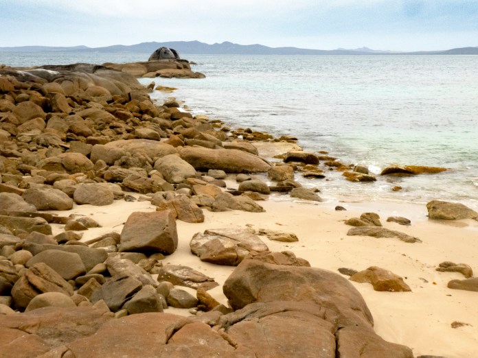
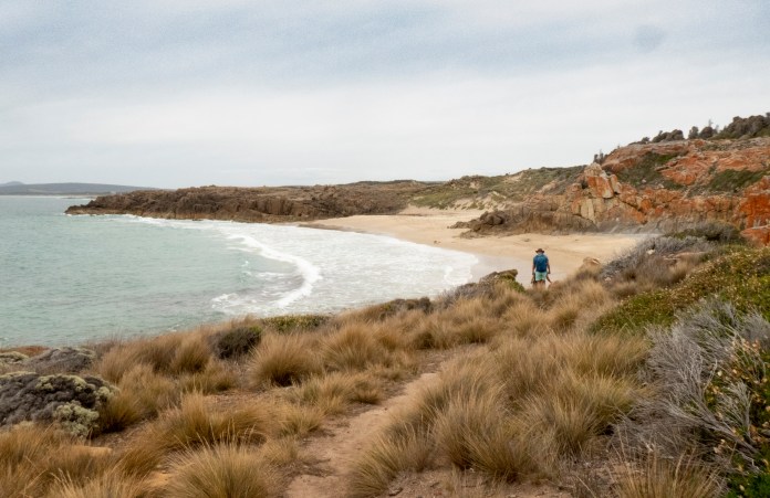
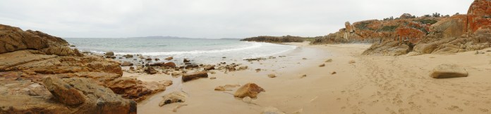
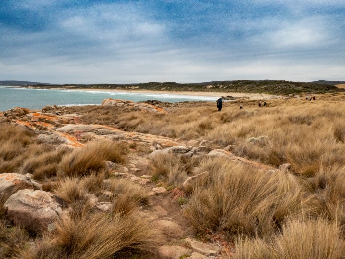
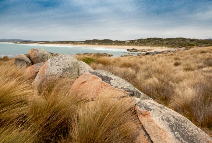
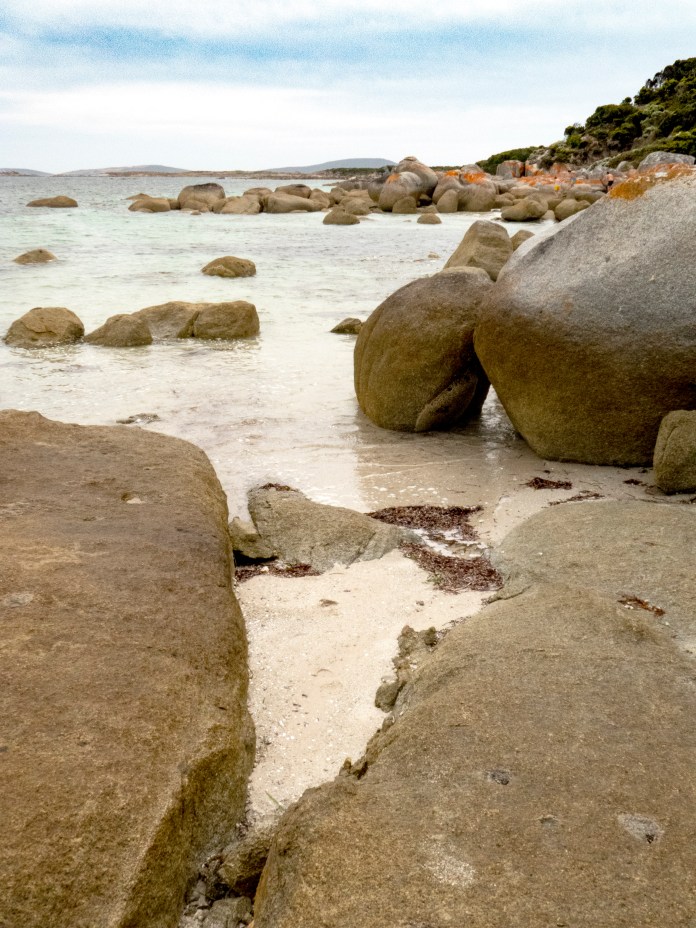
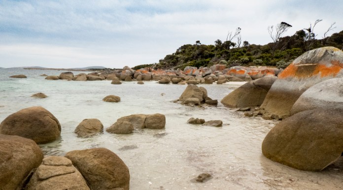
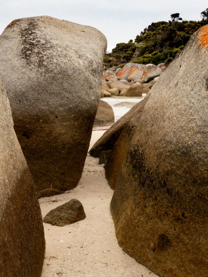
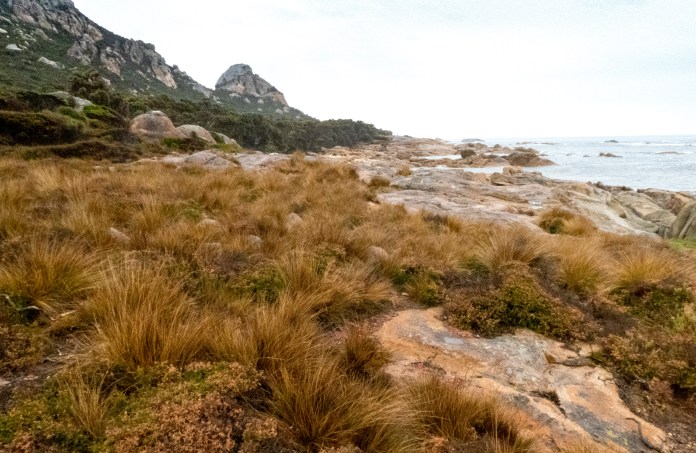
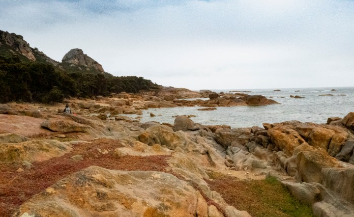
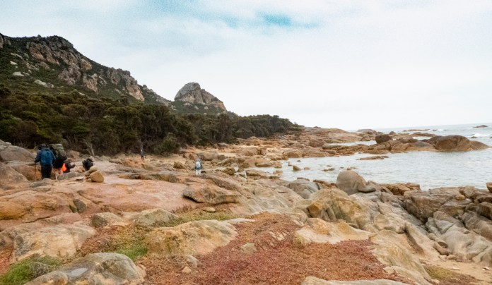
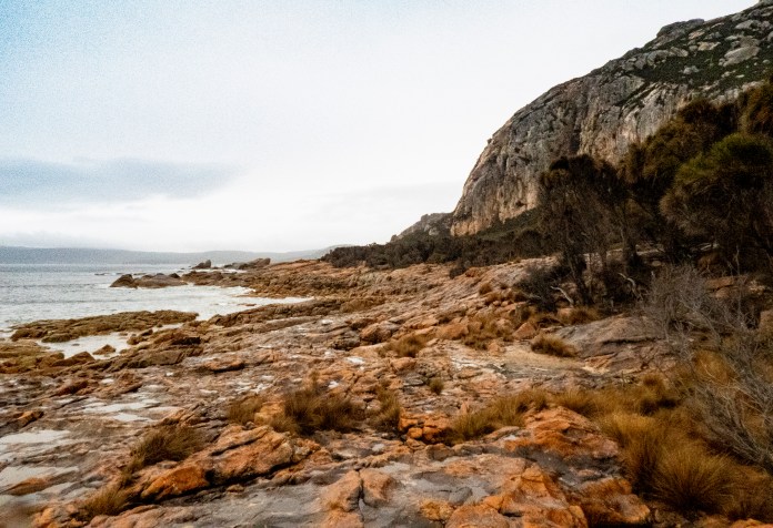
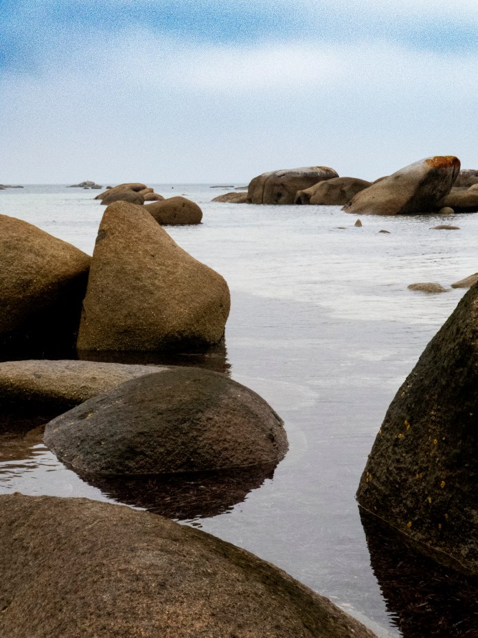
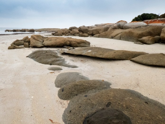
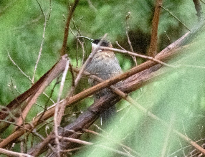
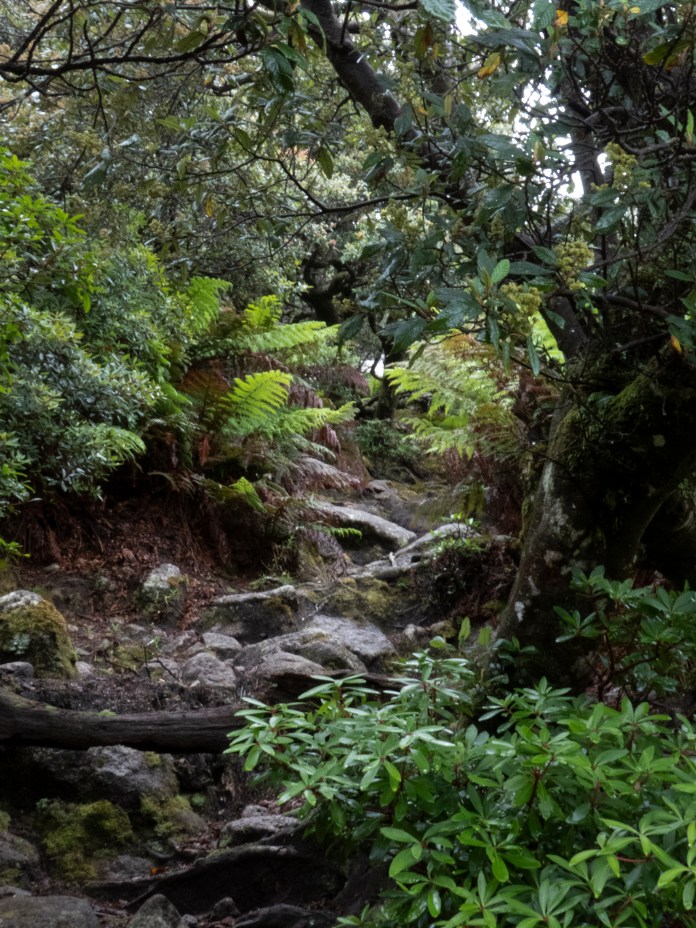
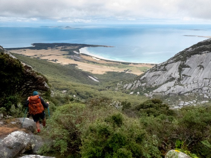
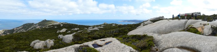
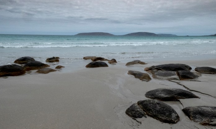
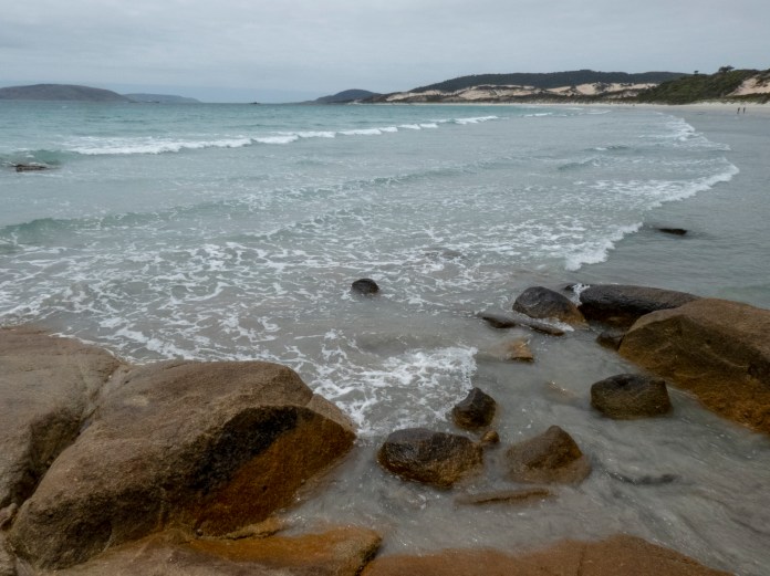
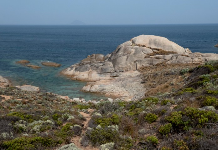
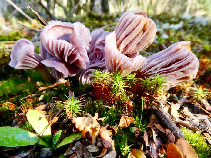
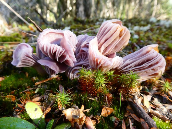
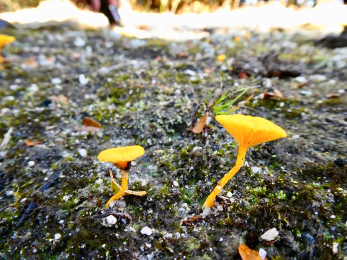
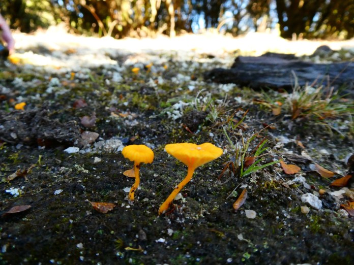
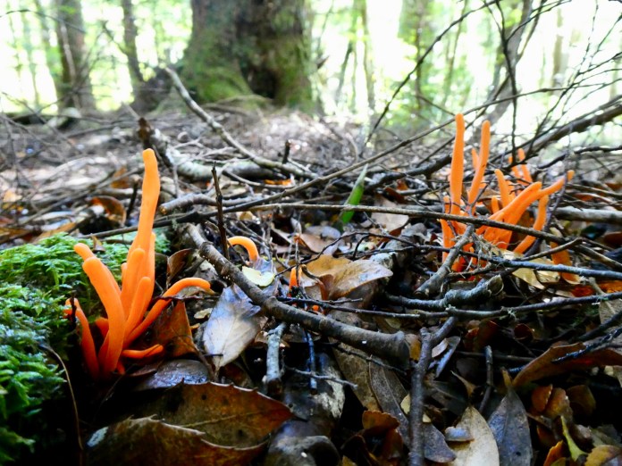
After lunch we boarded the bus for our first walk. We parked at the ramp/entrance to All-ports beach. The route is a perambulation along white sandy beaches, interspersed with horizontal giddy rambles over granite spits.Underfoot I balanced on small, wobbly rocks wedged between doubtfully fixed boulders. I took great care to avoid a fall as the consequences of tipping over with a rock wedged ankle are not to be countenanced. There are few shore or ocean birds to watch; there was a Pacific Gull gliding overhead, red lippy on aperky, orange beak. There was pair of Sooty Oystercatchers goosestepping in the shallows before launching into the air and flapping in single file over the water. We saw no migratory birds, and indeed, according to locals, their numbers are way down on previous years. It can only be hypothesized why this is the case. One suggestion is the lack of plankton in the north pacific and waters north of Australia. Muttonbirding is a major industry for Flinders Island which depends on adequate numbers of Shearwaters arriving from Siberia and setting up in their old nests in the Furneaux group. Locals, especially Aboriginals, put their hand and arm down a tunnel, to pull out a shearwater; however, sometimes it’s a sleep deprived Tiger Snake! What a surprise!
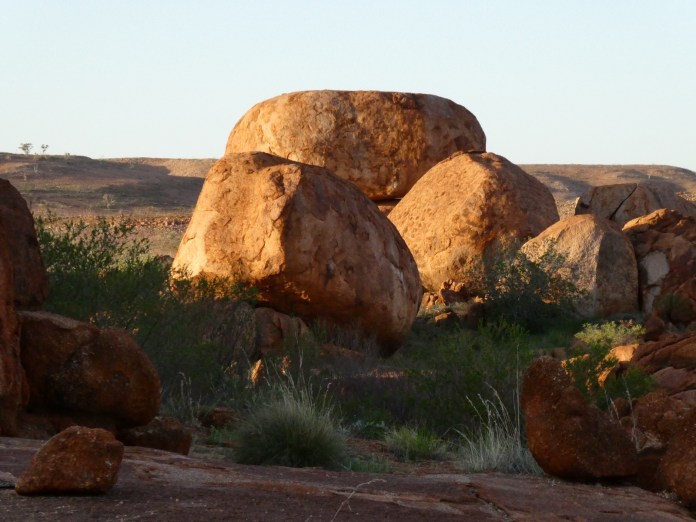
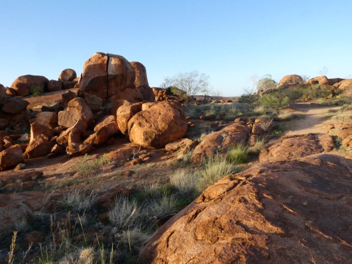
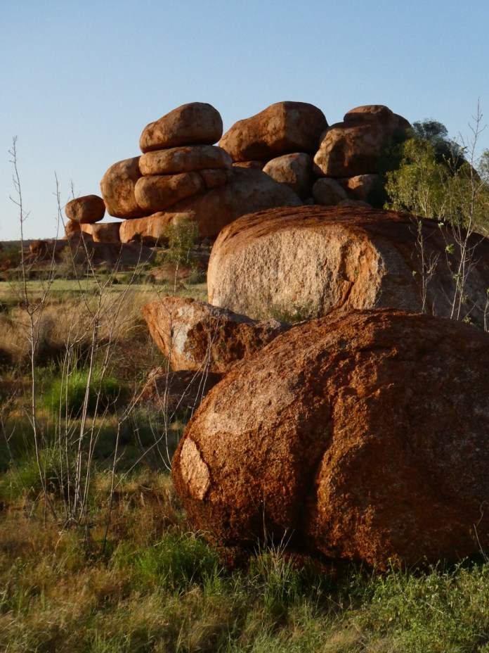
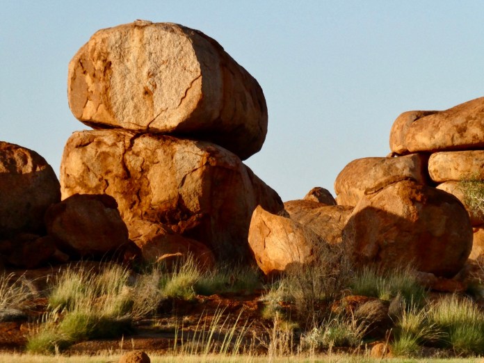
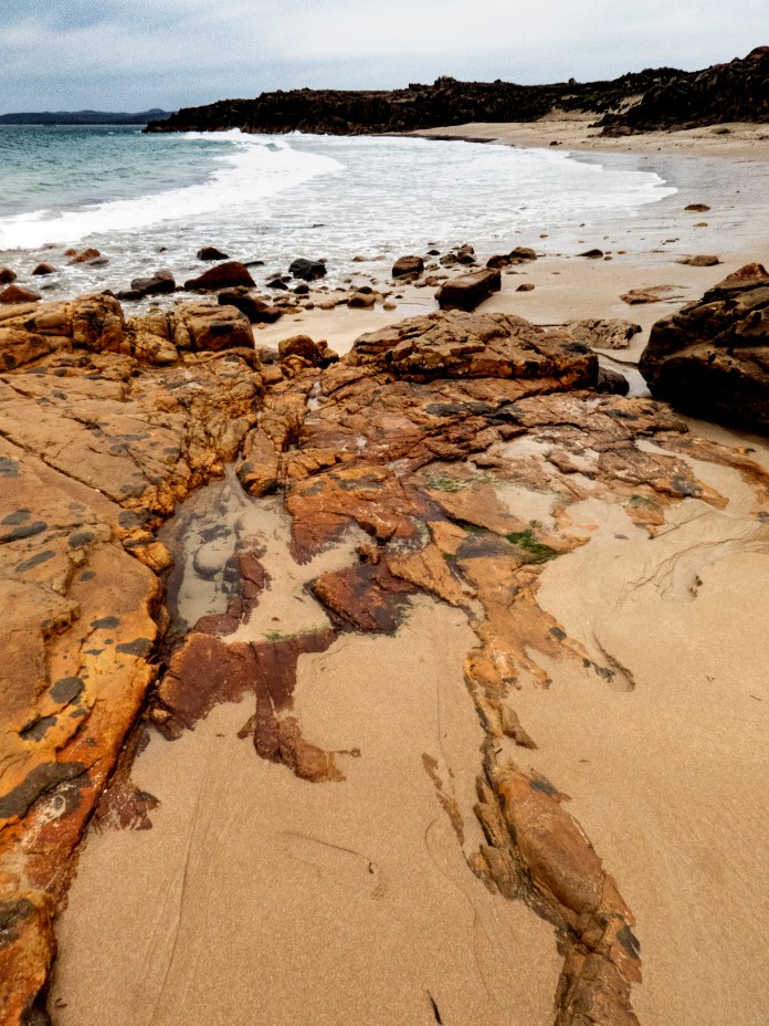
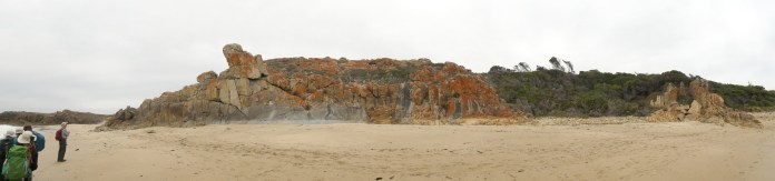
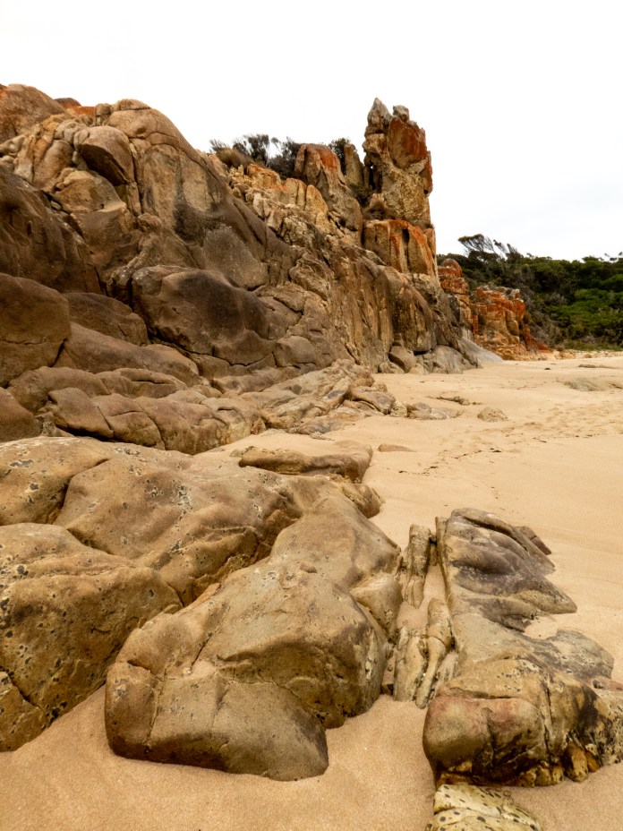
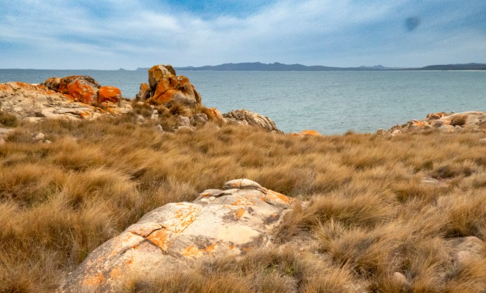
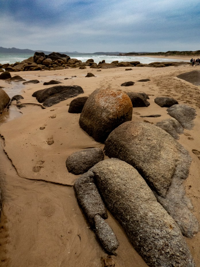
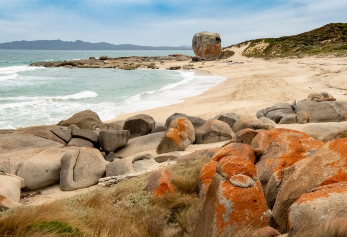
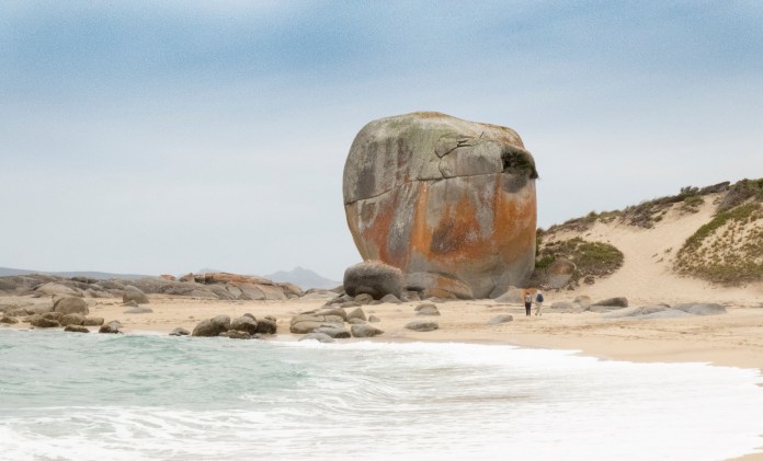
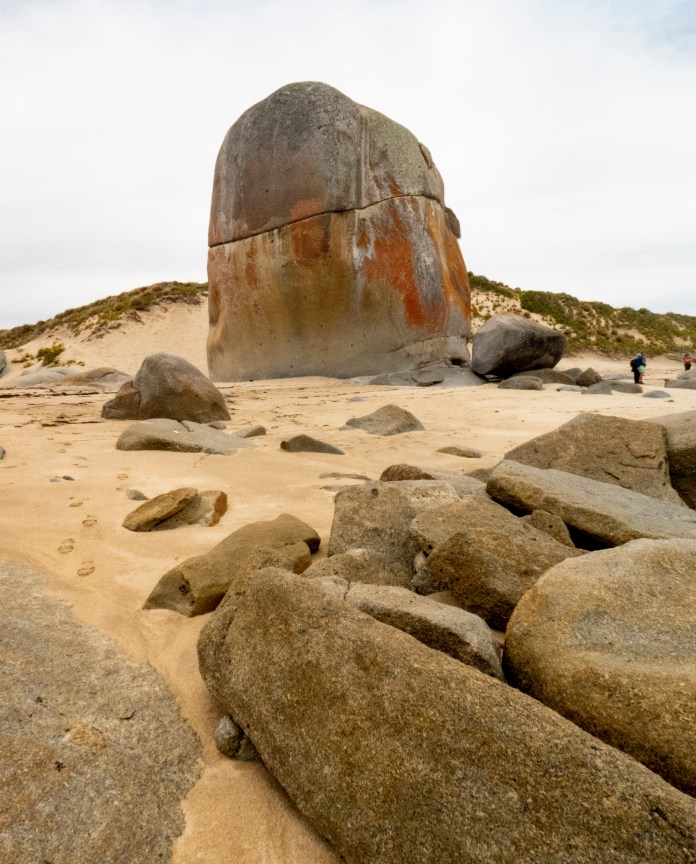
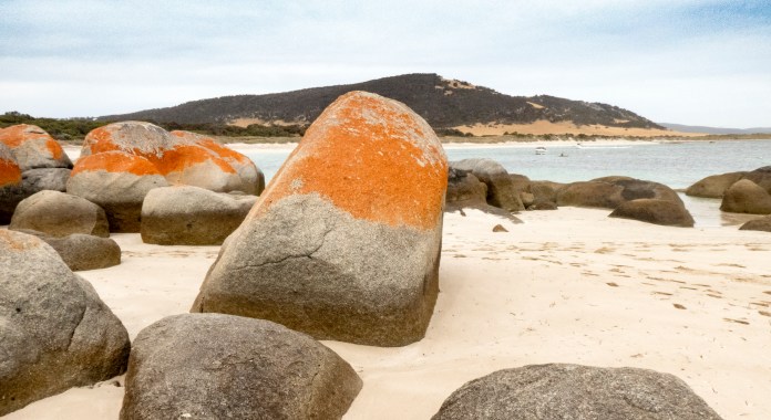
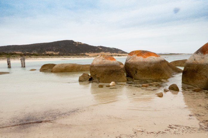
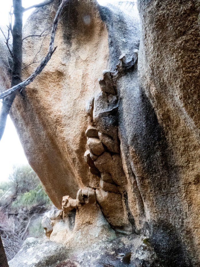
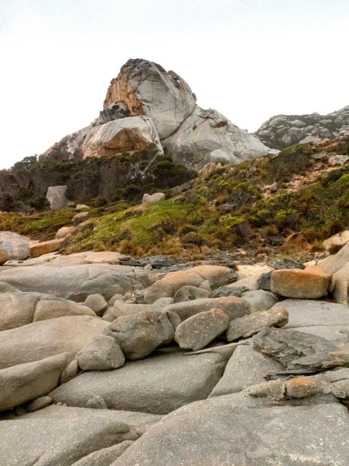
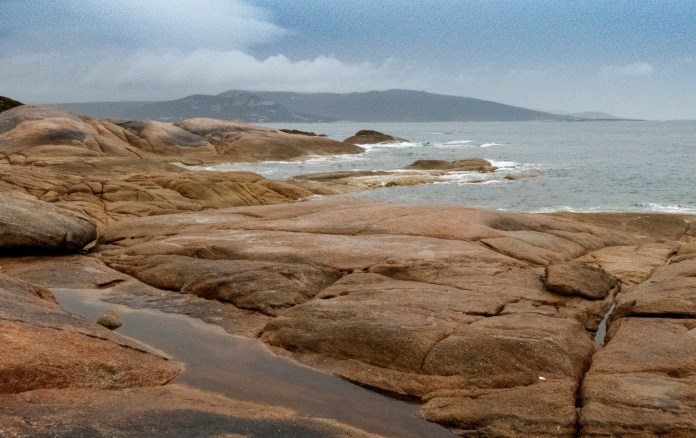
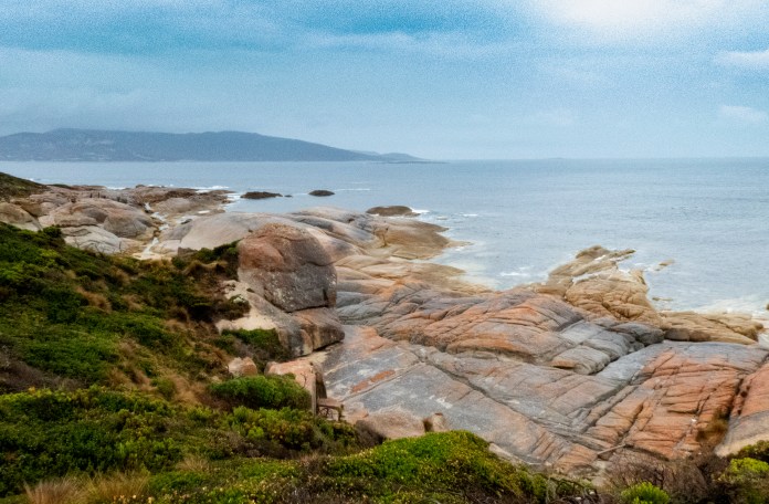
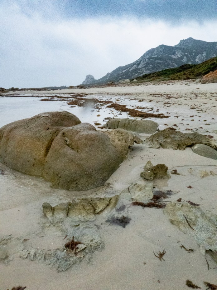
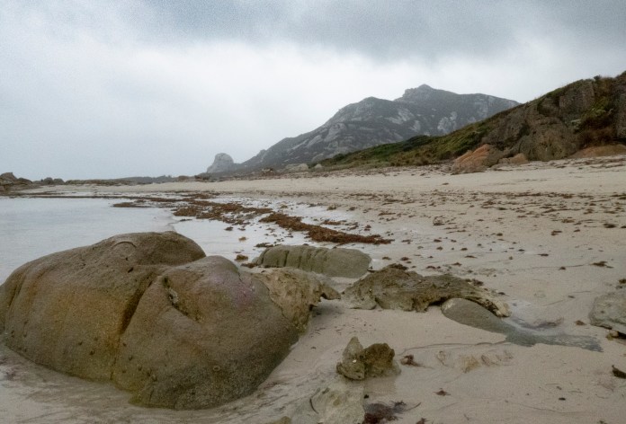
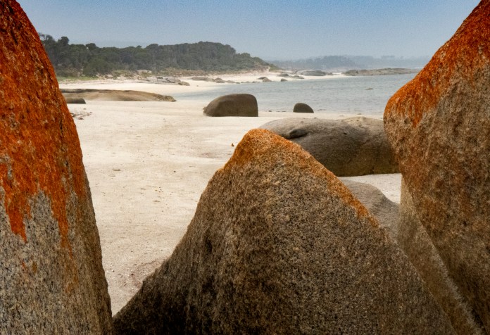
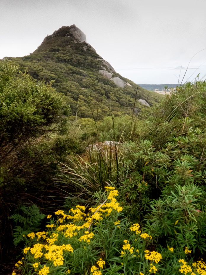
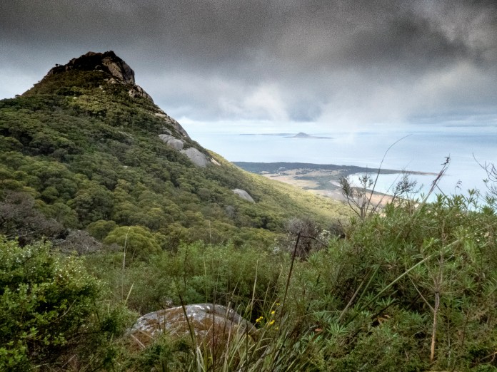
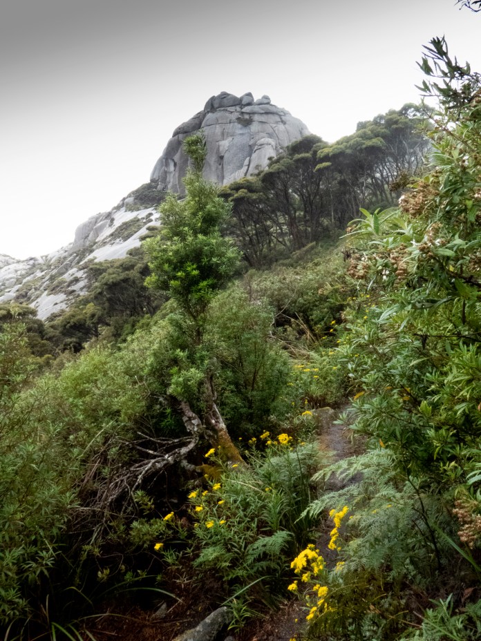
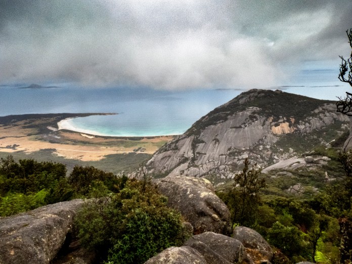
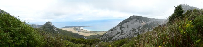
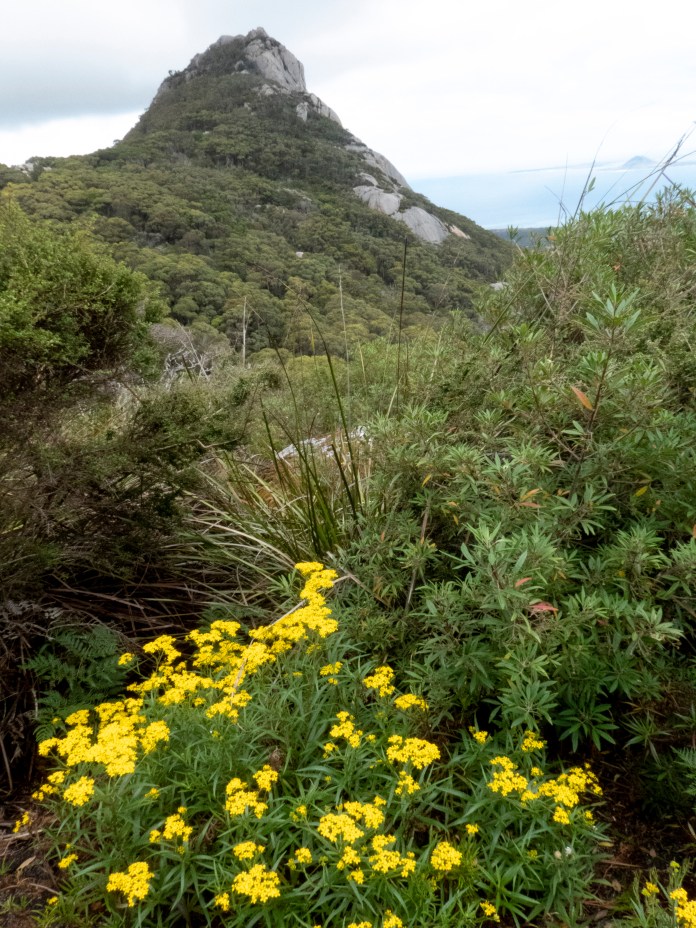
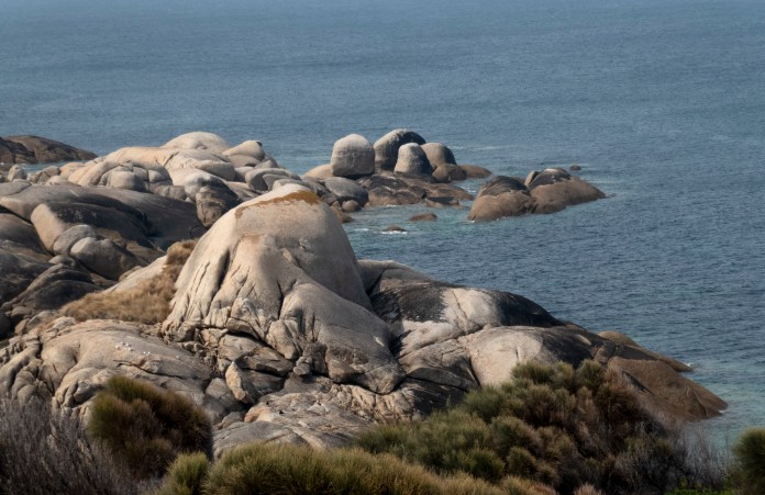
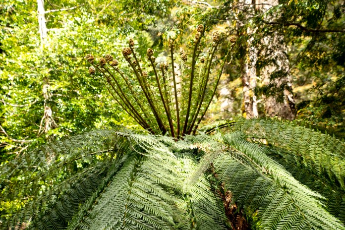
The walk is only a few kilometres, ending at Castle Rock. Castle rock is a large tor situated high up the beach. There is a great crack bifurcating this loaf of granite. It is smeared with red streaks of feldspar and coated with orange coloured lichen. When I studied the surface of the rock, I could feel and see its roughened nature, a dough of stone peppered with abundant crystals. I am no geologist but basically, granite consists of three major ingredients, mica, silica and feldspar that can all form crystals. Granite contains traces of other crystals such as tin or the famous Killiecrankie Diamonds, a less than valuable garnet. These “diamonds” are washed out of eroding granite onto the beaches we are now walking on.
After our walk, we drove to Whitemark to buy any alcohol we wanted. The pub is called the “Interstate Hotel”. This is easily the biggest building in Whitemark. It was built in 1911, boasts a balcony and 32 rooms. Thankfully, the originally installed acetylene lighting has been replaced by electricity. The bar was full of fishermen, farmers and a few firefighters all sipping beers. Two boxed pizzas were waiting to be picked up and smelled rather good! Meanwhile, the solitary barmaid would rest her elbows on the bar, listen to your order then abruptly dart back into the cool room to retrieve a bottle, cask or usually a carton. Flinders Island has its own winery, it is called Unavale winery and its located on the south western tip of the island. Some of the other guests bought a bottle to sample the wine and they enjoyed it very much.
There has been a fire on the north east of the island for the last three days, its nothing like the size or severity of the mainland fires but the local crews were not being complacent about it. The road north was blocked and at least three crews were working there around the clock. The island is dry, the typical Irish green paddocks of Tasmania replaced by fields of stunted, brown turf. The forests and bush in the nature reserves is drier than normal and this is where dry lightning started the current bushfire.
After a brief interlude at the campsite, we visited Wybalenna. Wybalenna is the saddest place in Tasmania. Aborigines had not lived on Flinders Island for 10,000 years before being dragged here in the 1800s. The original Indigenous inhabitants had been on the island from about 40,000 years to 10,000 years ago. They were marooned as the waters rose, flooding their great hunting plain from Westernport to Tasmania to create Bass Strait, and make their homes into islands. The reed and bark boats built by Tasmanian Aborigines are terrific for estuaries or rivers, but these vessels would not have been able to provide safe travel between Flinders Island and Tasmania.
To North Tasmanian Aborigines, Flinders Island was the land of the dead. Between 1833 and 1847, the Tasmanian government of the time, moved Aborigines rounded up around Tasmania to a settlement called Wybalenna. It is now farmland with little indication as to its previous notoriety. Large compounds built to house the 134 Aboriginals have gone, though the brick chapel has been well restored and at least there is some information here about what happened to the men and women transported here. George Robinson convinced and cajoled the Aborigines he met when travelling Tasmania, to come here. I doubt they had much choice.
When only 47 Aboriginal people were left alive, the facility was closed and thesurvivors were moved again, this time to Oyster Bay in eastern Tasmania. The people at Wybalenna died from malnutrition, neglect and depression. I walked into the cemetery, I saw a few tombstones to white people who are buried there, but there is only one marker, one plinth, that lists the number of (approximate) Aboriginal dead scattered in the earth. MJ asked me what I felt, I said I felt physically sick.
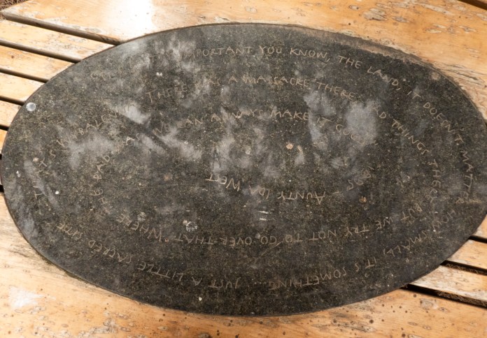
I was looking with a very jaundiced eye at this place but two things lifted my mood; a local farmer, physically indigenous, was pleased our group was visiting and learning about Wybalenna, giving us a cheerful, thumbs up and wave as he drove his Ute along the gravel road beside the cemetery and the second thing was an oval plaque in the garden behind the chapel. I cannot remember the details of what was said but, an esteemed elder, a woman, wrote that though bad things had happened here, good can happen too. No matter how bad things were or can be, there is still a place for good. Our visit here kicked off many discussions about modern Aborigines and how their opportunities and future could be improved not only in Tasmania but all over Australia. Certainly, many stories have been lost, but new ones can be made which could include both white and black Australians. New Zealanders embrace Maori culture, maybe it is overdue for all of us in Australia to embrace Aboriginal culture!
After returning to the campsite, MJ explained that our walks for tomorrow and indeed for our entire stay would be decided by weather and fire. Certain climbs should not be attempted in windy conditions, while an ascent of Killicrankie should not be done in wet weather as a large granite shelf near the summit, can become too slippery for safety.
Overnight, I slept well, I was warm and comfortable with the tents outer fly open but the inner well secured to discourage little visitors of reptilian persuasion. As much as I might enjoy discovering a tiger snake curled up on my chest in the morning, I would not want to frighten the animal by launching it into orbit. I arose in plenty of time for a 6:30 am breakfast. Though it had not rained overnight, there was now a fine damp drizzle, so we enjoyed our meal in the tent. Though it is a little cramped, it was better than getting wet before the day had even begun. MJ and Alice cooked up fried eggs and toast for us all. I sat consuming muesli and sliced up banana while I waited.
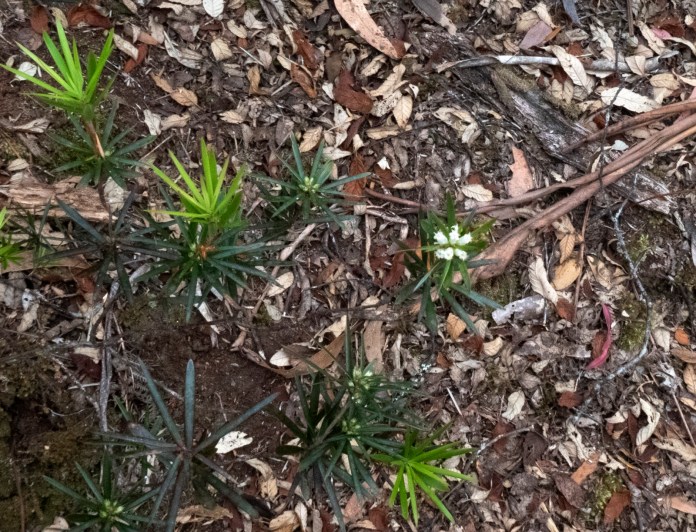
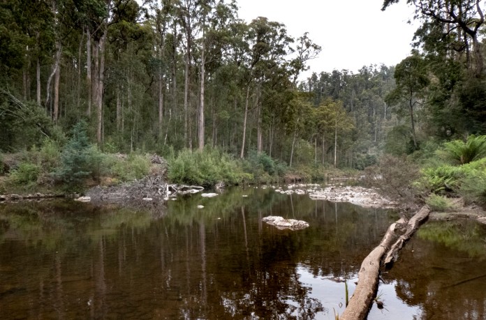
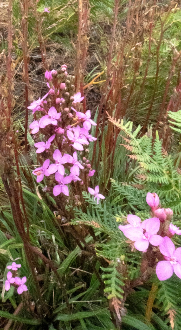
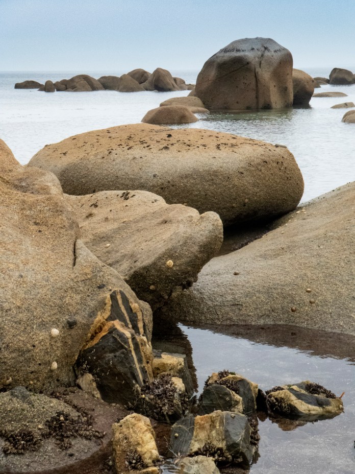
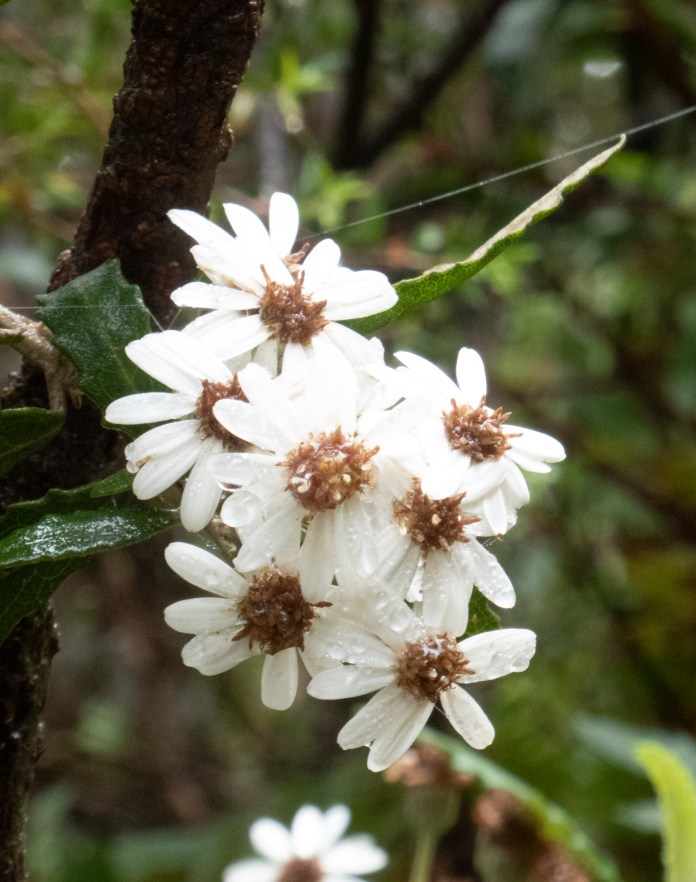
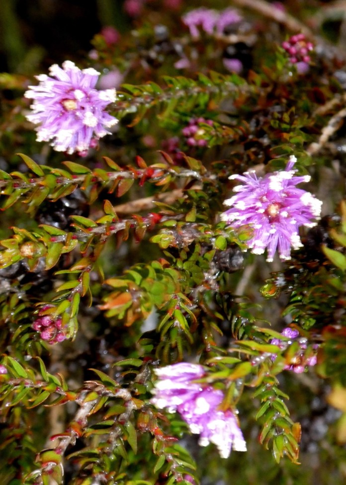
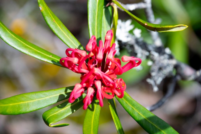
After breakfast, after washing my plates, I packed up my gear for the day especially not forgetting to bring plenty of water. We drove to a parking area near Killiecrankie docks to commence our morning walk to the hamlet of Killiecrankie which is to the south west. The walk commences with a kilometre stroll down a winding 4WD track with some fine views of beaches and granite formations located to the north. The dock is a collection of eroded granite boulders interspersed with sandy beaches and would be beautiful in any weather. The track skirts the coast. It is a mixture of magnificent bushland,rockhopping and trudges on sand. There were many coastal flowers including: coastal trigger plants (delicate purple flowers poised off a single stalk). There was abundant coast wattle; rounded pigface (a purple flowered prostrate clinging to sandy ground); smooth rice flower (masses of tubular, white flowers) and my favourite, twining glycine with its purple pea flowers – a climbing plant sheltering amongst larger shrubs.
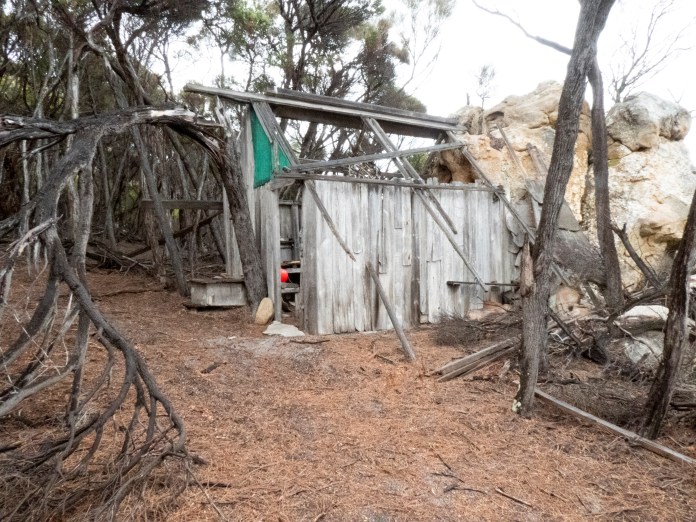
We found an old sealer hut wedged up against a granite wall. The roof was blown off to one side. Most of its timber paling walls were broken, and some supports were askew. Sealers were amongst the earliest inhabitants of Flinders Island. The survivors of the ship “Sydney Cove” regaled their drinking companions in the inns of Sydney with stories of seeing many seals in the Furneaux Islands. The ships used to transport the men and the seals they killedwere small vessels and so many sealers had to bunk in isolated huts to continue their grizzly work of extracting oil and preparing skins while waiting for their ship to return. However returning ships were often delayed, and sometimes wrecked. Dwindling of their provisions made their isolation and privations extreme. Unfortunately for the seals, these marine mammals had no fear of men, and it was not long before they became extinct. This was despite last minute warnings and quotas imposed from far off Sydney. Newly arriving American sealers took no notice of colonial authorities and finished the complete slaughter of these beautiful animals. Sealers lived in these tiny, inadequate huts – all much like the one we visited – for often many, lonely months. It would have been very cold and bleak when sheltering from winter storms and the long nights typical of Bass Strait. For company, they sometimes captured Aboriginal women from the mainland. Their descendants are still living on Flinders Island today.
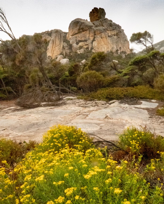
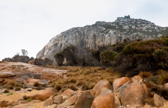
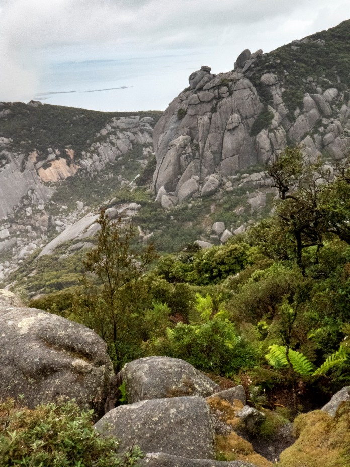
The track was hard to follow in one section, but we soon sorted that out. We stopped there for morning tea and a sit down to ponder the world, on a rocky area with a fine view of a haze covered ocean and the steep hill called Old Man’s Head. This consists of an upward thrusting jumble of granite boulders. It is very visible from Mount Killiecrankie as it arises from its western foothills.Even though it is not tall, its top was still obscured by low cloud. This coast is very reminiscent of the scenery at Wilson’s Promontory on the southern coast of Victoria. Here is the same orange flecked granite, shields of stone, and she–oakforests filling the interstices with green at the lower altitudes, while a plethora of Tasmanian Alpine trees do so at higher levels. The bare rock of exposed summits defies all but the smallest and hardiest of plants. The gnarled shrubs and trees are natural bonsai, hugging water filled rock holes and whatevershelter they can find amongst the stones.
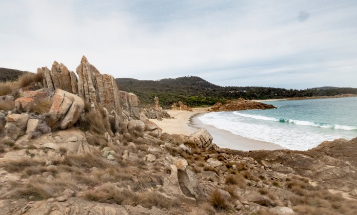
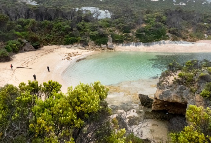
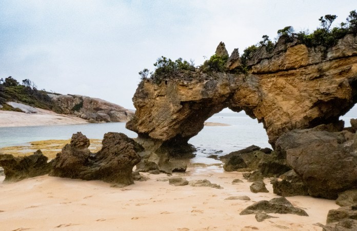
I plunged along, taking photographs and brainlessly leaving the actual path just before I reached the turn off to the base of Stacky’s bite. The idea was to walk beneath it rather than over it! I could see my companions milling about on the beach below me. I threaded my way back into the bush and soon joined everyone else on the beach. I was now the same level as the sandstone arch, named Stacky’s bite. MJ had explained how it formed but I was unable to hear or seek clarification as I was then high overhead on top of said arch. The bite is rough, ripped stone; it’s not smooth at all. This rough surface was created as jagged pieces of ancient sandstone were extracted by torrential winds, surf and sand to create this appearance. Larger fragments were strewn on the adjacent beach, all festooned with drying kelp and sea grass. This sandstone predates the granite of the island. The arch was at one of two headlands that together create an entrance to a small bay. From above, the beach curved gently over its extentand faced a pulsating, jade of entering waves.
Beyond us are many small islands, the breakers of Bass Strait carelessly hurl water up and over them, the cascading water briefly drapes them in a white cowl.
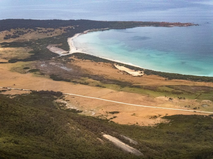
Beyond this little bay, the track soon alters from a bush path to a route on a vast,wide beach. The sand here is grey to white depending on how much sunlight can bathe the sand. This sand is made from the silica grains washed out of the granite backbone of this island and its cousins. after twenty minutes walking, we reached the hamlet of Killiecrankie, a cosy headland sheltered by long granite spits, a few houses nestled in bushland. Two fishing boats were moored in the shallow bay. MJ had prepared lunch for us. By now, due to the constant drizzle and wind, I was becoming rather cool. I had been uncharacteristically diligent in wearing wet weather gear but I had sweated over the walk so my clothes were damp. After lunch I was happy to climb back into the warmth of the minibus and return to the campsite to put on fresh, dry gear.
In the afternoon, we visited the Furneaux Museum. About five years ago, enthusiasts of local history received a grant to set up this wonderful museum. There is a new building which houses the entrance area and main exhibit; an exhibition which changes from month to month. There are four other buildings of historical significance, all related to aspects of island life. There is the whole school- house (named Dryazhell as no alcohol was available locally for the sole teacher) which in addition to information about education, contains geological and natural history exhibits, artefacts of Aboriginal life and many fine paintings and photographs of famous ships which worked or came to grief in Bass Strait. There is an old mutton birder shed with photographs and exhibits of how the killed birds are still processed. Another shed contains larger artefacts including old machines used in farming and shipping. Even medical care is discussed with a doctor’s leather bag from the 1920s, anaesthetic and surgical equipment. In the main exhibition hall, the display was about island graves; too many children died of infections and other – now preventable – diseases while most adults also died long before their time.
The museum is managed and totally staffed by volunteers. It is an excellent museum located at Emita with views of All-ports beach.
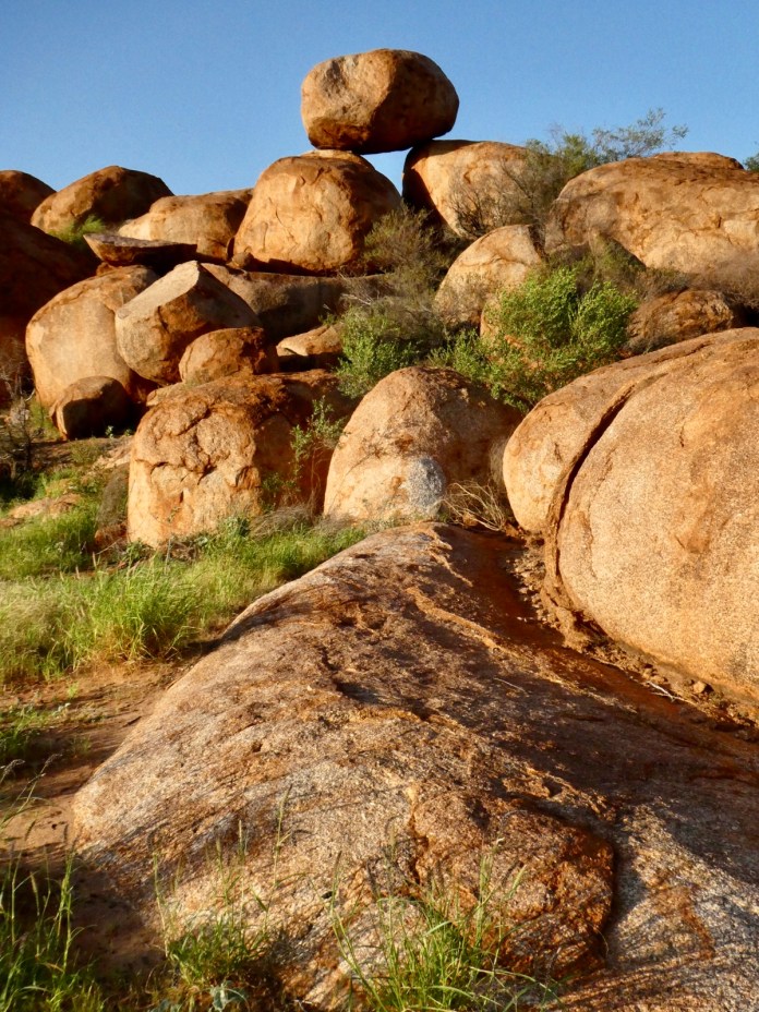
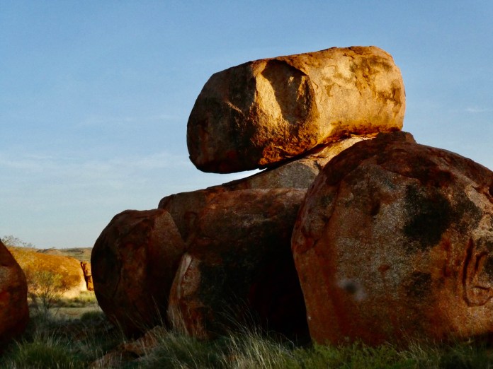
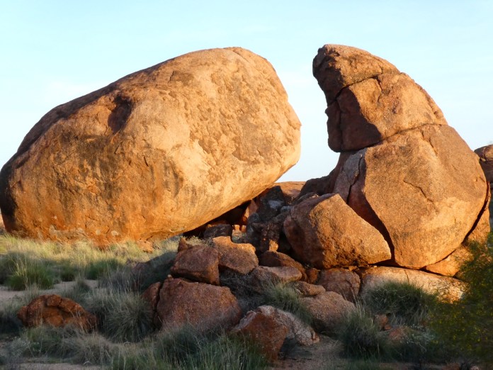
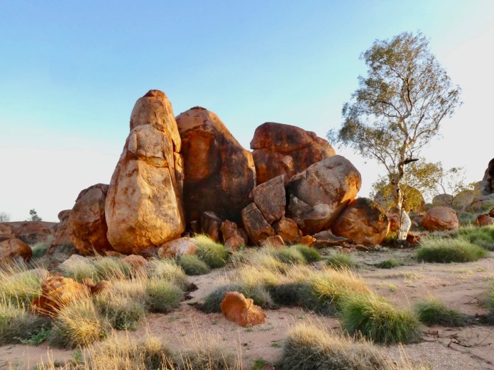
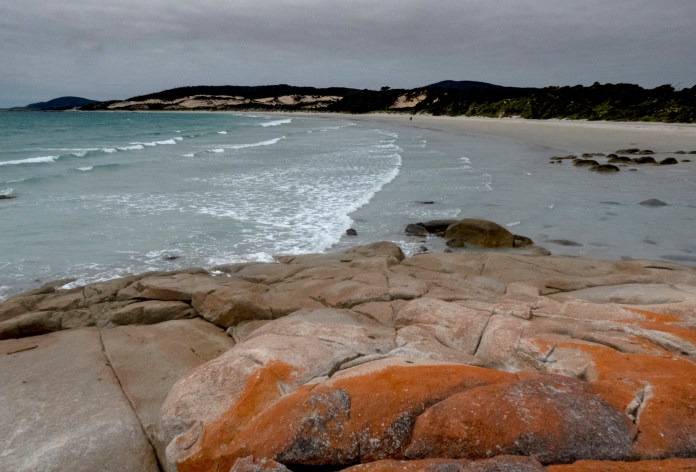
My favourite display is a series of drawers containing numerous geological samples from around the island. An accompanying booklet explained the significance of each rock or fossil. I read with interest how granite forms and of what it consists. Granite arrived in Tasmania a very long time ago. Between 350 and 400 million years ago, magma swelled up from deep in the mantle, and was trapped deep underground by sandstones that had been created from the sandy floors of shallow seas 50 million years before that. When magma cools slowly, it forms crystals, principally of feldspar – an iron containing mineral which is naturally orange or red in colour–, mica and silica/quartz. These crystals give a graininess to the rock – scientists recognised the similarity to grain, in Latin,called granum – grain – hence granite in English. Magma which cools more quickly than granite but is still underground (intrusive), is much smoother when it solidifies – and it’s called dolerite. The granite here is Jurassic in origin, thus coexisting with the time of the dinosaurs – so when you look at granite mountains on Flinders Island you should imagine how these impressive structures have eroded from Himalayan dimensions over the last 200 million years. Erosion – powered by the action of ice, glaciers, sand, wind, lichen, plants and water – acted to smooth, rip and crack the boulders and monoliths into the amazing shapes we see on Flinders Island today.
I think it is obvious how much I enjoyed the two hours I spent at Furneaux Museum. I would be delighted to return there.
After our visit, we back tracked to Whitemark for supplies then back to the campsite. The steady rain meant we had to huddle inside the tent to enjoy dinner – a splendid chicken kormas. The rain ceased during the meal and the wind rose, blowing steadily for most of the night.
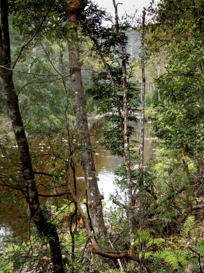
On Tuesday, the weather was Bass Strait fickle. At least the rain allowed us to head north east, along a road that had been closed due to fires. We drove to the north eastern tip, parking the minibus in view of Northeast inlet. This is a long, almost rectangular bay which has truly feral tides. I later read of the many travellers in this area who came to grief negotiating the turbulent tides of this bay. I could not see far, barely across to the other side of the inlet due to thick smoke.
The original plan was to walk north west, cutting cut across to Palana beach to see its famous dunes. MJ decided that the views would be poor and there would be a significant risk of getting lost due to necessary landmarks obscured by mist and smoke. We headed south along the road, repeatedly taking any opportunity to photograph the inlet. Unfortunately, the smoke was aggravating one guest’s asthma, so we packed up to drive off and find somewhere away from the smoke.
We drove to a beautiful beach, waves placidly lapping its clean, white sand; the water is only a few metres from parallel lines of seaweed washed there by the morning tide. In the distance, hovering on the ocean was the blue silhouette of Mt Killiecrankie. What a wonderful walk, boots trudging in the moist sand, green translucent water bubbling into wavelets to my left and above me, a wild sky, a churning battle of smoke, wind and rain.
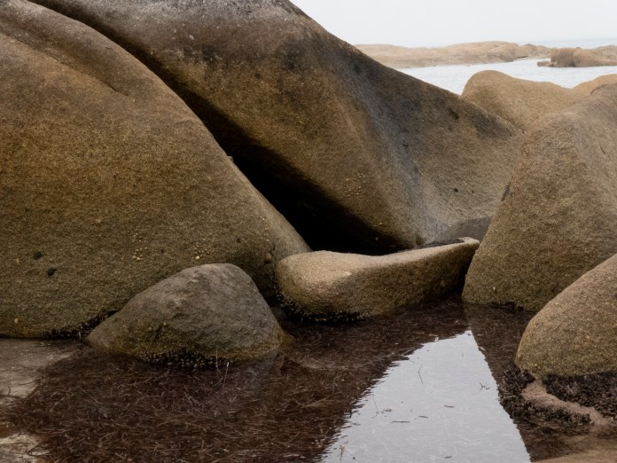
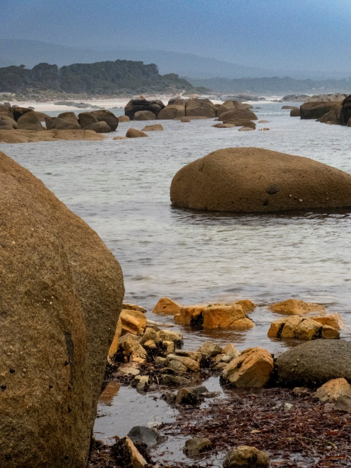
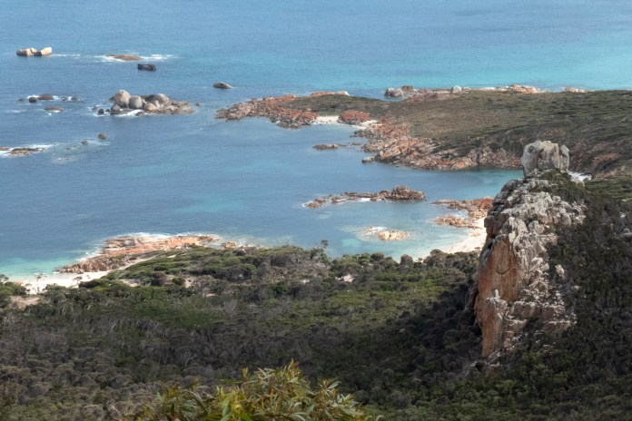
We could not see our destination until we were quite close. Blue rocks is a point of land littered by blue granite boulders and huge sheets of blue stone. We stopped here for morning tea while MJ scouted a route to the next beach. Unfortunately, land has been sold right to the high tide mark and now some locations and routes are no longer safely accessible. The clamber over slippery shoreline rocks was not felt to be adequately safe, least of all when even more wet and slippery in rain. MJ called Alice on the UHF radio from the road and soon Alice arrived with the minibus to take us to Sawyers Rocks Coastal Reserve for lunch and the opportunity for yet another beach ramble.
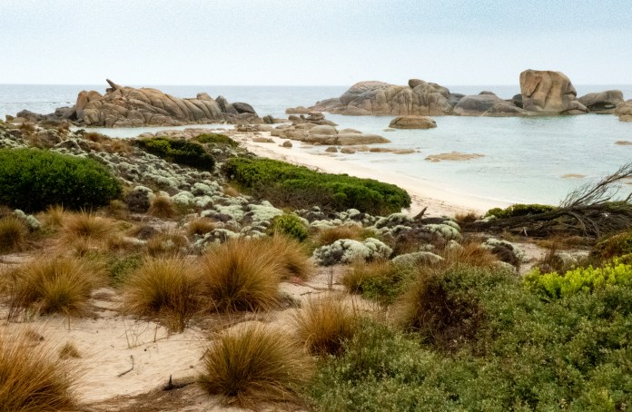
Happily, our time at this magnificent reserve coincided with the main dry spell of the day. We ate lunch at a picnic table beside the beach before commencing our exploring. This section of coast has many cosy beaches however its main feature are multiple granite boulders and rocks strewn in both water and along this coast. Some boulders were solitary, reflected in still ocean; others in mad groups of wildly, jutting stones, sharp dinosaur teeth stained not red but orange; while some form placid, harmonious clubs, each member an individual with a uniqueness created by wind, ice and deep time. I walked between them, splashing my way through the retreating tide, camera clicking away, each fresh image stealing my attention from that preceding. Periwinkle, scallops and abalone attach to the lower surfaces of the more sheltered boulders.
I saw one couple taking photos but beside the members of our small group, there was no one else. This sense of isolation, of a natural space to finally be, is refreshing and relaxing. It is a special charm of this island and helps make any journey here especially rewarding.
We drove back to camp for an expedition. MJ wanted to find the route that leadsfrom our camp site to Marshall Bay, in sight of Castle Rock. Our intrepid journey began by following car tracks to the first of four dunes. At this point, the track was harder to follow as it was covered by trees and bush. We skirted the old fence line, now fallen to the sandy ground; darted under bush and trees and climbed up a dune to see the Pacific. I felt a stirring in my chest, like Balboa, who stood atop a hill and saw the Pacific – the peaceful ocean – for the first time. We plummeted down another dune, then arrived at the beach. By now light was beginning to fade, the sky was so dark and hazy, so similar in colour and texture to the ocean, that the horizon was a thin white line, barely lit by the falling sun.
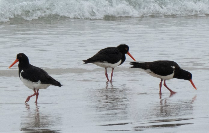
I was spellbound watching three pied oystercatchers. They were marching up and down the wet sand, kicking up water and staring intently downwards amongst the grains for food.
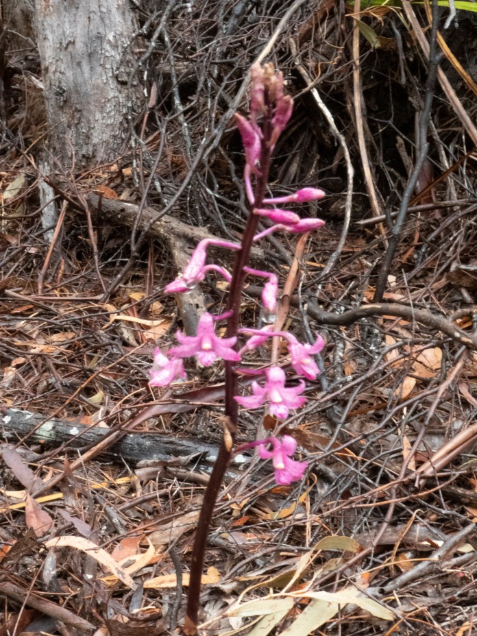
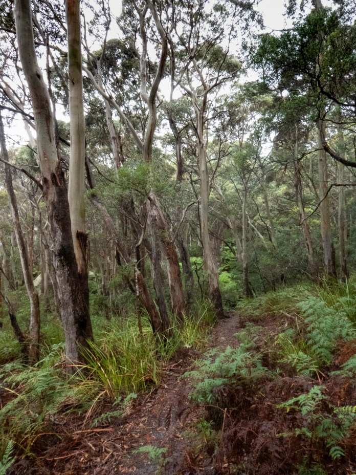
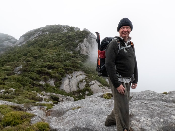
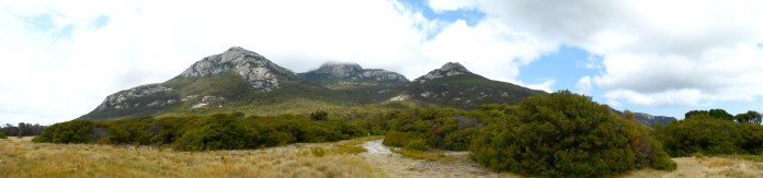
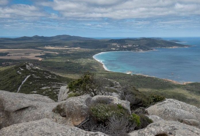
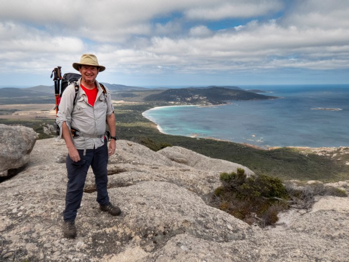
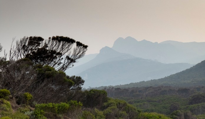
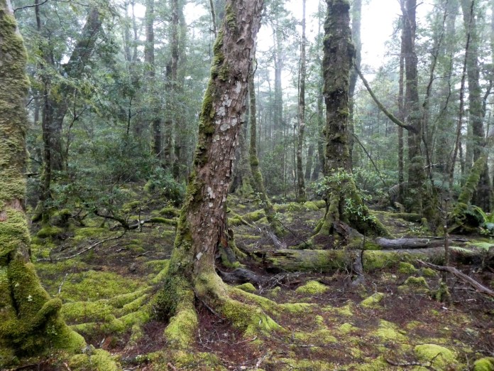
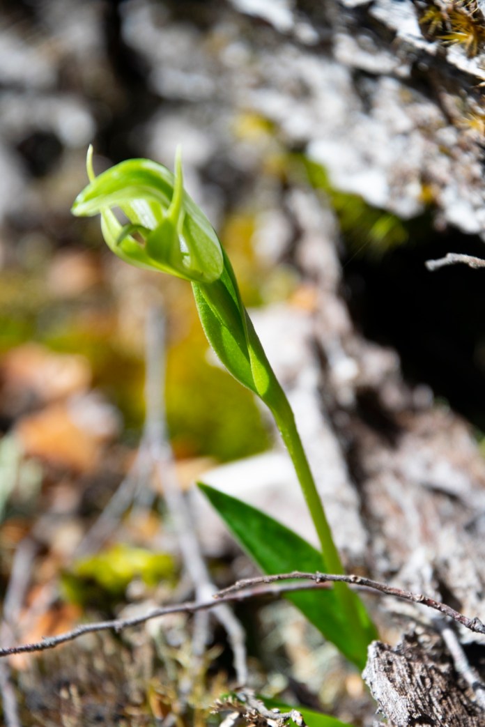
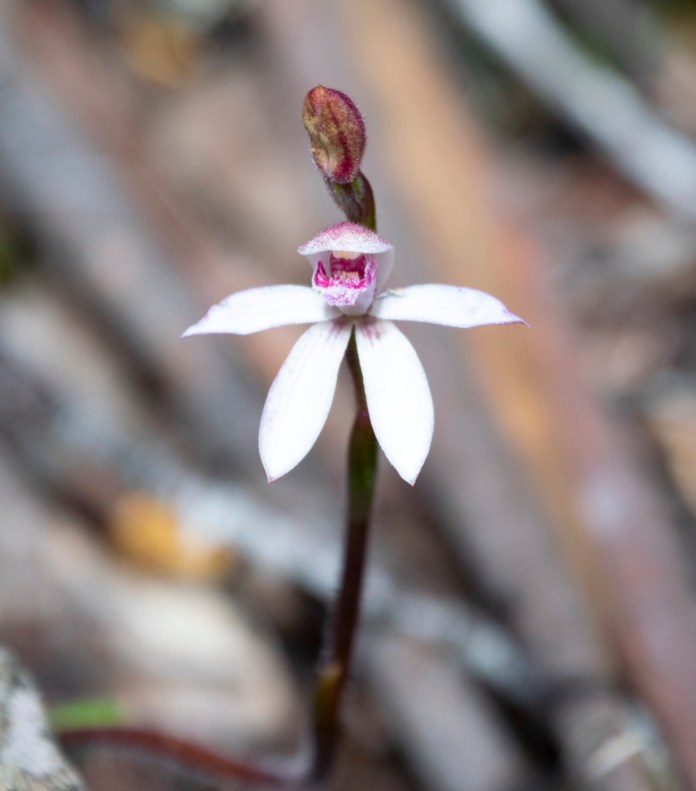
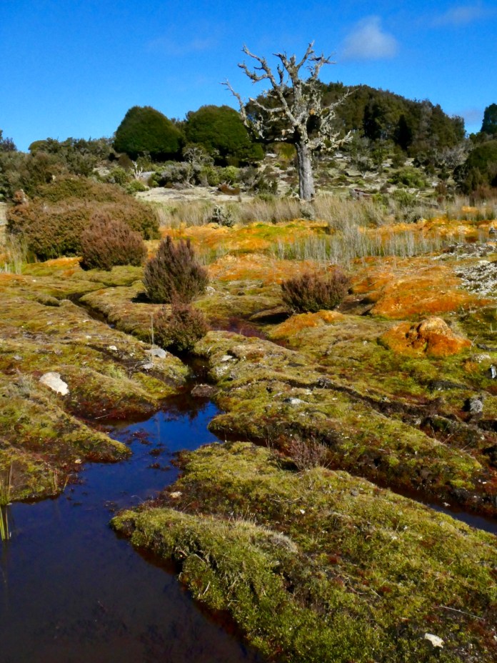
On Wednesday the 8th of January, we climbed Mt Strezlecki. The decision to this was a leap of faith, the “leap” being the plan that the sky would clear enough to make any views worthwhile. It was an early breakfast with a departure at 7:15 am from the campsite. The drive was south to Strezlecki National Park. The walk began with a climb over a fence then into the lightly forested foothills of the mountain. It was a steady climb up to the peak at an altitude of 756 m and about four kilometres from the start. The type and density of vegetation changes radically with the ascent; beginning with coastal forest below to alpine mosses and spare natural bonsai near the peak. One of the highlights of my journey on the island was discovering a hyacinth orchid standing proudly upright beside the track. This beautiful orchid is much smaller and more delicate than its cousins in the Victorian High Country, but its bright magenta colouring is the same.
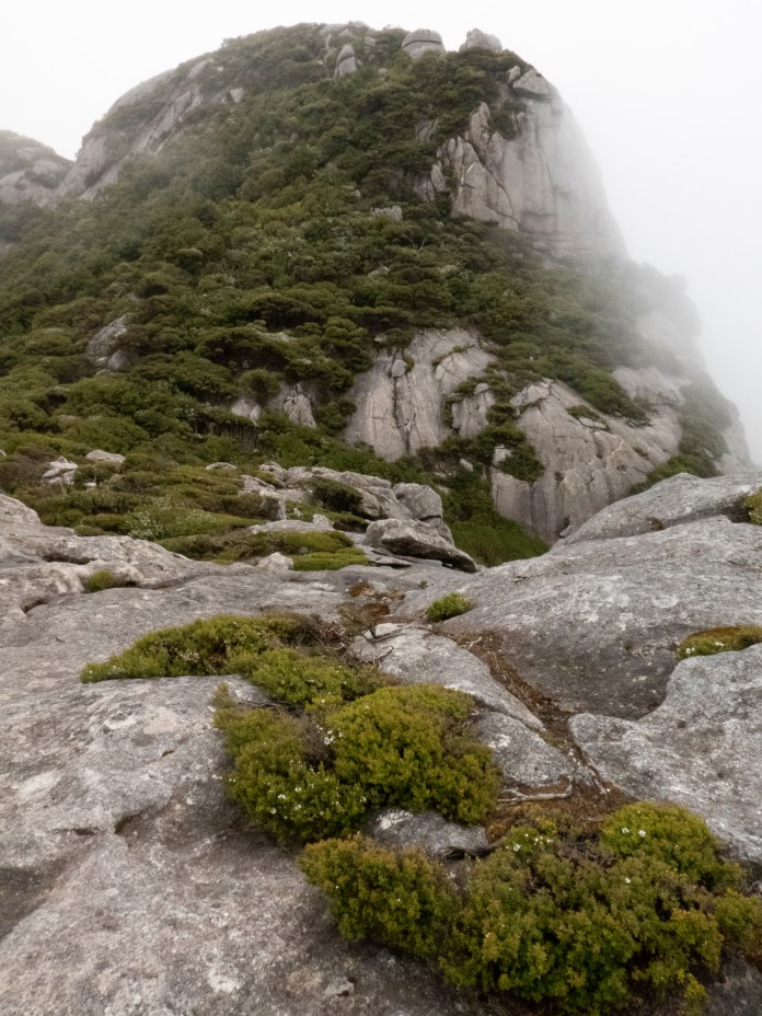
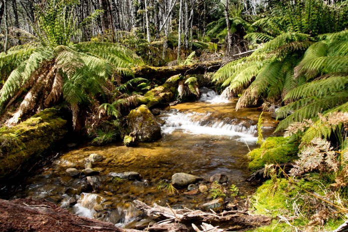
The climb was doggedly upwards except for brief respites; pauses where the track curled its way around rocky cliffs with showers of water raining down to ferns below, a cool glade of tree ferns nestled around a dry creek and at the switchbacks that separated the steadily steepening ascents. Views to the beach below and the Furneaux Islands beyond were fleeting, obscured by cloud. When the mist briefly dissipated it allowed glimpses of a peak or one of the other mountains arising from the Mount Strzelecki foothills. As we rose higher, the cloud rose even faster finally giving us some magnificent views. However, the pinnacle of our climb remained hidden and mysterious above us.
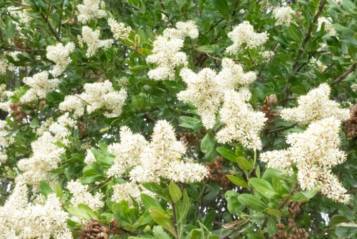
There many trees and shrubs to admire, as well as many flowering bushes and plants creating gorgeous white and yellow masses of colour. There were Pepperberry, Dogwood, tall Rice flowers, the much taller Blackwood and all sizes of ferns, from those that grazed our knees to those under which we hiked.
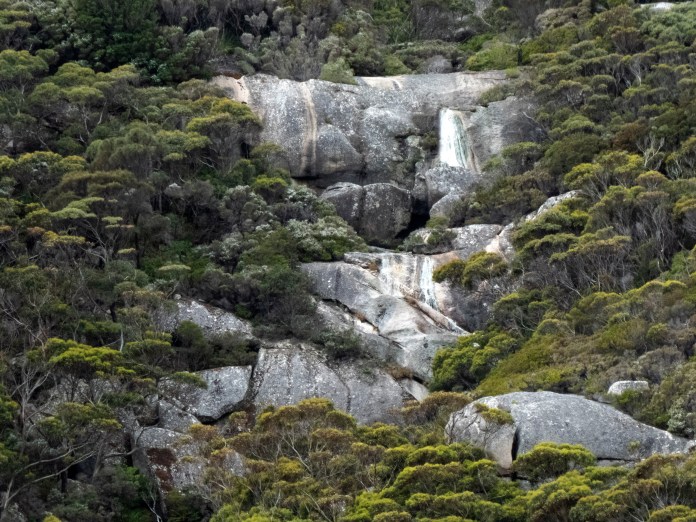
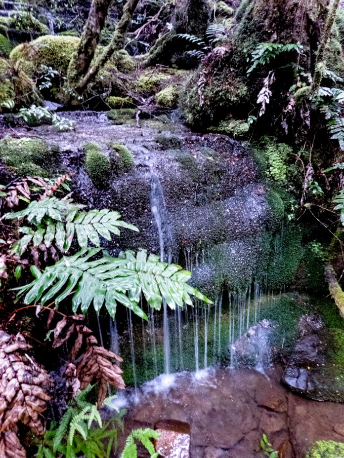
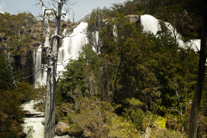
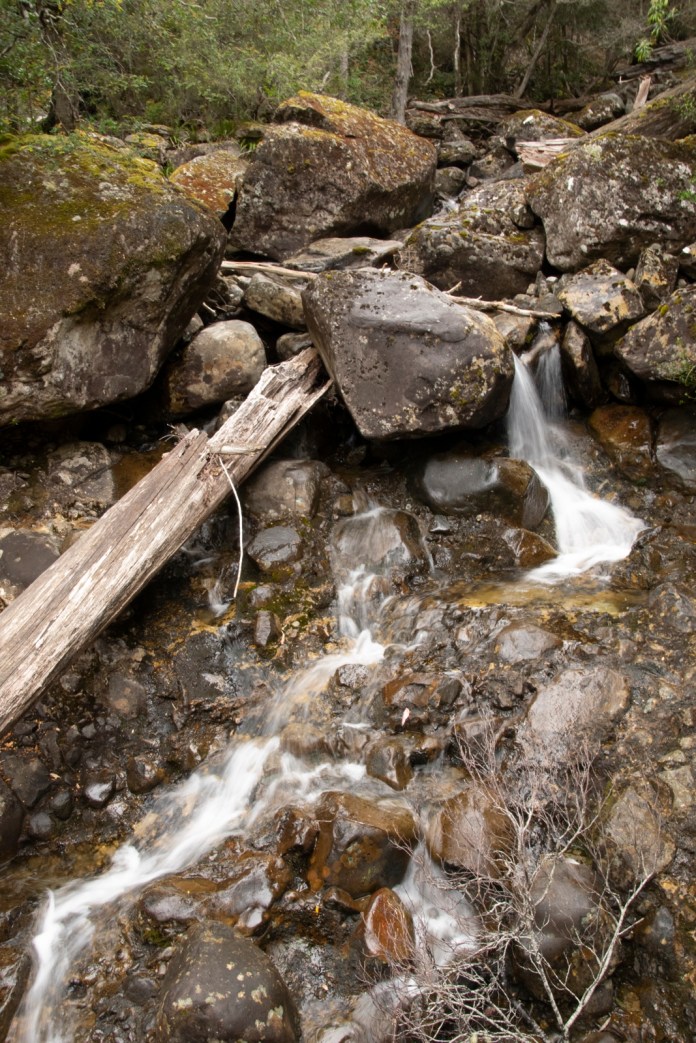
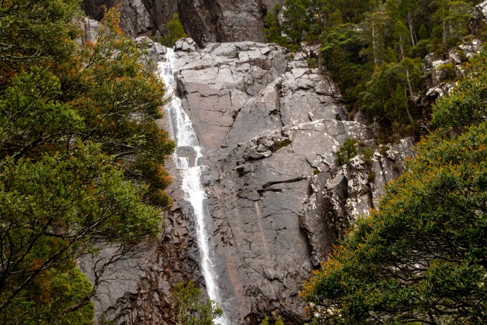
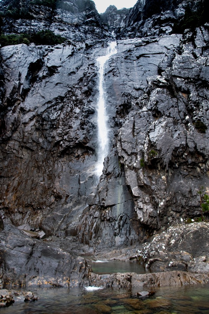
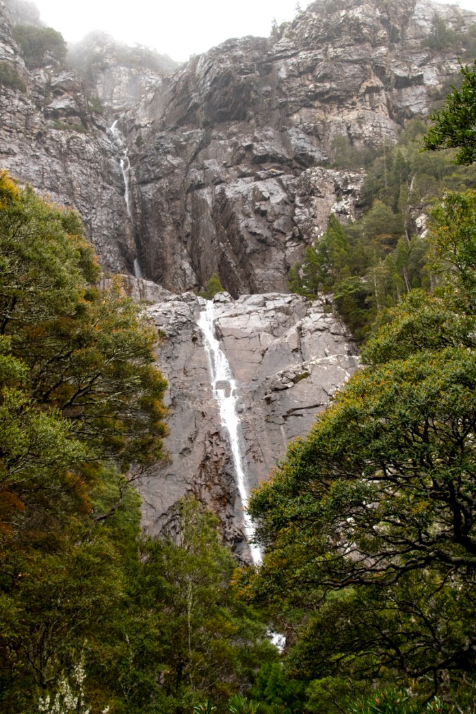
As we climbed into sub alpine forest, the atmosphere was refreshing and moodily beautiful, mist left streaming damp onto the leaves and branches as we pushed them aside. Water condensing directly from clouds tumbled down graceful mossy stone cliffs forming streams which dropped to a two tieredwaterfall we had already seen from the track below.
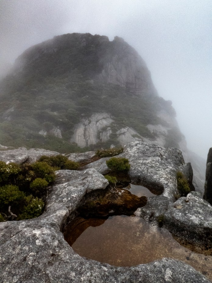
The track is rough and steep and becomes more so, challenging us technically as we ascended. I did not find it easy and was getting apprehensive about the looming descent on a slippery trail. A few of our hikers opted to wait it out on a sheltered corner. Those of us who persisted arrived on an exposed rocky shelf, overlooking a saddle with the final climb before us. The final ascent was quite steep and covered in cloud. We decided to pause here before heading down the track. We stared through the mist only able to see vague outlines of the peak, then suddenly and only for a few moments, there was a gap in the cloud, revealing its striking appearance towering against the forests and lesser peaks.The gamble had paid off!
It was cold at our viewpoint so could not stay long and soon commenced our descent. The track is slippery even in dry conditions, so extra care was needed today. I extended my walking poles, converting me into an ungainly quadruped but the extra support and stability they provided were very valuable. I slipped occasionally but never seriously, carefully placing my boots in clefts or wedges and then lowering myself down. The hurdy gurdy of the racing descent is not for me. MJ emphasized the benefits of descending sideways, so if you do fall you land on your side and not on your head.
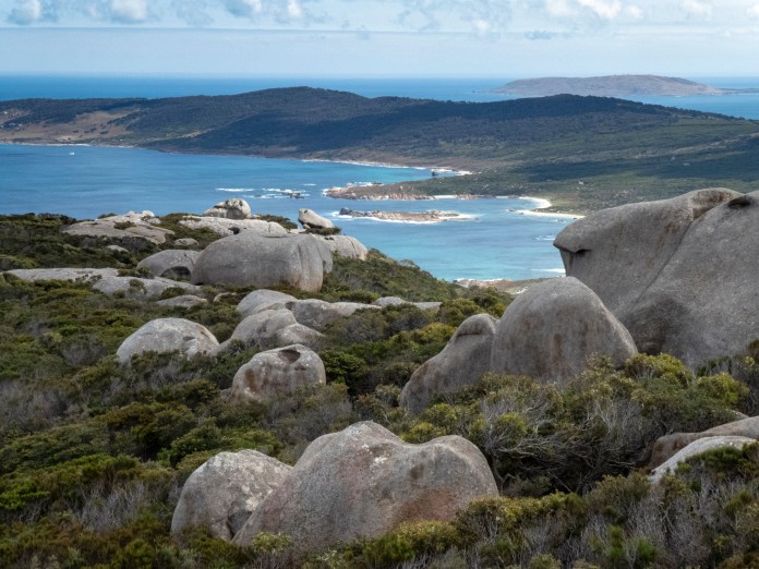
The track became less demanding and less technical as we dropped below the 500 metres mark, returning to a pleasant stroll through a shrub lined track with fine views over Bass Strait and the islands: Mount Chappell Island, Badger Island, East Kangaroo Island and Big Green Island: all of which lie to the east of Mt Strezlecki and the coast.
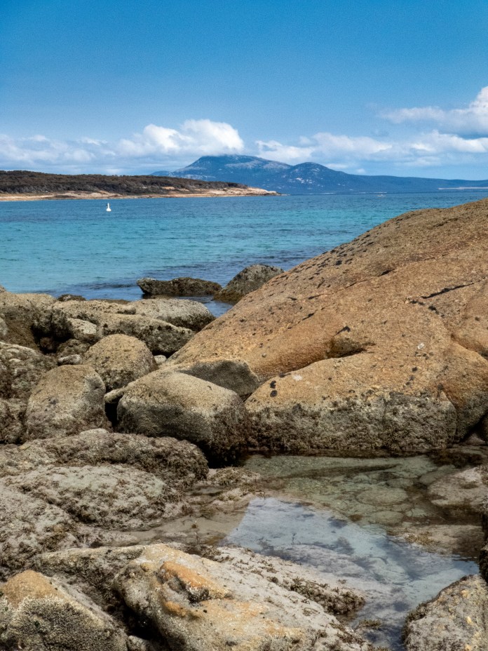
After we returned to the bus, we drove to a bay with fine views of the mountain and its accompanying range. Trouser Point beach has crystal clear water for ocean swimming. A coterie of black swans cruised the water while a few children played happily, laughing and splashing in the shallows. Their parents watching them from the beach. In the distance I could see the western corner of Cape Barren Island, a mountainous blue tinged island poured over the waters of Bass Strait. While some of the others went swimming, I explored the granite spits and shelves above the water, taking photographs of this wonderful scenery.
On Wednesday evening we had dinner at the Flinders Island Golf Club. We all enjoyed our selections from the marvellous meals on offer. I had gnocchi and it was terrific. The only ill fortune of this otherwise great day was that one of the hikers injured her ankle stepping off her tent platform.
On Thursday, we were all a bit tuckered out but only one of us had an injury worth noting. Unlike Wednesday. We had a slow start with my usual muesli,fried eggs and toast for breakfast. The plan was to walk up Mt Killiecrankie. So rather than walk along the coast from the docks, instead taking the narrow, sign posted track to the top. Mt Killiecrankie is half the height of Mt Strezlecki and thus lacks the splendid variety of flora of its taller southern cousin.
The track winds its way gently upwards through tea tree and silver banksia, then ascends amongst a garden of granite sculptures, the work of father time and erosion. It is these wonderful formations that inspires interest; there is the Oneeyed man that resembles a character from the pen of Hogarth, all bulging cheeks and hooked nose. There are tors rocks hollowed through their bases creating sheltered pools and caves .All the wild shapes channel the wind into a whipping hourie blowing off our hats.
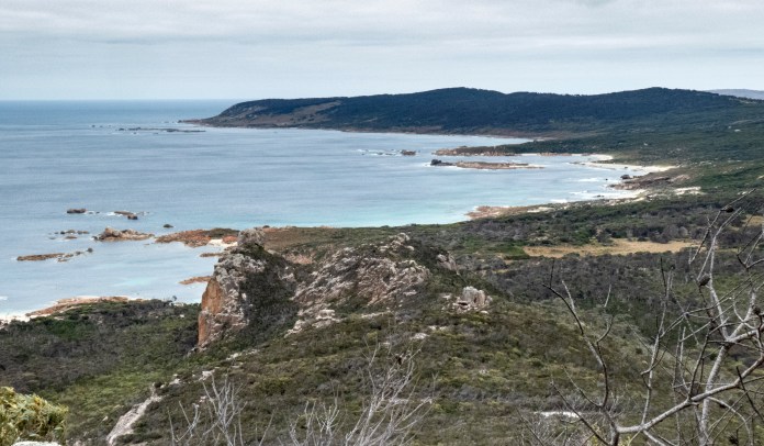
We negotiated a low cave then a narrow split in the granite to reach an ascending slope of granite. This the end point if there has been any rain, making it dangerously slippery. We climbed up it to re-join the track, then it was a short path to the final climb, a balance up some steep granite boulders. I demurred at this point while the others went to the Trig Point. I camped out below but had wonderful views of Mt Tanner, the green hinterland and the townlet of Killiecrankie at the head of Killiecrankie Beach.
I was high above the rock formation called Old Mans Head about which we had walked a few days before. I spent a relaxing thirty minutes admiring all these views from the serenity of my rocky eyrie.
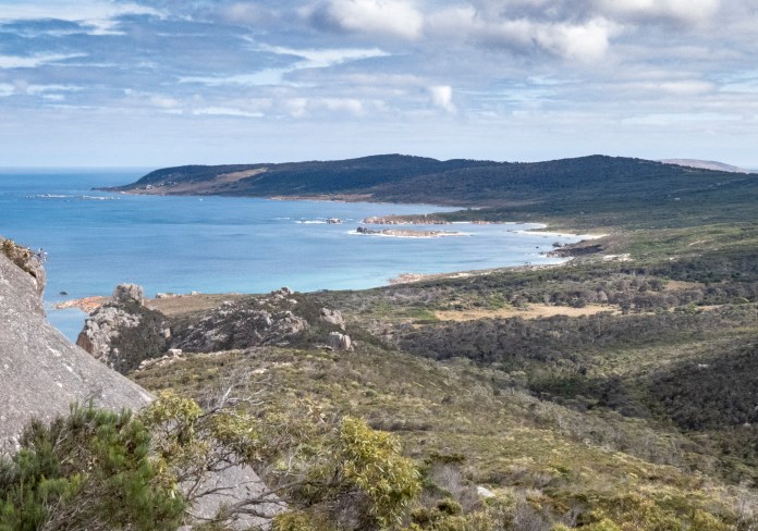
As we descended, we met a few groups on their way up, including a small dog named Trixie. The sky had cleared substantially over the morning allowing unhindered views of the steep massif above Killicrankie docks which abruptly emerges out of coastal forest. Its backdrop are the splendid northern beaches below a cloud-flecked, blue sky.
We soon arrived back at the bus and were conveyed to Palanna beach at the north of Flinders Island. We had lunch at the southern tip of the beach, enjoying views of the two Sister Islands. Sunlit granite shoals are just off the beach. It is truly a magnificent sight, a long stretch of sand, peerless ocean water and waves washing up the beach, great sand dunes piled up above us and birds hunting on the wing: pacific gulls dropping to beneath the surface and then flapping away to an outcrop to enjoy a crab, and oystercatchers pecking industriously at wet sand for worms and tiny crustaceans. My camera then had a convulsion and refused to work. I managed to do a factory reset later and it was all apples. I was very smug with myself as I have never in my life repaired anything electrical much less electronic! After lunch I enjoyed a long, slow walk in brilliant sunshine along the beach, skirting the wetter, deeper sand, and repeatedly stopped to gaze westwards, admiring a gently curving horizon, full of ocean and islands.
After lunch and the walk at Palanna, we drove to Whitemark. I tried the whisky at the café next to the jetty. It’s a local distillation but I did not like it, a bit too astringent for me. I wandered over to Jon the Juggler’s shop, where he makesand sells, sauces, condiments, jams and all sorts of yummy products. I visited the council office for brochures about Flinders Island, and then bought some books at the local newsagent. I was walking around main street, there were three people walking or shopping, and they were all relaxed and charming, smiling and saying hello at any opportunity. This is a grand place.
Back at camp, it was time to clean myself up. I had put the solar showers on the main table, and they had warmed up nicely over the morning and early afternoon. In fact, we had to add some cold water to avoid any scalding. Dinner was wallaby patties and salad, delicious.
After dinner, in fading light, we drove down to an evening soiree at Castle Rock. MJ and Alice cut up a fruit platter which we all enjoyed when chatting and sitting together as we looked out over the darkening ocean. The sunset was lack lustre, but the company was terrific.
When it became too dark, we donned headlamps and scuttled up the sandy path to the minibus. By the time we arrived back at camp, the wind was rising, buffeting the tents and trees. It was not a great night for sleeping as each time a gust of wind blasted the canvas, the rebound would hit me on the head. I had also had two normal coffees that afternoon. At 3am, I was like a meerkat hopping on a mound of hot sand in the Kalahari. I was awoken at 6am by MJ as she walked amongst the tents, calling out that breakfast was ready. I had tidied up my tent, bag and gear the previous evening, and actually located some clean socks and underwear for our final day; fortuitous? Yes?
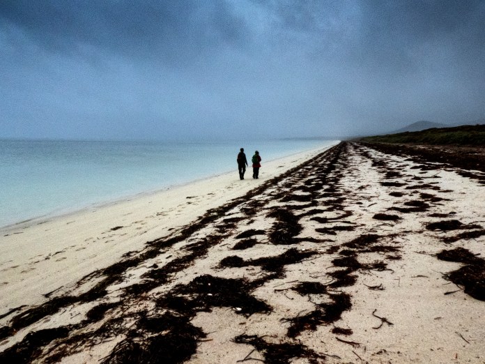
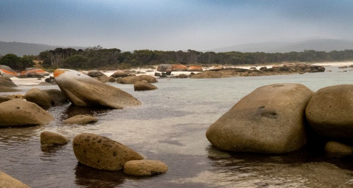
After breakfast of pikelets and muesli, I swept up my tent once more, and carried my bag to a spot near the bus and trailer. I even had time to help with dishes and the general washing up. Anyway, we were all soon packed up and ready to go. We drove south to Trousers point beach. On this occasion we walked the entire length of the beach. Smoke haze had worsened, and the mountains were muted, irregular silhouettes standing up behind grassy dunes and glades of trees. Water was lapping the beach, crunching, walking in sand – white, gritty crystals without number – seaweed with its microscopic cargo of eggs and seeds lay serpentine on the tide line. We walked, talked, fossicked for a shell or driftwood, in touch with the waters edge. We soon arrived at the picnic area at Trousers Point. One story is that a solitary cabin boy survived a shipwreck, cast ashore sans pants, at this very promontory.
We continued into the bush beyond the point. It is a charming and easy walk with a wide variety of coastal endemics including she-oaks and boobiallas. The track then leaves the bush and returns to the point in parallel with a granite laden coast. There are many delicate coves, full of glittering green water and rocky pillars and platforms washed smooth by incoming sea. The smoke had cleared again, here was an unhindered view of Bass Strait beneath a rich, blue sky. What a beautiful day it had become! We re–entered the forest, and re–joinedAlice. She had made up a super plate of food: cheeses, salmon terrine, salami, sliced fruit, baguette, and biscuits to dress up with all this delicious produce.Before lunch, I went for a swim. The water was so inviting but so cold! There was hardly anyone on the beach to be appalled at my slow – glacial – entry. Just three adults chatting in the shallows, who did not even notice me. The sandy bottom formed temporary clouds as I walked along. Flecks of seaweed bobbed at different depths. I could see the bottom with complete clarity. It took me some time to get my head under water but at last I could enjoy thrashing around in the water and swimming a few strokes before heading back, then out to get dressed, ready for our lunch then return to the airfield.
The sky was getting hazy again and the weather forecast was not good if we further delayed our departure, so we headed to the airfield early. The same plucky little planes flew us back to Bridport. The mountains, islands and sea beneath us was as hazy as the sky. I could see the lead plane in front of us as it darted through clouds. The islands were beautiful, water surging onto their granite coasts, precious small beaches and flat, treeless interiors.
By 4pm I was home, by 4:30 pm I had had a shower and was ready for dinner.
Final word – for now
Flinders Island is a wonderful place to visit, it is relaxing, low key, great dining and fine local produce. It is very beautiful whether you are most interested in looking at flora, fauna, the coasts, forests or mountains.
The friendliness and professionalism of our two guides -MJ and Alice – was first rate. I cannot wait to get back and see more of the island as well as revisit old haunts.
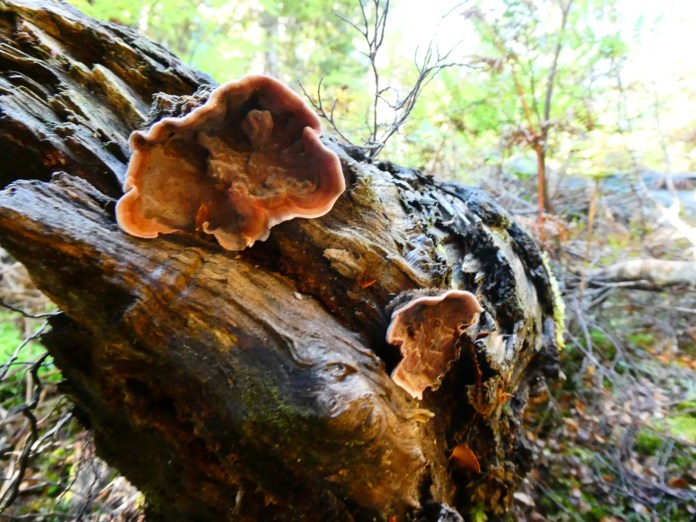
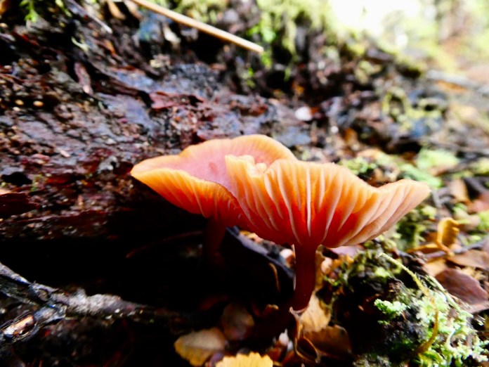
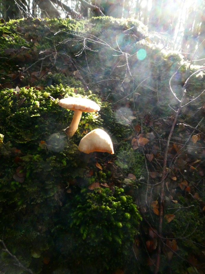
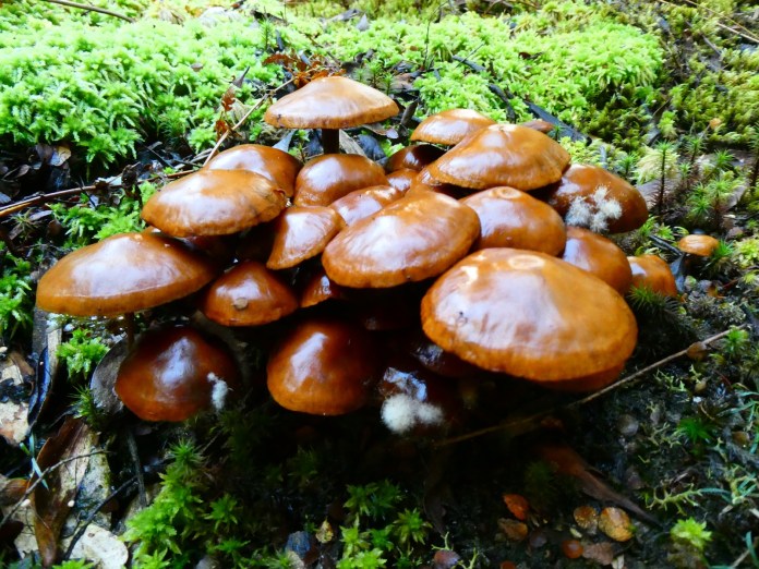
All the images from the trip have already been posted. Check back in the blog.
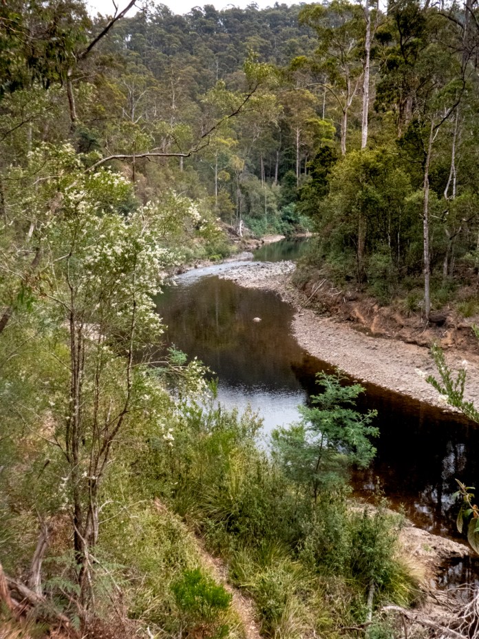
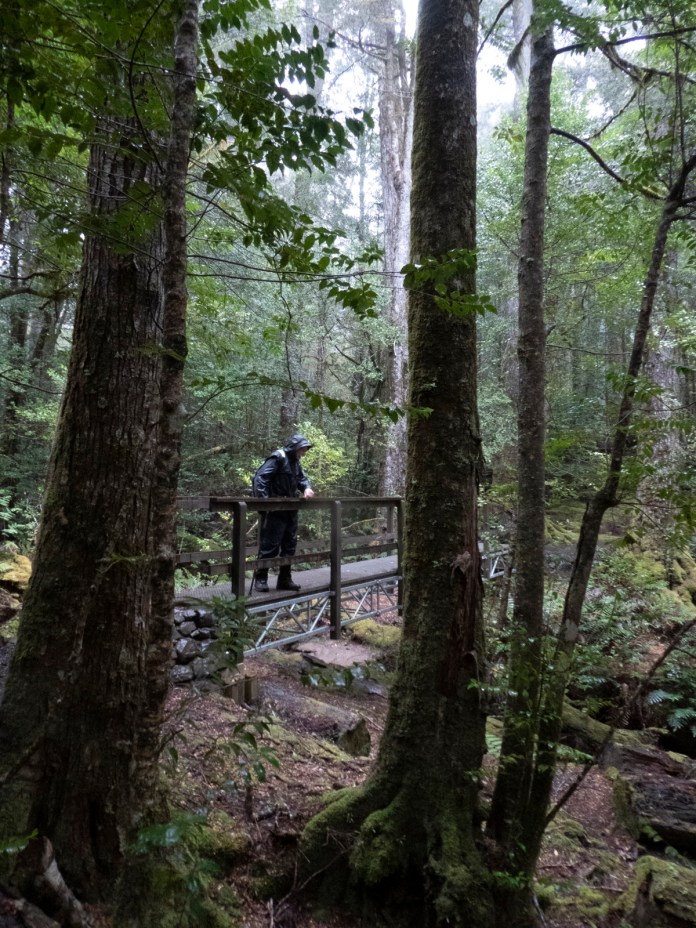
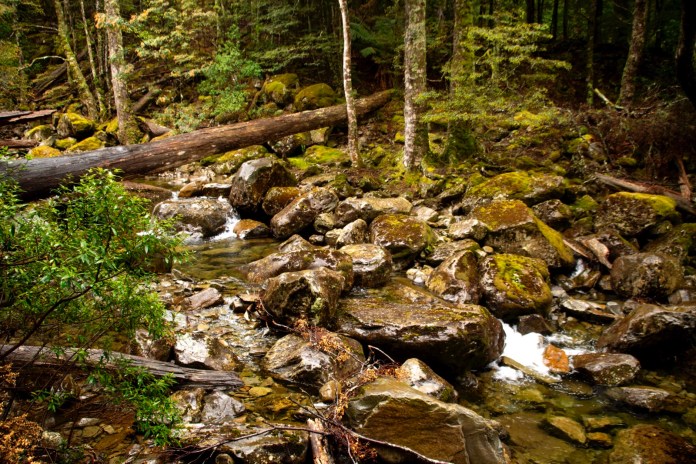
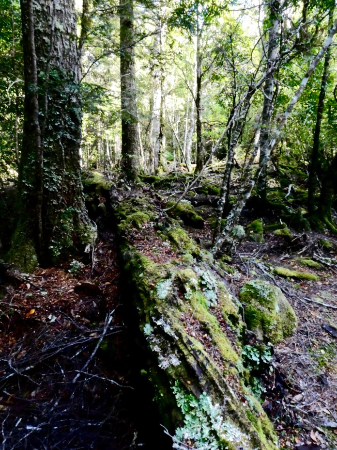
Dooley track – Ramblers Walk beside and across Wilmot River
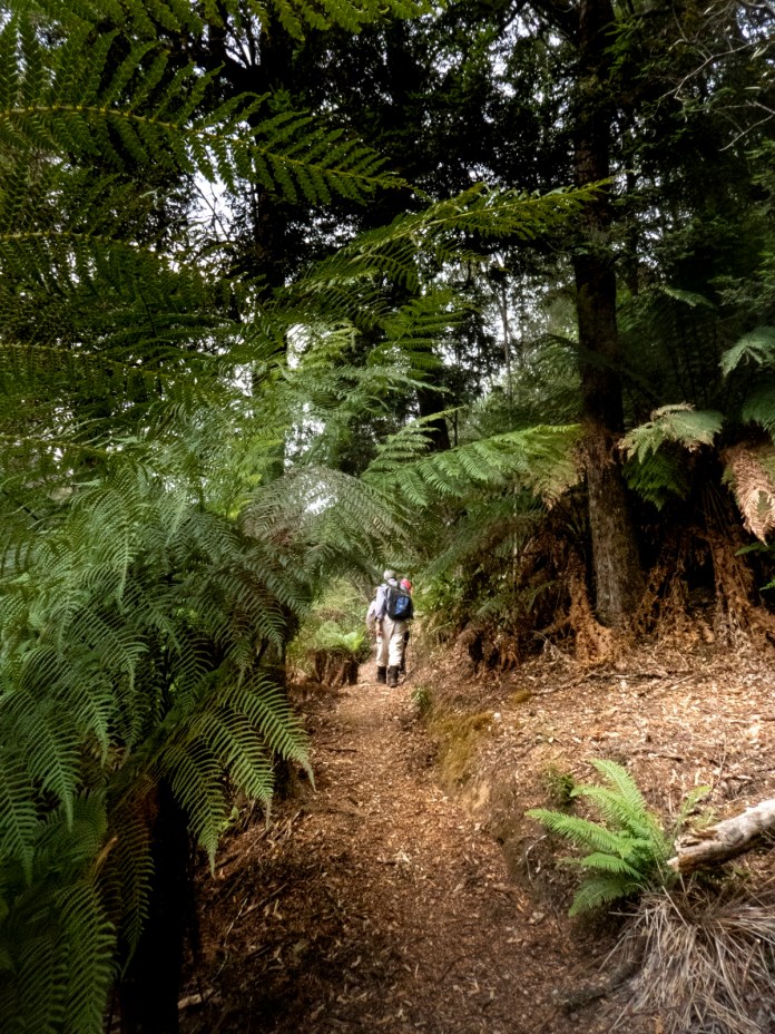
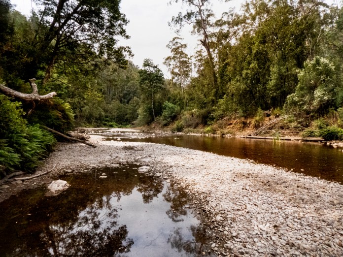
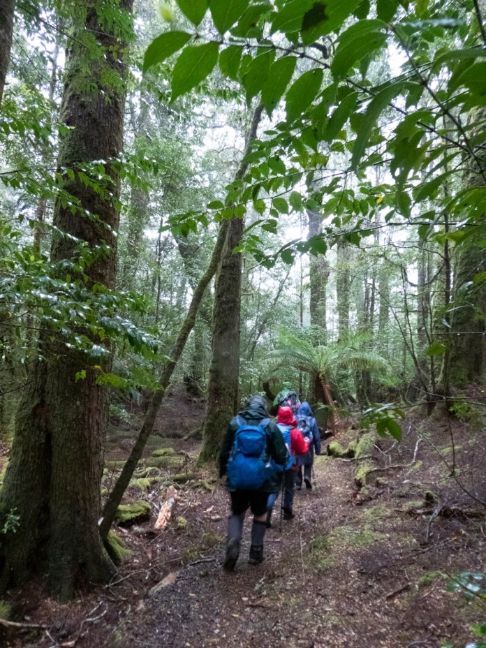
Today, seventeen Ramblers walked along a track beside the Wilmot River, located just beyond the tiny north Tasmanian town of Forth. There was some difference of opinion about the total distance but sixteen kilometers seems a reasonable compromise.
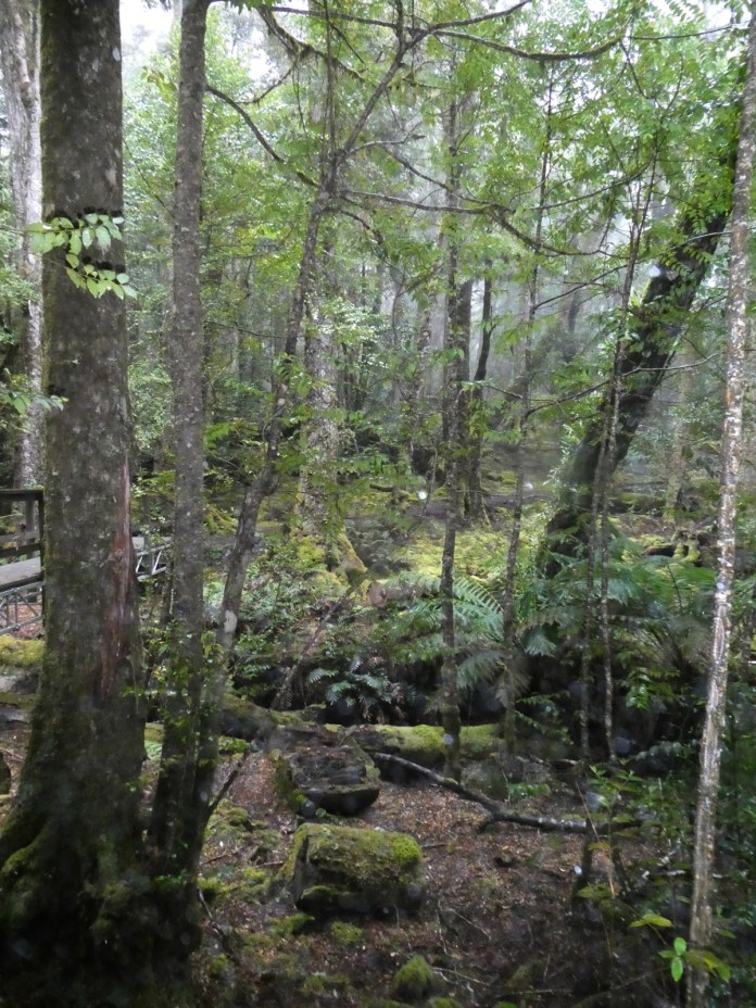
The walk crosses a private area before narrowing to a track that undulates up and over the spurs and valleys of this beautiful area. The track is rough in parts with hidden potholes and slippery sections especially downhill.
The flora is amazingly rich with Waratah, pepper berries, laurel, cheese berry, and dogwood lining the track and filling the vistas in every photo. Magnificent tree ferns hugged the shelter provided beneath firsts of maple beech and tall mountain ash.
Every step provided views of this gentle – now – river as it wound its way to the Forth valley and Bass Strait far beyond. Cascades, islands and stretches of placid flowing water charmed and delighted all of us as it curved in and out of sight.
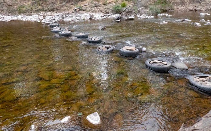
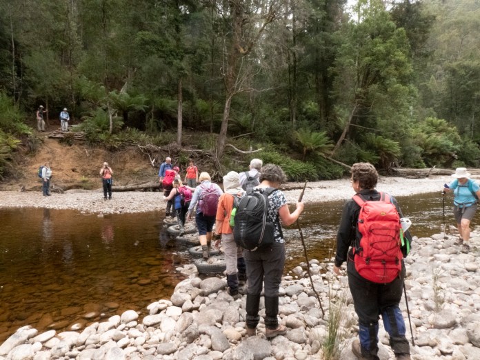
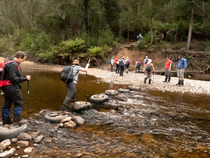
We had lunch at a large, grassy picnic area. It was all very leisurely until we followed what proved to a be a labyrinth of tracks back to the start. We had crossed the river before lunch and then crossed it again further downstream to rejoin our initial track. The crossings were low stress as the stones were corralled in tyres providing good footing.
We found a burning car wreck with a smouldering fire that had extended to the nearby ferns. Elaine used our sat phone to contact fire services. Then we legged it before helicopters arrived to dump us with coloured flame retardant. We later met the owner of the property where the track commences. She was very appreciative of us finding the fire and notifying the emergency services.
A truly wonderful walk and thoroughly enjoyed by all of us, and as a special bonus, we may have saved the whole area from being destroyed by a bushfire. Things don’t always fall apart as sometimes you are in the perfect place and time. Perhaps, you always are. Isn’t that a crazy idea!


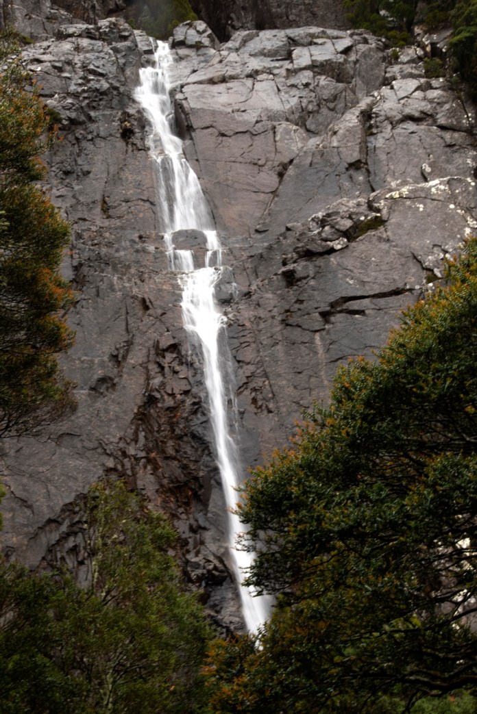
Victoria Falls and the sounds of Ralph Falls.
On Sunday, 15 December we went for a walk on Mt Victoria to visit Ralph Falls. and the much less well known, Victoria Falls. It was a wet, cloudy day with the weather becoming even more inclement as we drove to Scottsdale, then Ringarooma. We stopped at the history centre at Scottsdale and Rae, the days leader, gave us the options. We all agreed to forego the steep, slippery walk up Mt Victoria and do two smaller walks instead. It was not a great day for views.
After the short drive to Ralph Falls car park, we dived into the bush to walk to Victoria falls. This track commences immediately opposite the more formal, sign posted track to Ralph Falls. In spite of the rain it was a very pleasant hike. There is barely a track and the route is marked by pink plastic ties every few meters. It is very old,minimally disturbed forest with fine old trees, abundant moss decking rocks and fallen trunks, occasional splashes of light illuminated grottos while just overhead swirled the mists and clouds all hugging the mountain.
It is a small but beautiful small waterfall, surrounded by gnarled old beech trees and small boulders through which water continued its tumbling flow.
We posed for a group photo before threading our way back, descending through the forest.
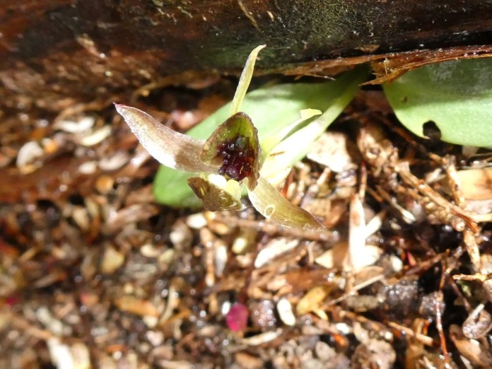
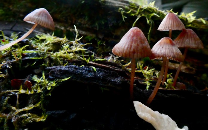
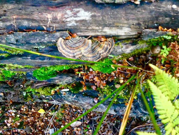
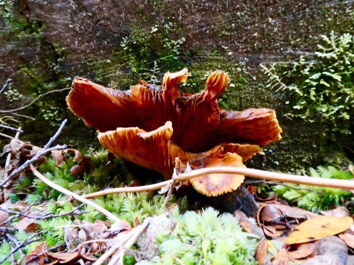
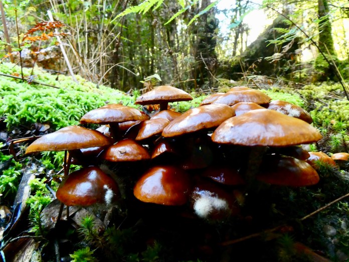
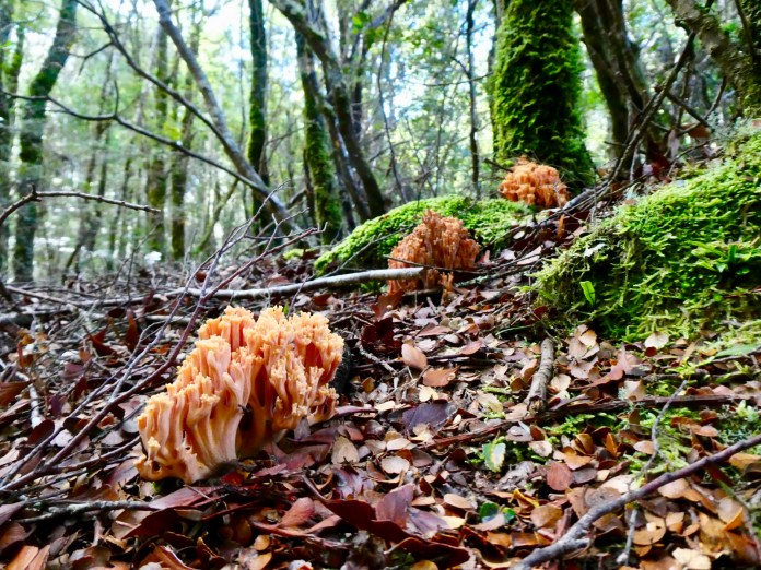
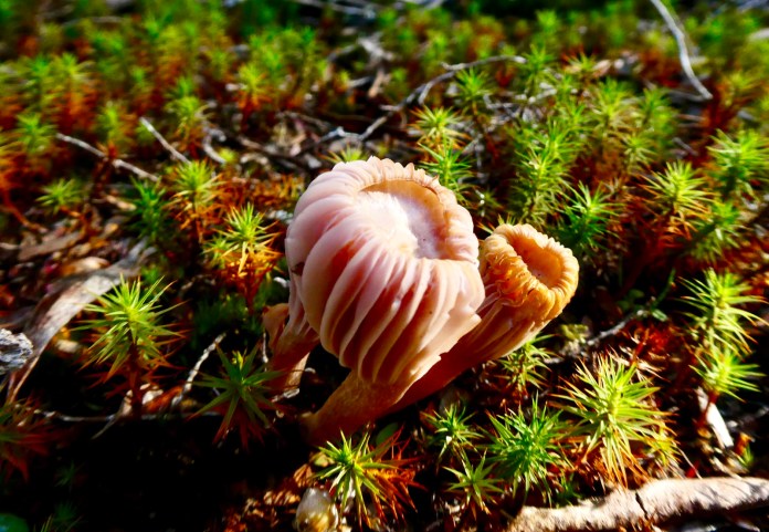
We arrived back at the road, misted by rain and cloud, then walked to the lookout to see Ralph Falls. They were loud but the cloud was impenetrable and there was not a trickle to be seen. We carried on the track, through drier forest, stopping to study many orchids and fungi.
Back at the car park, we had lunch, sheltered in a wooden shed. It was only a short day but lots of fun and boasting many wonderful opportunities for photography.


Grail Falls – another great Ramblers Walk
At the southern end of the Mersey Forest Road is a small car parking area. The track to Grail falls begins here.
Aftermath
We walk within a forest
Knee high ferns
Coil upwards
no leaves glinting
Broken limbs spear the ground
Beeches crowd the land
All dead
white
Creaking with imminent fall
Cathedral
Beyond the crossing
Heading sharply up
A cathedral of beech
Massive trunks leap into the sky
Bark stained in shadow
Between
Branches dripping with leaves
Glow bright green in the sunlight
Stained glass windows
Of supplicant apostles
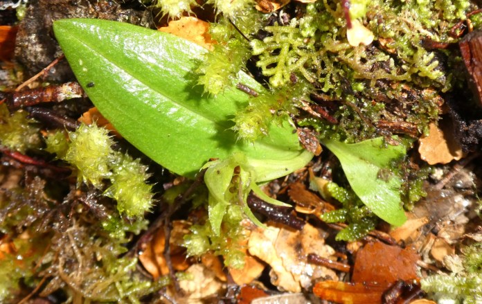
Orchids
Nestled by a fallen log
Bark rotting above mud and moss
We see the orchids
Five
Green
Slight and straight
Bearing scimitar tusks
Simultaneously fierce, beautiful and delicate
Hungry for light and air
Thriving after Winter.


Water
First
There is the steady roar
Falling water
Second
The mist
Fine webs of vapour
Cool and fresh
Third
The view
Bifurcated falls
Form two streams
The cliff
Black, jagged, stepped
Water hurtles in sheer leaps
And broken ones
Dazzlingly white


Meander Falls: Ramblers Dec 1st, 2019
Today, Sunday the 1st of December I joined eight other Ramblers on a walk to Meander falls.


 We met at the Adult Education car park in High Street, Launceston for a 7:30 am departure. The morning was cool, overcast and windy with a high chance of rain for the walk. None the less we were all in good spirits as Neville, todays leader passed around the emergency contact sheet for each of us to record any next of kin! I joined Trevor, Elaine and Jan in Trevor’s Subaru for the trip to Meander falls car park. We travelled through the outskirts of Launceston and then Deloraine, taking the road to Meander that starts beside the Meander River. There were wonderful views of the gentle, now wide river, green banks and trees beside it. Due to our early start, we had plenty of time to enjoy the experience.
The track is rough and uneven from the start, it gets even steeper and rougher later. This walk can only qualify as a medium hike in Tasmania where hard walks are totally insane. The track is sheltered, nearly all under the canopy of trees. The track is easy enough to follow and there are frequent red triangles attached to trunks to reassure a hiker they are still on the track. The rain was generally very light, that steady light drizzle that wets everything slowly. It was briefly heavy when we stopped for lunch, at a site overlooking the actual falls.
There was not much conversation on this walk because of the need to keep a close, un- distracted study of the track. The variety of surfaces was wide, from soft, leaf lined paths, slippery irregular rocks a jumble to walk on with knees and ankles frequently askew. There were well positioned rock steps up some of the ascents and even wooden steps blazed with chicken wire. Some climbs were scrambles using knobs of stone and dirt for purchase.
There many flowers, yellow, white crowding the tree branches as well as some snug, pink-red Tasmanian Waratahs. Most of the orchids were resting from the activity of Spring but there were few to see; brown, pointed petals glistening with raindrops. Forest light was subdued in the fine mist and overhanging low cloud. Whatever light there was could only drift in, deleting the world of contrast and the stark shadows of normal summer. This ambience fostered a haunting quality; moss and lichen laden rocks and boulders, tall crowded maples, dripping fronds of ferns bent downwards with the weight of water along their lengths,and earth, rich and dark choked with the fine roots and threads of shrubs and trees.
The Meander River always splashed, bubbled and tumbled to our right. There were not many viewpoints to take an unhindered photograph but its presence, its sound, the clean fresh tinkling of flowing water – a fresh turbulence of joy and light – leaping small cascades, its never ending tumbling down pebbled beds, to sweep gracefully down between the hills of the Upper Meander Valley.
The early morning light of dawn hardly changed over the day so birds kept singing and calling from the forest, a stereophonic cacophony of news and greetings we cannot understand but still can delight in.
We reached the Meander Falls viewpoint not long after eleven o’clock. It is an oval, stony area with comfortable rocky seats to balance a thermos and hot cup of tea. I sat down in the rain and munched my sandwich. The falls drop from at least two huge shelves with seperate pools at different heights. Today the water travels in a narrow band, it cadence interrupted by steps creating smaller leaps within the greater fall, mist billows out, darkly staining as water coats the cliff wall. A few of us walked the short, rough descent to the lowermost pool. I looked up to make a study of the geology. The surface is not bland, not smooth at least visually but carved with deep, groves, cut down into stone and dragged to earth, not once but many times. As if a Dreamtime God, has driven a knife with an irresistible blade into the stone and dragged it downwards, hands grasping the pommel. The grooves are vaguely parallel but each is its own injury to the rock, each a distinct mark or scar. Far above me, giant trees hover on ledges. They are half way up the height of the cliff, and drive upwards out of massive, lichen wrapped pillars of stone. The pool at my feet, is clean; a near absolute translucence permits every colour, of every pebble to be seen. The Meander has begun its journey.
We had views of Bastion Bluff, and the cliffs of the Tiers, mostly in a low cloud as it tumbled slowly over us but for a few moments, it cleared, summer light dazzling the hills, illuminating the narrow dolerite pillars of the Bluff and the eroded stone sheltered akimbo at its base.
The walk back demanded even more concentration, and a few of us slipped over but thankfully there no significant injuries. The fatigue of the walk was beginning to show. We dropped down through the forest, holding trunks for support and balance, carefully placing booted feet on suspiciously wet stones and rocks, negotiating trees that had fallen across the track and and then walking gently between the trees on soft, undemanding paths.
After the walk we stopped In Deloraine for hot drinks and slices and chatted about the walk.
At the time I did the walk, so much of my attention was on staying upright and dry that I could not do my normal daydreaming at the time but the experience is there, placed forever in my memory to be naturally softened by time and increasingly treasured.

Free haiku inspired by the Blue Tiers
Ramblers
Walk
In the forest
Breathing
Looking
Being
Ramblers gather
Near their cars
Greet
Number
Name
Then pierce the fog
Driving / driven
Is it
Snow in Autumn
Scatterings of weaves, of lace
Not pure White
But hued the palest of green
Moss and grass beneath
Waiting
Fungi= they
Crude, raw colours
Have erupted from the ground
From dead and living trees
From the detritus of ferns
In perplexing multiplicity


I saw a conning tower
Above the water
yet I do not call it a submarine
I see eyes
mouth, lips and nose obscured
and yet do not call those eyes a face
I see one of them
And can understand I am seeing only the smallest part.
Riotous colour
Form and shape
Limbs leaping
Saucers jostled together
Moisture pooled like glistening sweat
Light leaps in


Ramblers Walk
Talk
Listen and and be
Forming tendrils of friendship and acceptance
As do they
spiralling in earth or logs
With multiple fibres
Like us
Communicating and knowing
And being truly alive

Miners
Of different races
Dug and drained the high tiers
In the desolate cold
Following lodes of tin
shining, metallic hyphae
Leading to ruin
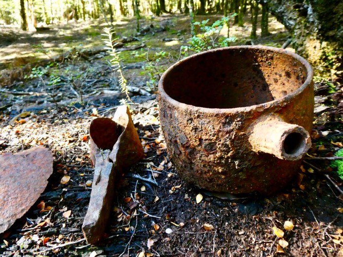
Till the soil spills the debris of their time
Pots, tractors, glass, and blades
At our feet


Solomon’s Jewels with the Ramblers
I am sitting at home in my comfy armchair warmed by the fire crackling to my right; it’s cold and windy outside, almost hostile in that bleak way Tasmania’s weather excels at. It’s in sharp contrast to yesterday when at this same time, I was driving down to the LINC centre to meet the other walkers, ramblers all, for the walk to Solomons Jewels.
This was not a treasure hunt, well not in the usual sense of historic or mythical artefacts with monetary value or at least serious bragging rights, for the treasures are of the transcendent type, offerings of natural beauty with sensations and memories to be hopefully treasured.
Neville is the leader, a tall, silver bearded true gentleman who gathered up we chicks as we arrived, handing us each in turn, the record book in which I signed too. I soon learned that there were to be twenty one walkers in all. This is a big turn out. Despite my forebodings about big groups in the bush, it all worked. The group turned out to be great as a group and sparkling and fun as individuals.
The weather looked very, very promising. It had been raining the previous few days, including an impressive lightning and thunderstorm but the morning of may 5th, was one of clear skies with, a mere hint of wind. I must admit to feeling a bit of a fraud as regards being a true dinks Tasmanian hiker as I have rarely walked in conditions that were anything less than superb. I should have experienced appalling, character building inclement conditions, but no, I generally trot along in warm sunshine, cool breezes, returning home in complete safety, while other walkers, leaving as I arrived back at a trail head, have to be airlifted out because of flooding a day later. I almost feel guilty while enjoying warm jammy crumpets with the sound of rain on the roof, and self emblazoning myself with walking credits all while I willingly eluded most bad weather.
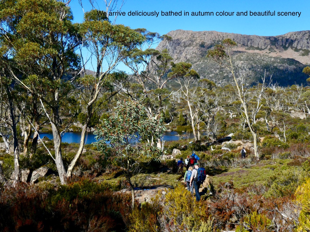
I joined three others in one of the cars and we drove first to Mole Creek, for toilet stops and to admire the Hereford cows, munching grass with the Western Tiers behind them.
Then carried on to the Walls of Jerusalem car park. This car park is in the process of being upgraded, with improved, larger area for car parking ( read level, marked spaces as opposed to sprawled vehicular chaos) and toilet facilities. The construction area is already marked off within a square of cyclone fencing. This car park can often overflow, with 4WDs crammed along the narrow road near the entrance to the car park.
We left the car park at 10am, and soon strode up to a boot cleaning station. The problems of fungi are quite real in the Tasmanian bush, already it has seriously damaged the Douglas Apsley area on the east coast. Scrape the boots, then insert into what looks like a high tech mouse trap. There is a handle with black squeeze pump which squirts antiseptic liquid under the boot. I like the smell of antiseptic, maybe it’s an occupational fetish.
The the walk finally begins, with the steep ascent to Trappers Hut. There are two routes to the hut, the one we are doing now; it is about three kilometres of winding, slightly rocky track with Waratahs ( no flowers till Spring), Ash and tall gum trees filtering the intense blue light of this Tasmanian morning. It’s not an easy climb, nor is it hard demanding acrobatics and strength; as is Goldilocks, it’s just right. The other option, is to drive along Fish creek road and take the short track, it is a mere 500m, but that is all 500m up.
Neville led the way and Floyd was tail end. They each had a Walkie talkie to stay in contact. Inevitably, the group strung out, but Peter regularly waited and let us all catch up. I was impressed he let the late arrivals have a rest too. In most clubs, and most casual groups, it’s traditional, to start again as soon as the slower walkers catch up to the main group. This of course makes the slower walkers even more hopelessly fatigued. On this walk, everyone’s comfort and well being was included as has always been the case on all the other Rambler walks I have done.
I took the principle of: BE BOLD START COLD. I am glad I did, as I soon warmed up on the ascent and thereby did not have to worry about putting on a pullover until I sat down for lunch at a Solomon’s Jewels.
There was some water on the track, mostly from small streams that intersected it, and the water splashed along amongst the rocks for a few meters before returning in into the forest, eventually it would reach Lake Rowellan via Fish Creek. The track is rough in parts, and modestly steep, especially in this section to Trappers Hut. The rocks and stones vary in size but provide a generally non slippery surface and handy foot holds. It’s a narrow track but the trees and shrubs are scattered enough that the route is hardly crowded by foliage.
One section of the walk that must not go unremarked are the views of the mountains that make up the Overland Walk. In these unusually clear skies, the clarity of view was wonderful. There was the massive bulwark of Mt Ossa, and over there the twin Pelions, east and west; and to the south, Mount Olympus.
Trappers Hut is an old construction with wooden slat walls, timber roof tiles and infamous for its population of truly Bolshevik possums which make sleeping inside a doubtful outcome for an evening sojourn. There is really no camping nearby. Approximately a kilometre further on, shortly beyond the side track to Lake Adelaide there is an attractive peat field, a luxurious lawn just asking for a golf tee.
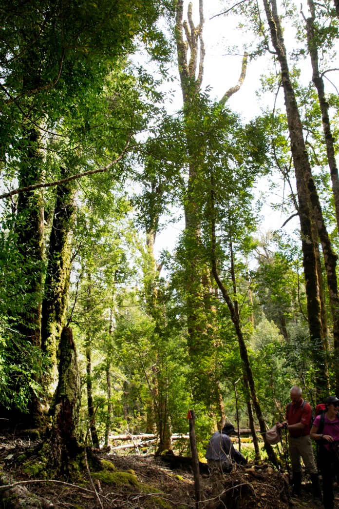
We sat on the rocks for morning tea. I spent the time admiring the beautiful forest, tall silvery and white trees towering above a scattered floor of shrubs, Waratahs, Mountain Peppers, red berries Bush or Mountain Berries and the many old timbers and now rotting trunks and logs fallen in winter storms or from the consequences of age. Several other walkers remarked how remarkably intense was the blueness of the sky. The rain and storms of the preceding few days had done a wonderful job of clearing any dust from the air as well as cleaning away the volatiles from the leaves of the eucalypts; these chemicals typically evaporate into the lower atmosphere with the later warming of the morning , washing out the rich natural boldness of the forests and mountains colours.
After morning tea we continued upwards and onwards, the track undulates more now, dropping down repeatedly to streams and tarns, before arriving at the turn off to Solomon’s Jewels. The tarns are gorgeous, the water is still and cold; in it stillness reflecting the forests, mountains, and rocks, whether near and far in translucent clarity. The steely majestic Pencil Pines spiral about the waters edge, lichen strewn rocks form repeating, mirrored ovals and distant stands of trees on rocky platforms now hover in watery sky.
The hues of the forest are breath taking. I’m looking at the photographs, I must admit if I had not been there, I would not believe the force of colour that comes from this scenery. I have always acknowledged the forces of nature; wind, sun, water but to that should be added colour.
We enjoyed lunch and mugs of tea or coffee, sitting on a rocky, tree sprinkled promontory amongst the tarns which make up Tasmania’s Solomon’s Jewels. In the distance the Walls – the majestic mountain which is King David’s peak; the wide blue sky; the water motionless and cool; the trees and forest visible all around and far beyond the tarns, and the 21 of us, all enjoying Neville singing the ballad of Ben Hall; the gentleman bush ranger who died at Forbes, NSW; his sad story all sung in his firm, clear voice. The putative reason being an anniversary of said event, the cause being the sheer joy of being in this wonderful place.


")
")
")
")
")
")
")
")
")
")
")
")
")
")
")
")
")
")
")
")
")

