


Category Archives: Travel
South West Walk
South West Walk, Tasmania
26/12/2018
The adventure begins! I am having a wonderful dinner with Jennifer opposite me at Rockwalls Bar and Grill Restaurant, Salamanca Place. An eye fillet steak washed down with an excellent Riesling from France; on its side is a plain rectangular white label with “Burgoyne” in curled italics and 2015 higher on the nape of the bottle.
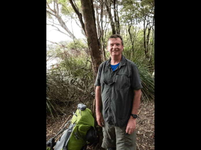
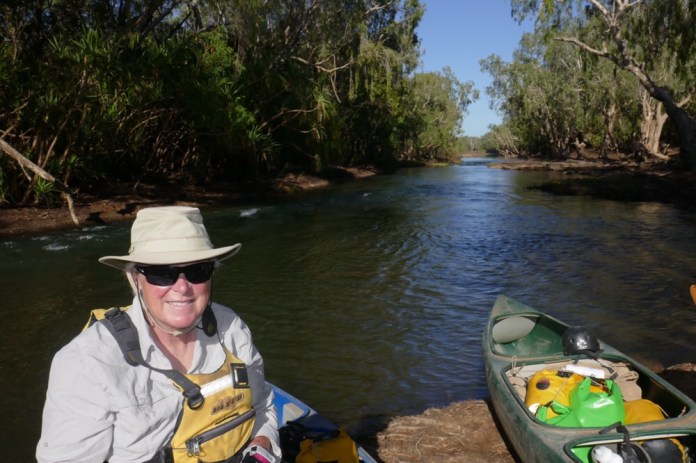
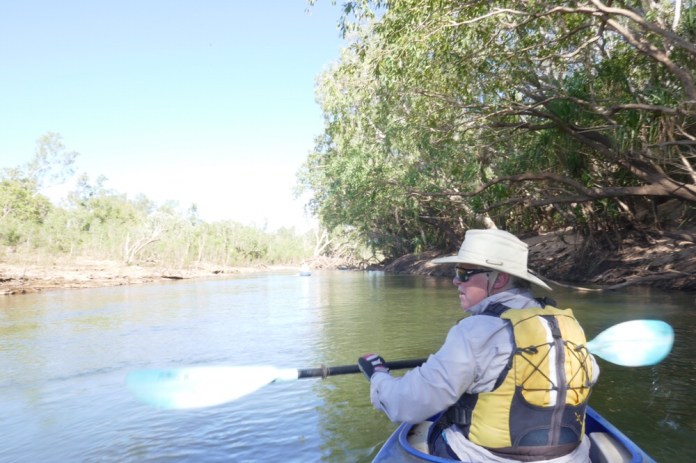
At 2pm today, I met the other walkers about to commence the South West walk with Tasmanian Expeditions. We met our two Tasmanian Expedition guides at the Mountain Outdoor store in Bathurst Street. I felt a tap on my shoulder and turned to see Earle. Earle was one of the three guides on the Jatbula Trail I completed a few months before. Nom is a young woman and with Earle, the second half of our guiding complement. They checked our gear.
(In retrospect, I really, really need to economise on the gear I take on these long walks but everything seems so… necessary at the time of packing. It does not feel so necessary when I am carting a 24 kilogram pack for 10 hours up hill and down dale.)
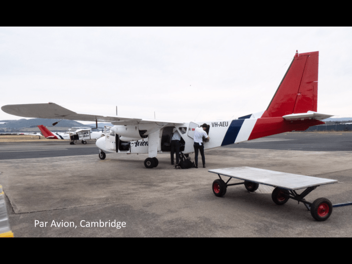
Tomorrow we will meet on the pavement outside the doors of the Astor Private Hotel, for bus transfer to Cambridge airport. From Cambridge, Par Avion will convey our group piecemeal to Melaleuca.
I must admit to some self-doubt about my fitness. I have been training for 4 months with packs and weight vests and I hope that will be enough.
Sunday 30/12/2018
I have not written about any events or musings these last few days due to straight out weariness. A weariness which is not ennui surrounding modern consumerism but weariness which means I cannot actually move any part of my body. Arrive camp, set up tent, collapse (in it), hibernate until I can move something and my overall body pain drops to tolerable levels: this was arrival protocol for the last 3 days of walking.
The reason I am writing today, day 4 of the walk, is that it has been a rest day and I must admit was an opportunity very well received by me.
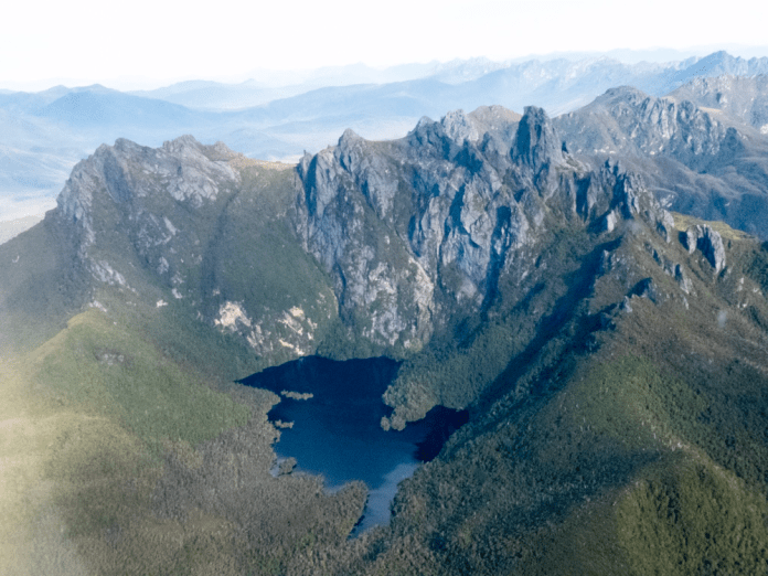
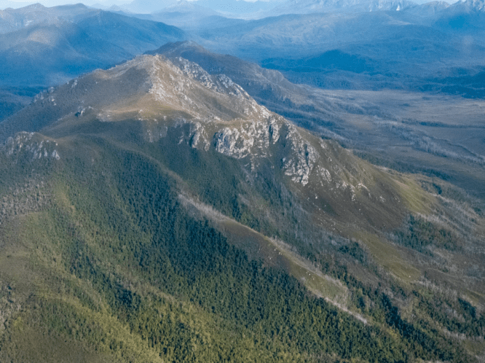
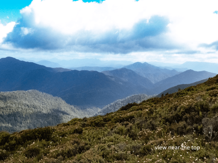
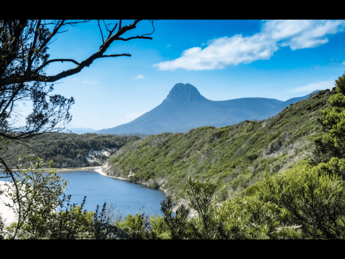
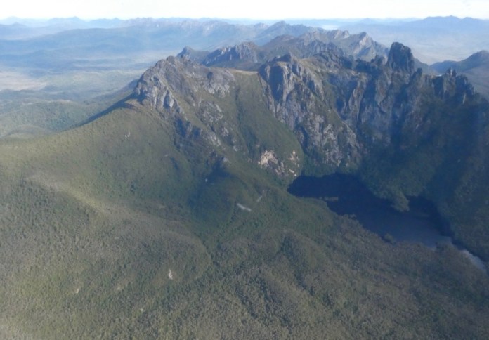
In the late morning of the 27th of December, we arrived in aerial convoy into Melaleuca. Each plane carried four of our party as well as our gear. The flight can be described as fantastic, with almost clear skies, minimal wind and magnificent scenery over which to fly. The blue of the sky punctuated by scatterings of white fluffy clouds and distant views only vanishing into haze hundreds of kilometres away. I could see Cradle Mountain hovering on the horizon far to the north. There were the Western Arthurs rising into the air; ranges of massive rugged mountains some with lakes, blue, still and poised between pillars of stone.
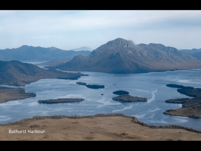
The plane skirted Mt Picton; great buttresses of rock erupted through bare, slopes, all stark and featureless above the dense forest situated below its tree line. Then we saw Bathurst Harbour. It has been barely 45 minutes since we departed Cambridge. The harbour is huge and our destination, Melaleuca, sits on one of the southern arms. Islands dot the harbour. The solitary air strip looks as if a giant pale cream paint roller was run along the ground leaving a narrow white strip. As the plane turns and spirals down, the mountains and ranges all around spin crazily around, until the craft adroitly levels again, and the strip lies in front and just below the nose.
At Melaleuca, we had an hour of free time to explore the area before leaving on the first part of the walk. This afternoon’s hike leads to Cox Bight ; a beach nestled beneath and to the east of the New Harbour Range as it juts into the southern ocean. I visited the Deny King museum, which has displays about the area as well as the many personalities like Deny who lived and worked here for much of their lives. Deny’s old radio transmitter/receiver is on display under a glass cabinet. He used this to communicate with the outside world, to help in rescues and in educating his children. I did the short walk beside the river which eventually carries on all the way to Port Davey. This short walk has many interesting displays about the Aboriginal experience in this region.
I walked back to the airfield. The ranger was wearing gumboots and a sunhat, typical southwest apparel and told us tiger snakes and their babies, were lodged under the water tank. Mmmm. Thirsty or not?
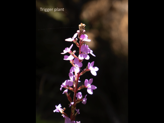
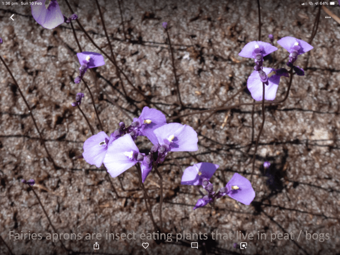
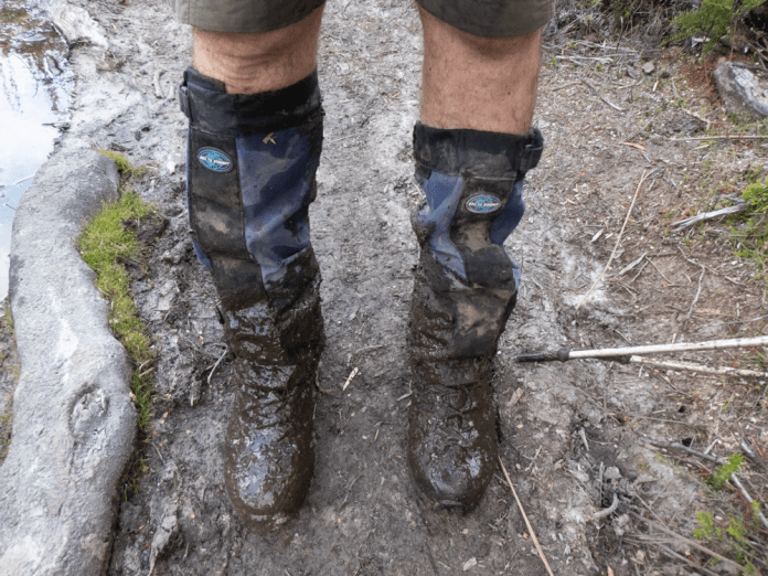
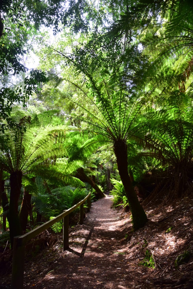
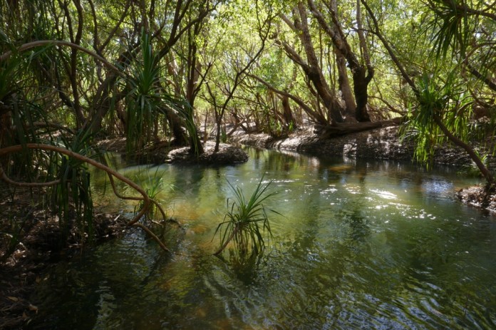
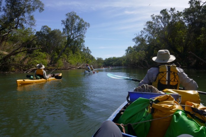
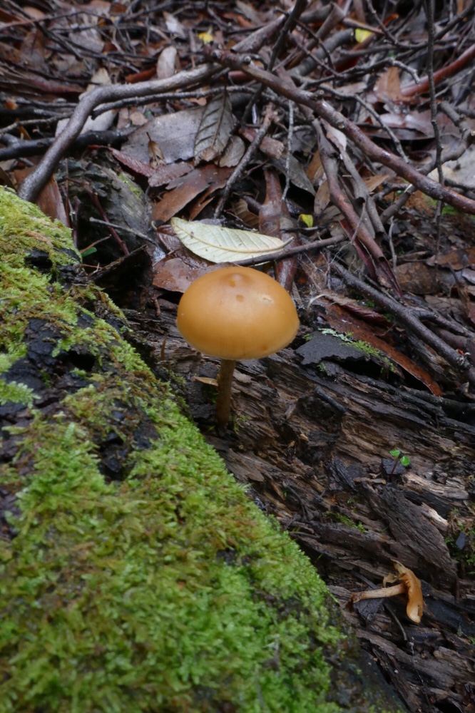
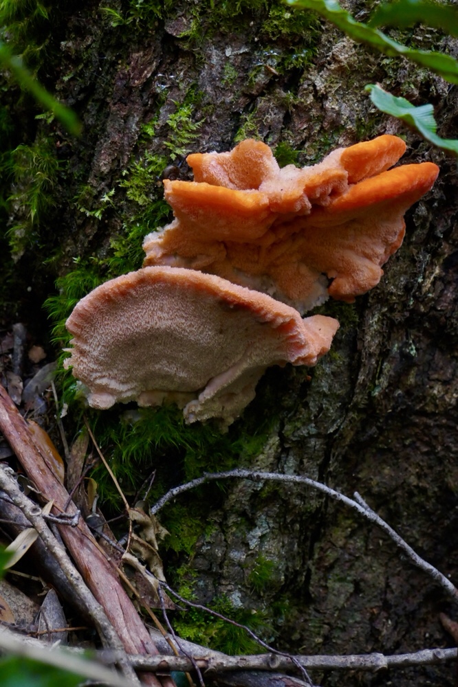
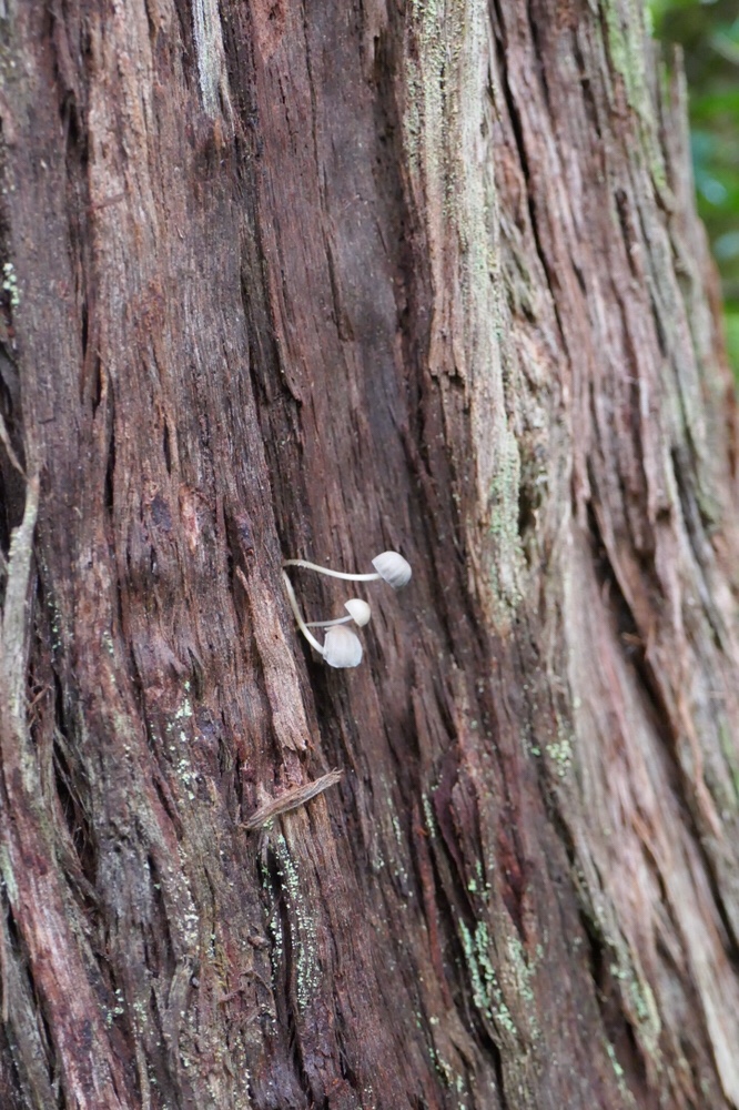
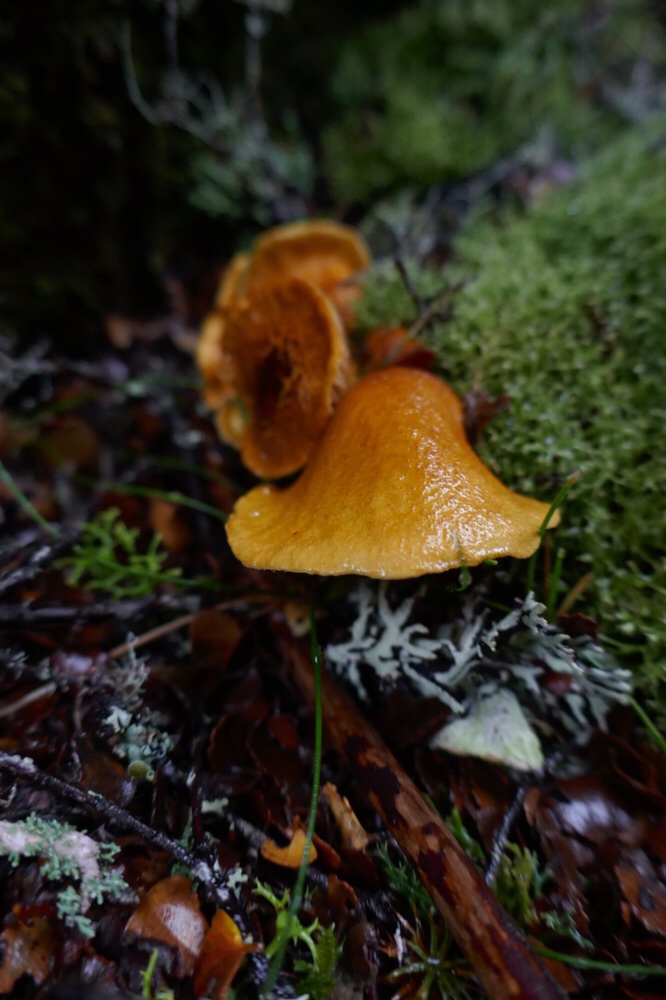
We loaded up, put our packs on and began the 11 km walk to Cox Bight. The track consists of pine boardwalks and dried-out muddy tracks; it winds and undulates gently, surrounded by button grass and low heath. At ground level are fairies aprons as well as sundews emerging from the dense mud. Fairies aprons are single petal purple flowers with thin dark stalks and are carnivorous. They are a member of the genus, bladder worts. The term Bladder worts refers to “bladder” a sac filled with water and “wort” is old English for plant. Water fleas or other insects thriving in the water at the base of the plant. The “bladder” is filled by water under negative pressure, and has a small opening at water level, sealed by stoma. An insect touching these stoma triggers them to open, and water and the insect are then sucked into the bladder. The opening is sealed internally by mucus and then the feast begins! Sundews have glistening, sugary mucus that attracts flies but once they alight, they cannot extricate themselves and then the sundew produces digestive enzymes.
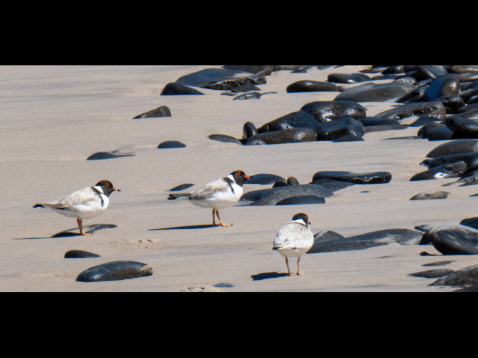
I saw a sun orchid, it was so heavily festooned with flowers that it lay on the surrounding grasses. A duck orchid stood proudly, barely bobbing in the sea breezes.
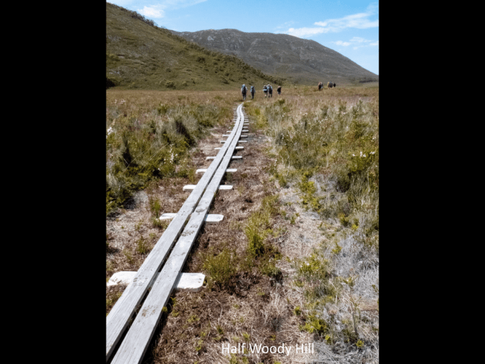
The boards on which we walked are dry and provide a secure walk way. When wet I think the outcome would be very different. The sliding of hikers on the now wet, already smooth, timber is legendary.
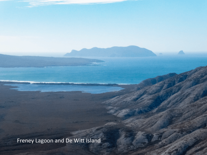
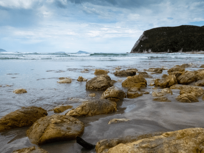
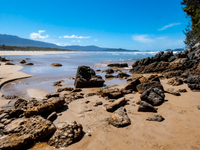
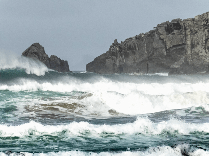
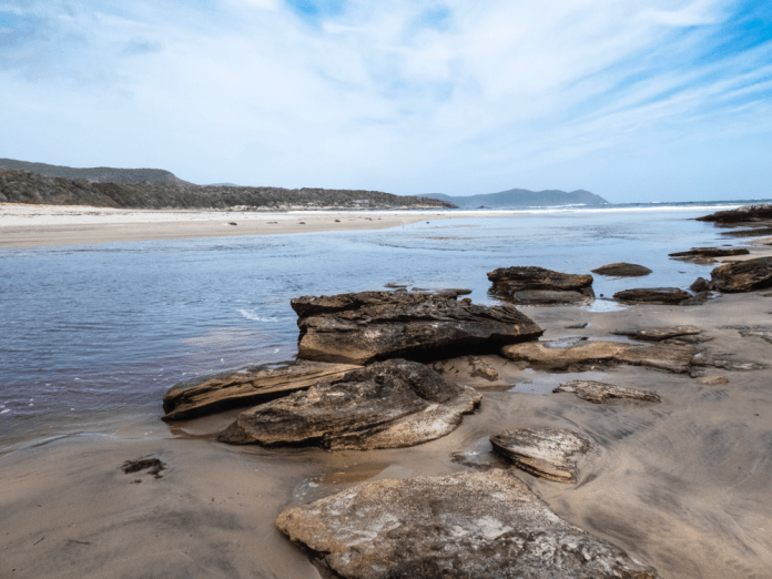
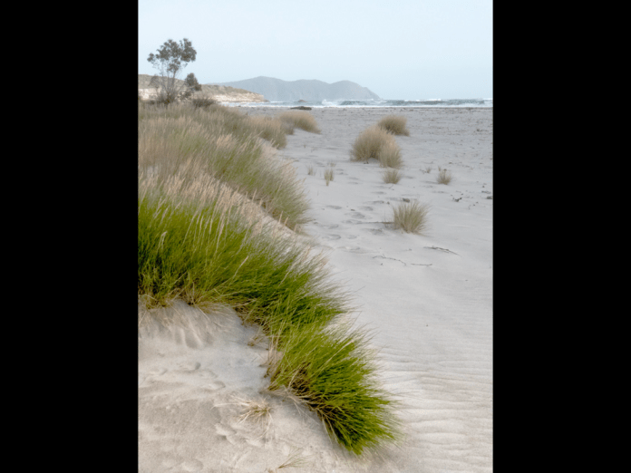
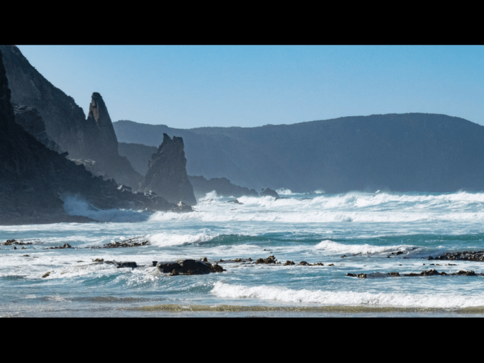
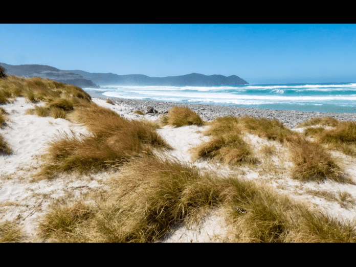
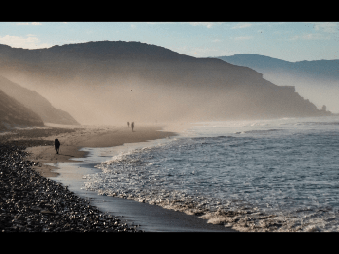
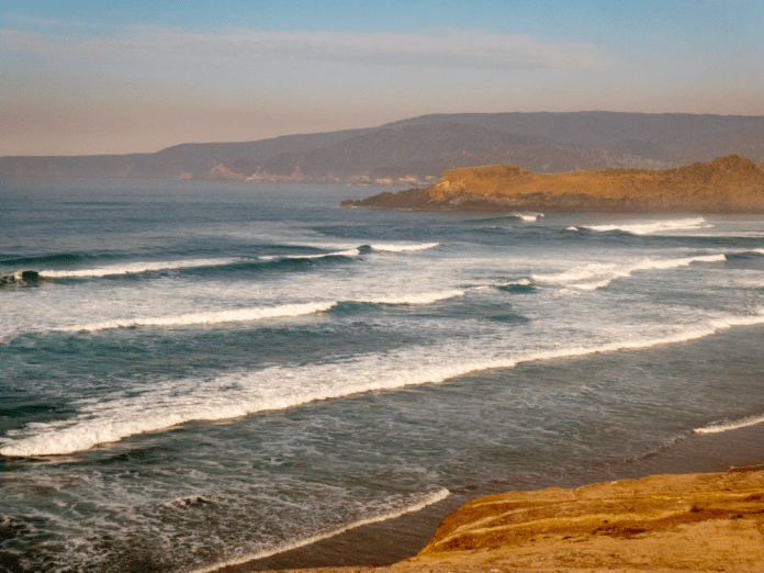
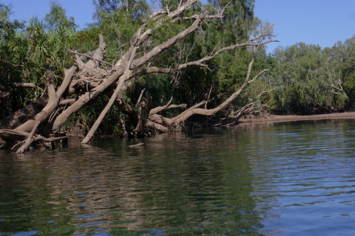
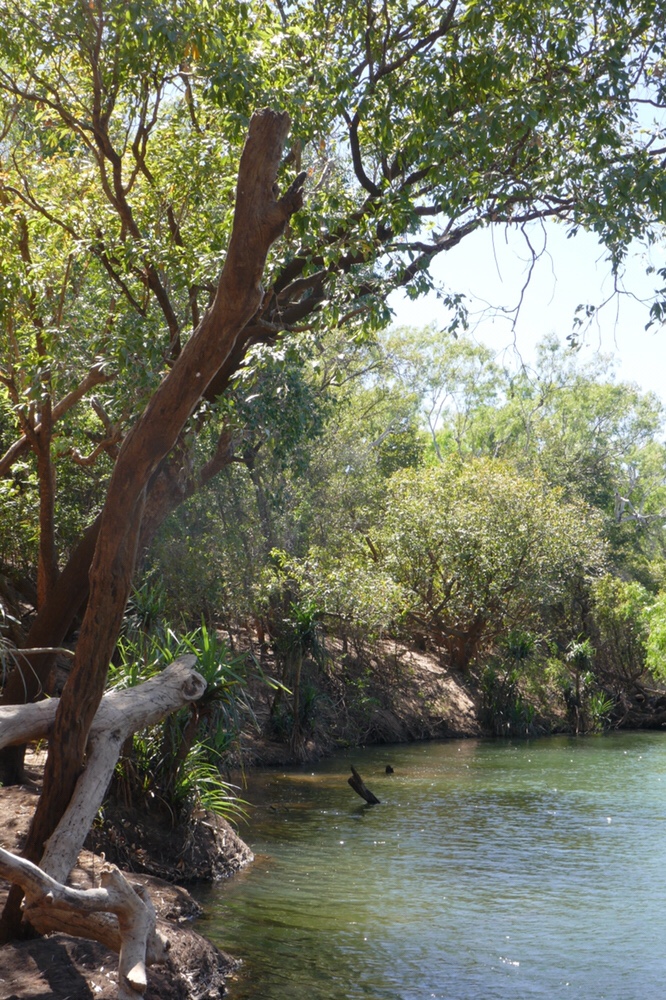
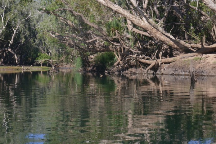
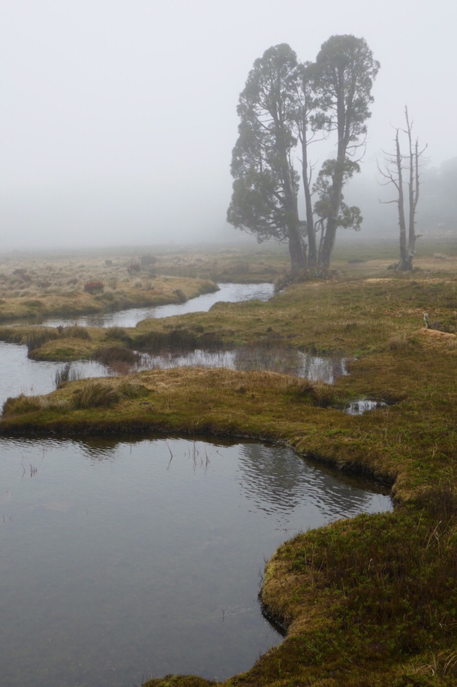
The track slews up and around the lower eastern slopes of New Harbour range. Freney lagoon is a brackish large body of water that lies behind the beach at Cox Bight. Freney lagoon was grey; a silver shimmer danced on its surface in marked contrast to the long lines of rolling white surf coming into Cox Bight from the Southern Ocean.
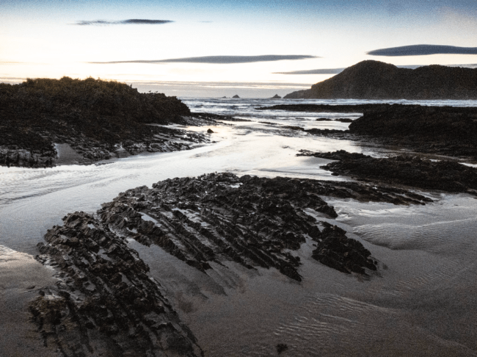
It is only a short walk along the beach to the campsite near Eric Point. The campsite is both beautiful and sheltered. After setting up my tent I walked along a sandy track back down to the beach. White sand within the reach of water darkens to metallic grey as surf transmutes and merges into repeating circles on the bank; wavelets ascend the shore then fall back, awash into the sea. This blisteringly clean beach and coast is magnificently back dropped by Eric Point and New Harbour range.
Some of the walkers decided to go for a swim. They all described the rip on the bays edge.
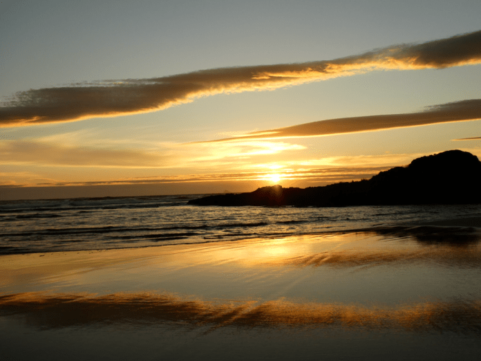
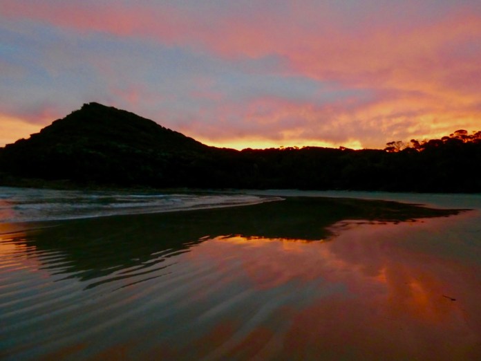
In the approach of evening, a band of curved cloud hung over the hills, and as the sunset grew in colour, the pink purple richness of the sky was reflected in a film of water glistening on the beach.
As I laid my head down in my tent, the sound of surf did not lull me to sleep as I still felt untested on this walk, and much was still to come.
In the morning, I needed to fill my two water bottles for the days walk. A nearby stream carved its way through the beach. The water tested fresh and cool. Our guides had set up breakfast. Tea, porridge and coffee. The way they made coffee is interesting. A large, wide lidded saucepan is filled with water, the water is boiled. Over the top of the boiled water, sprinkle ground coffee. Let it brew for a few minutes. Then score the coffee with a knife (Criss-crossing). Then replace the lid and bang on the side of the saucepan. Then wait for the grounds to sink. This takes about 10 minutes. Then use a scoop to fill your coffee cup while taking care not to disturb the coffee at the bottom of the water.
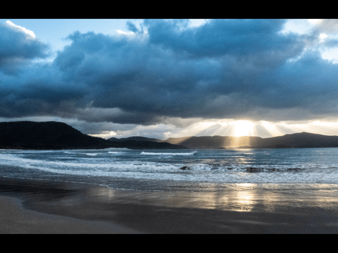
I visited the beach again. To the south the sky was filled with abundant grey cloud, turning the water and surf a steely-grey. Then the sun pierced through a small gap in the clouds, sending scintillating beams of light through the air to dance on the crests.
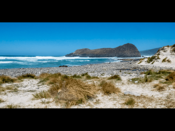
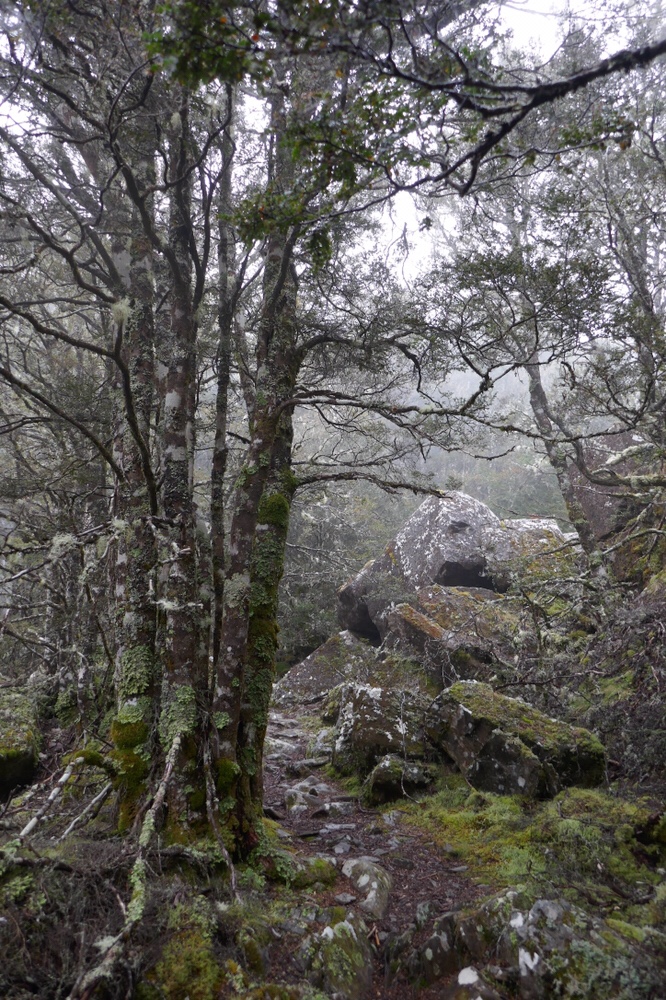
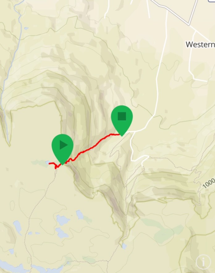
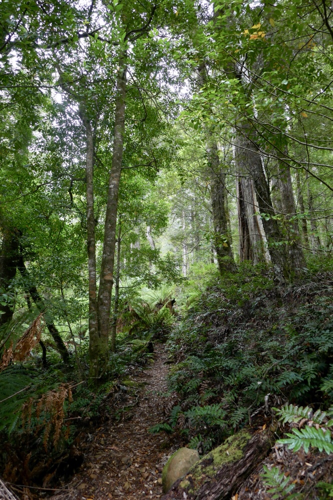
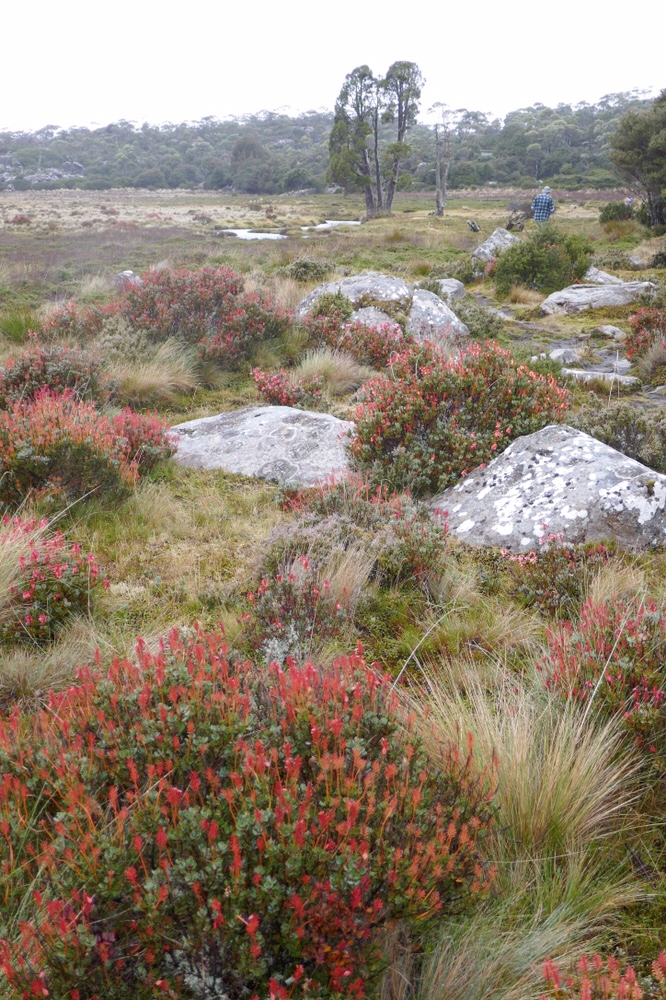
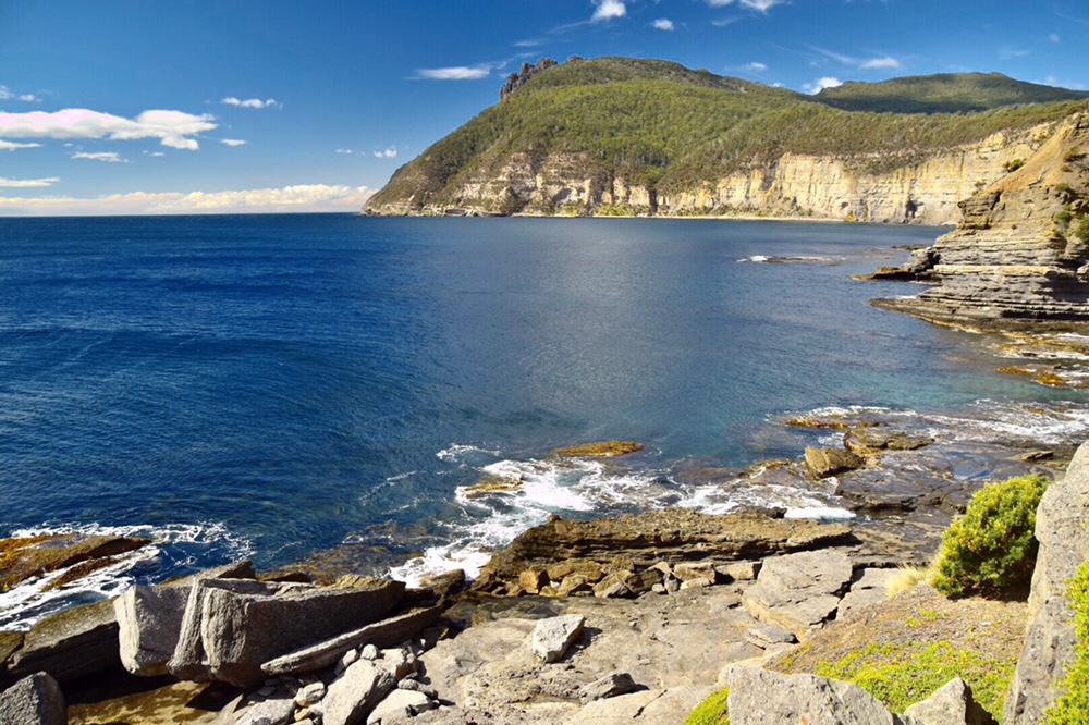
Today we walked from Cox Bight to Louisa River. The walk begins with a stroll along the beach which offers wonderful views in all directions. The full majesty of the New Harbour range becomes increasingly apparent as it rises above the straggly gum trees with each step eastwards. There are a few shallow creek crossings, the streams diffused as water straggles over the shore. The yellow coloured rock at the end of the beach is the point where we left the beach and truly begin our approach to the climb over Red Point Hills. These hills are 250 meters high, with a pretty steep and unrelenting climb. It provides a litmus test to whether a walker (like me) should continue the rest of the South west walk or not.
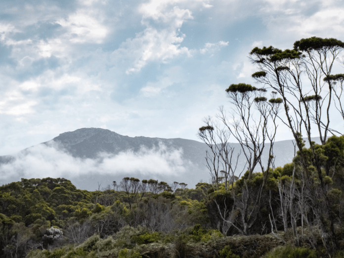
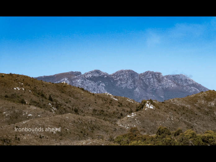
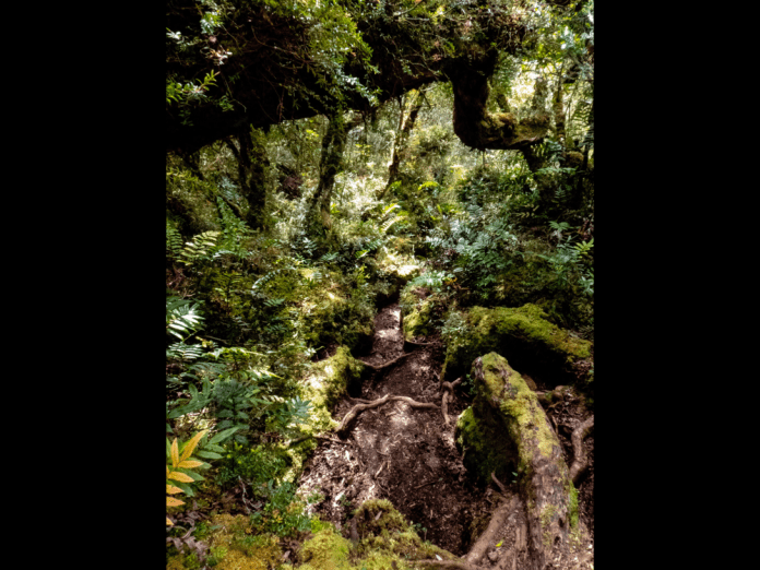
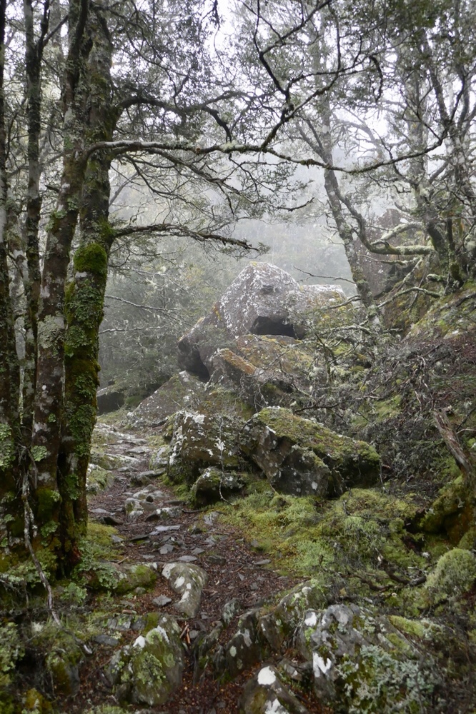
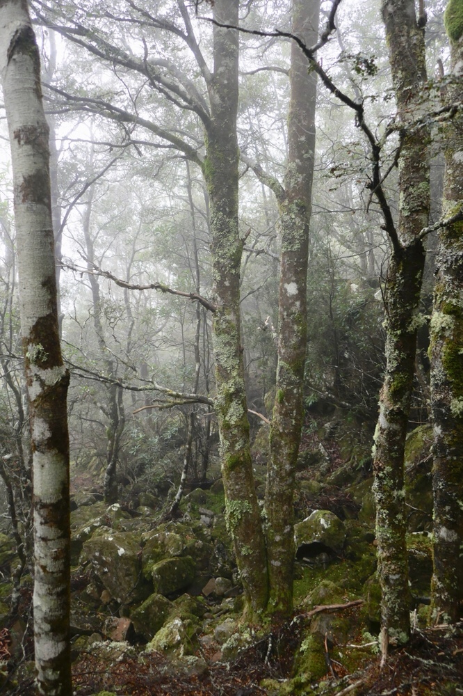
Climbing up carved steps, then rocky depressions, all the time ascending inside a forest; views hidden by the trees. It is indeed a solid walk and a fair test of anyone’s fitness. After descending the hills. The track winds, travelling up and down through the Spica Hills, patches of forest interspersed with heathland full of wind stunted scrub. This scrub is virtually impenetrable. The reason people get lost is that there are sometimes many tracks, created to skirt deep ponds of mud. However, the dry conditions and winds of the last month, have made the muddy areas considerably easier to negotiate. A few creeks were crossed but all were shallow and presented no challenge or concerns. Over one of them, a rope was suspended across to help walkers get over in high water conditions. In a situation where a fall could occur, it is essential to undo the buckles on your pack otherwise there is a real risk of drowning if trapped by your pack under water. Beyond this creek, the forest is murky and dark, trees blotting out the sun. Suddenly I entered a great field of button grass and heath, a waving plain of soft green, and there above low hills was the Ironbound Range, a triple peaked monolith silhouetted against purest, blue sky.
It is a massive range that stands alone, a fusing of four mountains with a demanding 1000meter ascent and then an equally difficult descent.
By this time. Some 7 hours into the walk, I was getting sore in the shoulders. I am using a new pack that I think is operating above its weight specifications and I am sure I have not correctly set it up. It is amazing how additionally fatiguing pain can be over and above the physical effort of a hike. The pain became so troublesome, I just walked in a gritted teeth, determined way but even the aching I was tolerating was not enough to lessen my appreciation of the beautiful views around me.
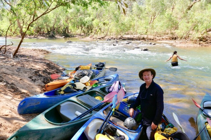
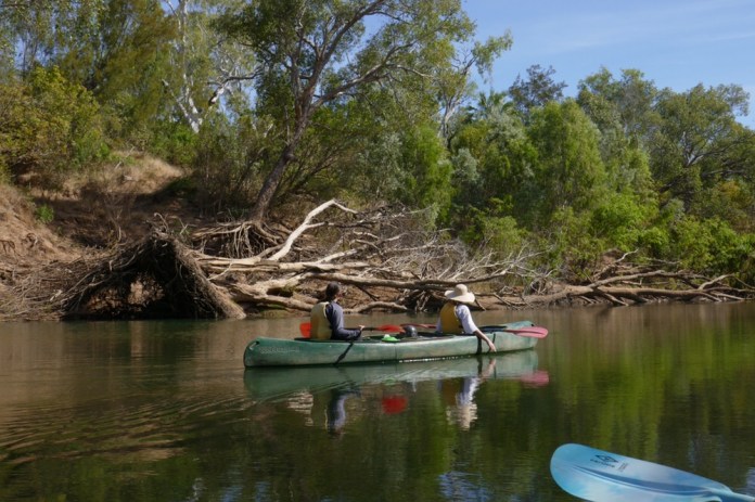
We then dropped into a narrow valley, into forest, and skirted a river at its bottom following it downstream briefly. Here was the Louisa River and the camp site was on the other side! This river is far from fast flowing now but is none the less much deeper than all the creeks I had already crossed with nonchalance. I tried to balance on rocks to get across and keep my boots dry. Well that did not last long. I slipped in sideways, avoiding a fall into the river but I could not prevent water tumbling over the lips of my gaiters and into my boots. Bother!
I cannot be too upset as the experience of many other walkers is that crossing the Louisa River can be a terrifying affair. A rope crosses over the flow, to provide a hand hold. The water can be deep and very fast flowing and can often be impassable, forcing walkers to wait till it is safe to cross. A small sign advises you to do just this.
The campsite is beside the river. After tipping the excess water out, I put my boots on a fallen tree branch beside my socks to encourage some drying in the afternoon sunlight! I had brought some sandals to wear around the camp site and give my feet a chance to breathe. Early in today’s walk, I had developed a blister on my big toe, and Nom had help me dress it. I was surprised how quickly it formed while still on the beach at Cox bight. I think it put the tape on too tight as the nerves in my toe were affected, almost a tourniquet effect as the toes swelled up on the rest of the walk. Blisters are a serious problem on long walks, a common reason for forcing air evacuation if it becomes impossible to continue.
I found a flat site near the river and near the camp kitchen. I put up the inner part of my tent then correctly fitted the fly on. I had put it on upside down the night before! Other campers did not believe that was even possible to do.
Before dinner, I sat down with Earle and we adjusted the pack back cables to shorten the fitting along my spine. It is a new design to both of us both, but I think we figured it out.
We walked 18 kilometres today and boy, was I tired. I walked down the short track to the river and took many photographs. I followed the river around its bend climbing over branches and balancing on rocks. The water is deeply tannin stained by the tea trees that line the valley and river edge. Like nearly all the water here, it requires no filtration or cleaning. Only at one spot (South East cape rivulet) was the drinking water somewhat brackish and I emptied it as soon as I could to replace it with fresh stream water.
Nom gathered us together after dinner to tell us about the next day, the walk up and over the Ironbounds; up and out of sleeping bags, then breakfast at 4am. The hike is 12 kilometres but involves 1 kilometre up and 1 kilometre down and 1 kilometre across the top. Did I imply it’s hard? Well it certainly is, and all the more for lugging up 23kg of pack. Alan, another walker, carried an item for me that saved me a few kilograms. This was very much appreciated. If I can pre-empt my overall impression of the Ironbounds; it is the hardest walk and the most beautiful walk I have ever done. This description can be justly applied to the entire South West walk.
In the morning, I awoke to a pitch interior in little tent, grabbed my headlight and then quickly packed up my gear into the pack. By 4.30 am I was having porridge, and by 5am I was ready to set off. Light was beginning to filter over the horizon, the valley walls and the trees as I walked into and among the trees and as swiftly, began my ascent.
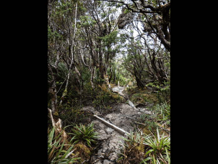
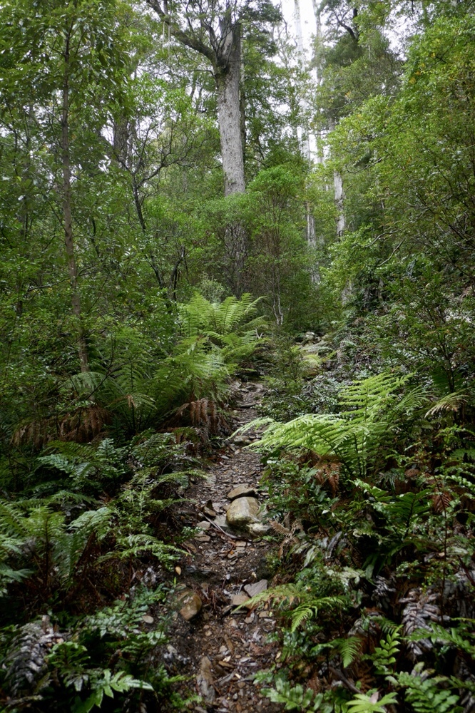
The track winds up steeply through forest, the track alternately rocky and muddy in stages. It’s a grunt, a slog rather than technical mountaineering. We left the tree line, entering the sole preserve of shrubs and grasses. As I climbed these were increasingly lower and more stunted. Around me the wind shrieked louder and louder. While behind me, the clouds looked increasingly threatening and dark, obscuring distant views of the coast, and the nearby mountains and valleys of yesterday’s hike. There were the tell-tale signs of rain, the grey thin streaks of water bending in the wind which was steadily rising more and more as we ascended. Rarely, a portion of the skies would clear and sunlight stream in to illuminate a tiny portion of the landscape. To the south was the Southern Ocean with its surf entering Cox Bight; to the west the majestic Spica hills, and far to the south there were the many islands of the Matsuyker group. I did not know that Sue and Tony, my friends, were sitting at Louisa Bay and thinking of me as I climbed into the teeth of a gale. Then mists, wind and cloud jostled the mountains and I could see nothing more of what was now far below me.
Nom was encouraging me as I walked up. Both of our guides are first rate and blend a love of the country with a ton of practical knowledge about safe walking in remote places like this. Nom explained that it is important to shorten the stick and palm the hand, with the palm over the top of the stick. This helps increase both strength and balance. The pack adjustments made last night, were very helpful in reducing pain in my shoulders.
As I ascended, there were sections of board walk, and some wooden and rock steps to make it easier. It is not a trackless ascent. However, much of the climb up the western side of the Ironbounds is very exposed and as the wind rose and rose, it became harder and harder to keep my balance and walk as well. Some of the other hikers had bad falls injuring knees and ankles.
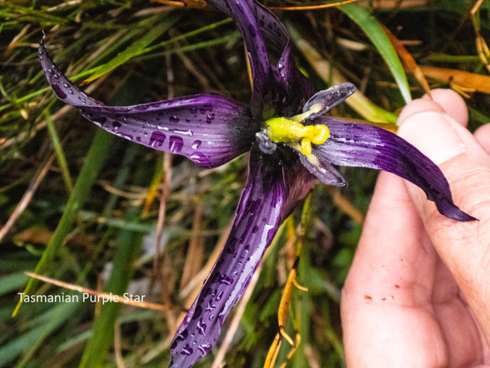
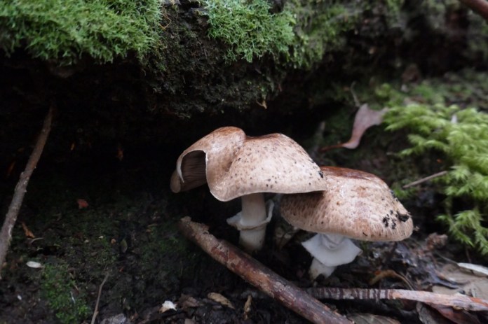
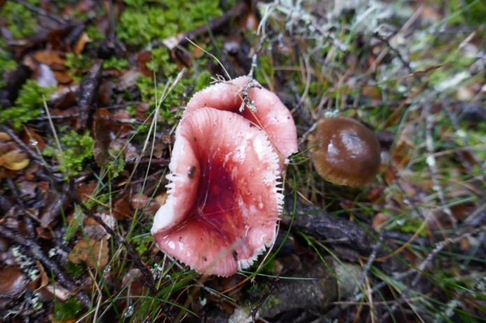
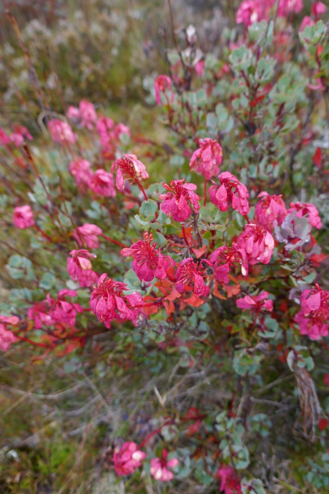
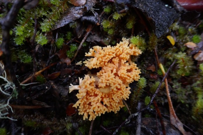
Nom and I found several flowers, including: a Tasmanian Star lily which for all the world looks just like an orchid – it’s a purple flower with long petals and a yellow stamen and style. I photographed this in rain and wind and somehow the shot worked. There were many other flowers including; other irises, Christmas bells with their cherry red bells, spider orchids which should be too delicate for these places but thrive here, and the brown and beautiful duck orchid. Orchids are the largest of all plant groups. They get their nourishment not from photosynthesis like most plants. They have symbiotic fungi that tap into other plants root systems and steal nourishment from them and then shares the stolen sugars and minerals with the orchid perched gaily above.
The ascent is described in three stages, a steep first pinch, a less sloped section then a final steep pinch. I had got used to the less steep middle section, skirting between pillars of rock, decked at their bases with orchids and other flowers. Then I looked up, a high peering through mist, the other walkers were dotted on the slope far above me. With echoes of our favourite movie, Galaxy Quest, “you have got to be kidding”. “Who designed this?”
I climbed up this section feeling somewhat aggrieved but admittedly I was forewarned by Nom. At the top, the wind slammed into me. The boardwalk on this near level section across the tops, would normally provide an easy path but today the wind barrelled over the lip of the mountain throwing me off. Walk a few little, little steps then stop, balance into the wind while the gust hits. I fell twice dancing over the rocks till I was left standing, amazingly with no injury but at some points the boardwalk is high off the ground and I am very glad I did not fall there.
The wind roared over the mountain. It was deafening.
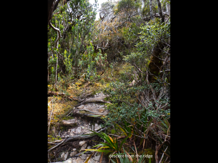
The top of the Ironbounds is reasonably flat, and it is 2 kilometres until High Camp, the first sheltered spot. Actually, this is the first sheltered spot since leaving Louisa River. When I arrived there the earlier arrivals were wearing rain jackets, stamping feet and snacking to keep warm. I enjoyed a muesli bar and a drink of water before heading out again. I was under the impression it was going to be all downhill from here, but I was mistaken. The track re-joined the plateau and quickly became even more exposed to the weather. Earlier the wind would erupt toward me in gusts with pauses, brief ones but with just enough time to shuffle onwards; this time it gusted non-stop. We all had to walk leaning 40 degrees into the wind and walk like crabs clutching our sticks and toppling side-ways to where the descent properly began. The track drops quickly from the plateau but the walk is not precipitous, just “technical”. The term “Technical” is jargon for difficult terrain; abundant muddy tracks, fallen branches, long rocky drops, diverging tracks and all of it, very slippery; yep it was technical.
I can only begin to imagine how hazardous and demanding it would be in really bad weather with rain and fog obscuring the route and frustrating walking. The rain that had dogged the early ascent of the Iron bounds had gone, and sunshine splintered through the overhanging crowns of trees. I soon stopped to remove my waterproof jacket and pull out my tucked in shirt to let it flap around me. Two hours after leaving High Camp, I arrived at Low Camp where I met the leading walkers. I could have stopped for the day right here; my earlier energy was spent. However, on this walk, there were still many kilometres to go before I could relax at a campsite. I just had to dig deep and keep going. The lunch was splendid as always; wraps we could generously stock with salad and meats.
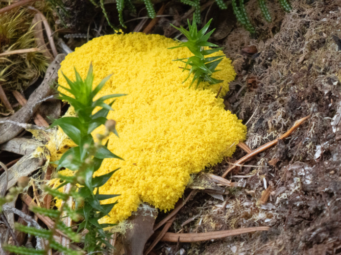
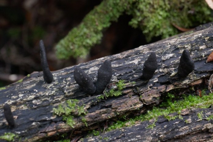
I hope I have made clear how totally demanding the walk is but what I have not emphasized enough is how truly beautiful and biologically amazing the flora is. Over the last two hours I had travelled in alpine flora, then subalpine trees and flowers; wandered into fern glades, littered with glistening moist moss, slime moulds hunting: then entered a dark gloomy rainforest at the bottom of the Ironbounds. If you know New Zealand, this single day is like a Heaphy track in splendid miniature.
From Low Camp there was still three more hours to get to Little Deadman’s Bay.
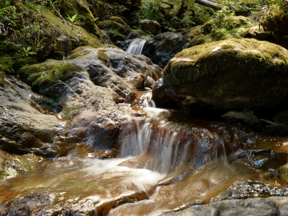
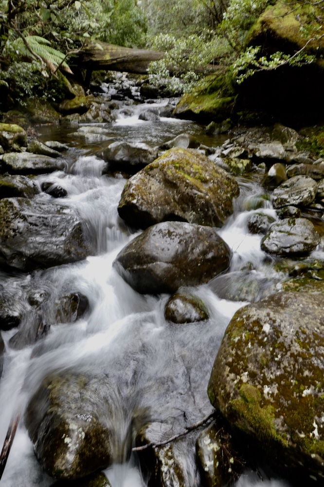
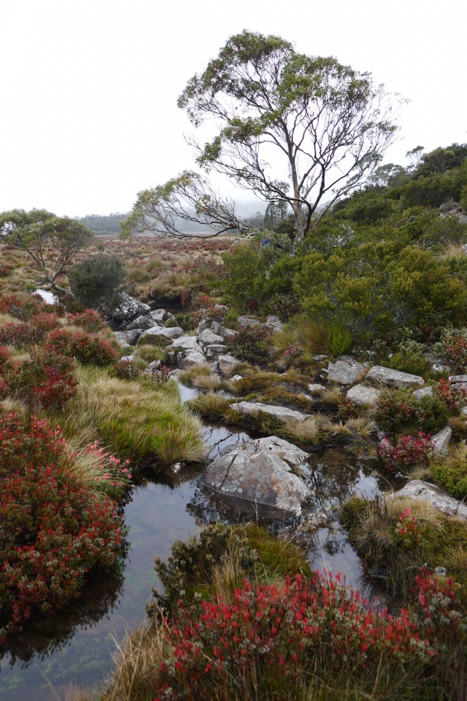
A kilometre from the lunch spot is a set of waterfalls and cascades, great for a rest and a place to fill up my diminishing supply of water. I carried 4 litres of water. One of the bottles had electrolyte solution to replace some of the salts my body lost on the walk; doing this this really helped prevent cramps and muscle fatigue. The rocks and platforms around the waterfalls are sloped and wet, very slippery and especially so when trying to put heavy packs back on. These heavy packs require a wild hurl into the air then swiftly swinging a shoulder under one harness before wrestling into it, and that is hard enough to do correctly on the flat. Luckily, Earle has spent some time with me resetting the pack and as a result the walk was much more comfortable than on the previous day. Most of the remaining three hours walking was on easier track with the notable exception of the first few kilometres. This section had a steep sideways cambered slope, so it paid not to fall over and end up down in the tree filled gully on my right. Considerable erosion combined from, the many walkers, the wild rain and weather, had severely narrowed the track and made many sections deep and very muddy. Then suddenly there was a hint of blue, the ocean through the trees, and steadily the increasing roar of surf penetrated the forest. There was still 45 minutes to go, and the track was now quite easy twisting its way amongst sassafras, coast banksias and ferns. The track hovers above the coast, the rocky cliffs and promontories, and rocky narrow grottos at sea level: all struck by waves that surge up their stony flanks. The sea is a blue expanse rippled by long lines of waves which span the full length of the greater bay. As they finally meet land they become airborne, roaring into tumbling, white foam above the rocks.
There are many small inlets, choked with kelp and offering caves in their cliffs. Alan climbed down to one the next day and later told us about the sounds of water echoing within them as water surged in.
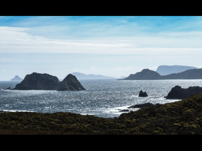
The rocks and platforms of the many inlets glisten and glow, reflecting the light of the falling sun.
I arrived at the camp at Little Deadman’s Bay at 6pm; I had walked for at least 12 hours after commencing at 5 am. I was astonished that I felt less tired than at the end of the previous day. However, all I wanted to do was sleep. It had been easy to keep myself well hydrated using the twin water bottles tucked in small packs on my front. After dinner, a pasta dish, I went to bed and crashed into slumber. I don’t think I even dreamed, just slept! I woke at 6am and decided to spend this break day bludging which was more- or- less the plan from the start. This was a designated rest day and I was going to do just that. I beach combed up and along the small bay, then wandered a short distance along the forest tracks; I sat on rocky platforms to admire and photograph the beautiful southern light and gorgeous coastal scenery. Off the coast are magnificent islands including: DeWitt, Il de Golfe, both are part of the larger Maatsuyker group. To the south east, South Cape could be seen jutting into the Southern Ocean. Though my legs did not actually hurt they were not really interested or indeed motivated to do things like lift me up or walk more than a short distance, so I spent much of the day resting in my tent, eating and reading. I sent messages to Jennifer on my In-reach communicator, just to let her know I was okay and what I was doing. It is only capable of sending and receiving text but does include a map of my location with very accurate longitude and latitude. Being able to keep in touch with Jennifer was great for my morale. The weather was exceptionally kind, sunny and a warm breeze perfect for drying off wet boots, gaiters and other gear.
31/12/2018
Well 2019 is about to commence. I am in my tent camped at Surprise Bay as I write this. Unlike the soft lapping of the water at Little Deadman’s Bay or the riverine gurgling at Louisa river, there is now the steady sound of uninterrupted surf; white caps on the top of the rolls of waves are ceaselessly entering Surprise Bay. In the distance, surf is jetting into the air as the ocean washes up the rocky edges of islands off Pretty Point. Before I wrote this, I went for a morning walk on the sand and amongst the rocks, to take advantage of the morning light. When descending to the beach from the campsite, the track steepens and a rope with monkey fists tied along its length provides traction and support. At the base of this cliff, my first obstacle is a lagoon; depending on the tide it is about 5 metres across. It is shallow now and the water is refreshing as I wade through it. It is cool and wet on my bare ankles and feet as I cross over to the beach. Now I am wearing sandals, so it does not matter if they get wet. Seagulls wheel in the air and screech as I approach their nesting platforms hidden high among the rocks. My short walk on a lonely beautiful beach is an inspiring way to commence the day. However, I am getting ahead of myself so I will recommence today’s story with the tale of my walk from Little Dead man’s bay which ended at Surprise Bay last night.
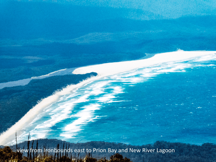
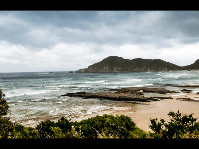
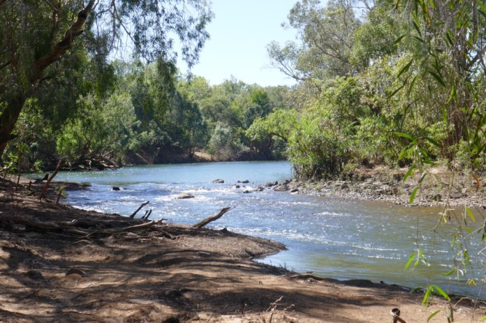
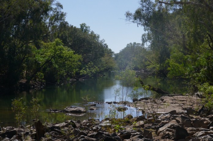
Though it is “only” thirteen kilometres from Little Deadman’s bay to the campsite at Surprise Bay, it took me 13 hours including breaks; leaving at 8am and arriving at 7pm. The walk begins with a short stroll along the rocky Little Dead man’s Bay, past the little creek that provides such delicious fresh water, until reaching an orange marker on a tree. Here is where the track continues. The track is rough (but easy to follow) requiring sustained concentration on foot placement and balance. An injury anywhere on this walk would be very difficult to manage. On a map the small black dots that signify the walk route break few contour lines, but inside that contour interval of 40 metres, it undulates and twists remorselessly. We briefly walk along Deadman Bay before leaving the coast once more to walk through forest and climb over Menzies Bluff. Many matures trees provide shade for this section of the walk. About three hours after leaving Little Deadman’s Bay we reach the stately Prion beach. The walk along Prion beach goes for four kilometres and provides wonderful views of the surrounding mountains, and adjacent ocean. We continued along its length until meeting a sandbar. Here we turned north to find the boats and other walkers all making ready to cross. The boats are well secured against rising tides and weather and we needed to unclip and haul them down to the wide lagoons water line. This beautiful body of water, the end of the biggest river of this coast is named New River lagoon. The water is a deep blue, a breeze ruffling its surface; there is a band of trees and scrub and standing far behind and high above them, I can see Precipitous Bluff. This is an impressive near vertical monolith stained an even blue by haze and distance. To cross, packs are stowed in the rowboats and oars placed in rowlocks; it only takes 10 minutes to row across. It is essential to leave a boat on each side and both will need to be secured as we leave. The attachment points are sturdy steel carabineers attached in turn to heavy rope. We had lunch sitting on the ground in the forest lying just beyond the lagoon. The weather was beautiful, sunshine and clear skies, it all made for amazing vistas. I could only imagine how difficult it would be to cross the lagoon in rough seas and heavy rain.
After lunch we continued the walk. The track first dropped into forest, its warm still air hovers in the shade. Then a sudden climb, a grunt up a short climb to a vantage point; I could see Precipitous bluff, and to the left and much further away was Federation Peak, looking like a small collection of toppled pillars on the horizon.
We left the coast, losing sight of water and waves, walking on tracks, some muddy, some very muddy, through plains of button grass and heath. Here at last we met the serious mud for which this walk is famous (or is that infamous). I have not described the extensive lengths of track that had mud some 20 cm deep but here some bogs a metre or more in depth and were met with no warning. Nom plopped downwards in front of me as if she was riding a fast elevator straight down. She adeptly lurched to the right placing herself against the more solid edge of the track. Alan helped hoist her out. Luckily her boots stayed on; boots can be sucked off in the process of being extracted from the sucking mud.
The boardwalks are few on this section of the walk. Typically, they consist of two parallel boards, 10 cm wide and 2 metres long; there is usually no chicken-wire (anti slip) covering them. This is not a problem in the dry conditions we have had on our walk but in the wet the timber can be very slippery indeed. I should mention that the weather conditions of this current walk are exceptional; dry, minimal rain, warm sunny days. Look it certainly makes for easier, more pleasant walking but the plants, especially ferns and shrubs looked stressed. They flourish in and are adapted for wind, cool weather and frequent rain, not these persisting sunny, hot and dry conditions. Even while I was walking this section, fires were kindling north of me, in the heart of the South West Wilderness Area.
Soon we re-entered forest, appreciative of the shade and skirted the coast once more, providing more opportunities for views of the steep rocky promontories piercing the southern sea. It was now two kilometres from the tracks junction with Surprise Bay. By now I am tired but there is no option but to continue. In this situation, I rely on my training for the walk; the fitness it has provided as well as a determination to just keep going. Life is about two things; turning up and keeping going. I think that most people who do this walk have to dig deep in their personal resources (physical and mental) at one stage or another. I did not rely on mental and physical toughness. I snacked on glucose treats. I had muesli bars. I made sure every second litre of fluid I drank was topped with electrolyte solution to replace some of the salts lost in sweat on the walk; disturbances in body chemistry are easily prevented but hard to remedy without prolonged rest.
The track wove its way up and down through forests of tall eucalypts and ancient tree ferns, their litter of shed leaves and fallen fronds making this steep track deliciously soft underfoot. The fronds of the many ferns hanging above shone with golden auroras of light from the setting sun. I was simultaneously tired in one sense but refreshed in another; it is strange how two such contrary feelings can exist side by side. Now, the walk meets a steep uphill section, then turns beginning a gentle downhill meander that seemed to be take me near the beach, so close I felt I was about to arrive, then it drifted away, time and time again this happened before finally I arrived at the beach.
This beach is truly beautiful and worth every painful step to get here. The sand is clean, white and pure, it surrounds several rock formations; sandstone and conglomerate cobbled together; then tossed into the sky by the energies of the ancient earth. It reminded me of the Statue of Liberty tipped askew and emerging from a similar beach in the closing scene of the original “Planet of the Apes”.
There is still a kilometre to go and my feet hurt! When I walk up a track and especially down a cliff, my increasingly swollen toes jam and strike the boots toe box.
At the end of the beach is shallow river, it is an easy wade across to reach a rocky platform. This continues up a cliff. Here is the end of a gracefully curving lagoon, tannin coloured water eager to enter the ocean. As I cross the flow tugs at my ankles. The track then continues on up a steep rock face which is easy to climb because of a length of sturdy rope, its repeated knots provide hand holds allowing me to haul myself up, step by step.
The campsite is only a few tens of metres further on. By now I am in a daze and intellectually struggle to find a camp spot. All my mental processes are sluggish; thick like cold porridge. Finally, I find a site, assemble my tent, climb in and rest without bothering to inflate a mat or pillow; being horizontal never felt so good!
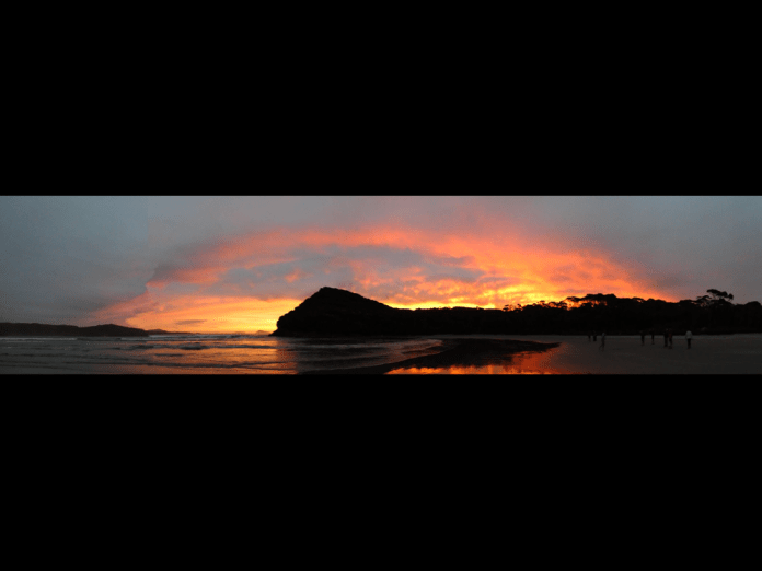
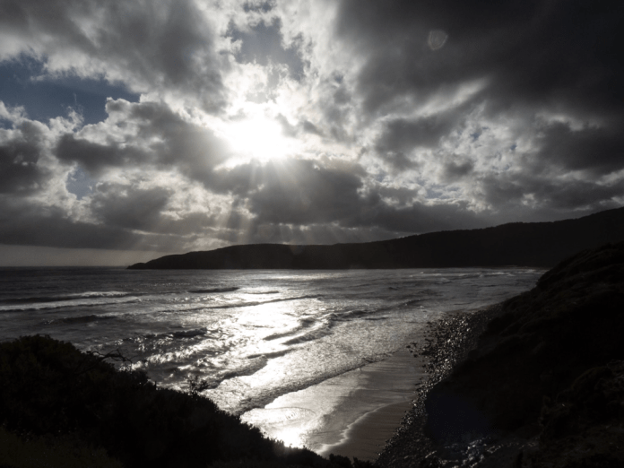
At 7:40 pm I felt rejuvenated enough to climb down to the beach. I crossed the river in my sandals then walked across the sandy shore. The sun was now low in the sky; coloured horizon and clouds glowed in orange and gold in interrupted bands; its richness mirrored faithfully in the sheen of seawater on the beach.
Dinner was cooked by our terrific guides and consisted of Beef Stroganoff with Tim Tams for dessert. Afterwards I slept very well.
Today, it is only a short walk of 3 hours to the campsite at the east end of Granite Bay.
1/1/2019
It is 6pm and I am sitting after a fashion in my tent at Granite Bay Campsite; I am more hunched over than I would prefer as I am scribbling on my note pad. It is too hard writing lying down. We spent the morning relaxing at Surprise Bay and left on the walk to Granite Bay after lunch. Nom gave us a very interesting talk about ferns. The track enters the forest and goes up and up, and you guessed it, up some more. The track is not rough just steep. The forest itself is beautiful; mountain gums, ferns, mountain peppers, geebungs and many other Tasmanian shrubs and trees create a botanical wonderland which is a pleasure to walk within. The track then descends to Granite Bay. There is a precipitous climb down an ancient timber ladder held together by ropes down to the beach, all of which I negotiated on my bottom. Large packs have an unspoken shared conspiracy with any ladder to cause teeter tottering on any descent. I am a safe walker but not an elegant one! Nom stepped down this rickety ladder with complete confidence.
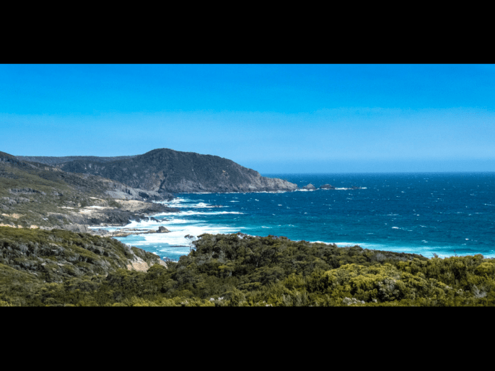
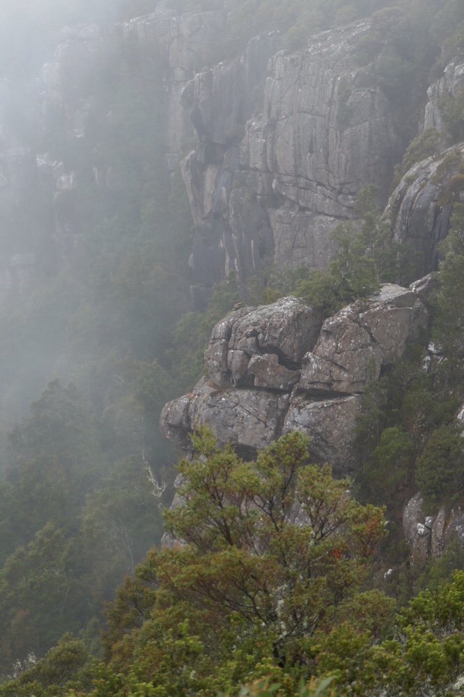
At the beach we could see across the waves and ocean swells, the magnificent cliffs of South Cape. These kilometres of dolerite cliffs, Earle explained, are 300 metres high. Dolerite is ancient, it forms deep beneath the surface and is immensely strong rock: it has been described as the backbone of Tasmania. These cliffs drop vertically into the ocean, each hexagonal pillar fused to its neighbour for aeons. Sea surf crashes into their bases never endingly sending up jets of salty sea spray into clouds of sea haze.
It was a short walk along a rocky beach, hence the name Granite Bay. The surf covered the sandy part of the shore near the water’s edge. We had to clamber like lobsters with our walking sticks in place of pincers, balancing on the slippery rocks. At the end of the beach is a waterfall which was not all that impressive owing to minimal rain. I clambered up the rock face with some help and then it was barely a hop and a step to the campsite. This is perhaps my favourite camping area of the entire walk, with abundant tea trees, plum trees, and celery top pines. Later on, Alan and I visited a small waterfall upstream of the other waterfall that plunges onto the beach.
2/1/19
This morning we left the Granite Bay campsite. My sleep was only interrupted by the need to get up at 1 am and reorient the tent. It was a simple matter to remove pegs and turn it to lie down the slope and not obliquely across it. The entire slope issue had utterly escaped me when I set up the inner and fly earlier in the day. The wind howled over me as I fixed the tent pegs down. The toilet at this camp site is a disgrace! Most of the toilets on the walk are modern enough with heavy doors which cannot be opened by the local fauna and a seat and “bowl” over a drop toilet. At Granite bay, there was merely a small rectangular hole in the floor, no seat at all, and already the results of the morning ablutions were sad to say the least. Eeech!
We left the campsite at 7:50 am and immediately entered forest and began a 5 kilometre climb up a rocky track of which the first two were very steep. On the way up, the track would dip creating hollows where water and mud would collect, creating some very boggy track. These bogs are not only deep but wide as well and it can be challenging to skirt them without damaging the track even further. I think that in these difficult sections, there should be track work to not only ease walker access but help prevent erosion. The track modifications need to be selective, targeting stretches of track where walkers are causing damage. On the sections of the walk with boardwalk or hardened surface, plants and flowers can be found right beside the track while in the muddy boggy sections, the churn of 1500 (per annum) walkers prevent anything at all from growing there.
The track dried out considerably as the highest point was reached. The other walkers were waiting under a canopy of tall eucalypts. They were talking about seeing a large tiger snake on the track. I never saw a snake on the entire walk which does not bother me one bit. After a snack and a drink, I hauled my pack back on, and headed down the track. It was a beautiful walk, a track winding its way gently downhill amongst tall straight mountain gums, between ferns and scattered native trees. Then the track emerged suddenly into splendid sunshine before carrying along a boardwalk to the lunch spot; the route sinuously twisting in a landscape of dense heath and small native trees.
Lunch: wraps stuffed with salad, salami, cheese and tomato.
There was only a further three kilometres to go after lunch. After lunch, there was yet another climb but a much gentler one than earlier. Then it drops down slowly descending a long ridge. On the way, it cuts across to the clifftops, to form eyries with fine views of South Cape and Ocean far below. The track ends today at South Cape Rivulet. At the rivulet, Earle lead us seaward where the water was shallow. The rivulet enters at the western end of superb long sandy beach with a forest of tea tree and tall native grasses above the seashore. To my left, the rivulet widens into a wide, serpentine lagoon that blends into forest. Sunlight lit up the leafy crowns of the tallest trees on the hills above the lagoon. Far across the bay, South East Cape beckoned amongst surf and waves: as the sun provides a crystalline blue sky to bathe all of the bay and beach.
In a romantic (impractical) beachcomber way, I pitched my tent on the sand on the beach. There was some shelter from the wind but not nearly enough. I improvised sand pegs, burying the pegs in the sand. The tent at least was not going to blow away. I was feeling smug with myself. I rested in the tent and though admittedly it was not going to blow away, least of all with my weight inside, the walls of the tent were flattened into my face by the wind. I decided I would move the tent and I soon found a much more sheltered spot among the grass trees. Mum and daughter on the walk pitched their two- person tent adjacent to me. Suddenly a gust of wind pulled the tent into the air, jettisoning the pegs into the underbrush. They (the pegs) were never located. I must bear some responsibility as my first choice of campsite heavily influenced their own selection. In my new campsite, I could still hear the roar of the surf and the wind blowing through the trees but now that the tent was sheltered and motionless. I would sleep easily.
3/1/19
I have had a nap. The day has been all a dreamy heat and after a short walk from the Rivulet camp site we soon arrived at the new campsite located just beyond Lionhead Island. I slept okay last night at South Cape Rivulet, but it was too warm, and overnight, I soon exited my sleeping bag and thermals to lie on them instead. These small tents are terrific at keeping heat in and the fly zips are not adequate to adequately ventilate them. After so many days with no shower, I am glad I was in a single person tent.
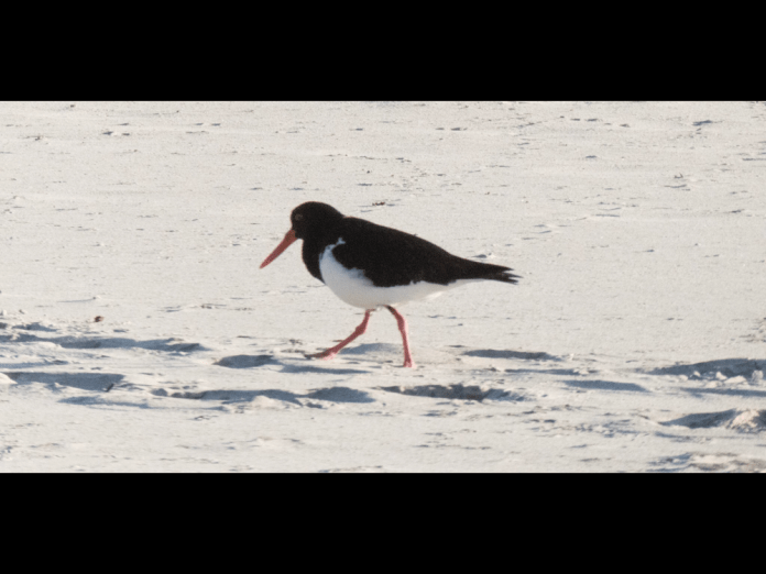
This morning I woke up, grabbed my trusty camera, a Panasonic TZ-90, and revisited the beach for some early morning photography. It impossible for me to do justice in words or even pictures to the serenity and still beauty of this place. Far in the distance, across an expanse of ocean, is South East Cape a narrow promontory, a featureless blue due to sea and wind haze. Turning my eyes to the left, I can see a nearer promontory, its distinct layers of stone and rock merging with the east end of the beach. Surf crashes over the rocky platforms that emerge from the sand covering them in white flecks of tumbling water. The beach sweeps around the bay, white and unobstructed, with hooded plovers quickly marching on the shore, sea gulls and pied oyster-catchers wheel over the waves before landing on the beach and peck at the sand beneath their feet. Grasses clump in small protective mats in the sand higher up the beach. Behind them tea trees and taller grasses form a forest well above the water-line. The surf roars non-stop: long unbroken wave crests cross the width of the bay, before crashing into rocky points or surging up the beach where I am standing. Waves surge into the mouth of the rivulet, sending ripples across the brown water of the lagoon before dissipating upstream, wobbling the tree reflections as they pass.
I followed the rivulet upstream, it bends first to the left and then to the right, it is a wide and lazy water, mirroring the forest above it. After breakfast and packing up my gear, we began the walk from South Cape Rivulet to Lionhead. The walk begins along the beach which I had already explored, turning off into the scrub at the orange marker used the length of this track. It began on loose stones to a clear smooth track. The walk goes through coastal forest, full of banksias, ferns and low gum trees, forever shorn of height by winter storms and winds. The way was often overgrown; I struggled to clear the path with my sticks trying to locate any snakes. The track was muddy in sections and moderately steep. Some trees had been felled by wind or weather and had to be climbed over, but all in all, it was not a difficult walk. I arrived at the first of two beaches. As I walked along the sand skirting the waves, I looked up to see a gothic tower, perhaps built by nature out of its arrogant opposition to surf and waves; its crown was the wild water tossed high over its battlements.
Then this beach was left behind. The walk twisted upwards through forest before descending to a sandy grotto where the most delicious water flowed. The water at the rivulet had been adequate but was a bit too brackish to enjoy. I glutted myself with this new water before filling my two water bottles. There was only a short walk to the beach, worn boots collapsing in the soft deep sand.
I walked along the stony uphill section of the beach, past Lionhead rock and I would have carried on all the way to Cockle Creek given the ease of the walking. Earle tapped me on the shoulder and telling me I had walked right past the campsite. I had seen the steps leading up the site but carried on anyway. It was located very close to the stream where I had stopped earlier to drink. The timber stairs are solid and well built. The drop on either side of the steps is a few metres. I am a bit nervous of heights, but Nom sensing my concerns, had told me of a useful trick. Hold your poles in front of you and just in the periphery of your vison. The brain sees this as a wall and if you don’t dilly dally, the brain can maintain this illusion long enough to descend a staircase or steep, narrow slope or a narrow bridge.
At the top of the staircase is a short boardwalk through tea trees to leads to a small campsite. We had the pick of the sites as we were the first to arrive that day. Later arrivals had to find other sites such as near the bottom of the stair case amongst the grasses or in the sand behind the beach.
Most of the other walkers decided to try and walk to south East Cape. Though it looks close on the map, the tough tea tree, heath and scrub make a direct traverse impractical. This was my opinion. I stayed behind enjoying a nap in my tent, a quiet read on my kindle, and a pleasant generally mindless reverie in the afternoon sunshine; an afternoon filtered through the branches.
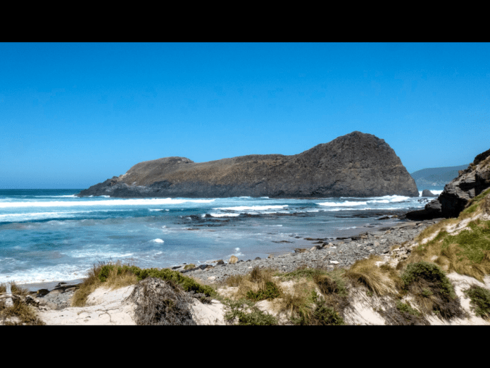
I wandered down to the beach to fill up my bottles once more and then walked to explore the rocks and rock pools beneath the Lionhead, the huge stone island abutting the coast. To me it resembles a lion couchant, with its hind quarters facing the incoming seas. Between the island and the beach are vast rock pools and stone formations, while giant untethered kelp now wafts in the water beneath its surface.
The others arrived back at 4pm.
Tomorrow is the final section of the South West walk, the 11 kilometres to Cockle Creek.
4/1/19
I am lying in bed at Amberly House, Sandy Bay road. I have had a shower, extracted dead insects from behind my ears, admired the wreckage of my toes, shaved my nine-day beard and have put on clean clothes.
This morning began at Lionhead, after a hot night in the tent. I opened the fly as much as I could do but it was still warm, too warm to stay consistently asleep. I woke up at 5:30 am, I let my thoughts meander for 30 minutes, vainly trying to slot them in useful parts of my brain. I packed my gear into the pack, sent a message to Jennifer on the in reach and had breakfast. Porridge in a bowl, added hot water, mixed vigorously with a spoon till the flakes dissolve and form an edible mixture. I scooped a cup of coffee into my cup with the ladle sitting on the lid.
I descended the four flights of stairs. I stopped often to admire the impressive views of beach and coast. Unfortunately, the clear vista of the Lionhead itself was obscured by haze. I walked along the beach leaving Lionhead behind me. The sea haze filled the atmosphere over the beach giving a magical quality, a hazy background to silhouettes of the walkers further along the beach. The track commences with a short steep path from the beach, up and over Coal Bluff where there is a visible seam of coal. Fragments of what look like shattered briquettes crunch under foot. The track enters a forest; cool shade is very welcome as the day is already beginning to warm up. The path is easy, its undemanding nature makes for quick walking. Also, the packs are the lightest they have been, putting lightness in the step. The forest soon opens out into a rolling expanse of button grass and heath. The coastal views of ocean and mountains enjoyed early in the walk are now replaced by low hills, with none of the drama of our first climbs. It is none the less gentle sweet country. We finally enter a tea tree woodland, before arriving at Cockle creek. I had spent much of today’s hike walk chatting with first one then another of my fellow walkers and the day had gone quickly.
We visited the whale sculpture and generally stretched our legs, having left our packs near where the bus would arrive. We boarded the bus on our return to our packs. We stopped for lunch in Huon at a café. We soon arrived at our destination outside the Astor Private hotel. The walk was over at last.
Afterword
I am in the townhouse at Alice Springs, its hot outside but the air conditioners are keeping us both comfortable. It has been four weeks since I completed the walk. I can sum up the walk like this; it was the hardest walk I have ever done, and the most beautiful. The other walkers and guides supported and encouraged me and I did likewise for them. Perhaps this is the most important lesson for me; whatever you can achieve alone is nothing when compared to what can be achieved as a team working toward the same goal.
Walking in Tasmania
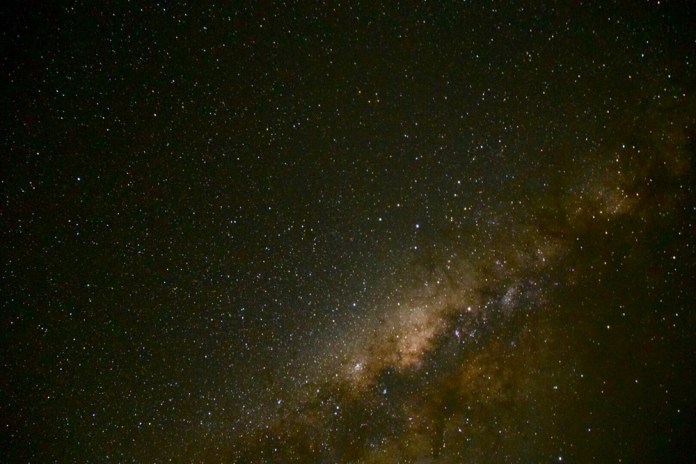
As you may realise not a great deal happened on our stint in October. It’s starting to resemble comfortable slippers, a few less surprises and a lot more comfort. I took some sky photos in Hart’s Range. This is a community on the Plenty Highway only about Three hundred and fifty kilometres from the Queensland border. Almost shopping distance! The accomodation for staff is a short distance from the community so it makes walks in the surrounding country easier and being outside at night is a bit safer too.


 I was able to do some wilderness walks with friends while back in Launceston.
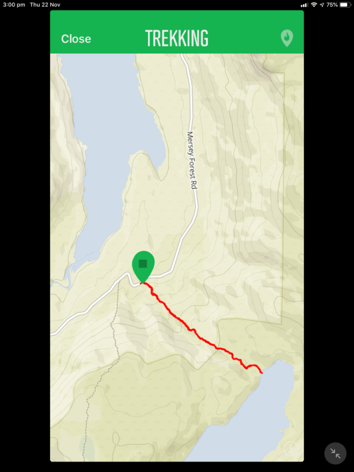
I joined a walk with the Ramblers club. It’s was a fine sunny day, a Sunday. We drove all the way to Lake Rowellan and along the Mersey forest road. This road allows access to the Walls walk, Lake Myrtle and of course Lake Louisa. Yep, we were going to walk to this highland lake. An ancient glacial lake which splashes its banks only 3 kilometres from Lake Rowellan but it’s a somewhat vertical route. The walk starts about 100 meters short of the Juno river road crossing. Pink tape is suspended from tree branches to mark the start and to indicate much of the route. The track is not well defined but if there is any doubt, just go up!
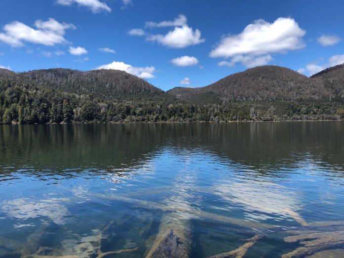
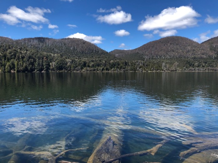
There were 16 walkers, Jock took up the tail end and Trevor lead the way. We were warned to keep the next walker in sight because of the scrub and narrow winding track. It’s a solid climb up, including a short scrambles over rocks and trees that have crashed on the path, then a refreshing meander through a glistening rainforest, all the branches, mosses and lichens dripping with moisture despite the sunshine. A slime mould which I kid you not, resembled snot smeared over a child’s cheeks, it was white and shiny and snotty on a log we all carefully stepped over. The end of the track is on a narrow lake bank. We stopped for lunch right here and munched sandwiches while enjoying the view both sublime and very peaceful.The water was so clean and clear, the ancient logs which had tumbled in over the years could be distinctly seen beneath the surface.
The weather was beautiful from start to finish. We headed down, and thankfully, it’s never as steep going back. Funny that. We surfaced from the forest above Juno creek taking some photos there before re entering the forest and then dropping down to the road.
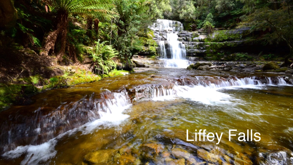
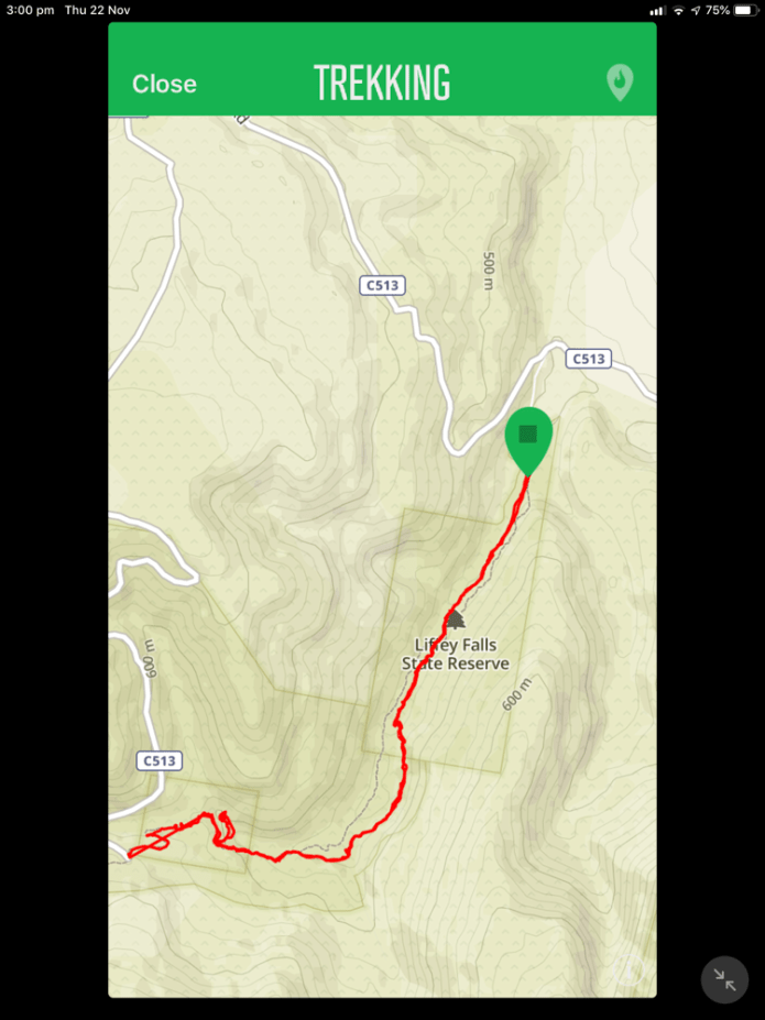
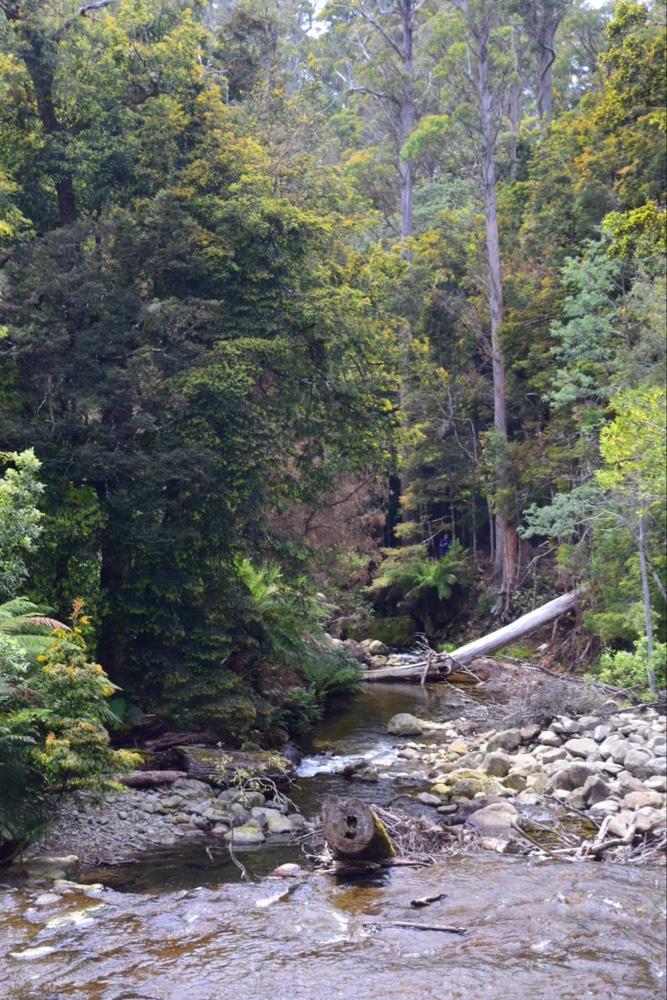
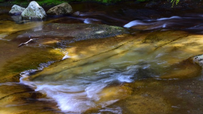
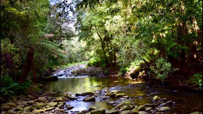
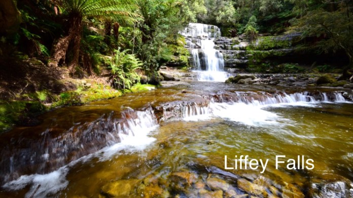
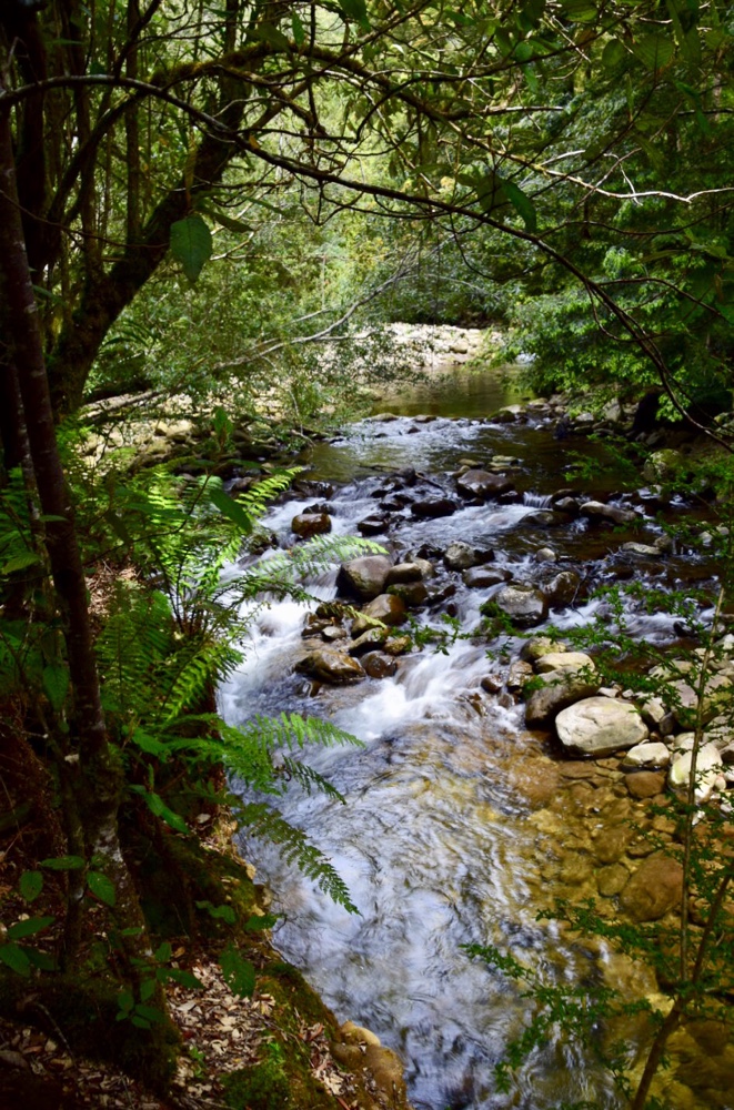
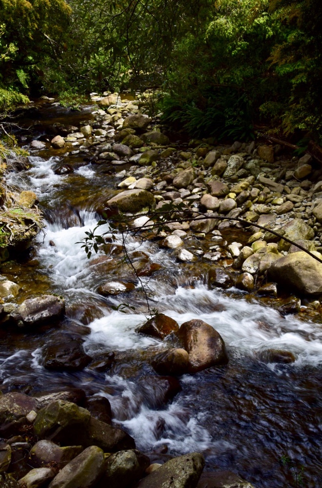
 On Monday I went walking with Gareth. We drove to the lower, downstream end of the Liffey falls walk. It was a very pleasant hike up always within cooeee of the rivers and creeks of this area. The track is vastly improved from a few years ago, it’s well benched and easy to follow. There are established ferns and trees providing shade and shelter. There are creek crossings on well built bridges. Not a challenging walk perhaps, but very refreshing and beautiful. The waterfalls did not disappoint. There are now several viewing platforms to enjoy the river and waterfalls.
We had lunch in the upper visitors area, sandwiches for me and some sort of sport food for Gareth, that read like rocket fuel, it’s ingredients were so alien to actual food. But after a mug of hot tea our spirits were amply restored and so sustained, we continued our walk, back downhill to the car, strolling along the river.


Corroboree billabong Trip
We are sitting in the shade of the camper trailer having just returned from a tour with Evan, the guide for Wetland cruises. A delicious cool breeze is fanning around the camping ground. I suppose the outside temperature is about 28 degrees C.
We booked this outing soon after arriving in Darwin. Max and Lyndel had told us about this area when we stayed a few days with them in Katherine. They will be sharing a houseboat with friends, cruising the forty kilometres of waterways over an informal long weekend. We did not have this much time so we decided on the one day trip, from and then return to Darwin.
 The bus arrived right on time at 9am. On the ninety minute drive to the billabong and the cruise, Evan told us all sorts of interesting things about Darwin, the bush and the billabong. He was a mine of knowledge. Like many people, he works in the”DRY” and travels elsewhere to work during the “WET”. The current weather is mild with sunshine, pleasant breezes and cloudless skies but the climate takes a nose dive even before the wet.
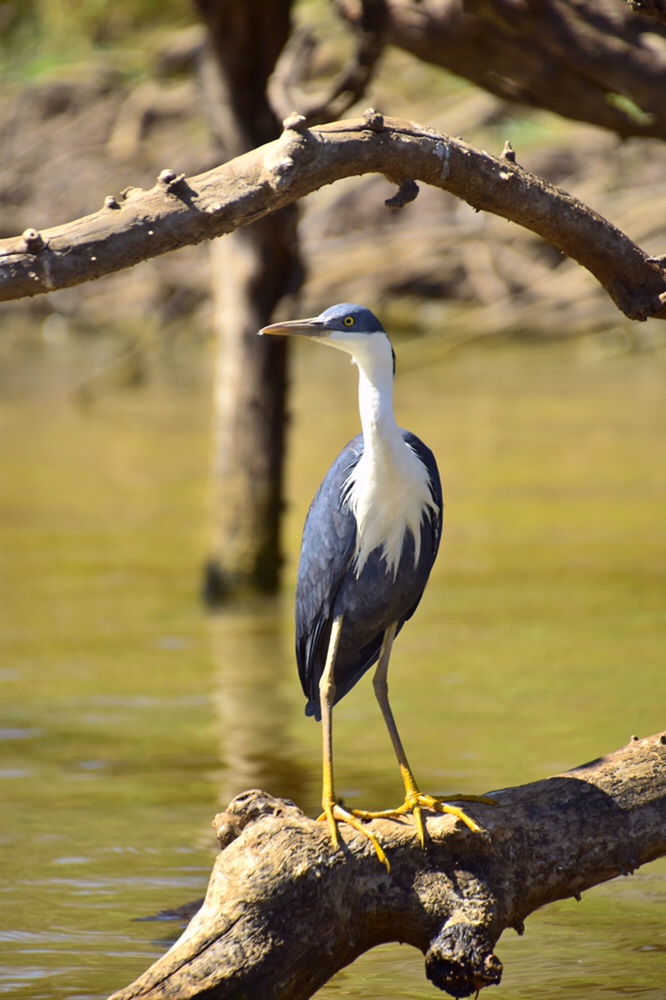 The “build up” is over September and October with very high humidity and dry thunderstorms, and then the WET begins. The population of Darwin is about 200,000 over the dry but falls to less than 150,000 over the WET. This is due to tourists and others escaping south to less humid climes.
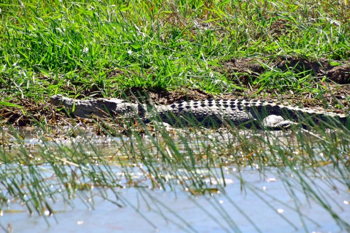 Darwin is a melting pot, with many different people making up its mix of inhabitants. A quarter are Aborigines; local Aborigines and “Long grasses” which is the term for Aborigines arriving from further afield. They used to sleep in the abundant long grass around Darwin but in modern times, they sleep on benches and in public areas. Owing to the abundance of tucker all year round, Arnhem Land, Kakadu and the Darwin area has always carried a large population of Indigenous inhabitants. In the WET, they retreated into the high country and in the following DRY walked north, to feast on bush food and fish.
 There are lots of Americans and not only well heeled tourists in colourful shirts and Bermuda shorts but well muscled Marines with short military style haircuts. We drove through Humpty Doo and saw the huge radio transmitters used by the defence forces of Australia and the USA to communicate with their forces all over the world. There are barracks along the Stuart Highway for soldiers and RAAF personnel.
 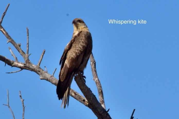 The locals are pleasant, very much so, but the per capita consumption of alcohol is the highest in Australia. A Darwin stubby is two and a half litres of, according to Evan, a really quite noxious beer.
 We boarded the large flat boat at Corroboree Billabong after having an introduction to the vagaries of wetland life by visiting an information centre just short of the billabong.There were twenty eight people in the boat but we all had excellent seating and visibility for the cruise.
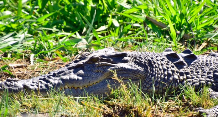
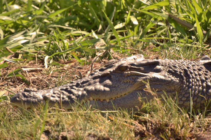
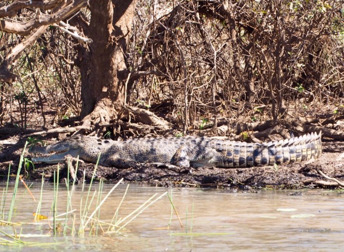
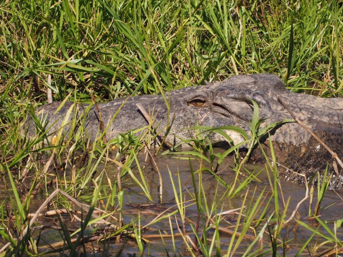
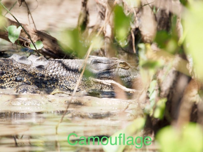
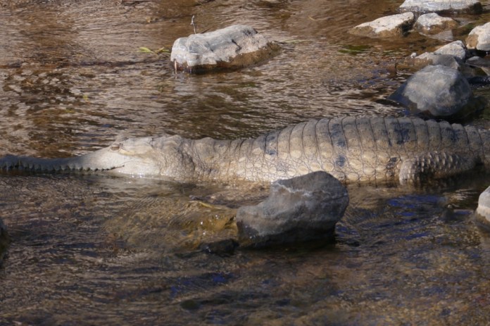
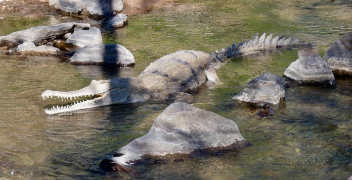
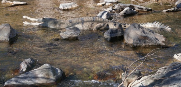
The cruise went for over two and a half hours, and we saw so much interesting wildlife. I’m sure I will forget to mention everything but we saw crocodiles. There are no alligators in Australia despite there being three different Alligator Rivers. There are fresh water crocodiles that hunt fish and are smaller and less aggressive than Salt water or Estuarine crocodiles. Salties as they are called can thrive in any fresh water, open ocean, salty tidal areas and in fact any waterway they can get to. In the early 1970s, the unrestricted shooting of the Salty was banned, and so now there are 150,000 to 300,000 salt water crocodiles. They do kill people, mostly locals who take them for granted. If you are ten meters from a riverbank you are potentially safe, as these crocodiles launch out of the water using their powerful tails, but their legs are puny and they cannot sustain a pursuit over even a short distance. They swiftly build up lactic acid which can produce a fatal acidosis. Read the signs about safety near water and do what it says. A salty can sprint through water at 40 km per hour and produce no turbulence, no sound until it launches out of the water. Guides and tour companies take the threat of these magnificent, if deadly creatures, very seriously indeed and so should you!
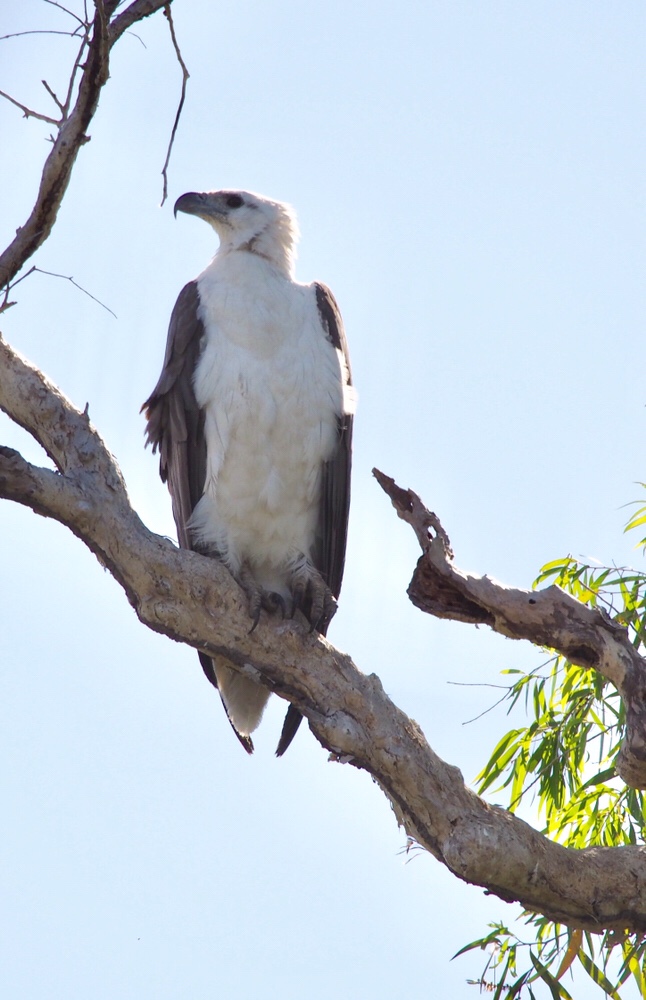
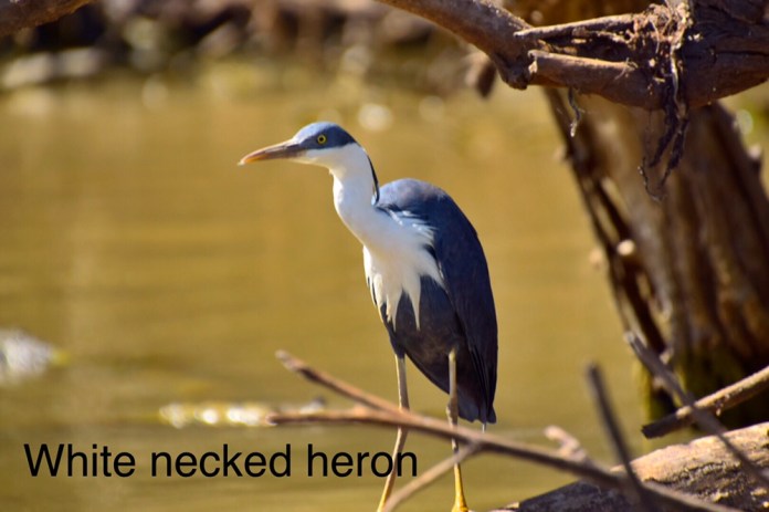
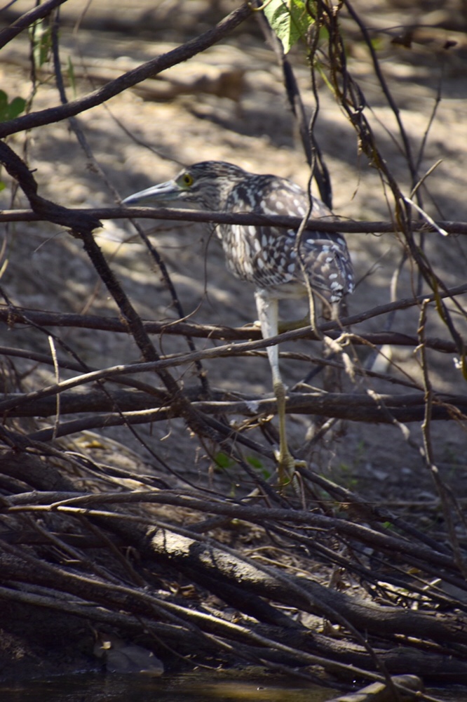
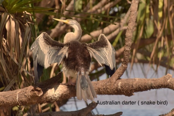
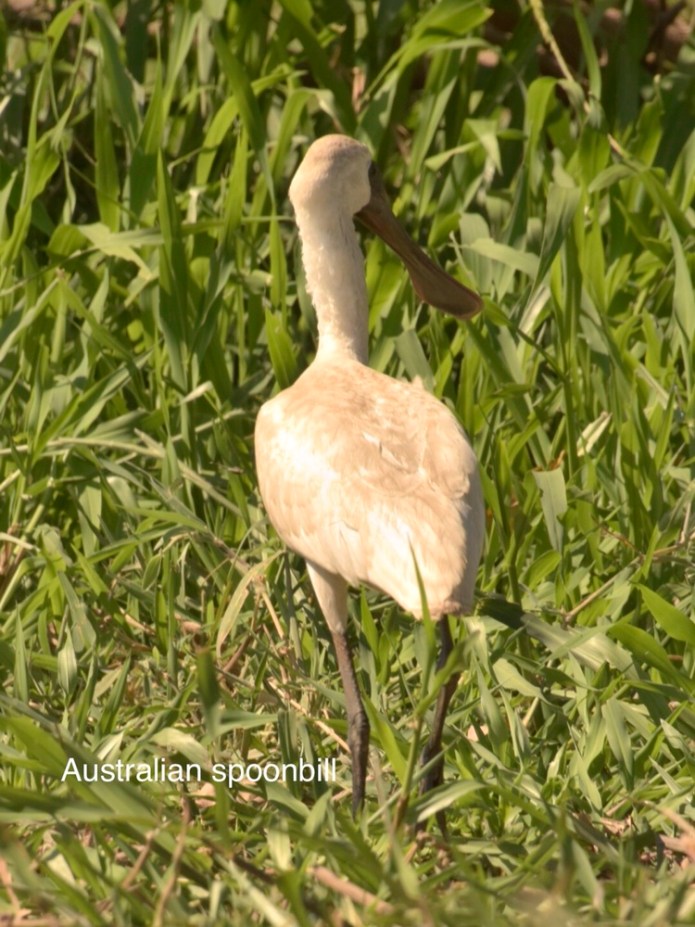
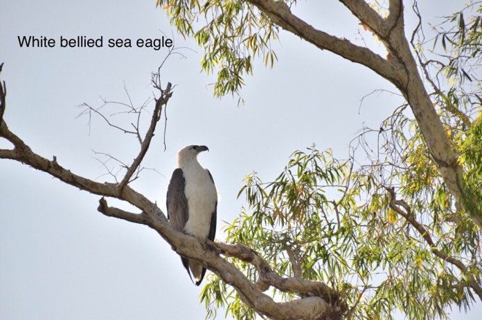
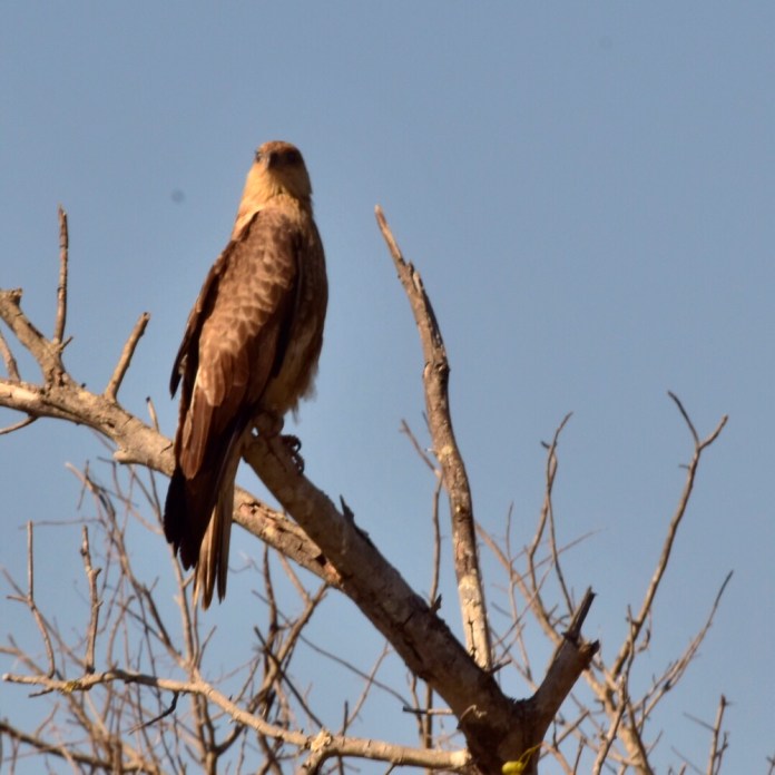
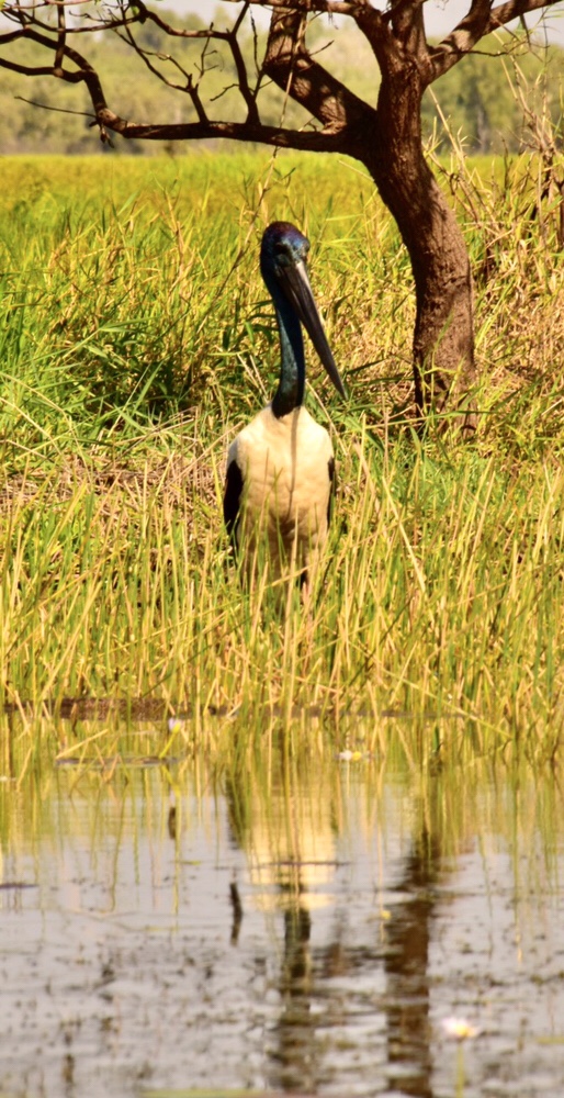
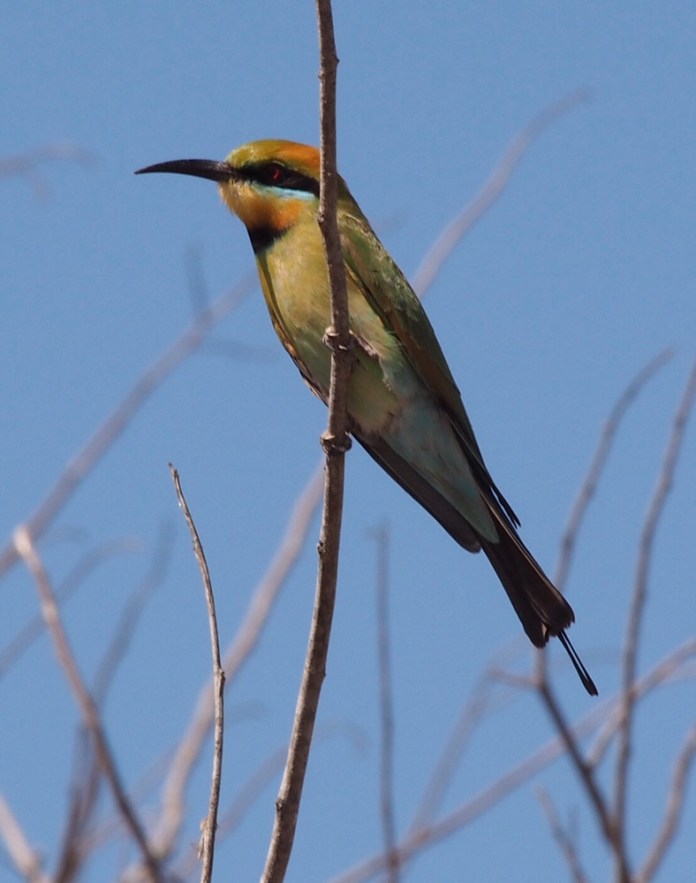
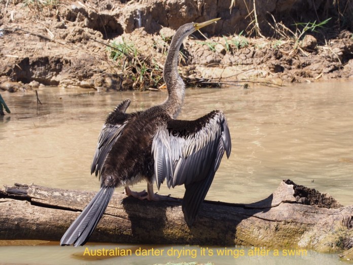
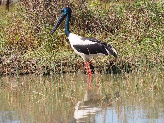
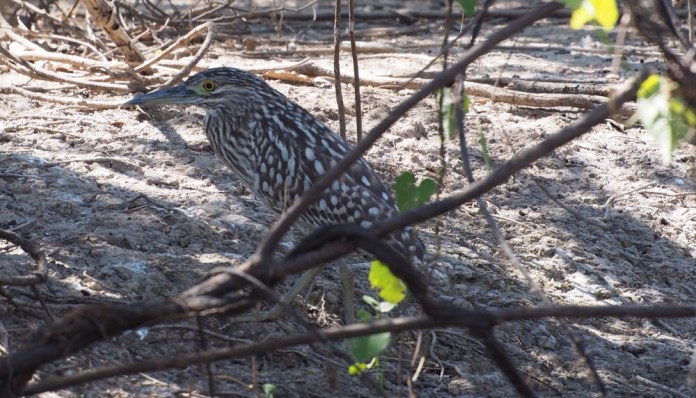
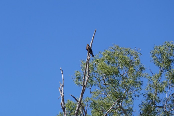
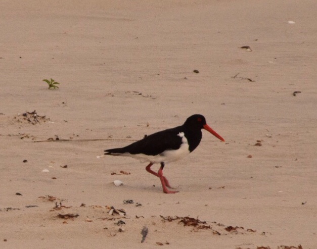
As well as crocodiles, there were lots of birds. And I mean lots. Herons, egrets, Australian darts, spoonbills, sea eagles, night herons, whispering kites, jabiru as well as rainbow bee eaters and azure kingfishers. I had trouble photographing the smaller birds as my lens was not as powerful as Jennifer’s. We heard the breathy calls of the whispering kites. We saw a dogfight between white bellied sea eagles and whispering kites in the airspace above us. The sea eagle can rip the smaller attacking bird in half if it can get the chance. We saw the stately Jabiru, red stalk like legs, purple beak and neck, strutting along the bank. Even the crocodiles avoid messing with a jabiru as it’s long beak can even puncture the tough plating on a crocodiles back. The rainbow bee eaters dig holes in the river bank to nest and in daytime hunt insects over the water. Blue winged kookaburras, build nests in arboreal termite mounds. No one has the faintest idea why this ever arose. The nankeen night heron, sits placidly beneath a shrub; the Buddha of the bush, as it seems to spend the day in silent meditation before its evening spent hunting. 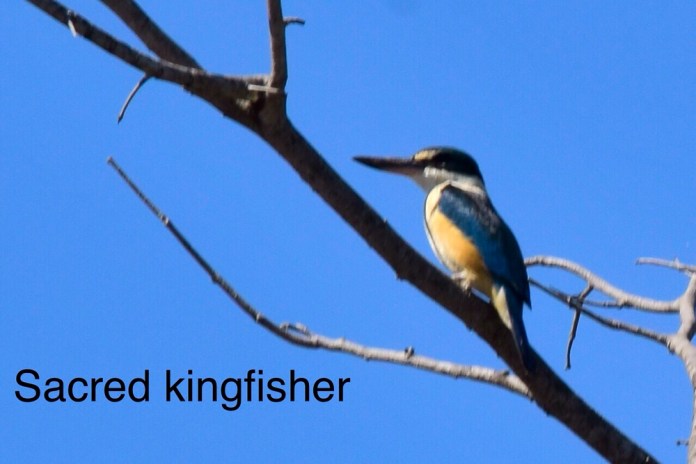
 Around the waterways are many trees and shrubs. The pandanus provides a habitat for baby fish and other animals especially the barramundi. We saw the tree a called ” Leichhardt tree” named after the ill fated German explorer. Paperbarks provide ample vantage points for eagles and kites.
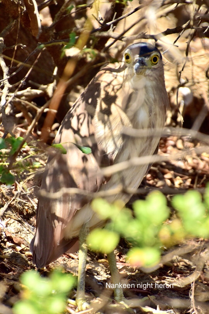 A very large salty took exception to us being near it and it violently twisted out of the water opening it massive jaws before plunging into the muddy water. It was invisible in moments. Its plating preventing any tell tale ripples disturbing the surface. This same plating is protective armour and the basis of its passive solar heating system as crocodiles rely on external heat. Blood vessels flow beneath the plates allowing blood to convey warmth through the whole of the animals body.


 The time passed too quickly. A wonderful day.
Here are some of Jen’s shots of birds.
AND CROCODILES!


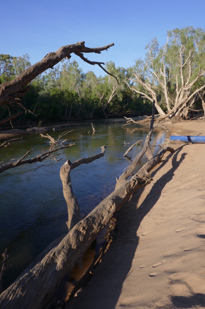
Katherine river canoe trip


 It is a beautiful sunny day in Darwin. We have been shopping. Shopping for hiking gear for me, including some long sleeve Craghopper shirts, a new sleeping mat, some washes and antiseptic creams and hand wash. It’s fun shopping for this sort of stuff, I see things I did not realise I actually needed.
Jennifer is talking to Hilary on FaceTime while I am basking in post prandial agreeability.
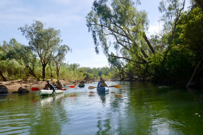
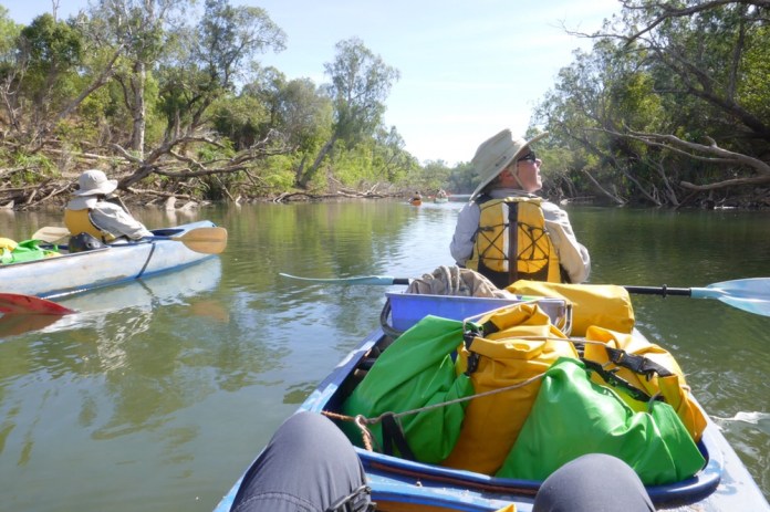
I have a few spare moments so I had better write down about our splendid trip on the Katherine River.
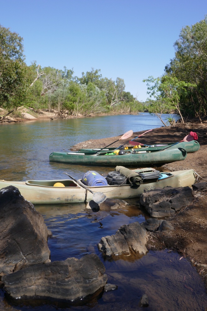
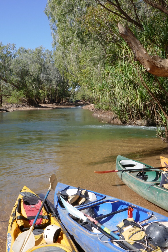
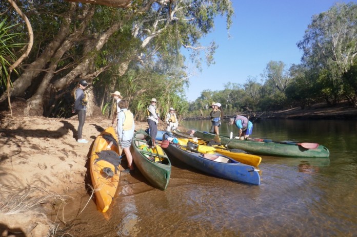
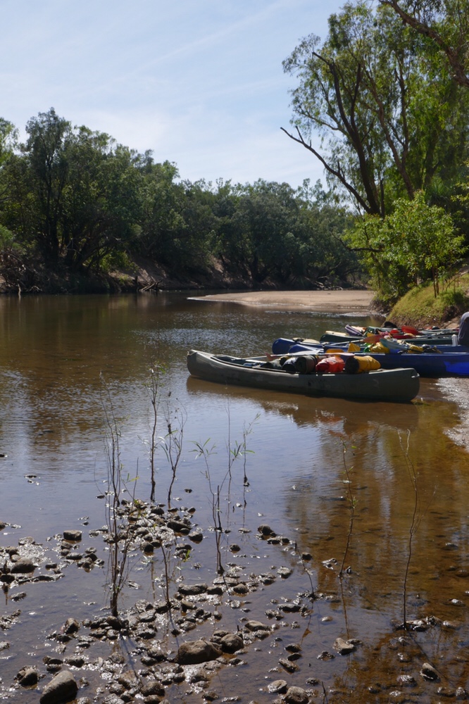
This three day trip is a paddle along some forty kilometres of the Katherine river. We booked through World Expeditions but we actually went with Mick from Gecko canoeing. We got off to a shaky start waiting for pick up. Apparently some issues about WE did not notify them about the pick up. Anyway, Jen sorted out the mess with some frantic phone calls and so soon we were on our way.
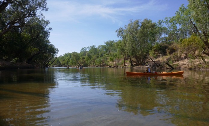
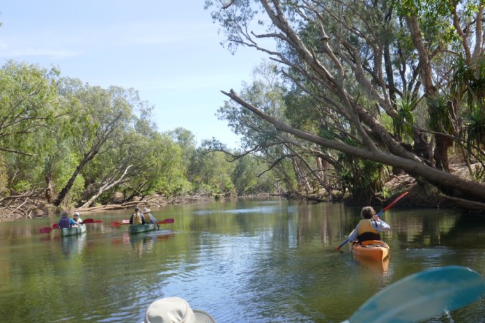
We packed up our gear into dry bags at Gecko canoe’s huge shed, then we all boarded their 4WD bus to be driven to the launch off point. We were on the same trip as a family group, Micks father and his step sister, Travis ( assistant guide) and Mick (chief guide and owner of business). The weather was, and in fact was for the entire trip, simply stunningly beautiful. There was as much sunshine as anyone would want, a clear sky, light cool breezes out of the south east and a river with water so clean our water bottles could be filled anytime we needed by placing it off the side of the canoe and letting it gush in with a satisfying gurgle.
Jennifer and I travelled in a short Canadian style canoe, which has superior manoeuvrability through often narrow rapids but does not track as well as the traditional longer canoes we used in NZ.
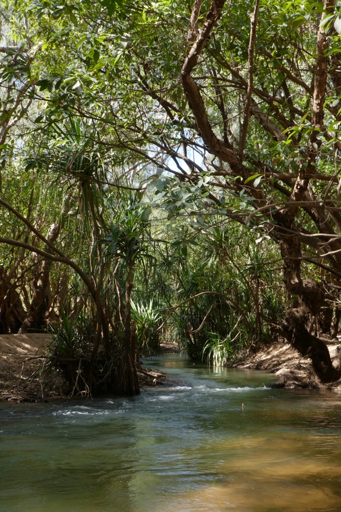
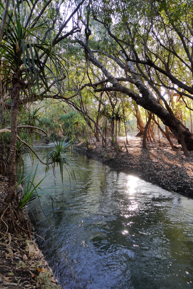
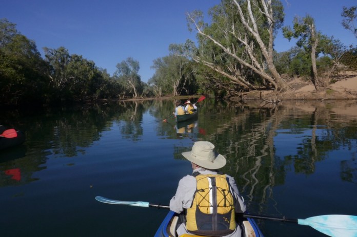
The three day trip was frequently glorious, often exciting and occasionally scary. The beautiful stretches of river with riverine pandanus draped on the banks, and graceful paperbacks and branches arching over the river. There are silver paperbarks with shiny olive green leaves, river paperbarks, Lily Pily trees with their thick green foliage. On the larger red gums which are more common down stream, are ” feathers”, black and grey enveloping the lower trunk. In fact they are not feathers despite their appearance, they are actually roots. In the wet season the river rises over fifteen meters, immersing the trees. These roots draw water and nutrients from the flowing water. Looking high above us, branches broken in the summer floods are lodged in the topmost of trees, very far above the ground.
The water now is not summer turbid but crystal clear, it’s fish and turtles and if lucky, occasional sting rays can be seen gliding through the faintly green tinted liquid. The river can be deep and can then be very shallow especially over the sandbanks inhabiting midstream. A few times I had to clamber out and let the canoe float up; now I could propel the boat along till I could climb back in, bum first, wet shoes splashing in sand and water, and paddle off again.
The rapids are grade 1. Well that does not seem much but it’s more than high enough for Jennifer and I to provide rescue experience for Mick and Travis. At one point, Jennifer had the option to abandon ship and Mick offered to get in the canoe. Well…..I steered the canoe pretty well until there was a rock. I could not decide whether to go right or left. I was still puzzling which was the best option when we hit the rock. Mick was a bit flabbergasted. Anyway, he pushed us off and I chugged along backwards down stream with Jennifer madly photographing my debacle. This scored an honourable mention!
I must admit some rapids went pretty well, and we shot through, on the right line, turned at the correct time, in the correct fashion. A real buzz. Other times we achieved the impossible, broaching on a submerged log and being super stuck until Travis waded in and pushed us off. Jennifer hitting a tree with her head and me hitting my knee (on the same tree) as we ricocheted through a narrow canyon. Our main problem was slewing the canoe. The turn was fine but the stern splayed off line, hitting the banks, rocks, other boats and Mick as well.
Mick thinks it is due to over steering. In any case, canoeing is a great deal harder than it looks!
As well as the adrenaline of the rapids there are long stretches of gentle paddling with trees and riverbanks filled with bird life. We saw many birds, including; cockatiels, the brightly coloured rainbow bee eaters striking their insect prey against tree branches, great billed herons lofting out of trees with majestic sweeps of their grey wings, azure kingfishers darting over the water grabbing humming dragonflies, black kites wheeling in the sky to alight on the utter topmost of bare branches to study the river flowing beneath them. There are blue winged kookaburras calling out as they sweep from bank to bank disappearing in the foliage. Graceful White faced herons glide down the river, and so many other birds flying, above and around us. What’s delight!
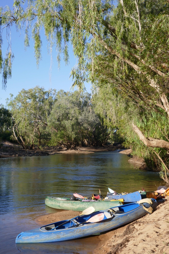
We drew up to the sandy banks for lunch, morning teas and dinner. We camped on the river banks, on soft sand. While we set up our campsites, Mick and Travis prepared terrific meals. We laid out a ground mat on the sand then rolled out the swags and sleeping bags.
Dinner was slow cooked in a camp oven. Coals from the campfire were laid using the shovel onto the ovens. Barramundi, Russian beef, vegetables. Yummy. Tablecloths, candles, and relaxing conversation and of course the superbly cooked meals made for very pleasant evenings.
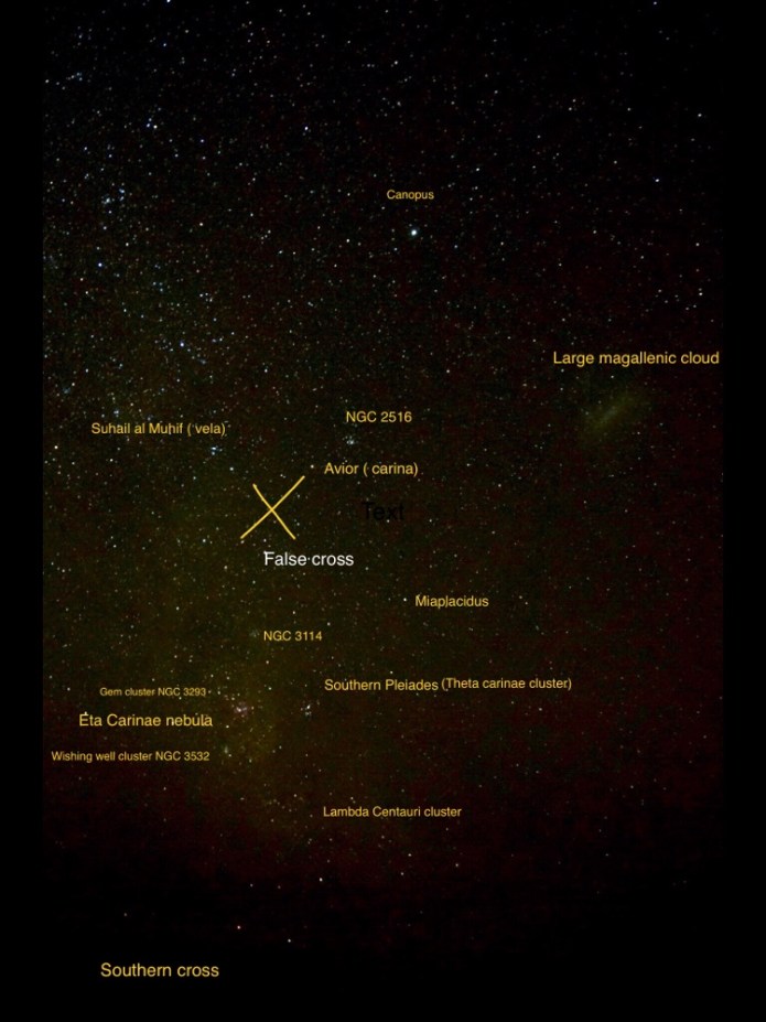
Close your eyes, and after a count of fifteen, look up. Wow, stars galore. The sky was festooned with stars. Jupiter and Venus shining brightly, the former near the zenith and Venus to the west. At two am, during a toilet break, Mars had well and truly replaced Jupiter at the Zenith, the war god’s planet bright orange light outdoing all the other lights in the sky.
In the river forest, out of the dark, we could hear the calls of Blue winged kookaburras, of owls, micro bats, and other animals. I watched over the water, wondering I would see the eyes of a crocodile. But Mick had chosen well, and I never saw a saltie, slang for a salt water crocodile. We did see a few fresh water crocodiles, one was basking, warming up near our second campsite.
Why does the river flow all year round? It has not rained here for a few months and yet still it’s navigable throughout its length. In Summer, monsoonal rain fills the watershed of the Katherine River, its Gorge, its valleys and all the feeding creeks and smaller watercourses, to overflowing! In winter, the skies are cloud free and no rain is in the offing for many months. There are several prolific natural Springs which supply our river with the water we need. The water is pleasantly warm due to sunlight and due to subterranean heating of the spring water. The water is bubbling along between a hundred to ten thousand years under the ground depending on which sandstone aquifer is discussed.
The trip was well worth doing, the peace and beauty of the river is impossible to beat and the guiding by Mick, with his abundant knowledge of the river and its inhabitants was first rate.


 great
great
Higgs track with the Ramblers April 2018
Higgs track April 2018
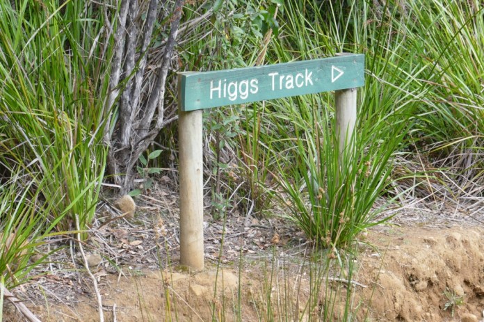
 This Sunday was my first walk with the Ramblers. This group has just celebrated its 45th anniversary as a walking and hiking club. There were four people at High street where we had been asked to meet. Two more joined us, Julie at Deloraine and Peter at the start of the walk.
 it was a cloudy day with a forecast of heavy rain by mid afternoon. As we approached the steep slopes of the western tiers, cloud partially swathed the mountain sides. The light was softened and gentle.
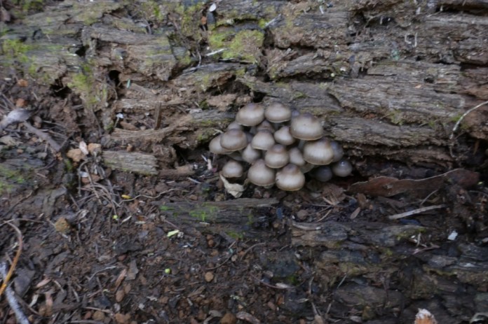
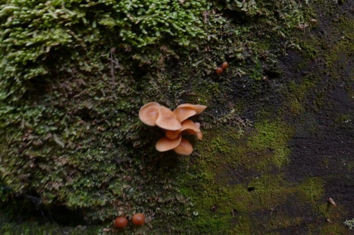
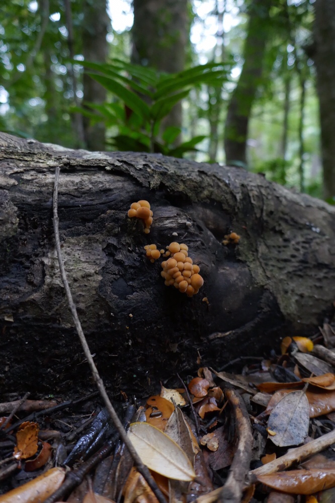
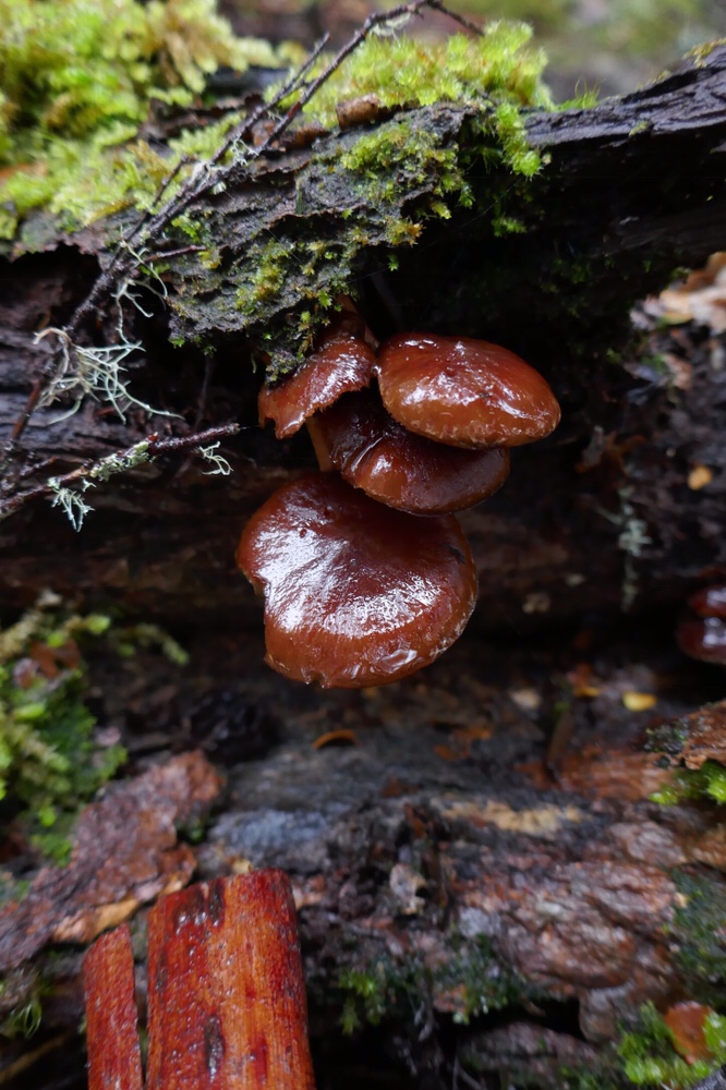
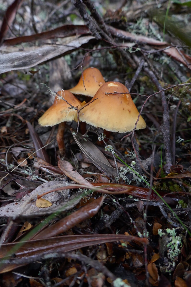
The walk begins on a bark trail, crosses a creek by an established bridge. We saw the first of many fine examples of Tasmanian fungi. Elaine is even more enthusiastic about them than I am. We took so many photos. The damp mizzle blessed them with the most delicate coating of moisture, making them appear even more delicate and sublime than in harsher daylight.


 The track winds up the slope, the steps on the rocky track needed care but did not present too severe a technical challenge. Then after crossing a rocky creek bed, water chugging beneath us as we clambered over them, the route became more difficult. This was only a short interlude before arriving at the cairn marking the culmination of the track.
On the way up we passed a track to the right which is actually the original path, where Stanley Higgs brought up cattle to feed on the alpine meadows and heaths in the Tasmanian summer. He built the track himself in the 1880s.
Mist filled the forests. The blue light and soft wet haze made every image magical. There is something about a foggy forest that harkens back to our north European ancestry in the medieval and ancient woodlands. It resonates with the subconscious.
 The plateau is covered by snow grass, cushion plants, rocket and herb fields. Ponds and streams woven within the landscape. A solitary pencil pine was silhouetted by the fog. The hut is well provisioned with bunk beds, blankets and cooking utensils. After lunch, we walked the short distance to the lake. It seemed so vast, it’s opposite bank hidden by the prevailing cloud.
The first part down deserved attention , and I was slow as always on any treacherous surface and had only two inconsequential tumbles.
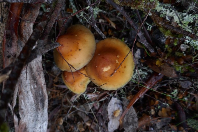
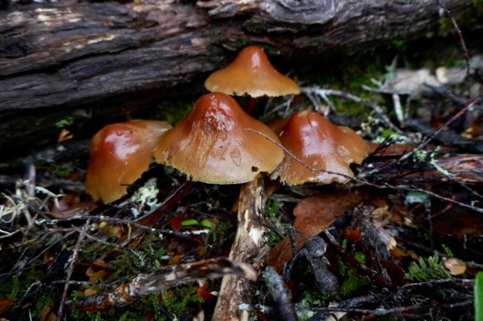
We soon reached the easier section of the descent, and enjoyed the many fungi some nestled in fallen leaves, others emerging from rotting bark and logs and a few peeking out between fern fronds. So many colours and forms.
The ferns and ash trees, the myrtle beechs spotted liberally with moss and bright, iridescent flaky lichens. The bush was quiet and still. It was all very beautiful.


 We soon arrived back at the cars, and left this wonderful area. We stopped at an excellent providore in Deloraine for Cake and coffee.
What a super days walk with great company.

Maria Island Walk April 2018
I have never been to Maria Island. I have been to Freycinet and driven along the eastern coast of Tasmania. Always It sits there, tantalising me only five kilometres from the mainland. It can be justifiably thought of as comprising two parts, two mountainous islands joined by a narrow, sandy isthmus.
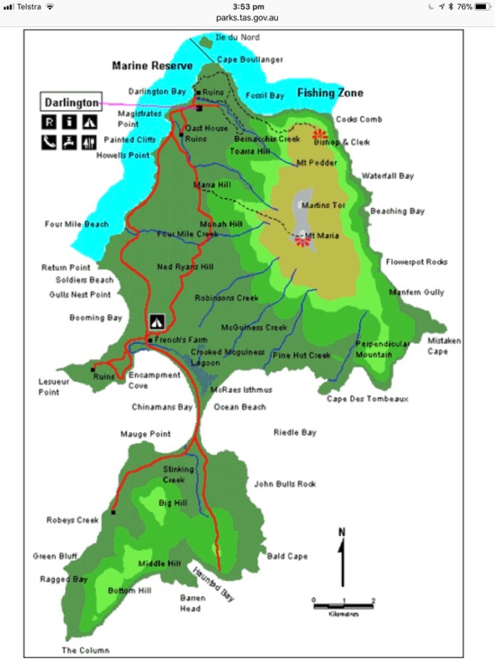
This is a map published by Tasmanian Parks.
 .
.
I decided to visit. I went as a paying guest of the Maria Island Walking Company. It’s under the same “ great walks” umbrella as Larapinta Walk and boasts similar standards of service and accommodation. I started my trip with them on the 27th of March. Jennifer, and Jennifer’s two sisters had spent a few days in Hobart, staying in an open loft apartment at the Wool store. I joined them on Monday afternoon, having caught the afternoon bus from Launceston. We had a wonderful meal at Annapurna restaurant in Salamanca. Jennifer and I walked down earlier because I had forgotten a down top. Luckily Kathmandu was still open and I was able to buy a very reasonably priced down vest. It came in handy on the walk.
On Tuesday morning, we waited outside the Wool store, until I was collected by the bus. Onboard were some of the other guests with whom, I’d be sharing walking, meals and as it turned out, interesting conversations. We were transported to their office in Hobart. I did not need to repackage stuff or use much of the equipment they provide so instead, I enjoyed browsing their books and hats, while sipping a hot cup of tea.
The cast: Laura and Philip were from Toronto, Canada. John and Moya, were locals from Hobart. Campbell and Anna, from Melbourne. Our two guides, Jai and Ella, were also locals.
The preceding week’s weather had been quite dreadful, very rainy and windy but the forecast for us looked very good. The bureau predicted rain at night but except for a brief five minute sprinkle at Darlington, my rain gear stayed in the bottom of my pack.
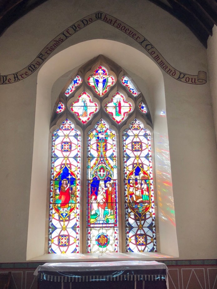
The drive from Hobart to Triabunna take 90 minutes. We stopped at an old church at Orford. The stained glass window here is interesting and its provenance proven but obscurity does arise in the details. It’s a genuine fourteenth century stained glass window, which had squirrelled away at the time of the destruction of the churches and only emerging in the early nineteenth century, before being promptly exported here to Orford.
 At Triabunna we helped the guides and driver, get our packs off the bus, then boarded a motor boat. The water was calm and the crossing uneventful but for seeing a pod of Common Dolphins. There would have been ten at least, their smooth dark grey bodies swimming in the wide blue water between us and the coast.
We moored at Chinamens bay, only a few meters from the beach. We all removed our boots, then holding them up, we splashed into the water, and waded quickly to Maria Island. Jai and Ella brought the packs ashore. After drying off wet feet and putting our boots back on, we walked a short distance up the beach, before crossing the isthmus to Ocean beach. We had lunch sitting in the sand overlooking this wonderful stretch of coastline. There were gentle waves of pristine sea water. The water here is especially clean because the continental shelf is only a few kilometres away and flushes this coastline all the time. It’s hard to calculate depth, as it’s so clear, a meter looks much the same as two or three meters.
Many shore birds were going along the beach, some walking, some running and some gliding, looking for food. The terns flying smoothly over dazzlingly bright wave crests.
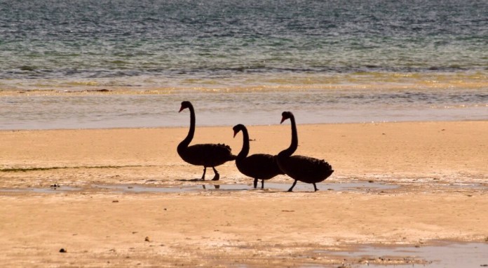


 Swans, sea eagles, hooded plovers, terns, seagulls, are just a few of the beautiful sea birds we saw on the many beaches on which we walked during our stay.
We walked south before diverting off the beach, then going a short distance on a forest track, surrounded by mature casuarinas and silver banksias, to arrive at Casuarina Camp. It’s a permanent base now. Originally it had to be disassembled over winter but in recent years that onerous requirement has been lifted. The facility is made up of five tents. These tents are really glamps, timber walls, timber bed bases and comfortable beds. The windows are canvas as is the roof. There proved to be very comfortable accommodation. There are composting toilets, showers, and washroom. For a shower, you collect four litres of warm water, top this bucket into a steel bucket in the shower, hoist it up, then when ready, you turn the handle and water comes down and out. The main eating area, has an outside verandah, and inside, under canvas, is a large dining area. Two gas heaters are there for cold nights.

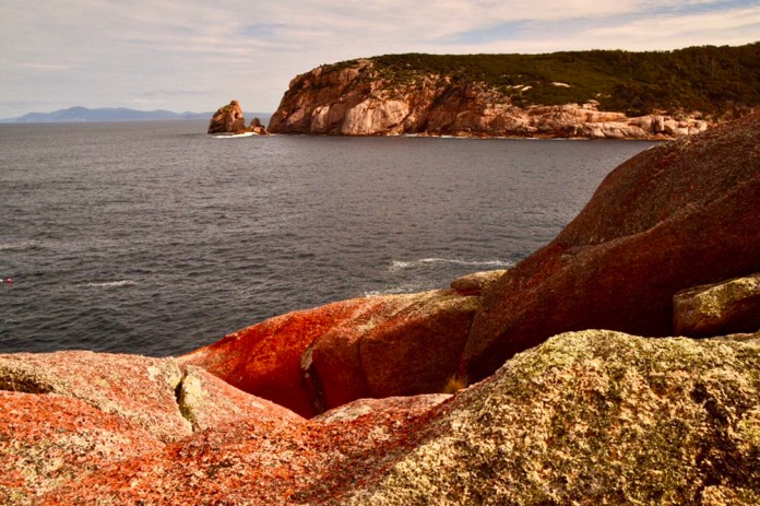
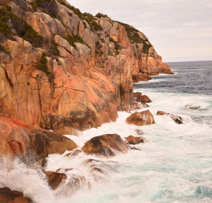

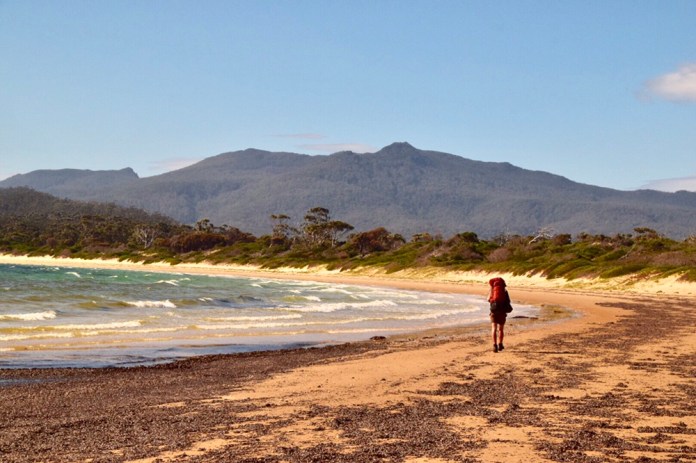 The afternoon options for walks were either Robys Farm or Haunted Bay. John and Moya went with Jai to the abandoned farm. I went with Ella and the others to Haunted Bay. It’s name comes from the eerie echoes of penguins as heard by the whalers who were once based there. The walk goes steadily upwards, through forests of banksia, gum trees, and bracken. Then there is a reasonably steep descent to the rocky shoreline of the bay. Here you can see the southern tip of Maria Island. Even in this gentle swell, the waves crashed over the rocks. It would very spectacular in a southern storm! The rock is orange and red, it’s the only area of basalt on Maria Island. It’s very reminiscent of Wilson’s Prom, and Freycinet. Most of the rest of the island is either well cropped lawn ( courtesy of the three thousand wombats), forest or mountains made up of dolerite. Dolerite is the tough scaffold of most of Tasmania, and Maria Island is no different.
We spent forty five minutes there, sitting on a shelf of rock, and taking lots of photographs. The waves transforming into sheets of white as they struck and flooded over the rocks. I can only imagine how impressive it would appear in a big sea.
We walked back to camp. It was time for showers or a swim. I elected to have a shower while there was still daylight. I tidied up my tent, placing the sleeping bag liner in place. At five, we assembled on the wooden patio, happily relaxing on chairs while Jai and Ella brought out a wonderful selection of cheeses, pickled onions, quince paste and some local reds and white. The Bream Creek Sauvignon blanc was my favourite. As we chatted about the day amongst ourselves, our guides assembled dinner. There is a long wooden table, three lit tea candles providing illumination. I can’t remember all the meals but I think we started with a bruschetta, then a meat dish and desert of Berry and cream. By the time we had finished our superb meal, it was time for bed. It was quite cool now, but I soon fell asleep. The wattle birds calling in the night air.
In the morning, no rush, a breakfast of cereals then an egg based hot meal with rolled salmon. Some of us decided to explore the Ocean Beach, and took our packs down and set them in the white sand. I watched with fascination the crowds of hooded plovers, these tiny white seabirds were darting around some oystercatchers who were unperturbed by their antics.
We all came across at different points, so had to assemble again and again. We crossed the isthmus but before we did. Ella pointed down to the sand and there were tracks. One step, then two footprints side by side, then one step. Pudgy little footprints typical of the Tasmanian devil. Maria Island is one major refuge for these wonderful marsupials. They cruise the beachs. I could see the track heading straight along the beach as as far as I could see.
We stopped on the isthmus, amongst the silver banksias, and rolling dunes, where it flattened out. Here was the location for one of the best known middens or living areas, created and used by many generations of Aboriginal people. In summer, it was too dry to stay here. However in winter, a large fresh water lagoon provided reliable water and then they could seriously settle in and party. On the western, more sheltered beach, were mussels, and shell fish. A short swim, took you to water filled with scallops and anchovies. It was the women and not the men who did the fishing. They would coat their bodies in ochre and seal fat to protect them from the cold water, and provide camouflage. They would swim out to collect the abundant sea food. On the eastern, ocean side, the water teemed with whales, fish and seals. The women would swim the two or three kilometres to the shelves where seals basked, climb stealthily from the water, club the seal, and then swim it back, all the time keeping an eye out for sharks. The men hunted the small game on the island and mined ochre from a single, significant deposit on the eastern tip of the northern section of Maria Island. Scientists estimate that about forty to fifty people would canoe across from Oyster Bay, and setup camp for winter. They did this every year until whalers stopped them in the 1840s.
We skirted this significant cultural area before walking down to Chinamen beach. It’s called that because in the 1880s, Chinese divers collected abalone to sell in the Melbourne fish markets. Eventually, tariffs between states, made the business uneconomic but the name persists. We walked along* this beautiful beach, gentle wavelets petering out upon wide sandbanks, while groups of Black swans sauntered along. They were enjoying the warm, sunny day as much as us.
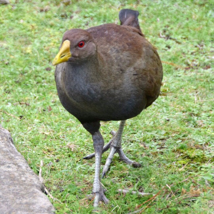
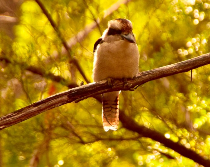
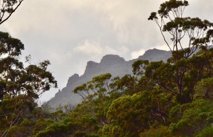
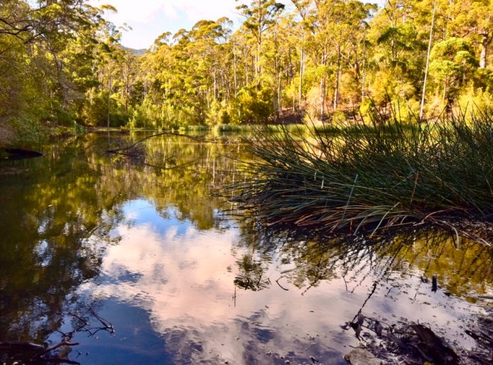
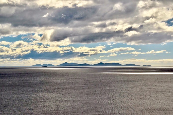

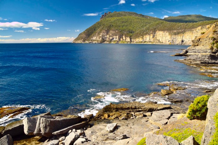
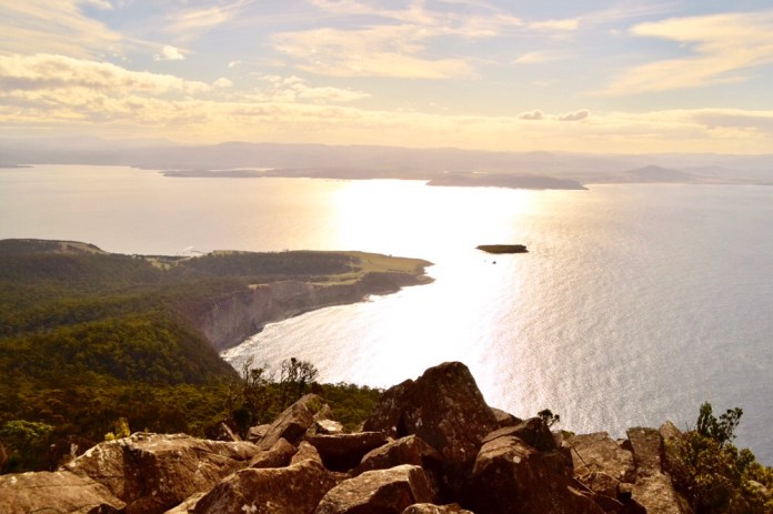
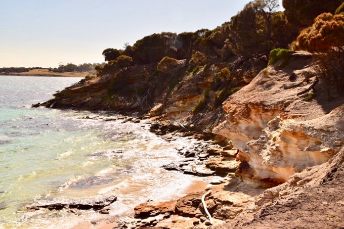

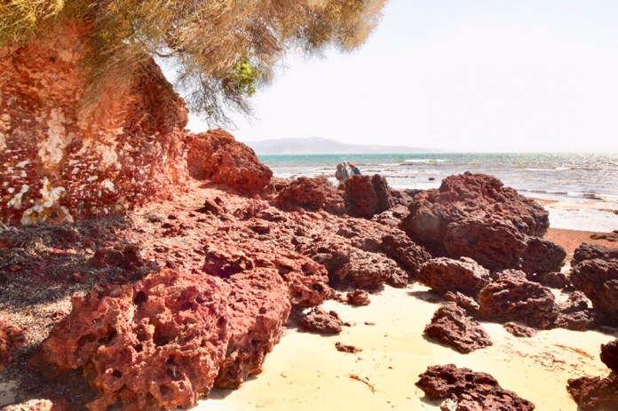 We stopped at French farm. Robey and French were the two main farms with sheep and cattle, they stayed were occupied until the 1950s. It was a lonely existence for the Robeys but the French family had lots of children, who got up to many sorts of mischief. There was a substantial stand of wheat awaiting harvest. One of the junior boys was worried about the mice who he believed would eat all of it. So with the aid of a slightly older sibling they decided to exterminate the mice of French farm. They poured kerosene down the mouse tunnels, it took ages to fill. Then they lit it. The ground lifted under their feet with the chthonic ignition, then burning, crazed mice ran in panic upwards and out of their tunnels, their flaming bodies setting alight the wheat as they tried to escape the inferno created by the young French boys.
Today, we sat by the outhouse, inside it’s not all that interesting. While I was in the loo a tiger snake travelled near the group. Wombats were totally uninterested in the snake and us. The wombats here are a cross breed between the pale, almost blond original wombats and imports from the mainland. So some are blond, “ surfie” wombats while other resemble very fat quolls only with dark not white smudges in their fur. They mow the grass. All three thousand of them!
We walked on from their uphill, and inland to the Probation buildings. It was very windy as we walked up and above the beach, to a long brick structure. We sheltered on the eastern side, enjoying our lunches. Jai told us about this penal building which was made up of numerous cells. The least pleasant at one end and the most pleasant at the other. Privileges for these convicts increased as well. It was only used for a few years due to the unforeseen high costs of running this establishment. It was envisaged, the convicts would grow their own food but their skills in agriculture were pretty poor and barely applicable to the conditions on Maria Island. It was not a success!
We then travelled east along La Suer point or Long Point. We joined our third beach for the day. We skirted the remnants of old whaling piers. Their timbers eroded into beautifully carved spears jutting out of and not into the sand. A large clay pit was stained by red minerals, creating impressive ochre pit. The rock is called laterite and creates a striking point of land, richly red rock climbing out of the sand beneath the shady coastal casuarinas.
Now, we were only a short stroll from White Gums camp. We crossed another headland with yet another beautiful beach made even more attractive by the bronze tonings on the rocks and the lapping water created by the sun sitting low in the sky.
On this walk, John had decided to take on the five swim challenge. He bravely donned bathers at each beach and swam every beach. Tougher than me. I went for one swim, and I took ages to get my tummy below the water line.
The campsite is nestled under, you guessed it, white gums. Pretty much the same layout as Casuarina camp, and again, a splendid presentation of pre dinner snacks and then the meal itself. All first class. Over the table, conversation flowed fast and touched on all sorts of subjects reflecting the diverse interests and life experiences of the guests. Another early night. In the morning, I found my Apple, it was notched by little teeth. I had been woken briefly by a steel mug hitting the timber floor of the hut. It must have been disturbed by my little visitor.
Day three, was the walk to Darlington. Jai had already worded us up about the three options. He held up a map stuck to a board, and showed us these options. Campbell and Anna decided to walk to Mt Maria. They quickly turned off from the main track and headed uphill for what was the hardest option. The rest of us walked along the road to Darlington, visiting a convict quarry. This limestone was used for building both here and Hobart. It’s still a striking view after all these years.
We visited another old farm house. The walls made of old shipping crates, old fruit boxes and the like. Old newspapers were glued on to provide insulation and perhaps reading matter. The rooms were empty, and only the old brick fireplaces reminded me of how they had once been homes.
We visited Painted Cliffs. The route down was a bit steep for me as I was carry8 g a big camera. It dangled awkwardly in front of me if I descended steeply. Cameras are great for recording events and scenery but can be a walking hazard as well. The rocky shelf’s and cliffs I could reach easily are still very beautiful so I was not disappointed.
Increasing numbers of cyclists and walkers, some enthusiastic, some reluctantly in tow, and all coming from Darlington. They all passed us as we approached the township. We passed on isolated house where a lady had managed the telegraph for many years in the 1940s. She would have enjoyed the view of Darlington Harbour. We walked past massive old trees first planed in the convict era. Then walked the short distance to the Bernacci house. This is not the original residence of Diego Bernacci, which is now a ruin on the hill above Darlington. Nonetheless, our accommodation is a finely restored and comfortable residence that exudes, gentlemanly relaxed living of the late nineteenth century. Opulent sofas, old maps of Tasmania, even some old convict manacles can be studied in their glass case on the piano. In a few words, A very nice place to stay.
After lunch, four of us decided to walk to Bishop and Clerk. It was still early enough to reach the peak comfortably before dark. The selling point for me of this option as opposed to Mt Maria, were the liberal number of views. Most of the Mt Maria walk is in forest but this walk has views in abundance. This was certainly the case. We had many opportunities to study the limestone cliffs as well the dolerite peaks that make up Bishop and Clerk. Looking south I could see, over the grey sheen of the ocean, Freycinet and Schouten Island, and there to the left, were the Hazards, their notched contours unmistakeable.
The track is about twenty meters from the cliff. Wombats munch contentedly. The surf can be heard crashing at the cliff base. We entered forest, then climbed up wards quite gently until coming to a scree field. The Hobart Walking club has scored a track which zig zags up this scree. They have put in some more solid footings but the track is not easy. It’s about four hundred meters and it’s steep. Then the track winds it way onto much bigger boulders. The plants typical of alpine tasmania such as mountain plum pine now take over from the banksias lower down. I got to within twenty meters of the top when I decided that was high enough for me. Too much vertical! Any way I took the opportunity to enjoy the view. High up on my eeyrie, I could see the light of the setting sun shimmering in a wide band on the water, the blue dusky shape of mainland hills and coast, the northern point of Maria Island and il de nord, a small island just off the tip of Maria Island. It was a very beautiful and peaceful view despite the prospect of a descent down scree, which didn’t turn out to be all that bad. It’s always quicker going down, which suited me. The light was softening as we walked back. We passed a few walkers going up, carrying torches, hopefully reliable ones.
We all met together at Bernacci house to shower and clean up for dinner. Yet another wonderful meal, but now in a grand dining room. A magnificent walnut dining table. The main was seared salmon, yummy. I slept very well.
In the morning, I woke early and took off for an hour before breakfast to take a few photos around Darlington before breakfast. There is a campground below the house, many other restored buildings are there to visit including the coffee palace, which is now an interactive museum, laid out as a dining house. After breakfast, Laura, Philip, Campbell, Anna and I walked to the convict built reservoir. Mature gum trees, and mixed forest surrounds the track. The reservoir is still, clean collection of water. We continued to the fossil cliffs. These cliffs are filled with sea shell fossils, about 290 million years old. We explored this wonderful area before carrying on back for lunch. We had bubbly and fresh rolls before heading back across the water to Triabunna. It was a great deal rougher going back but no problems.

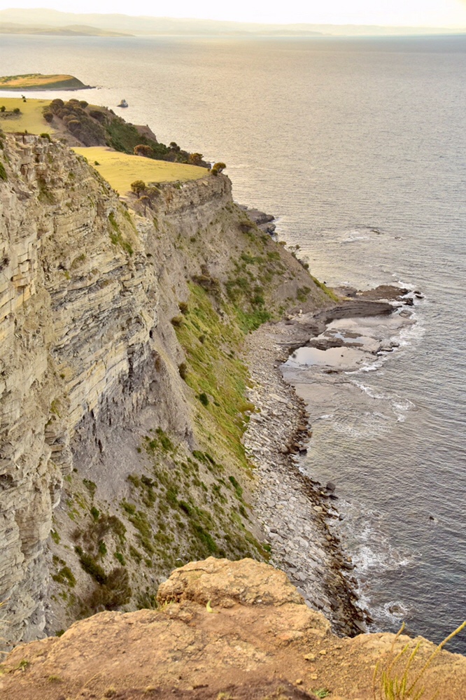
 It has been a super trip. Great people, food, views, walking and accommodation. It wins every way. I’m looking forward of doing more of this style of walking.

Central Australia Road trip 18 Epilogue
We have arrived safely at the kids place in Melbourne. We spent last night at Dimboola. What A terrific choice it was! We decided to stay in a unit rather than camp out as a wet camper canvas would never dry out in Tasmania. The unit was small but more than adequate. As Dimboola is two kilometres off the highway, its quiet with only the croaking of amorous bullfrogs echoing over the camp ground. The Wimmera River is beside the park, and so it’s only a short walk to enjoy some attractive scenery.
In the evening we went to the Victoria Hotel for dinner. It was built in 1924 by the Ballarat Brewing Company. It’s step back in time with ageing, cracked but still very comfortable chesterfields in the lounge and reading room. The shelves are stocked with the classics such as books by Conrad and Maupassant, as well as whole sets of encyclopaedias. The chicken parmis were great, especially with the Cape Jaffa Sauvignin Blanc to help wash it down.
On the drive back to Melbourne, our only major stop was to have lunch and a wine tasting at Seppelts at Great Western. A very nice spot to enjoy food and wine.
Well, that’s that for the trip. It has been a terrific chance to see and experience so much of Australia, including; meeting the many people of the outback, the relics and stories of the Ghan, the natural history of central Australia and the Flinders, and eat at some wonderful venues. As well as getting robbed in Adelaide, losing stuff, and breaking bits off the camper-trailer. A very great adventure. Will have to do some other spots next year if we can drive up in 2018!

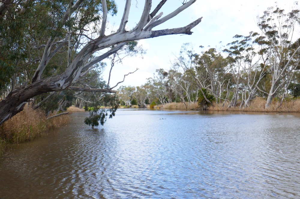
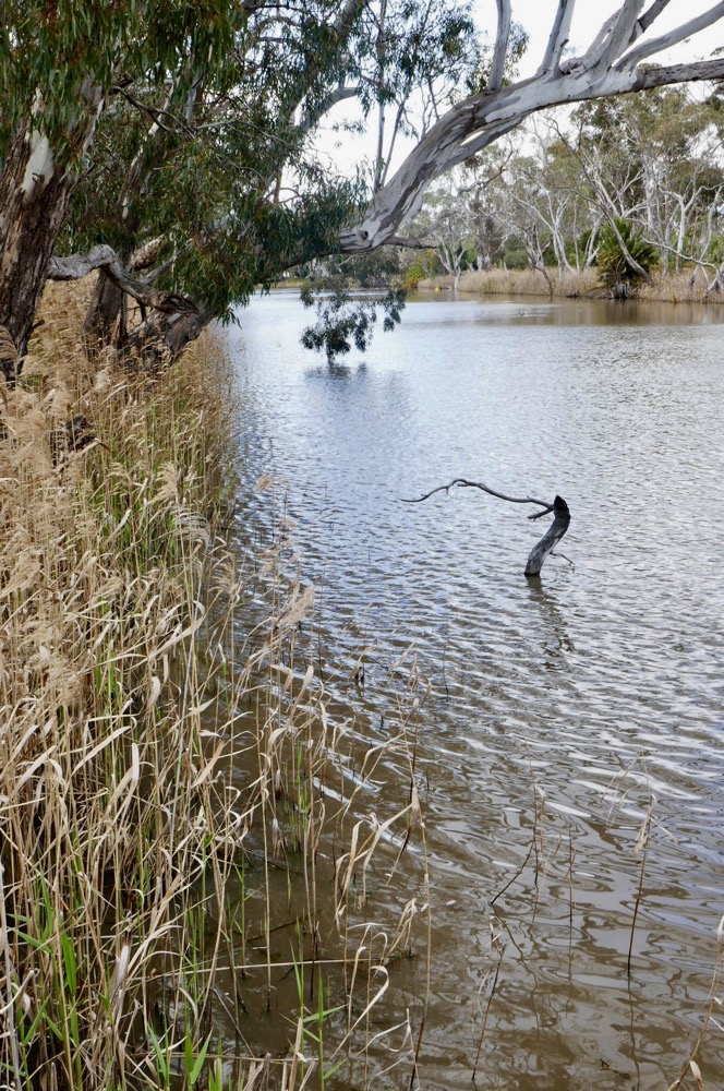
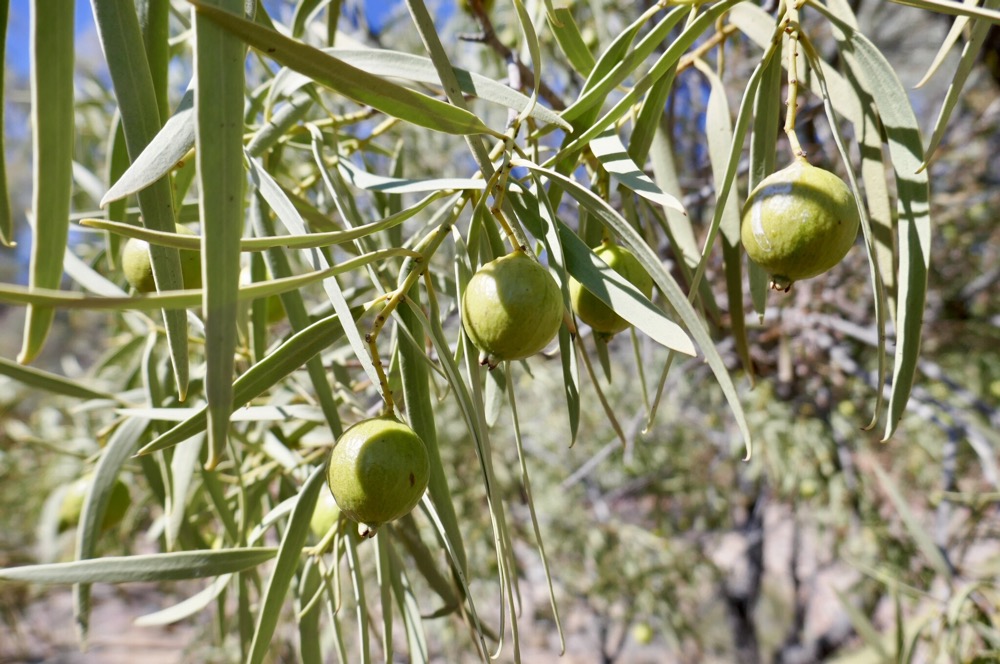
Central Australia Road Trip number 17 Martindale Hall, Clare, SA
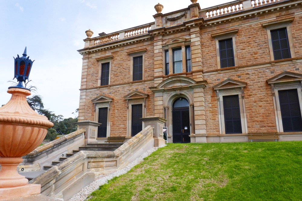
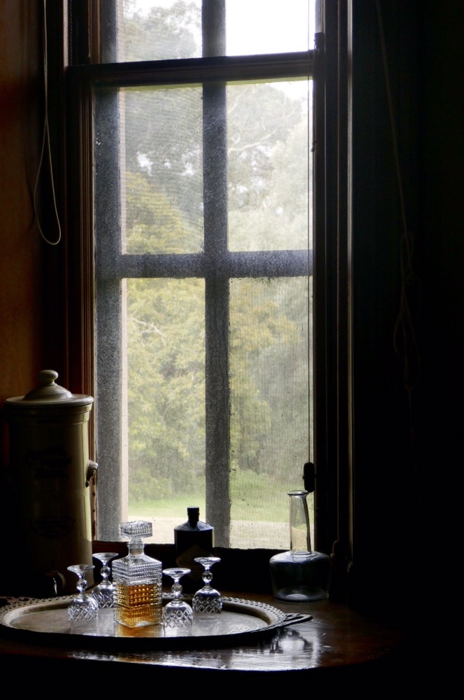
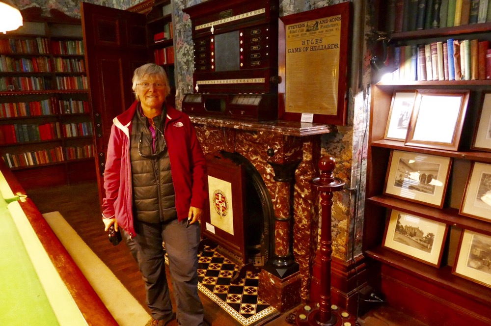

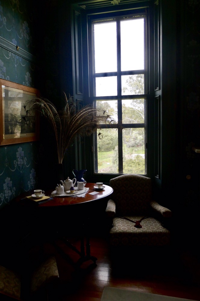


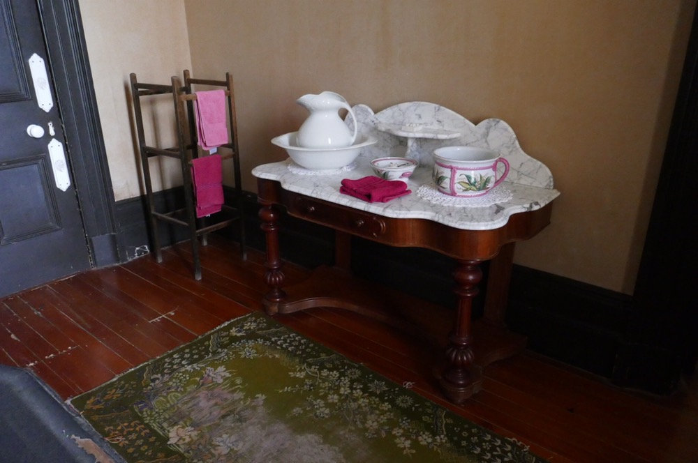


 We are seriously on our way home. We left Arkaroola on Sunday morning and drove to Hawker. On the way we drove through the Flinders Ranges and Wilpena. The road is bitumen through the southern Flinders so travel is a lot faster and a lot less dusty. At the end of the dirt roads is the small town of Blinman. Blinman was the site of a major copper mine and even today there are mine tours available. We did not have the time for a tour but did have time to enjoy a famous Blinman meat pie. They are just huge and taste great. I followed it up with a quandong tart – takes like a rhubarb and pear mixed together. Now quandongs are not only very tasty and very interesting. The quandong tree is a root parasite. It uses the nutrients directly from the roots of another tree to grow. Once the quandong is big enough it can go out on its own. We saw plenty of quandongs at Arkaroola.
The southern Flinders ranges is very beautiful. The roads bend and twist, cross creeks, and provide spectacular views of this magical country.
After arriving at Hawker, we looked at our watches, mmmm, only two o’clock so why not get to Clare. So we did, taking the R.M. Williams Way there. We arrived at Clare caravan park at just after five. It closes at 5:30. Set up camp then went to Sevenhills Hotel for a meal. A very good choice. This morning we visited Crabtree Winery, Annies Lane winery and had lunch at Paulets. The Bush Devine cafe at Paulets has wonderful views of the Clare. Gum trees dotted around rolling green hills, with the bright yellow of canola dominating some pasture.
However the high point of the day was our early morning visit to Martindale Hall. This has to be the best Victorian era Georgian Italianate mansion / great house we have ever visited either here in Australia but even in the U.K. The house, the grounds, the halls interior, the furnishings, the paintings, the clothes hung in wardrobes and on dressers are all original. You are asked not to touch anything but there are hardly any of those dreadful roles and barriers, and glass screens people like to put inside stately homes.
The hall was built in the mid nineteenth century by a very wealthy family. They had made their money in sheep grazing and were originally from the Lake District. It was this money, 30,000 pounds of it that paid for the building in 1858. By the twentieth century, the house had to be sold, and eventually was bequeathed by a subsequent owner to the University of Adelaide As a venue for agricultural studies. In 1986 it was passed to the National Trust. It’s a building that had has always been loved by whoever owned it.
Its interiors and exteriors were used in the film “ Picnic at Hanging Rock” to show the school in the movie. While we were there, the sound system played Handel not Beethoven as in the film.
We have had a quiet afternoon after returning from lunch and will be continuing our journey to Station Pier tomorrow morning. We have met some delightful fellow travellers including some other Tasmanian refugees. All of them thoroughly enjoying retirement and their lives on the road.
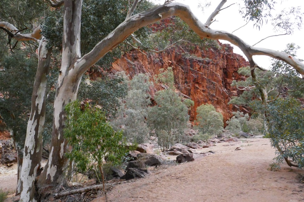
Bararranna track, Arkaroola
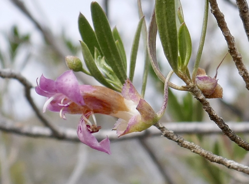
Emu bush
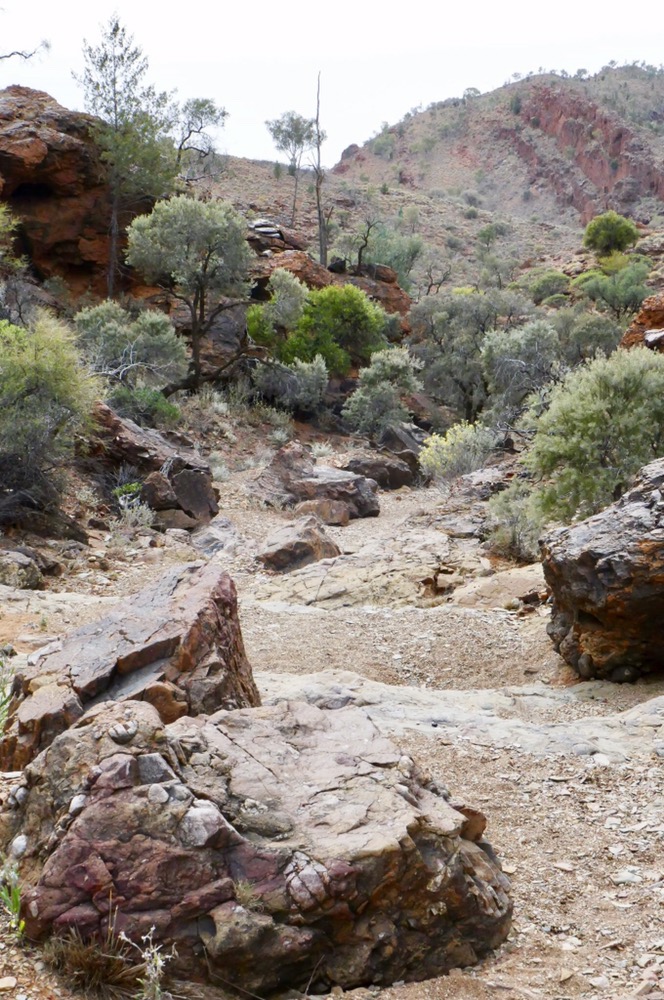
Tellite Gorge

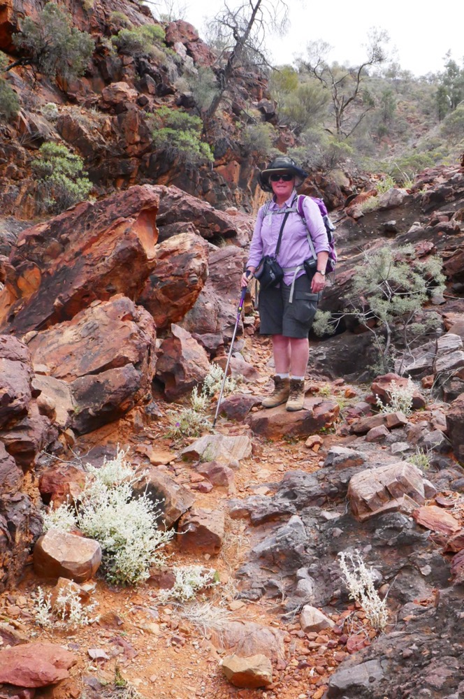
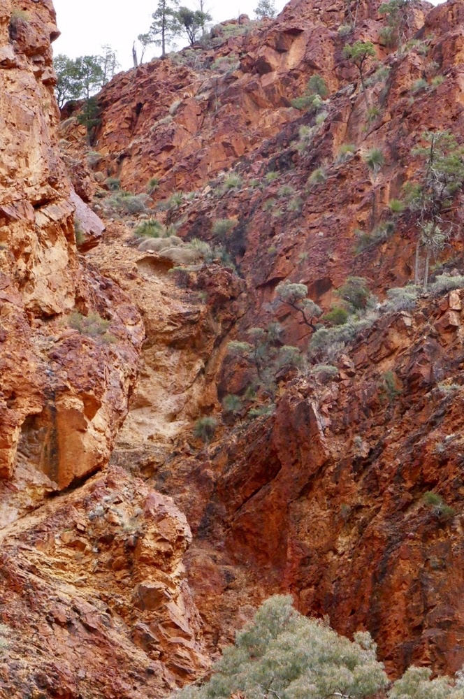
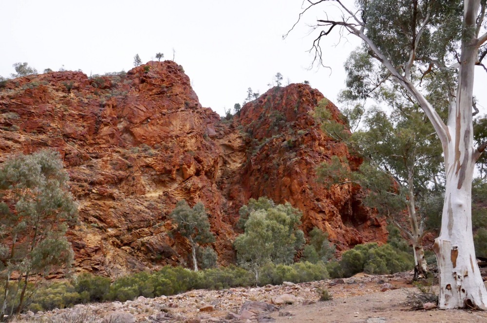
Stubbs Waterhole
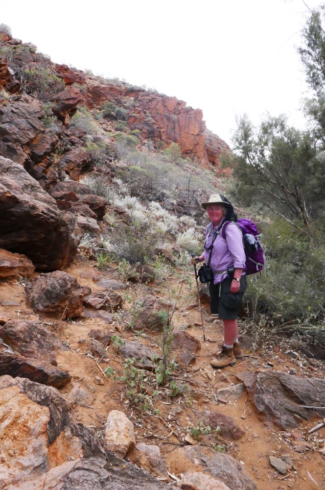
Here we are in Arkaroola. Arkaroola is private wilderness sanctuary to the north and immediately abutting the Gammon ranges national park. It’s dry and hot in Summer but this time of the year, well, it’s still dry but it’s not hot. Overnight, it’s cold and over the day it gets to the high twenties. It’s perfect walking weather. Sunny, warm enough and usually a breeze to keep the flies from finding us.
Arkaroola was a pastoral lease for many years until it was bought by Reg Sprigg, a geologist and academic, in the 1960s as a sanctuary for rocks, plants and animals. It’s the northern extreme of the Flinders Ranges. From any high point, there are Ranges of abrupt hills as far as the the eyes can see to both the north and south.
We are camped in a powered site, not far from the shower and amenities block. Around us are tall hills, bright orange in dawn or afternoon light, acacias snarled up the steep slopes. On this our first night, a full moon came up between two hills making an arresting sight.
We are staying here five days. On our first day, after breakfast, we got a lift from the sanctuary owners to the start of the Acacia Ridge walk. It begins about five kilometres along the road. We were joined by an older couple, Michael and Rosemary on the walk. As we took loads of photographs, they left us for dead, but waited for us every five hundred of so meters along the track. The track goes steadily upwards and provides some terrific views of Old Arkaroola station and it’s surrounding hills. At the top there is a branch to the summit, wow, there are some great views north. It is some very impressive scenery. On the way, we saw different types of flowers and shrubs including fox tails, red hops, dead finish, bush tomatoes and Sturt’s nightshade, a tall plant with blue flowers rather than the purple bush tomato flowers. We saw bush pears, big and green but not for eating yet.
From the summit, the track winds past a huge steep rock face and then drops quickly on a slippery surface. We grappled our way down till we reached the road, then only a short distance from the village. By now it was getting warm, so we relaxed over the afternoon beginning with lunch of ham-cheese toasties at the cafe. We later returned in the evening for dinner. It’s a very good restaurant. Afterwards we walked along the gravel, stony road up to the campsite.
The next morning, we decided to walk the Mawson Spriggina walk. Spriggina is a 15cm flatworm that was one of the denizens of the pre Cambrian seas and oceans. It’s named after Reg Sprigg, it’s discoverer. The walk commences near reception, and heads past the motel style units, then onto the rough Arkaroola countryside. It undulates around hills, and dry creek beds with some wonderful views. We saw some interesting plants including the beautiful Curly Mallee, as well as hakeas and coolabahs. We reached some fascinating volcanic intrusions. These were ancient upwelling of lava that never reached the then surface, but were trapped into the tough sedimentary rock. There is Sitting bull, as well as the Pinnacles. Their orange colouring contrasting with the blue grey of the sedimentary rock remaining. The walk continued back. We met a mum and baby red kangaroo. They were a bit nervous about us but we still took some great photos as they watched us. In the afternoon, Jennifer drove to Bolla Bollana Rockpool. This very pretty Rockpool, is reached by quite a rough Track. The next Waterhole was an even more difficult road trip. After seeing the 4WD AHEAD OF US rocking and dropping, we piked, and turned around only to meet another car on this really narrow bit of road. We nestled the car as far off the road as we could, giving the car a massage with dead finish. Much of the scratching merely removed the caked-on bulldust, but there has been some slight damage. The result is called bush pinstripes.This acacia is tough and spiky. We got back about 4:30 and chilled out over the evening.
Today has been a quieter but still very interesting day. We visited the mining museum with loads of interesting stuff about geology and many examples of rocks and fossils found here in Arkaroola. This was timely to do as Jen and I did a geology field trip over the afternoon. Mark Sprigg drove us out to see several interesting geology features of this area. Arkaroola, like the rest of the flinders ranges is part of an uplift that was created by the ramming of what would come to be the eastern states of Australia with the much more ancient original australian continent. In Arkaroola there are some important faults, we saw one today. It’s movement is frequent but tiny with about 300 microtremors per year. At faults there is weakening of the barrier rock layers usually provide and minerals can come up and penetrate the sedimentary rock. We visited disused copper, and manganese mines. There was also a reasonably successful gold mine. The gold was all near the surface and not in a vein. No one could figure out why until only very recently. The reason is quite amazing. Apparently a particular type of Cyanobacteria eats gold. Then water bubbling up the fault, carries the bacteria including its contained gold up into the upper levels of sediment. This makes Cleopatras talent for drinking pearls look stingy. We visited the ochre wall. Ochre from here would go all over Australia. An endemic mica containing iron was considered very valuable for its glistening red colour as a paint. As Mark drove across a creek, he told us over the car engine noise that two years ago, scientists had been studying the rock formations and fossils here. It’s ancient, about 700 million years which is long before plants and animals but in the Proterozoic. This was the site of an immense coral reef, made up by bacteria and primitive life forms and was larger than our current barrier reef. The atmosphere was much lower in oxygen than today and so these bacteria survived on carbon dioxide and sulphide gases. Impressive stuff. However, the highlight of the day was our visit to Tillite Gorge. It’s a steep, rough road but Mark handled it expertly. Tillite Gorge is named so because the sedimentary rock contains huge rocks. They were dumped from a glacier into a shallow estuary or sea a very long time ago. The larger rock floor of the gorge is scratched by the ice grabbing stones and ripping them along. It must have sounded like four fingernails on a blackboard. Apparently, this actual site was instrumental in discovering Snowball earth. This was 800 million years ago, and describes our whole planet covered in a giant glacier: A giant snowball.
It has been a very interesting afternoon. Jennifer got more tips about 4WDing.
This evening, we had dinner at the restaurant, before walking back here and snuggling up in the camper trailer.
One thing I have learned on the walks here is that in dry, relatively cool weather conditions, thirst is NOT a reliable guide to hydration requirements. When I walked with Di and Dave I had a lot more fluid and electrolytes and felt fine during and well after the walk. Here I drank only to quench thirst and felt fine during the walk but completely awful that evening and the next day. So the point is, keep those fluids up!
It’s Saturday and it’s our last day before departing in earnest to catch the boat. It is still overcast which might put a mozzie on tonight’s astronomy experience. Mm. Any way we gave had a terrific day, doing the final short walk in Arkaroola. It’s called the Bararranna Walk and it’s Highlights are the tellurite lined creek from Tellurite Gorge, and the Bararranna Gorge and Stubbs Waterhole. The track is a circuit beginning from Welcome mine trail head. This was the site of a copper mine so there is lots of malachite and ansurite fragments on the ground. The mines are vertical drops mostly with just a few bits of timber marking them. However unless you were silly enough to go near them, they don’t pose a risk to adults. The track winds westward, its narrow and rocky and eventually comes to a slate and shale field. There are Emu bushes here, it’s a pretty red fuschia flower. It’s on the blog prior to this one.
We dropped down into a creek bed, and went downstream, climbing down the dry waterfalls. Everywhere tellurite rock. This forms beneath melting glaciers as stones and small boulders drop into the sea bed. When this sea bed sand becomes rock, the erratics are still imbedded. We enjoyed our cups of tea nestle don the rocky outcrops. We were on the lookout for rock wallabies but no luck, though we did see some wallaroos.
The track follows the creek to its junction with Arkaroola creek. Here we found Stubbs Waterhole, and it’s very still, very beautiful. Sheer quartzite walls with a green Rockpool. The rivergums all standing mute as sentinels near the banks. There was a small yellow bird drinking water and then flew up to sit in a tree near the Waterhole. Arkaroola creek is also fine walking. The track now requires small and large boulder hopping rather than scrambling. The stones are of so many colours reflecting their many origins. We diverted to visit Bararranna Gorge. There’s a massive ripple rock platform tipped into the vertical. There are masses of blue flowers. There is some water in the rock pool. It is a very peaceful sight. We carried on along the creek and ultimately back to the car. We passed some interesting geology. There was a huge rock that had been scratched by stones moved by a glacier. There was the formation called Humanity seat which is vertical sedimentary rock consisting of quartzite and shale. There is a spot early on in the walk where you see two small hills, these contain evidence of early bacteria that once created the huge coral reef I mentioned earlier.
The walk has been terrific. Though only seven kilometres, we were tired out by the end. We drove back to the restaurant at Arkaroola. The kitchen was closed by now so we had chocolate cake instead.
Right now I’m sitting beside the camper, I’ve had a shower so smell a bit better, and Jennifer has put on the clothes to wash. Arkaroola has been a great place to visit. I can really recommend it for the adventures and beauty it offers to the traveller.
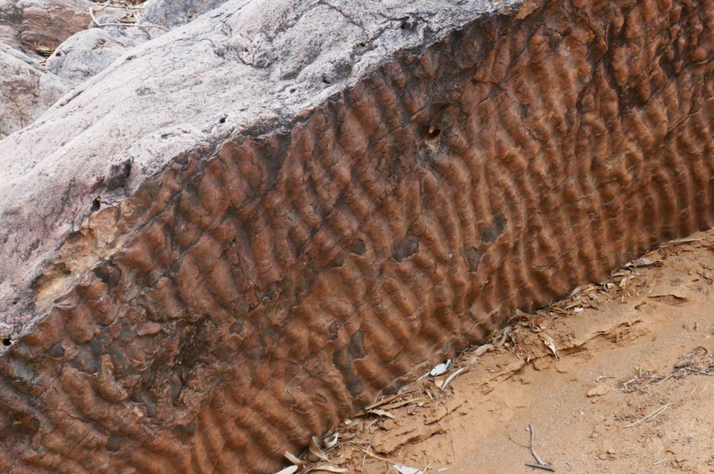
Ripple rock – ancient sea floor
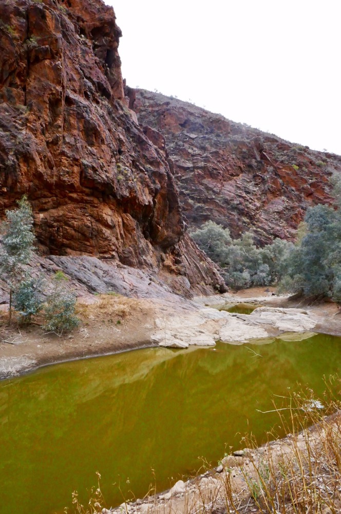
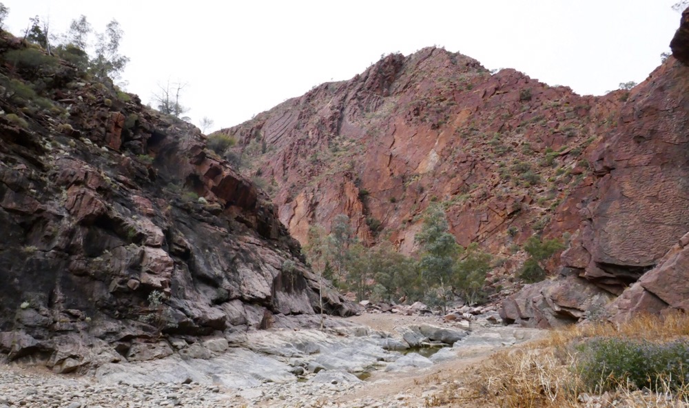
Bararranna Gorge

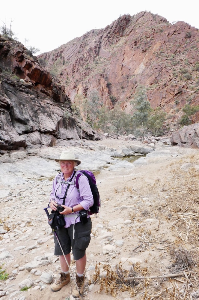
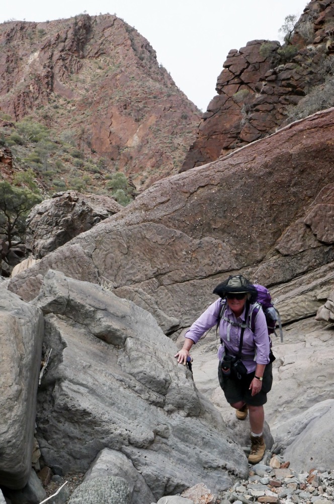
Scratching indicates glaciation – stones imbedded in moving ice scratch the rocks
