I’m lying in a tent, no fly, in the campground at Dalhousie Spring in South Australia. I can only see a brilliant half moon high in the eastern sky, all the stars dimmed to disappearance by the orange glow of imminent sunrise. Each night of this trip, all of us try to look up frequently to enjoy the multitude of stars in a cloudless sky. The great wheel of the Milky Way turns slowly and majestically in our southern sky.
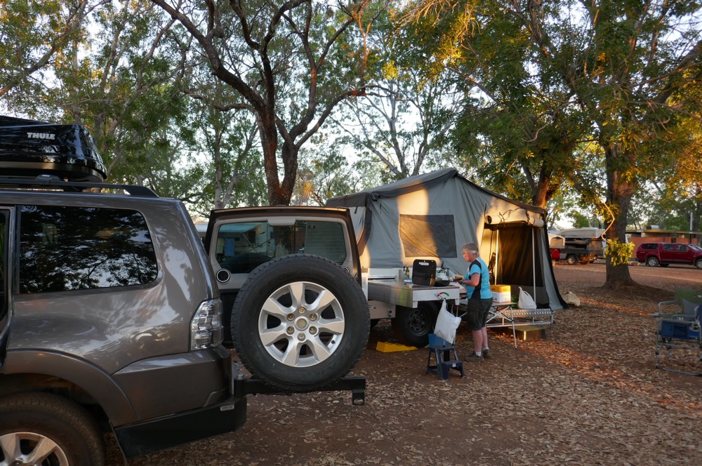
Jennifer and I had driven back from Wauchope after our second two week stay in Elliott. The stay at Wauchope was quieter than our trip up. The park filled up at 8pm rather than 3pm. We met David and Di Seaton who had flown up from the Chilly bin ( Launceston) a few days before,. They were staying at Desert Sands. It was great catching up. In the evening we all had dinner at Hanumans Restaurant, and shared a terrific meal. Jennifer and I were staying on Sunday evening at Doubletree. At six pm, Jennifer had driven the car and trailer around to Mark’s place. Mark is the guide and driver for our trip.
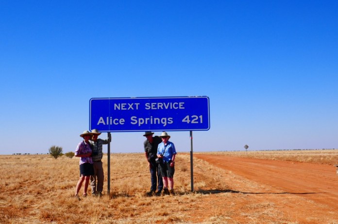
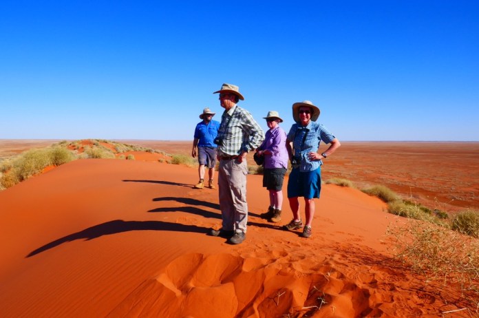
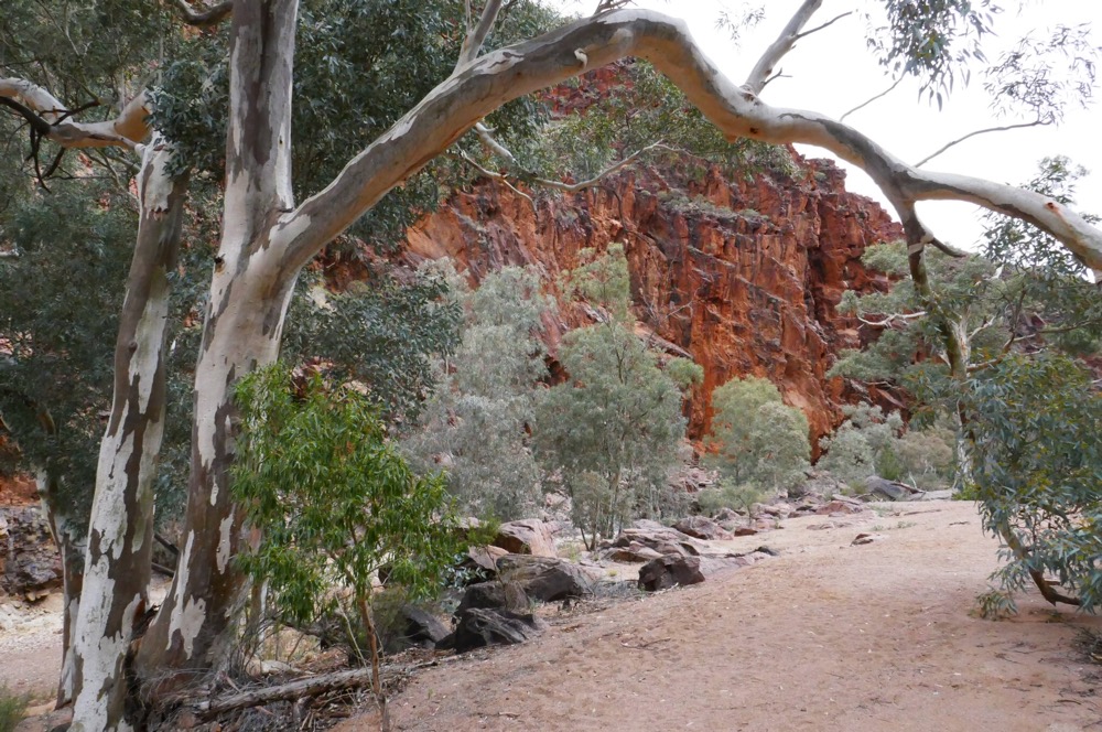
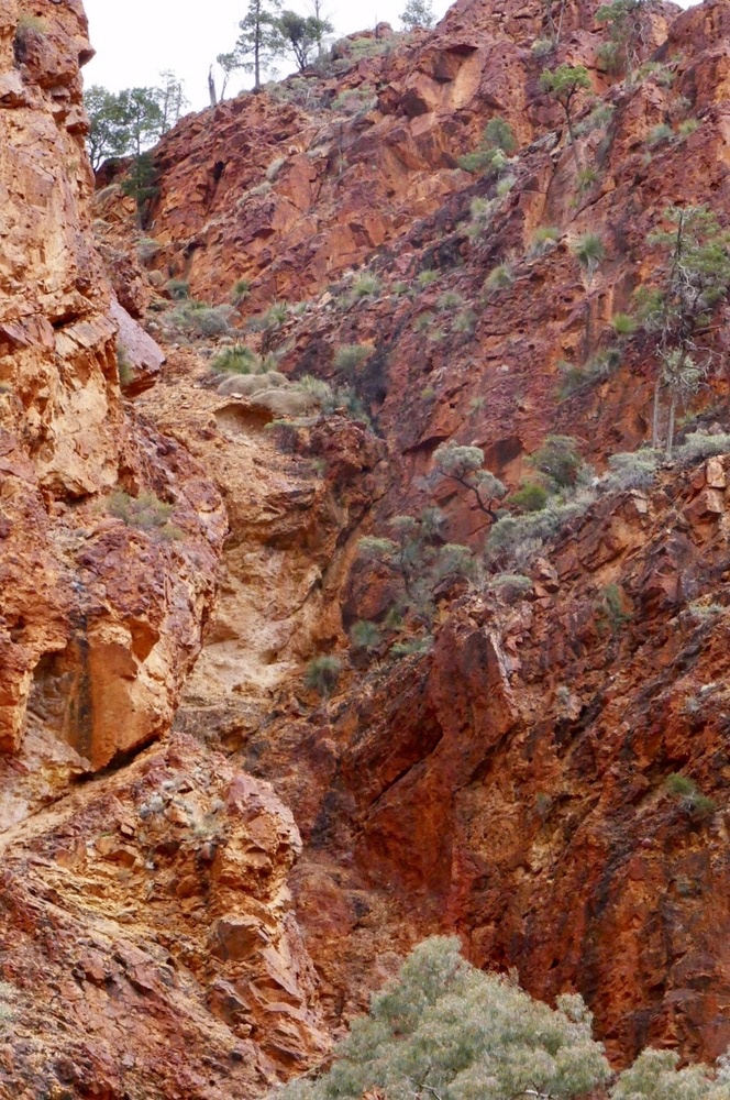
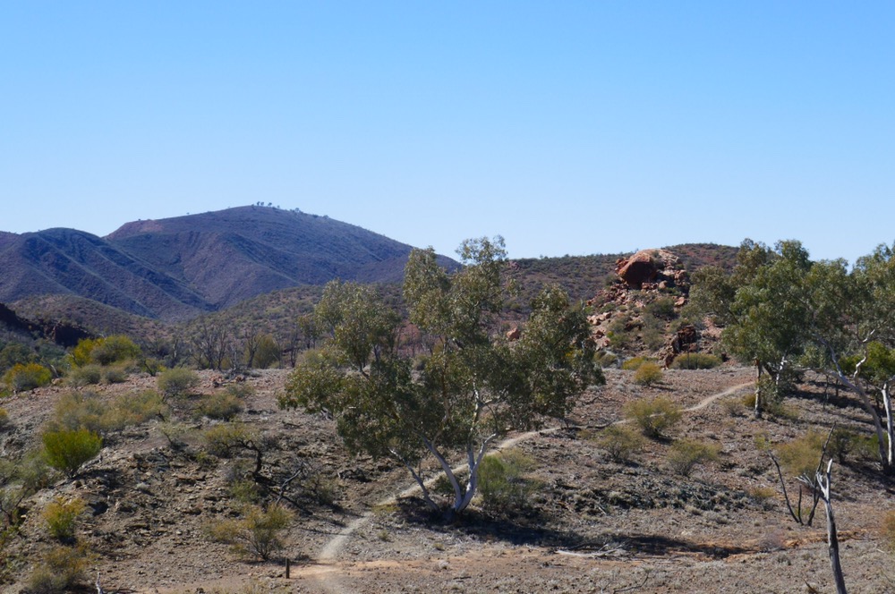
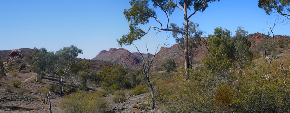
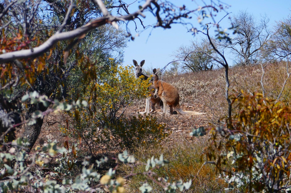
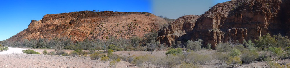
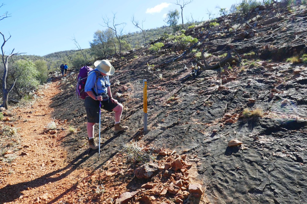
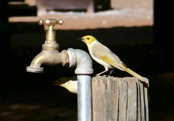
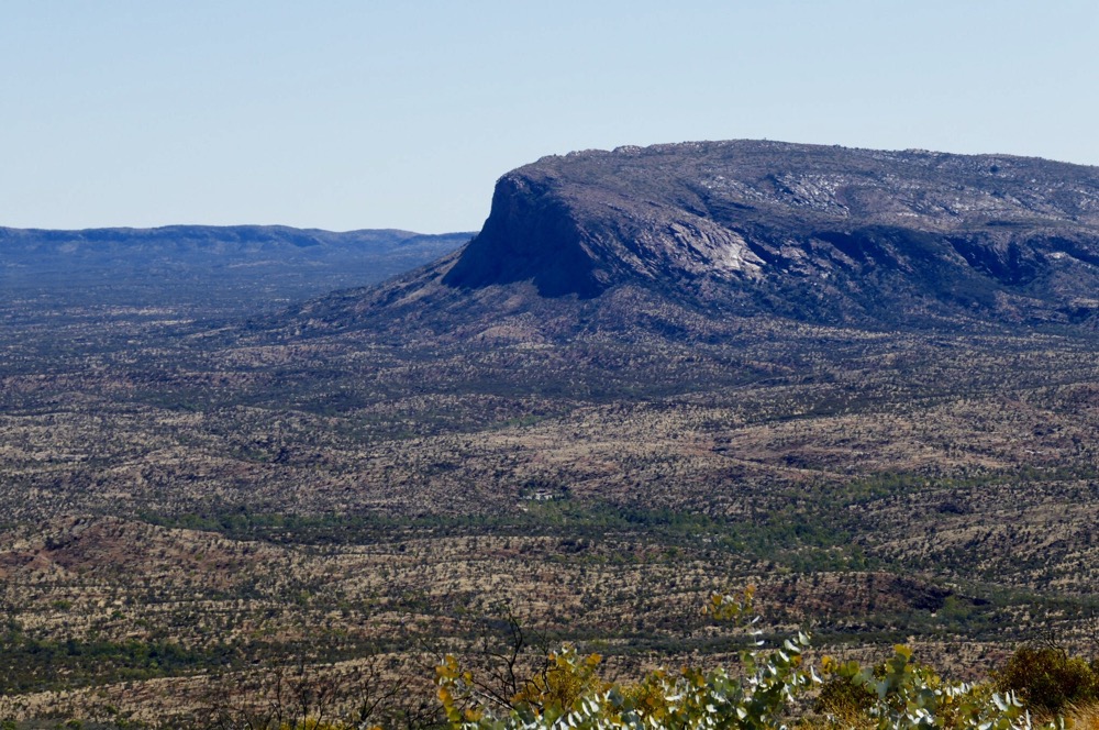
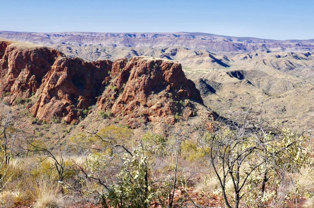
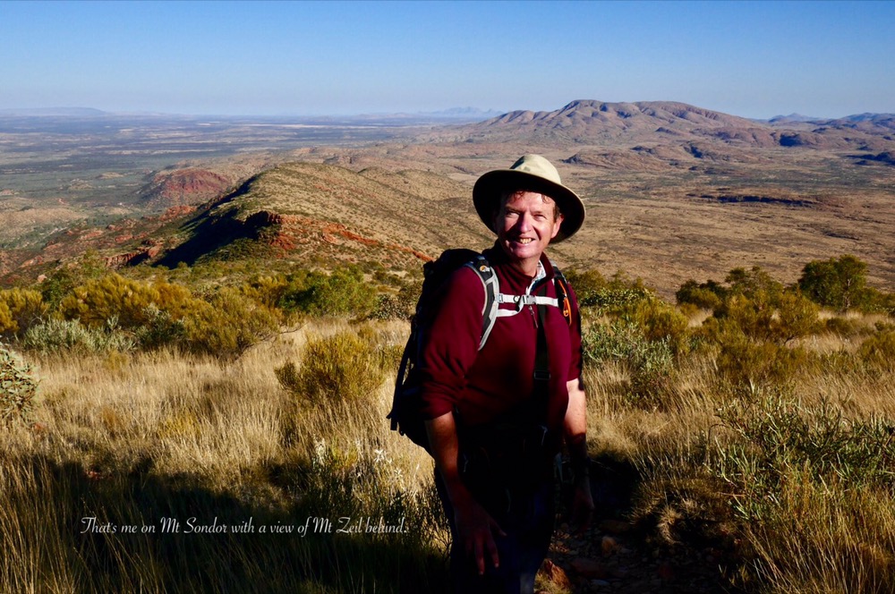
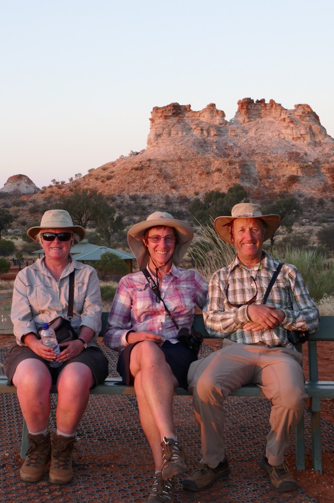
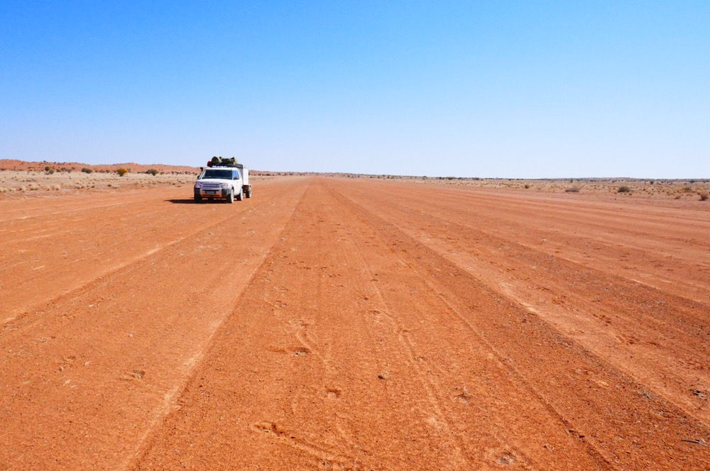
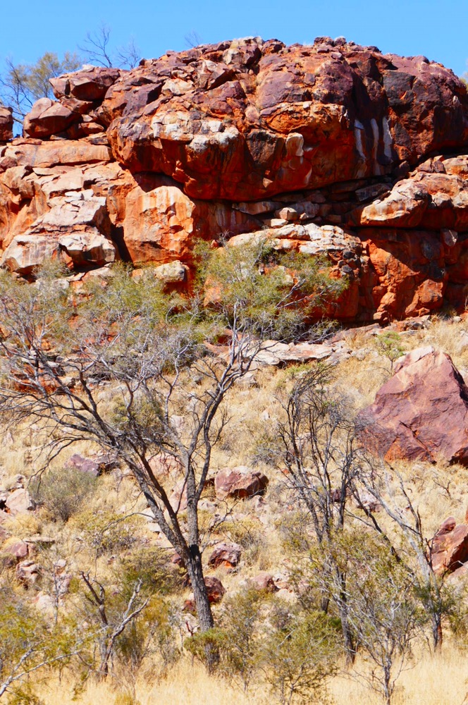
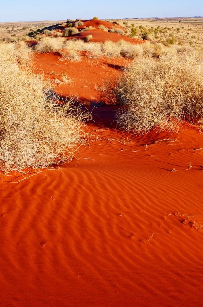
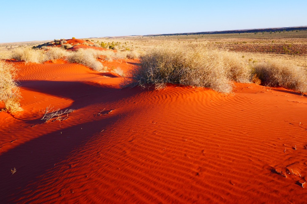
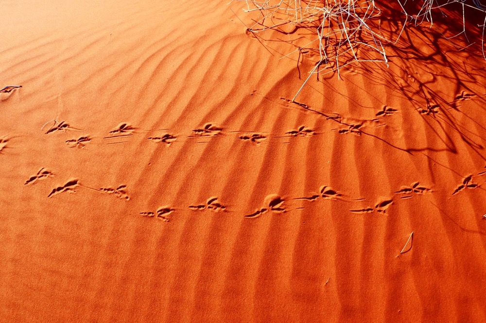
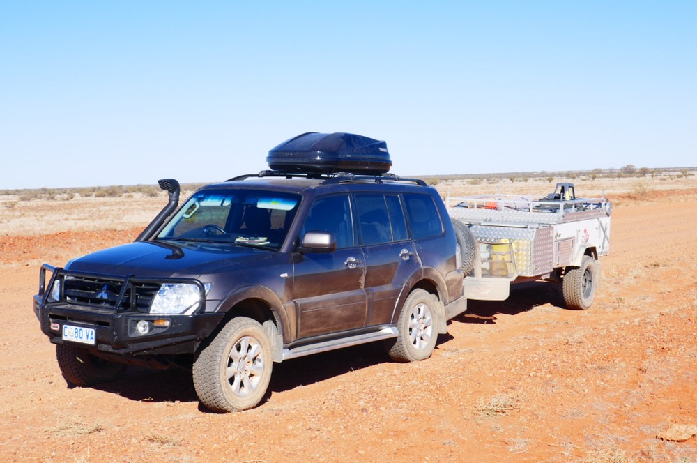
On Monday morning, we all went in the Seaton’s rental car to the airport, then waited for Mark to collect all of us there. His trusty Range Rover arrived and Mark loaded our bags in. We drove east, skirting the community of Santa Teresa, then through plains and hills. The Train range to our east. We pulled over a few times for tea and biscuits, and to take some photographs of the ranges near the road. We had lunch at the last tree for many kilometres. There were great views and a cool breeze. The temperature is warmer than is usual for winter here in the centre. It’s about thirty five Celsius after a cool morning and overnight temperature of about ten degrees. It heats up over the two hours after sunrise. We carried on the drive, to the edge of the Simpson desert. At last, here were the famous Simpson sand dunes, stabilised to an extent by spinifex, woolybutt ( a grass here) and shrubs. The sand is a rich red, the grasses are in tufts, are a washed olive green. A beautiful blend of colours. We trudged up them, one step up and forward then two steps back and down, but we got there. Looking down at the sand shows the sand dunes are more like an apartment block than ones idea of a desert. Instead of animals struggling for life, there are many holes of different sizes that would house desert mice, small marsupials like bilbies, goannas and lizards. In the sand were veritable tram tracks, busy, busy, busy creatures bustling amongst the spinifex. Hopping mice, lizards and snakes all leaving tracks. There was the swish of a perenties tail, here was the lopping stride of a sand goanna and at our feet there was the madcap hopping of marsupial mice, all clearly visible in the sand until the afternoon wind wipes the sand clean to make ready to record the next nights adventures.
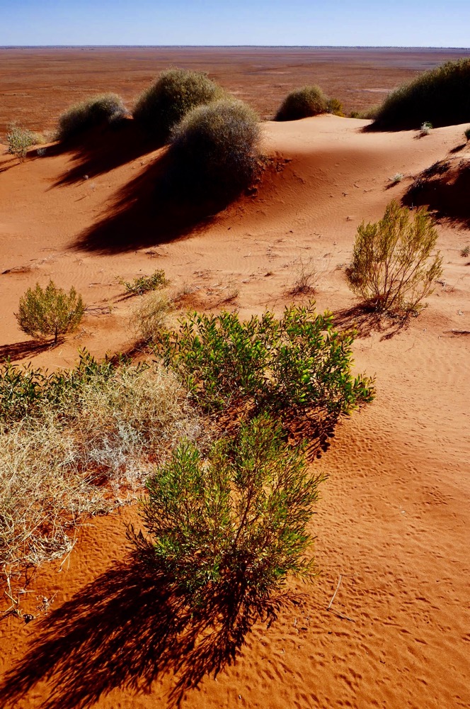
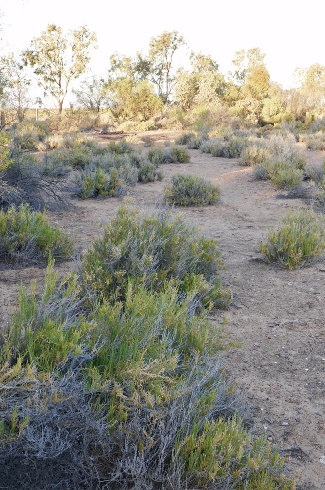
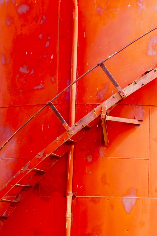
Sand dune , Simpson desert
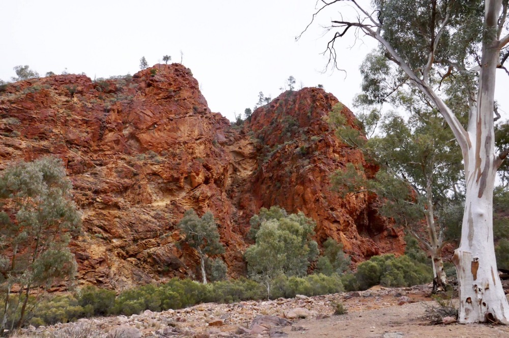
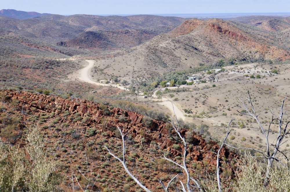
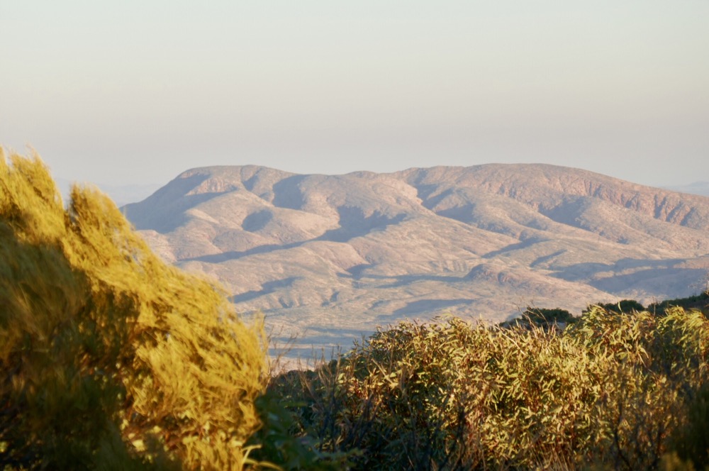
Our destination for Monday evening was Old Andado Station. We arrived at about four thirty. The sun was hastening in its descent as we walked from the campground up our final dune for the day. We stopped on the way to see the small family cemetery, where Molly Clark, the long term matriarch of Andado, is buried. High up, standing on the dune, we looked out across the Simpson, the flat plain between distant sand dunes, sparingly dotted with desert grasses, the dimensions of the desert and of the landscape of the centre dwarfs human conceptions of scale. In other words, it’s so bloody big! Mark had cold beers waiting for us to enjoy as we sat beside the campfire, and looked into the distance country surrounding now Old Andado.
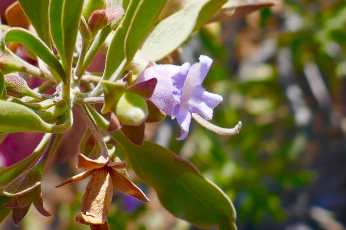
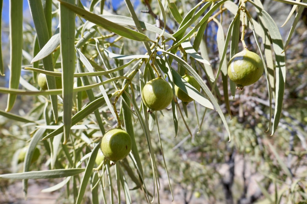
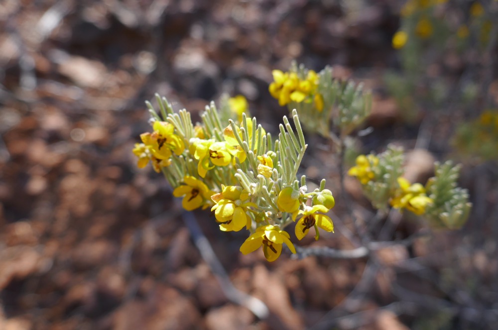
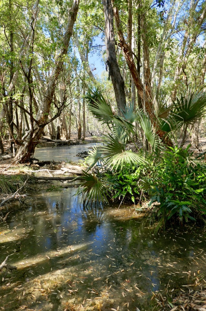
We visited a unique grove of trees, huddled along a remote creek, Acacia Peuce, it’s a very rare tree. It’s only found in this tiny area. It’s a reserve now. The scrubby adolescent tree, becomes a wiry adult tree with these huge seed pods, scallop shaped seed pods litter the ground beneath the trunk.
Mark cooked a wonderful meal of chicken, couscous, and vegetables with a mini pavlova for desert.
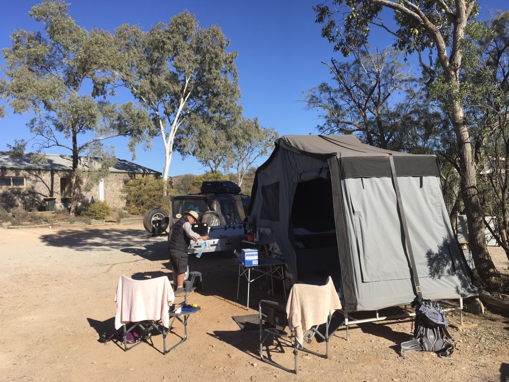
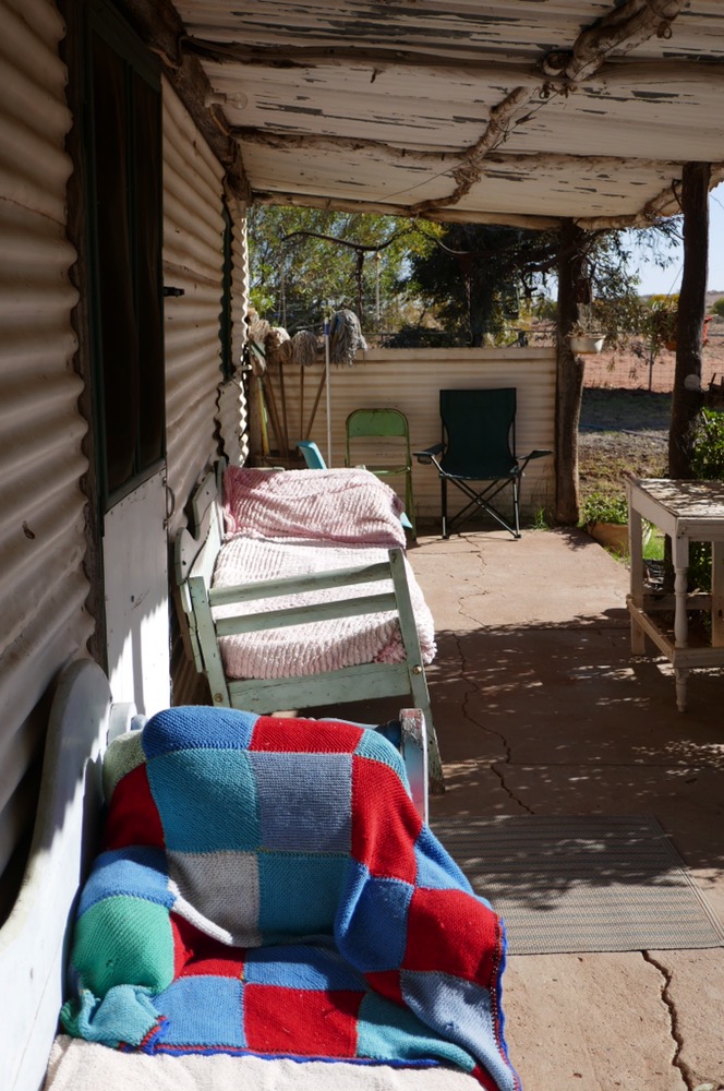
We camped out in swags of Mark’s design, no zips to get jammed on inner sheets or sleeping bags. I lay back my head and looked up at the stars. By 2 am the moon was up, so I had to to pull my beanie over my eyes from its brightness, and later on pulled over the swags lip to shield my face from the early morning breeze.
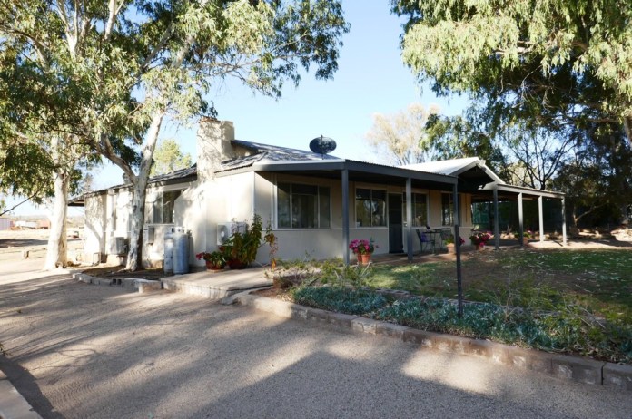
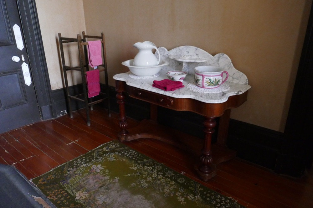
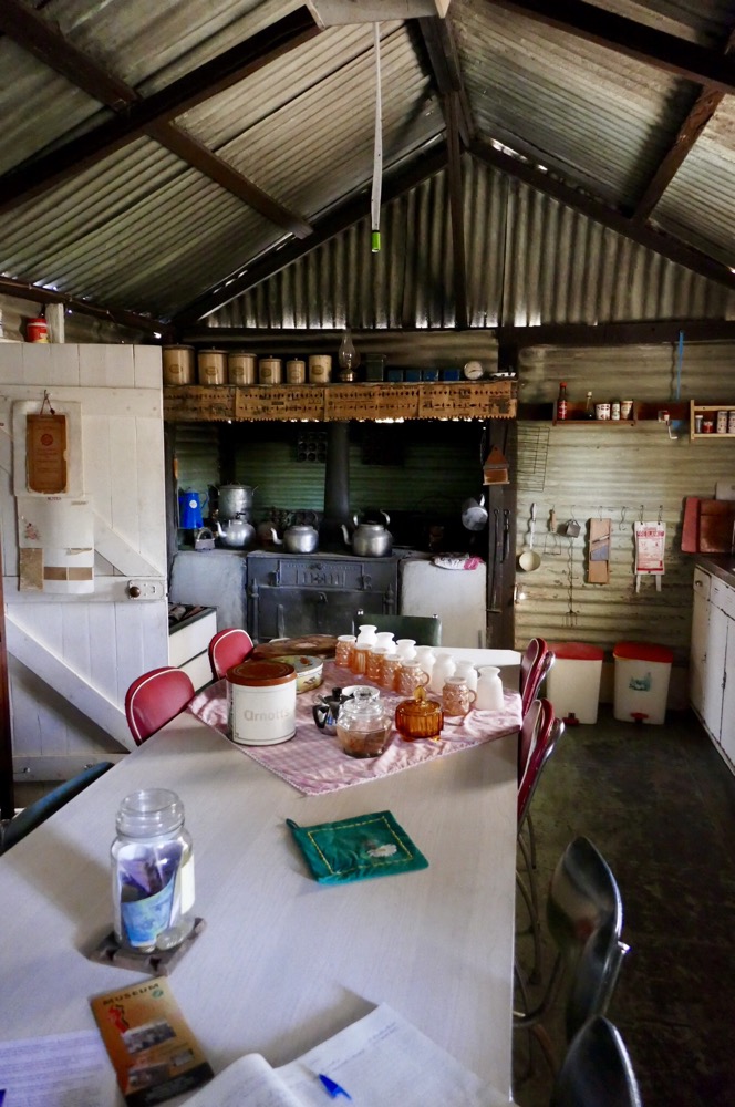
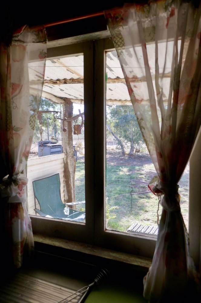
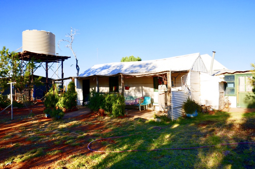
Next morning, our project was to explore the station. The original station built here in the 1880s is long gone, it was constructed of mud bricks. The newer station was built by Mac and Molly Clark in the 1950s. Molly and her husband, and eventually her three boys worked the cattle station. Then in short succession both her husband and a son died in separate accidents. Soon after the cattle were destroyed because of suspicion of bovine TB. It was a very difficult time but Molly persisted at the station, surviving fifty degree days under the corrugated steel roof and walls. She made curtains for the windows, stacks of books and National Geographics for reading, a portable organ for music, and eventually when diesel generators were installed, refrigerators complemented the foolhardiness, warm showers replaced cold ones but the beloved wood stove was not replaced and still features in the kitchen. When Molly finally left the station in 2006, and then died in 2012, the whole place was locked up. Molly had been taking guests in to raise some income, as well as cooking meals and entertaining the campers for several years. The national trust now owns the property, and a caretaker is there to mind the bathrooms and keep an eye on the place and its contents. The house was never cleared out, all the utensils, medical kit, Traeger radio, furnishings, well in fact everything. It is like taking a step back in time, to see the things we were used to as kids. We enjoyed a cup of tea with the caretaker’s wife, in Molly’s kitchen, before heading off to our net stop, Mt Dare.

Old Andado station


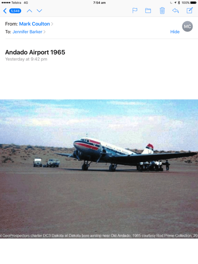
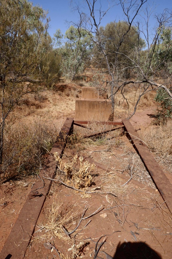
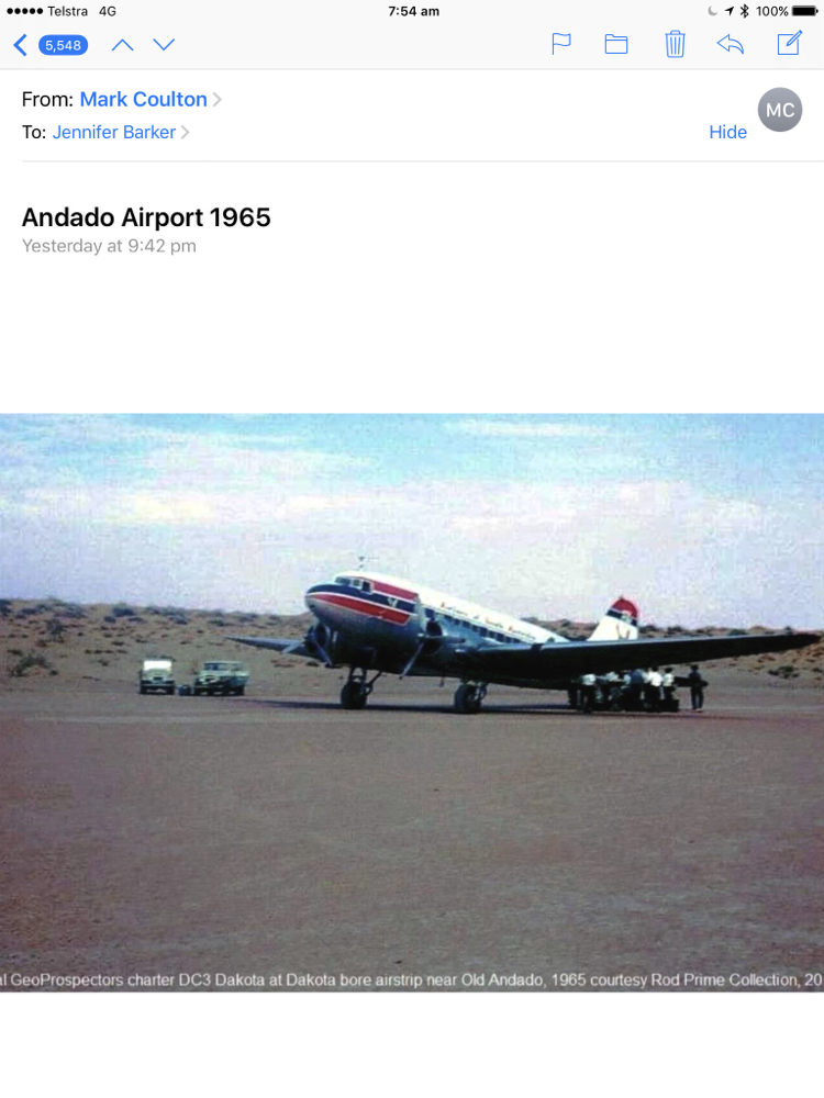
We visited Andado International Airport. Yep, an airport. Ansett once flew in 727s here to start Simpson desert trips but the big users were the geologists who flew in on huge survey planes that cris-crossed the Simpson doing geomagnetic aerial surveys. The runway is over two km long. It’s a packed gravel surface.
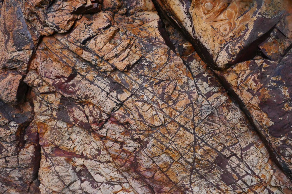
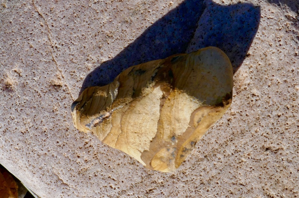
We carried on, stopping along the way. At one spot, we walked to a sand dune crossing a gibber pain. Gibber rocks look greasy, in the right light the whole area looks purple and at other times it looks tarry. I picked up a dark red rock from the ground, expecting it to be greasy but surprisingly it was smooth and satiny in texture; wind blasted.
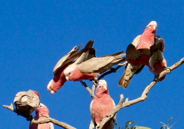
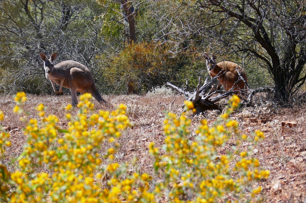
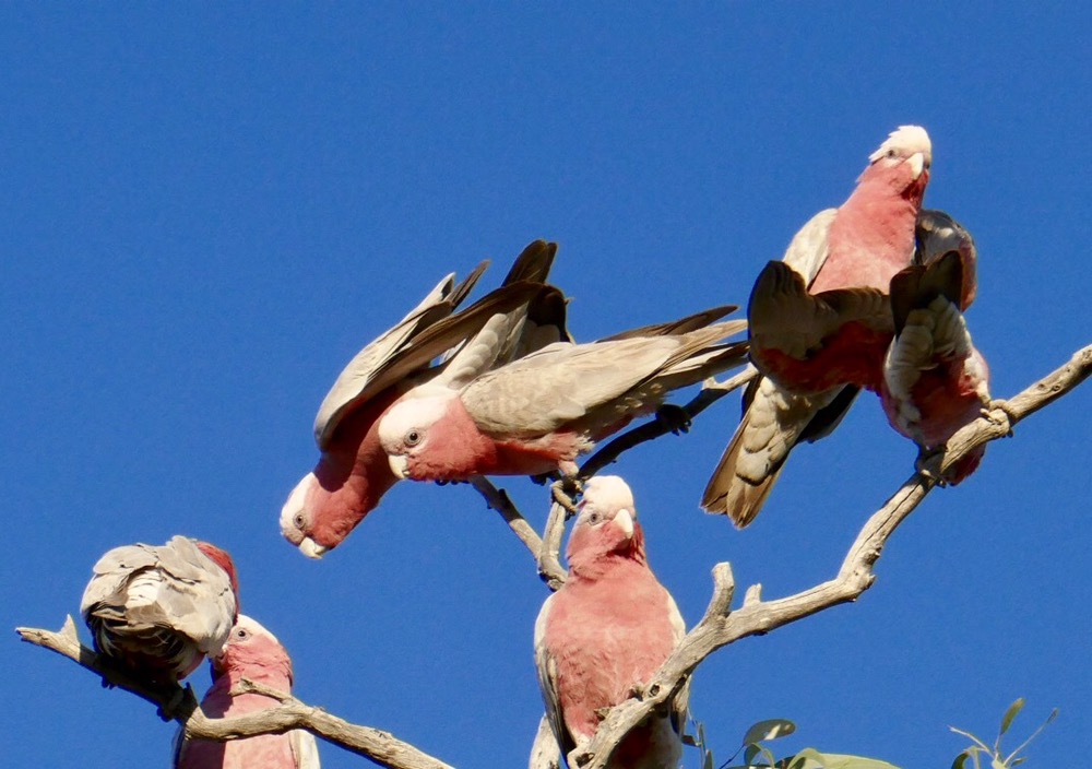
We passed some cattle yards, the cows on the way to Argentina for use in breeding, and the bulls on the way to your plate. Major Mitchell Cockatoos were in the coolabah trees surrounding the yard.
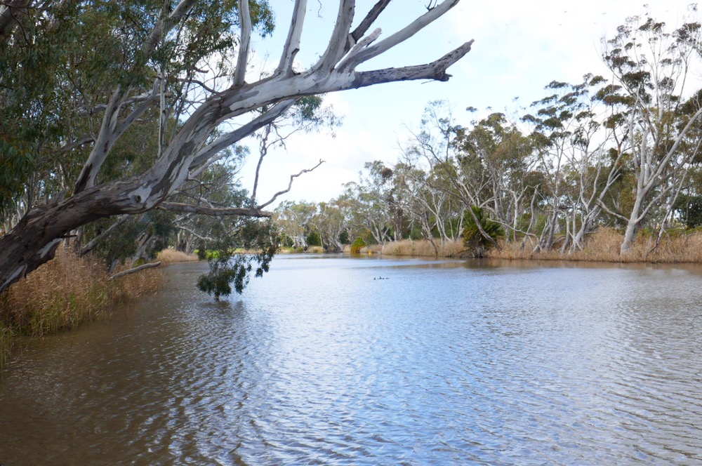
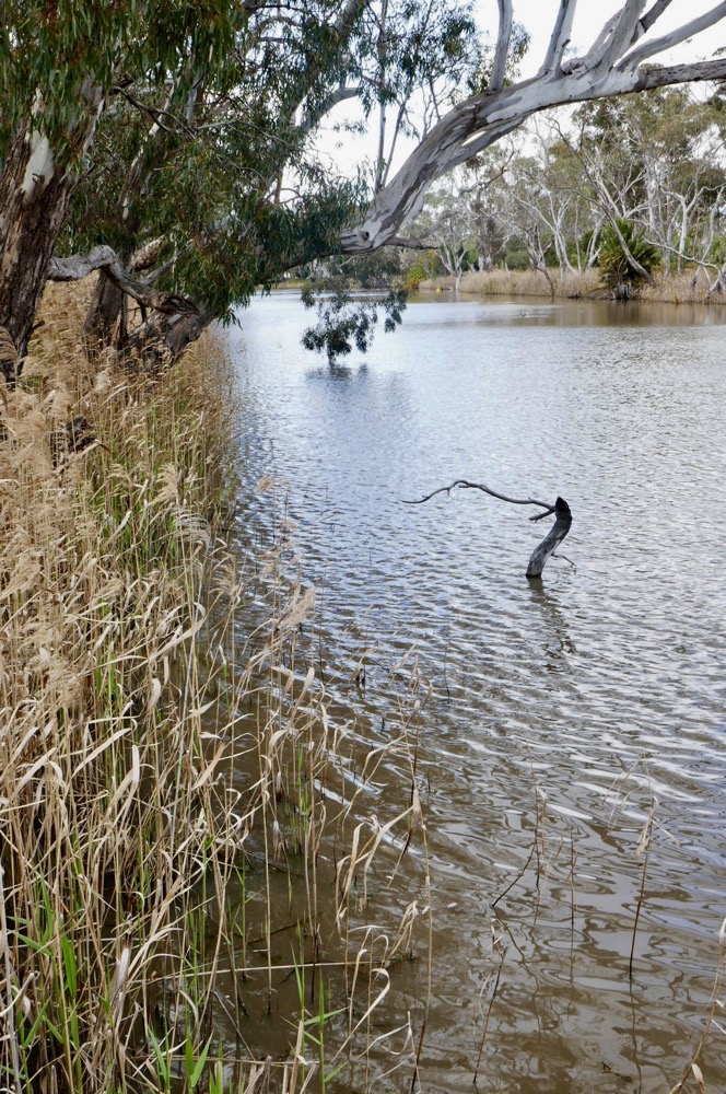
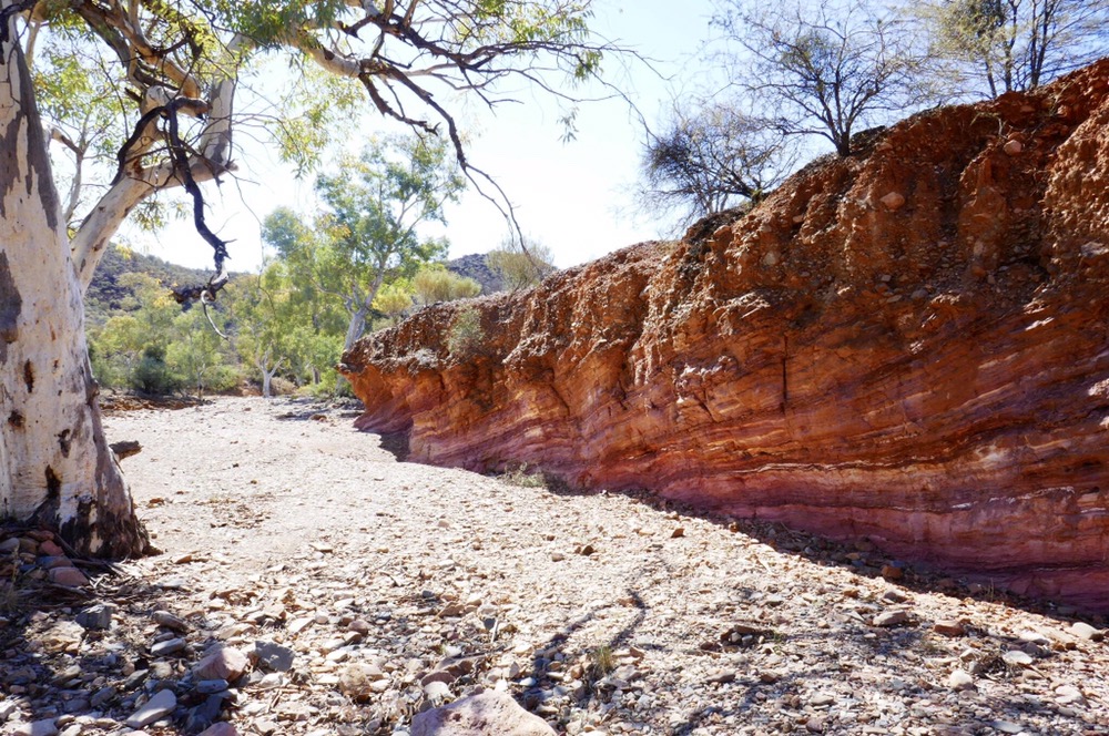
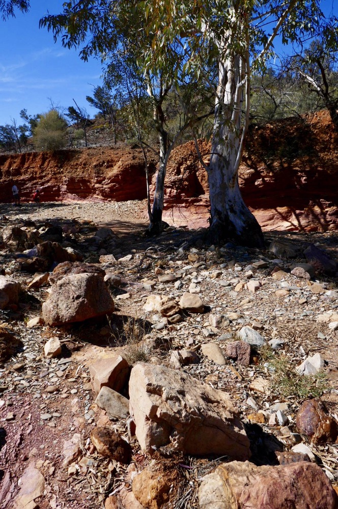
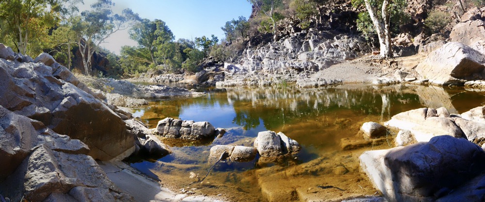
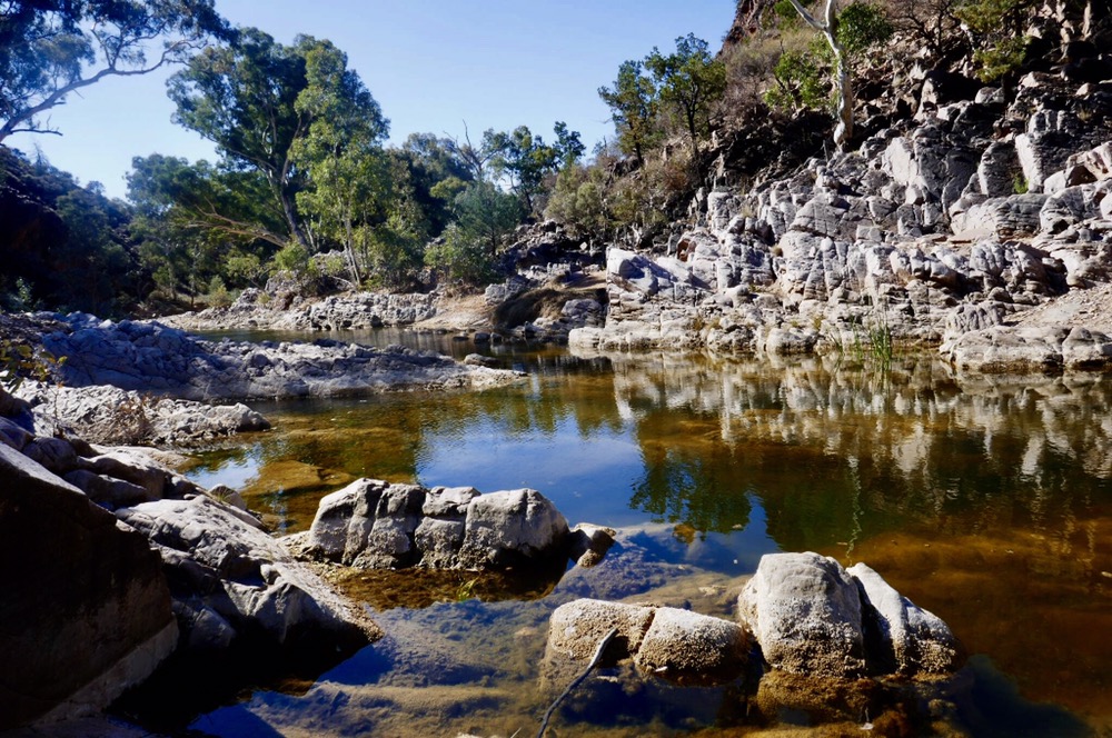
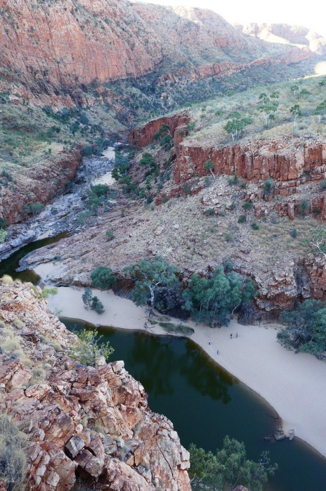
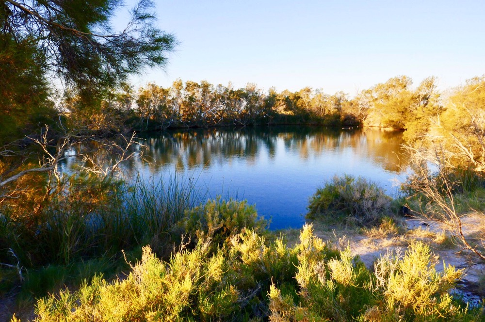
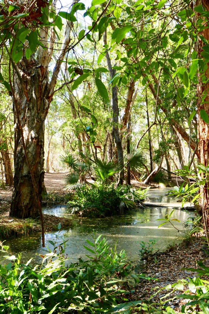
We stopped for lunch adjacent to the headwaters of the Finke River. This ancient river peters out into salt pans north west of Lake Eyre. Until that time, when it flies it’s a mighty river. We drove through a now dry swamp, filled with coolabahs, and a floor of dried baked clay, this swamp goes for a hundred kilometres and can be filled to a depth of up to three meters. Its exit into the Finke bloats and enriches the river. We walked along the dry white sandy river bed, admiring the old, immense river gums. Some had dead branches and then a robust trunk almost two meter in circumference. Other trees showed the damage to roots and branches caused by flotsam in the river. Now it was quiet, the clay of the riverbank scoured into patterns by branches washed down in summer. There were trees, blown apart by dry lightning, black and charred ruins with surrounding ash. We had wonderful lunch of pickles, roast beef and chicken. After lunch we drove to Dalhousie Springs.
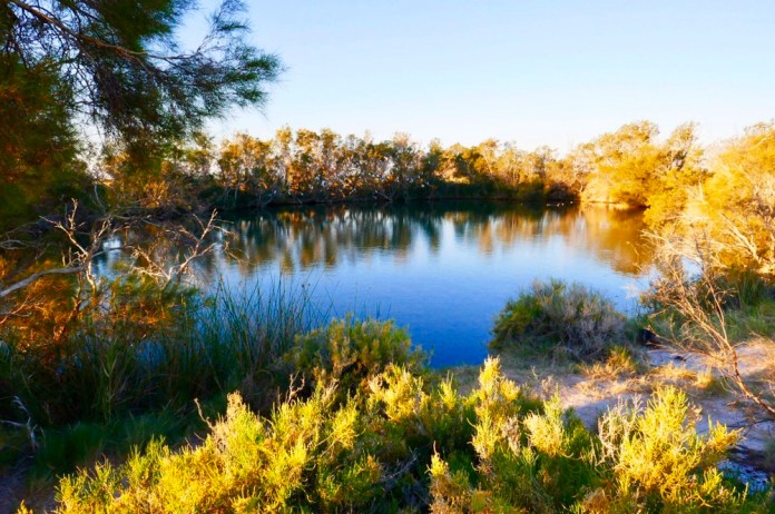
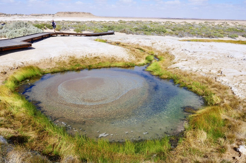
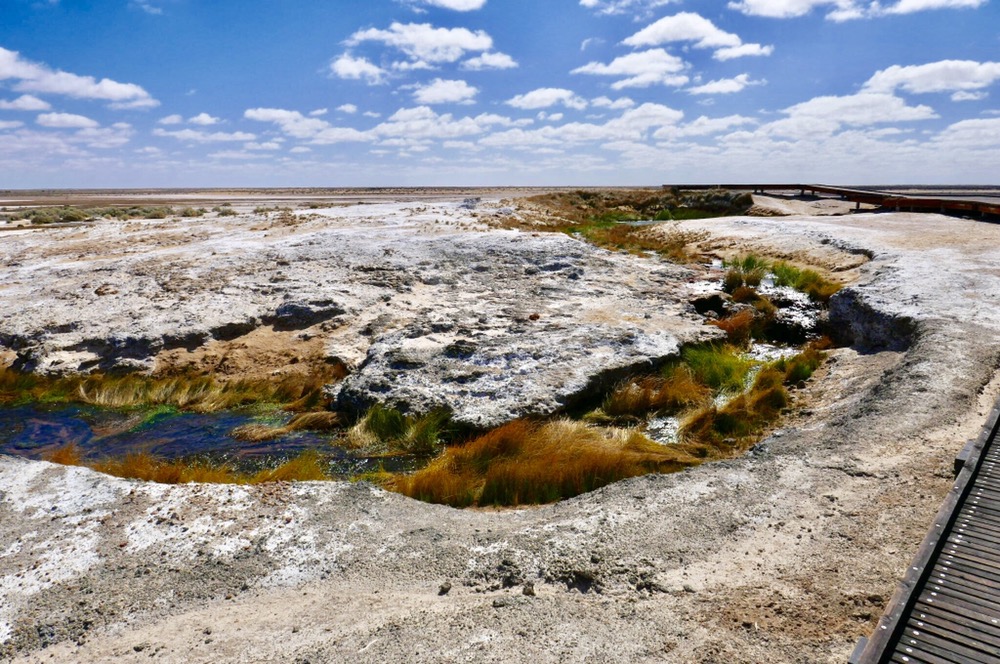
Dalhousie springs
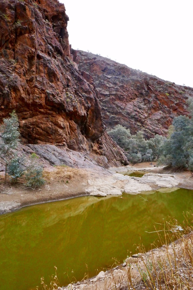
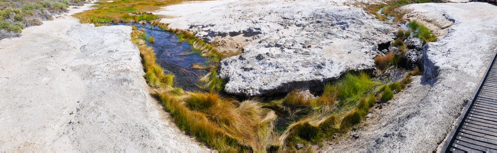
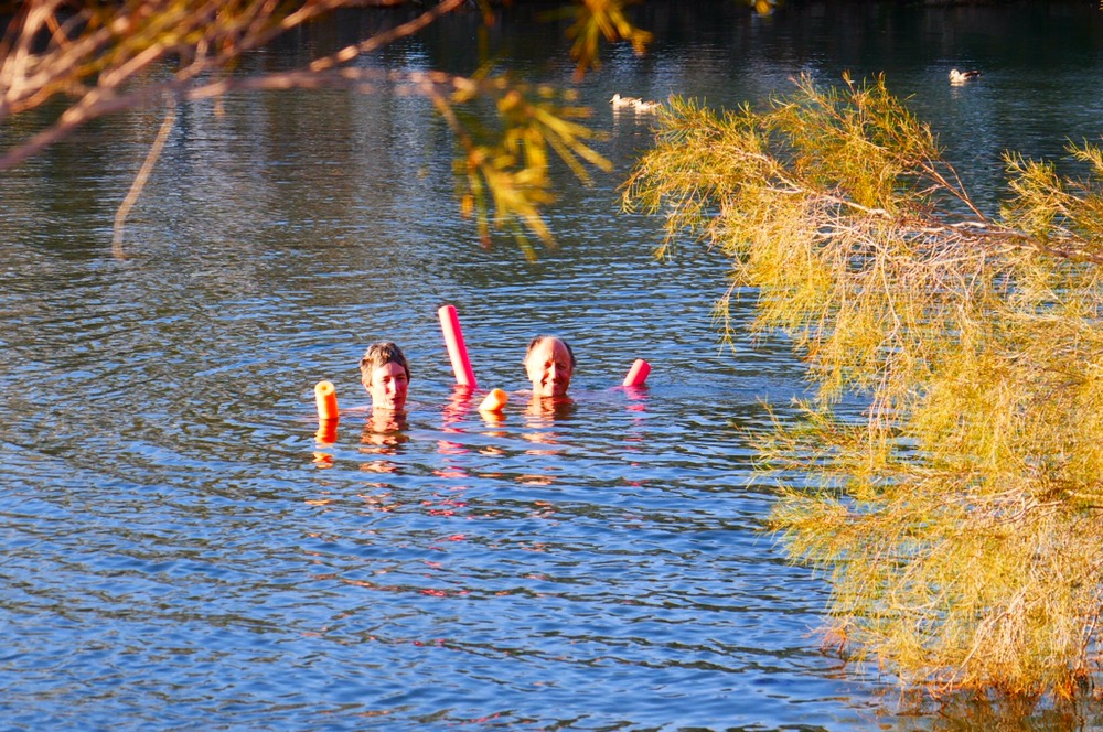
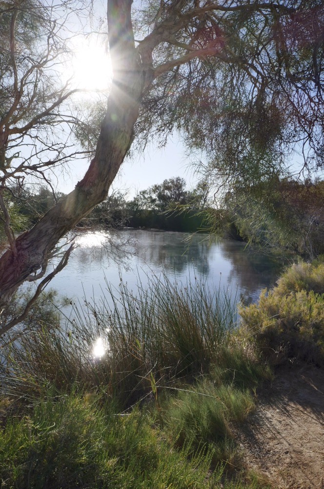
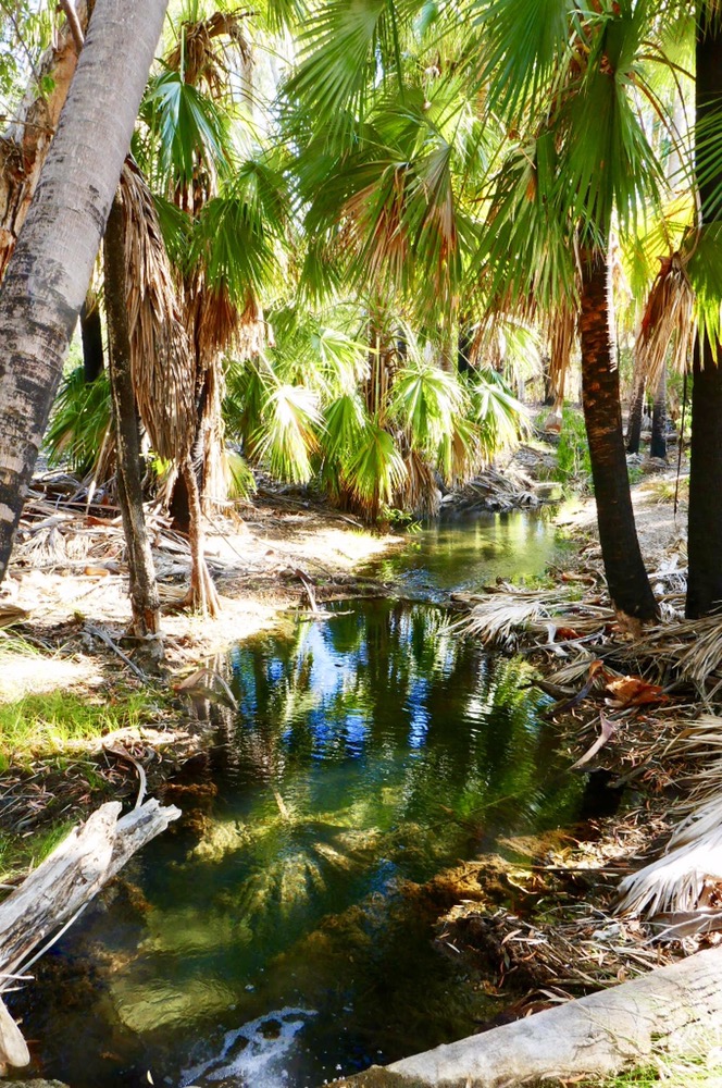
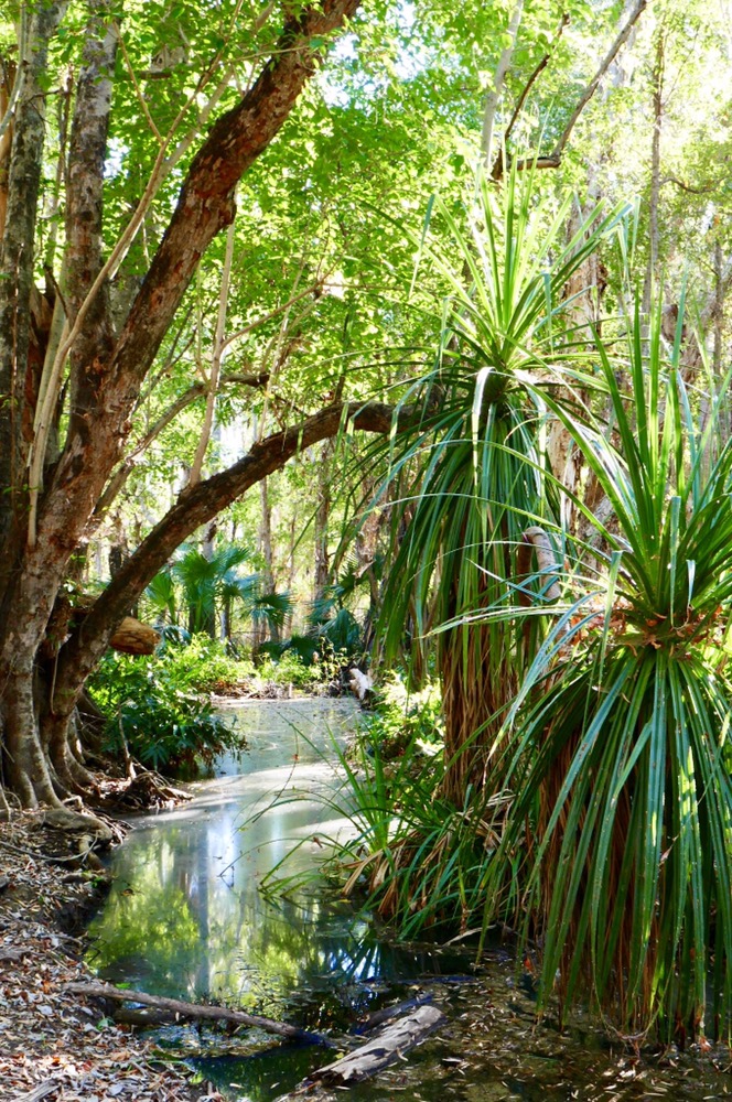
Dalhousie springs are natural springs where the water from the great artesian basin appears on the surface. There are several springs here but the main one is used for swimming. It’s a warm 34 degrees. Corellas fill the trees, chittering and calling from the branches. I grabbed a foam noodle and walked down the short steel steps to the water. It’s not uncomfortably warm but it’s close. The water is very clean as well as hot. The sky above is a brilliant clear blue. The trees are lush, and green, and abut the water. The surrounding lands are salt laden, the plants are incredibly salt tolerant, excreting salt on their leaves. We were only in the water a few minutes, it was quite refreshing when we got out of the water. The breeze which had been warm was now cool thanks to the physics of evaporation . We walked back to the camp site. Mark had assembled the inner mesh of the tents to keep the bugs and dingos out as we slept. Dalhousie springs has a lot of dingos wandering about at night so I did not leave out my boots or any food supplies.
Mark cooked beef stroganoff and then a pudding for desert. Yummy as always. It was getting dark, and the mozzies and gnats were buzzing around feasting on Jennifer and Di. We sat around our camp lights, talking and laughing about the day and life in general. Di and David are retired and Jennifer and I are semi retired, and so we have a lot to talk about. It was quiet overnight until the wind picked up at 2 am, and was quite wild for a few hours.
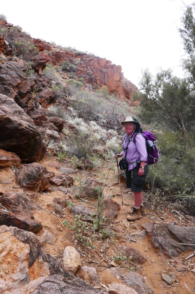
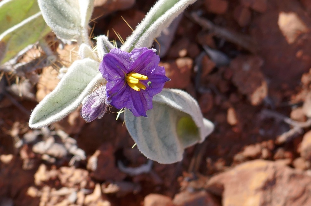
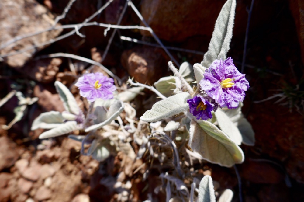
This morning at five am, a woman with a voice like a motorised cheese grater started talking to a friend. She had the same idea as a one year old, which is” if I’m awake, everyone else should be awake too”. She told the locals about the sad state of her bum which had been savaged by mosquitos in the toilet while hovering over the long drop. Anyhow, I did have enough sleep. After breakfast of pancakes, bacon and fruit we all did a 700m walk that wound its way around the springs and to some of the nearby hills. It was a great chance to see the escarpment to the east, the salt pans surrounding a stony hill nearby. The plants are fascinating, many of them are green but all seem to be flourishing in this salty soil. Amazingly some resemble our Tasmanian cushion plants.
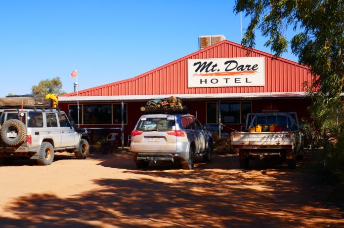
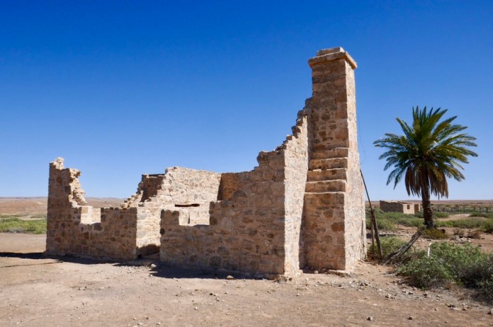
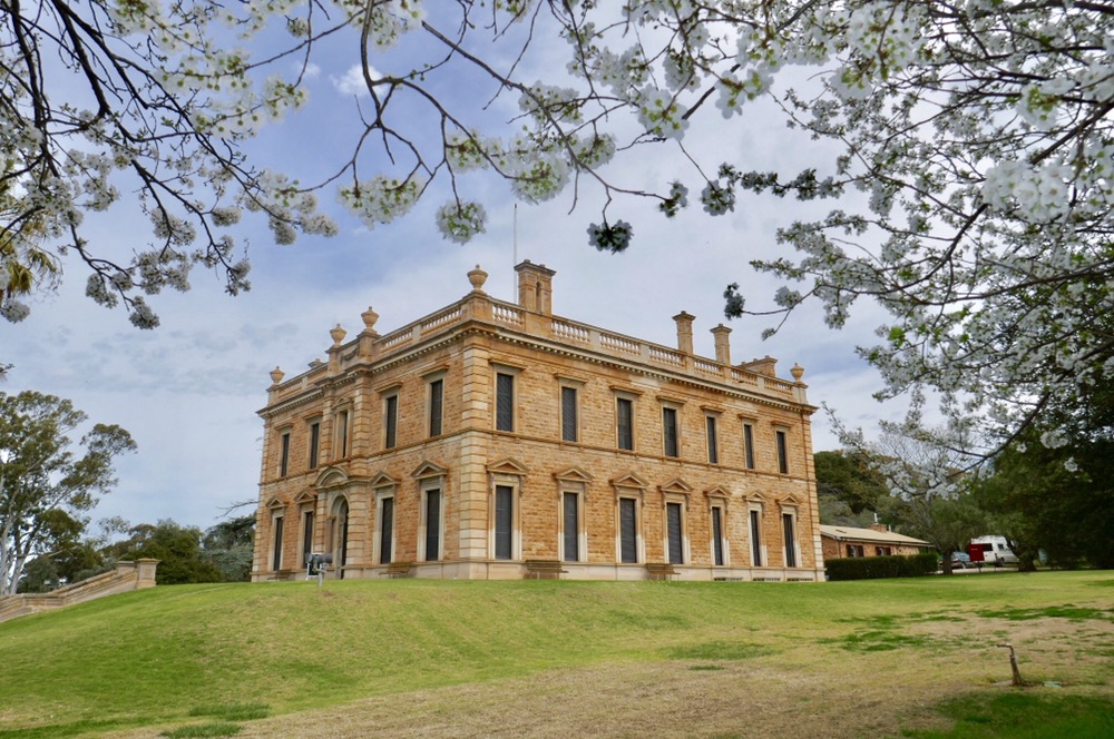
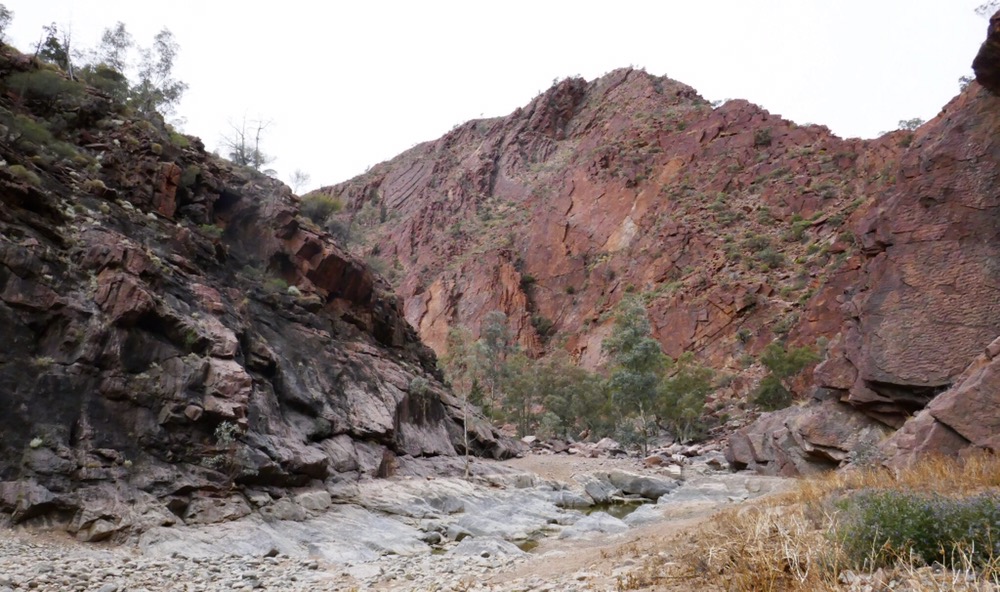
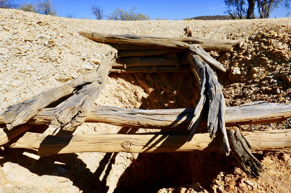
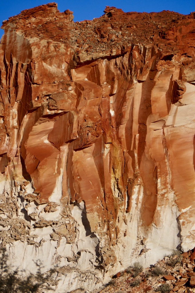
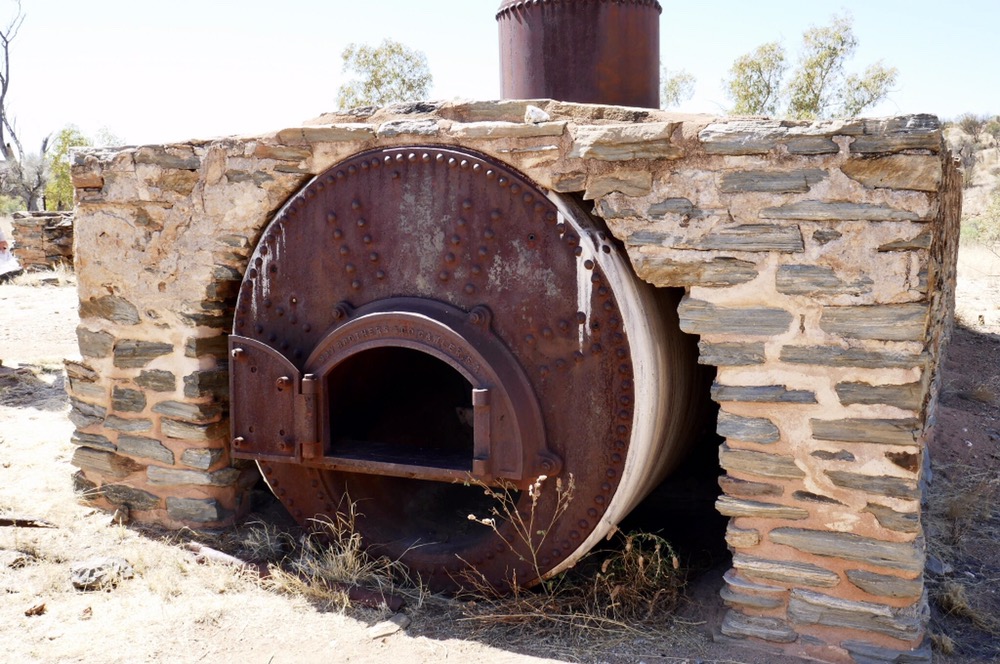
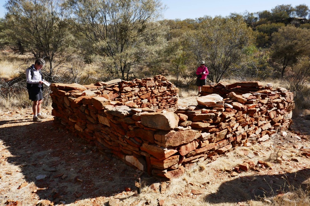
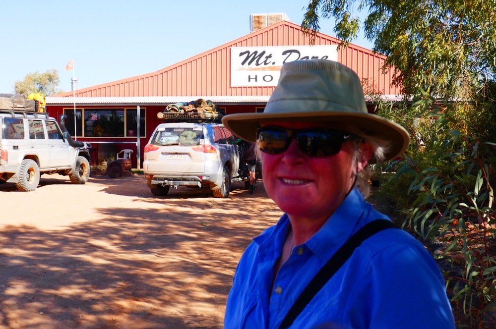
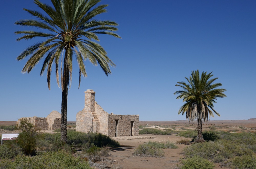
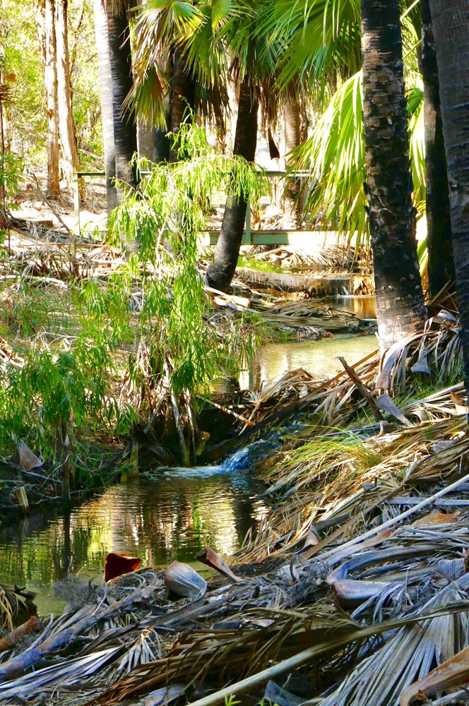
We then drove to Mt Dare. This took most of our Day, as we visited lookouts, Opossum Waterhole, Bloods Creek, but our first stop were the ruins of Dalhousie station. This was built in the 1880s and they tried to run cattle, sheep, and other animals . Dalhousie had its own spring but droughts, influenza and amalgamations of stations left Dalhousie out in the cold. They planted date palms which choked the spring located there. The ruins remaining are the Homestead, the workers cottage and the blacksmiths forge and hut. These were fashioned from blocks of local stone still firmly mortared by limestone. The roofs are gone but the buildings ( at least three of them) are still recognisable. It’s impossible to begin to imagine the isolation, and remoteness of places like this. For the Aboriginal people this was home but for the Europeans who decided to live there, many would die there, buried in their now forgotten graves. All their efforts yielded very little, their relics are ruins, not working farms. It’s all national park now in SA, and has been so since 1985 when Witjara national park was declared. Dalhousie had ceased to be a going concern for decades before that.
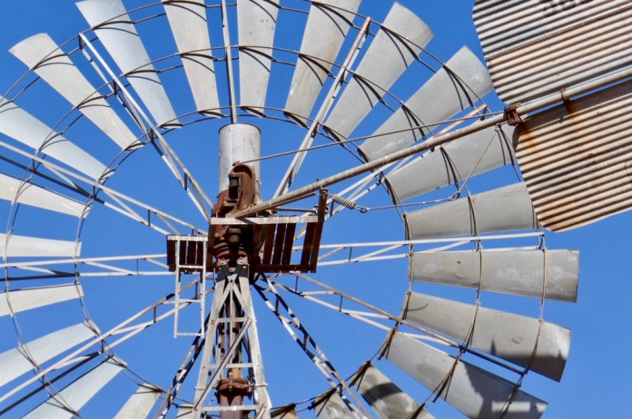
We visited Blood creek, which is not named after a conflict but the first owner, a man with the surname Blood. There’s very little here now, but nearby is a windmill for the bore that was constructed in 1885 and was over 600 meters deep. It would fill huge water tanks, with an output of 4,200 litres of fresh artesian water in any 24 hour period. This allowed cattle to water while on the move to Birdsville. Blood creek had a hotel for the drovers, the railway workers ( the line was barely a kilometre away) and the travellers in this part of the Simpson. Giles was an explorer who on his way to Alice Springs in the 1920s, visited this hotel and thought it wretched and the publican and patrons equally drunk. In the 1950s the then owner was Ted Colson, who was the first white man to cross the Simpson Desert. Other people have crossed the Simpson in those early days a crossing which is established now as the Madigan line and another route is the French line.
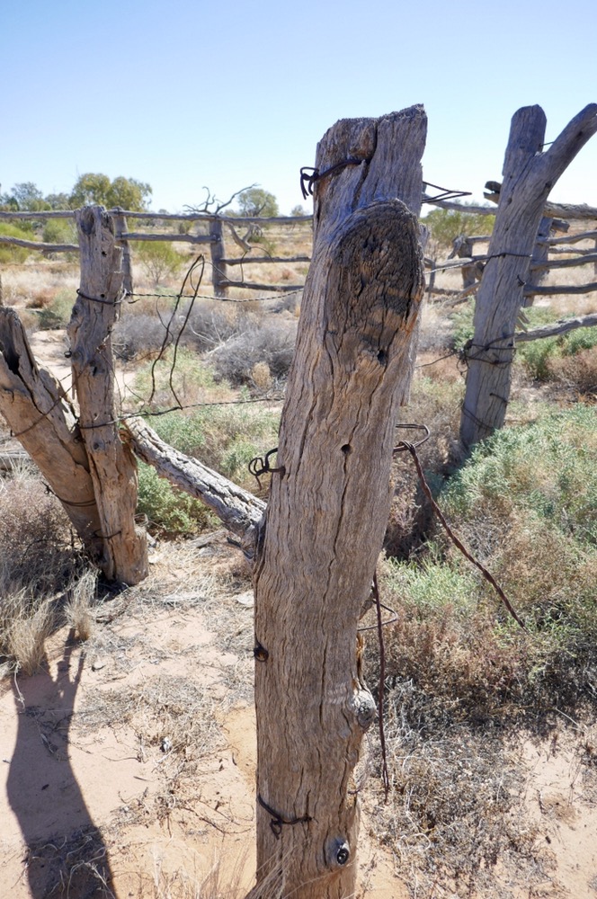
We visited Federal station. It’s not even a ruin, just a few broken bottles remain of a once substantial building, but in its day it was a happy place, with loads of fresh vegetables and fruit grown by the owner. Aborigines built the cattle yards nearby which are still there today. These huge wooden posts connected by this black wire provided a set of vast pens for travelling cattle on their the way south.
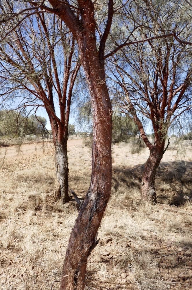
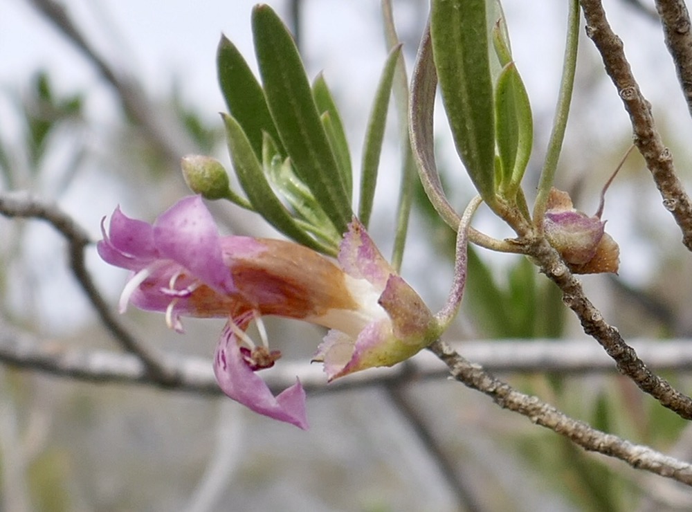
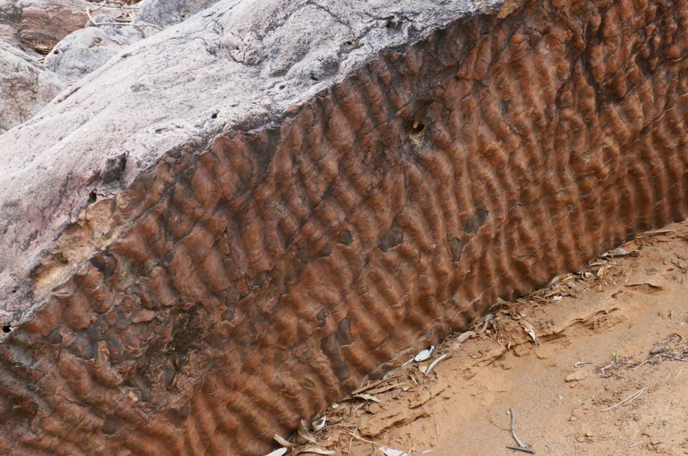
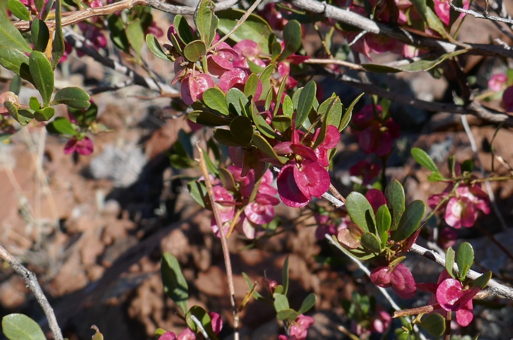
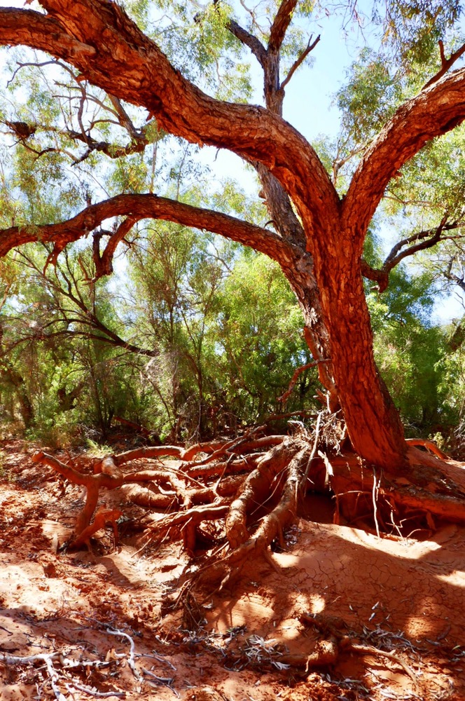
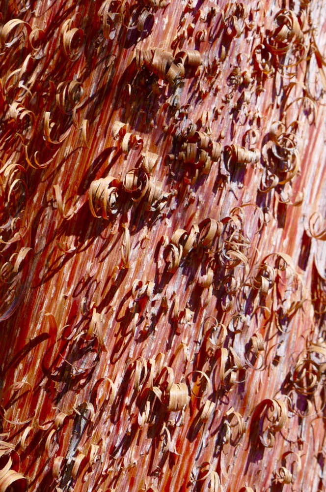
We had lunch at Opossum Waterhole. It’s pretty low now but it’s still very pretty. A falcon is nesting in a tree. On the other side of the road we had out first look at Red Mulga. This is only found in a few locations, it’s a beautiful tree with the most unusual red bark. It looks as if someone had used a wood plane lifting up curls of red bark.
Mark was concerned at the rear shock absorbers as they were not working as well as they should. When we got to Mt Dare, he pulled apart the compressor and pretty well got it going again. We helped out by setting up camp.
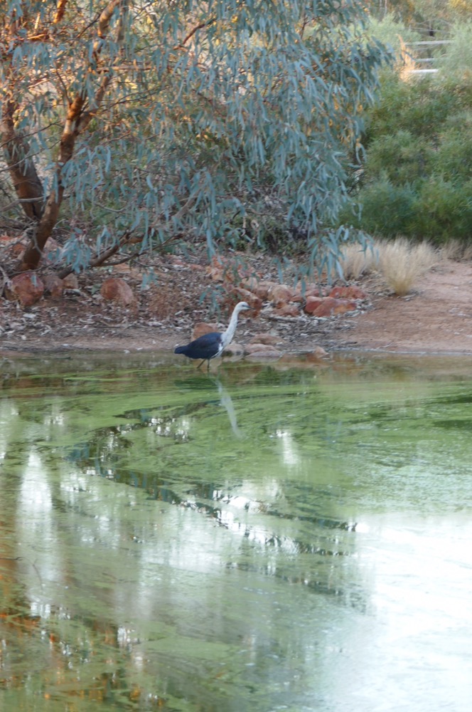
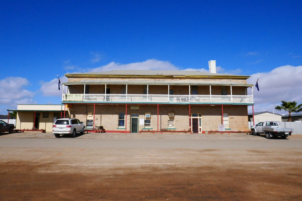
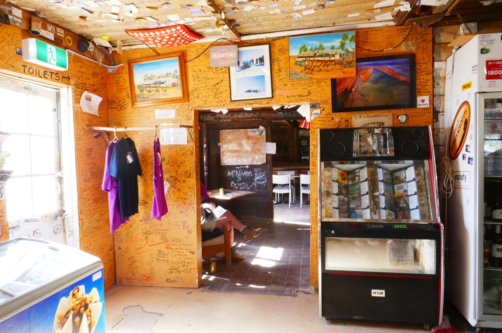
I’m now sitting in the dining room at Mt Dare hotel. We ordered our dinner for tonight yesterday. Outside there is a pond, where we watched a heron hunting. Galahs high up on branches above us. I’m looking forward to my steak and chips!!
………………………………………………………………………………………………………………………
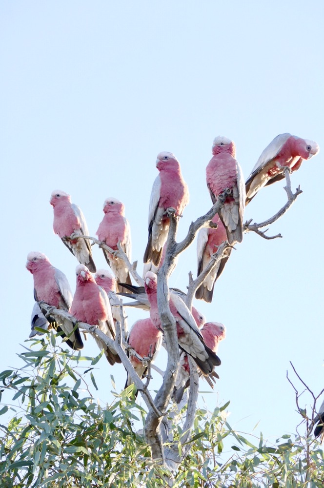
I’m sitting under the stars at the Chambers Pillar camping ground. It’s been a super day. We were woken up by a flock of corellas erupting out of the trees at Mt Dare. Galahs settled into the same branches to enjoy the sunrise. We all helped pack up then began the drive to Chambers Pillar.
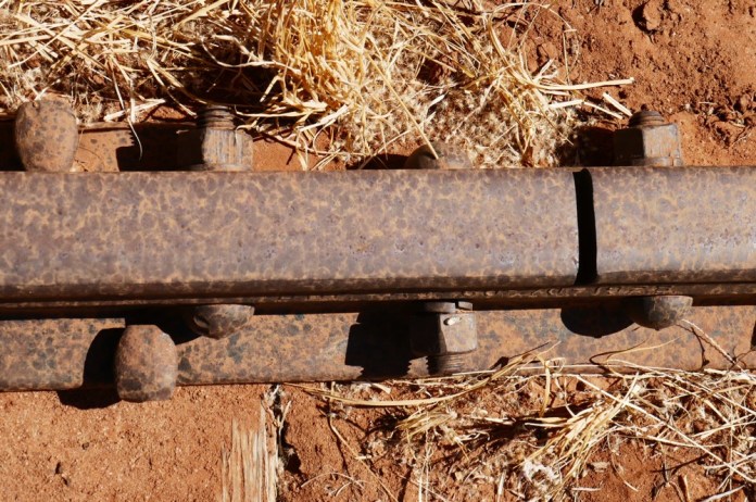
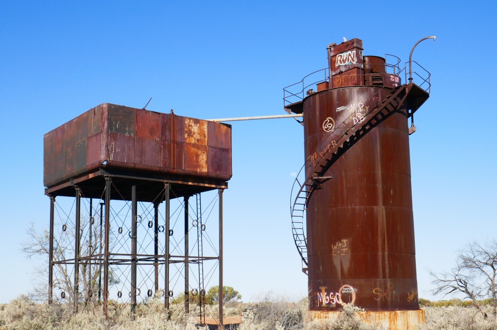
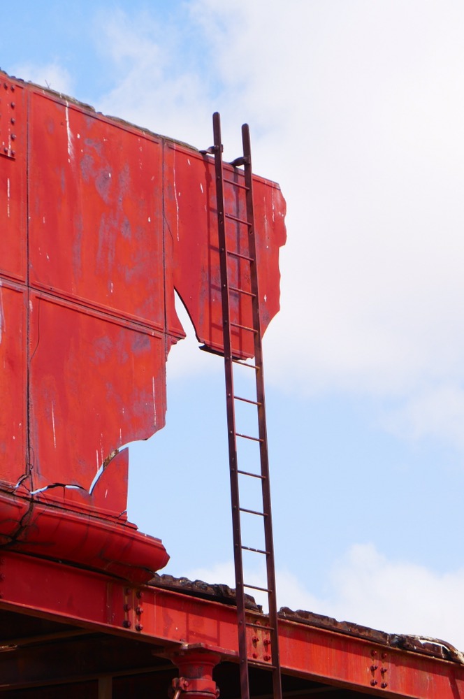
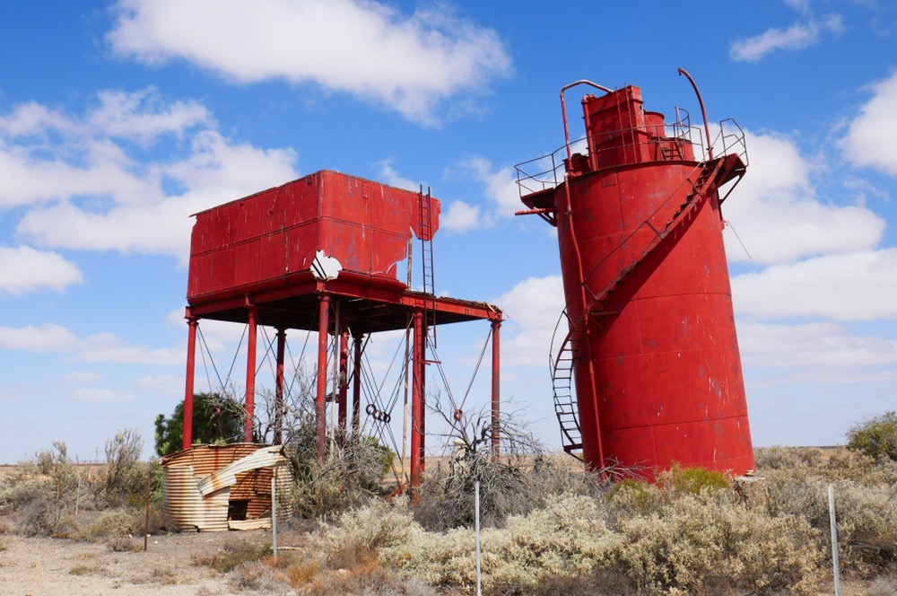
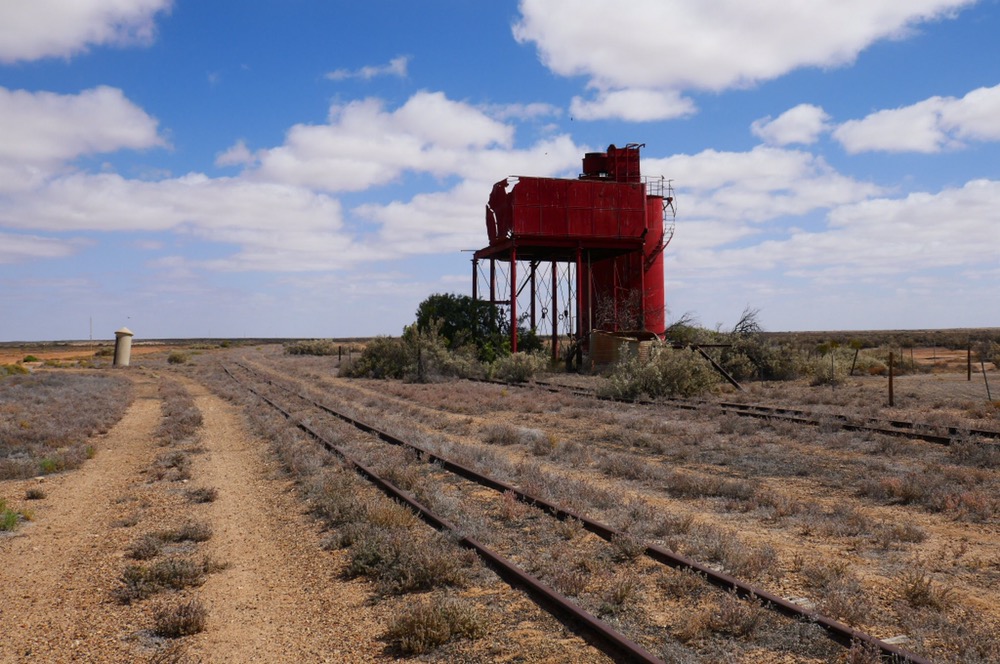
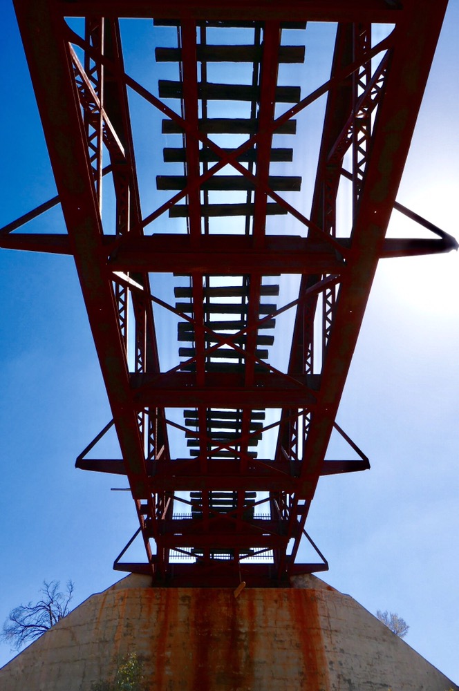
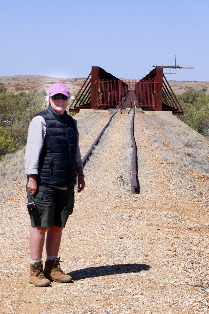
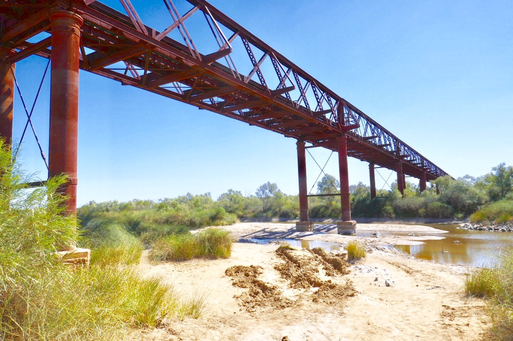
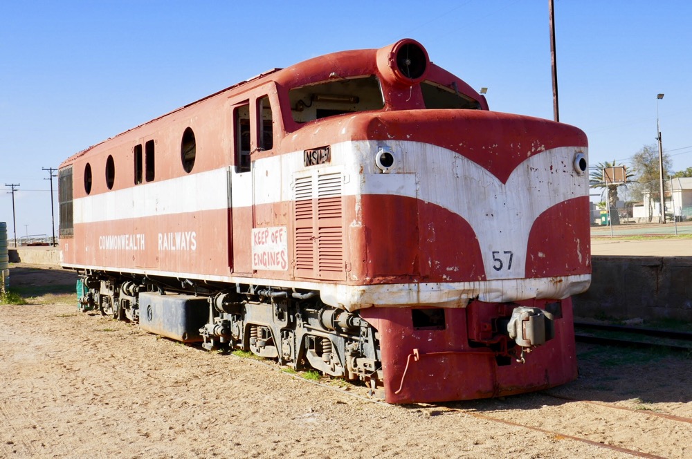
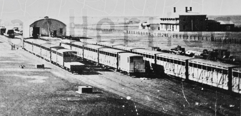
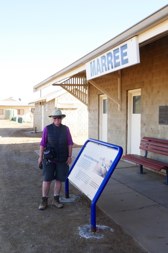
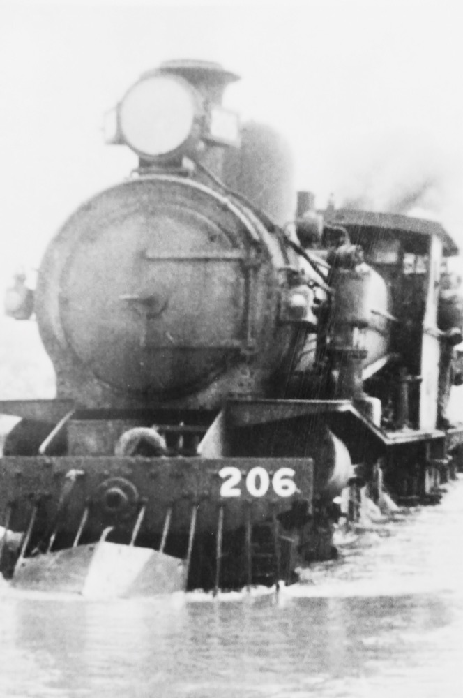
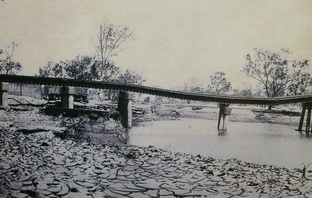
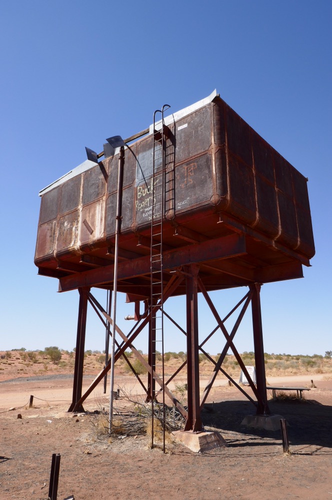
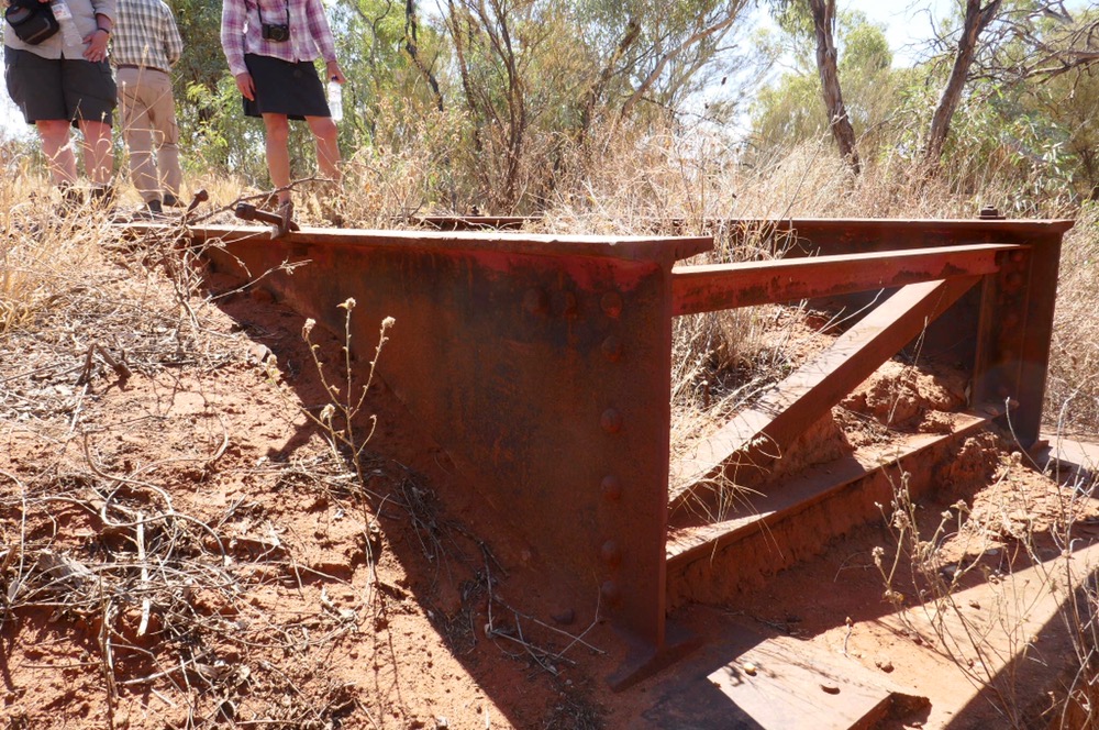
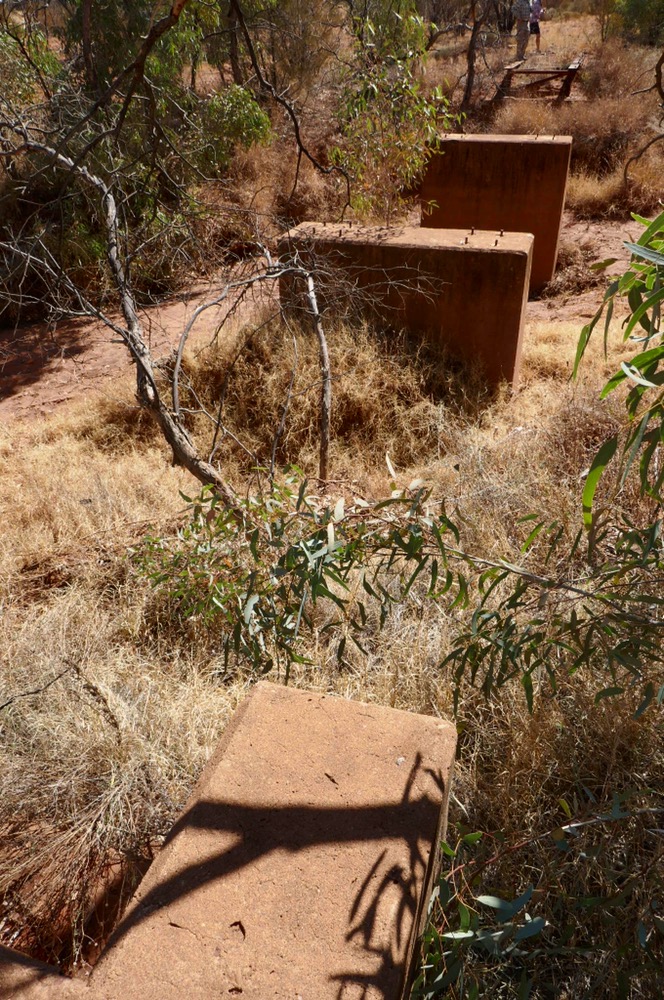
We stopped for morning tea at Goodyer River. When we started again, great clouds of bull dust billowed up and over the car. Di told me to open the window to let some pesky flies out, the cabin filled with sand but the flies had andoned the car. We carried on over the actual route of the old Ghan railway. The original rail line began as a standard gauge line from Port Augusta to Maree. The first proposal was for a connection to Birdsville for the cattle transport to the coast. However, the second proposal to build a narrow gauge line eventually to Stuart ( old name of Alice Springs) was accepted. This wound it’s way near bores and waterholes, over sandy country to Oodnadatta. Thus is where it stopped from 1889 to 1929, when it was finally connected to Alice Springs. This section of the line was the most problematic. Land subsided, waterholes were variably filled, rivers washed away bridges, sand dunes covered the tracks and trains were delayed for weeks due to overflowing rivers such as the Finke or even Alice Creek. A steam locomotive could cross a flooded river but the later Diesel engines could not. Once materials arrived at Oodnadatta, it was the Afghan cameleers who arranged carriage north in camel trains. The delays, the damage became so troublesome that a new line was built 250 kilometres west if the old Ghan. Today we visited the Finke River, Boodamun siding, an old bridge, and saw many interesting things. The immense elevated steel water towers that provided water for thirsty steam trains, the piles of coal left over from the heyday of steam and the ruins if an old bridge across Alice Creek, its concrete pillars as strong as the day it was made.
Along the road, you can see old rail spikes lying about. It must have been a tremendous site to see these steam engines of the old Ghan, risking passage through a flooded river, blowing its whistle outside Boodamun siding or steaming past desert oaks and through deserts, gibber plains and beside immense sand dunes.
I photographed the old police station and the old hotel at Finke. They are closed now but could provide a venue for tourism based on the Ghan. The Ghan is a magical and exciting story, of floods, gangers, soldiers moving north, and train wrecks with lucky escapes.
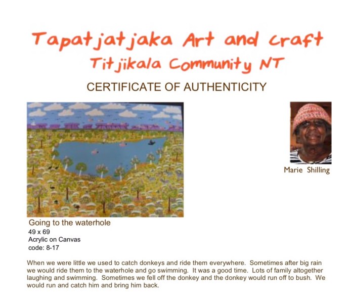
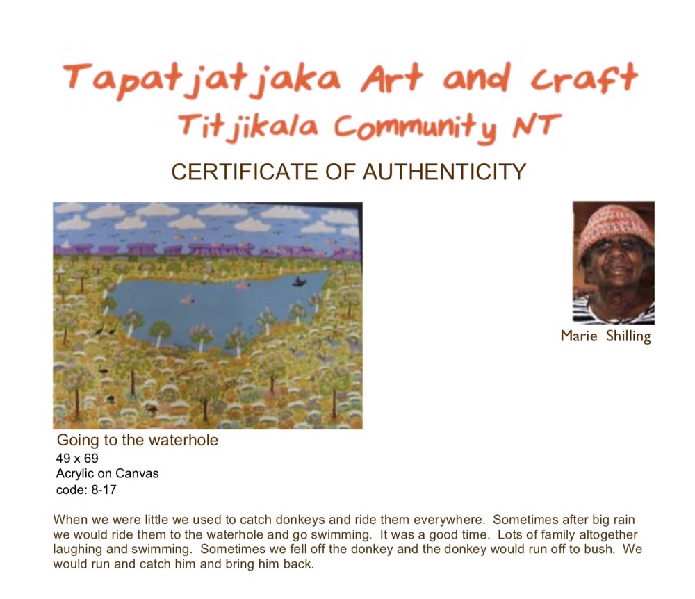
We stopped at Titijilka ( Maryvale). This Community was first established as a limited settlement at a Telegraph station. Later it became an Aboriginal community. I met Jane who runs the art gallery located in the centre of town. It’s a large cheerful space, with much coming and going. I bought a painting by Marie Shilling, of forest, waterholes and galahs on a canvas. I will find a place for this at home. The only downside of the day was poor Mark, who was terrorised by a mouse when he dozed off in his car, he found it munching our scroggin supply. Then in the afternoon, the compressor for the left back wheels suspension was struggling, dropping the wheel down on that corner. Mark pulled it apart, but there seems to be a crack of hole in the air chamber. Mark borrowed Janes car and drove us all along the challenging road to Chambers Pillar, set us up , made dinner ( chicken stir fry) and then headed off back home to fetch a new car for the rest of the trip. It’s about 150 kilometres from here, which is a great deal less than the 700 kilometres from Dalhousie Springs. When we started the troopie, a splendid gust of red dust blew into the cab courtesy of the air conditioner.
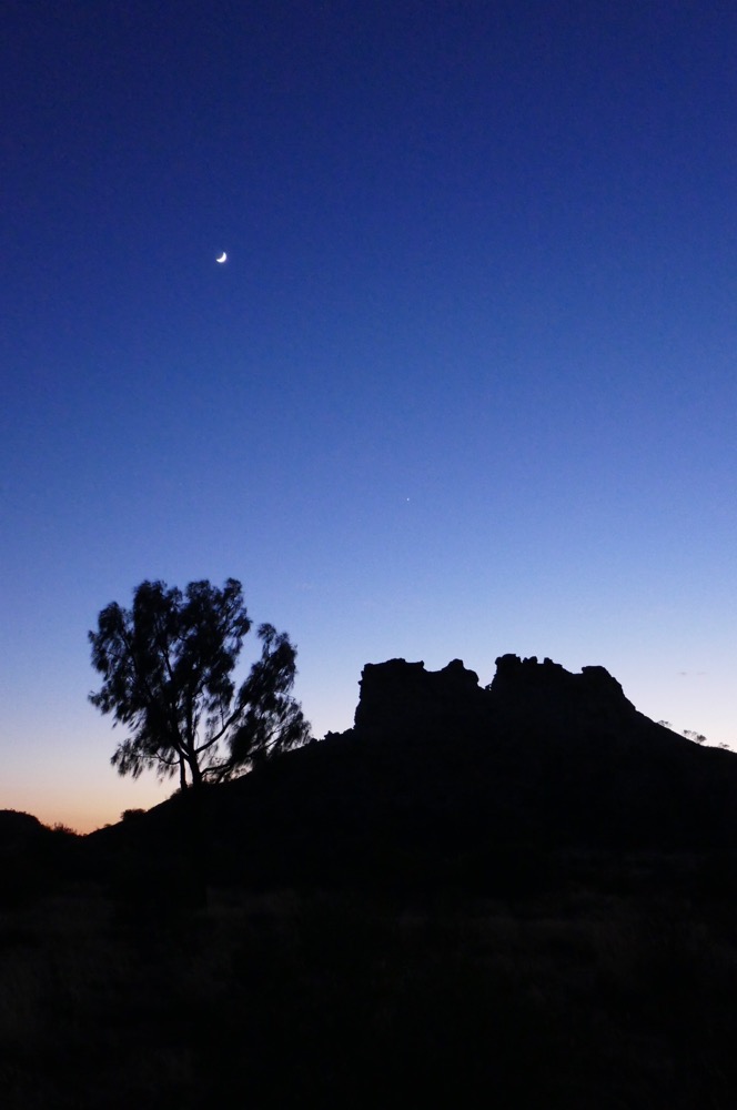
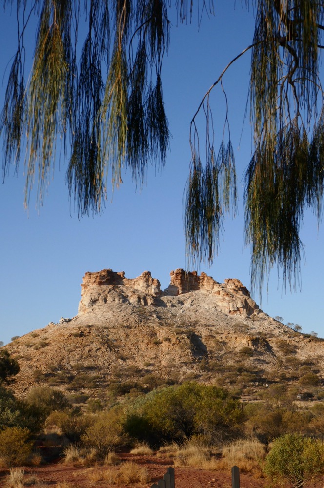
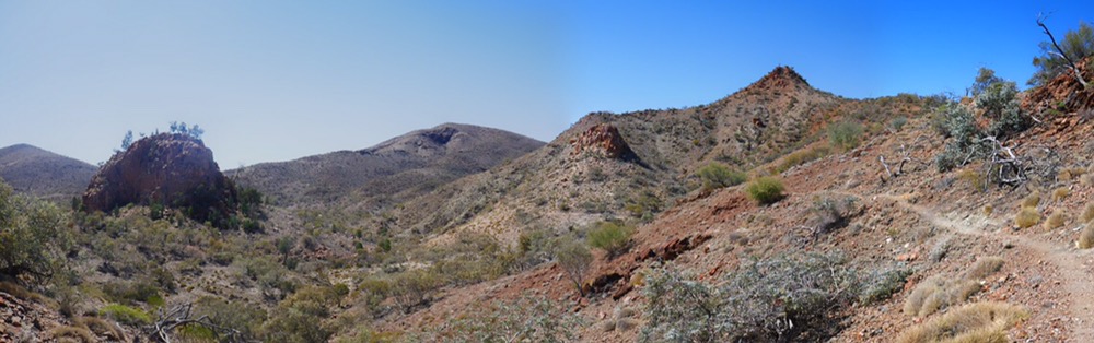
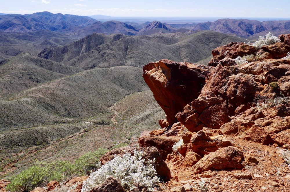
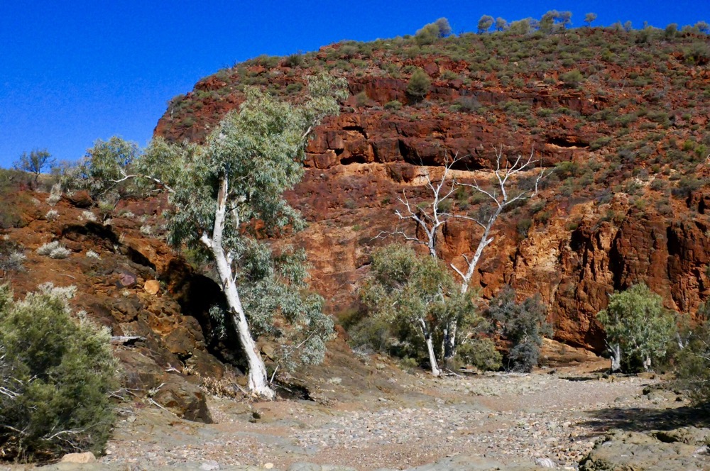
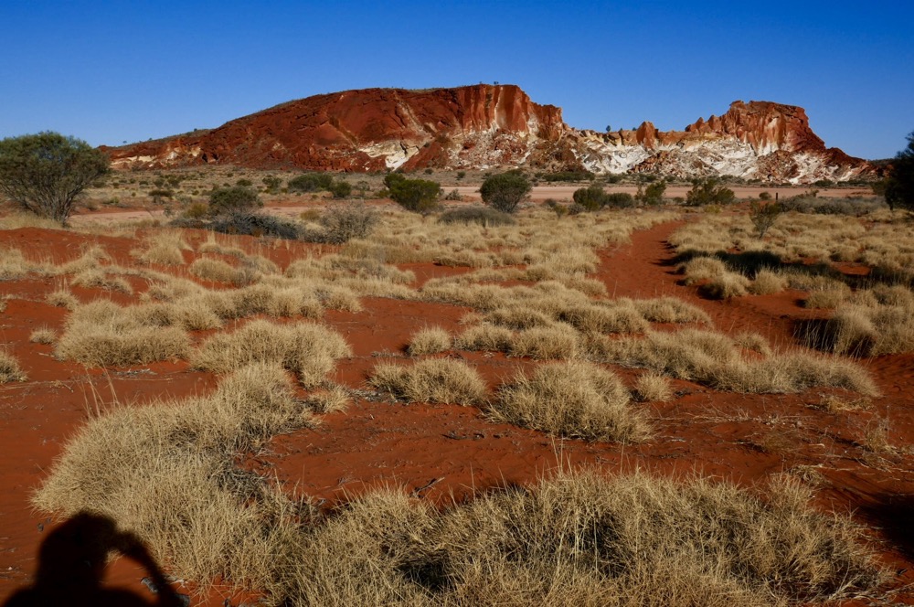
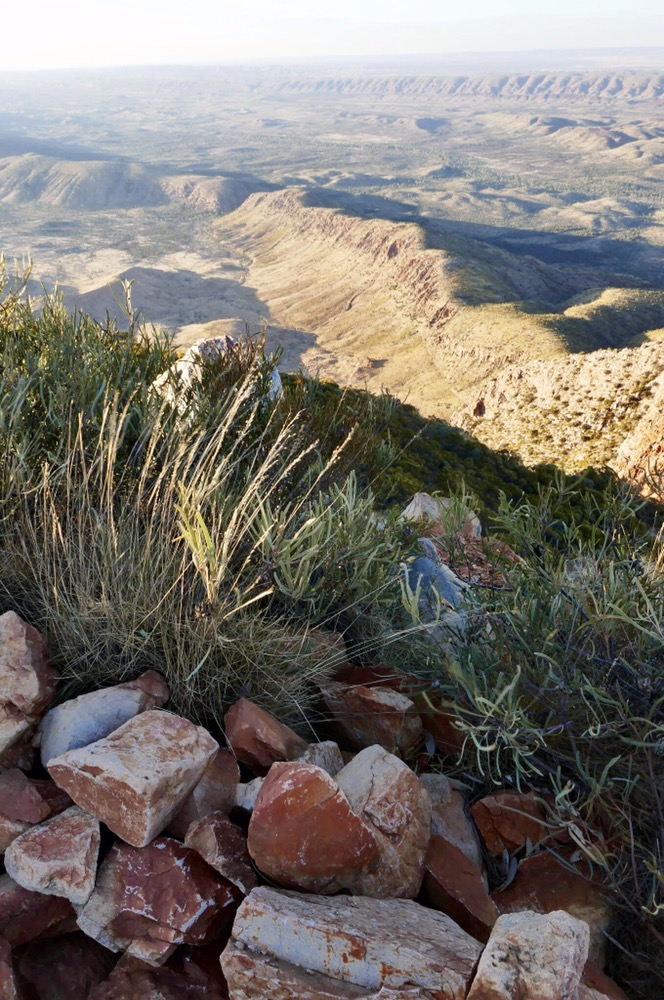
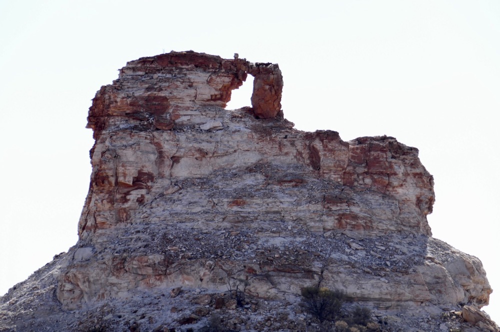
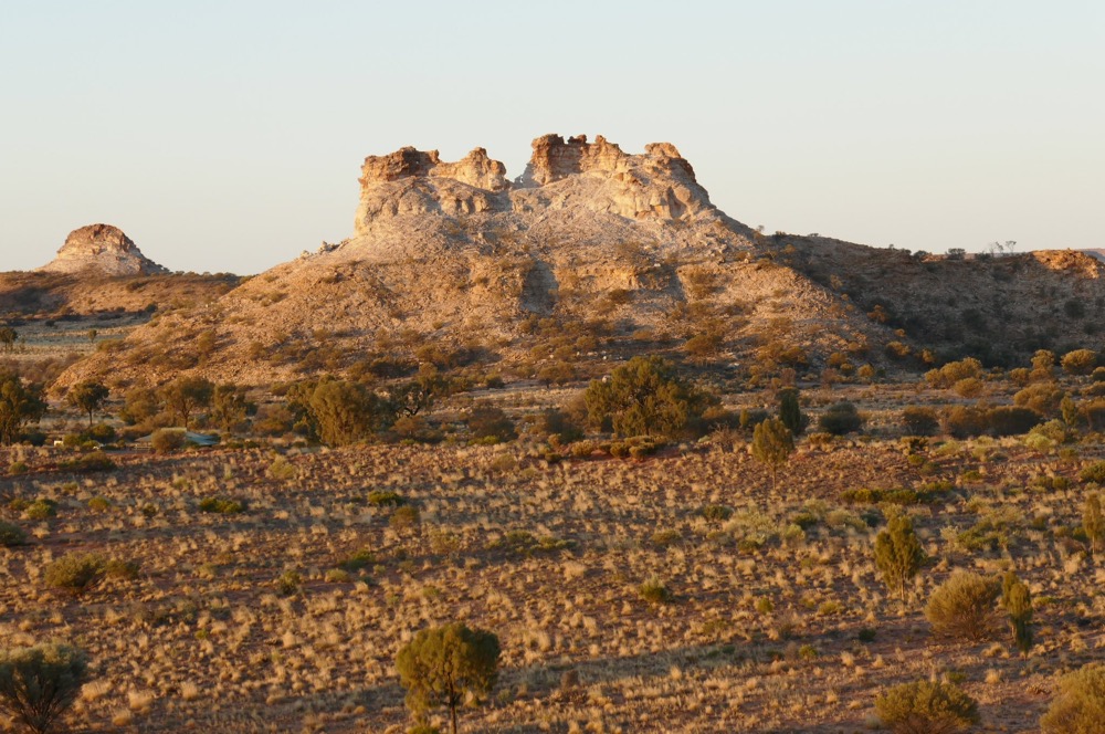
We arrived at this campground at about four thirty pm. And headed off to visit the Pillar. Chambers Pillar is a significant remnant of the original iron rich sandstone formed beneath the last great sea located here in central Australia, that’s about about twenty to thirty million years ago. All the rest of the ancient sea flood was worn down to firm the red sandy dunes, soil and roads of the Simpson desert. Why it remains is a mystery? But there is no mystery about how beautiful it is. The trick is to see it at sunset and sunrise, to see it’s two splendid faces lit up red and golden above the flat plain. There are other similar geological features here, including Window rock. Chambers Pillar was originally a bad man, who seduced other men’s wives, until two women used magic to convert him into the Pillar we see today. Unfortunately, the magic made them into stone as well. These two pillars are nearby and are just as impressive as the better known Chambers Pillar. It’s dark now, and the campfire coals are cooling. I’ll be off to bed soon, tucked up in my sleeping bag and swag, my Beanie keeping my head warm. The stars have faded now as high level cloud has come over and obscured them.
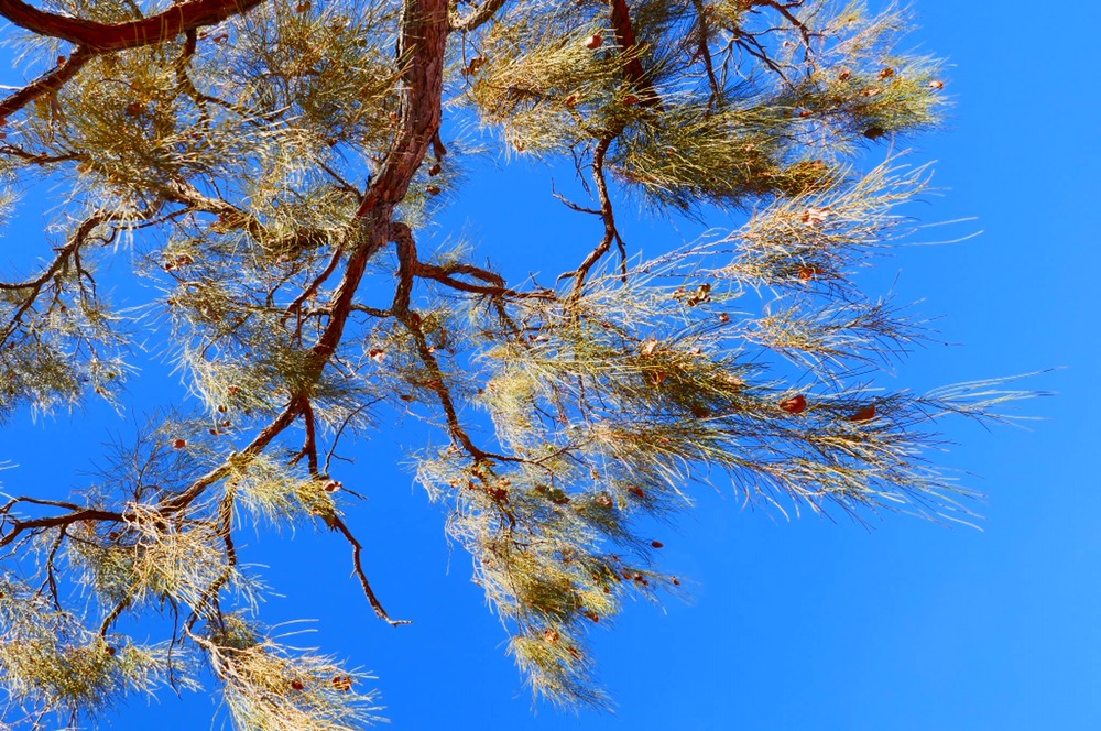
Near our tent is a tall desert oak. They have this magical property, they magnify and sussurate the gentlest of wind, giving it a soothing quality as well as amplifying it. Incredibly peaceful.
……………………..
It’s late on Friday afternoon, and I’m lying down on a comfy bed in the main cottage of Hale River Homestead. We are about 26 kilometres from Arltunga, and about 140 from Alice Springs.
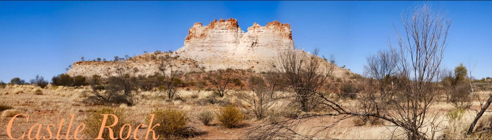
This morning we all got up before sunrise, and took photographs of the sun lighting up the western flank of Chambers Pillar. It was cold in a biting wind. The sun eventually peered over the eastern horizon, sprinkling light on the grass waving in the wind and the white and orange rock of the Pillar. After breakfast, Mark arrived back with another car. He made us a cooked breakfast of what he calls fluffy eggs with chopped up bacon, tomato and spinach. It was very good! After breakfast, Jennifer and I walk around Castle rock, to see it’s now sunlit side. The track was sandy, with sparse scrub and occasional desert oaks. We helped Mark connect the trailer as the tow ball was much higher than on the land rover. Up she went and it kept going, well that can’t be good with the trailer bar near vertical.
We then drove back to Titijilka to collect a red kelpie. On the way back from Alice, just near Oak Crossing, a red kelpie darted in front of Mark. When he stopped it leapt into the car. He left it at Titijilka and let people know what he’d found. Eventually the owner located us, and Mark was able to return the dog.
We had lunch at Omarrina Hotel. This is an old venture given new life by fresh owners. It’s only 23 kilometres from Alice Springs. It’s an interesting place. It was used as a location to build film sets. So there is western style hotel, pioneer cottage, a windmill. However, because they were built for the movies and not for actually living in, they were constructed very poorly. One house fell over last year, and the whole top of the windmill blew off a month ago. There are private cabins nestled in the rocky valley of the Homestead. The restaurant is large and has a wonderful view from full length windows. Mark was able to relax thinking his worries were over, little did he know, fate had saved the best for last!
After lunch, we drove back to Alice Springs, with the intention of skirting it and heading off to Emily Gap and then to Hale Homestead. We stopped to see some extant sections of the old Ghan and of the telegraph line. Both were in excellent condition. Mark told us that up until a few years ago, a train would go on this track with some of the Ghans old timers to explain the story of this great steam train trip. While this was happening, Mark had a phone call, to say the wife of his bus driver was in hospital. So Mark had to drive this drivers bus home and we had to drop the bus driver into hospital. Well, it all went to plan but when we went to fill the car with fuel. Ooooops, where is the lifter. A fellow customer, grabbed a spanner and gently popped the fuel lid.
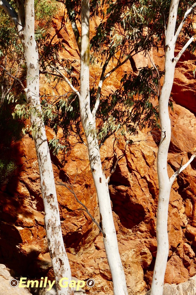
Jennifer drove the car all the way to Hale River Homestead. We stopped at Emily Gap and Jessie Gap. We decided to leave exploring Arltunga till tomorrow. The scenery at both gaps as well as the whole drive is spectacular. Massive red ranges, many creek crossings, kangaroos, donkeys and wonderful views made it a very enjoyable drive. Hale River Homestead is as welcoming as ever, and we are all looking forward to dinner tonite. (Spaghetti Bolognese and birthday cake!)
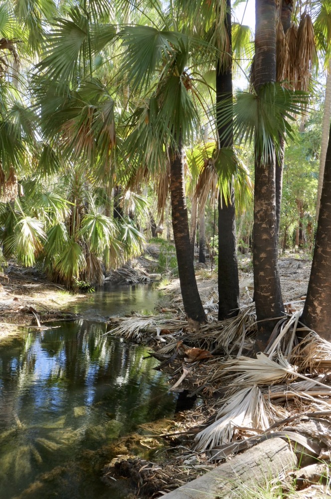
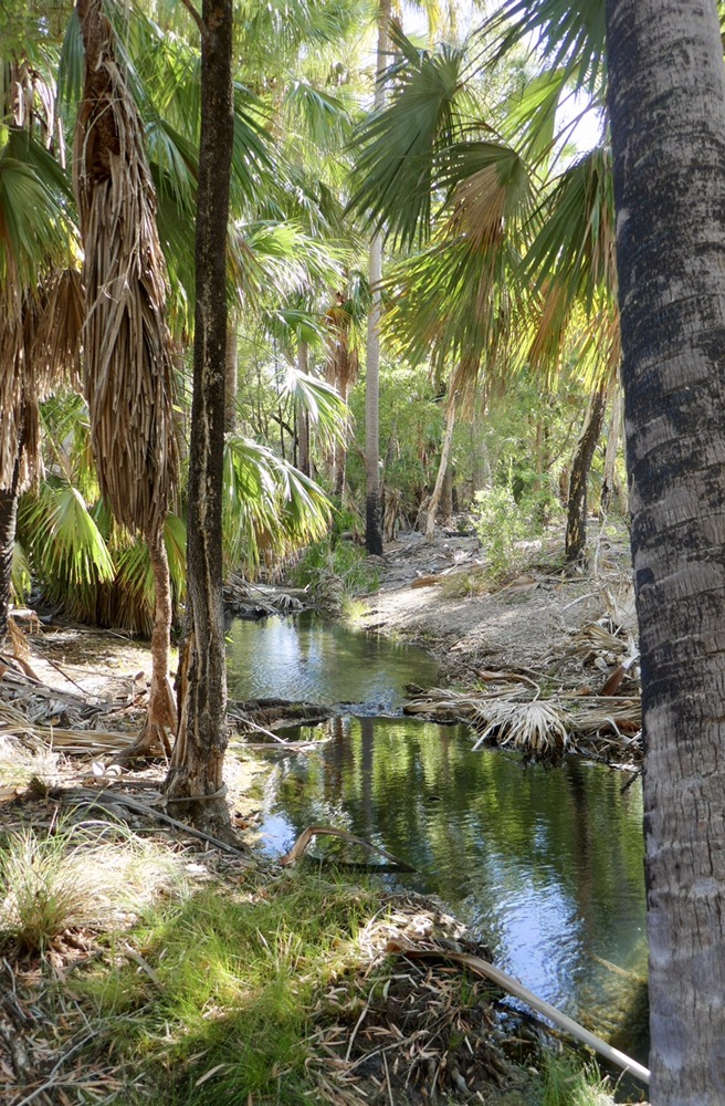
Jennifer and I are sitting in shade at the Joker Gorge car park. Dave and Di gave gone off track and are exploring the mine here. Breakfast was great, poached eggs, yummy muesli, a generous serve of yoghurt. Sophie made coffees for all of us. The restaurant is the old workshop, but in one corner, Nathan who is Sophie’s Dad, makes leather goods including traditional bull whips and belts. Hale River Homestead is a great place to stay. We four shared the cottage. There are three spacious bed rooms, numerous sitting areas, no wi fi, and so it’s easy to relax. The building has been well restored, but still retains a strong flavour of the 1940s and 1950s. The black round power switches, the paintings and pictures on the walls, the decor all harkens back to a less sophisticated but less demanding time in our history. The dining area is open, but it wasn’t cold or windy, there are books and newspapers to read while sitting in comfy old leather armchairs. The dinner was excellent, a scrumptious spaghetti Bolognese, with salad, and a stir fry as well. Desert was a piece of six year old Davids birthday cake. He’d spent the day creating this layered work or art. We chatted amongst ourselves, with Sophie, with Lyn and with some other guests who told us about their experiences in northern NT, and also about their adventures travelling the Canning stock route in 1995. A very convivial evening, indeed…………………………………………
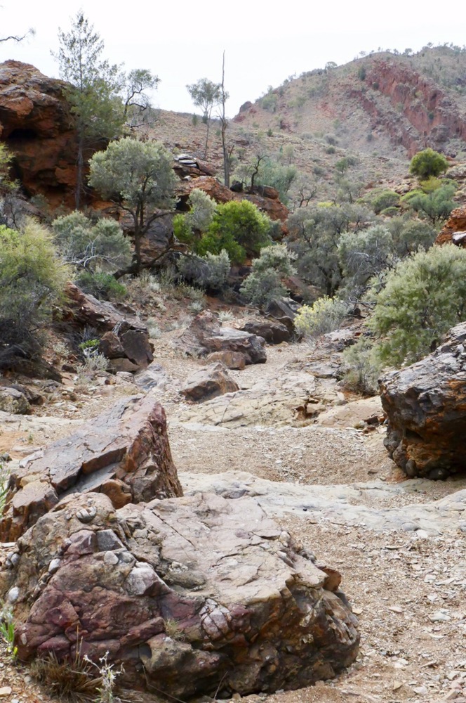
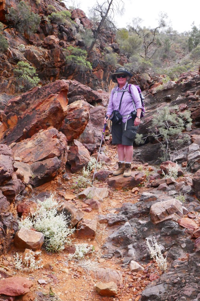
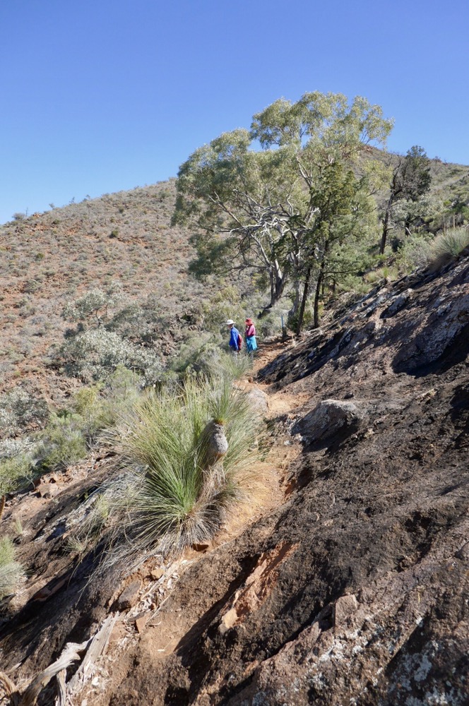
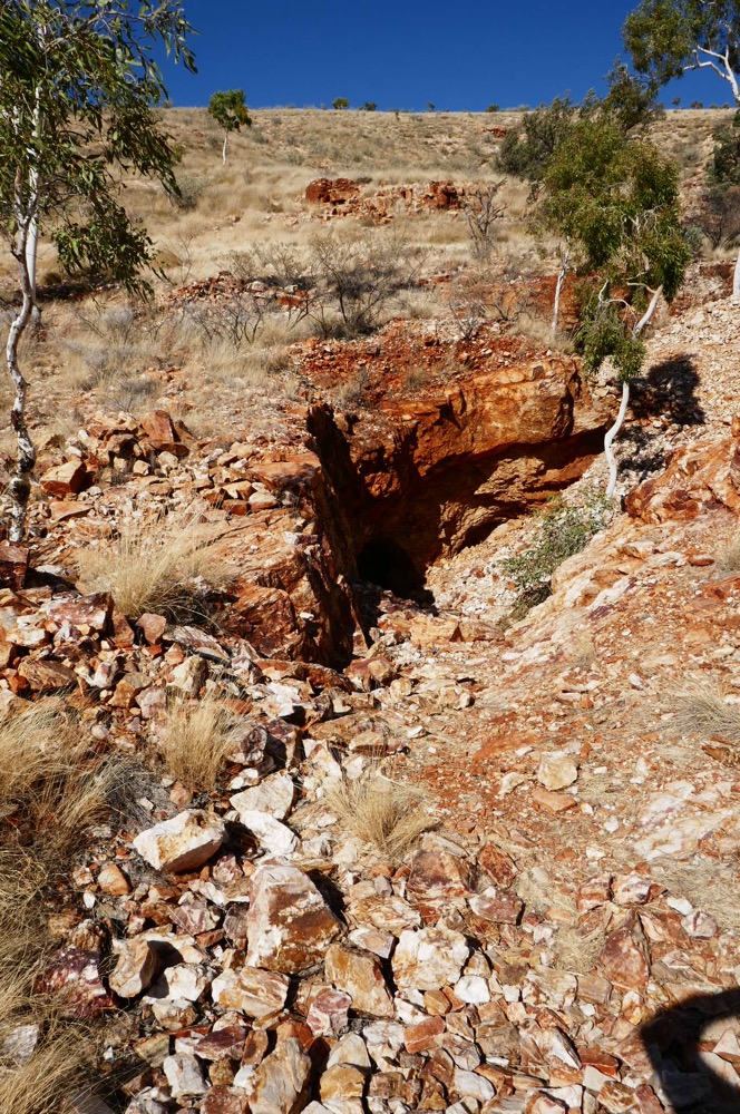
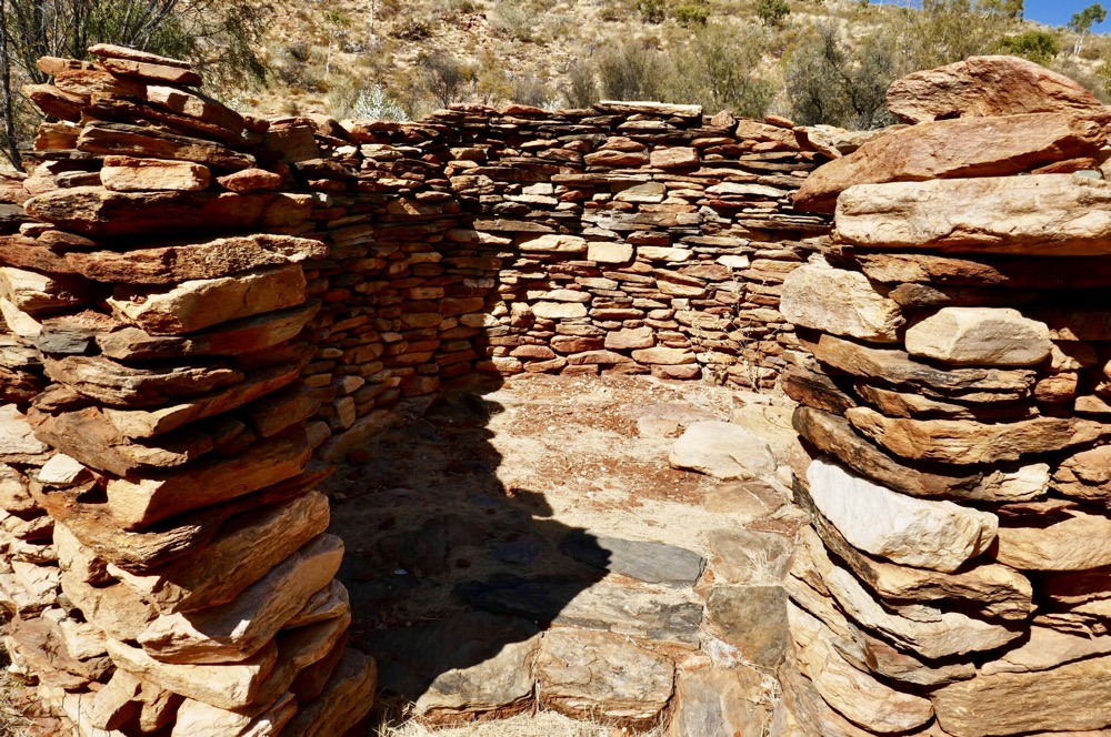
I’m sitting at McDonnell Caravan park, it’s 6 pm and Jennifer has driven to the supermarket to get supplies. We have spent a wonderful day exploring Arltunga. We began with A small cemetery, near Joker Gorge, then a mine, then the gorge itself. It was a cool morning, and this made for very pleasant walking. The gorge is rough, and involved a lot of boulder clambering. The cemetery was small, only four graves but it had a beautiful view of the surrounding hills. Another much larger cemetery we visited later, included the epitaph “ he was a good mate”. I hope someone can say that about me one day. We explored the police station which had been restored to much of its former glory in 1984, the government works with many restored buildings, assessor, assayers, manager, and even the old battery and its engines to crush up the quartz ore to relieve it of its burden of gold. This area produced many millions of dollars in gold, in today’s terms, and made many people rich. However, many died of lung disease due to inhaling ground up quartz. The post office processed mail every two week in 1910, which was a lot quicker than the camel trains which brought supplies every 2 months. The camels trekked up from Oodnadatta, crossing the sand hills, and rough scrubby country in terrible heat and dry conditions. We spent a fascinating four hours there, including walking beside the miners cottages, which were only four foot high walls, as the rest of the structure was made up of timber supporting a canvas roof. Other miners buildings were just a fireplace today, as the walls were of timber and daub, and have succumbed to weather, fire and termites. Near to most cottages were simple, dry stone forges, where the miners would sharpen their picks and shovels. It’s an inspiring place to visit, to see where they lived, the tools and machines they used, their simple, tiny houses, and to realise that they survived and made livings in the harshest of environments. The last (open cut) gold mine ceased production in 1990. Most of the mines had closed down by the 1920s. We visited the tourist information centre which gave in depth information about Arltunga, and described their lives. The ongoing feud between the local policeman and the local publican. The embezzler assayer who got caught. The 600 kilomters trek of each miner, who pushed their laden wheelbarrow all the way from Oodnadatta. Some miners had come even further, in one of the graves rested a miner who’d come all the way from Boston, USA. What a story he would tell if he could.

Miners hut at Arltunga
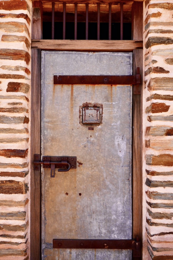
Prison lock up at the Police Station, Arltunga
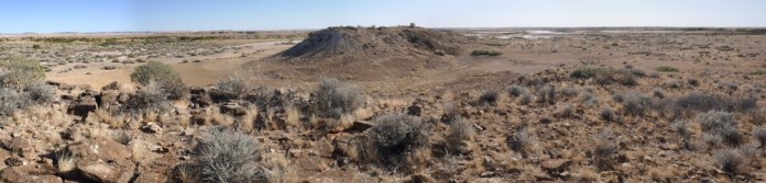
After lunch we started our drive back, stopping briefly to circumnavigate Corroboree Rock, which is a striking stone piece of strata lifted into the vertical by titanic natural forces 800 million years ago and coloured by tropical seas 60 million yrs ago.
It’s been a terrific day, and a wonderful holiday. We’d like to truly thank Mark of Sandrifter Safaris, who coped with all sorts of disasters and still delivered a great adventure as far as we are concerned. We always felt safe, superbly looked after and valued as people and clients.
One final reflection. Much of the history of central Australia has been a story of struggle, painful failure before later generations finally succeeded, the harshness of the deserts and country but our painting we bought from Marie Shilling, gives another kinder view of this beautiful country. In her painting, the skies are blue, the waterholes are full, the flowers have opened and bursting with colour beneath the trees, emus and kangaroos are moving in the forests and the people are playing, dancing and singing. For her, this country is her playground, a place where she can enjoy life to the fullest. Because the wants of many Aboriginals are few, there is enough water, there is enough food and there is enough time to enjoy playing, hunting, and dancing in this country we seem to struggle in.
Arltunga

Two stamp battery, Police Station
Cottage at Hale River Homestead


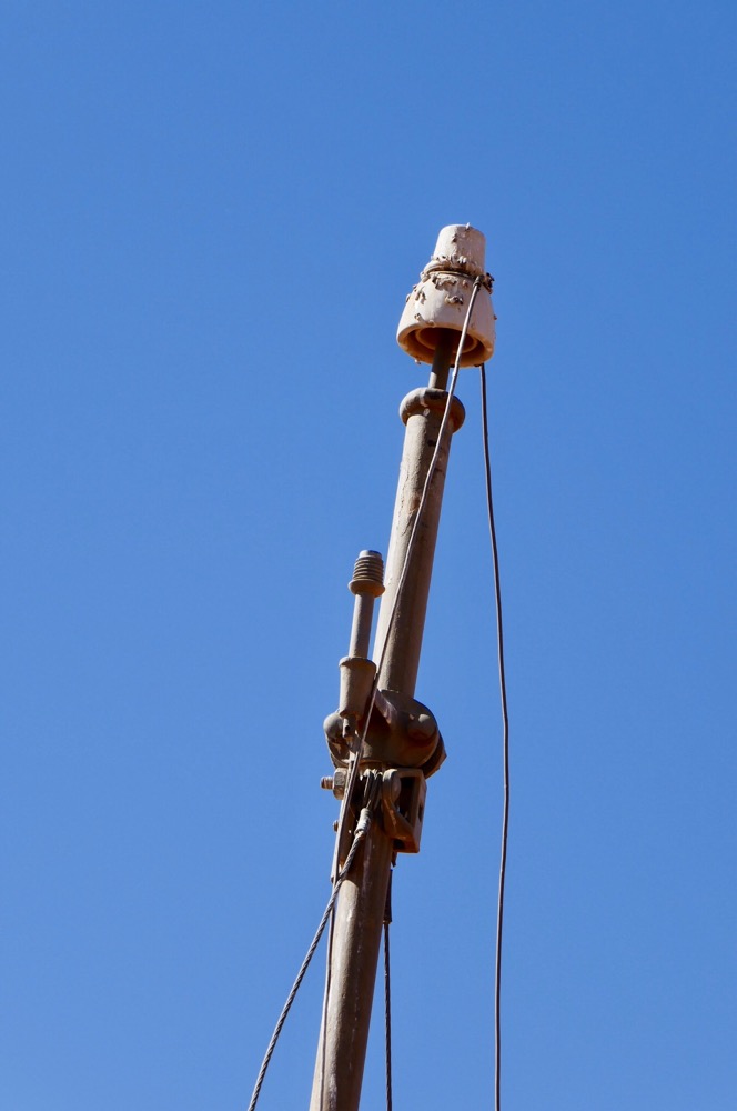
Overland telegraph


Emily Gap
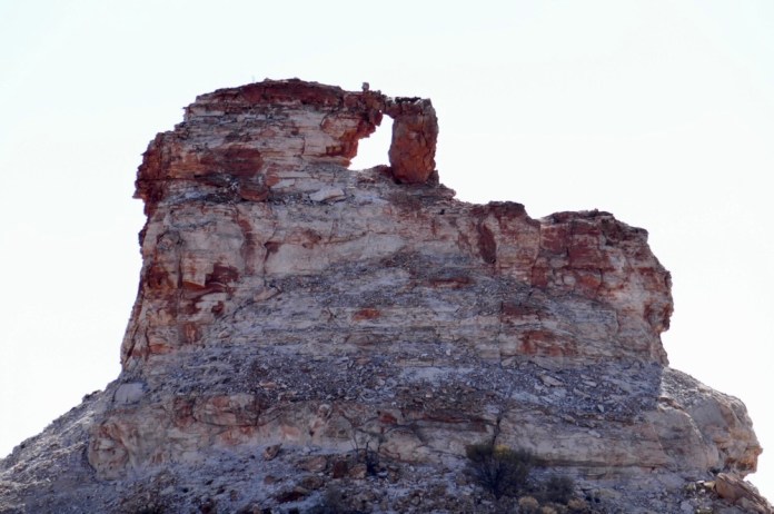
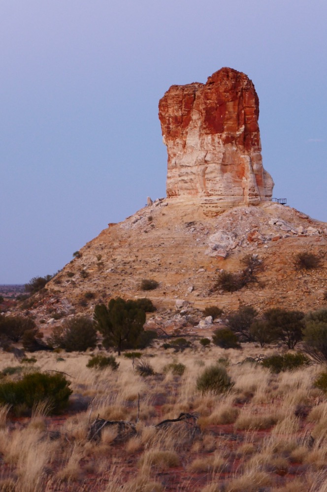


Chambers pillar


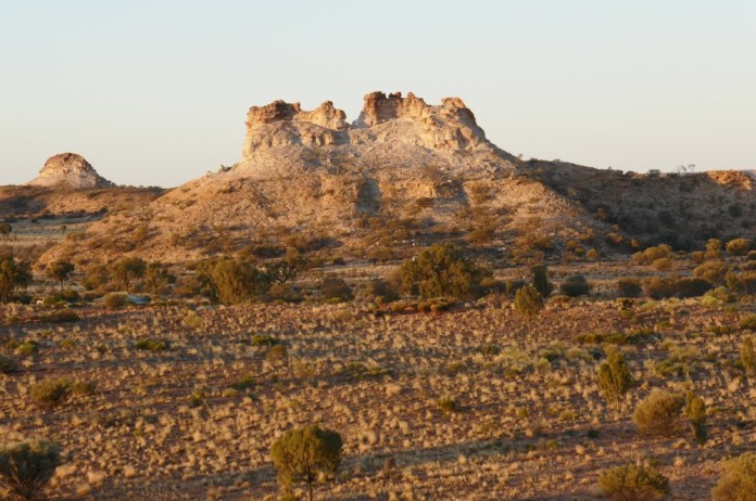
Castle rock behind us


Red gums on the Finke River

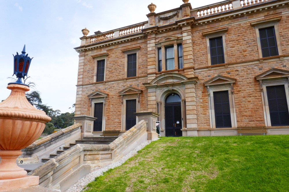
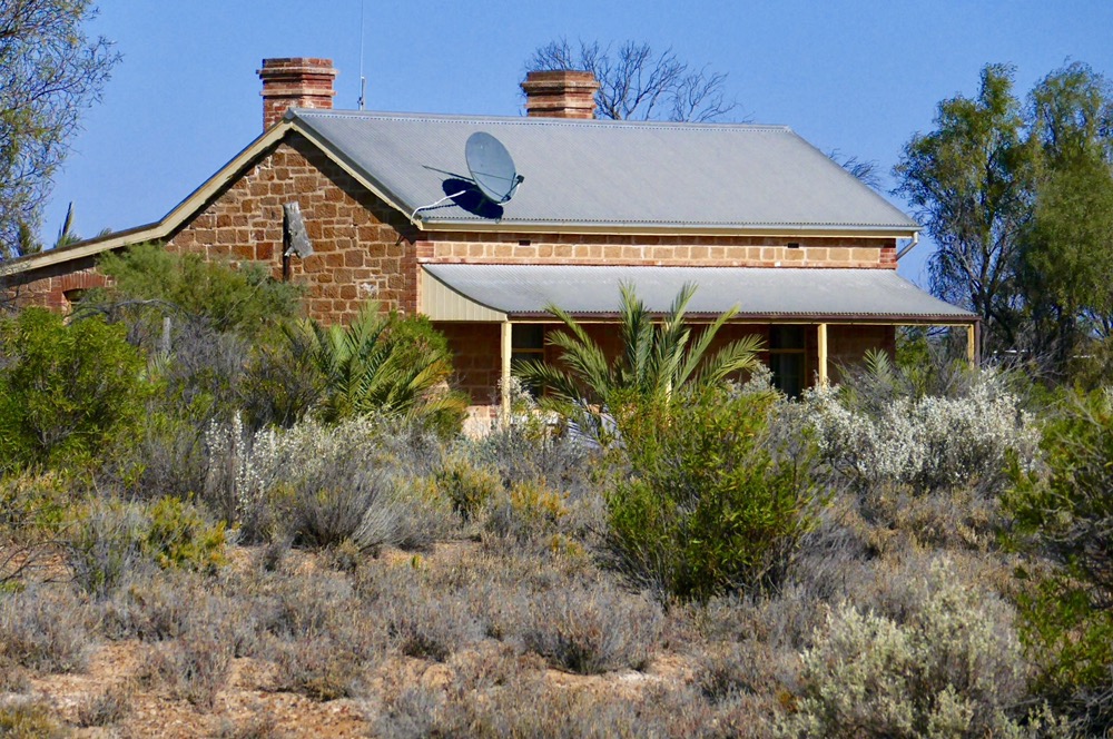
Homestead at Old Andado station


Mt Dare hotel


Dalhousie springs

Dalhousie station
Red mulga

Red mulga


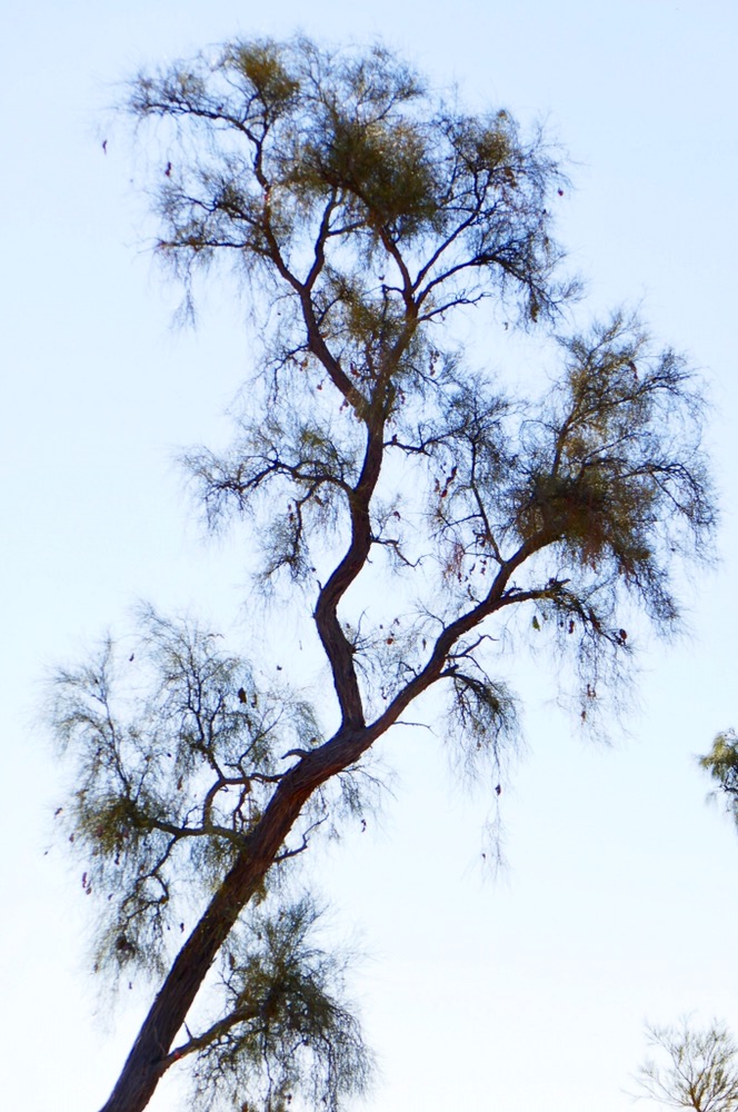
Acacia Peuce


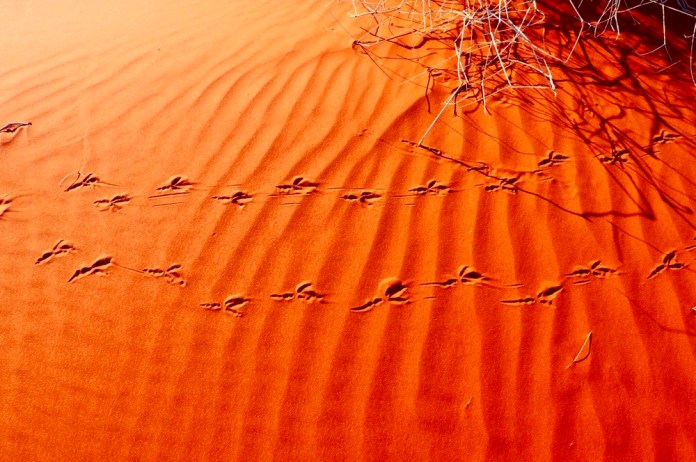
Perenties tracks, sand dune, Simpson

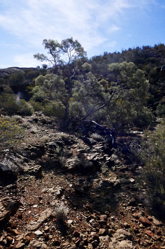
Sand dune near Old Andado station

Homestead at Old Andado station
-23.733399
133.868020


