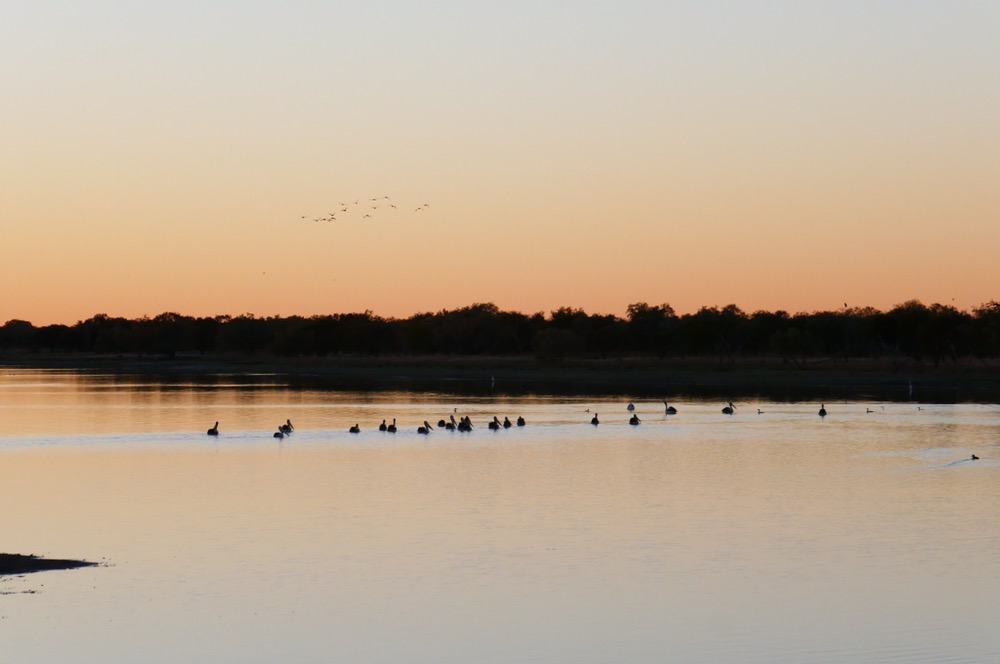
I am sitting in a camp chair beside the campfire, the immense octagonal tent that provides shelter and a place for lounging about and meals is behind me. This camp is the second one used on this Larapinta walk, it’s called Charlie’s camp after one of the first guides. But I should begin at the beginning.
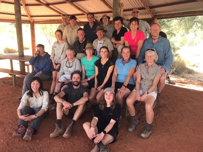
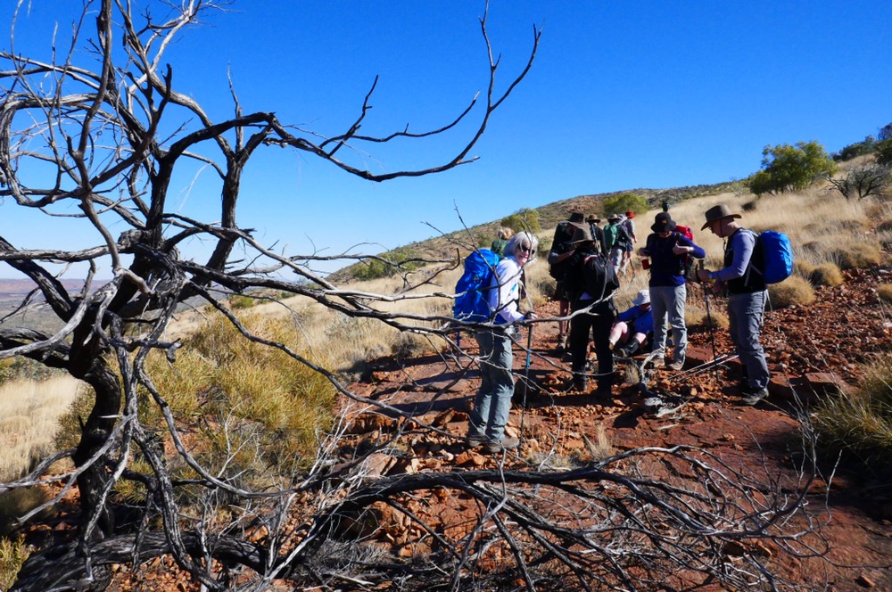
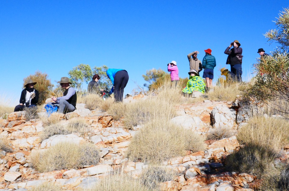
On Wednesday morning we were collected at our overnight accommodation, Doubletree in Alice Springs bright and early at 7:30 am. There are sixteen walkers, and all of us have elected for the highlights version of the famous Larapinta trail. The full walk takes anything from twelve to sixteen days, and walkers have to be very well organised with food drops and equipment. We met two walkers, young men who had been walking for eight days or seven, they weren’t sure. Our little packs looked very diminutive beside their solar panel laden multi day packs, the road trains of the Larapinta trail.
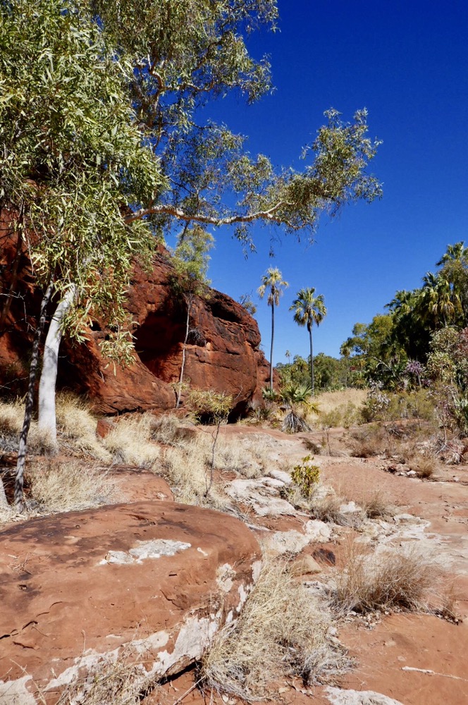
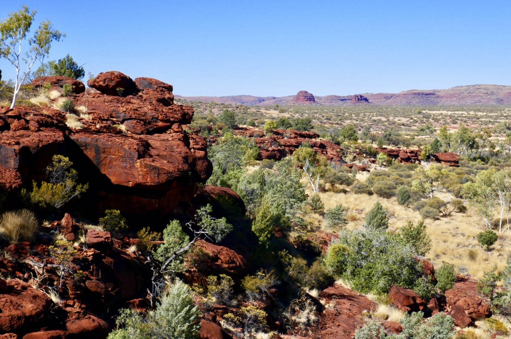
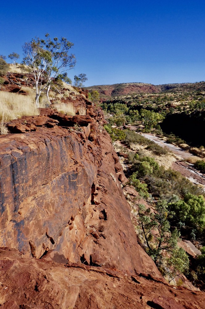
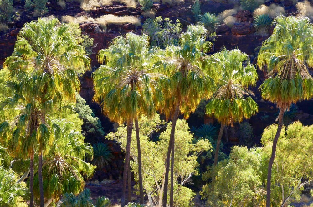
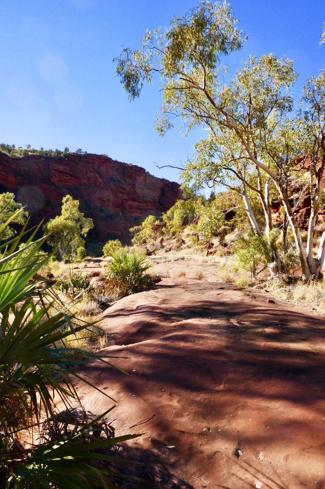
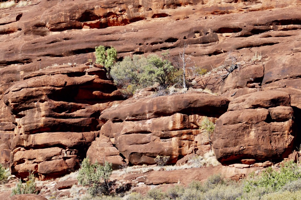
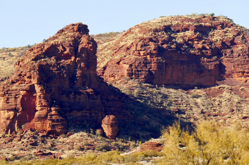
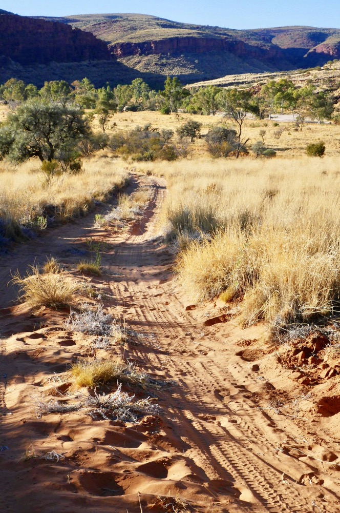
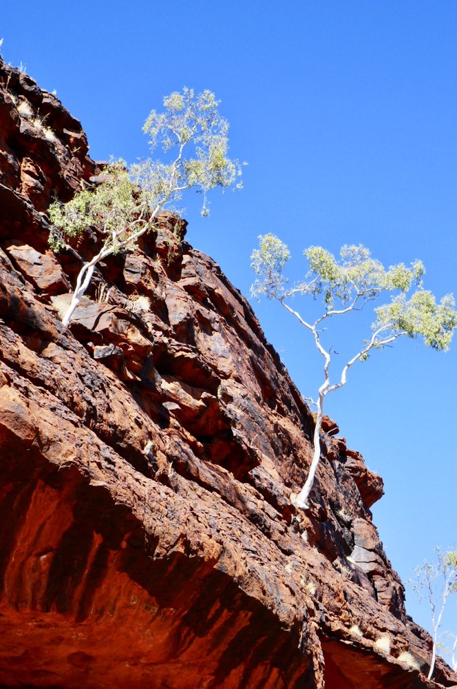
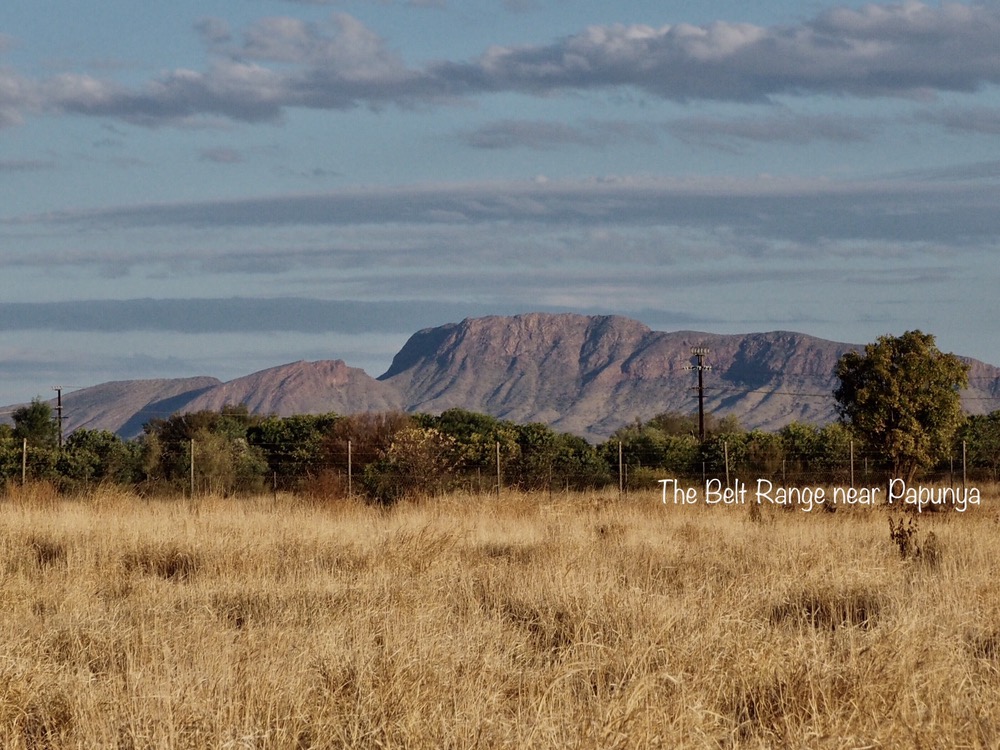
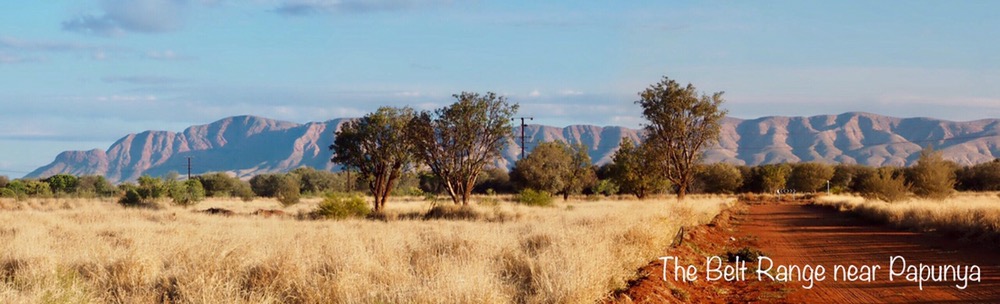
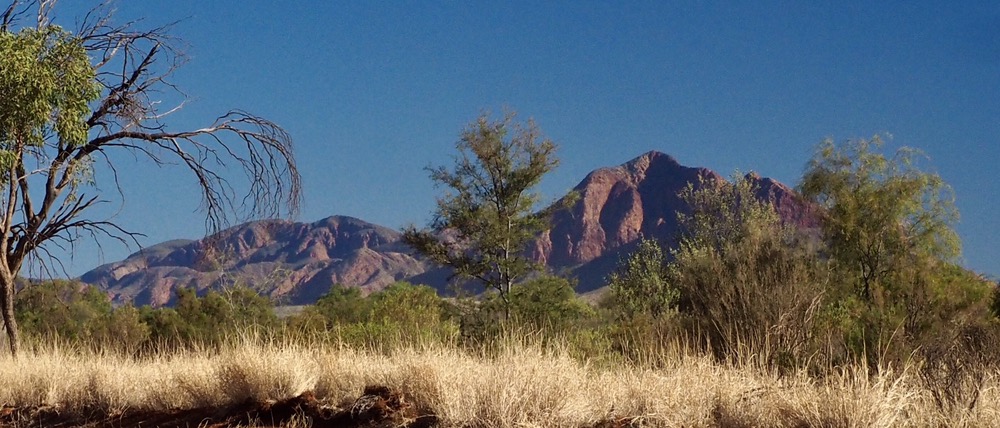
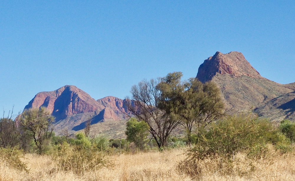
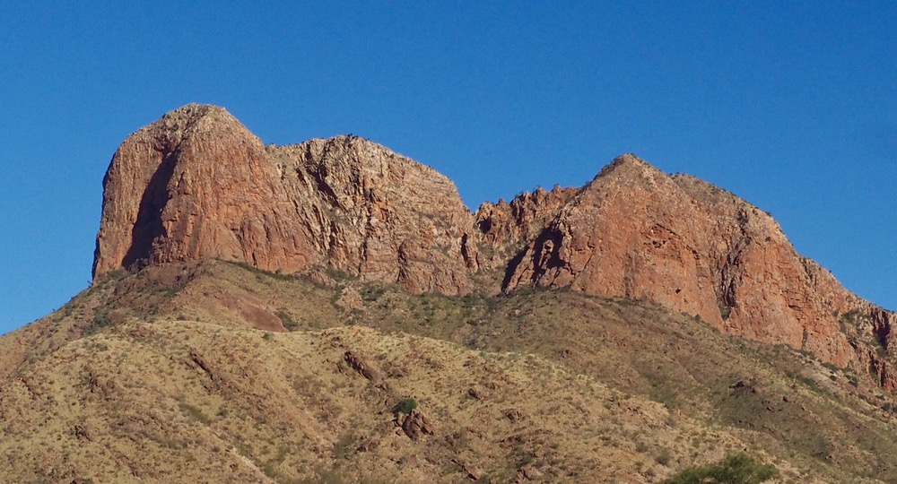
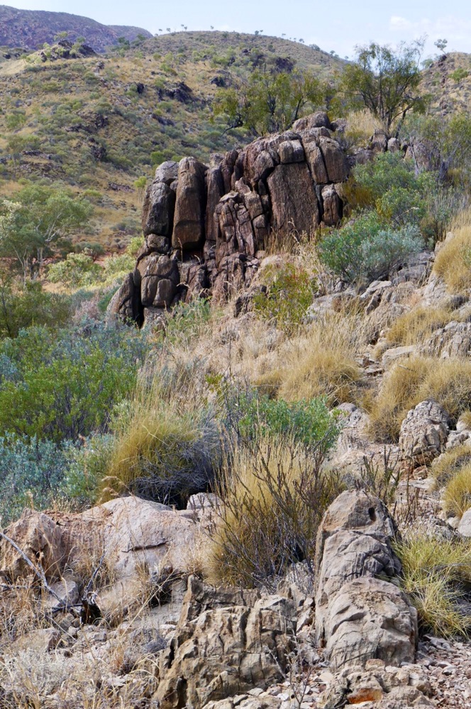
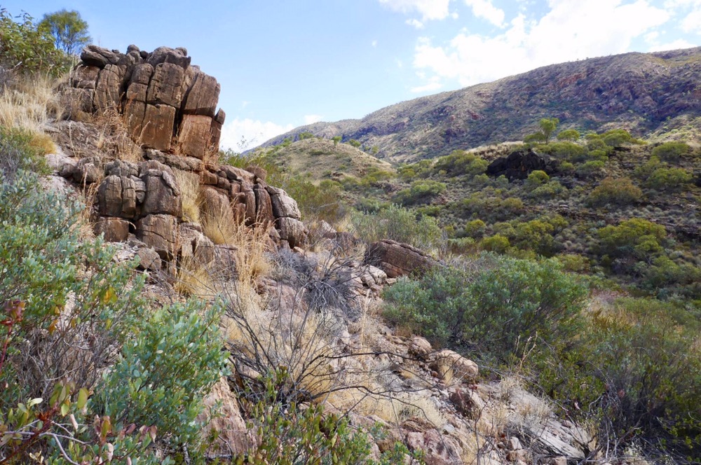
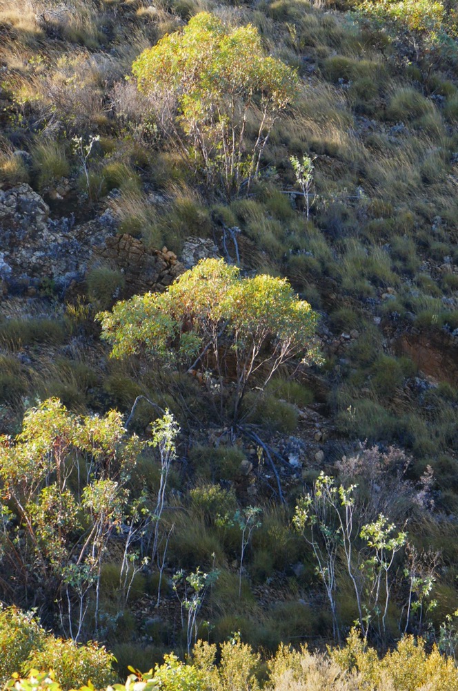
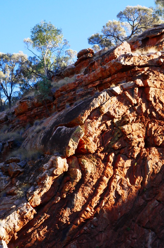
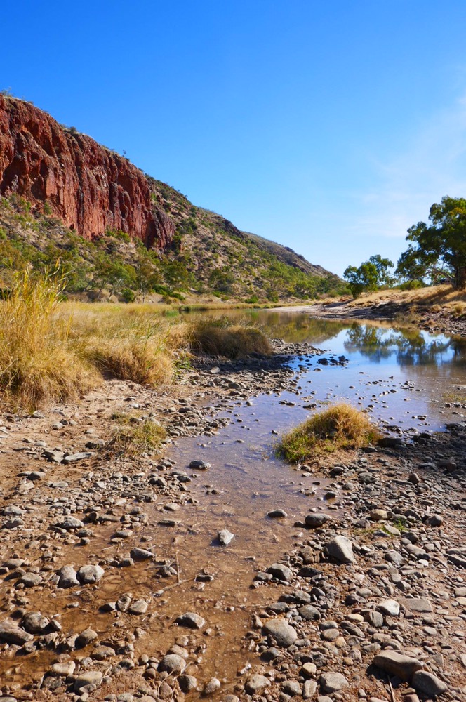
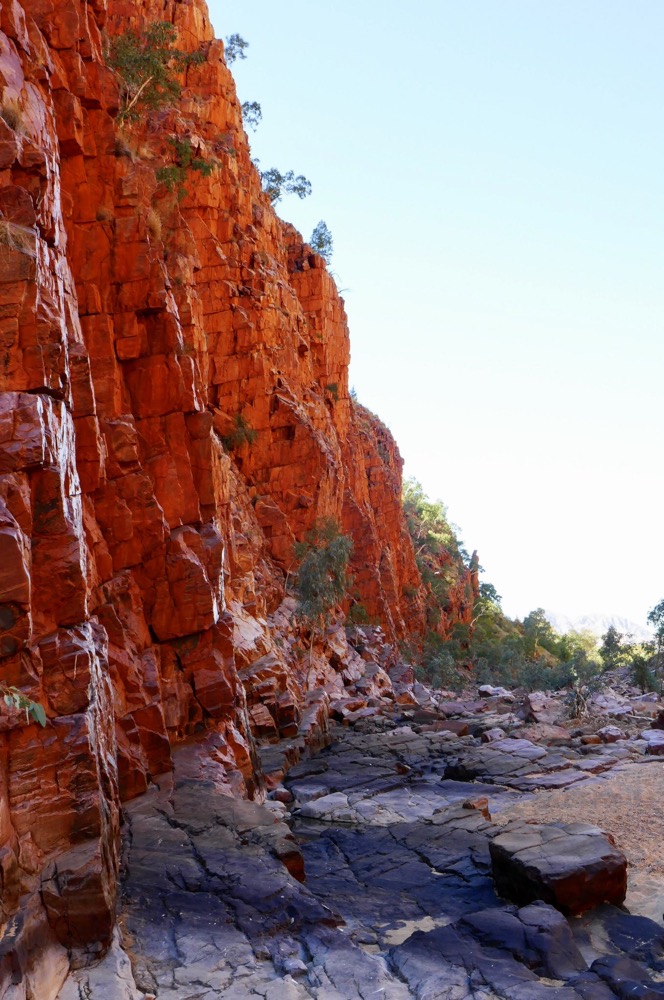
We grouped at Telegraph station on the outskirts of Alice Springs, made introductions. The walkers are from age fifty to sixty and all of them have done many interesting adventures both here and overseas. We were dressed in warm gear because of the cold. Little did we know, that it was going to get a lot colder. We skirted the old station, and commenced the first section of the trail. Cloudy, cool, mild fresh breeze and perfect weather for walking. A frizzle threatened, and over the day it grew into a drizzle, and finally rain overnight. Today, we aimed to complete the walk to Wallaby Gap. We travelled past Charles River, under the Stuart highway, then up along ridges of the ranges. The fall to the left is precipitate, a three hundred meter drop, with wonderful views of the Pattuca range to the south beyond the spinifex and mulga plains. There are many opportunities to see the orange cliffs.
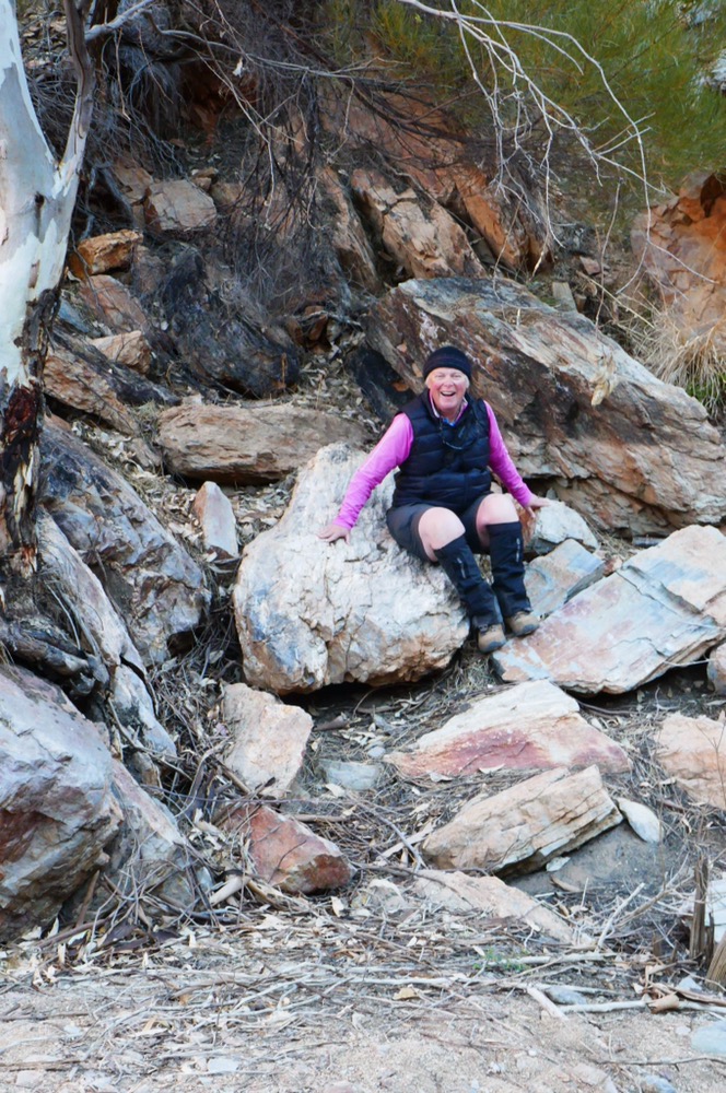
Lunches are under trees on the trail, a large black tarp is laid out, and a selection of ham, salami, salads, dips and garnishes are available for us. One does eat well on these walks. You need the energy, as the track undulates over ankle twisting rocks and gravel. I needed to stay alert despite my Scarpa boots and sticks, occasionally slipping but no harm done. I’d been bitten by a camp dog two weeks ago, and thankfully it’s well on the way to being healed, so it did not give me any problems on the walk.
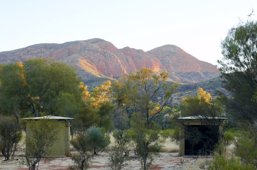
The World expeditions bus was waiting for us at Wallaby Gap, a bumpy ride to the highway, then a drive to Charlie’s camp. The tent sites are very organised and very discrete, invisible from the highway, but the orange roof of the main tent makes them very visible from higher altitudes. There are semi-permanently set up tents for sleeping, a large tent as I said before for meals and lounging. The showers are hot water, one fills a bucket with hot water from a “donkey” into a bucket in the shower cubicle , hoisted aloft then the handle is turned, allowing water to rain down. The cool breezes wafting up from the gap between floor and cubicle, means the two and half minutes shower time is ample. The soaps and shampoos used are biodegradable, to protect the environment. The lady before me, fished out a dead bird from the shower bucket, so I was pleased to be second for once.
On this first evening, we had a real treat. Raelene, who runs and owns, a bush food cafe in Alice Springs called Kungku foods. She is an Arrente lady who has harnessed her people’s heritage of bush foods to create a business. The older ladies in communities such as Utopia, gather the bush tucker in traditional ways and get paid for what they gather. As far as cultivating these plants plantation style, this does not work, the plants and trees die after two seasons. In the desert diseases cannot easily spread. The two main challenges are the encroachment of buffel grass choking the native vegetation, and secondly, the fracturing of Aboriginal society that makes it difficult to pass on the bush food story and skills to the next generation.
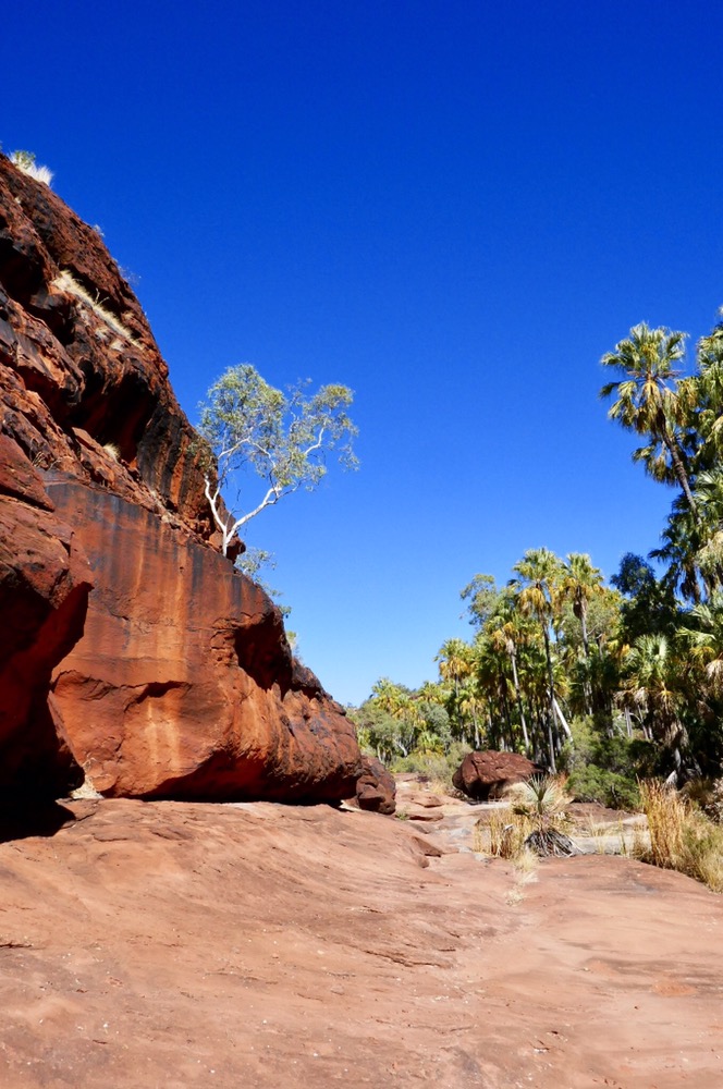
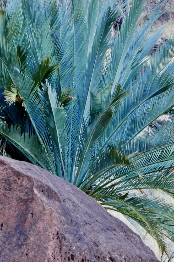
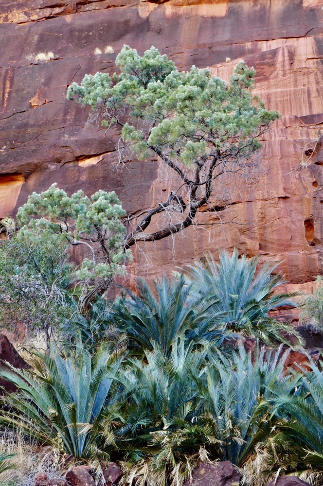
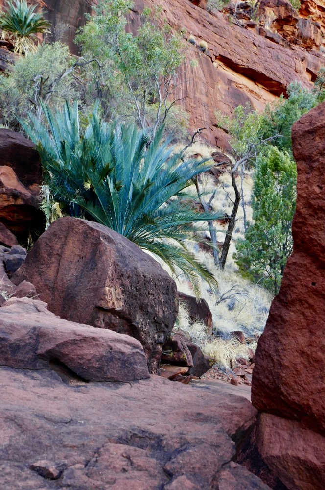
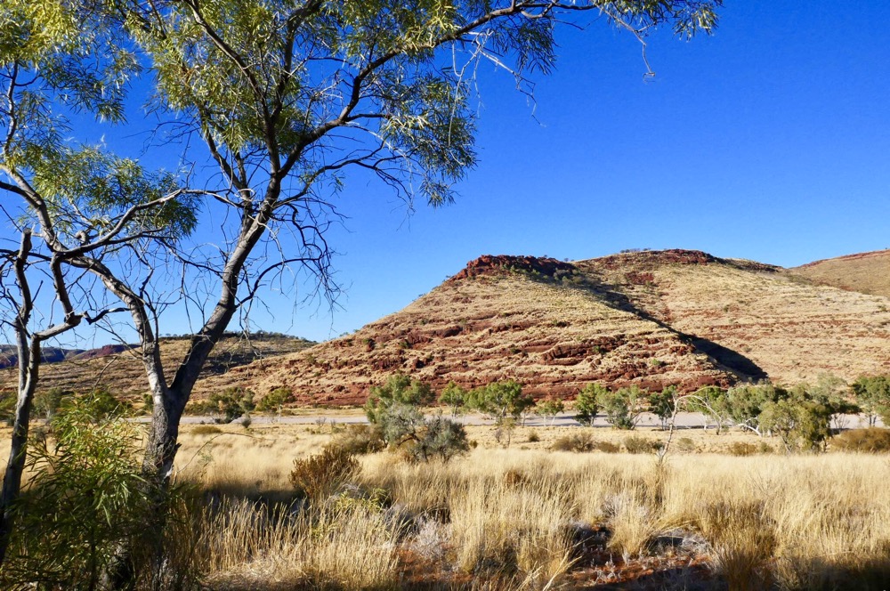
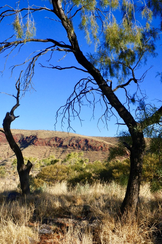
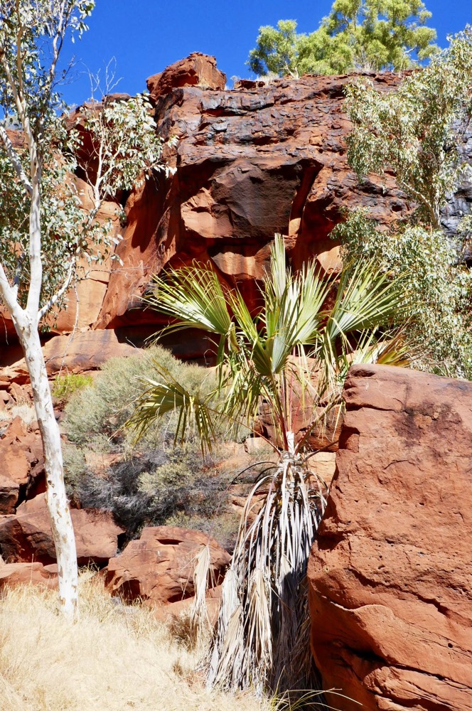
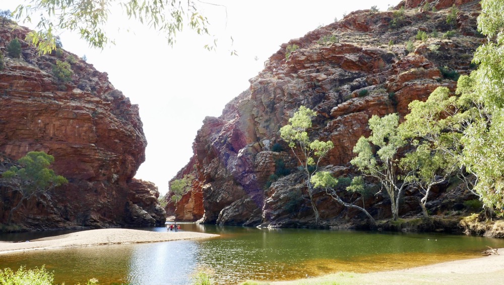
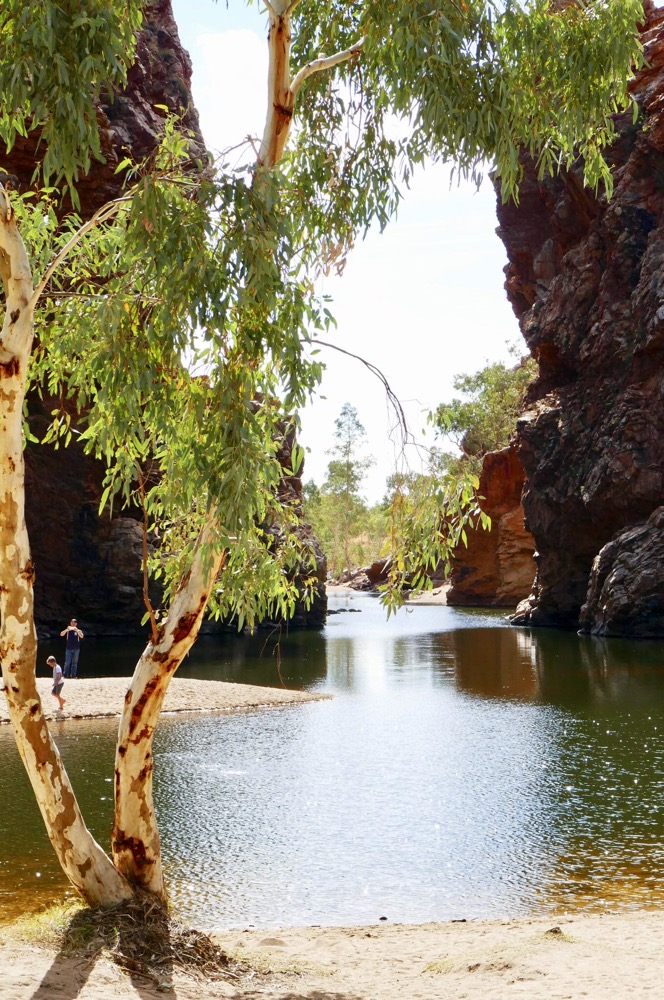
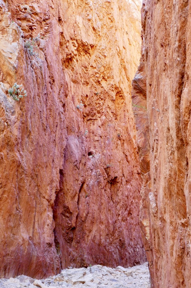
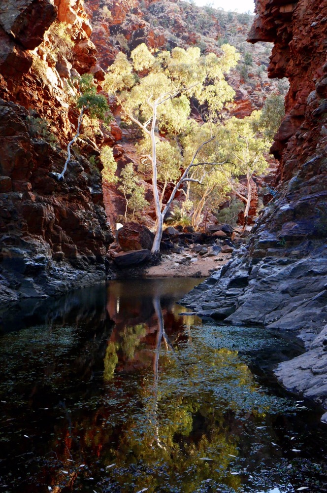
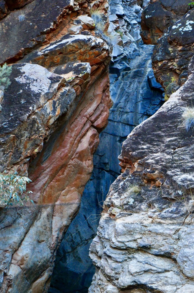
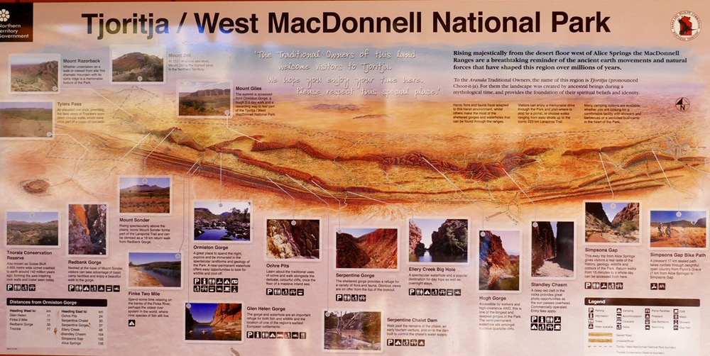
The next morning we finished section one by walking to Simpson Gap. This hike followed the hills beneath cliffs and ultimately provided fine views of the gap. It was cloudy and cold but rays of sunlight struggled through illuminating the valley. Simpsons Gap is wide, beautiful and sacred. The inviting pool is not for swimming. River gums twisted by the rigours of summer floods sit in the sand and stones of the ancient waterway, a creek course that long precedes the range it breeches. Ghost gums with their bright green foliage and shimmering white bark grip the sandstone walls. After exploring the gap we bussed to Standley Chasm. This geological feature is named for Ida Standley, an early twentieth century educator who actually taught aboriginal kids. We waited for our guide, Dee, but she had been double booked so had to catch up with her after lunch. Ryan, one of our four guides took us into the chasm. It is a gorge with sheer walls of orange quartzite. The narrow passageway echoes any conversation. The air is still and cool. It is impossible not to feel a sense of awe. This chasm was made by the erosion of a layer of white dolerite, leaving the quartzite for us to see today. Or was it two euro brothers who had an argument and one split the hill apart with the downward lash of his tail? I guess we will never know for sure. On the walk, Ryan showed us spearwood. Spearwood looks like a group of thin canes but if you hold one over a fire and stretch it straight, you can create a very good spear. It’s light, and made deadly by tying on a shard of quartzite or the poisonous wood of the mulga. It’s thrown from the rear of the spear and with little practice, can prove very accurate.
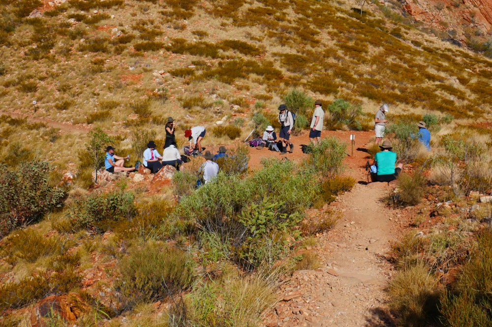
Dee met us after lunch, by now the sun had come out and we were all sitting on the grass. Dee runs a business called Cultural Connection NT. This enterprise is about educating people like us about aboriginal culture and history, about things that might otherwise cause misunderstanding. Dee explained that there are hundreds of tribes, and most of these have unique languages as different as Japanese and French to us. They have different beliefs and different attitudes by which they live. So it is not surprising that it is going to be difficult to achieve a unified voice. Europe has twenty nations and they cannot work together. Skin names are separate from your family names. Different tribes have different numbers of skin names, four, eight or as many as sixteen. Only certain skin name pairs can marry. This system was invented to reduce inbreeding. A child’s skin name, and his siblings which include his first cousins, have the same skin name. This skin name is different to the parents. It sounds complex and only looks marginally more straightforward on a chart with lines going clockwise and anticlockwise depending on the mother’s and fathers skin name respectively.
Education is different from the western style we are used too. It’s a life long learning, beginning in childhood singing, chanting, dancing, and listening to stories, observing the elders, and seeing the land, skies and weather over many years. Aural traditions everywhere in the world cannot write information down so it is necessary to learn using all the senses and by repetition, and then apply it.
Most of the social problems including drug abuse, health issues, and violence, are new ones. For forty thousand plus years plus, tribal lore and community, relations between people and other tribes, were sorted out and codified. In the last two hundred years, all that has been thrown into disarray. This uncertainty about culture creates unease, it means many Aboriginal people struggle to understand who and what they are. There are no rules about drugs in Aboriginal culture because they drugs did not exist. Learning from television, books and writing is completely alien from the experiential style of Aboriginal learning. Understanding new concepts is difficult when English is your third or second language. In some schools in Alice Springs there are now textbooks in many subjects, with the majority of teaching and examinations done using Arrente language.
Many of the attitudes which are so useful living in semi-arid Australia prove problematic when interfacing with white society. White people are so obsessed with punctuality and time while Aboriginal people live in the now. If the passing of time is anything, it’s morning, noon, and afternoon based on the suns position.
All this was done by Dee in her own style. She commented that Aboriginal people will not criticise, push eye contact or even ask questions because of their concern that by doing so, it would mean the other person lose face. This is the basis of the shyness and their reticence to ask questions.
At the conclusion of our talk with Dee, I think all of us had gained insights into Aboriginal culture and how it relates to us.
Afterwards we climbed back into the bus and were transported back to our new campsite, Charlie’s campsite. We skipped showers this evening. I played my guitar, sitting on my camp bed until it got too dark and too cold to play. The dinner was wonderful. Early to bed. I had my beanie on, thermal top and snuggled into my sleeping bag with only my nose sticking out.
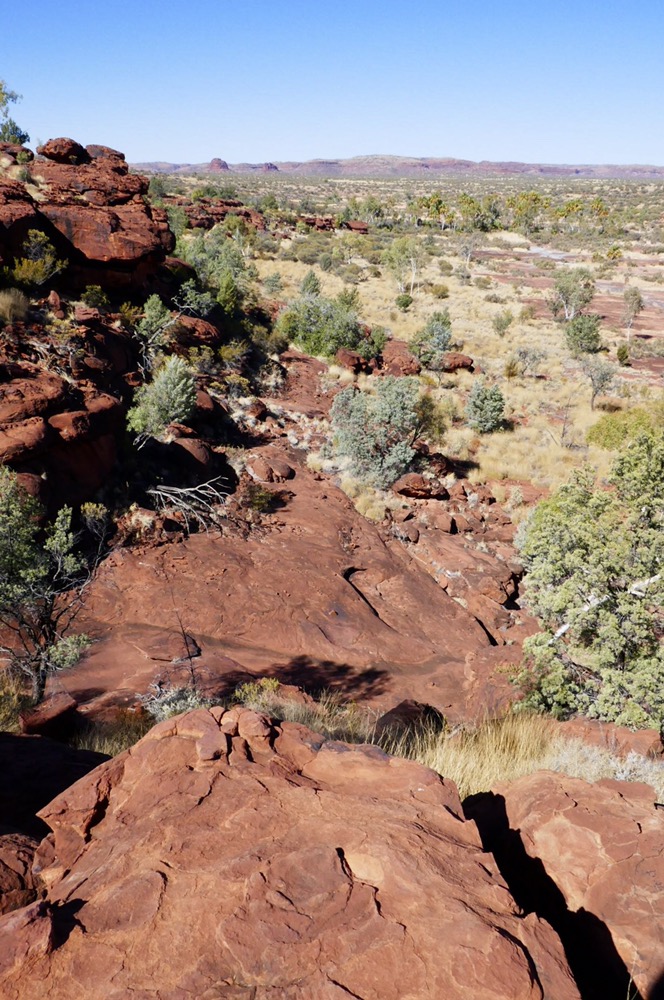
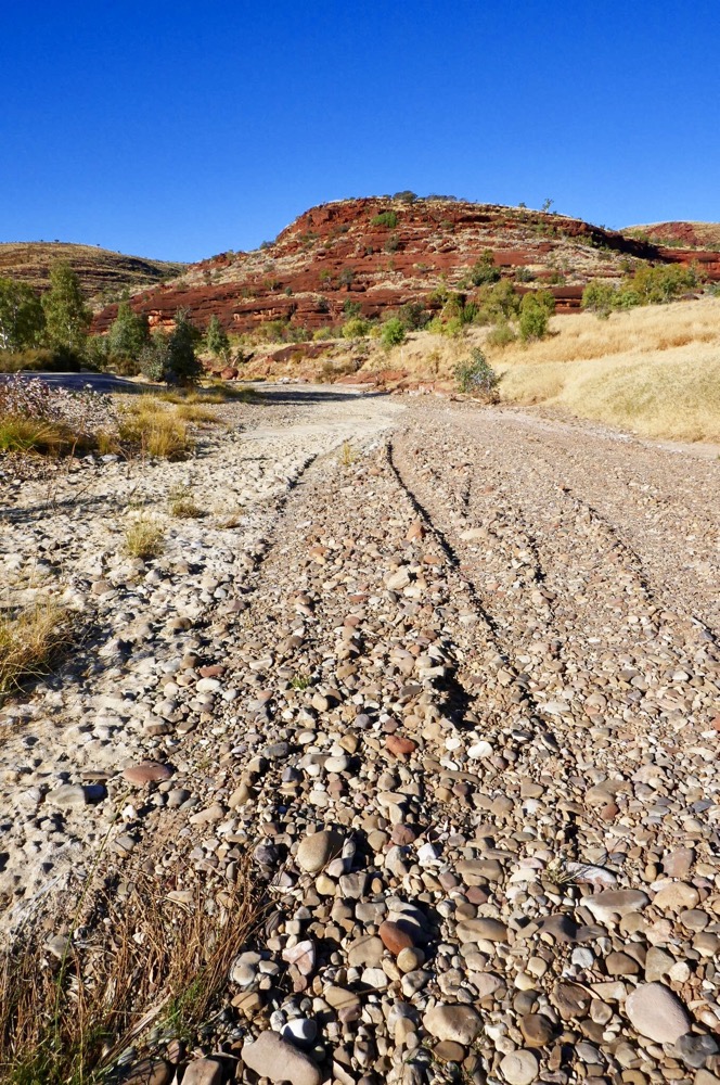
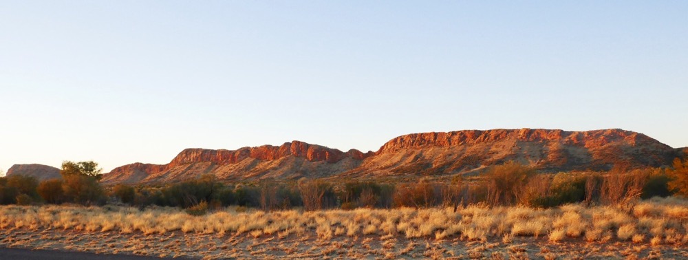
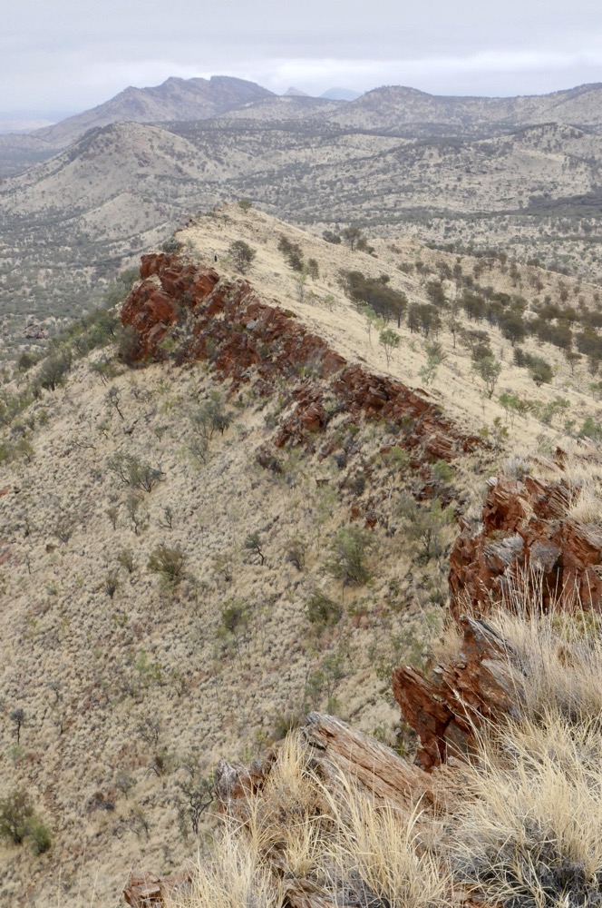
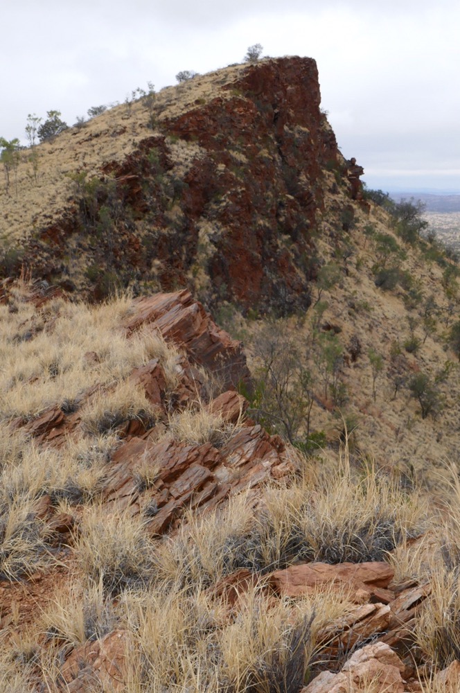
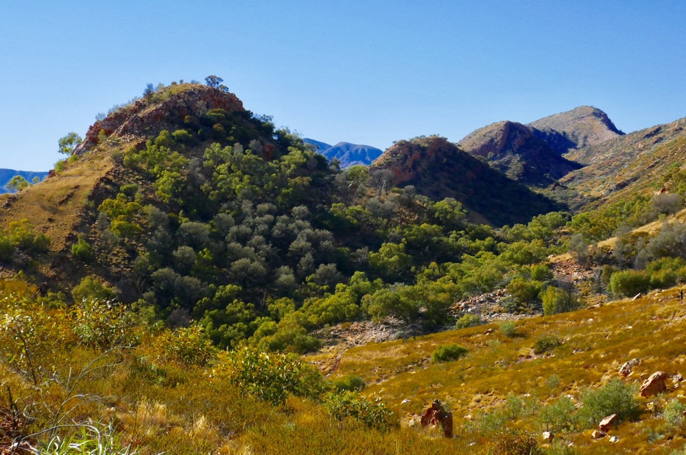
Up again in the morning, day three, up at six am for breakfast of muesli, yoghurt and tea. Today’s walk to Count point is spectacular. It’s an arduous hike along loose rocky tracks, and onward and upward to Counts junction, then after dropping packs, a short walk to the point. The walk commenced with a short walk to Serpentine Gorge which in my opinion is the most tranquil and inspiring of the many gorges on the Larapinta trail. This provides amazing views, Gosse Bluff ( old impact crater) in the distance, two long ranges below us with an almost glacial looking valley between them. The Chewing Range and the Heavitree Range. Then a three hundred meter drop to the camp site. Today’s walk was seventeen kilometres.
On day four, it had been again a very cold night, the ice in any outside bucket ample testimony of that. There are composting toilets with heavy plastic/nylon curtains and solar powered lights for necessary illumination. The washing up area, is nearby, a bucket full of fresh water, a steel cup with several holes is filled by dunking in the bucket, then suspended above the basin.
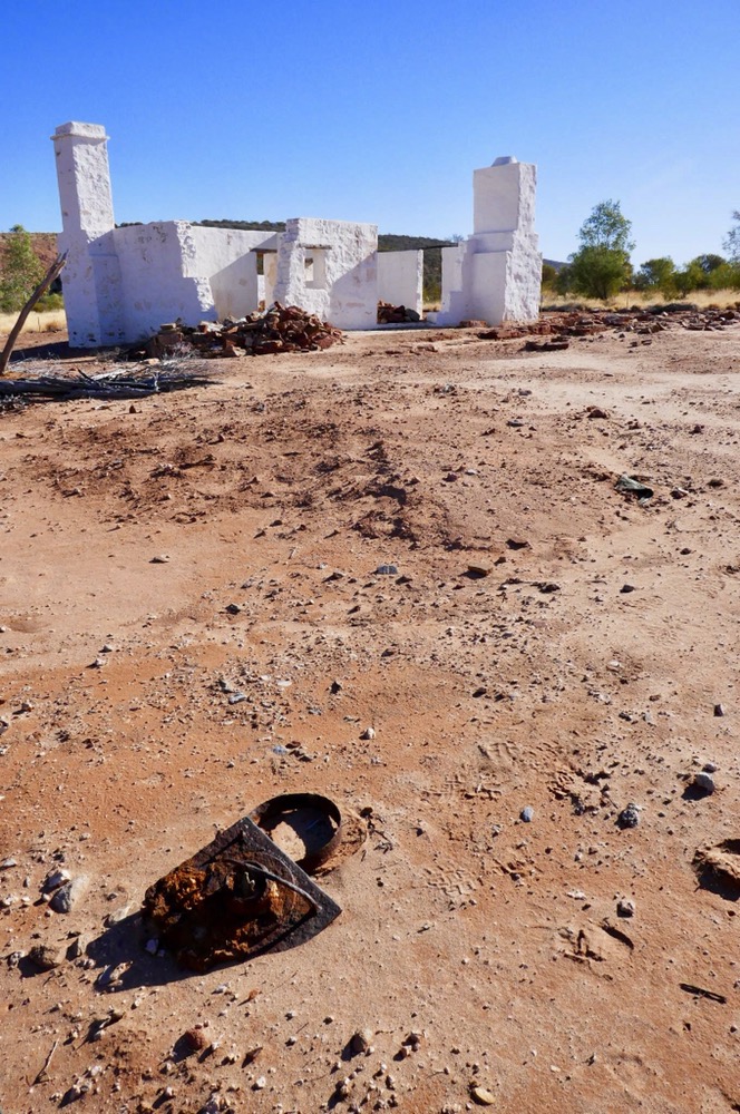
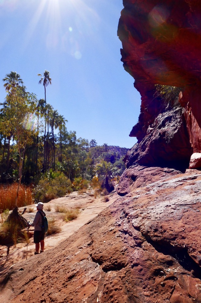
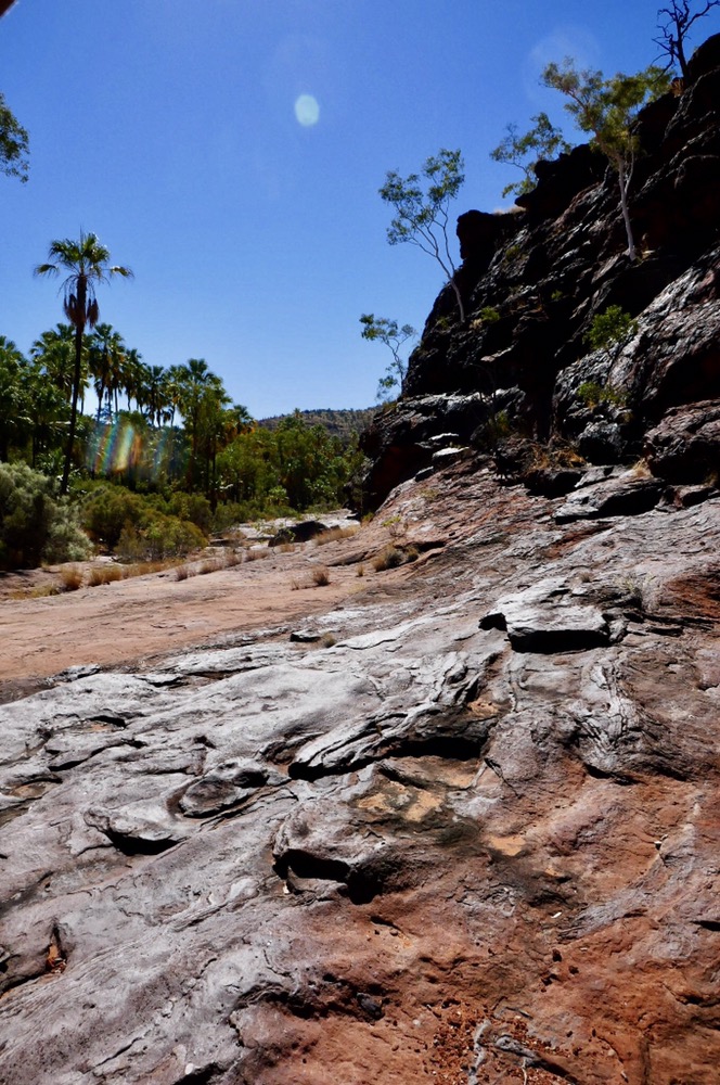
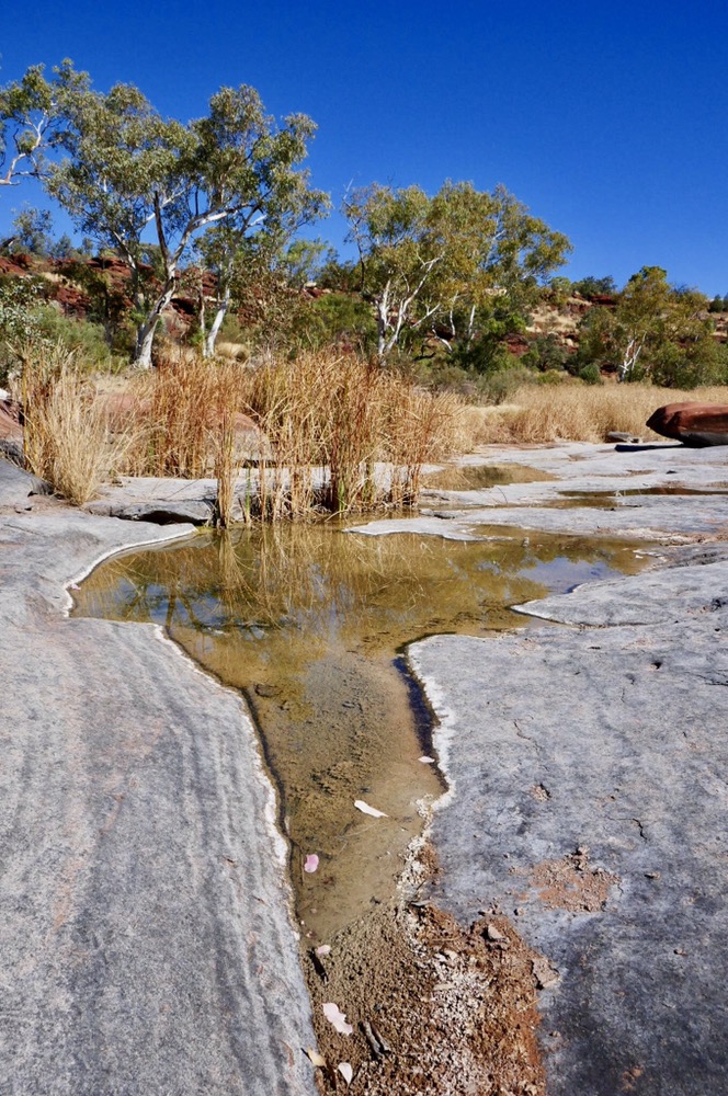
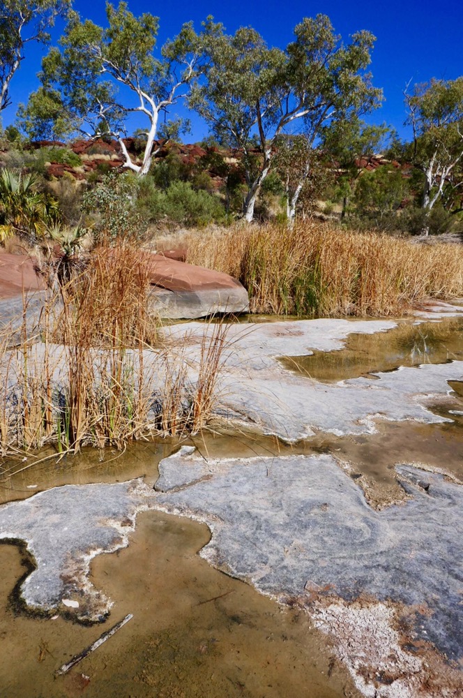
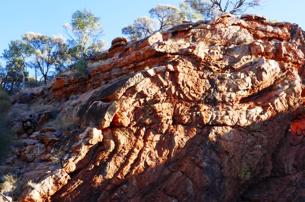
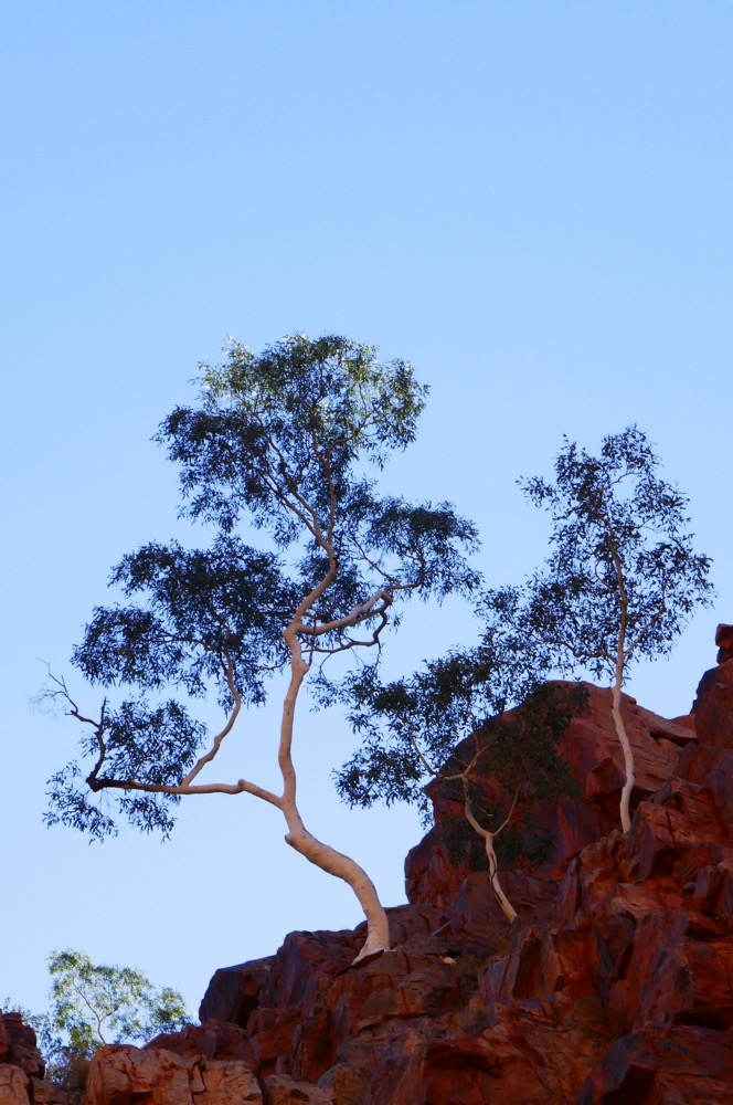
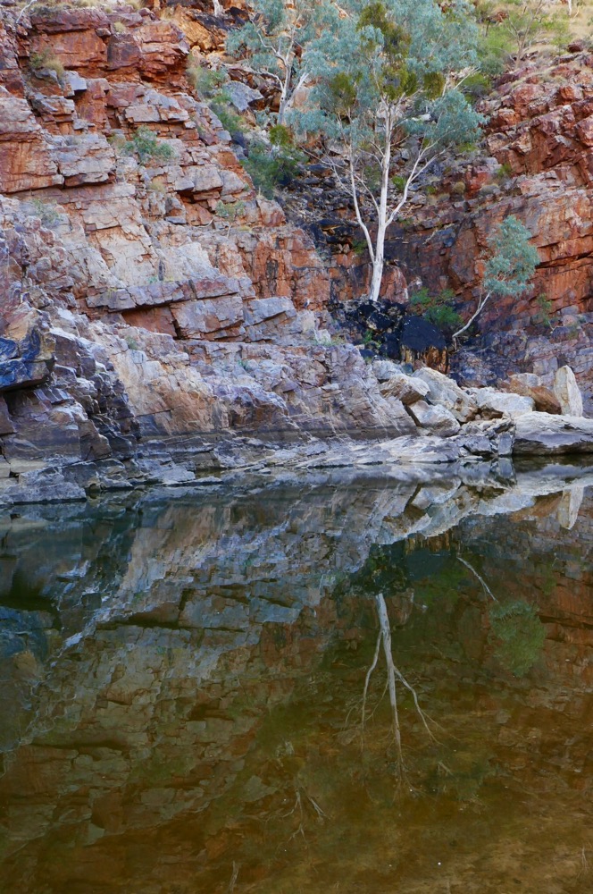
Our walk this morning, commenced in the most magical of early morning light. You know on some special mornings, the crispness and toning of the light give a beautiful glow to the natural world. One of the guides said to look out for some unique natural rock formations on the walk. Some of us were a bit non plussed about where the artificial geological formations were. While our bags were being carried to our next campsite, we walked to serpentine chalets dam. This dam was built below a narrow Gorge and provided water for the shirt lived Serpentine Chalet. Only the ruins remain, it was constructed in the 1950s before the road was improved and the speed of travel meant stopping for a night was unnecessary. The walk to the dam involves some rock clambering. The Gorge here is very beautiful. Our guide took us on a vertical side trip, to see these formations. The layers of rock are curved, in near swirls of sandstone over a hundred meters. The forces would have been truly immense to create this amazing appearance. We walked to Inarlunga pass. The trees here can be heard, pressing my ears against the white trunk of a ghost gum, I can hear the glug glug of water moving upwards from the roots on the way to the leaves above.
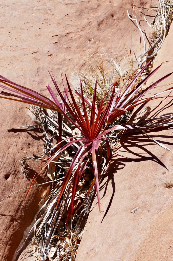
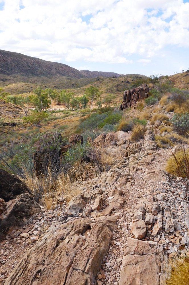
We returned to collect our packs, then shed some thermal gear with the increasing warmth of the day, then carried on, meeting the Arrente track. This track connects the Inarlunga Pass (Echidna Pass) with the Ochre pits. It is only a nine kilometre walk but it’s not easy, the rolling rocks which make the track, discourage mindless walking. I needed to stop before taking photographs, repack the camera, survey where to put my next step before carrying on. The track provides wonderful views of the ranges on either side of the track. It weaves over and between the crests of a series of hills. There are occasional information stands. These describe the plants and how they were used in Arrente life.
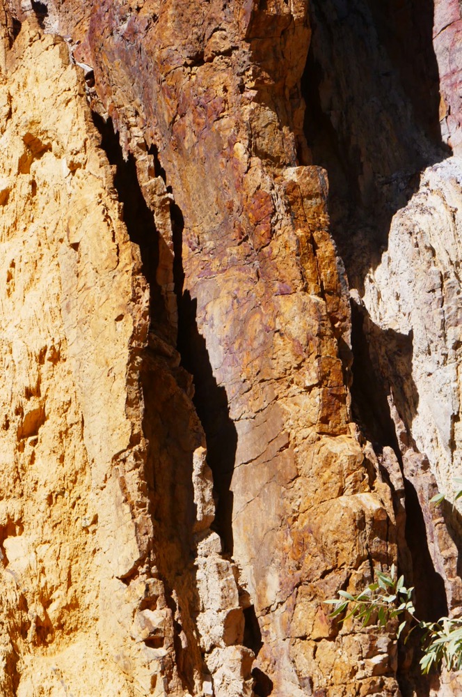
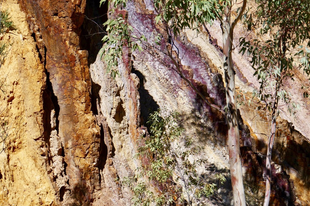
The Ochre pits have been mined for thousands of years, and the different colour Ochres gave been traded along song lines throughout central Australia. The ochre consists of kaolin with varying amounts of iron oxide and other minerals. Today, it is still mined by local Arrente men and used in ceremony and art. We drifted along admiring the colours and play of light on the carved-out ochre. Then a short drive to Glen Helen. This old station is now fully geared up for tourism. There is both camping sites and cabins for rent. Cheap beer but expensive diesel. Behind the lounge are comfortable seats and tables where you can relax sipping beer or eating ice creams and study the orange glow of the ranges rocks. We walked to the gorge. There is a large rock pool that spans the gorge. Some of the guides braved the cold water to freshen up for a swim. It is yet another wonderful sight to enjoy. While we were walking and exploring, two of our number enjoyed the helicopter trip to see the sights from above.
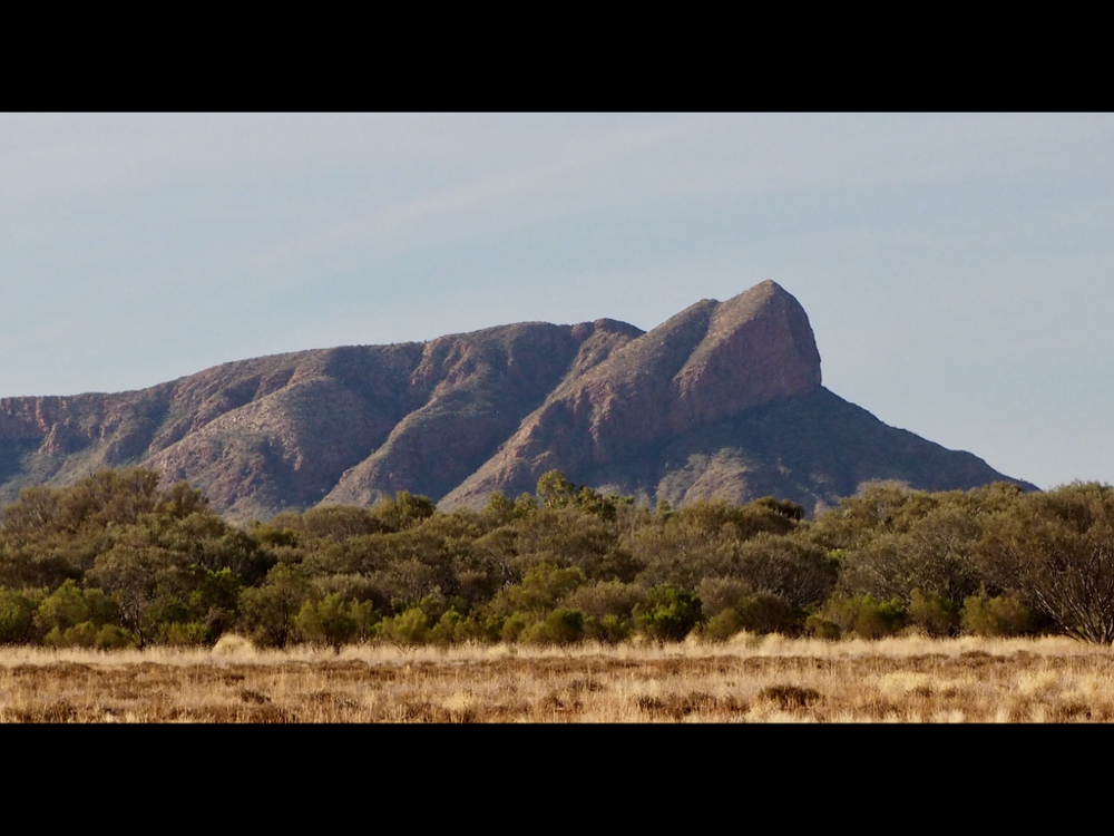
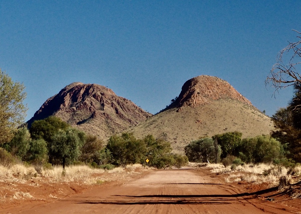
Then we drove to camp Fearless. It’s named after Sue Fear , a tribute to a legendary climber who died in Nepal. This morning, as I’m writing this, most of our number have elected to do the sunrise walk up to the south summit of Mt Sonder. Jen and I slept through the wake up call at 2:15 am and decided to spend the day in meditation and tea/coffee appreciation.
Right now, I’m sitting on a camp chair and finally getting warm. It was minus two overnight. ( This does not encourage frivolity on mountains). The camp fire is sending smoke away from me. Lunch is cooking in a camp cooker sitting on the hot coals. Mt Sonder is looking majestic in the morning sun beyond the camp tents. A few ring necked parrots are fluttering around.
( Dinners so far . Loin shanks. Barramundi. Chicken curry. Beef stew. Roast lamb and poached pear with chocolate and cream)
It is now five pm and I’m sitting under the big tent at Camp Fearless. Jennifer and I have had a quiet day, relaxing, talking. When the rest of the group returned from the 16 kilometre hike up and down Mt Sonder, they looked a bit battered and worn out by the adventure but were equally full of praise for the beauty of the mountain and the splendid views it delivered. Maybe next time for us, I need to be a lot fitter to have the strength you need to cope with the relentless climb and then descent. Jennifer and most of the group took the bus to revisit Glen Helen while I stayed here in camp to practice. I also went for a brief walk with two of my fellow travellers along the dry creek beside the campsite. No two river gums are the same are they? There are some great views of Mt Sonder to be had as well, its massif silhouetted by the giant gums and cork trees on and near the bank.
We are altogether on the bus returning to Alice Springs. Today we packed up our stuff, tidied our bivies, had breakfast and sat around the campfire in the morning light. We have spent a wonderful day walking at Ormiston Pound. A pound is a plain ringed all around by ranges. Ormiston pound has three entrances. We entered the pound after skirting the range climbing and then descending via the first pass. In the distance I could see the further most band of ranges. The nearer hills bright orange and in the distance the haze fading those same colours to blue. We all walked steadily, winding our way across the pound, crossing two dry river beds. Two meters above the rivers bed and wrapped around trunks and branches was grass and foliage washed there by the last flood.
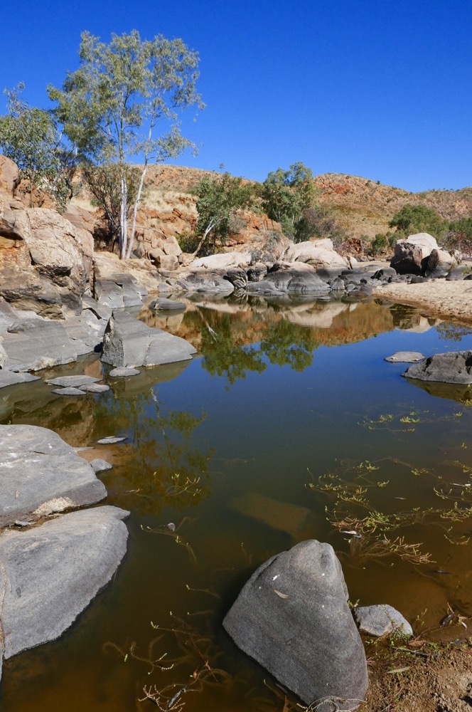
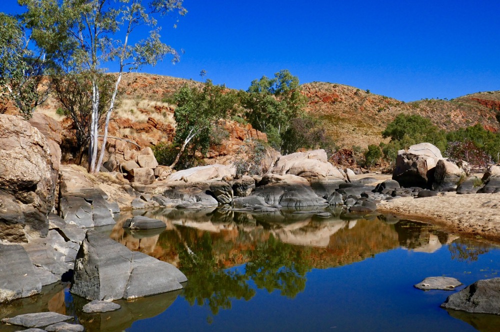
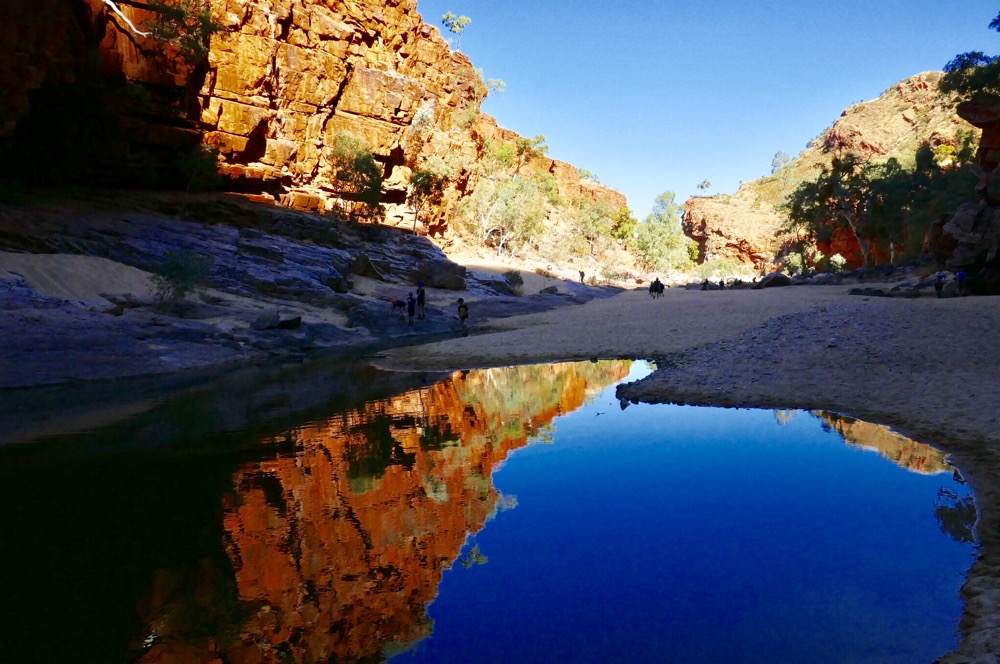
Water still remained from those long ago floods, cool and inviting pools, reflecting the red gums and ghost gums; a all peaceful symmetry of form and colour.
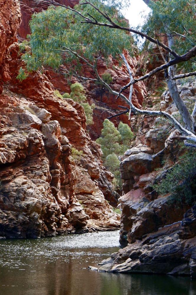
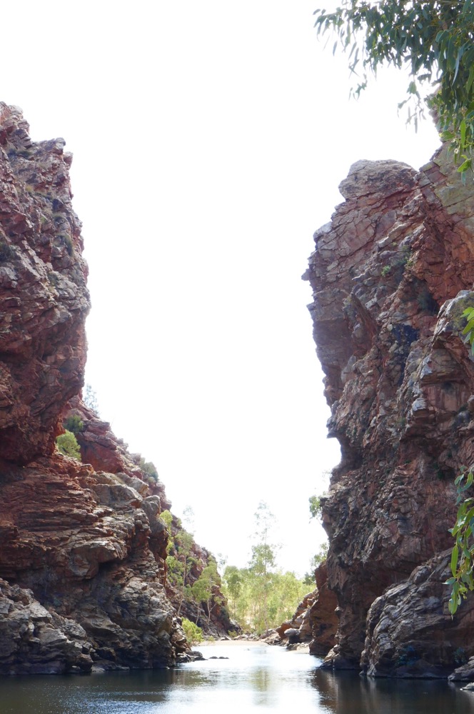
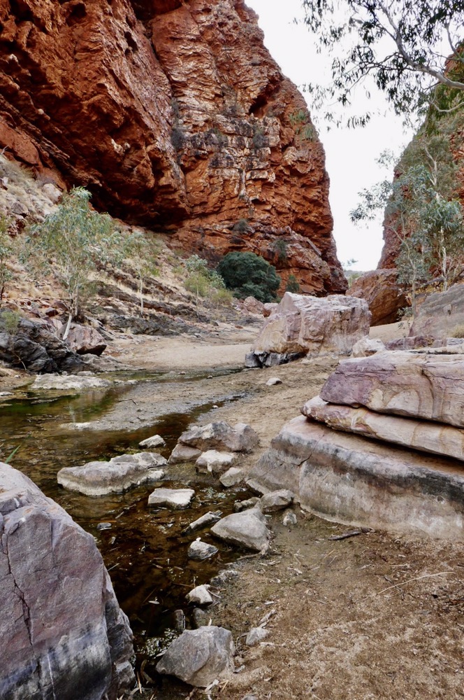
Finally we entered the gorge itself. This place is beautiful, I cannot find words to express it meaningfully. Here are rich colours of the orange quartzite cliffs, soft cool shadows lying over jumbled stone and water, and the many hues from purple to grey streaking the very substance of the boulders we all scramble across. Herons careen in the air calling as they fly in the narrow airspace of the gorge. Their voices loud and clear, but almost alien in this ancient landscape. The rock pools are large and plentiful, providing too ample an opportunity for photography. The vivid clarity of the reflections, then tones blending in any subtle movement of the water. A very special place.
We crossed the largest pool, my fellow travellers helping me across the biggest jumps. It is amazing how sure my footing is when I’m helped. Then more boulder hoping and scrambling, to reach the car park and a yummy lunch under one of the picnic shelters.
After ice creams and a photo stop, we got back in the bus and here we are.
Before I wrap up this blog, I need to record the tremendous guides who helped, fed, encouraged and well, guided all of us in this superb region of central Australia. They are Ryan, Jen, Kia and Maddie. All top blokes and Sheilas.
The final thank you has to be to all our fellow adventurers, all of them interesting, all of them terrific people and all of them great company.
I hope to meet many of them this evening at Hanuman restaurant.